River
Awash River
1,200 km from source to mouth · Ethiopia.
 EthiopiaFlows into Lake Abbe1st longest in Ethiopia
In numbers
Length
1,200km
Average flow
270m³/s
Basin
64,000km²
Drop
1,909m
from 2,149 m to 240 m
Country
1
The journey
From source to mouth
1,200 km of river and 28 stops on the way: 8 towns and cities on its banks, dams, bridges and the tributaries that feed it.
- 0 kmSourceat 2,149 m
- 1 kmGīnch’ī37,600 people
- 122 kmAkaki Rivertributary
- 163 kmDēra30,700 people
- 179 kmLake York3.6 km²
- 183 kmLake Gladys2.8 km²
- 189 kmSomba Hāyk'2.1 km²
- 195 kmModjo Rivertributary
- 215 kmKoka Reservoir150 km²
- 230 kmWonji29,200 people
- 368 kmLake Basaka38 km²
- 414 kmĀwash36,500 people
- 414 kmAwash36,500 people
- 450 kmGermama Rivertributary
- 456 kmKabenna Rivertributary
- 463 kmDebhilē Bahir0.7 km²
- 659 kmCaddabasa92 km²
- 723 kmBorkana Rivertributary
- 800 kmLower Valley of the AwashUNESCO World Heritage
- 897 kmMille Rivertributary
- 931 kmLogīya34,500 people
- 940 kmLogiya Rivertributary
- 954 kmDubti36,100 people
- 1,019 kmAsaita39,400 people
- 1,062 kmLake Gummare53 km²
- 1,069 kmLake Afambo35 km²
- 1,072 kmSuwata Hāyk'2.4 km²
- 1,086 kmLake Bario22 km²
- 1,144 kmLake Abbe312 km²
- 1,200 kmLake Abbeat 240 m
Water level along the river (RiverATLAS; the height is exaggerated). Towns: GeoNames and Wikidata; bridges, dams and tributaries: Wikidata.
Major river in Ethiopia
At the mouth it carries 266 m³/s on average: an Olympic pool every 9.4 seconds. It drops from 2,149 m to 240 m, 1.6 m per kilometre on average. Its basin covers 64,000 km², about the size of LV. 11.5 million people live in it. Highest water: from August to September; lowest: from November to February. It is heavily dammed: reservoirs can hold 51% of a year's flow.
Where to start
- AsaitaLargest city on its banks · 39,400 people
- Djibouti-Ambouli Airport (JIB)Nearest airport with scheduled flights, 188 km from the city
- From October to FebruaryThe best months to visit
Awash River, month by month
Highest water: from August to September
Lowest water: from November to February. Best months to visit: from October to February.
From about 67 m³/s in the lowest month to 770 m³/s in the highest. An estimate: the monthly flow is modelled from the lowest and highest months of WaterGAP (RiverATLAS, 1971–2000) and the rain and snow along the river (WorldClim). Dams change the real rhythm. The chip is the average air temperature; below it, the month's rain.
Plan the trip
Plan the trip: boat trips, a bed by the river, a car
Some links above are affiliate links: if you book through them we may earn a commission, at no extra cost to you. It never changes what the data on this page says.
The basin
Awash River: the basin in numbers
90,994 km² of land send their water to this river. This is what lives on it.
- 11.5millionpeople live in the basin
- 127/km²people per km²
- 1,244maverage altitude of the basin
- 652mmof rain a year (basin average)
- 23.1°Caverage air temperature
- 30%protected areas
- 0.7%covered by lakes
- 4.3km³held in reservoirs
What covers the basin
- 19% Cropland
- 23% Pasture
- 3% Towns and cities
RiverATLAS (HydroATLAS v1.0, CC BY 4.0): land cover, people, protected areas, glaciers and dams over the whole basin upstream of the mouth.
Along the river
Awash River: what you find on the way
- 3Weirs
- 3WaterfallsAwash waterfalls
From OpenStreetMap, within 2.4 km of the river. Not mapped is not the same as not there.
Cross-checked with our atlases
Awash River in our other atlases
What our sister atlases know about the waterfalls on this river, the lakes it flows through, the beaches at its mouth, the mountains where it rises and the islands off its mouth.
 12lakes on its wayLakeyas
Lakes and reservoirs (12)
Lakes it flows through, by Lakeyas
- Lake Yorkkm 1483.6km²
- Koka Reservoirkm 178150km²
- Lake Basakakm 30438km²
- Caddabasakm 54692km²
- Lake Gummarekm 87953km²
- Lake Afambokm 88535km²
- Lake Bariokm 90022km²
- Lake Abbekm 948 · 37 m deep312km²
4 more on LakeyasLakeyas is coming soonOpen Lakeyas ↗
From space
The source and the mouth, seen from orbit
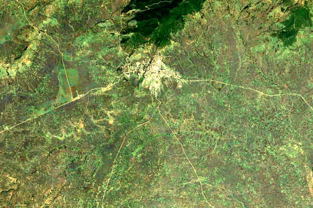
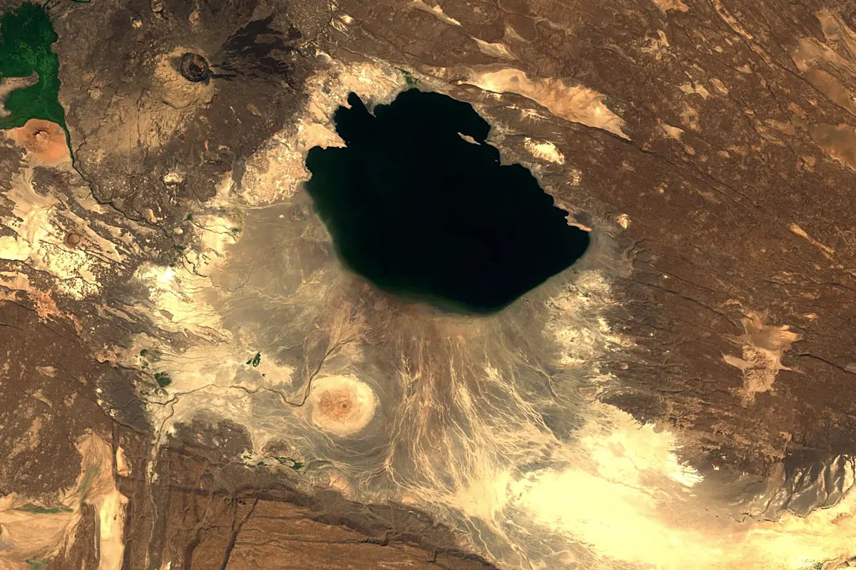
Sentinel-2 cloudless 2016 by EOX IT Services GmbH (contains modified Copernicus Sentinel data 2016), CC BY 4.0. The glowing line is the river as drawn by RiverATLAS.
Photos
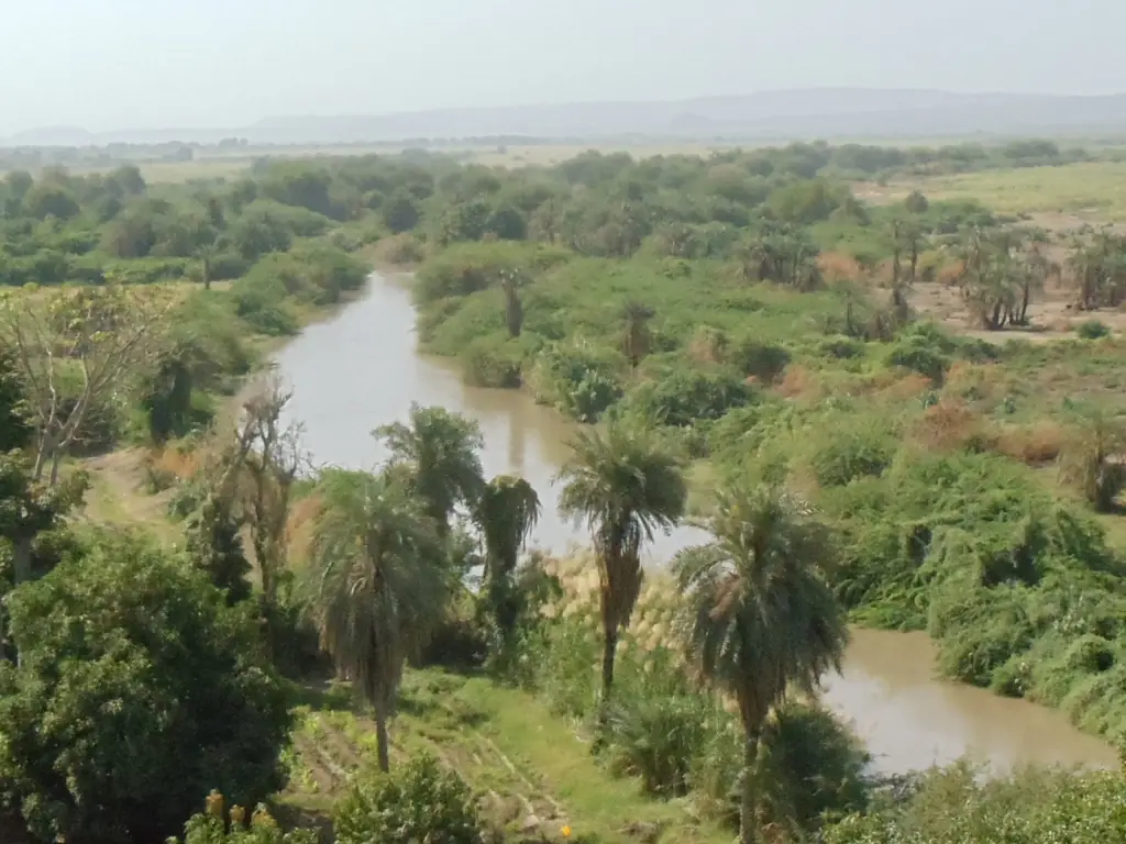
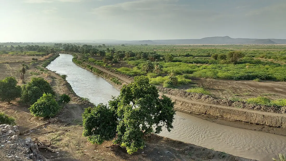
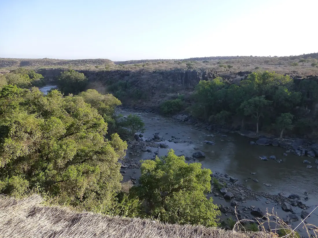
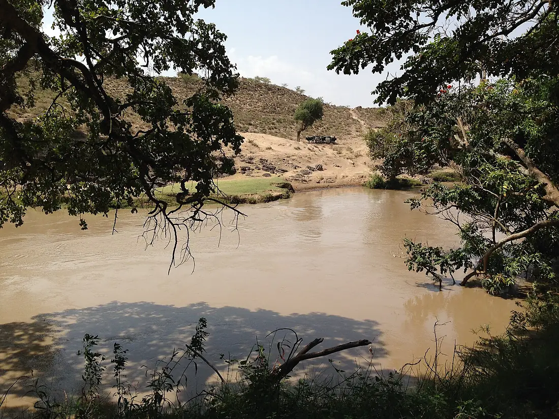
Awash River in pictures
Tributaries
Where it flows, and what flows into it
Tributaries (11)
Also: Germama River, Akaki River, Dechatu River, Mille River, Borkana River, Kabenna River, Ataye River, Logiya River, Modjo River, Hawadi River, Keleta River
Nearby
Rivers nearby
 Yemen
YemenWhere these numbers come from
| Name, length, places | Wikidata (Q782845) · CC0 |
|---|---|
| Course, profile, basin | RiverATLAS v1.0 (HydroATLAS, Linke et al. 2019) · CC BY 4.0 — followed from the source to the mouth given by Wikidata |
| Flow | WaterGAP (RiverATLAS), 1971–2000 · CC BY 4.0 |
| Climate along the river | WorldClim (RiverATLAS), 1970–2000 · CC BY 4.0 |
| Towns, bridges, dams | Wikidata · CC0; GeoNames · CC BY 4.0 |
| Along the river | © OpenStreetMap contributors · ODbL |
| Images | EOX Sentinel-2 cloudless 2016 · CC BY 4.0; Wikimedia Commons |
| Our other atlases | Lakeyas — Wikidata · CC0; © OpenStreetMap contributors · ODbL; GeoNames · CC BY 4.0; HydroLAKES · CC BY 4.0; NOAA OISST |
Every source and licence is on the data sources page.
The family
Do you prefer beaches, lakes, mountains, waterfalls, islands, rivers or canyons?
Same idea, other landscapes: field atlases built on open data, month by month, in seven languages.
 beaches
 Find your beach: sea temperature, sun and swimming month by month.Visit lakes
 Every lake on Earth: water temperature, ice, depth and the shore.Coming soonVisit
  mountains
 Every summit in 3D: summit weather, the 0 °C line, huts and trails.Visit
  waterfalls
 Every waterfall: height, flow month by month and when it roars.Coming soonVisit
  islands
 Every island from the sea up: size, sea temperature, ferries and 3D.Coming soonVisit
  rivers
 Every river from source to sea: the journey, the flow and the basin in numbers.You are here
 canyons
 Every canyon cut to scale: depth to the floor, rim and floor temperatures, trails and viewpoints.Coming soonVisit