River
Cauca River
965 km from source to mouth · Colombia.
 ColombiaFlows into Magdalena River4th longest in Colombia
In numbers
Length
965km
Average flow
1,400m³/s
Basin
80,000km²
Drop
2,118m
from 2,132 m to 14 m
Country
1
The journey
From source to mouth
965 km of river and 42 stops on the way: 29 towns and cities on its banks, dams, bridges and the tributaries that feed it.
- 0 kmSourceat 2,132 m
- 19 kmPopayán318,059 people
- 63 kmMorales26,707 people
- 84 kmLake Salvajina18 km²
- 86 kmSuárez19,690 people
- 96 kmBuenos Aires34,631 people
- 114 kmSantander de Quilichao116,535 people
- 131 kmPuerto Tejada46,166 people
- 134 kmJamundí96,993 people
- 144 kmCascada La Paila
- 171 kmYumbo92,192 people
- 193 kmGuacarí35,513 people
- 201 kmYotoco8,362 people
- 204 kmLaguna de Sonso7.1 km²
- 207 kmCiénaga Regina0.4 km²
- 210 kmBuga128,945 people
- 235 kmRiofrío9,236 people
- 249 kmBugalagrande20,970 people
- 267 kmRoldanillo33,697 people
- 269 kmZarzal47,062 people
- 282 kmLa Unión40,339 people
- 284 kmLa Victoria11,064 people
- 317 kmCartago Municipality210,558 people
- 317 kmLa Vieja Rivertributary
- 330 kmLa Virginia32,330 people
- 340 kmOtún Rivertributary
- 345 kmMarsella24,131 people
- 349 kmBelalcázar9,690 people
- 449 kmCartama Rivertributary
- 490 kmConcordia20,271 people
- 550 kmSanta Fe de Antioquia26,164 people
- 552 kmPuente de Occidente
- 659 kmValdivia11,511 people
- 694 kmCáceres42,112 people
- 748 kmCaucasia90,213 people
- 790 kmCiénaga Hoyo Grande0.4 km²
- 802 kmNechí25,790 people
- 804 kmNechí Rivertributary
- 855 kmCiénaga La Veta9.3 km²
- 871 kmAchí23,051 people
- 905 kmCiénaga La Burra27 km²
- 909 kmCiénaga Manteguera11 km²
- 912 kmPinillos23,349 people
- 965 kmMagdalena Riverat 14 m
Water level along the river (RiverATLAS; the height is exaggerated). Towns: GeoNames and Wikidata; bridges, dams and tributaries: Wikidata.
River in Colombia
At the mouth it carries 1,350 m³/s on average: an Olympic pool every 1.9 seconds. It drops from 2,132 m to 14 m, 2.2 m per kilometre on average. Its basin covers 80,000 km², about the size of CZ. 11.7 million people live in it. Highest water: from October to November; lowest: from February to March. Its dams hold back little of its water (2.1% of a year's flow).
Where to start
- PopayánLargest city on its banks · 318,059 people
- Guillermo León Valencia Airport (PPN)Nearest airport with scheduled flights, 2 km from the cityCar hire at CLO airport (Cali)Discover Cars · Affiliate link↗
- On the water30 ferry piers, marinas, boat rentals and boat ramps along the river (OpenStreetMap)
- From January to FebruaryThe best months to visit
Cauca River, month by month
Highest water: from October to November
Lowest water: from February to March. Best months to visit: from January to February.
From about 1,200 m³/s in the lowest month to 3,100 m³/s in the highest. An estimate: the monthly flow is modelled from the lowest and highest months of WaterGAP (RiverATLAS, 1971–2000) and the rain and snow along the river (WorldClim). Dams change the real rhythm. The chip is the average air temperature; below it, the month's rain.
Plan the trip
Plan the trip: boat trips, a bed by the river, a car
Some links above are affiliate links: if you book through them we may earn a commission, at no extra cost to you. It never changes what the data on this page says.
The basin
Cauca River: the basin in numbers
61,902 km² of land send their water to this river. This is what lives on it.
- 11.7millionpeople live in the basin
- 189/km²people per km²
- 1,385maverage altitude of the basin
- 2,582mmof rain a year (basin average)
- 20.9°Caverage air temperature
- 7%protected areas
- 0.6%covered by lakes
- 1.5km³held in reservoirs
What covers the basin
- 25% Forest
- 12% Cropland
- 46% Pasture
- 3% Towns and cities
RiverATLAS (HydroATLAS v1.0, CC BY 4.0): land cover, people, protected areas, glaciers and dams over the whole basin upstream of the mouth.
Along the river
Cauca River: what you find on the way
- 1Weirs
- 14WaterfallsSegundo Pailón, Primer Pailón, Cascada El Mango and 11 more
- 2Boat ramps
- 27Ferry piersTerminal Ferry Arenal and 26 more
- 1Marinascentro de integración ciudadana
- 8River beachesPlaya Rica, Playón del Rio, Isla Del Cuatro and 5 more
From OpenStreetMap, within 2.3 km of the river. Not mapped is not the same as not there.
Cross-checked with our atlases
Cauca River in our other atlases
What our sister atlases know about the waterfalls on this river, the lakes it flows through, the beaches at its mouth, the mountains where it rises and the islands off its mouth.
 1waterfall on the riverCascadyas
 7lakes on its wayLakeyas
 5mountains at the sourcePeakyas
Waterfalls (1)
On the river, by Cascadyas
- Cascada La Pailakm 156
Cascadyas is coming soonOpen Cascadyas ↗
Lakes and reservoirs (7)
Lakes it flows through, by Lakeyas
- Lake Salvajinakm 9218km²
- Laguna de Sonsokm 2217.1km²
- Ciénaga Reginakm 2250.4km²
- Ciénaga Hoyo Grandekm 8570.4km²
- Ciénaga La Vetakm 9289.3km²
- Ciénaga La Burrakm 98227km²
- Ciénaga Manteguerakm 98611km²
Lakeyas is coming soonOpen Lakeyas ↗
Mountains at the source (5)
Within 15 km of the source, by Peakyas
- Puracé15 km away4,756m
- Sierra Los Coconucos15 km away
- Alto Palacé12 km away
- Serranía del Oso10 km away
- Loma El Novillo12 km away
From space
The source and the mouth, seen from orbit
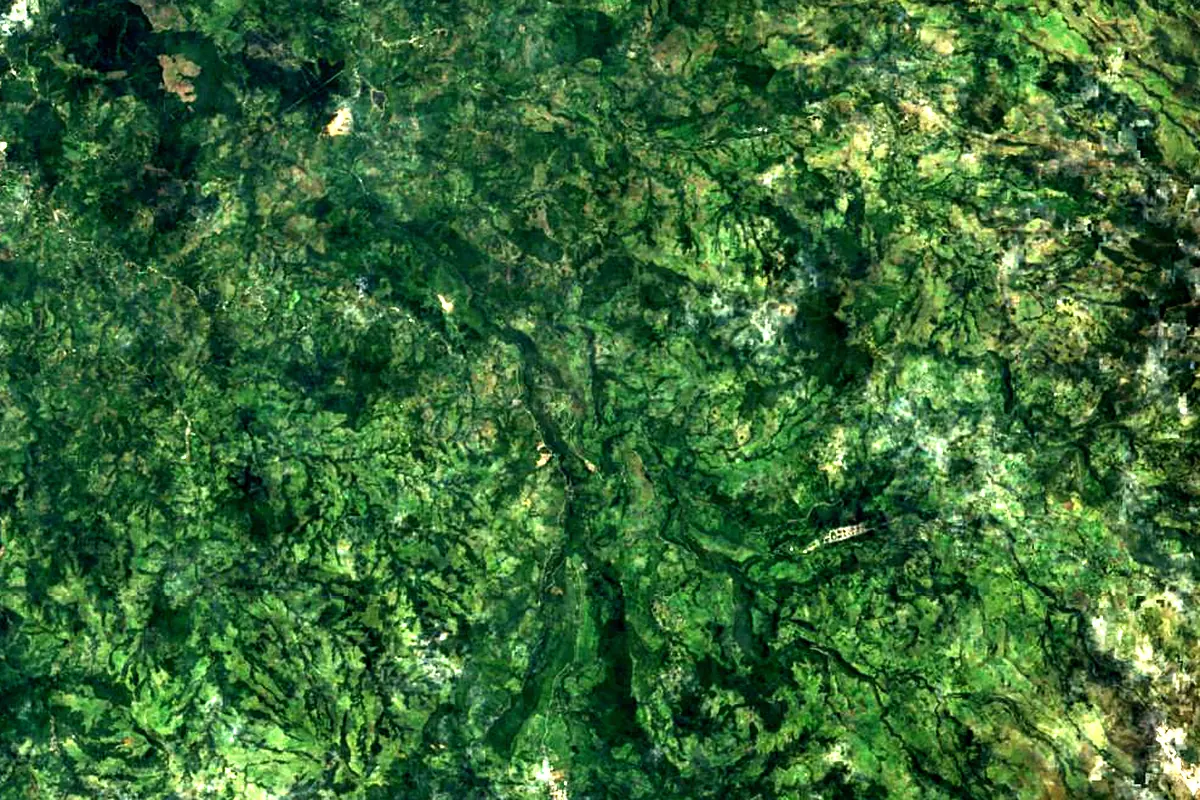
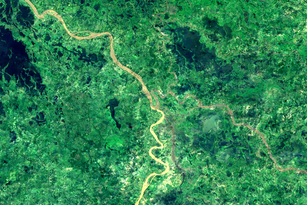
Sentinel-2 cloudless 2016 by EOX IT Services GmbH (contains modified Copernicus Sentinel data 2016), CC BY 4.0. The glowing line is the river as drawn by RiverATLAS.
Photos
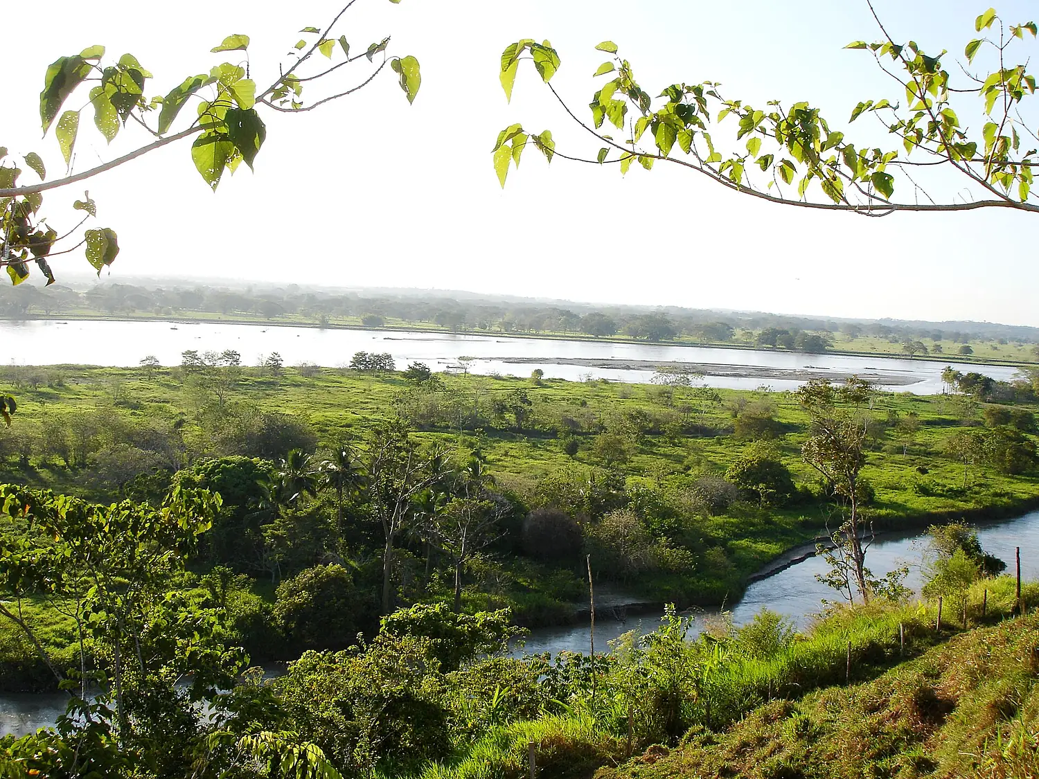
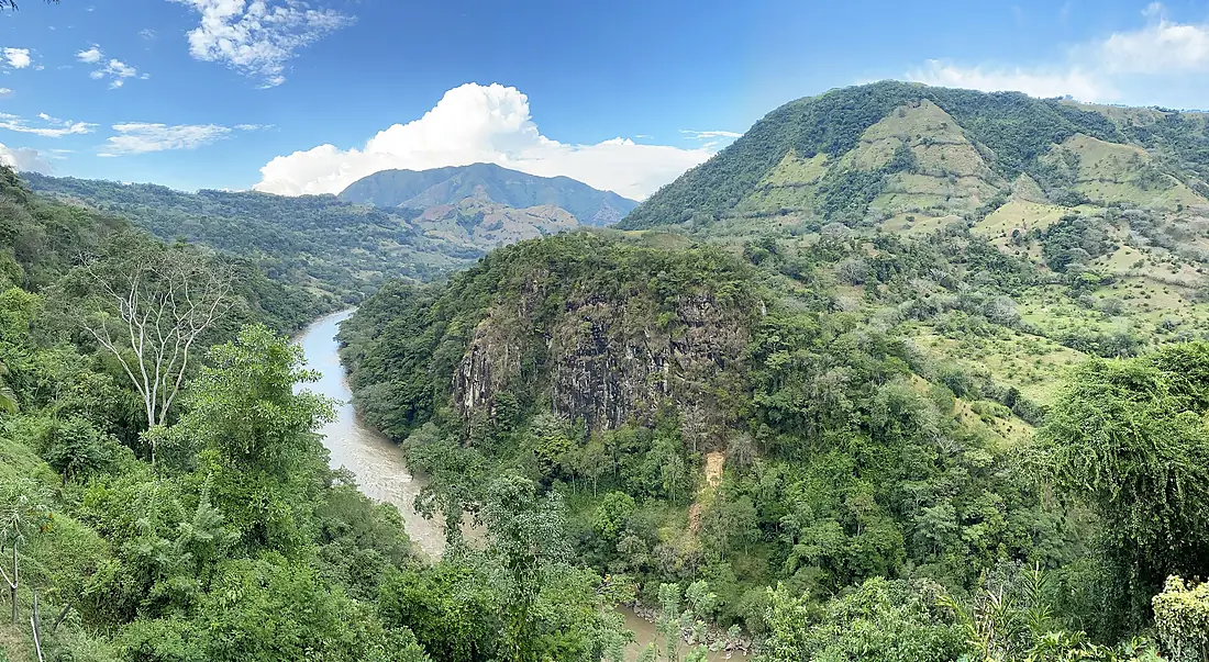
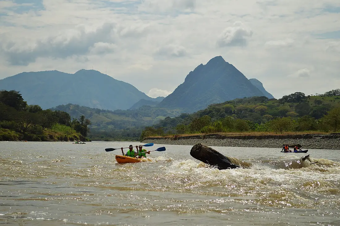
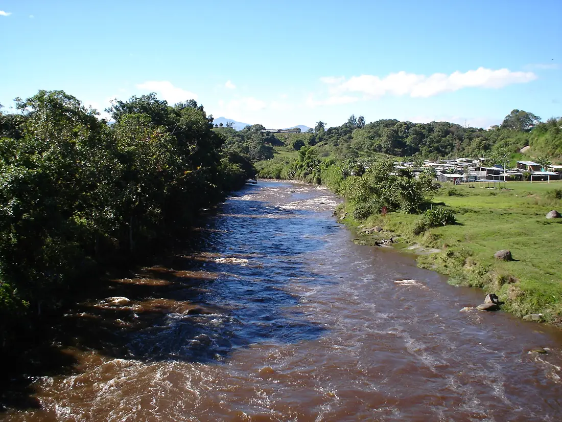
Cauca River in pictures
Tributaries
Where it flows, and what flows into it
It flows into
Magdalena RiverColombia1,528 km7,200 m³/sTributaries (10)
Also: Otún River, Nechí River, Cali River, La Vieja River, Río Chinchiná, Cartama River, Río Campoalegre, Río Arma, Zanjón Rozo, Quebrada Juan Garcia
 Venezuela
 Panama
Where these numbers come from
| Name, length, places | Wikidata (Q853332) · CC0 |
|---|---|
| Course, profile, basin | RiverATLAS v1.0 (HydroATLAS, Linke et al. 2019) · CC BY 4.0 — followed from the source to the mouth given by Wikidata |
| Flow | WaterGAP (RiverATLAS), 1971–2000 · CC BY 4.0 |
| Climate along the river | WorldClim (RiverATLAS), 1970–2000 · CC BY 4.0 |
| Towns, bridges, dams | Wikidata · CC0; GeoNames · CC BY 4.0 |
| Along the river | © OpenStreetMap contributors · ODbL |
| Images | EOX Sentinel-2 cloudless 2016 · CC BY 4.0; Wikimedia Commons |
| Our other atlases | Cascadyas, Lakeyas, Peakyas — Wikidata · CC0; © OpenStreetMap contributors · ODbL; GeoNames · CC BY 4.0; HydroLAKES · CC BY 4.0; NOAA OISST |
Every source and licence is on the data sources page.
The family
Do you prefer beaches, lakes, mountains, waterfalls, islands, rivers or canyons?
Same idea, other landscapes: field atlases built on open data, month by month, in seven languages.
 beaches
 Find your beach: sea temperature, sun and swimming month by month.Visit lakes
 Every lake on Earth: water temperature, ice, depth and the shore.Coming soonVisit mountains
 Every summit in 3D: summit weather, the 0 °C line, huts and trails.Visit waterfalls
 Every waterfall: height, flow month by month and when it roars.Coming soonVisit
  islands
 Every island from the sea up: size, sea temperature, ferries and 3D.Coming soonVisit
  rivers
 Every river from source to sea: the journey, the flow and the basin in numbers.You are here
 canyons
 Every canyon cut to scale: depth to the floor, rim and floor temperatures, trails and viewpoints.Coming soonVisit