River
Doce River
853 km from source to mouth · Brazil.
 BrazilFlows into Atlantic Ocean
In numbers
Length
853km
Average flow
1,100m³/s
Basin
83,400km²
Drop
690m
from 690 m to 0 m
Country
1
The journey
From source to mouth
853 km of river and 33 stops on the way: 12 towns and cities on its banks, dams, bridges and the tributaries that feed it.
- 0 kmMantiqueira Mountainsat 690 m
- 8 kmAlto Rio Doce10,891 people
- 105 kmPorto Firme10,569 people
- 129 kmGuaraciaba9,753 people
- 182 kmPonte Nova57,776 people
- 209 kmDo Carmo Rivertributary
- 288 kmCasca Rivertributary
- 302 kmMatipó Rivertributary
- 341 kmCachoeira do Inferno
- 357 kmBoi Streamtributary
- 363 kmPiracicaba Rivertributary
- 374 kmLagoa Silvana4.0 km²
- 381 kmIpaba17,136 people
- 408 kmCachoeira Escura
- 418 kmSanto Antônio Rivertributary
- 454 kmCachoeira Baguari
- 458 kmCorrente Rivertributary
- 467 kmSuaçuí Pequeno Rivertributary
- 489 kmGovernador Valadares266,561 people
- 562 kmCaratinga Rivertributary
- 571 kmConselheiro Pena20,824 people
- 607 kmResplendor17,226 people
- 644 kmAimorés25,269 people
- 647 kmManhuaçu Rivertributary
- 651 kmBaixo Guandu30,674 people
- 654 kmGuandu Rivertributary
- 702 kmFlorentino Avidos Bridge
- 702 kmColatina129,301 people
- 711 kmPancas Rivertributary
- 735 kmLagoa do Limão2.8 km²
- 766 kmLagoa Juparanã Mirim14 km²
- 776 kmLinhares183,797 people
- 780 kmLagoa do Meio0.6 km²
- 821 kmFarol do Rio Doce
- 853 kmAtlantic Oceanat 0 m
Water level along the river (RiverATLAS; the height is exaggerated). Towns: GeoNames and Wikidata; bridges, dams and tributaries: Wikidata.
River in Minas Gerais & Espírito Santo, Brazil
At the mouth it carries 1,061 m³/s on average: an Olympic pool every 2.4 seconds. It drops from 690 m to 0 m, 0.8 m per kilometre on average. Its basin covers 83,400 km², about the size of AT. 3.5 million people live in it. Highest water: from December to January; lowest: from June to September. No large dam holds it back: it is one of the world's free-flowing rivers.
Where to start
- Governador ValadaresLargest city on its banks · 266,561 people
- Coronel Altino Machado Airport (GVR)Nearest airport with scheduled flights, 6 km from the cityCar hire at GVR airport (Governador Valadares)Discover Cars · Affiliate link↗
- On the water15 ferry piers, marinas, boat rentals and boat ramps along the river (OpenStreetMap)
- Kayak and canoe7 put-ins and rapids mapped (OpenStreetMap)
- From May to SeptemberThe best months to visit
Doce River, month by month
Highest water: from December to January
Lowest water: from June to September. Best months to visit: from May to September.
From about 170 m³/s in the lowest month to 2,900 m³/s in the highest. An estimate: the monthly flow is modelled from the lowest and highest months of WaterGAP (RiverATLAS, 1971–2000) and the rain and snow along the river (WorldClim). Dams change the real rhythm. The chip is the average air temperature; below it, the month's rain.
Plan the trip
Plan the trip: boat trips, a bed by the river, a car
Some links above are affiliate links: if you book through them we may earn a commission, at no extra cost to you. It never changes what the data on this page says.
The basin
Doce River: the basin in numbers
82,937 km² of land send their water to this river. This is what lives on it.
- 3.5millionpeople live in the basin
- 43/km²people per km²
- 569maverage altitude of the basin
- 1,271mmof rain a year (basin average)
- 21.7°Caverage air temperature
- 3%protected areas
- 0.2%covered by lakes
- 0.1km³held in reservoirs
What covers the basin
- 15% Forest
- 11% Cropland
- 42% Pasture
- 1% Towns and cities
RiverATLAS (HydroATLAS v1.0, CC BY 4.0): land cover, people, protected areas, glaciers and dams over the whole basin upstream of the mouth.
Along the river
Doce River: what you find on the way
- 13Weirs
- 14WaterfallsCachoeira do Inferno and 13 more
- 7Rapids
- 2Boat ramps
- 12Ferry piersBalsa Itueta Velha and 11 more
- 1MarinasClube Náutico Alvorada
- 4River beachesPraia da Baixa, Praia dos Coqueiros, Praia do Meio and 1 more
From OpenStreetMap, within 2.4 km of the river. Not mapped is not the same as not there.
Cross-checked with our atlases
Doce River in our other atlases
What our sister atlases know about the waterfalls on this river, the lakes it flows through, the beaches at its mouth, the mountains where it rises and the islands off its mouth.
 3waterfalls on the riverCascadyas
 4lakes on its wayLakeyas
 3beaches at the mouth and on the banksCoastya
Waterfalls (3)
On the river, by Cascadyas
- Cachoeira do Infernokm 301
- Cachoeira Escurakm 360
- Cachoeira Baguarikm 400
Cascadyas is coming soonOpen Cascadyas ↗
Lakes and reservoirs (4)
Lakes it flows through, by Lakeyas
- Lagoa Silvanakm 3294.0km²
- Lagoa do Limãokm 6472.8km²
- Lagoa Juparanã Mirimkm 67514km²
- Lagoa do Meiokm 6870.6km²
Lakeyas is coming soonOpen Lakeyas ↗
Beaches (3)
At the mouth (25 km) and on the banks, by Coastya
- Praia de Regência6.2 km away27.2°C
- Praia de Povoação2.6 km away27.2°C
- Praia de Monsarás7.1 km away27.2°C
From space
The source and the mouth, seen from orbit
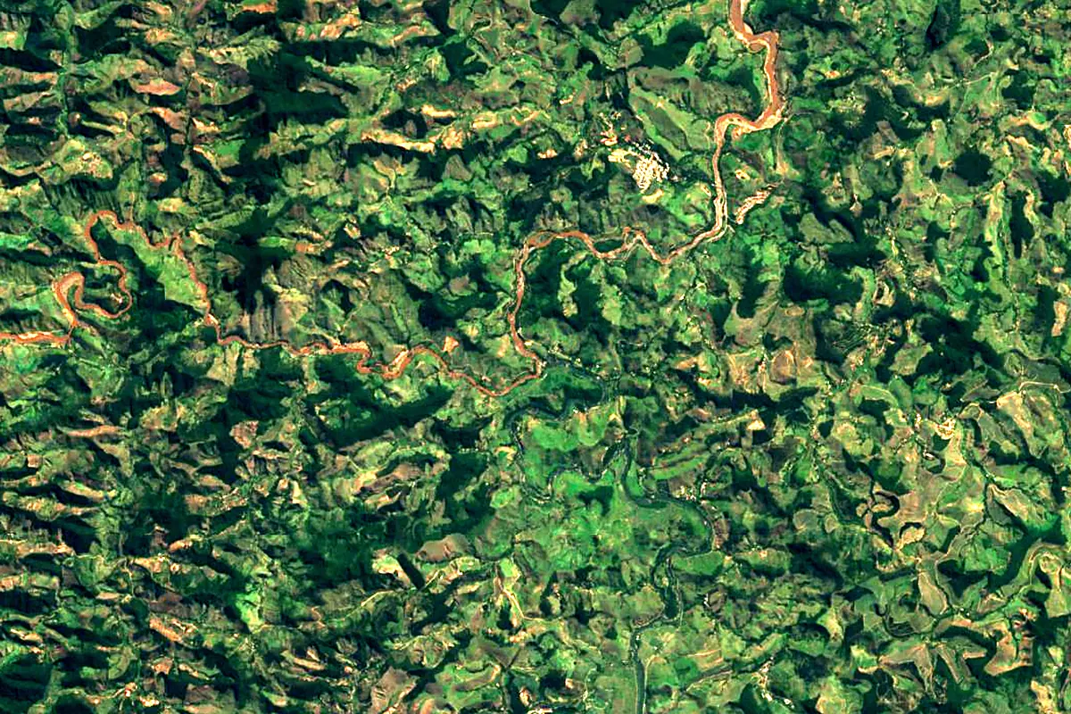
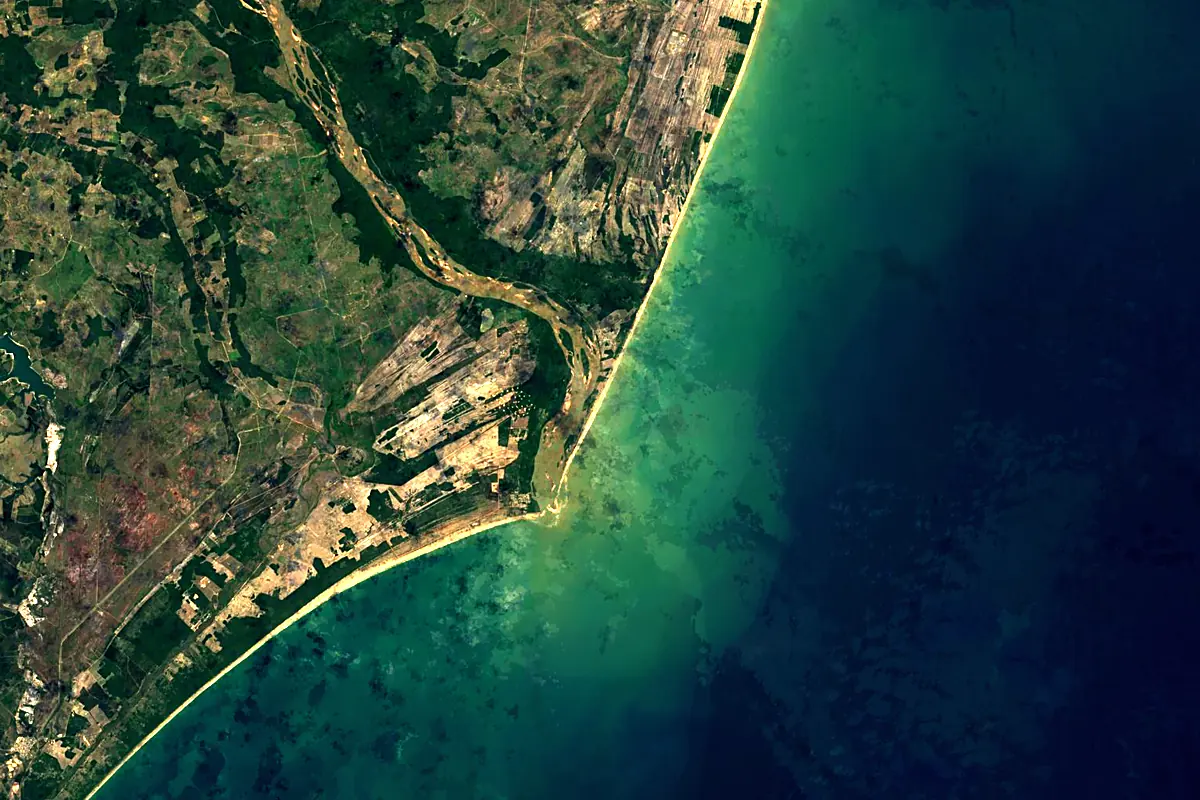
Sentinel-2 cloudless 2016 by EOX IT Services GmbH (contains modified Copernicus Sentinel data 2016), CC BY 4.0. The glowing line is the river as drawn by RiverATLAS.
Photos
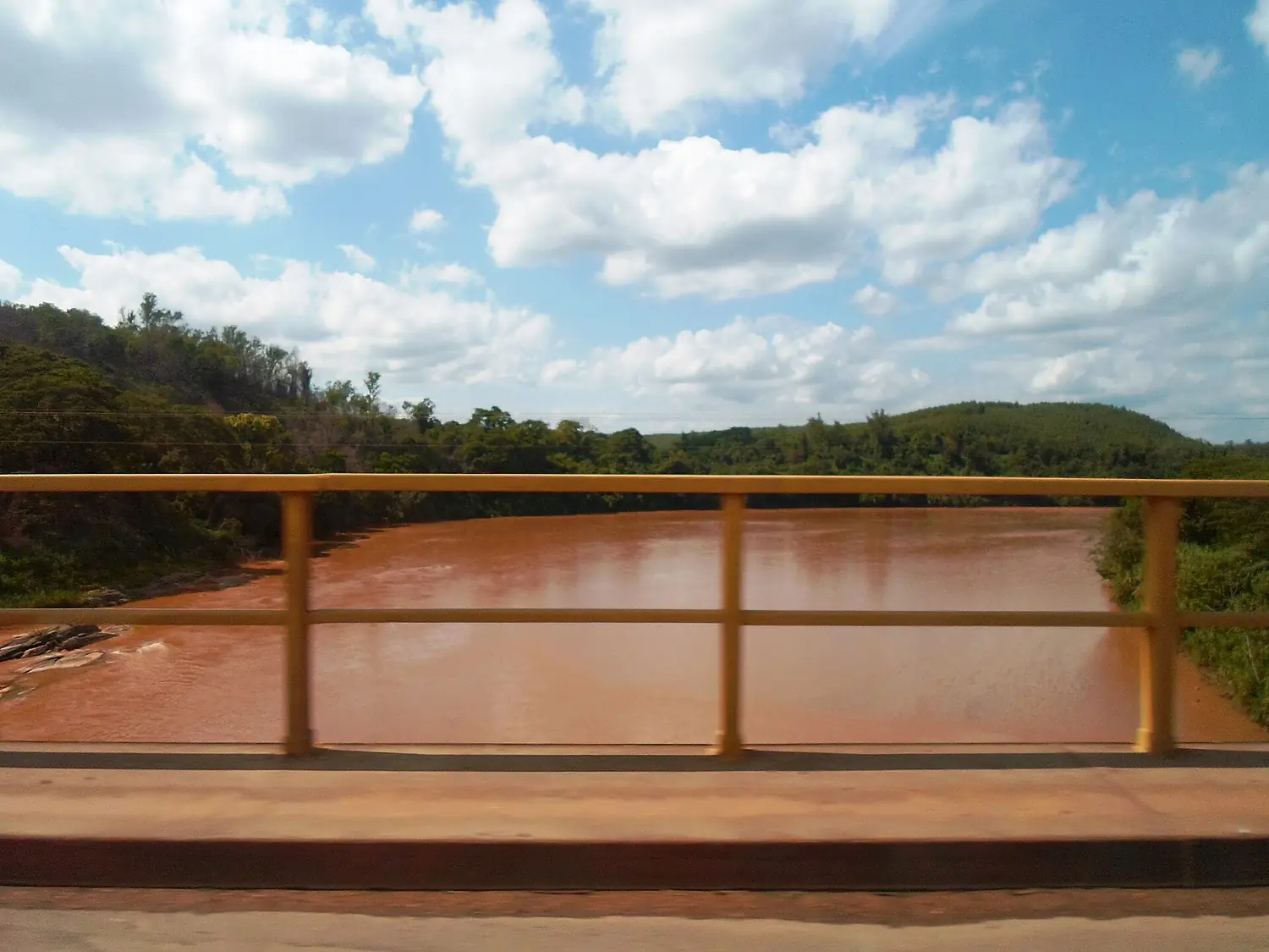
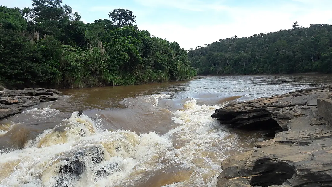
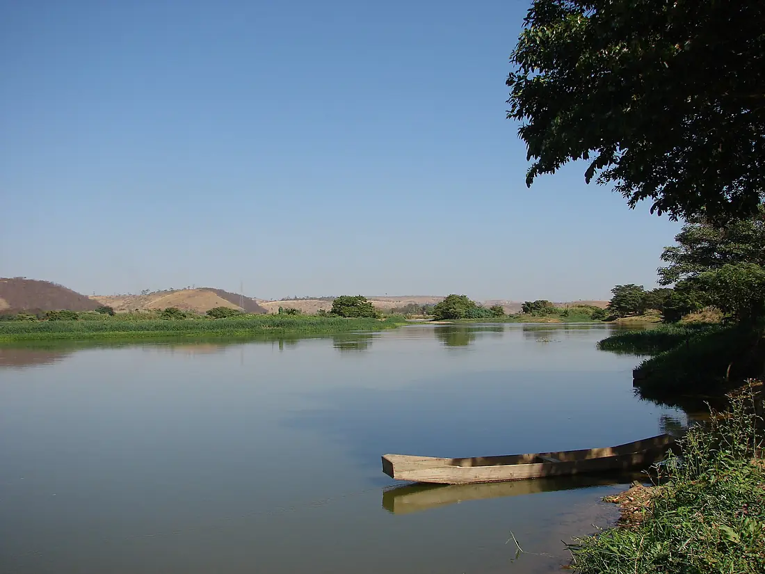
Doce River in pictures

Tributaries
Where it flows, and what flows into it
Tributaries (19)
Also: Piracicaba River, Do Carmo River, Manhuaçu River, Santo Antônio River, Suaçuí Pequeno River, Casca River, Corrente River, Guandu River, Matipó River, Suaçuí Grande River, Pancas River, Santa Joana River, Caratinga River, São José River, Mutum River, São João Grande River, Rio Laje, Boi Stream, Santa Maria do Rio Doce River
Where these numbers come from
| Name, length, places | Wikidata (Q1757394) · CC0 |
|---|---|
| Course, profile, basin | RiverATLAS v1.0 (HydroATLAS, Linke et al. 2019) · CC BY 4.0 — followed from the source to the mouth given by Wikidata |
| Flow | WaterGAP (RiverATLAS), 1971–2000 · CC BY 4.0 |
| Climate along the river | WorldClim (RiverATLAS), 1970–2000 · CC BY 4.0 |
| Towns, bridges, dams | Wikidata · CC0; GeoNames · CC BY 4.0 |
| Along the river | © OpenStreetMap contributors · ODbL |
| Images | EOX Sentinel-2 cloudless 2016 · CC BY 4.0; Wikimedia Commons |
| Our other atlases | Cascadyas, Lakeyas, Coastya — Wikidata · CC0; © OpenStreetMap contributors · ODbL; GeoNames · CC BY 4.0; HydroLAKES · CC BY 4.0; NOAA OISST |
Every source and licence is on the data sources page.
The family
Do you prefer beaches, lakes, mountains, waterfalls, islands, rivers or canyons?
Same idea, other landscapes: field atlases built on open data, month by month, in seven languages.
beaches Find your beach: sea temperature, sun and swimming month by month.Visit lakes
 Every lake on Earth: water temperature, ice, depth and the shore.Coming soonVisit
  mountains
 Every summit in 3D: summit weather, the 0 °C line, huts and trails.Visit waterfalls
 Every waterfall: height, flow month by month and when it roars.Coming soonVisit
  islands
 Every island from the sea up: size, sea temperature, ferries and 3D.Coming soonVisit
  rivers
 Every river from source to sea: the journey, the flow and the basin in numbers.You are here
 canyons
 Every canyon cut to scale: depth to the floor, rim and floor temperatures, trails and viewpoints.Coming soonVisit