River
Don
1,870 km from source to mouth · Russia.
 RussiaFlows into Sea of Azov
In numbers
Length
1,870km
Average flow
940m³/s
Basin
422,000km²
Drop
166m
from 163 m to -3 m
Country
1
The journey
From source to mouth
1,870 km of river and 68 stops on the way: 6 towns and cities on its banks, dams, bridges and the tributaries that feed it.
- 0 kmCentral Russian Uplandat 163 m
- 17 kmKimovskoye Vodokhranilishche3.6 km²
- 29 kmBolshaya Sukromkatributary
- 45 kmNepryadvatributary
- 55 kmMokraya Tabolatributary
- 75 kmPanikatributary
- 103 kmKochurovkatributary
- 132 kmVyazovkatributary
- 156 kmSkvirnyatributary
- 178 kmKrasivaya Mechatributary
- 213 kmBystraya Sosnatributary
- 268 kmKamenkatributary
- 286 kmKhmelinkatributary
- 286 kmRepetstributary
- 298 kmSnovatributary
- 350 kmBolshaya Vereykatributary
- 350 kmNegatributary
- 376 kmVedugatributary
- 391 kmDevitsatributary
- 410 kmVoronezh Reservoir56 km²
- 411 kmVoronezhtributary
- 424 kmPogonovo1.2 km²
- 441 kmNovovoronezh37,392 people
- 466 kmKhvorostantributary
- 473 kmOzero Nazarovo (lanaw nga porma ug arko)0.4 km²
- 476 kmOzero Beloye0.4 km²
- 492 kmPotudantributary
- 506 kmTikhaya Sosnatributary
- 513 kmOzero Bogatoye (lanaw sa Rusya, Voronezhskaya Oblast')0.8 km²
- 516 kmLiski55,939 people
- 525 kmOzero Peskovatskoye0.7 km²
- 548 kmIkoretstributary
- 596 kmBityugtributary
- 640 kmOsered Rivertributary
- 666 kmKazinkatributary
- 682 kmChyornaya Kalitvatributary
- 763 kmBogucharkatributary
- 780 kmTolucheyevkatributary
- 807 kmYar Sukhoy Donetstributary
- 821 kmMatyushinatributary
- 831 kmPeskovatkatributary
- 860 kmTikhayatributary
- 903 kmOzero Ostrovnoye (lanaw sa Rusya, Rostovskaya Oblast')0.4 km²
- 946 kmKhopyortributary
- 976 kmMedveditsatributary
- 1,069 kmSukhaya Perekopkatributary
- 1,139 kmVolochilischetributary
- 1,158 kmIlovlyatributary
- 1,168 kmTishankatributary
- 1,186 kmPanshinkatributary
- 1,284 kmDonskaya Tsaritsatributary
- 1,431 kmTsimlyansk14,731 people
- 1,433 kmTsimlyansk Reservoir2,254 km²
- 1,433 kmTsimlyansk Hydroelectric Station
- 1,435 kmKumshaktributary
- 1,455 kmOzero Tumovskoye0.7 km²
- 1,483 kmStary Dontributary
- 1,528 kmKagal'niktributary
- 1,558 kmDonetstributary
- 1,579 kmSal Rivertributary
- 1,641 kmManychtributary
- 1,645 kmBagaevsky Hydroelectric Complex
- 1,677 kmAksay38,871 people
- 1,689 kmGrebnoy Canal1.0 km²
- 1,690 kmRostov-on-Don1,143,123 people
- 1,691 kmTemernik Rivertributary
- 1,705 kmKoysugtributary
- 1,720 kmAzov79,872 people
- 1,735 kmAzovkatributary
- 1,870 kmSea of Azovat -3 m
Water level along the river (RiverATLAS; the height is exaggerated). Towns: GeoNames and Wikidata; bridges, dams and tributaries: Wikidata.
Russian river, fifth-longest river in Europe
At the mouth it carries 935 m³/s on average: an Olympic pool every 2.7 seconds. It drops from 163 m to -3 m, 0.1 m per kilometre on average. Its basin covers 422,000 km², about the size of IQ. 17.9 million people live in it. Highest water: from April to July; lowest: from January to March. It is heavily dammed: reservoirs can hold 81% of a year's flow.
Where to start
- Rostov-on-DonLargest city on its banks · 1,143,123 people
- Krasnodar Pashkovsky International Airport (KRR)Nearest airport with scheduled flights, 247 km from the city
- On the water55 ferry piers, marinas, boat rentals and boat ramps along the river (OpenStreetMap)
- From May to SeptemberThe best months to visit
Don, month by month
Highest water: from April to July
Lowest water: from January to March. Freezing months (average below −4 °C): from January to February. Best months to visit: from May to September.
From about 310 m³/s in the lowest month to 2,900 m³/s in the highest. An estimate: the monthly flow is modelled from the lowest and highest months of WaterGAP (RiverATLAS, 1971–2000) and the rain and snow along the river (WorldClim). Dams change the real rhythm. The chip is the average air temperature; below it, the month's rain.
Plan the trip
Plan the trip: boat trips, a bed by the river, a car
Some links above are affiliate links: if you book through them we may earn a commission, at no extra cost to you. It never changes what the data on this page says.
The basin
Don: the basin in numbers
437,307 km² of land send their water to this river. This is what lives on it.
- 17.9millionpeople live in the basin
- 42/km²people per km²
- 143maverage altitude of the basin
- 490mmof rain a year (basin average)
- 7.3°Caverage air temperature
- 3%protected areas
- 1.1%covered by lakes
- 25km³held in reservoirs
What covers the basin
- 3% Forest
- 62% Cropland
- 22% Pasture
- 2% Towns and cities
RiverATLAS (HydroATLAS v1.0, CC BY 4.0): land cover, people, protected areas, glaciers and dams over the whole basin upstream of the mouth.
Along the river
Don: what you find on the way
- 7Weirs
- 14LocksKanal imeno Lenina and 13 more
- 2Waterfalls
- 5Boat rampsSlip and 4 more
- 31Ferry piers
- 13Marinas
- 25River beaches
From OpenStreetMap, within 2.8 km of the river. Not mapped is not the same as not there.
Cross-checked with our atlases
Don in our other atlases
What our sister atlases know about the waterfalls on this river, the lakes it flows through, the beaches at its mouth, the mountains where it rises and the islands off its mouth.
 11lakes on its wayLakeyas
 1island off the mouthIslandyas
Lakes and reservoirs (11)
Lakes it flows through, by Lakeyas
- Kimovskoye Vodokhranilishchekm 173.6km²
- Voronezh Reservoirkm 40456km²
- Pogonovokm 4191.2km²
- Ozero Bogatoye (lanaw sa Rusya, Voronezhskaya Oblast')km 5060.8km²
- Ozero Peskovatskoyekm 5180.7km²
- Tsimlyansk Reservoirkm 1,4142,254km²
- Ozero Tumovskoyekm 1,4360.7km²
- Grebnoy Canalkm 1,6671.0km²
3 more on LakeyasLakeyas is coming soonOpen Lakeyas ↗
Islands off the mouth (1)
Within 30 km of the mouth, by Islandyas
- Cherepakha Islet25 km away
Islandyas is coming soonOpen Islandyas ↗
From space
The source and the mouth, seen from orbit
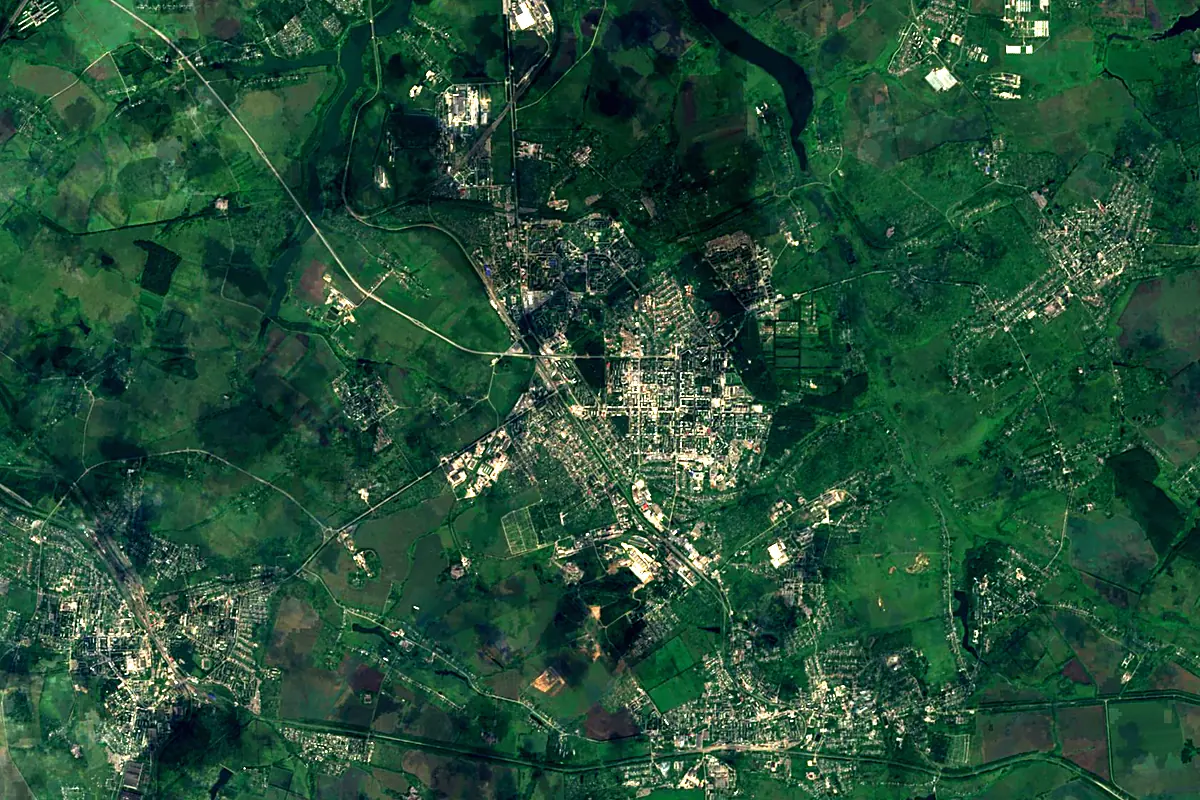
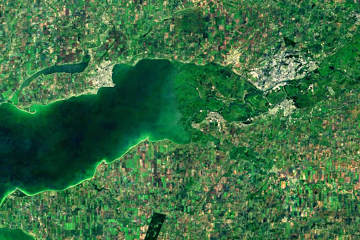
Sentinel-2 cloudless 2016 by EOX IT Services GmbH (contains modified Copernicus Sentinel data 2016), CC BY 4.0. The glowing line is the river as drawn by RiverATLAS.
Photos
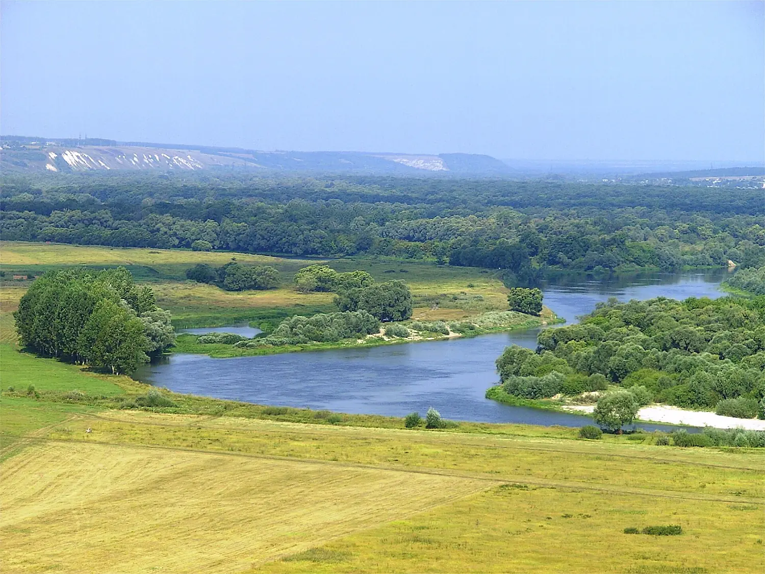
Don in pictures
Tributaries
Where it flows, and what flows into it
Tributaries (76)
Also: Voronezh, Manych, Medveditsa, Chir, Bystraya Sosna, Bityug, Sal River, Ilovlya, Tikhaya Sosna, Krasivaya Mecha, Temernik River, Nepryadva, Chyornaya Kalitva, Veduga, Donskaya Tsaritsa, Osered River, Bogucharka, Tolucheyevka, Khvorostan, Bolshaya Vereyka, Panshinka, Potudan, Kazinka, Matyushina
 Ukraine
Nearby
Rivers nearby
Where these numbers come from
| Name, length, places | Wikidata (Q1229) · CC0 |
|---|---|
| Course, profile, basin | RiverATLAS v1.0 (HydroATLAS, Linke et al. 2019) · CC BY 4.0 — followed from the source to the mouth given by Wikidata |
| Flow | WaterGAP (RiverATLAS), 1971–2000 · CC BY 4.0 |
| Climate along the river | WorldClim (RiverATLAS), 1970–2000 · CC BY 4.0 |
| Towns, bridges, dams | Wikidata · CC0; GeoNames · CC BY 4.0 |
| Along the river | © OpenStreetMap contributors · ODbL |
| Images | EOX Sentinel-2 cloudless 2016 · CC BY 4.0; Wikimedia Commons |
| Our other atlases | Lakeyas, Islandyas — Wikidata · CC0; © OpenStreetMap contributors · ODbL; GeoNames · CC BY 4.0; HydroLAKES · CC BY 4.0; NOAA OISST |
Every source and licence is on the data sources page.
The family
Do you prefer beaches, lakes, mountains, waterfalls, islands, rivers or canyons?
Same idea, other landscapes: field atlases built on open data, month by month, in seven languages.
 beaches
 Find your beach: sea temperature, sun and swimming month by month.Visit lakes
 Every lake on Earth: water temperature, ice, depth and the shore.Coming soonVisit
  mountains
 Every summit in 3D: summit weather, the 0 °C line, huts and trails.Visit
  waterfalls
 Every waterfall: height, flow month by month and when it roars.Coming soonVisit islands
 Every island from the sea up: size, sea temperature, ferries and 3D.Coming soonVisit
  rivers
 Every river from source to sea: the journey, the flow and the basin in numbers.You are here
 canyons
 Every canyon cut to scale: depth to the floor, rim and floor temperatures, trails and viewpoints.Coming soonVisit