River
Indus River
3,180 km from source to mouth · Pakistan, China and India.


 Pakistan, China and IndiaFlows into Arabian Sea1st longest in Pakistan
In numbers
Length
3,180km
Average flow
6,600m³/s
Basin
1,165,000km²
Drop
5,151m
from 5,150 m to -1 m
Countries
3
The journey
From source to mouth
3,180 km of river and 55 stops on the way: 18 towns and cities on its banks, dams, bridges and the tributaries that feed it.
- 0 kmTibetan Plateauat 5,150 m
- 260 kmGar24,910 people
- 301 kmGar Tsangpotributary
- 332 kmSengge Zangbotributary
- 581 kmChoglamsar10,754 people
- 605 kmZanskar Rivertributary
- 626 kmAlchi Bridge
- 657 kmYapola Rivertributary
- 802 kmShyok Rivertributary
- 839 kmSkardu112,996 people
- 840 kmShigar Rivertributary
- 844 kmKatpana Lake0.4 km²
- 844 kmSatpara Streamtributary
- 975 kmBunji Bridge
- 981 kmJaglot27,000 people
- 981 kmGilgit Rivertributary
- 995 kmAstore Rivertributary
- 1,005 kmRaikot Bridge
- 1,154 kmDasu Dam
- 1,239 kmYouyi Bridge
- 1,339 kmTarbela Dam
- 1,340 kmTarbela Lake208 km²
- 1,365 kmMusa Banda/Musa khan kallay18,000 people
- 1,386 kmJamgah10,044 people
- 1,391 kmKabul Rivertributary
- 1,392 kmAttock Fort
- 1,394 kmAttock Bridge
- 1,405 kmHaro Rivertributary
- 1,521 kmSoan Rivertributary
- 1,533 kmKalabagh Dam
- 1,539 kmKalabagh15,976 people
- 1,582 kmKurram Rivertributary
- 1,601 kmChashma Barrage
- 1,637 kmKalur Kot29,578 people
- 1,686 kmDera Ismail Khan109,686 people
- 1,715 kmGomal Rivertributary
- 1,890 kmPayala Lake Ghazi Ghat1.2 km²
- 2,037 kmPanjnad Rivertributary
- 2,127 kmGuddu Barrage
- 2,275 kmRohri92,135 people
- 2,276 kmLansdowne Bridge
- 2,276 kmAyub Bridge
- 2,278 kmSukkur499,900 people
- 2,280 kmSukkur Barrage
- 2,295 kmBagarji8,005 people
- 2,356 kmLarkana490,508 people
- 2,518 kmDaulatpur14,574 people
- 2,529 kmSehwan75,167 people
- 2,592 kmSann8,834 people
- 2,610 kmManjhand140,766 people
- 2,678 kmKotri Barrage
- 2,685 kmMehran Railway Bridge
- 2,686 kmKotri Bridge
- 2,686 kmKotri259,358 people
- 2,774 kmKeenjhar Lake100 km²
- 2,819 kmChakomar Dhand0.5 km²
- 3,180 kmArabian Seaat -1 m
Water level along the river (RiverATLAS; the height is exaggerated). Towns: GeoNames and Wikidata; bridges, dams and tributaries: Wikidata.
River in Asia
At the mouth it carries 6,600 m³/s on average: 2.6 Olympic pools every second. It drops from 5,150 m to -1 m, 1.6 m per kilometre on average. Its basin covers 1,165,000 km², about the size of CO. 184 million people live in it. Highest water: from August to September; lowest: December. Dams and reservoirs hold back a large share of its water (38% of a year's flow).
Where to start
- SukkurLargest city on its banks · 499,900 people
- Begum Nusrat Bhutto International Airport Sukkur (SKZ)Nearest airport with scheduled flights, 8 km from the cityCar hire at KHI airport (Karachi)Discover Cars · Affiliate link↗
- On the water20 ferry piers, marinas, boat rentals and boat ramps along the river (OpenStreetMap)
- From April to June and from September to OctoberThe best months to visit
Indus River, month by month
Highest water: from August to September
Lowest water: December. Best months to visit: from April to June and from September to October.
From about 880 m³/s in the lowest month to 7,700 m³/s in the highest. An estimate: the monthly flow is modelled from the lowest and highest months of WaterGAP (RiverATLAS, 1971–2000) and the rain and snow along the river (WorldClim). Dams change the real rhythm. The chip is the average air temperature; below it, the month's rain.
Plan the trip
Plan the trip: boat trips, a bed by the river, a car
Some links above are affiliate links: if you book through them we may earn a commission, at no extra cost to you. It never changes what the data on this page says.
The basin
Indus River: the basin in numbers
854,650 km² of land send their water to this river. This is what lives on it.
- 184millionpeople live in the basin
- 216/km²people per km²
- 2,144maverage altitude of the basin
- 425mmof rain a year (basin average)
- 12.7°Caverage air temperature
- 8%protected areas
- 0.4%covered by lakes
- 3%glaciers
- 14%permafrost
- 49km³held in reservoirs
What covers the basin
- 12% Forest
- 28% Cropland
- 14% Pasture
- 6% Towns and cities
- 3% Ice
RiverATLAS (HydroATLAS v1.0, CC BY 4.0): land cover, people, protected areas, glaciers and dams over the whole basin upstream of the mouth.
Along the river
Indus River: what you find on the way
- 31WeirsGhazi Barrage and 30 more
- 1Locks
- 7WaterfallsHussainabad Waterfall, Husseinabad waterfall (small), Karakorum Waterfall and 4 more
- 3Boat ramps
- 17Ferry piers
From OpenStreetMap, within 3.0 km of the river. Not mapped is not the same as not there.
Cross-checked with our atlases
Indus River in our other atlases
What our sister atlases know about the waterfalls on this river, the lakes it flows through, the beaches at its mouth, the mountains where it rises and the islands off its mouth.
 5lakes on its wayLakeyas
Lakes and reservoirs (5)
Lakes it flows through, by Lakeyas
- Katpana Lakekm 8860.4km²
- Tarbela Lakekm 1,407208km²
- Payala Lake Ghazi Ghatkm 1,9851.2km²
- Keenjhar Lakekm 2,913100km²
- Chakomar Dhandkm 2,9610.5km²
Lakeyas is coming soonOpen Lakeyas ↗
From space
The source and the mouth, seen from orbit
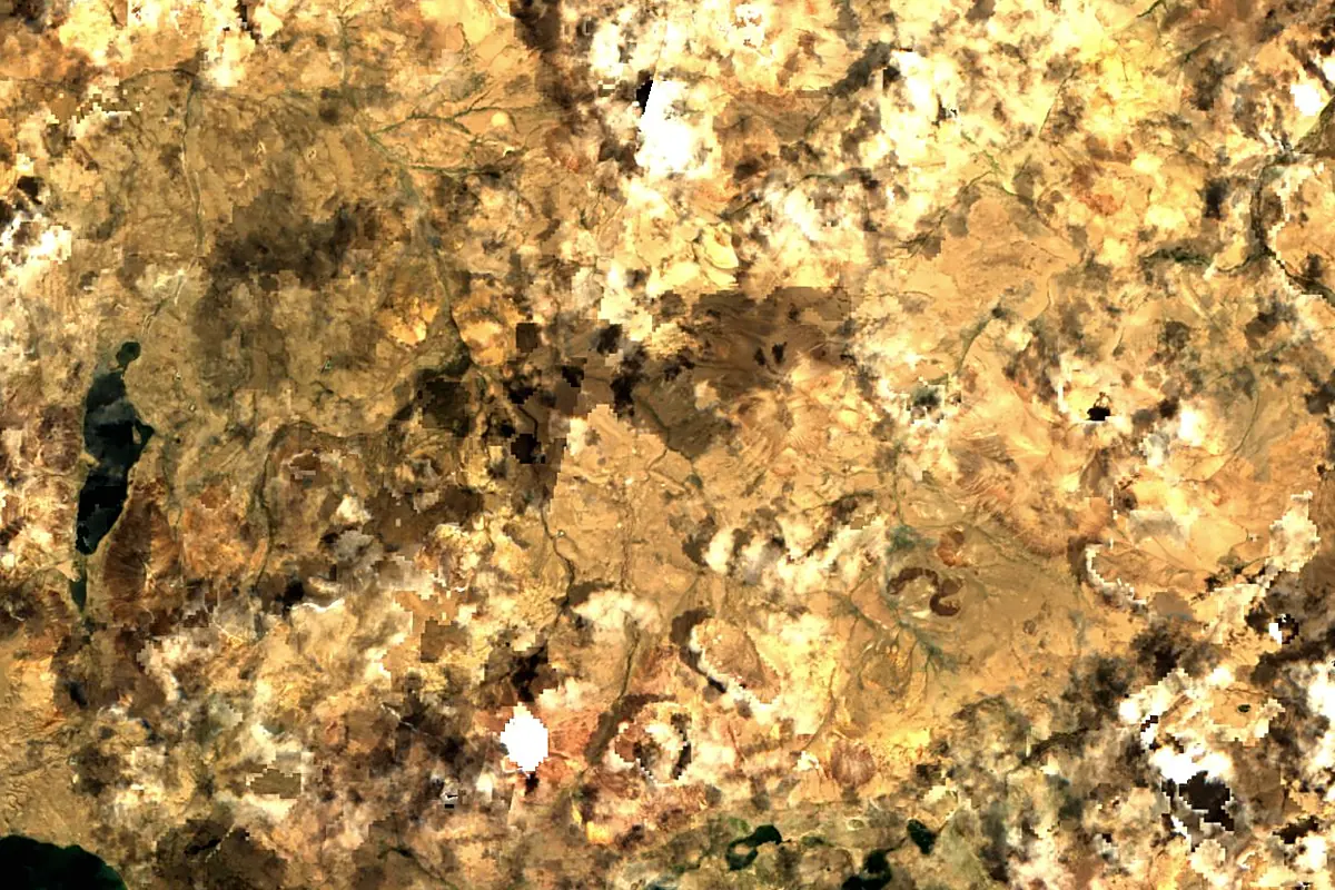
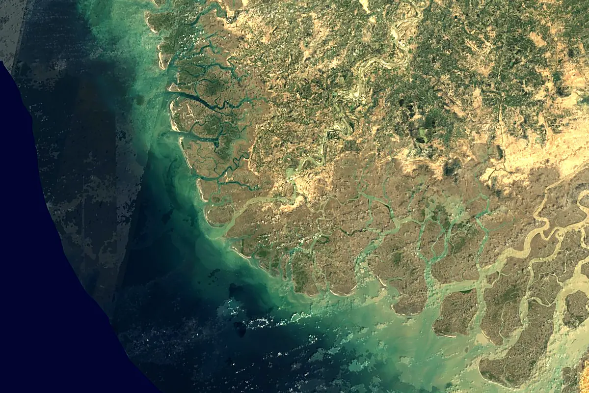
Sentinel-2 cloudless 2016 by EOX IT Services GmbH (contains modified Copernicus Sentinel data 2016), CC BY 4.0. The glowing line is the river as drawn by RiverATLAS.
Photos
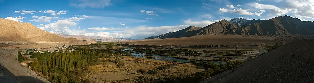
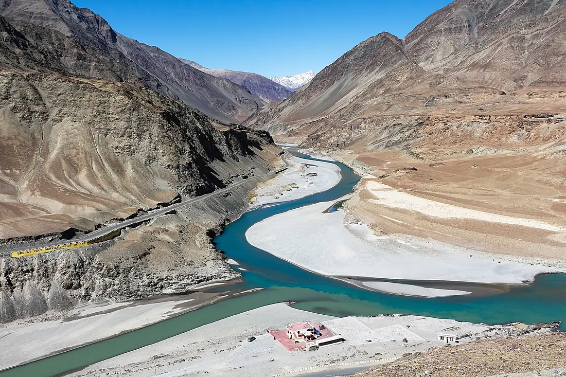
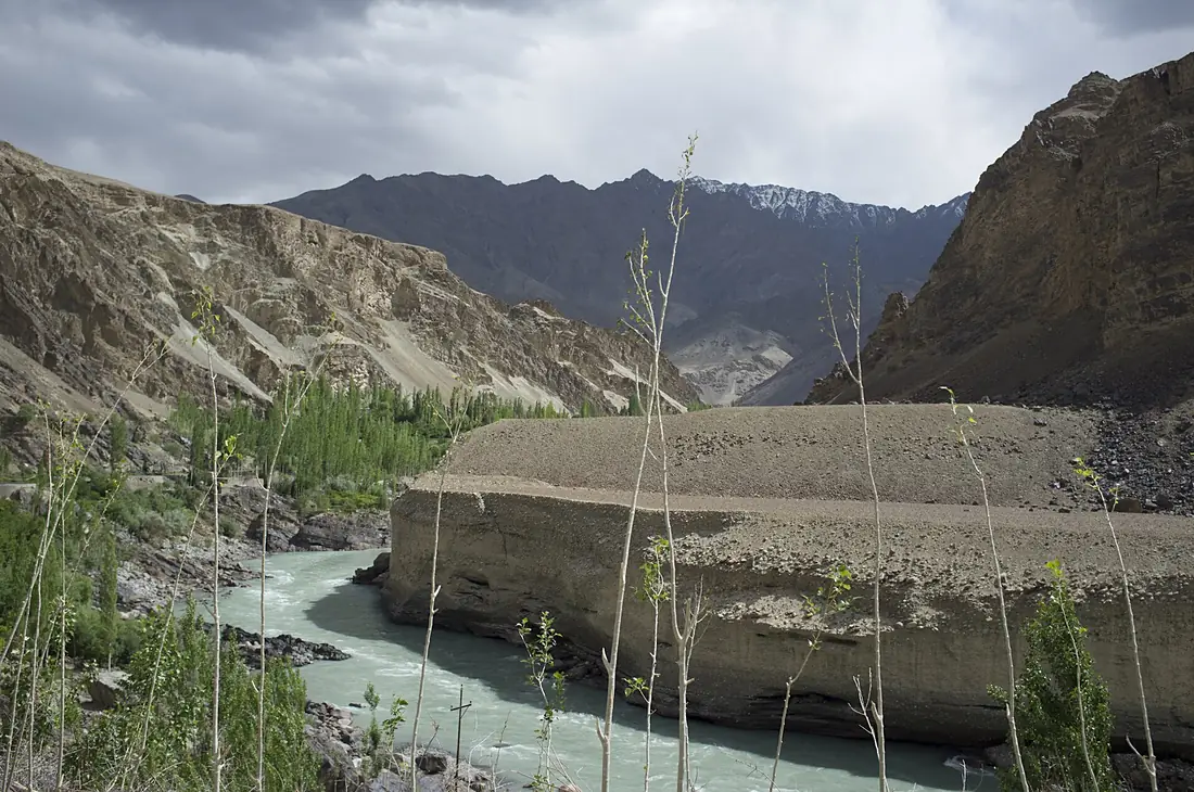
Indus River in pictures
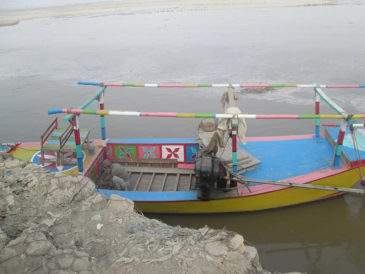
Tributaries
Where it flows, and what flows into it
Tributaries (21)
Pakistan550 km130 m³/sjoins at km 842Kabul RiverPakistan460 km1,200 m³/sjoins at km 1,461Gilgit RiverPakistan263 km1,000 m³/sjoins at km 1,031Also: Gomal River, Panjnad River, Zanskar River, Soan River, Haro River, Kurram River, Shigar River, Astore River, Shingo River, Yapola River, Sengge Zangbo, River Jindi, Gar Tsangpo, Xiangquan He, Satpara Stream, Siran River, Ghizer River, Sumar River
 Afghanistan
Nearby
Rivers nearby
Where these numbers come from
| Name, length, places | Wikidata (Q7348) · CC0 |
|---|---|
| Course, profile, basin | RiverATLAS v1.0 (HydroATLAS, Linke et al. 2019) · CC BY 4.0 — followed from the source to the mouth given by Wikidata |
| Flow | WaterGAP (RiverATLAS), 1971–2000 · CC BY 4.0 |
| Climate along the river | WorldClim (RiverATLAS), 1970–2000 · CC BY 4.0 |
| Towns, bridges, dams | Wikidata · CC0; GeoNames · CC BY 4.0 |
| Along the river | © OpenStreetMap contributors · ODbL |
| Images | EOX Sentinel-2 cloudless 2016 · CC BY 4.0; Wikimedia Commons |
| Our other atlases | Lakeyas — Wikidata · CC0; © OpenStreetMap contributors · ODbL; GeoNames · CC BY 4.0; HydroLAKES · CC BY 4.0; NOAA OISST |
Every source and licence is on the data sources page.
The family
Do you prefer beaches, lakes, mountains, waterfalls, islands, rivers or canyons?
Same idea, other landscapes: field atlases built on open data, month by month, in seven languages.
 beaches
 Find your beach: sea temperature, sun and swimming month by month.Visit lakes
 Every lake on Earth: water temperature, ice, depth and the shore.Coming soonVisit
  mountains
 Every summit in 3D: summit weather, the 0 °C line, huts and trails.Visit
  waterfalls
 Every waterfall: height, flow month by month and when it roars.Coming soonVisit
  islands
 Every island from the sea up: size, sea temperature, ferries and 3D.Coming soonVisit
  rivers
 Every river from source to sea: the journey, the flow and the basin in numbers.You are here
 canyons
 Every canyon cut to scale: depth to the floor, rim and floor temperatures, trails and viewpoints.Coming soonVisit