Stream
Kaveri
765 km from source to mouth · India.
 IndiaFlows into Bay of Bengal
In numbers
Length
765km
Average flow
310m³/s
Basin
80,000km²
Drop
927m
from 927 m to 0 m
Country
1
The journey
From source to mouth
765 km of river and 54 stops on the way: 38 towns and cities on its banks, dams, bridges and the tributaries that feed it.
- 0 kmSourceat 927 m
- 62 kmHolenarasipura29,974 people
- 131 kmHemavati Rivertributary
- 148 kmLakshmana Tirthatributary
- 157 kmKrishna Raja Sagara80 km²
- 170 kmShrīrangapattana25,061 people
- 194 kmBannūr25,455 people
- 206 kmKabini Rivertributary
- 207 kmBhairāpura14,276 people
- 207 kmTirumakūdal Narsipur9,980 people
- 257 kmShivanasamudra Falls98 m
- 257 kmGaganachukki Falls
- 267 kmShimshatributary
- 273 kmShimsha Falls
- 294 kmMekedaatu
- 294 kmArkavatitributary
- 340 kmHogenakkal Falls20 m
- 340 kmHogenakal Falls
- 385 kmVīrnūr16,665 people
- 390 kmStanley Reservoir121 km²
- 392 kmMettur56,743 people
- 406 kmPūlāmpatti9,477 people
- 411 kmAmmāpettai8,552 people
- 423 kmThevūr8,548 people
- 432 kmKumarapalayam195,071 people
- 434 kmBhavāni39,744 people
- 434 kmBhavani Rivertributary
- 434 kmPudūr17,240 people
- 439 kmSūryampālaiyam28,585 people
- 442 kmBrāhmana Periya Agrahāram24,798 people
- 442 kmVīrappanchathiram84,453 people
- 445 kmCauvery Bridge
- 445 kmPallipalayam40,140 people
- 446 kmĀlampālaiyam20,286 people
- 446 kmErode521,891 people
- 483 kmKodumudi13,225 people
- 485 kmChennasamudram8,111 people
- 493 kmVegarai9,330 people
- 495 kmPottanūr18,455 people
- 496 kmVelur25,012 people
- 499 kmPugalūr23,408 people
- 501 kmTottakkurichchi10,969 people
- 512 kmMohanūr14,315 people
- 525 kmAmarāvati Rivertributary
- 535 kmKrishnarayapuram10,792 people
- 540 kmThottiyam14,909 people
- 551 kmKulittalai27,910 people
- 553 kmMusiri30,209 people
- 556 kmMarudūr10,925 people
- 564 kmSirugamani10,743 people
- 585 kmTiruchirappalli1,022,518 people
- 590 kmPāppākurichchi24,023 people
- 597 kmLalgudi23,740 people
- 677 kmTirupananthal11,169 people
- 699 kmManamodu9,017 people
- 765 kmBay of Bengalat 0 m
Water level along the river (RiverATLAS; the height is exaggerated). Towns: GeoNames and Wikidata; bridges, dams and tributaries: Wikidata.
River in southern India
At the mouth it carries 308 m³/s on average: an Olympic pool every 8.1 seconds. It drops from 927 m to 0 m, 1.2 m per kilometre on average. Its basin covers 80,000 km², about the size of CZ. 37.3 million people live in it. Highest water: from October to November; lowest: from February to May. It is heavily dammed: reservoirs can hold 80% of a year's flow.
Where to start
- TiruchirappalliLargest city on its banks · 1,022,518 people
- Tiruchirappalli International Airport (TRZ)Nearest airport with scheduled flights, 6 km from the cityCar hire at COK airport (Kochi)Discover Cars · Affiliate link↗
- On the water7 ferry piers, marinas, boat rentals and boat ramps along the river (OpenStreetMap)
- From December to FebruaryThe best months to visit
Kaveri, month by month
Highest water: from October to November
Lowest water: from February to May. Best months to visit: from December to February.
From about 41 m³/s in the lowest month to 930 m³/s in the highest. An estimate: the monthly flow is modelled from the lowest and highest months of WaterGAP (RiverATLAS, 1971–2000) and the rain and snow along the river (WorldClim). Dams change the real rhythm. The chip is the average air temperature; below it, the month's rain.
Plan the trip
Plan the trip: boat trips, a bed by the river, a car
Some links above are affiliate links: if you book through them we may earn a commission, at no extra cost to you. It never changes what the data on this page says.
The basin
Kaveri: the basin in numbers
78,368 km² of land send their water to this river. This is what lives on it.
- 37.3millionpeople live in the basin
- 477/km²people per km²
- 615maverage altitude of the basin
- 932mmof rain a year (basin average)
- 25.3°Caverage air temperature
- 16%protected areas
- 0.8%covered by lakes
- 7.8km³held in reservoirs
What covers the basin
- 46% Forest
- 61% Cropland
- 4% Pasture
- 12% Towns and cities
RiverATLAS (HydroATLAS v1.0, CC BY 4.0): land cover, people, protected areas, glaciers and dams over the whole basin upstream of the mouth.
Along the river
Kaveri: what you find on the way
- 26Weirs
- 1Locks
- 8WaterfallsYedmuri Falls, Balamuri Waterfall, Barachukki Falls and 5 more
- 6Ferry piersNagamari Ferry, Mettur Dam Observation Ferry and 4 more
- 2River beachesPalaiyar Beach, Kodiyampalaiyam Beach
From OpenStreetMap, within 2.3 km of the river. Not mapped is not the same as not there.
Cross-checked with our atlases
Kaveri in our other atlases
What our sister atlases know about the waterfalls on this river, the lakes it flows through, the beaches at its mouth, the mountains where it rises and the islands off its mouth.
 6waterfalls on the riverCascadyas
 2lakes on its wayLakeyas
Waterfalls (6)
On the river, by Cascadyas
- Shivanasamudra Fallskm 26498m
- Gaganachukki Fallskm 264
- Shimsha Fallskm 282
- Mekedaatukm 302
- Hogenakkal Fallskm 35020m
- Hogenakal Fallskm 350
Cascadyas is coming soonOpen Cascadyas ↗
Lakes and reservoirs (2)
Lakes it flows through, by Lakeyas
- Krishna Raja Sagarakm 16280km²
- Stanley Reservoirkm 402 · 40 m deep121km²
Lakeyas is coming soonOpen Lakeyas ↗
From space
The source and the mouth, seen from orbit
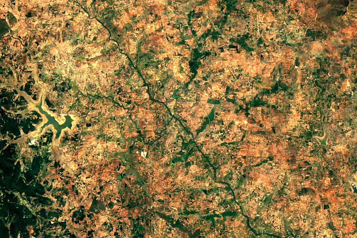
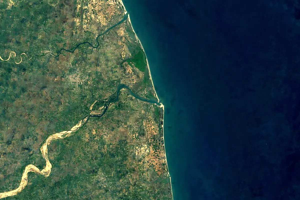
Sentinel-2 cloudless 2016 by EOX IT Services GmbH (contains modified Copernicus Sentinel data 2016), CC BY 4.0. The glowing line is the river as drawn by RiverATLAS.
Photos
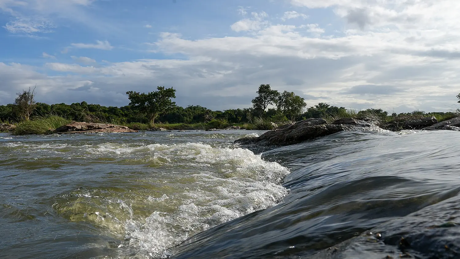
Kaveri in pictures
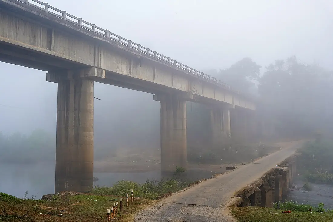
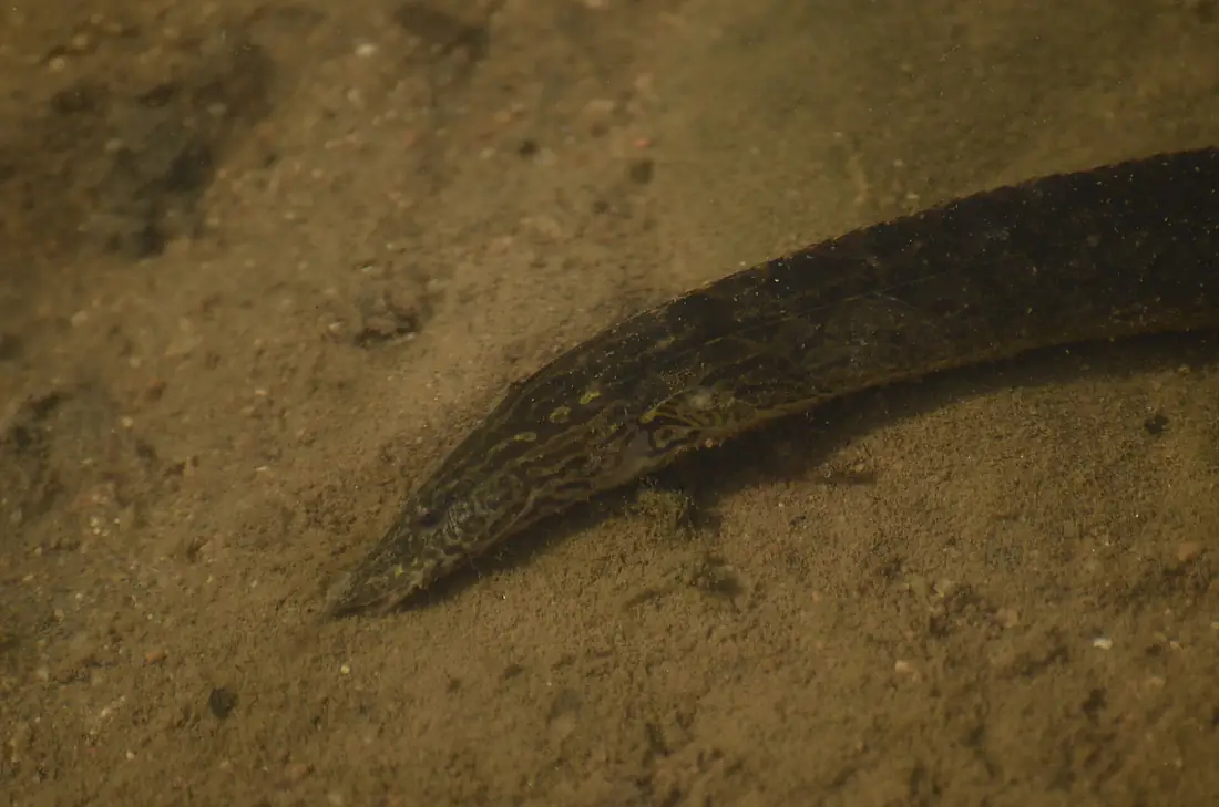
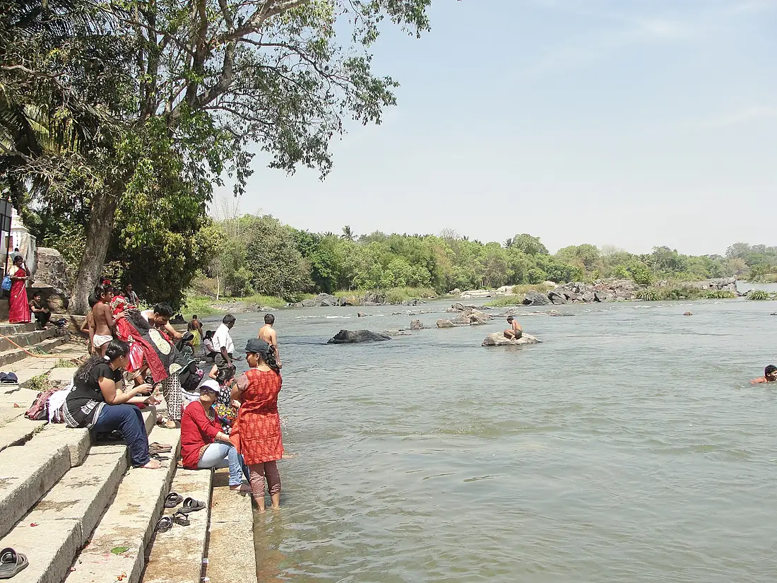
Tributaries
Where it flows, and what flows into it
Tributaries (9)
Also: Bhavani River, Kabini River, Amarāvati River, Arkavati, Hemavati River, Shimsha, Moyar River, Lakshmana Tirtha, Thirumanimutharu river
 Sri Lanka
Where these numbers come from
| Name, length, places | Wikidata (Q216239) · CC0 |
|---|---|
| Course, profile, basin | RiverATLAS v1.0 (HydroATLAS, Linke et al. 2019) · CC BY 4.0 — followed along the river network from the point given by Wikidata |
| Flow | WaterGAP (RiverATLAS), 1971–2000 · CC BY 4.0 |
| Climate along the river | WorldClim (RiverATLAS), 1970–2000 · CC BY 4.0 |
| Towns, bridges, dams | Wikidata · CC0; GeoNames · CC BY 4.0 |
| Along the river | © OpenStreetMap contributors · ODbL |
| Images | EOX Sentinel-2 cloudless 2016 · CC BY 4.0; Wikimedia Commons |
| Our other atlases | Cascadyas, Lakeyas — Wikidata · CC0; © OpenStreetMap contributors · ODbL; GeoNames · CC BY 4.0; HydroLAKES · CC BY 4.0; NOAA OISST |
Every source and licence is on the data sources page.
The family
Do you prefer beaches, lakes, mountains, waterfalls, islands, rivers or canyons?
Same idea, other landscapes: field atlases built on open data, month by month, in seven languages.
 beaches
 Find your beach: sea temperature, sun and swimming month by month.Visit lakes
 Every lake on Earth: water temperature, ice, depth and the shore.Coming soonVisit
  mountains
 Every summit in 3D: summit weather, the 0 °C line, huts and trails.Visit waterfalls
 Every waterfall: height, flow month by month and when it roars.Coming soonVisit
  islands
 Every island from the sea up: size, sea temperature, ferries and 3D.Coming soonVisit
  rivers
 Every river from source to sea: the journey, the flow and the basin in numbers.You are here
 canyons
 Every canyon cut to scale: depth to the floor, rim and floor temperatures, trails and viewpoints.Coming soonVisit