River
Namsen
229 km from source to mouth · Norway.
 NorwayFlows into Namsenfjorden6th longest in Norway
In numbers
Length
229km
Average flow
280m³/s
Basin
6,200km²
Drop
616m
from 616 m to 0 m
Country
1
The journey
From source to mouth
229 km of river and 36 stops on the way: 0 towns and cities on its banks, dams, bridges and the tributaries that feed it.
- 0 kmNamsvatnetat 616 m
- 0 kmOnne Tjohkelenjaevrie0.8 km²
- 2 kmGievkere1.1 km²
- 14 kmStoerre-garse
- 25 kmLuvlie-Raajhkere1.2 km²
- 26 kmStorgollomsvatnet5.3 km²
- 31 kmKråavvajaevrie0.9 km²
- 35 kmNamsvatnet39 km²
- 39 kmLuvlie Kaajien-jaevrie0.3 km²
- 41 kmStoerresovvene0.3 km²
- 46 kmJofossen
- 54 kmSmeelehjaevrie1.4 km²
- 55 kmOterfossen
- 55 kmMellingsvatnet4.5 km²
- 57 kmSteinvatnet (lanaw sa Noruwega, Nord-Trøndelag Fylke)0.3 km²
- 64 kmMellingfossen
- 68 kmStorfrøyningen2.6 km²
- 86 kmLitfossen
- 93 kmStoerre Braahkenjaevrie0.5 km²
- 94 kmStorfossen
- 101 kmKjelmyrfossen
- 113 kmTrongfossen
- 114 kmTronesfossen
- 116 kmAusvatnet0.7 km²
- 121 kmStorvatnet1.1 km²
- 131 kmÅsmulfossen
- 134 kmSellfossen
- 136 kmGammelkvennfossen
- 139 kmLiafossen
- 142 kmKvennfossen
- 144 kmBreidfossen
- 146 kmHolterfossen
- 152 kmNes bridge
- 156 kmKvernfossen
- 158 kmFiskumfoss
- 158 kmFiskemfossen
- 227 kmNamsbrua
- 229 kmNamsenfjordenat 0 m
Water level along the river (RiverATLAS; the height is exaggerated). Towns: GeoNames and Wikidata; bridges, dams and tributaries: Wikidata.
River in Trøndelag, Norway
At the mouth it carries 285 m³/s on average: an Olympic pool every 8.8 seconds. It drops from 616 m to 0 m, 2.7 m per kilometre on average. Its basin covers 6,200 km², about the size of PS. 9,814 people live in it. Highest water, with the snowmelt: from May to June; lowest: from January to March and August. Its dams hold back little of its water (8.0% of a year's flow).
Where to start
- NamsosLargest city on its banks · 8,413 people
- Rørvik Airport, Ryum (RVK)Nearest airport with scheduled flights, 45 km from the cityCar hire at TRD airport (Trondheim)Discover Cars · Affiliate link↗
- On the water5 ferry piers, marinas, boat rentals and boat ramps along the river (OpenStreetMap)
- Kayak and canoe5 put-ins and rapids mapped (OpenStreetMap)
- From July to AugustThe best months to visit
Namsen, month by month
Highest water: from May to June
Lowest water: from January to March and August. Freezing months (average below −4 °C): January. Melting snow makes up much of its water. Best months to visit: from July to August.
From about 58 m³/s in the lowest month to 760 m³/s in the highest. An estimate: the monthly flow is modelled from the lowest and highest months of WaterGAP (RiverATLAS, 1971–2000) and the rain and snow along the river (WorldClim). Dams change the real rhythm. The chip is the average air temperature; below it, the month's rain.
Plan the trip
Plan the trip: boat trips, a bed by the river, a car
Some links above are affiliate links: if you book through them we may earn a commission, at no extra cost to you. It never changes what the data on this page says.
The basin
Namsen: the basin in numbers
6,558 km² of land send their water to this river. This is what lives on it.
- 9,814people live in the basin
- 2/km²people per km²
- 476maverage altitude of the basin
- 1,358mmof rain a year (basin average)
- 2.5°Caverage air temperature
- 22%protected areas
- 6.1%covered by lakes
- 1%permafrost
- 0.6km³held in reservoirs
What covers the basin
- 45% Forest
RiverATLAS (HydroATLAS v1.0, CC BY 4.0): land cover, people, protected areas, glaciers and dams over the whole basin upstream of the mouth.
Along the river
Namsen: what you find on the way
- 14WeirsFiskumfoss and 13 more
- 38WaterfallsStoerre-garse - Storfossen, Helvetesfossen - Lijkiehagke, Jofossen and 35 more
- 5RapidsFarflya, Grøtet, Hoekkerfossen and 2 more
- 1Boat ramps
- 4Ferry piersOrelva, Storelva, Børgefjellfoten and 1 more
From OpenStreetMap, within 1.7 km of the river. Not mapped is not the same as not there.
Cross-checked with our atlases
Namsen in our other atlases
What our sister atlases know about the waterfalls on this river, the lakes it flows through, the beaches at its mouth, the mountains where it rises and the islands off its mouth.
 19waterfalls on the riverCascadyas
 15lakes on its wayLakeyas
 3beaches at the mouth and on the banksCoastya
 78mountains at the sourcePeakyas
 4islands off the mouthIslandyas
Waterfalls (19)
On the river, by Cascadyas
- Kjelmyrfossenkm 79
- Trongfossenkm 88
- Tronesfossenkm 89
- Åsmulfossenkm 102
- Sellfossenkm 104
- Holterfossenkm 114
- Fiskumfosskm 123
- Fiskemfossenkm 123
11 more on CascadyasCascadyas is coming soonOpen Cascadyas ↗
Lakes and reservoirs (15)
Lakes it flows through, by Lakeyas
- Storgollomsvatnetkm 205.3km²
- Kråavvajaevriekm 240.9km²
- Namsvatnetkm 2739km²
- Mellingsvatnetkm 434.5km²
- Steinvatnet (lanaw sa Noruwega, Nord-Trøndelag Fylke)km 440.3km²
- Storfrøyningenkm 532.6km²
- Ausvatnetkm 900.7km²
- Storvatnetkm 941.1km²
7 more on LakeyasLakeyas is coming soonOpen Lakeyas ↗
Beaches (3)
At the mouth (25 km) and on the banks, by Coastya
- Sørråsa17 km away · cove13.9°C
- Vestgøten14 km away · cove13.9°C
- Saudalen8.3 km away · cove13.9°C
Mountains at the source (78)
Within 15 km of the source, by Peakyas
- Jengelfjellet12 km away900m
- Hutnegebaarmoe12 km away859m
- Kløyvfjellet13 km away820m
- Svaalenjunie11 km away800m
- Vektarlia11 km away
- Huddingslia14 km away
- Store Dærga7.5 km away
- Skarnja9.1 km away
70 more on PeakyasOpen Peakyas ↗
Islands off the mouth (4)
Within 30 km of the mouth, by Islandyas
- Otterøya22 km away143km²
- Jøa28 km away55km²
- Hoddøya21 km away10km²
- Elvalandet17 km away38km²
Islandyas is coming soonOpen Islandyas ↗
From space
The source and the mouth, seen from orbit
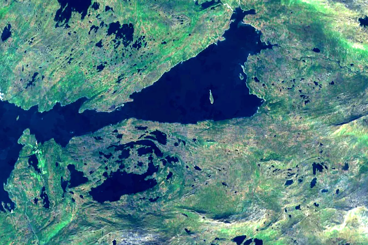
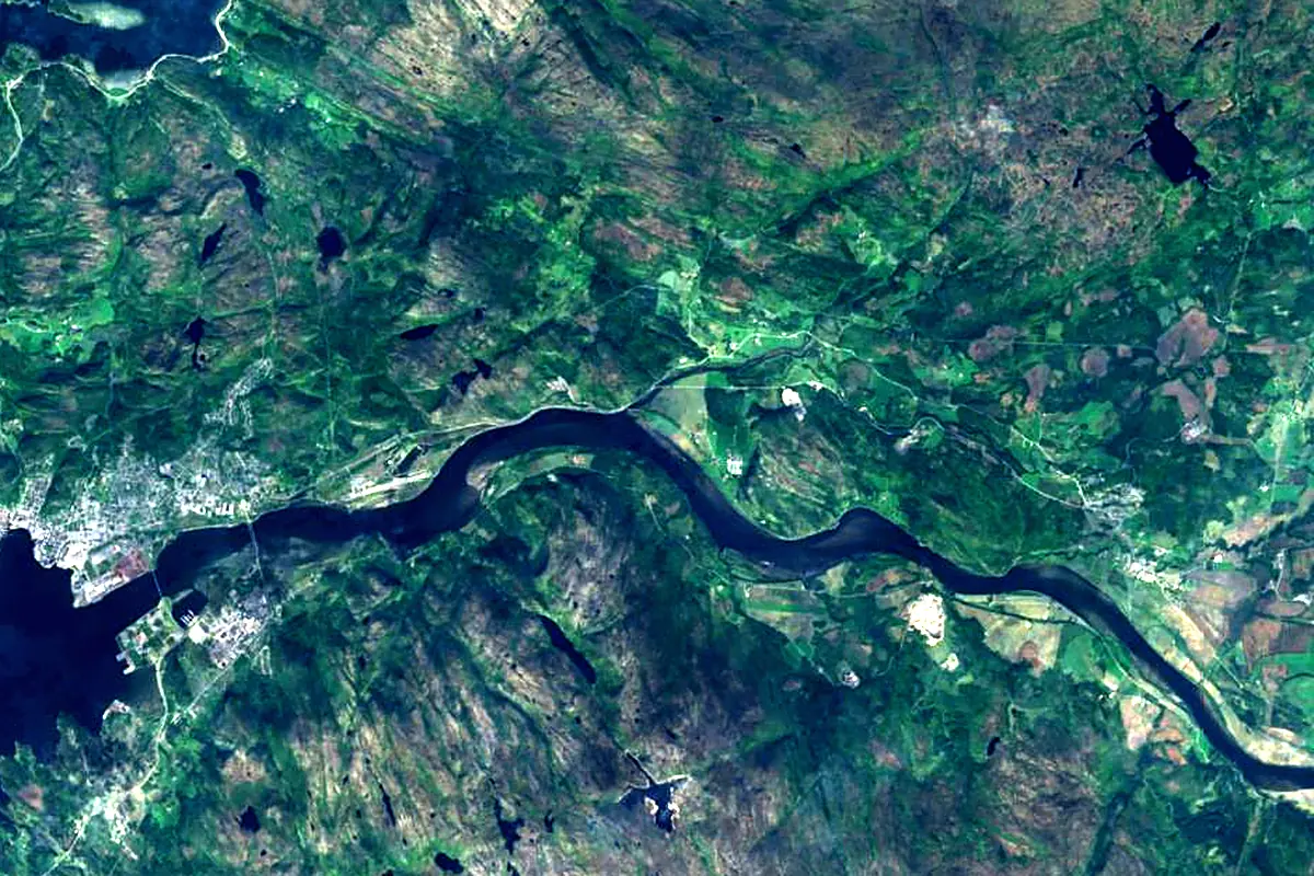
Sentinel-2 cloudless 2016 by EOX IT Services GmbH (contains modified Copernicus Sentinel data 2016), CC BY 4.0. The glowing line is the river as drawn by RiverATLAS.
Photos
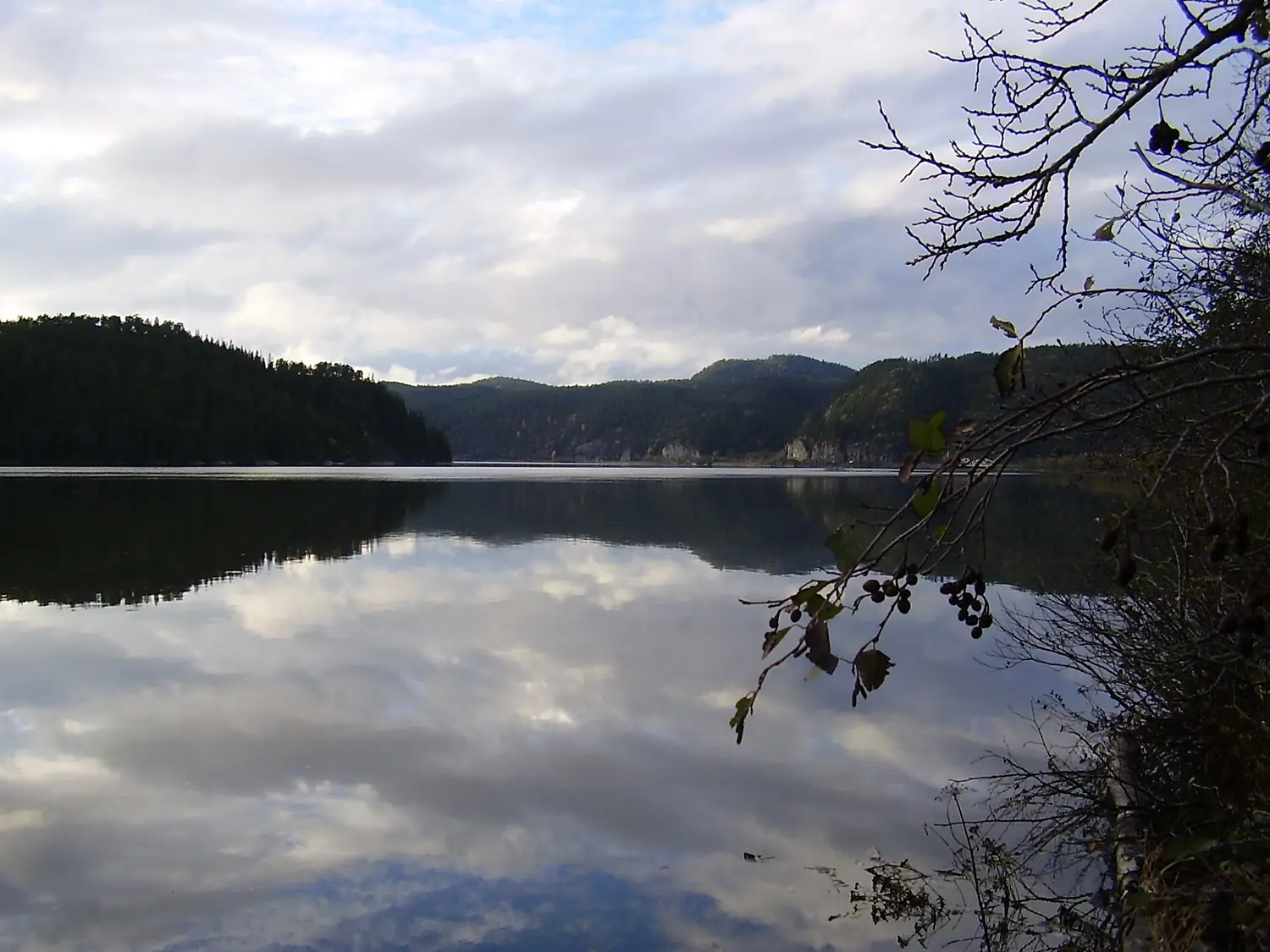
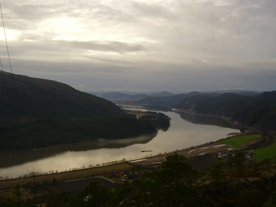
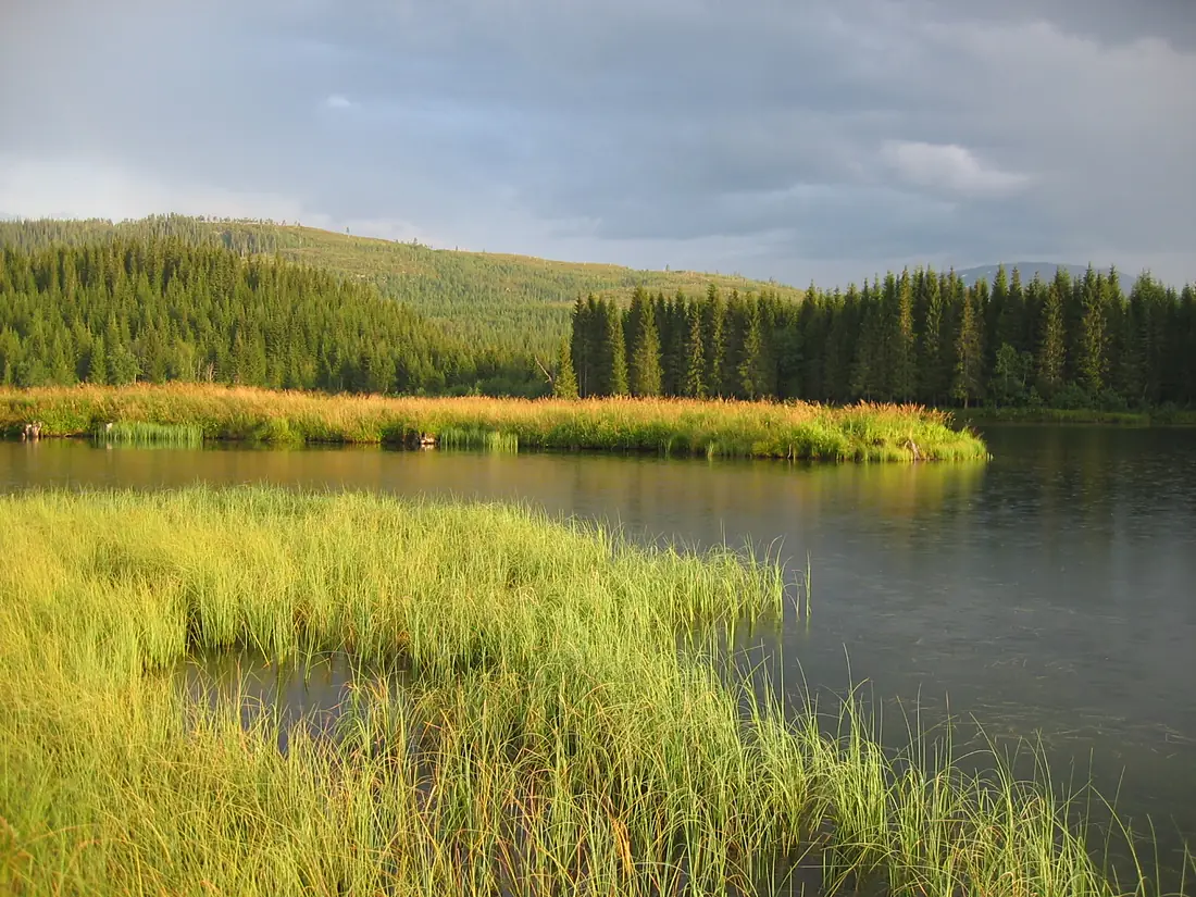
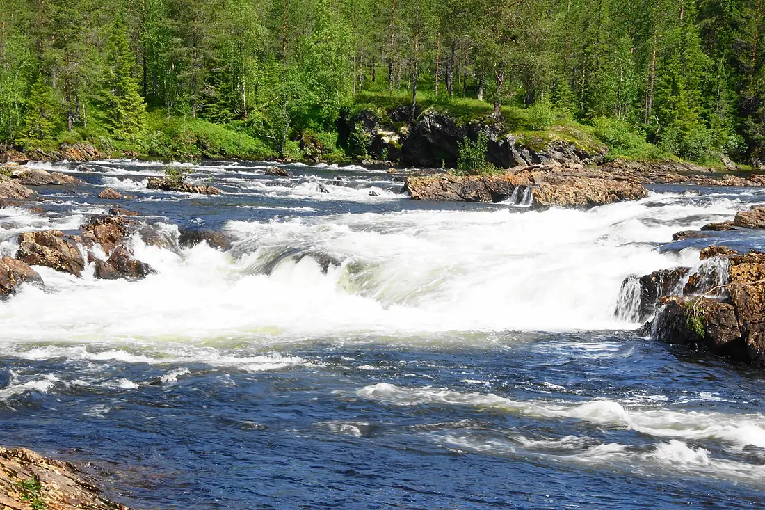
Namsen in pictures
Tributaries
Where it flows, and what flows into it
Tributaries (1)
Also: Sanddøla
Nearby
Rivers nearby
Norway30 km84 m³/s132 km awayOrklaNorway179 km50 m³/s156 km awayVefsnaNorway163 km210 m³/s167 km awayLjusnan Sweden440 km230 m³/s339 km awayIndalsälvenSweden420 km460 m³/s358 km awayLjunganSweden350 km140 m³/s373 km awayGudbrandsdalslågenNorway204 km220 m³/s379 km awayUme älvSweden467 km450 m³/s428 km away
Where these numbers come from
| Name, length, places | Wikidata (Q1518561) · CC0 |
|---|---|
| Course, profile, basin | RiverATLAS v1.0 (HydroATLAS, Linke et al. 2019) · CC BY 4.0 — followed from the source to the mouth given by Wikidata |
| Flow | WaterGAP (RiverATLAS), 1971–2000 · CC BY 4.0 |
| Climate along the river | WorldClim (RiverATLAS), 1970–2000 · CC BY 4.0 |
| Towns, bridges, dams | Wikidata · CC0; GeoNames · CC BY 4.0 |
| Along the river | © OpenStreetMap contributors · ODbL |
| Images | EOX Sentinel-2 cloudless 2016 · CC BY 4.0; Wikimedia Commons |
| Our other atlases | Cascadyas, Lakeyas, Coastya, Peakyas, Islandyas — Wikidata · CC0; © OpenStreetMap contributors · ODbL; GeoNames · CC BY 4.0; HydroLAKES · CC BY 4.0; NOAA OISST |
Every source and licence is on the data sources page.
The family
Do you prefer beaches, lakes, mountains, waterfalls, islands, rivers or canyons?
Same idea, other landscapes: field atlases built on open data, month by month, in seven languages.
beaches Find your beach: sea temperature, sun and swimming month by month.Visit lakes
 Every lake on Earth: water temperature, ice, depth and the shore.Coming soonVisit mountains
 Every summit in 3D: summit weather, the 0 °C line, huts and trails.Visit waterfalls
 Every waterfall: height, flow month by month and when it roars.Coming soonVisit islands
 Every island from the sea up: size, sea temperature, ferries and 3D.Coming soonVisit
  rivers
 Every river from source to sea: the journey, the flow and the basin in numbers.You are here
 canyons
 Every canyon cut to scale: depth to the floor, rim and floor temperatures, trails and viewpoints.Coming soonVisit