River
Parnaíba River
1,450 km from source to mouth · Brazil.
 BrazilFlows into Atlantic Ocean
In numbers
Length
1,450km
Average flow
990m³/s
Basin
344,112km²
Drop
391m
from 391 m to 0 m
Country
1
The journey
From source to mouth
1,450 km of river and 68 stops on the way: 9 towns and cities on its banks, dams, bridges and the tributaries that feed it.
- 0 kmChapada das Mangabeirasat 391 m
- 80 kmUruçuí-Vermelho Rivertributary
- 91 kmCachoeira Pedra de Amolar
- 151 kmCachoeira Apertada Hora
- 151 kmCachoeira d'Areia
- 210 kmCachoeira Pedra da Veneranda
- 233 kmCachoeira do Caititu
- 266 kmCachoeira Pedra do Puga
- 457 kmCachoeira de Conceição
- 470 kmUruçuí Prêto Rivertributary
- 479 kmDas Balsas Rivertributary
- 525 kmCachoeira Espera
- 532 kmCachoeira do Espírito Santo
- 551 kmCachoeira Canavieira
- 634 kmRepresa da Boa Esperança311 km²
- 634 kmCachoeira Banco de Areia
- 663 kmGurguéia Rivertributary
- 711 kmFloriano62,036 people
- 751 kmCachoeira Remanso
- 788 kmCanindé Rivertributary
- 878 kmParnarama35,008 people
- 969 kmTeresina871,126 people
- 971 kmTimon174,465 people
- 978 kmPoti Rivertributary
- 1,042 kmUnião46,119 people
- 1,092 kmCoelho Neto49,621 people
- 1,110 kmMiguel Alves33,833 people
- 1,139 kmLagoa da Taboca0.3 km²
- 1,140 kmLagoa do Murici1.2 km²
- 1,140 kmLagoa da Tapera1.9 km²
- 1,143 kmLagoa Maria Isabel0.4 km²
- 1,148 kmLagoa da Touceira0.9 km²
- 1,149 kmLagoa da Pintada0.6 km²
- 1,150 kmLagoa da Estiva3.4 km²
- 1,153 kmLagoa da Pouca Vergonha0.7 km²
- 1,157 kmLagoa da Inhuma0.5 km²
- 1,162 kmLagoa Carnaúba Torta0.4 km²
- 1,165 kmLagoa do Campo2.6 km²
- 1,167 kmLagoa da Raiz0.6 km²
- 1,170 kmLagoa dos Escalvados2.4 km²
- 1,174 kmLagoa dos Cavalos0.4 km²
- 1,180 kmLagoa da Sapucaia0.3 km²
- 1,182 kmLagoa do Surrão0.6 km²
- 1,184 kmLagoa do Cercado0.3 km²
- 1,187 kmLagoa das Corvinas4.2 km²
- 1,191 kmLagoa de São Francisco1.5 km²
- 1,195 kmLagoa Malhadinha2.2 km²
- 1,197 kmLagoa das Pedras0.7 km²
- 1,201 kmLagoa da Titara0.4 km²
- 1,202 kmLagoa Suçuapara1.2 km²
- 1,206 kmLagoa da Porta0.4 km²
- 1,206 kmLagoa Mutuns1.4 km²
- 1,211 kmLagoa do Cantinho5.3 km²
- 1,212 kmLagoa Sapucaia0.5 km²
- 1,215 kmLagoa do Canto do Rodeio0.9 km²
- 1,219 kmLagoa dos Caibros0.4 km²
- 1,234 kmLagoa das Inhumas0.7 km²
- 1,243 kmLagoa do Saco0.4 km²
- 1,254 kmLagoa da Melancia0.4 km²
- 1,269 kmLagoa da Boca da Catinga0.3 km²
- 1,273 kmLagoa da Onça0.9 km²
- 1,301 kmLagoa do Surubim0.4 km²
- 1,304 kmLagoa do Cabeçote0.5 km²
- 1,308 kmLagoa da Vargem3.0 km²
- 1,319 kmLagoa Grande do Buriti0.8 km²
- 1,325 kmLongá Rivertributary
- 1,334 kmLagoa do Meio0.4 km²
- 1,356 kmParnaíba162,159 people
- 1,371 kmIlha Grande9,274 people
- 1,450 kmAtlantic Oceanat 0 m
Water level along the river (RiverATLAS; the height is exaggerated). Towns: GeoNames and Wikidata; bridges, dams and tributaries: Wikidata.
River in Maranhão & Piauí, Brazil
At the mouth it carries 994 m³/s on average: an Olympic pool every 2.5 seconds. It drops from 391 m to 0 m, 0.3 m per kilometre on average. Its basin covers 344,112 km², about the size of CG. 4.3 million people live in it. Highest water: from March to April; lowest: from August to November. Dams and reservoirs hold back a large share of its water (19% of a year's flow).
Where to start
- TeresinaLargest city on its banks · 871,126 people
- Senador Petrônio Portela Airport (THE)Nearest airport with scheduled flights, 4 km from the cityCar hire at THE airport (Teresina)Discover Cars · Affiliate link↗
- On the water45 ferry piers, marinas, boat rentals and boat ramps along the river (OpenStreetMap)
- From June to JulyThe best months to visit
Parnaíba River, month by month
Highest water: from March to April
Lowest water: from August to November. Best months to visit: from June to July.
From about 360 m³/s in the lowest month to 2,500 m³/s in the highest. An estimate: the monthly flow is modelled from the lowest and highest months of WaterGAP (RiverATLAS, 1971–2000) and the rain and snow along the river (WorldClim). Dams change the real rhythm. The chip is the average air temperature; below it, the month's rain.
Plan the trip
Plan the trip: boat trips, a bed by the river, a car
Some links above are affiliate links: if you book through them we may earn a commission, at no extra cost to you. It never changes what the data on this page says.
The basin
Parnaíba River: the basin in numbers
332,986 km² of land send their water to this river. This is what lives on it.
- 4.3millionpeople live in the basin
- 13/km²people per km²
- 355maverage altitude of the basin
- 1,039mmof rain a year (basin average)
- 25.9°Caverage air temperature
- 10%protected areas
- 0.2%covered by lakes
- 6.0km³held in reservoirs
What covers the basin
- 36% Forest
- 6% Cropland
- 11% Pasture
RiverATLAS (HydroATLAS v1.0, CC BY 4.0): land cover, people, protected areas, glaciers and dams over the whole basin upstream of the mouth.
Along the river
Parnaíba River: what you find on the way
- 2Weirs
- 4Locks
- 1WaterfallsCachoeira das Tabocas
- 2Boat ramps
- 42Ferry piersSanta Filomena, Alto Parnaíba, Baixa Grande do Ribeiro and 39 more
- 1MarinasSolarium Marina
From OpenStreetMap, within 2.7 km of the river. Not mapped is not the same as not there.
Cross-checked with our atlases
Parnaíba River in our other atlases
What our sister atlases know about the waterfalls on this river, the lakes it flows through, the beaches at its mouth, the mountains where it rises and the islands off its mouth.
 12waterfalls on the riverCascadyas
 40lakes on its wayLakeyas
Waterfalls (12)
On the river, by Cascadyas
- Cachoeira Pedra de Amolarkm 85
- Cachoeira Apertada Horakm 141
- Cachoeira d'Areiakm 141
- Cachoeira Pedra da Venerandakm 196
- Cachoeira do Caititukm 217
- Cachoeira Pedra do Pugakm 248
- Cachoeira de Conceiçãokm 426
- Cachoeira Esperakm 489
4 more on CascadyasCascadyas is coming soonOpen Cascadyas ↗
Lakes and reservoirs (40)
Lakes it flows through, by Lakeyas
- Represa da Boa Esperançakm 590311km²
- Lagoa da Estivakm 1,0713.4km²
- Lagoa do Campokm 1,0852.6km²
- Lagoa dos Escalvadoskm 1,0902.4km²
- Lagoa das Corvinaskm 1,1054.2km²
- Lagoa Malhadinhakm 1,1132.2km²
- Lagoa do Cantinhokm 1,1275.3km²
- Lagoa da Vargemkm 1,2183.0km²
32 more on LakeyasLakeyas is coming soonOpen Lakeyas ↗
From space
The source and the mouth, seen from orbit
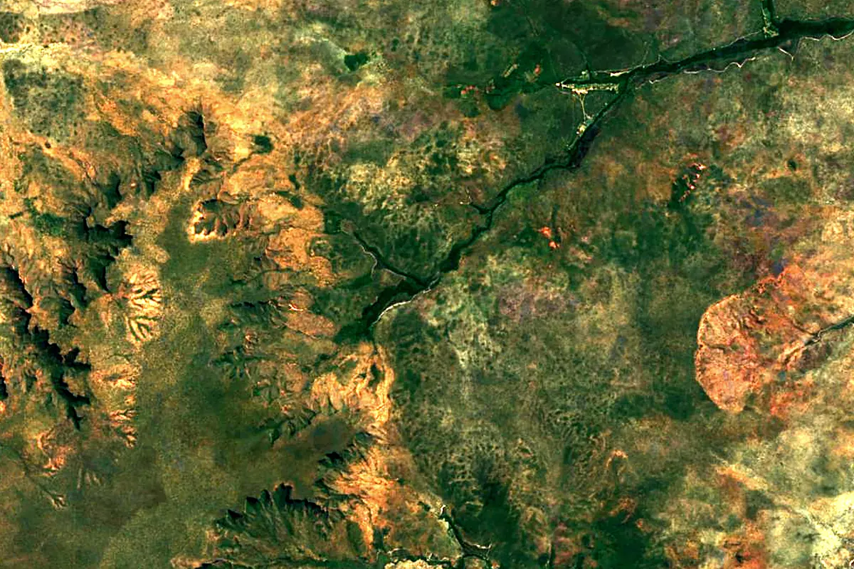
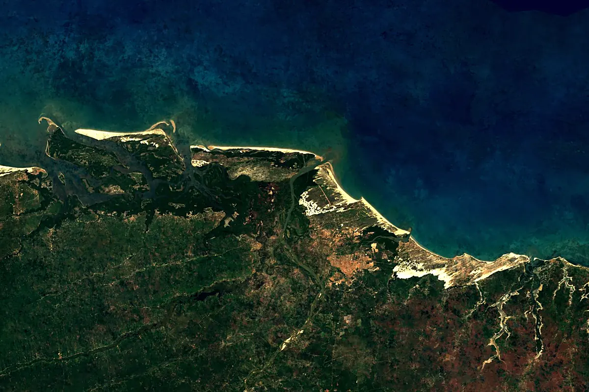
Sentinel-2 cloudless 2016 by EOX IT Services GmbH (contains modified Copernicus Sentinel data 2016), CC BY 4.0. The glowing line is the river as drawn by RiverATLAS.
Photos
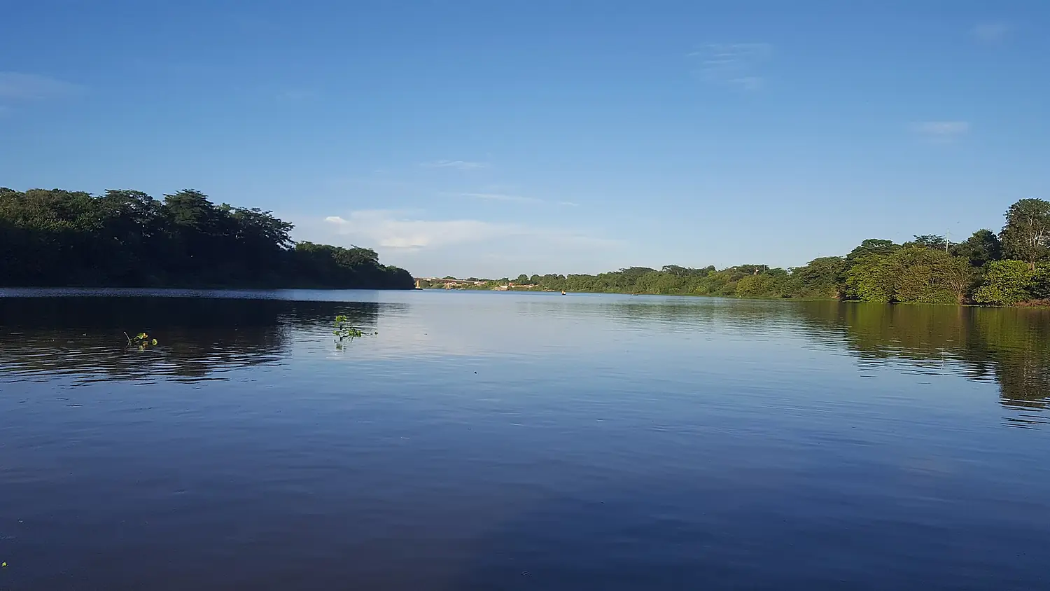
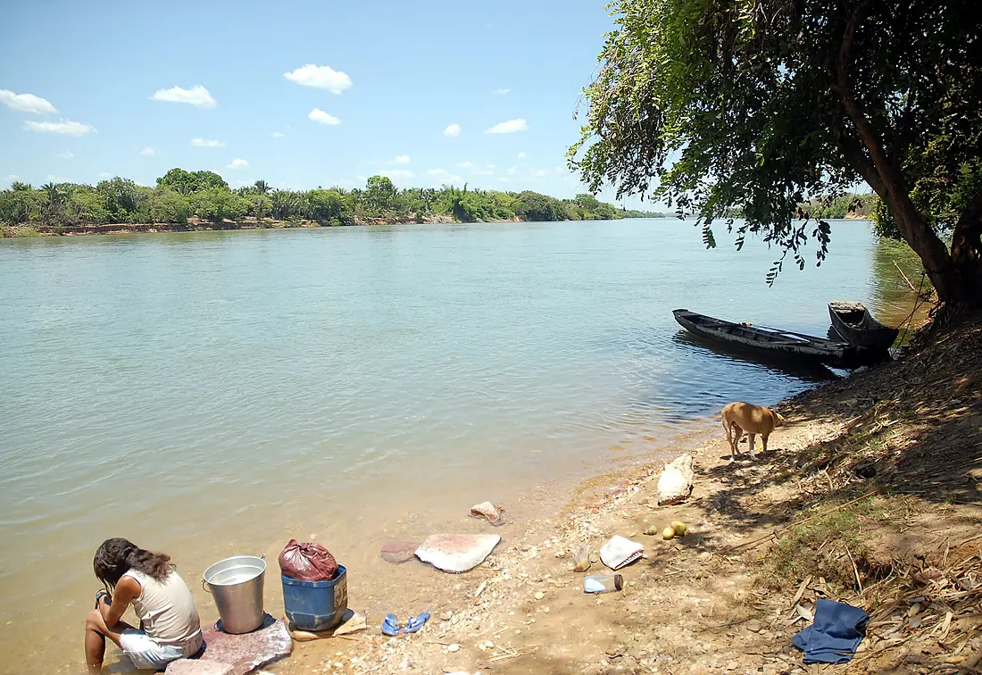
Parnaíba River in pictures
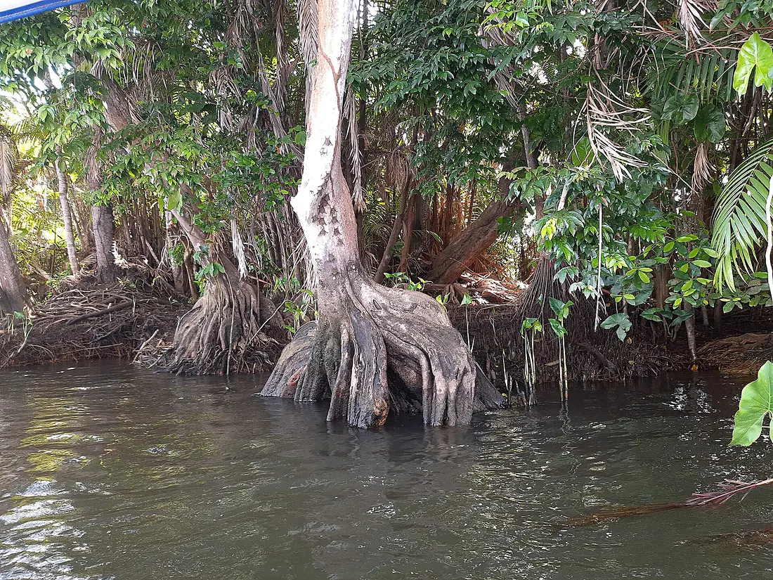
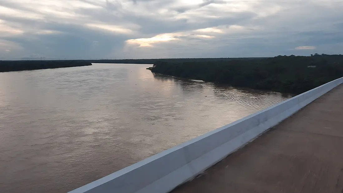
Tributaries
Where it flows, and what flows into it
Tributaries (12)
Also: Canindé River, Das Balsas River, Poti River, Longá River, Gurguéia River, Uruçuí Prêto River, Uruçuí-Vermelho River, Medonho River, Piranji River, Buriti River, Parnaìbinha River, Água Quente River
Where these numbers come from
| Name, length, places | Wikidata (Q1419084) · CC0 |
|---|---|
| Course, profile, basin | RiverATLAS v1.0 (HydroATLAS, Linke et al. 2019) · CC BY 4.0 — followed from the source to the mouth given by Wikidata |
| Flow | WaterGAP (RiverATLAS), 1971–2000 · CC BY 4.0 |
| Climate along the river | WorldClim (RiverATLAS), 1970–2000 · CC BY 4.0 |
| Towns, bridges, dams | Wikidata · CC0; GeoNames · CC BY 4.0 |
| Along the river | © OpenStreetMap contributors · ODbL |
| Images | EOX Sentinel-2 cloudless 2016 · CC BY 4.0; Wikimedia Commons |
| Our other atlases | Cascadyas, Lakeyas — Wikidata · CC0; © OpenStreetMap contributors · ODbL; GeoNames · CC BY 4.0; HydroLAKES · CC BY 4.0; NOAA OISST |
Every source and licence is on the data sources page.
The family
Do you prefer beaches, lakes, mountains, waterfalls, islands, rivers or canyons?
Same idea, other landscapes: field atlases built on open data, month by month, in seven languages.
 beaches
 Find your beach: sea temperature, sun and swimming month by month.Visit lakes
 Every lake on Earth: water temperature, ice, depth and the shore.Coming soonVisit
  mountains
 Every summit in 3D: summit weather, the 0 °C line, huts and trails.Visit waterfalls
 Every waterfall: height, flow month by month and when it roars.Coming soonVisit
  islands
 Every island from the sea up: size, sea temperature, ferries and 3D.Coming soonVisit
  rivers
 Every river from source to sea: the journey, the flow and the basin in numbers.You are here
 canyons
 Every canyon cut to scale: depth to the floor, rim and floor temperatures, trails and viewpoints.Coming soonVisit