River
Aras River
1,072 km from source to mouth · 4 countries.
 Azerbaijan, Armenia, Turkey and IranFlows into Kura River2nd longest in Azerbaijan
In numbers
Length
1,072km
Average flow
280m³/s
Basin
102,000km²
Drop
2,086m
from 2,067 m to -19 m
Countries
4
The journey
From source to mouth
1,072 km of river and 50 stops on the way: 17 towns and cities on its banks, dams, bridges and the tributaries that feed it.
- 0 kmBingöl Dağlarıat 2,067 m
- 31 kmTekman8,270 people
- 115 kmÇobandede Bridge
- 147 kmHorasan17,067 people
- 264 kmKağızman25,157 people
- 320 kmAkhurian Rivertributary
- 375 kmArazap1,362 people
- 401 kmMetsamortributary
- 406 kmHrazdan Rivertributary
- 412 kmHnaberd611 people
- 414 kmAzat Rivertributary
- 415 kmArtashat22,800 people
- 416 kmArtashat (Armenia)21,300 people
- 426 kmPokr Vedi3,091 people
- 427 kmLusarat2,699 people
- 438 kmVeditributary
- 466 kmUmut Bridge
- 501 kmArpa Rivertributary
- 519 kmZangmar Rivertributary
- 520 kmPoldasht-Shah Takhti Bridge
- 520 kmPoldasht42,170 people
- 568 kmNaxçıvançaytributary
- 573 kmAras Reservoir101 km²
- 573 kmAras Dam
- 590 kmQotur Rivertributary
- 590 kmChurch of the Holy Mother of God (Darresham)
- 603 kmKhajeh Nazar Caravanserai
- 604 kmAlinjatributary
- 610 kmJulfa13,700 people
- 621 kmYaycı8,500 people
- 630 kmGilançaytributary
- 677 kmAgarak caravanserai
- 684 kmMeghritributary
- 684 kmMeghri Dam
- 695 kmShvanidzor312 people
- 740 kmTsavtributary
- 747 kmVoghdji Rivertributary
- 763 kmHakari Rivertributary
- 774 kmKhudafarin Dam
- 774 kmEleven-Arch Khudafarin Bridge
- 775 kmFifteen-Arch Khudafarin Bridge
- 775 kmKhudafarin Bridges
- 787 kmGiz Galasi Dam
- 835 kmMil-Mughan reservoir1.9 km²
- 841 kmQarasu Rivertributary
- 860 kmQuruçaytributary
- 866 kmKondalanchaytributary
- 898 kmPārsābād102,996 people
- 936 kmImishli34,178 people
- 968 kmSaatlı20,300 people
- 982 kmSabirabad30,612 people
- 1,072 kmKura Riverat -19 m
Water level along the river (RiverATLAS; the height is exaggerated). Towns: GeoNames and Wikidata; bridges, dams and tributaries: Wikidata.
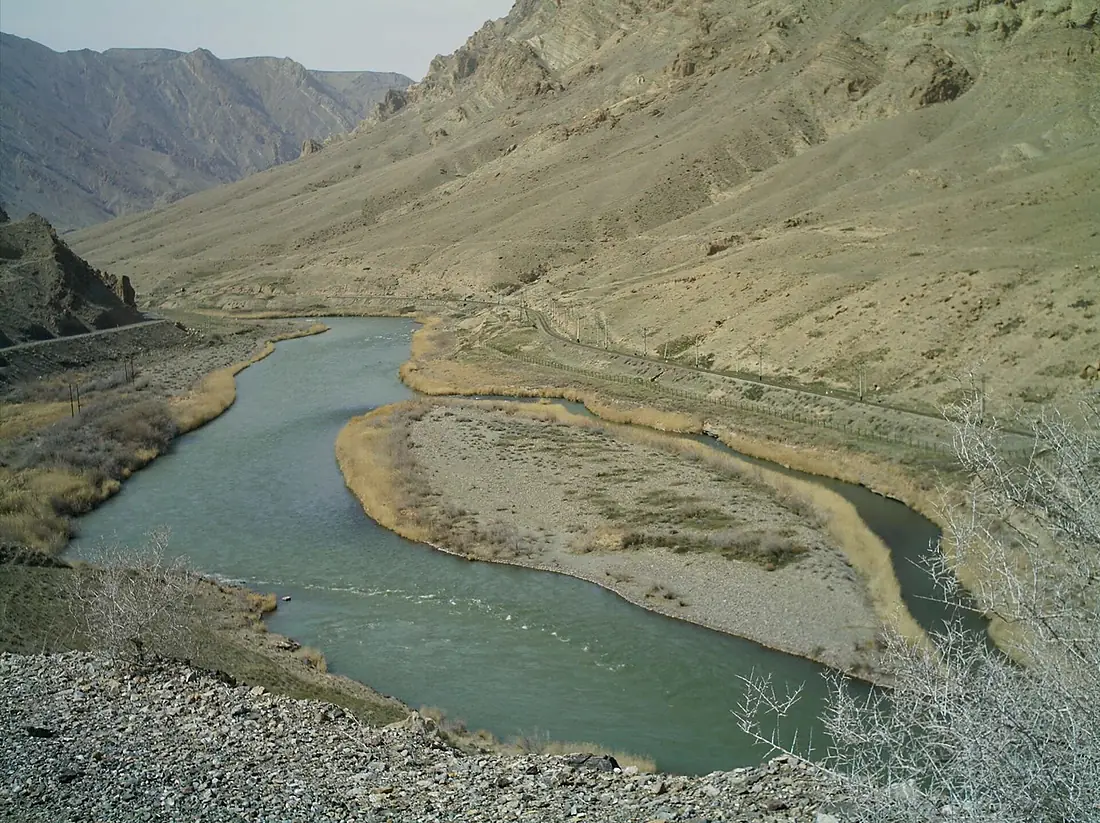
River located in and along the countries of Turkey, Armenia, Azerbaijan, and Iran
At the mouth it carries 285 m³/s on average: an Olympic pool every 8.8 seconds. It drops from 2,067 m to -19 m, 1.9 m per kilometre on average. Its basin covers 102,000 km², about the size of CS. 12.6 million people live in it. Highest water: from May to June; lowest: February and from August to October. It is heavily dammed: reservoirs can hold 92% of a year's flow.
Where to start
- PārsābādLargest city on its banks · 102,996 people
- Gabala International Airport (GBB)Nearest airport with scheduled flights, 130 km from the cityCar hire at GBB airport (Gabala)Discover Cars · Affiliate link↗
- From May to SeptemberThe best months to visit
Aras River, month by month
Highest water: from May to June
Lowest water: February and from August to October. Best months to visit: from May to September.
From about 190 m³/s in the lowest month to 1,900 m³/s in the highest. An estimate: the monthly flow is modelled from the lowest and highest months of WaterGAP (RiverATLAS, 1971–2000) and the rain and snow along the river (WorldClim). Dams change the real rhythm. The chip is the average air temperature; below it, the month's rain.
Plan the trip
Plan the trip: boat trips, a bed by the river, a car
Some links above are affiliate links: if you book through them we may earn a commission, at no extra cost to you. It never changes what the data on this page says.
The basin
Aras River: the basin in numbers
179,564 km² of land send their water to this river. This is what lives on it.
- 12.6millionpeople live in the basin
- 70/km²people per km²
- 1,394maverage altitude of the basin
- 517mmof rain a year (basin average)
- 8.4°Caverage air temperature
- 8%protected areas
- 1.3%covered by lakes
- 1%permafrost
- 20km³held in reservoirs
What covers the basin
- 8% Forest
- 25% Cropland
- 35% Pasture
- 3% Towns and cities
RiverATLAS (HydroATLAS v1.0, CC BY 4.0): land cover, people, protected areas, glaciers and dams over the whole basin upstream of the mouth.
Along the river
Aras River: what you find on the way
- 9Weirs
- 1Locks
From OpenStreetMap, within 2.6 km of the river. Not mapped is not the same as not there.
Cross-checked with our atlases
Aras River in our other atlases
What our sister atlases know about the waterfalls on this river, the lakes it flows through, the beaches at its mouth, the mountains where it rises and the islands off its mouth.
 2lakes on its wayLakeyas
 10mountains at the sourcePeakyas
Lakes and reservoirs (2)
Lakes it flows through, by Lakeyas
- Aras Reservoirkm 509101km²
- Mil-Mughan reservoirkm 7411.9km²
Lakeyas is coming soonOpen Lakeyas ↗
Mountains at the source (10)
Within 15 km of the source, by Peakyas
- Bingöl Dağları1.0 km away3,250m
- Serpulaş Dağı3.3 km away
- Mirkeşoti Tepesi3.7 km away
- Dağkale Tepe13 km away
- Bozca Hill13 km away
- Kırmızı Hill0.7 km away
- Dağkale Hill5.3 km away
- Kuşluca Hill10 km away
2 more on PeakyasOpen Peakyas ↗
From space
The source and the mouth, seen from orbit
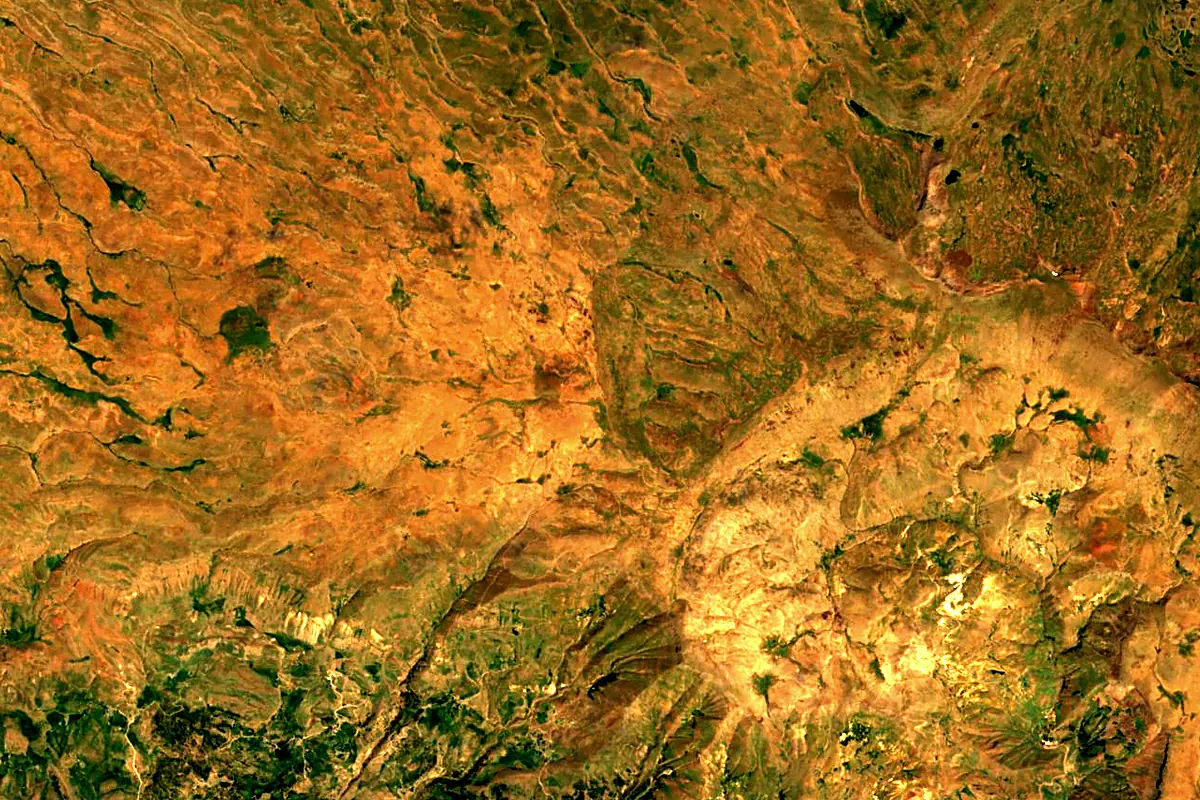
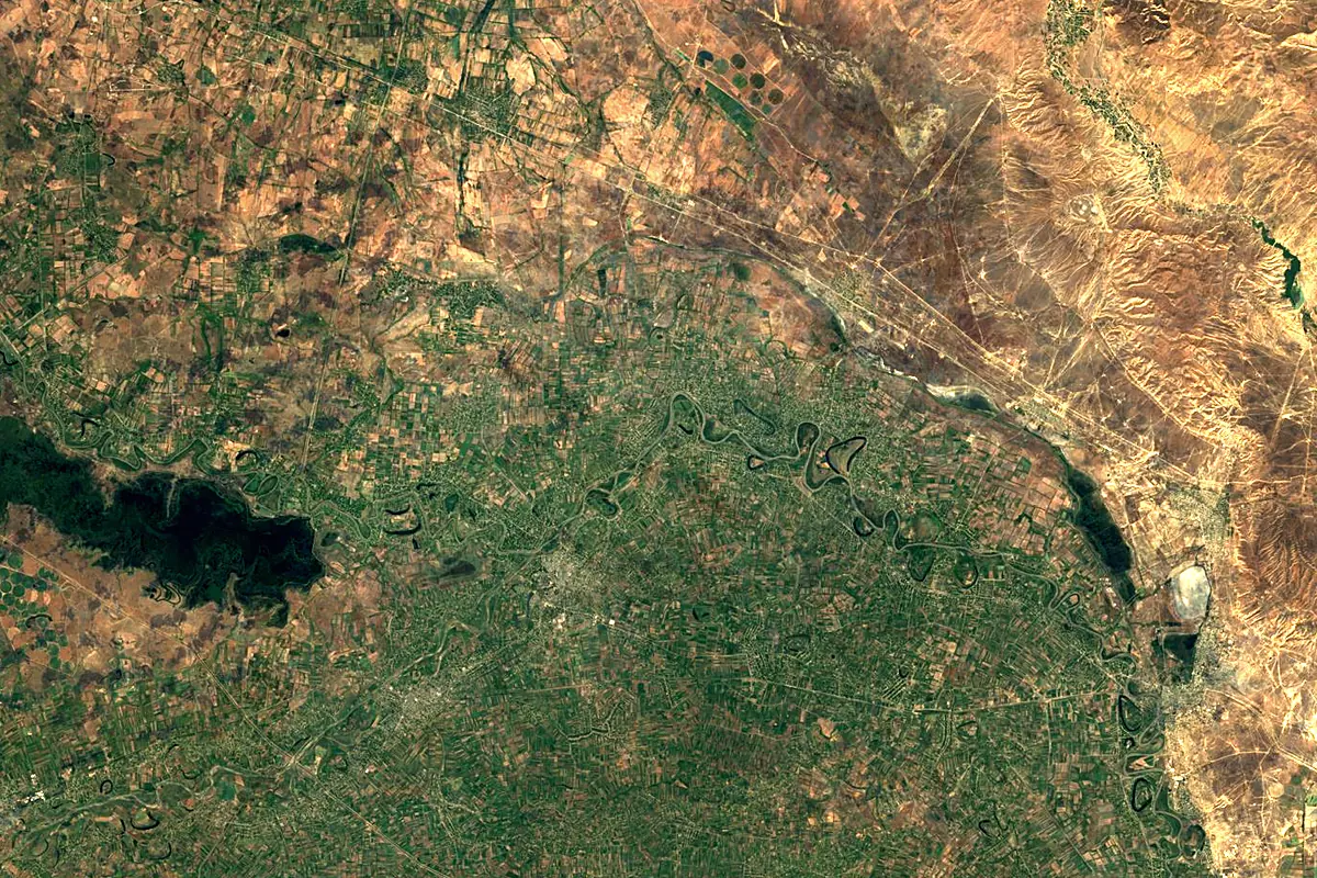
Sentinel-2 cloudless 2016 by EOX IT Services GmbH (contains modified Copernicus Sentinel data 2016), CC BY 4.0. The glowing line is the river as drawn by RiverATLAS.
Photos
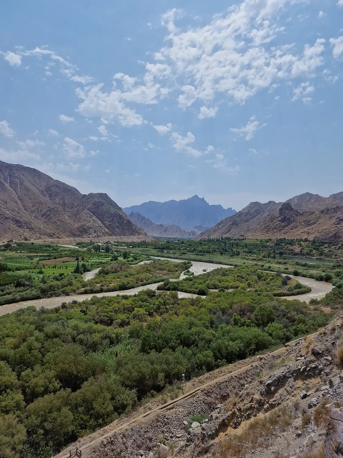
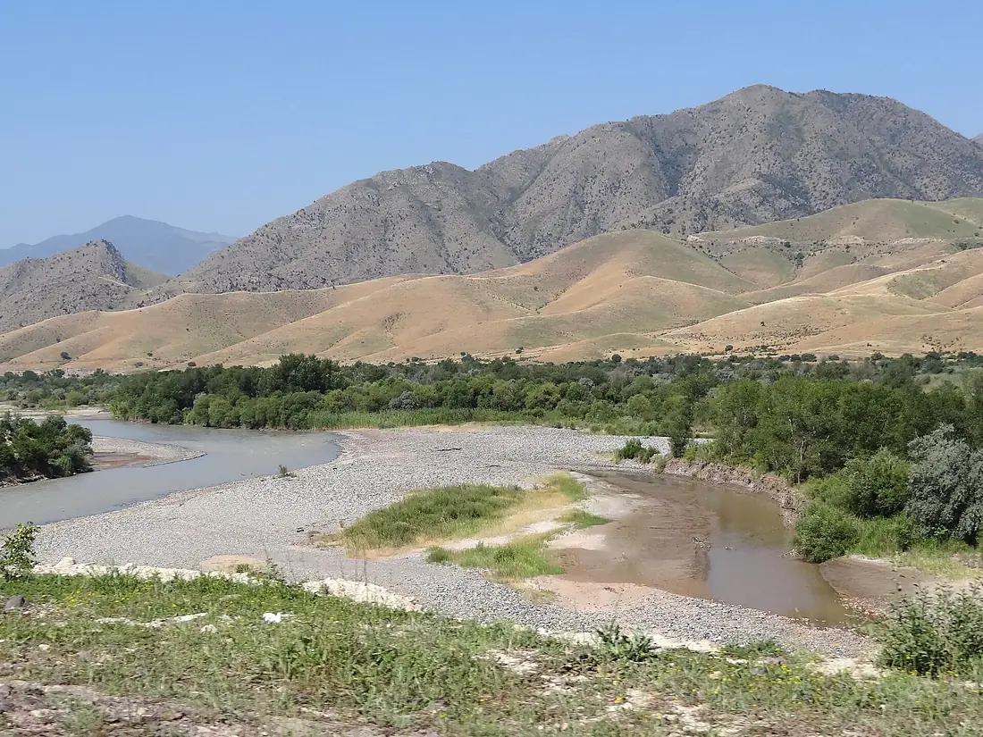
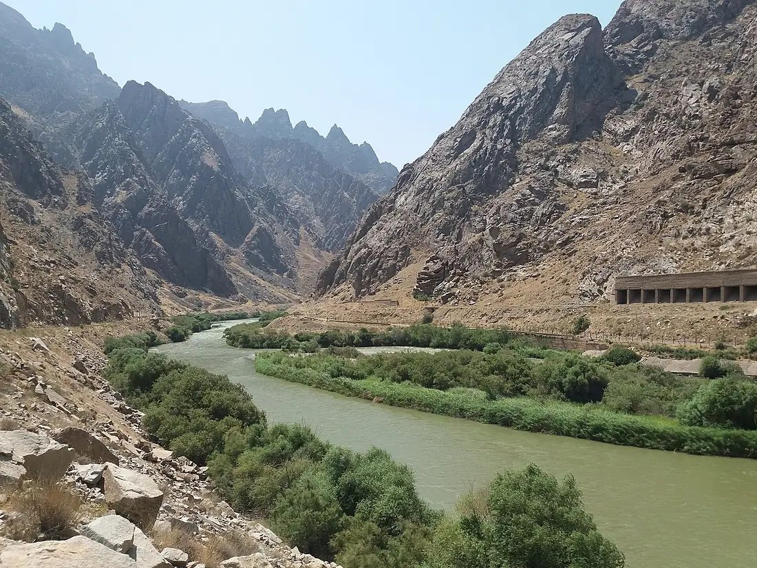
Aras River in pictures
Tributaries
Where it flows, and what flows into it
It flows into
Kura RiverAzerbaijan1,360 km440 m³/sTributaries (29)
Turkey186 km270 m³/sjoins at km 284Hakari RiverAzerbaijan170 km16 m³/sjoins at km 677Hrazdan RiverArmenia141 km18 m³/sjoins at km 360Arpa RiverAzerbaijan128 km21 m³/sjoins at km 445Azat RiverArmenia55 km36 m³/sjoins at km 367Also: Voghdji River, Metsamor, Vedi, Naxçıvançay, Meghri, Tsav, Kondalanchay, Qotur River, Zangmar River, Qarasu River, Quruçay, Gilançay, Alinja, Ordubad Çayı, Bağırsaqdärä, Aratso, Karavget, Vanand, Karasu Deresi, Qozluçay, Malev, Balha River, Karchevan, Shavigh
In the same basin
Azerbaijan351 km98 m³/sIori RiverAzerbaijan320 km120 m³/sDebed Georgia178 km30 m³/sVorotan RiverAzerbaijan178 km22 m³/sAragvi RiverGeorgia112 km33 m³/sKhrami RiverAzerbaijan201 km51 m³/sTartarAzerbaijan184 km23 m³/sAghstevAzerbaijan133 km8.2 m³/sKasagh RiverArmenia89 km6.8 m³/sKsaniGeorgia84 km15 m³/s
Nearby
Rivers nearby
Azerbaijan184 km23 m³/s113 km awayAlazaniAzerbaijan351 km98 m³/s185 km awayVorotan RiverAzerbaijan178 km22 m³/s184 km awayIori RiverAzerbaijan320 km120 m³/s200 km awayHakari RiverAzerbaijan170 km16 m³/s180 km awayAghstevAzerbaijan133 km8.2 m³/s288 km awayArpa RiverAzerbaijan128 km21 m³/s315 km awaySefid RudIran670 km310 m³/s315 km awayWhere these numbers come from
| Name, length, places | Wikidata (Q179751) · CC0 |
|---|---|
| Course, profile, basin | RiverATLAS v1.0 (HydroATLAS, Linke et al. 2019) · CC BY 4.0 — followed from the source to the mouth given by Wikidata |
| Flow | WaterGAP (RiverATLAS), 1971–2000 · CC BY 4.0 |
| Climate along the river | WorldClim (RiverATLAS), 1970–2000 · CC BY 4.0 |
| Towns, bridges, dams | Wikidata · CC0; GeoNames · CC BY 4.0 |
| Along the river | © OpenStreetMap contributors · ODbL |
| Images | EOX Sentinel-2 cloudless 2016 · CC BY 4.0; Wikimedia Commons |
| Our other atlases | Lakeyas, Peakyas — Wikidata · CC0; © OpenStreetMap contributors · ODbL; GeoNames · CC BY 4.0; HydroLAKES · CC BY 4.0; NOAA OISST |
Every source and licence is on the data sources page.
The family
Do you prefer beaches, lakes, mountains, waterfalls, islands, rivers or canyons?
Same idea, other landscapes: field atlases built on open data, month by month, in seven languages.
 beaches
 Find your beach: sea temperature, sun and swimming month by month.Visit lakes
 Every lake on Earth: water temperature, ice, depth and the shore.Coming soonVisit mountains
 Every summit in 3D: summit weather, the 0 °C line, huts and trails.Visit
  waterfalls
 Every waterfall: height, flow month by month and when it roars.Coming soonVisit
  islands
 Every island from the sea up: size, sea temperature, ferries and 3D.Coming soonVisit
  rivers
 Every river from source to sea: the journey, the flow and the basin in numbers.You are here
 canyons
 Every canyon cut to scale: depth to the floor, rim and floor temperatures, trails and viewpoints.Coming soonVisit