River
Ksani
84 km from source to mouth · Georgia.
 GeorgiaFlows into Kura River10th longest in Georgia
In numbers
Length
84km
Average flow
15m³/s
Basin
885km²
Drop
886m
from 1,352 m to 466 m
Country
1
The journey
From source to mouth
84 km of river and 5 stops on the way: 3 towns and cities on its banks, dams, bridges and the tributaries that feed it.
- 0 kmSourceat 1,352 m
- 22 kmChurtatributary
- 32 kmAleura Rivertributary
- 40 kmAkhalgori1,420 people
- 70 kmAghaiani1,505 people
- 84 kmDzegvi2,911 people
- 84 kmKura Riverat 466 m
Water level along the river (RiverATLAS; the height is exaggerated). Towns: GeoNames and Wikidata; bridges, dams and tributaries: Wikidata.
River in Georgia
At the mouth it carries 15 m³/s on average: an Olympic pool every 167 seconds. It drops from 1,352 m to 466 m, 11 m per kilometre on average. Its basin covers 885 km², about the size of HK. 579,000 people live in it. Highest water: from May to June. No large dam holds it back: it is one of the world's free-flowing rivers.
Where to start
- DzegviLargest city on its banks · 2,911 people
- Tbilisi International Airport (TBS)Nearest airport with scheduled flights, 35 km from the cityCar hire at TBS airport (Tbilisi)Discover Cars · Affiliate link↗
- From June to OctoberThe best months to visit
Ksani, month by month
Highest water: from May to June
Best months to visit: from June to October.
From about 18 m³/s in the lowest month to 540 m³/s in the highest. An estimate: the monthly flow is modelled from the lowest and highest months of WaterGAP (RiverATLAS, 1971–2000) and the rain and snow along the river (WorldClim). Dams change the real rhythm. The chip is the average air temperature; below it, the month's rain.
Plan the trip
Plan the trip: boat trips, a bed by the river, a car
Some links above are affiliate links: if you book through them we may earn a commission, at no extra cost to you. It never changes what the data on this page says.
The basin
Ksani: the basin in numbers
18,134 km² of land send their water to this river. This is what lives on it.
- 579,000people live in the basin
- 32/km²people per km²
- 1,750maverage altitude of the basin
- 752mmof rain a year (basin average)
- 4.6°Caverage air temperature
- 5%protected areas
- 0.5%covered by lakes
- 1%permafrost
What covers the basin
- 25% Forest
- 24% Cropland
- 31% Pasture
- 1% Towns and cities
RiverATLAS (HydroATLAS v1.0, CC BY 4.0): land cover, people, protected areas, glaciers and dams over the whole basin upstream of the mouth.
Cross-checked with our atlases
Ksani in our other atlases
What our sister atlases know about the waterfalls on this river, the lakes it flows through, the beaches at its mouth, the mountains where it rises and the islands off its mouth.
 30mountains at the sourcePeakyas
Mountains at the source (30)
Within 15 km of the source, by Peakyas
- Keli Highland7.1 km away3,736m
- Laghztsiti10 km away · prominence 745 m3,877m
- Khorisari11 km away3,736m
- Didi Mepiskalo8.4 km away3,695m
- Esikomi12 km away3,572m
- Patara Mepiskalo6.3 km away3,519m
- Mangaavtsagi11 km away3,339m
- Sharkhokhi7.1 km away3,303m
22 more on PeakyasOpen Peakyas ↗
From space
The source and the mouth, seen from orbit
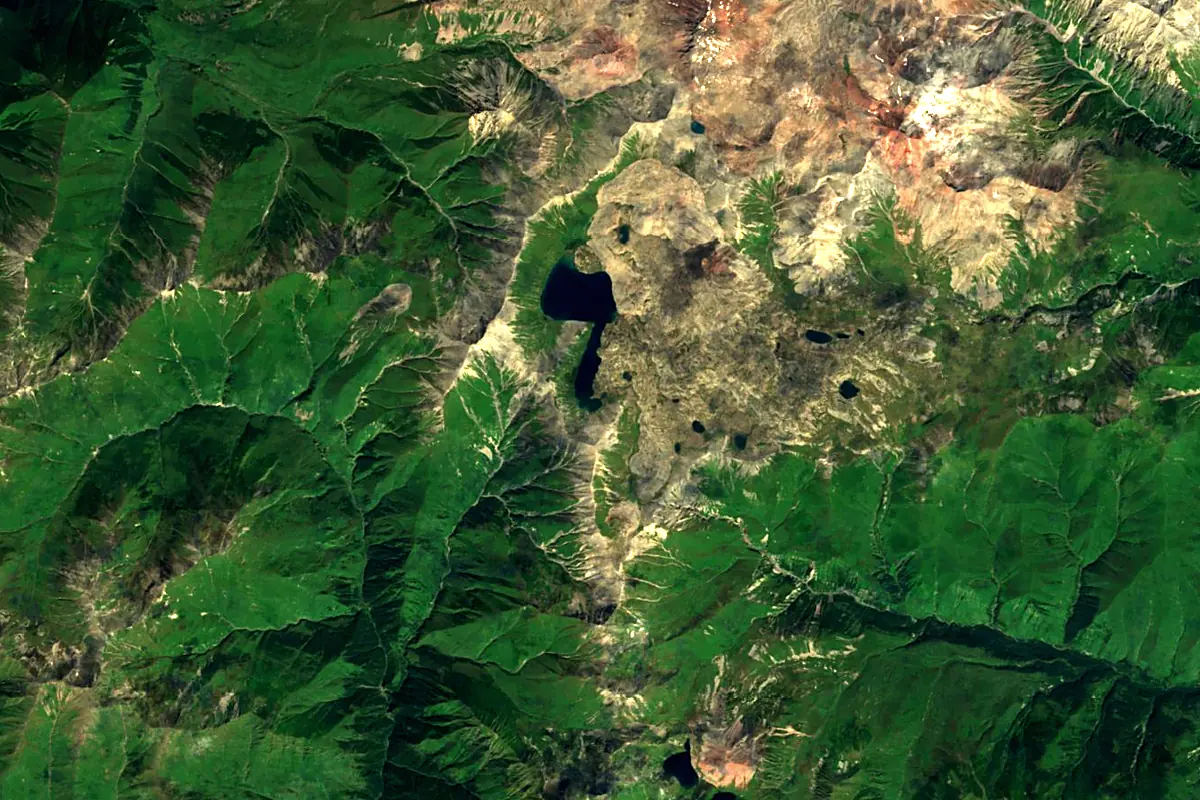
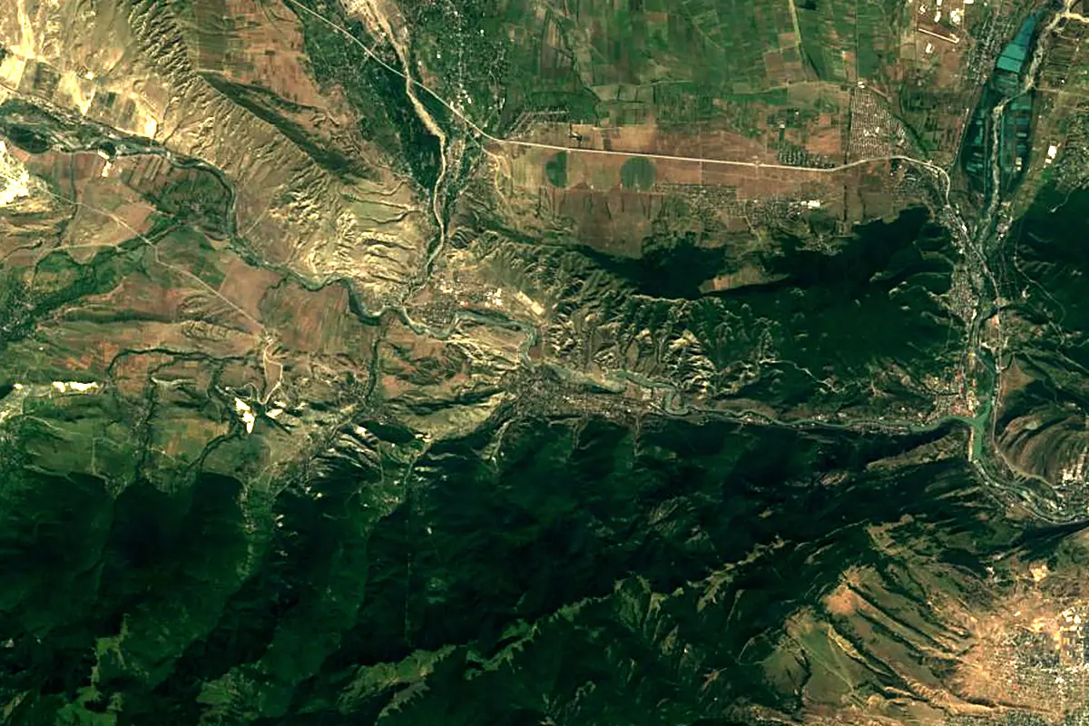
Sentinel-2 cloudless 2016 by EOX IT Services GmbH (contains modified Copernicus Sentinel data 2016), CC BY 4.0. The glowing line is the river as drawn by RiverATLAS.
Photos
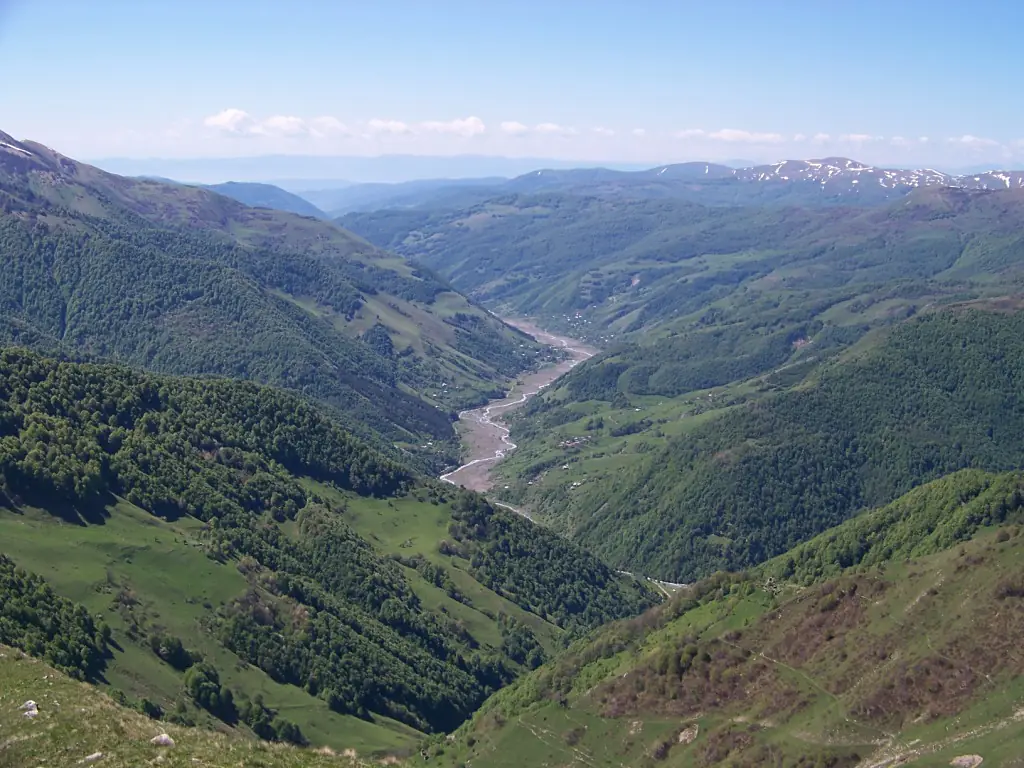
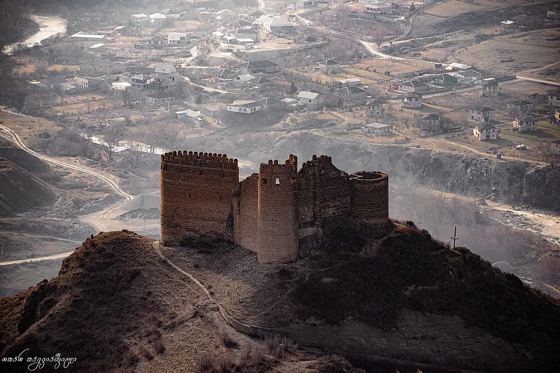
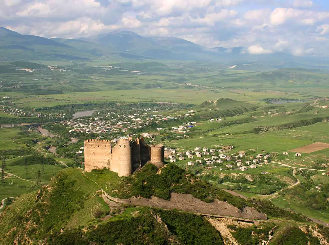
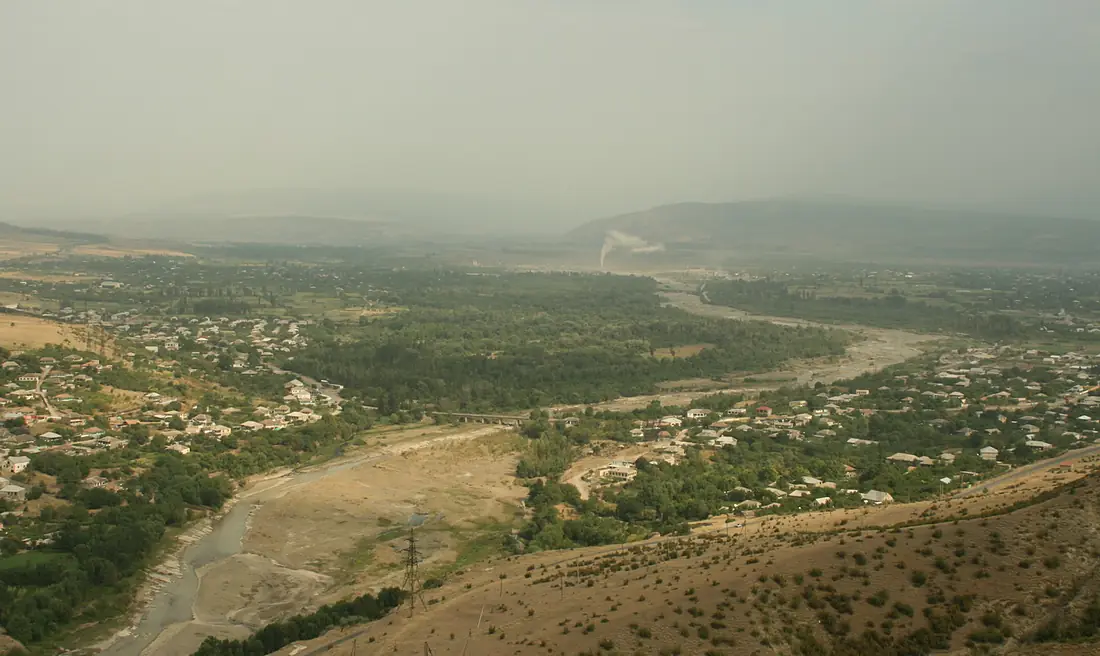
Ksani in pictures
Tributaries
Where it flows, and what flows into it
It flows into
Kura River Azerbaijan1,360 km440 m³/s
Tributaries (3)
Also: Churta, Aleura River, Tskhradzmula
In the same basin
Azerbaijan1,072 km280 m³/sAlazaniAzerbaijan351 km98 m³/sHrazdan River Armenia141 km18 m³/sAkhurian River
 Turkey186 km270 m³/sIori RiverAzerbaijan320 km120 m³/sDebedGeorgia178 km30 m³/sVorotan RiverAzerbaijan178 km22 m³/sAragvi RiverGeorgia112 km33 m³/sArpa RiverAzerbaijan128 km21 m³/sKhrami RiverAzerbaijan201 km51 m³/s
Nearby
Rivers nearby
Georgia112 km33 m³/s11 km awayDebedGeorgia178 km30 m³/s61 km awayKhrami RiverAzerbaijan201 km51 m³/s77 km awayAghstevAzerbaijan133 km8.2 m³/s100 km awayQvirila RiverGeorgia140 km90 m³/s159 km awayAlazaniAzerbaijan351 km98 m³/s200 km awayIori RiverAzerbaijan320 km120 m³/s185 km awayHrazdan RiverArmenia141 km18 m³/s208 km awayWhere these numbers come from
| Name, length, places | Wikidata (Q1789505) · CC0 |
|---|---|
| Course, profile, basin | RiverATLAS v1.0 (HydroATLAS, Linke et al. 2019) · CC BY 4.0 — followed from the source to the mouth given by Wikidata |
| Flow | WaterGAP (RiverATLAS), 1971–2000 · CC BY 4.0 |
| Climate along the river | WorldClim (RiverATLAS), 1970–2000 · CC BY 4.0 |
| Towns, bridges, dams | Wikidata · CC0; GeoNames · CC BY 4.0 |
| Along the river | © OpenStreetMap contributors · ODbL |
| Images | EOX Sentinel-2 cloudless 2016 · CC BY 4.0; Wikimedia Commons |
| Our other atlases | Peakyas — Wikidata · CC0; © OpenStreetMap contributors · ODbL; GeoNames · CC BY 4.0; HydroLAKES · CC BY 4.0; NOAA OISST |
Every source and licence is on the data sources page.
The family
Do you prefer beaches, lakes, mountains, waterfalls, islands, rivers or canyons?
Same idea, other landscapes: field atlases built on open data, month by month, in seven languages.
 beaches
 Find your beach: sea temperature, sun and swimming month by month.Visit
  lakes
lakes Every lake on Earth: water temperature, ice, depth and the shore.Coming soonVisit mountains
 Every summit in 3D: summit weather, the 0 °C line, huts and trails.Visit
  waterfalls
 Every waterfall: height, flow month by month and when it roars.Coming soonVisit
  islands
 Every island from the sea up: size, sea temperature, ferries and 3D.Coming soonVisit
  rivers
 Every river from source to sea: the journey, the flow and the basin in numbers.You are here
 canyons
 Every canyon cut to scale: depth to the floor, rim and floor temperatures, trails and viewpoints.Coming soonVisit