River
Ems
371 km from source to mouth · Germany.
 GermanyFlows into Dollart7th longest in Germany
In numbers
Length
371km
Average flow
80m³/s
Basin
17,934km²
Drop
102m
from 98 m to -4 m
Country
1
The journey
From source to mouth
371 km of river and 68 stops on the way: 40 towns and cities on its banks, dams, bridges and the tributaries that feed it.
- 0 kmSchloß Holte-Stukenbrockat 98 m
- 0 kmHövelhof16,799 people
- 5 kmSchloß Holte-Stukenbrock26,297 people
- 23 kmRietberg29,858 people
- 36 kmGrubebachtributary
- 38 kmRheda-Wiedenbrück47,935 people
- 43 kmHerzebrock-Clarholz16,337 people
- 47 kmGütersloh99,854 people
- 60 kmHarsewinkel25,480 people
- 62 kmAbrocksbachtributary
- 62 kmLuttertributary
- 63 kmRhedaer Bachtributary
- 73 kmLoddenbachtributary
- 82 kmWarendorf37,705 people
- 90 kmHesseltributary
- 104 kmTelgte20,128 people
- 115 kmBevertributary
- 119 kmKanalüberführung Münster-Gelmer
- 122 kmGellen-Bachtributary
- 122 kmWersetributary
- 130 kmMünstersche Aatributary
- 131 kmGreven38,080 people
- 143 kmGlanetributary
- 144 kmSaerbeck6,906 people
- 152 kmEmsdetten35,925 people
- 168 kmFrischhofsbachtributary
- 173 kmRheine77,552 people
- 176 kmHemelter Bachtributary
- 185 kmSalzbergen7,962 people
- 196 kmEmsbüren10,544 people
- 205 kmGroße Aa (Ems)tributary
- 207 kmHanekenfähr Ems Weir
- 215 kmLingen56,539 people
- 227 kmGeeste Reservoir2.1 km²
- 229 kmGeeste12,554 people
- 230 kmOsterbrock1,736 people
- 242 kmMeppen36,984 people
- 243 kmHasetributary
- 244 kmUmgehungsstraßen-Brücke Nr. 173b
- 244 kmNordraddetributary
- 262 kmHaren24,175 people
- 273 kmOberlangen994 people
- 274 kmNiederlangen1,319 people
- 277 kmVitus-Brücke Nr. 182
- 277 kmLathen6,748 people
- 279 kmFresenburg927 people
- 285 kmSustrum1,369 people
- 289 kmKluse1,779 people
- 290 kmSteinbilder Ems-Brücke Nr. 187
- 291 kmWalchum1,736 people
- 295 kmDersum1,457 people
- 299 kmDörpen5,501 people
- 301 kmHeede2,506 people
- 303 kmLehe991 people
- 312 kmRhede4,063 people
- 312 kmRhede (Ems)4,501 people
- 315 kmTunxdorf204 people
- 323 kmPapenburg36,972 people
- 333 kmFriesenbrücke (2025)
- 333 kmWeener railway bridge
- 334 kmWeener15,243 people
- 337 kmWestoverledingen21,119 people
- 342 kmLedatributary
- 343 kmJann-Berghaus-Brücke
- 344 kmLeer34,277 people
- 351 kmJemgum3,429 people
- 355 kmSauteler Kanaltributary
- 367 kmEmden49,009 people
- 367 kmEmden Harbour entry light Westmole
- 371 kmDollartat -4 m
Water level along the river (RiverATLAS; the height is exaggerated). Towns: GeoNames and Wikidata; bridges, dams and tributaries: Wikidata.
River in northwestern Europe in Germany and the Netherlands
At the mouth it carries 80 m³/s on average: an Olympic pool every 31 seconds. It drops from 98 m to -4 m, 0.3 m per kilometre on average. Its basin covers 17,934 km², about the size of KW. 2.6 million people live in it. Highest water: from December to January. No large dam holds it back: it is one of the world's free-flowing rivers.
Where to start
- GüterslohLargest city on its banks · 99,854 people
- Paderborn Lippstadt Airport (PAD)Nearest airport with scheduled flights, 36 km from the cityCar hire at PAD airport (Büren)Discover Cars · Affiliate link↗
- On the water72 ferry piers, marinas, boat rentals and boat ramps along the river (OpenStreetMap)
- Kayak and canoe12 put-ins and rapids mapped (OpenStreetMap)
- From June to SeptemberThe best months to visit
Ems, month by month
Highest water: from December to January
Best months to visit: from June to September.
From about 82 m³/s in the lowest month to 310 m³/s in the highest. An estimate: the monthly flow is modelled from the lowest and highest months of WaterGAP (RiverATLAS, 1971–2000) and the rain and snow along the river (WorldClim). Dams change the real rhythm. The chip is the average air temperature; below it, the month's rain.
Plan the trip
Plan the trip: boat trips, a bed by the river, a car
Some links above are affiliate links: if you book through them we may earn a commission, at no extra cost to you. It never changes what the data on this page says.
The basin
Ems: the basin in numbers
12,102 km² of land send their water to this river. This is what lives on it.
- 2.6millionpeople live in the basin
- 218/km²people per km²
- 46maverage altitude of the basin
- 802mmof rain a year (basin average)
- 8.9°Caverage air temperature
- 24%protected areas
- 0.2%covered by lakes
What covers the basin
- 8% Forest
- 46% Cropland
- 19% Pasture
- 13% Towns and cities
RiverATLAS (HydroATLAS v1.0, CC BY 4.0): land cover, people, protected areas, glaciers and dams over the whole basin upstream of the mouth.
Along the river
Ems: what you find on the way
- 69WeirsEmswehr Rheine, Wehr Hanekenfähr, Grundschwelle and 66 more
- 55LocksDortmund-Ems-Kanal, Ems-Vechte-Kanal, Sperrschleuse Hanekenfähr and 52 more
- 4Waterfalls
- 6Rapids
- 6Canoe put-insKanu-Einsatzstelle WAF 2, WAF 9 and 4 more
- 19Boat rampsST 8, Sportboothafen, Marina Bingum Slip and 16 more
- 10Ferry piersBockholter Emsfähre, Amisia Anleger, Leher Pünte and 7 more
- 41MarinasWarendorfer Wassersportverein e.V., Bootscenter Münster, Yachthafen Marina Alte Fahrt Fuestrup and 38 more
From OpenStreetMap, within 1.8 km of the river. Not mapped is not the same as not there.
Cross-checked with our atlases
Ems in our other atlases
What our sister atlases know about the waterfalls on this river, the lakes it flows through, the beaches at its mouth, the mountains where it rises and the islands off its mouth.
 1lake on its wayLakeyas
 18mountains at the sourcePeakyas
Lakes and reservoirs (1)
Lakes it flows through, by Lakeyas
- Geeste Reservoirkm 1802.1km²
Lakeyas is coming soonOpen Lakeyas ↗
Mountains at the source (18)
Within 15 km of the source, by Peakyas
- Hermannsberg14 km away364m
- Tönsberg15 km away333m
- Großer Ehberg15 km away340m
- Stapelager Berg14 km away365m
- Hunneckenkammer14 km away326m
- Menkhauser-Berg15 km away271m
- Hörster Berg14 km away
- Ravensberg14 km away
10 more on PeakyasOpen Peakyas ↗
From space
The source and the mouth, seen from orbit
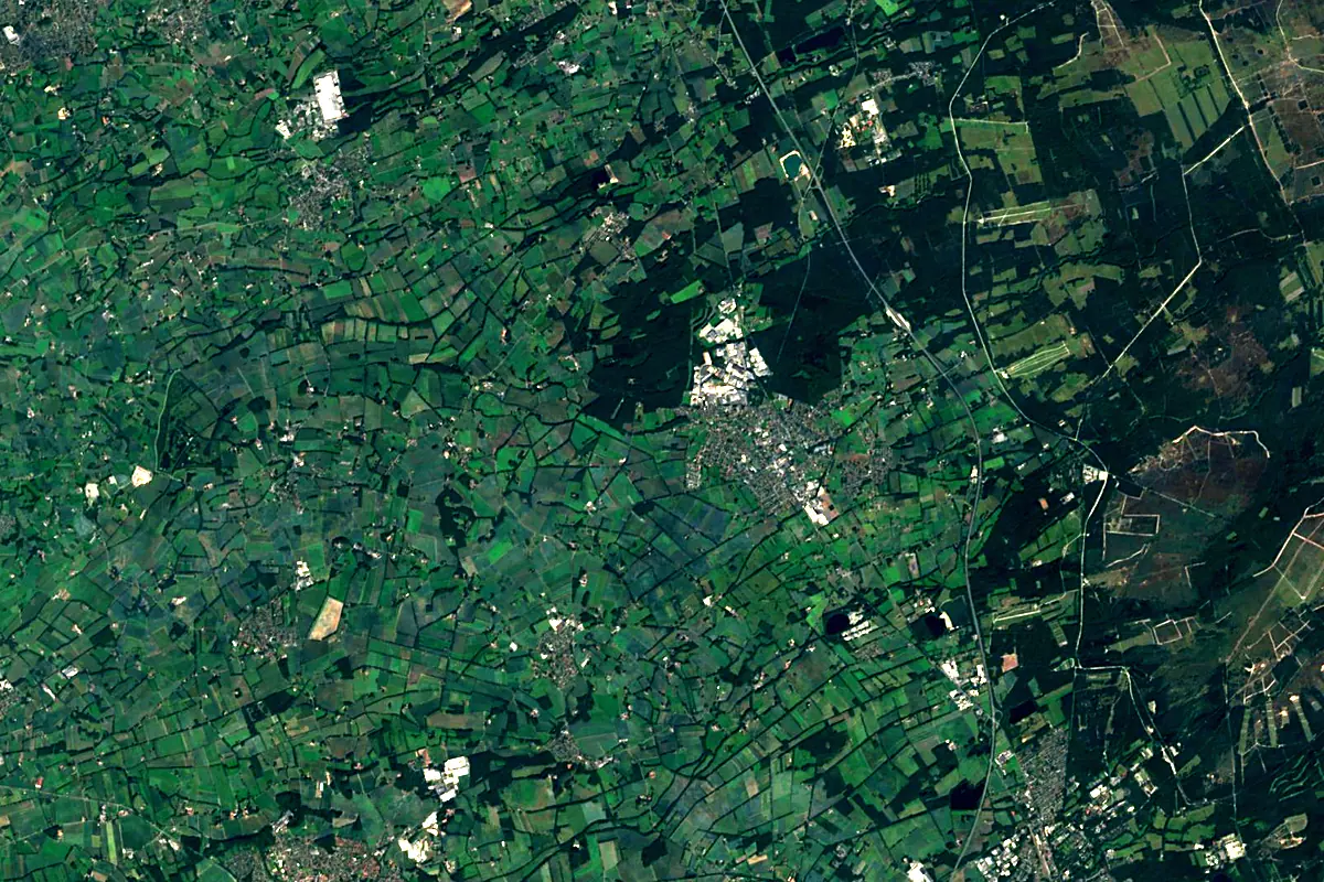
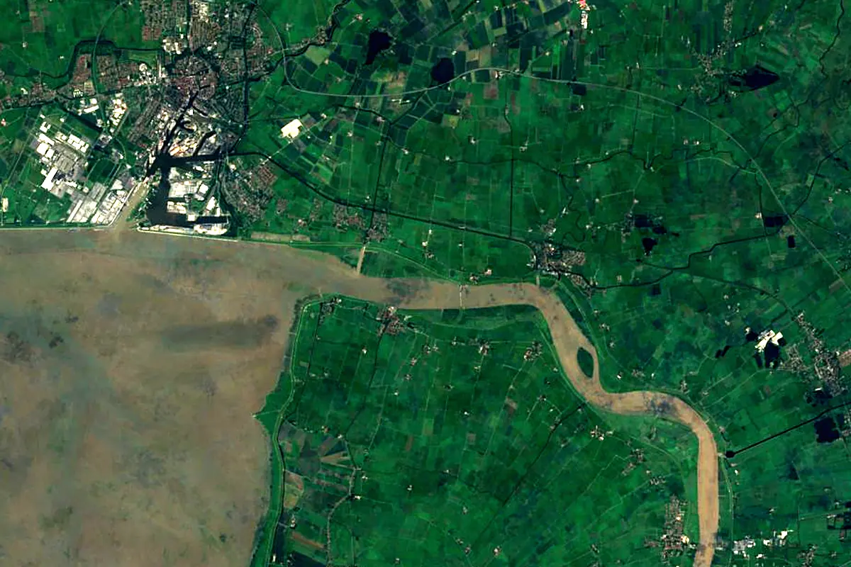
Sentinel-2 cloudless 2016 by EOX IT Services GmbH (contains modified Copernicus Sentinel data 2016), CC BY 4.0. The glowing line is the river as drawn by RiverATLAS.
Photos
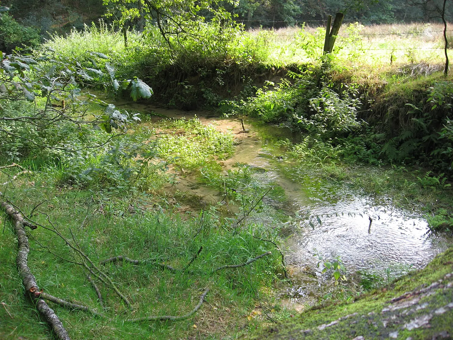
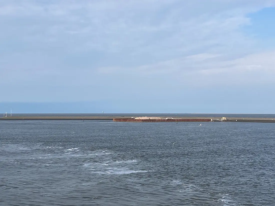
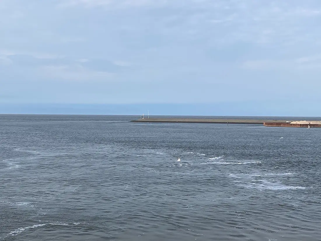
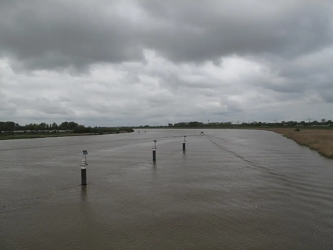
Ems in pictures
Tributaries
Where it flows, and what flows into it
Tributaries (32)
Also: Hase, Leda, Münstersche Aa, Bever, Werse, Abrocksbach, Axtbach, Dalke, Hessel, Rhedaer Bach, Lutter, Glane, Schwarzwasserbach, Loddenbach, Sennebach, Hemelter Bach, Knockster Tief, Furlbach, Eusternbach, Rothenbach, Grubebach, Ruthenbach, Frischebach, Frischhofsbach
Nearby
Rivers nearby
Germany451 km330 m³/s80 km awayHunteGermany189 km450 m³/s80 km awayAllerGermany263 km120 m³/s133 km awayVechteGermany167 km56 m³/s115 km awayLeineGermany281 km53 m³/s168 km awayRhine The Netherlands1,233 km2,200 m³/s261 km awayLippeGermany255 km240 m³/s192 km awayRuhrGermany217 km79 m³/s211 km away
Where these numbers come from
| Name, length, places | Wikidata (Q1648) · CC0 |
|---|---|
| Course, profile, basin | RiverATLAS v1.0 (HydroATLAS, Linke et al. 2019) · CC BY 4.0 — followed along the river network from the point given by Wikidata |
| Flow | WaterGAP (RiverATLAS), 1971–2000 · CC BY 4.0 |
| Climate along the river | WorldClim (RiverATLAS), 1970–2000 · CC BY 4.0 |
| Towns, bridges, dams | Wikidata · CC0; GeoNames · CC BY 4.0 |
| Along the river | © OpenStreetMap contributors · ODbL |
| Images | EOX Sentinel-2 cloudless 2016 · CC BY 4.0; Wikimedia Commons |
| Our other atlases | Lakeyas, Peakyas — Wikidata · CC0; © OpenStreetMap contributors · ODbL; GeoNames · CC BY 4.0; HydroLAKES · CC BY 4.0; NOAA OISST |
Every source and licence is on the data sources page.
The family
Do you prefer beaches, lakes, mountains, waterfalls, islands, rivers or canyons?
Same idea, other landscapes: field atlases built on open data, month by month, in seven languages.
 beaches
 Find your beach: sea temperature, sun and swimming month by month.Visit lakes
 Every lake on Earth: water temperature, ice, depth and the shore.Coming soonVisit mountains
 Every summit in 3D: summit weather, the 0 °C line, huts and trails.Visit
  waterfalls
 Every waterfall: height, flow month by month and when it roars.Coming soonVisit
  islands
 Every island from the sea up: size, sea temperature, ferries and 3D.Coming soonVisit
  rivers
 Every river from source to sea: the journey, the flow and the basin in numbers.You are here
 canyons
 Every canyon cut to scale: depth to the floor, rim and floor temperatures, trails and viewpoints.Coming soonVisit