River
Lippe
255 km from source to mouth · Germany.
 GermanyFlows into Rhine
In numbers
Length
255km
Average flow
240m³/s
Basin
4,882km²
Drop
93m
from 104 m to 11 m
Country
1
The journey
From source to mouth
255 km of river and 25 stops on the way: 10 towns and cities on its banks, dams, bridges and the tributaries that feed it.
- 0 kmLippequelleat 104 m
- 0 kmBad Lippspringe15,175 people
- 11 kmBeketributary
- 14 kmAlmetributary
- 17 kmLippesee0.8 km²
- 20 kmGunnetributary
- 53 kmLippstadt67,219 people
- 59 kmGlennetributary
- 106 kmLippeschleuse Heessen
- 108 kmAhsetributary
- 109 kmHamm178,967 people
- 113 kmpipeline bridge in Hamm
- 127 kmWerne30,810 people
- 142 kmSeseketributary
- 143 kmLünen91,009 people
- 143 kmRathaus
- 149 kmSchlossmühle Lippholthausen
- 163 kmKanalbrücke „Alte Fahrt“
- 177 kmHullerner Stausee0.9 km²
- 185 kmHalterner Talsperre2.5 km²
- 187 kmHaltern am See38,142 people
- 187 kmStevertributary
- 212 kmDorsten74,783 people
- 223 kmSchermbeck13,682 people
- 241 kmHünxe13,732 people
- 250 kmWesel61,685 people
- 255 kmRhineat 11 m
Water level along the river (RiverATLAS; the height is exaggerated). Towns: GeoNames and Wikidata; bridges, dams and tributaries: Wikidata.
River in Germany
At the mouth it carries 241 m³/s on average: an Olympic pool every 10 seconds. It drops from 104 m to 11 m, 0.4 m per kilometre on average. Its basin covers 4,882 km², about the size of TT. 1.9 million people live in it. Highest water: from December to January. No large dam holds it back: it is one of the world's free-flowing rivers.
Where to start
- HammLargest city on its banks · 178,967 people
- Dortmund Airport (DTM)Nearest airport with scheduled flights, 23 km from the cityCar hire at DTM airport (Dortmund)Discover Cars · Affiliate link↗
- On the water78 ferry piers, marinas, boat rentals and boat ramps along the river (OpenStreetMap)
- Kayak and canoe13 put-ins and rapids mapped (OpenStreetMap)
- From May to SeptemberThe best months to visit
Lippe, month by month
Highest water: from December to January
Best months to visit: from May to September.
From about 28 m³/s in the lowest month to 110 m³/s in the highest. An estimate: the monthly flow is modelled from the lowest and highest months of WaterGAP (RiverATLAS, 1971–2000) and the rain and snow along the river (WorldClim). Dams change the real rhythm. The chip is the average air temperature; below it, the month's rain.
Plan the trip
Plan the trip: boat trips, a bed by the river, a car
Some links above are affiliate links: if you book through them we may earn a commission, at no extra cost to you. It never changes what the data on this page says.
The basin
Lippe: the basin in numbers
4,819 km² of land send their water to this river. This is what lives on it.
- 1.9millionpeople live in the basin
- 394/km²people per km²
- 132maverage altitude of the basin
- 838mmof rain a year (basin average)
- 9.1°Caverage air temperature
- 48%protected areas
- 0.3%covered by lakes
What covers the basin
- 12% Forest
- 44% Cropland
- 12% Pasture
- 23% Towns and cities
RiverATLAS (HydroATLAS v1.0, CC BY 4.0): land cover, people, protected areas, glaciers and dams over the whole basin upstream of the mouth.
Along the river
Lippe: what you find on the way
- 75WeirsEsbecker Wehr, Wehr LSH, Speisungsbauwerk and 72 more
- 25LocksDatteln-Hamm-Kanal, Lippe, Wesel-Datteln-Kanal and 22 more
- 2Waterfalls
- 6Rapids
- 7Canoe put-ins
- 35Boat rampsMarina Rünthe, Ruderer RTGW and 33 more
- 11Ferry piersLupia, Fußgängerbrücke 'Schulweg-Steg', Kurbelfähre Maifisch and 8 more
- 28MarinasPaderborner Yacht Club, Segler-Verein Paderborn e.V., Wasserwanderrastplatz Hamm - Maxipark and 25 more
- 2River beachesWasserski Hamm Seebad, Seebad Haltern am See
From OpenStreetMap, within 1.6 km of the river. Not mapped is not the same as not there.
Cross-checked with our atlases
Lippe in our other atlases
What our sister atlases know about the waterfalls on this river, the lakes it flows through, the beaches at its mouth, the mountains where it rises and the islands off its mouth.
 3lakes on its wayLakeyas
 69mountains at the sourcePeakyas
Lakes and reservoirs (3)
Lakes it flows through, by Lakeyas
- Lippeseekm 120.8km²
- Hullerner Stauseekm 1310.9km²
- Halterner Talsperrekm 1372.5km²
Lakeyas is coming soonOpen Lakeyas ↗
Mountains at the source (69)
Within 15 km of the source, by Peakyas
- Barnacken9.9 km away · prominence 106 m446m
- Velmerstot11 km away · prominence 120 m464m
- Grotenburg14 km away386m
- Hausheide13 km away441m
- Preußische Velmerstot11 km away468m
- Lippische Velmerstot11 km away441m
- Stemberg12 km away402m
- Bielstein14 km away394m
61 more on PeakyasOpen Peakyas ↗
From space
The source and the mouth, seen from orbit
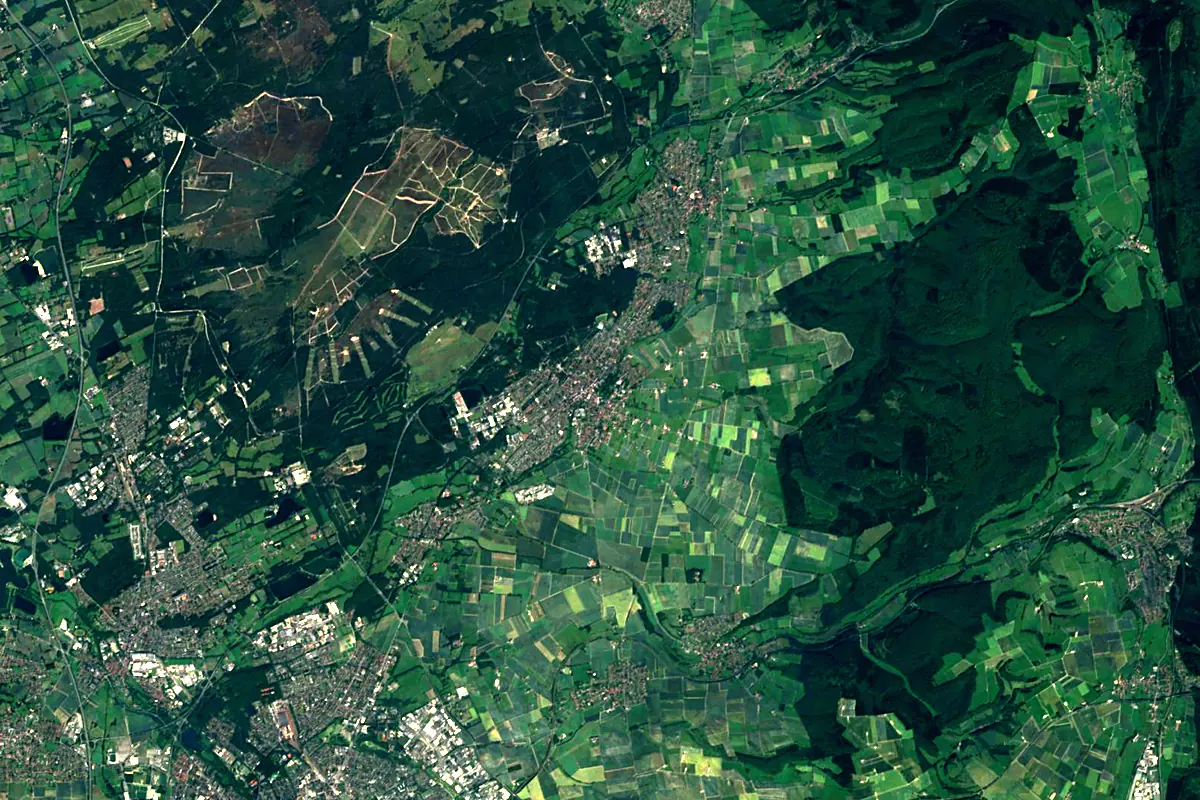
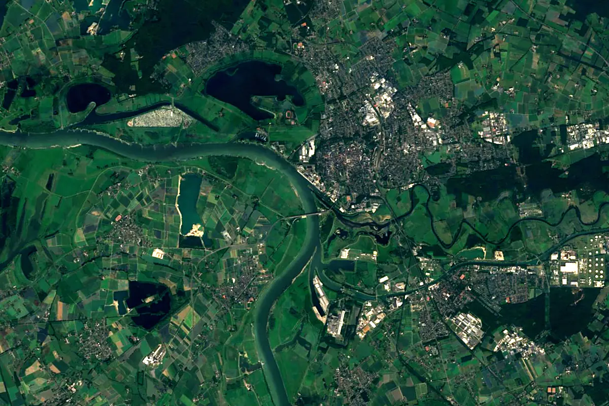
Sentinel-2 cloudless 2016 by EOX IT Services GmbH (contains modified Copernicus Sentinel data 2016), CC BY 4.0. The glowing line is the river as drawn by RiverATLAS.
Photos
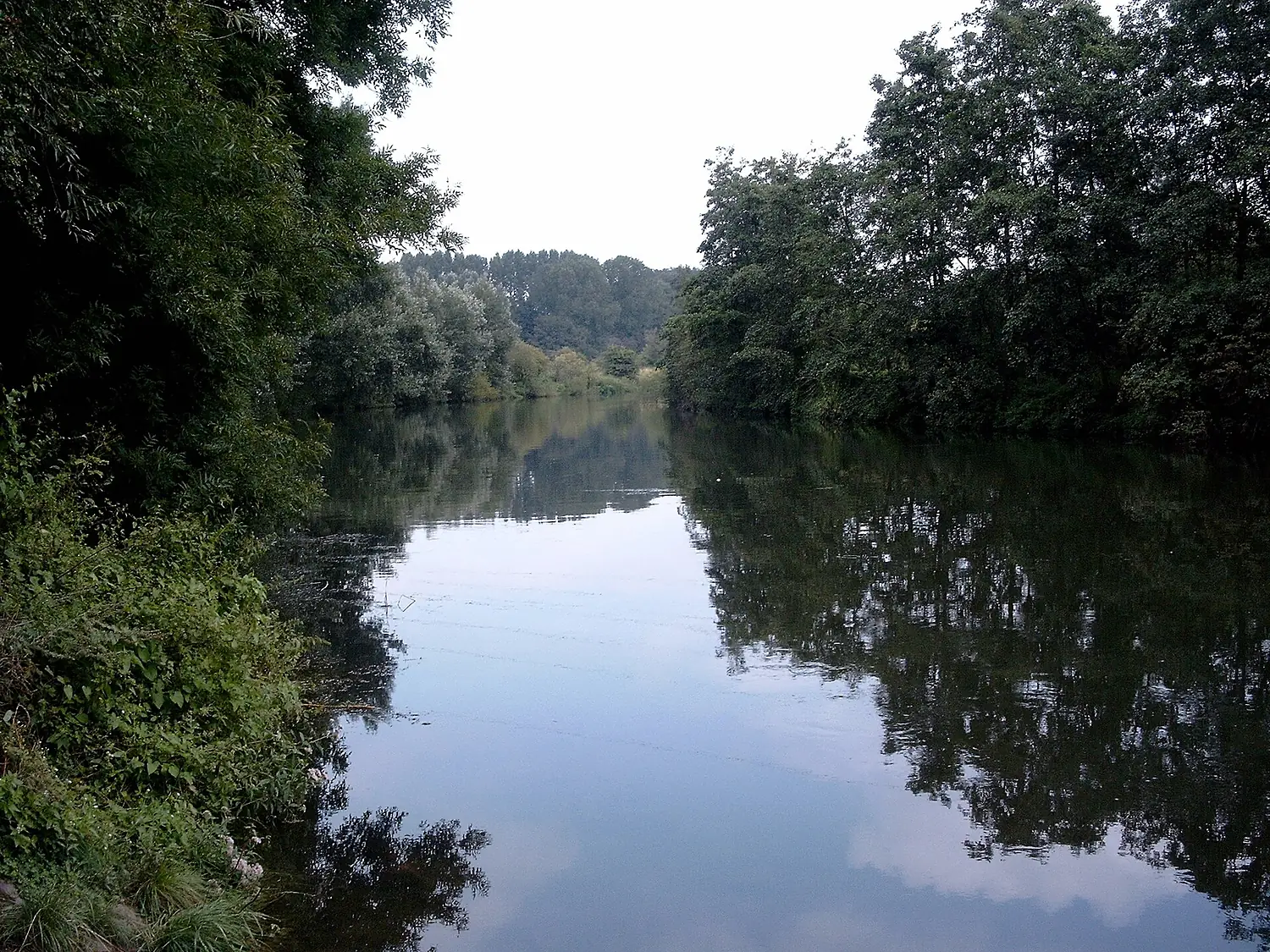
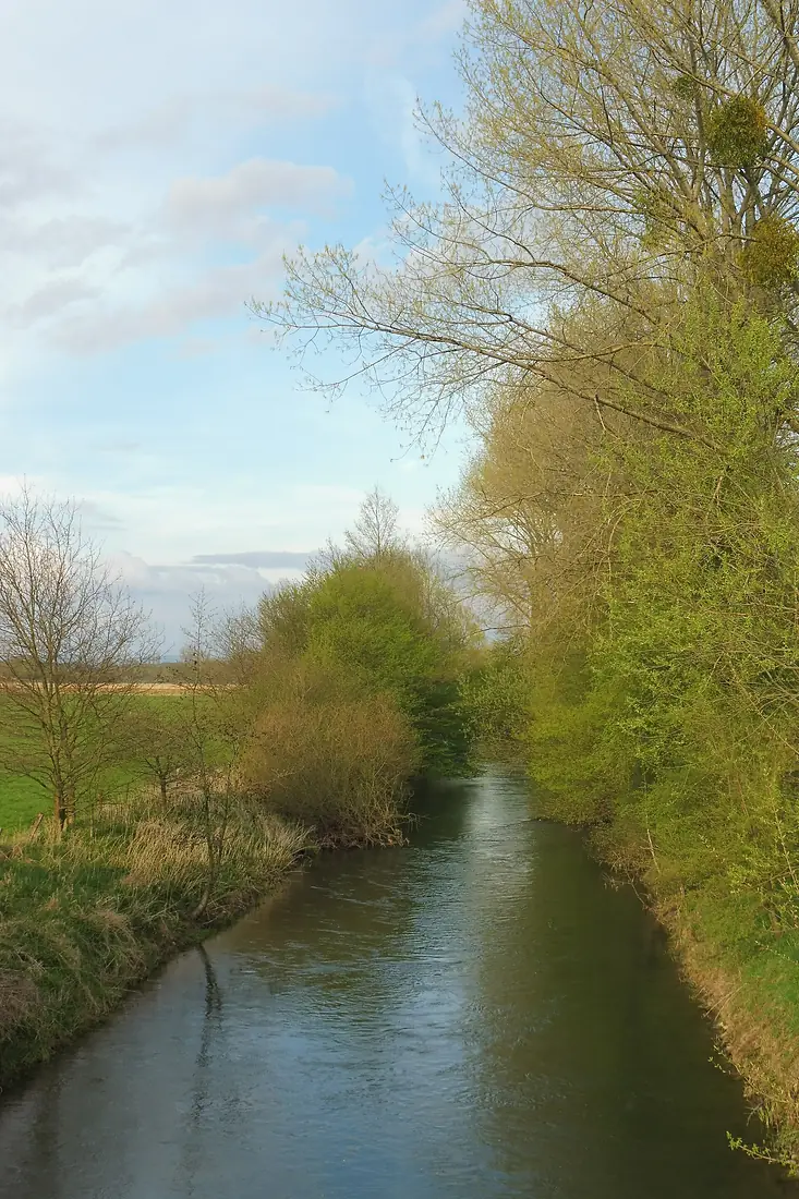
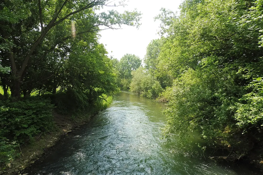
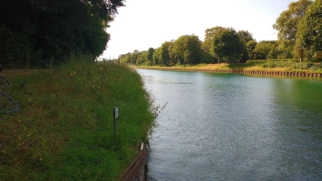
Lippe in pictures
Tributaries
Where it flows, and what flows into it
It flows into
Rhine The Netherlands1,233 km2,200 m³/s
Tributaries (21)
Also: Alme, Pader, Stever, Ahse, Beke, Thune, Baagebach, Heder, Seseke, Glenne, Sickingmühlenbach, Thunebach, Gieseler, Horne, Trotzbach, Brandenbaumer Bach, Weier Bach, Quabbe, Gunne, Rühenbecke, Südfeld-Bach
 Switzerland
 France
Nearby
Rivers nearby
Germany217 km79 m³/s23 km awayRurThe Netherlands164 km25 m³/s62 km awayLahnGermany242 km54 m³/s105 km awayMeuseThe Netherlands950 km230 m³/s134 km awayWupperGermany115 km17 m³/s71 km awaySiegGermany155 km52 m³/s101 km awayMoselleGermany544 km320 m³/s158 km awayDommel Belgium80 km10 m³/s91 km away
Where these numbers come from
| Name, length, places | Wikidata (Q153945) · CC0 |
|---|---|
| Course, profile, basin | RiverATLAS v1.0 (HydroATLAS, Linke et al. 2019) · CC BY 4.0 — followed from the source to the mouth given by Wikidata |
| Flow | WaterGAP (RiverATLAS), 1971–2000 · CC BY 4.0 |
| Climate along the river | WorldClim (RiverATLAS), 1970–2000 · CC BY 4.0 |
| Towns, bridges, dams | Wikidata · CC0; GeoNames · CC BY 4.0 |
| Along the river | © OpenStreetMap contributors · ODbL |
| Images | EOX Sentinel-2 cloudless 2016 · CC BY 4.0; Wikimedia Commons |
| Our other atlases | Lakeyas, Peakyas — Wikidata · CC0; © OpenStreetMap contributors · ODbL; GeoNames · CC BY 4.0; HydroLAKES · CC BY 4.0; NOAA OISST |
Every source and licence is on the data sources page.
The family
Do you prefer beaches, lakes, mountains, waterfalls, islands, rivers or canyons?
Same idea, other landscapes: field atlases built on open data, month by month, in seven languages.
 beaches
 Find your beach: sea temperature, sun and swimming month by month.Visit lakes
 Every lake on Earth: water temperature, ice, depth and the shore.Coming soonVisit mountains
 Every summit in 3D: summit weather, the 0 °C line, huts and trails.Visit
  waterfalls
 Every waterfall: height, flow month by month and when it roars.Coming soonVisit
  islands
 Every island from the sea up: size, sea temperature, ferries and 3D.Coming soonVisit
  rivers
 Every river from source to sea: the journey, the flow and the basin in numbers.You are here
 canyons
 Every canyon cut to scale: depth to the floor, rim and floor temperatures, trails and viewpoints.Coming soonVisit