River
Glomma
604 km from source to mouth · Norway.
 NorwayFlows into Skagerrak1st longest in Norway
In numbers
Length
604km
Average flow
720m³/s
Basin
42,441km²
Drop
694m
from 694 m to 0 m
Country
1
The journey
From source to mouth
604 km of river and 68 stops on the way: 10 towns and cities on its banks, dams, bridges and the tributaries that feed it.
- 0 kmAursundat 694 m
- 0 kmBolagen2.5 km²
- 1 kmTufsingen1.4 km²
- 2 kmBorgfossen
- 30 kmAursund46 km²
- 31 kmKurråsfossen
- 69 kmSmåvollfossen
- 71 kmLensmannsfossen
- 76 kmNedre Tallsjøen1.4 km²
- 122 kmFollatributary
- 143 kmUrstrømfossen
- 145 kmBarkaldfossen
- 156 kmTegningfallet
- 160 kmGrøtefossen
- 175 kmAtnatributary
- 216 kmMesseltfossen
- 260 kmRenatributary
- 283 kmØksnafallene46 m
- 289 kmBånerudfossen
- 291 kmStrandfossen
- 295 kmElverum12,490 people
- 296 kmPrestfossen
- 297 kmKlokkerfossen
- 303 kmSkjefstadfossen
- 322 kmBraskereidfossen
- 330 kmEidsfossen
- 343 kmFlisa bru
- 345 kmFlisatributary
- 364 kmGardsjøen0.5 km²
- 376 kmNugguren4.1 km²
- 376 kmNorsfossen
- 385 kmGjølstadfossen
- 388 kmPrestegardstjennet0.6 km²
- 395 kmVingersjøen2.6 km²
- 397 kmKongsvinger12,338 people
- 421 kmOppstadåatributary
- 437 kmFunnefoss
- 443 kmVormatributary
- 445 kmÅrnes3,289 people
- 460 kmRånåsfossen
- 463 kmSundfossen
- 466 kmBingsfossen
- 467 kmSørumsand5,878 people
- 469 kmRømuatributary
- 473 kmVarsjøen (lanaw sa Noruwega)0.5 km²
- 475 kmHeia0.5 km²
- 476 kmFetsund Bridge
- 477 kmFetsund6,441 people
- 480 kmSvelle6.5 km²
- 488 kmFlateby3,298 people
- 511 kmMørkfoss
- 516 kmØyeren70 km²
- 517 kmSolbergfoss
- 522 kmSpydeberg3,166 people
- 522 kmFossum Bridge
- 523 kmSmaalenene Bridge
- 527 kmAskim12,482 people
- 528 kmVrangen fossen
- 532 kmVammafossen
- 546 kmRakkestadelvatributary
- 546 kmBrekke foss
- 565 kmVestvannet27 km²
- 566 kmTunevannet2.3 km²
- 566 kmSarpsborg59,038 people
- 567 kmSarp Falls
- 570 kmSannesund Bridge
- 576 kmVisterflo3.3 km²
- 583 kmFredrikstad Bridge
- 583 kmFredrikstad83,761 people
- 604 kmSkagerrakat 0 m
Water level along the river (RiverATLAS; the height is exaggerated). Towns: GeoNames and Wikidata; bridges, dams and tributaries: Wikidata.
River in Norway
At the mouth it carries 720 m³/s on average: an Olympic pool every 3.5 seconds. It drops from 694 m to 0 m, 1.1 m per kilometre on average. Its basin covers 42,441 km², about the size of DK. 663,000 people live in it. Highest water, with the snowmelt: from April to June; lowest: from December to March. Its dams hold back little of its water (8.0% of a year's flow).
Where to start
- FredrikstadLargest city on its banks · 83,761 people
- Sandefjord Airport, Torp (TRF)Nearest airport with scheduled flights, 38 km from the cityCar hire at OSL airport (Oslo)Discover Cars · Affiliate link↗
- On the water70 ferry piers, marinas, boat rentals and boat ramps along the river (OpenStreetMap)
- Kayak and canoe1 put-ins and rapids mapped (OpenStreetMap)
- From June to AugustThe best months to visit
Glomma, month by month
Highest water: from April to June
Lowest water: from December to March. Freezing months (average below −4 °C): from December to February. Melting snow makes up much of its water. Best months to visit: from June to August.
From about 170 m³/s in the lowest month to 1,700 m³/s in the highest. An estimate: the monthly flow is modelled from the lowest and highest months of WaterGAP (RiverATLAS, 1971–2000) and the rain and snow along the river (WorldClim). Dams change the real rhythm. The chip is the average air temperature; below it, the month's rain.
Plan the trip
Plan the trip: boat trips, a bed by the river, a car
Some links above are affiliate links: if you book through them we may earn a commission, at no extra cost to you. It never changes what the data on this page says.
The basin
Glomma: the basin in numbers
41,122 km² of land send their water to this river. This is what lives on it.
- 663,000people live in the basin
- 17/km²people per km²
- 739maverage altitude of the basin
- 733mmof rain a year (basin average)
- 1.0°Caverage air temperature
- 21%protected areas
- 3.8%covered by lakes
- 1%glaciers
- 4%permafrost
- 1.6km³held in reservoirs
What covers the basin
- 53% Forest
- 5% Cropland
- 1% Towns and cities
- 1% Ice
RiverATLAS (HydroATLAS v1.0, CC BY 4.0): land cover, people, protected areas, glaciers and dams over the whole basin upstream of the mouth.
Along the river
Glomma: what you find on the way
- 5WeirsVannbasseng and 4 more
- 44WaterfallsFossan, Brufossen, Småvollfossen and 41 more
- 1RapidsGrøtefossen
- 46Boat rampsFlateby Båtforening, Båtrampe, Askim Havn Båtrampe and 43 more
- 12Ferry piersLisleby, Sellebakk, Cicignon and 9 more
- 11MarinasÅrnes brygge, Sørumsand Båthavn, Askim havn and 8 more
- 7River beachesBarvika, Sandstangen, Badestrand and 4 more
From OpenStreetMap, within 2.2 km of the river. Not mapped is not the same as not there.
Cross-checked with our atlases
Glomma in our other atlases
What our sister atlases know about the waterfalls on this river, the lakes it flows through, the beaches at its mouth, the mountains where it rises and the islands off its mouth.
 29waterfalls on the riverCascadyas
 15lakes on its wayLakeyas
 6beaches at the mouth and on the banksCoastya
 219mountains at the sourcePeakyas
 24islands off the mouthIslandyas
Waterfalls (29)
On the river, by Cascadyas
- Øksnafallenekm 26446m
- Skjefstadfossenkm 282
- Bingsfossenkm 434
- Mørkfosskm 476
- Vrangen fossenkm 492
- Vammafossenkm 496
- Brekke fosskm 509
- Sarp Fallskm 528
21 more on CascadyasCascadyas is coming soonOpen Cascadyas ↗
Lakes and reservoirs (15)
Lakes it flows through, by Lakeyas
- Bolagenkm 02.5km²
- Aursundkm 28 · 60 m deep46km²
- Gardsjøenkm 3390.5km²
- Nuggurenkm 3504.1km²
- Øyerenkm 481 · 76 m deep70km²
- Vestvannetkm 52727km²
- Tunevannetkm 5272.3km²
- Visterflokm 5363.3km²
7 more on LakeyasLakeyas is coming soonOpen Lakeyas ↗
Beaches (6)
At the mouth (25 km) and on the banks, by Coastya
- Vitbukt23 km away · cove18.1°C
- Hålleviken22 km away · cove18.1°C
- Oksrødkilen7.4 km away · cove18.2°C
- Røsneskilen17 km away · cove18.2°C
- Neskilen3.7 km away · cove18.2°C
- Langvikkilen9.5 km away · cove18.2°C
Mountains at the source (219)
Within 15 km of the source, by Peakyas
- Gruvsjøhøgda12 km away960m
- Heksinlia9.0 km away
- Høgvollia13 km away
- Stuggulia11 km away
- Mortenslia8.5 km away
- Sølendet7.9 km away
- Tamnesvola5.9 km away
- Granmyrhåmmåren13 km away
211 more on PeakyasOpen Peakyas ↗
Islands off the mouth (24)
Within 30 km of the mouth, by Islandyas
- Kirkeøy17 km away27km²
- Herføl22 km away2.0km²
- Husøy28 km away0.9km²
- Asmaløy14 km away9.0km²
- Føynland29 km away
- Hankø10 km away4.0km²
- Brattøya25 km away0.6km²
- Kråkerøy1.1 km away
16 more on IslandyasIslandyas is coming soonOpen Islandyas ↗
From space
The source and the mouth, seen from orbit
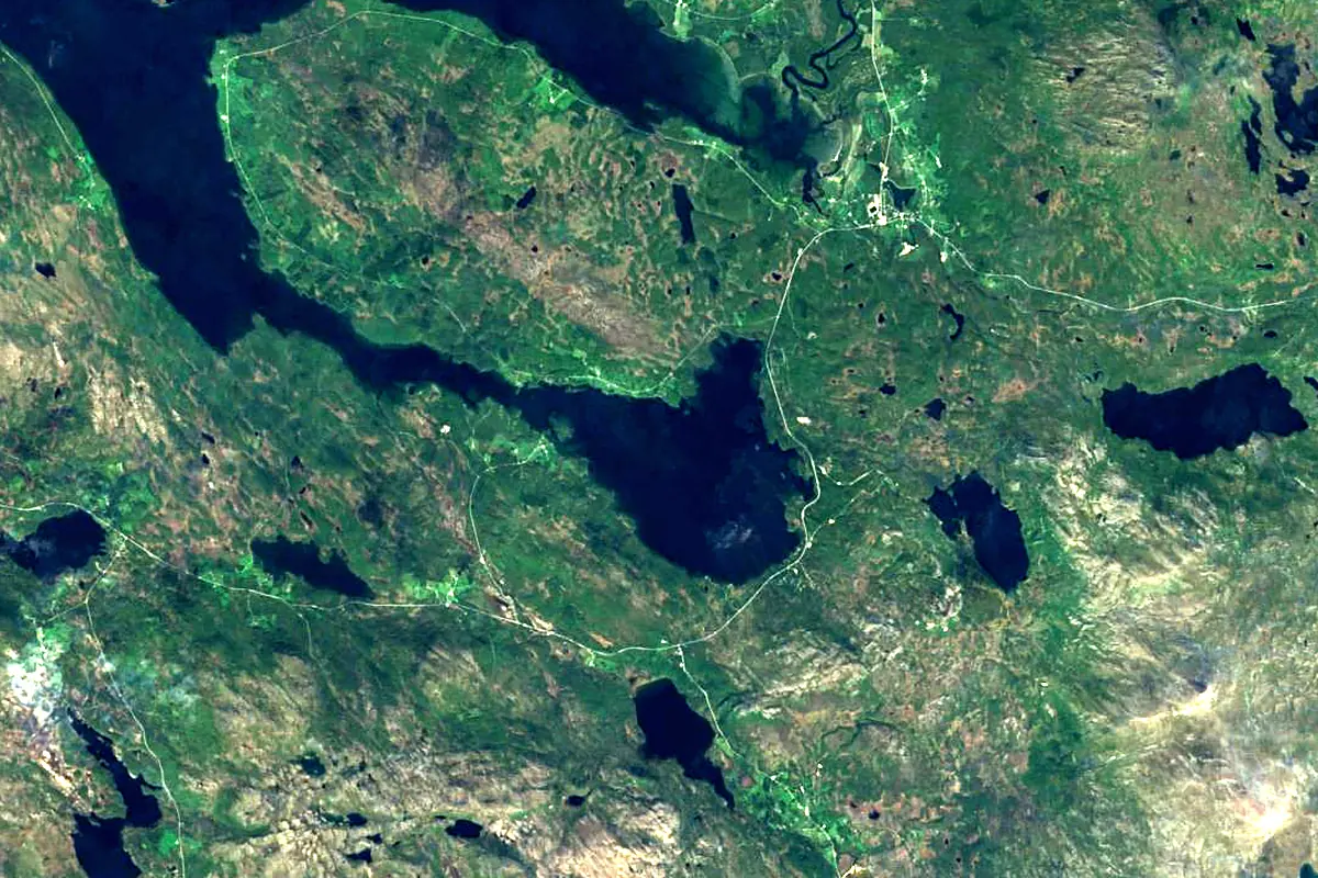
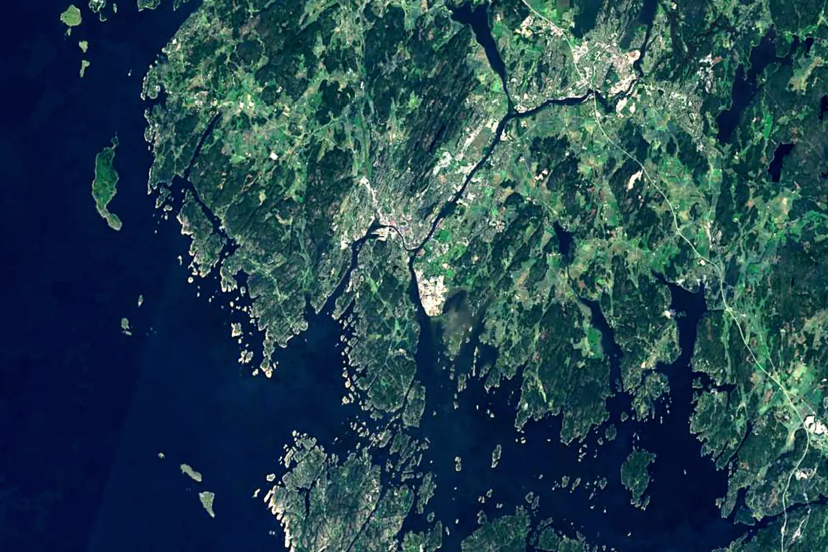
Sentinel-2 cloudless 2016 by EOX IT Services GmbH (contains modified Copernicus Sentinel data 2016), CC BY 4.0. The glowing line is the river as drawn by RiverATLAS.
Photos
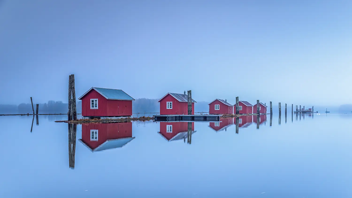
Glomma in pictures
Tributaries
Where it flows, and what flows into it
Tributaries (16)
Also: Vorma, Rena, Flisa, Folla, Norderåa, Atna, Rakkestadelva, Rømua, Oppstadåa, Åsta, Tegninga, Imsa, Auståa, Dysta, Vangrøfta, Moensbekken
In the same basin
Nearby
Rivers nearby
Norway358 km96 m³/s54 km awayDrammenselvaNorway48 km310 m³/s72 km awayKlarälven Sweden460 km160 m³/s150 km awayGöta älvSweden95 km570 m³/s164 km awayOtraNorway245 km150 m³/s206 km awayGudbrandsdalslågenNorway204 km220 m³/s215 km awayÖsterdal RiverSweden300 km150 m³/s277 km awayNissanSweden200 km41 m³/s304 km away
Where these numbers come from
| Name, length, places | Wikidata (Q214535) · CC0 |
|---|---|
| Course, profile, basin | RiverATLAS v1.0 (HydroATLAS, Linke et al. 2019) · CC BY 4.0 — followed from the source to the mouth given by Wikidata |
| Flow | WaterGAP (RiverATLAS), 1971–2000 · CC BY 4.0 |
| Climate along the river | WorldClim (RiverATLAS), 1970–2000 · CC BY 4.0 |
| Towns, bridges, dams | Wikidata · CC0; GeoNames · CC BY 4.0 |
| Along the river | © OpenStreetMap contributors · ODbL |
| Images | EOX Sentinel-2 cloudless 2016 · CC BY 4.0; Wikimedia Commons |
| Our other atlases | Cascadyas, Lakeyas, Coastya, Peakyas, Islandyas — Wikidata · CC0; © OpenStreetMap contributors · ODbL; GeoNames · CC BY 4.0; HydroLAKES · CC BY 4.0; NOAA OISST |
Every source and licence is on the data sources page.
The family
Do you prefer beaches, lakes, mountains, waterfalls, islands, rivers or canyons?
Same idea, other landscapes: field atlases built on open data, month by month, in seven languages.
beaches Find your beach: sea temperature, sun and swimming month by month.Visit lakes
 Every lake on Earth: water temperature, ice, depth and the shore.Coming soonVisit mountains
 Every summit in 3D: summit weather, the 0 °C line, huts and trails.Visit waterfalls
 Every waterfall: height, flow month by month and when it roars.Coming soonVisit islands
 Every island from the sea up: size, sea temperature, ferries and 3D.Coming soonVisit
  rivers
 Every river from source to sea: the journey, the flow and the basin in numbers.You are here
 canyons
 Every canyon cut to scale: depth to the floor, rim and floor temperatures, trails and viewpoints.Coming soonVisit