River
Numedalslågen
358 km from source to mouth · Norway.
 NorwayFlows into Larviksfjorden4th longest in Norway
In numbers
Length
358km
Average flow
96m³/s
Basin
5,600km²
Drop
1,239m
from 1,239 m to 0 m
Country
1
The journey
From source to mouth
358 km of river and 48 stops on the way: 2 towns and cities on its banks, dams, bridges and the tributaries that feed it.
- 0 kmBjornesfjordenat 1,239 m
- 2 kmNordmannslågen11 km²
- 25 kmBjornesfjorden18 km²
- 30 kmMelrakktjønne0.5 km²
- 35 kmGeitvatnet1.4 km²
- 41 kmReinavatnet0.5 km²
- 46 kmKrossvatn1.6 km²
- 56 kmSkrykken5.3 km²
- 58 kmGeitsjøen3.1 km²
- 62 kmNedre Hein1.1 km²
- 64 kmNordskarvet1.6 km²
- 79 kmOssjøen2.4 km²
- 93 kmIsmalfossen
- 106 kmGodfarfossen
- 116 kmPålsbufjorden19 km²
- 138 kmTunhovdfjorden25 km²
- 162 kmNorefjorden3.9 km²
- 170 kmKravikfjorden2.9 km²
- 173 kmBratterudfossen
- 178 kmMykstufoss
- 219 kmBeinsvatnet0.5 km²
- 239 kmPikerfossen
- 240 kmPikerfoss
- 247 kmKongsberg17,667 people
- 247 kmNybrufoss
- 247 kmNybrua
- 247 kmMyntbrua
- 248 kmGamlebrua
- 249 kmKongsberg Bridge
- 250 kmKloppfoss
- 254 kmLabrofossen
- 255 kmGravenfoss
- 258 kmLandefoss
- 259 kmKvennafossen
- 294 kmBrufoss bridge
- 294 kmBrufoss
- 294 kmSøndre Brufoss bridge
- 304 kmVrangfoss
- 305 kmKjærra
- 306 kmVestfossen
- 306 kmHeklafoss
- 308 kmVierødfossen
- 328 kmHolmfoss
- 335 kmÅsrumvannet1.2 km²
- 343 kmBommestad bridge west
- 343 kmBommestad bridge east
- 343 kmBommestad bridge
- 344 kmAbyfoss
- 349 kmLarvik23,113 people
- 358 kmLarviksfjordenat 0 m
Water level along the river (RiverATLAS; the height is exaggerated). Towns: GeoNames and Wikidata; bridges, dams and tributaries: Wikidata.
River in Flesberg, Hol, Kongsberg, Larvik, Nore og Uvdal and Rollag, Norway
At the mouth it carries 96 m³/s on average: an Olympic pool every 26 seconds. It drops from 1,239 m to 0 m, 3.5 m per kilometre on average. Its basin covers 5,600 km², about the size of BN. 69,000 people live in it. Highest water, with the snowmelt: from May to June; lowest: from December to March. Dams and reservoirs hold back a large share of its water (29% of a year's flow).
Where to start
- LarvikLargest city on its banks · 23,113 people
- Sandefjord Airport, Torp (TRF)Nearest airport with scheduled flights, 20 km from the cityCar hire at OSL airport (Oslo)Discover Cars · Affiliate link↗
- On the water15 ferry piers, marinas, boat rentals and boat ramps along the river (OpenStreetMap)
- Kayak and canoe6 put-ins and rapids mapped (OpenStreetMap)
- From June to AugustThe best months to visit
Numedalslågen, month by month
Highest water: from May to June
Lowest water: from December to March. Freezing months (average below −4 °C): from December to February. Melting snow makes up much of its water. Best months to visit: from June to August.
From about 38 m³/s in the lowest month to 290 m³/s in the highest. An estimate: the monthly flow is modelled from the lowest and highest months of WaterGAP (RiverATLAS, 1971–2000) and the rain and snow along the river (WorldClim). Dams change the real rhythm. The chip is the average air temperature; below it, the month's rain.
Plan the trip
Plan the trip: boat trips, a bed by the river, a car
Some links above are affiliate links: if you book through them we may earn a commission, at no extra cost to you. It never changes what the data on this page says.
The basin
Numedalslågen: the basin in numbers
5,730 km² of land send their water to this river. This is what lives on it.
- 69,000people live in the basin
- 12/km²people per km²
- 813maverage altitude of the basin
- 921mmof rain a year (basin average)
- 1.2°Caverage air temperature
- 26%protected areas
- 5.6%covered by lakes
- 0.9km³held in reservoirs
What covers the basin
- 57% Forest
- 3% Cropland
- 1% Towns and cities
RiverATLAS (HydroATLAS v1.0, CC BY 4.0): land cover, people, protected areas, glaciers and dams over the whole basin upstream of the mouth.
Along the river
Numedalslågen: what you find on the way
- 54WeirsPikerfossdammen and 53 more
- 28WaterfallsIsmalfossen, Godfarfossen, Bratterudfossen and 25 more
- 6RapidsHolmsbustryken, Eidstryken, Rudstryken and 3 more
- 6Boat ramps
- 3Ferry piersVestre Brygge, Larvik, Ferjeterminal Revet
- 6MarinasSmåbåtshavn, Skotta, Larvik båtforening and 3 more
- 8River beachesJondalsdammen, Rundetjern, Stupebrett and 5 more
From OpenStreetMap, within 1.7 km of the river. Not mapped is not the same as not there.
Cross-checked with our atlases
Numedalslågen in our other atlases
What our sister atlases know about the waterfalls on this river, the lakes it flows through, the beaches at its mouth, the mountains where it rises and the islands off its mouth.
 20waterfalls on the riverCascadyas
 17lakes on its wayLakeyas
 102beaches at the mouth and on the banksCoastya
 62mountains at the sourcePeakyas
 20islands off the mouthIslandyas
Waterfalls (20)
On the river, by Cascadyas
- Godfarfossenkm 94
- Pikerfossenkm 213
- Nybrufosskm 220
- Labrofossenkm 226
- Kvennafossenkm 231
- Kjærrakm 272
- Heklafosskm 273
- Holmfosskm 292
12 more on CascadyasCascadyas is coming soonOpen Cascadyas ↗
Lakes and reservoirs (17)
Lakes it flows through, by Lakeyas
- Nordmannslågenkm 211km²
- Bjornesfjordenkm 2218km²
- Skrykkenkm 505.3km²
- Geitsjøenkm 523.1km²
- Pålsbufjordenkm 10319km²
- Tunhovdfjordenkm 12325km²
- Norefjordenkm 1443.9km²
- Kravikfjordenkm 1512.9km²
9 more on LakeyasLakeyas is coming soonOpen Lakeyas ↗
Beaches (102)
At the mouth (25 km) and on the banks, by Coastya
- Steinstranda3.4 km away17.8°C
- Jordestranda2.6 km away17.8°C
- Jordfallet2.3 km away17.8°C
- Hvittensandkm 31117.8°C
- Andvikstranda8.6 km away17.8°C
- Kjærstranda8.4 km away17.8°C
- Lyhusstranda8.2 km away17.8°C
- Nalumstranda7.6 km away17.8°C
94 more on CoastyaOpen Coastya ↗
Mountains at the source (62)
Within 15 km of the source, by Peakyas
- Blyvarden11 km away1,446m
- Valgardsnutane11 km away1,414m
- Herrevardsnutane10 km away1,395m
- Låghellernuten12 km away1,393m
- Olavsoksli9.2 km away1,350m
- Hellenuten13 km away1,340m
- Skitvåknuten9.1 km away1,320m
- Holbergnutane9.1 km away1,320m
54 more on PeakyasOpen Peakyas ↗
Islands off the mouth (20)
Within 30 km of the mouth, by Islandyas
- Nøtterøy28 km away
- Hvasser23 km away3.6km²
- Sandøya19 km away
- Veierland21 km away
- Tjøme21 km away39km²
- Langøya18 km away
- Løvøya18 km away
- Håøya, Telemark14 km away
12 more on IslandyasIslandyas is coming soonOpen Islandyas ↗
From space
The source and the mouth, seen from orbit
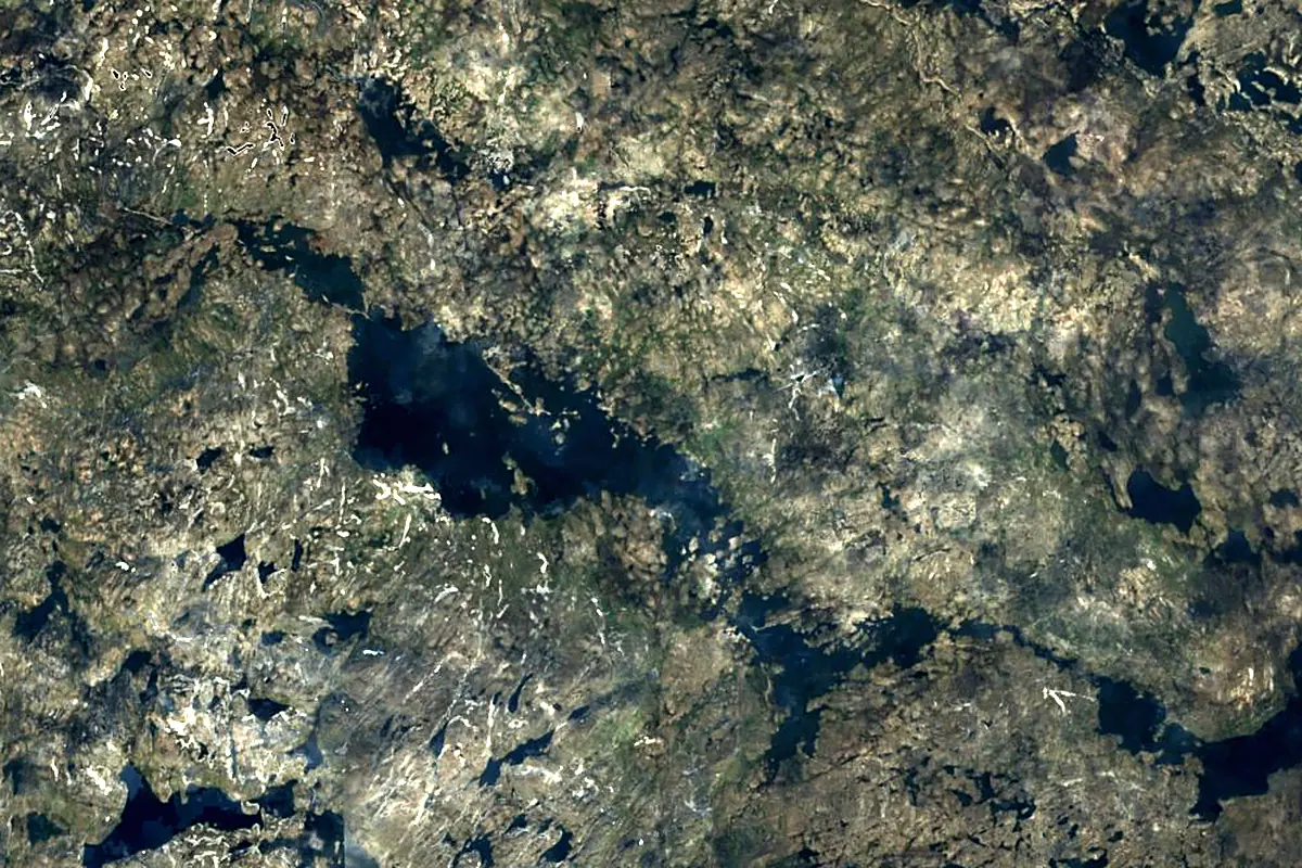
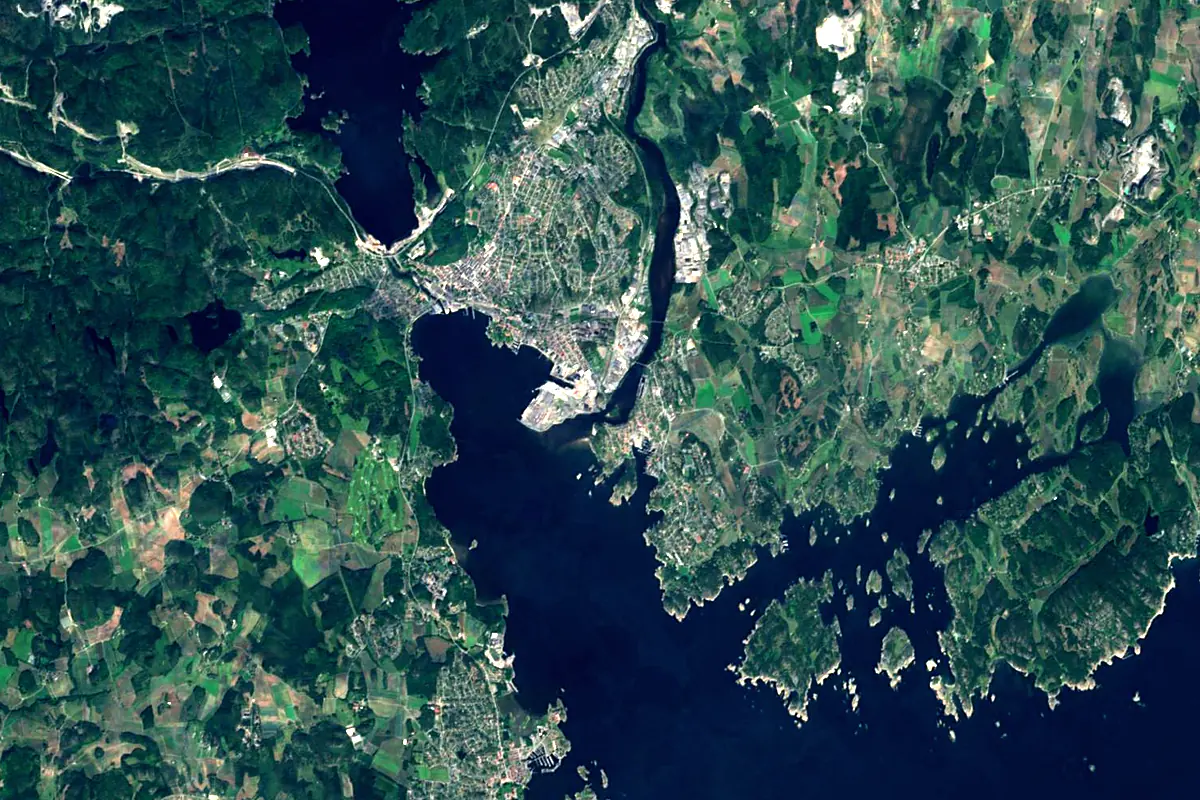
Sentinel-2 cloudless 2016 by EOX IT Services GmbH (contains modified Copernicus Sentinel data 2016), CC BY 4.0. The glowing line is the river as drawn by RiverATLAS.
Photos
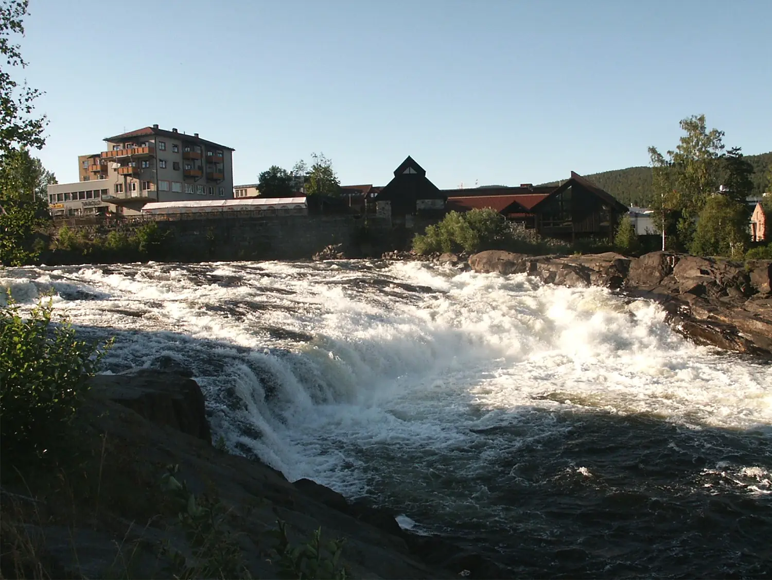
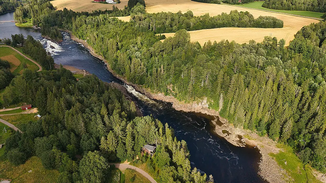
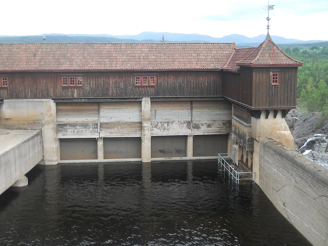
Numedalslågen in pictures
Tributaries
Where it flows, and what flows into it
Tributaries (2)
Also: Uvdalsåe, Jondalselva
Nearby
Rivers nearby
Norway604 km720 m³/s54 km awayDrammenselvaNorway48 km310 m³/s78 km awayGöta älv Sweden95 km570 m³/s173 km awayOtraNorway245 km150 m³/s155 km awayKlarälvenSweden460 km160 m³/s203 km awayGudbrandsdalslågenNorway204 km220 m³/s231 km awayNissanSweden200 km41 m³/s312 km awayÖsterdal RiverSweden300 km150 m³/s329 km away
Where these numbers come from
| Name, length, places | Wikidata (Q1420630) · CC0 |
|---|---|
| Course, profile, basin | RiverATLAS v1.0 (HydroATLAS, Linke et al. 2019) · CC BY 4.0 — followed along the river network from the point given by Wikidata |
| Flow | WaterGAP (RiverATLAS), 1971–2000 · CC BY 4.0 |
| Climate along the river | WorldClim (RiverATLAS), 1970–2000 · CC BY 4.0 |
| Towns, bridges, dams | Wikidata · CC0; GeoNames · CC BY 4.0 |
| Along the river | © OpenStreetMap contributors · ODbL |
| Images | EOX Sentinel-2 cloudless 2016 · CC BY 4.0; Wikimedia Commons |
| Our other atlases | Cascadyas, Lakeyas, Coastya, Peakyas, Islandyas — Wikidata · CC0; © OpenStreetMap contributors · ODbL; GeoNames · CC BY 4.0; HydroLAKES · CC BY 4.0; NOAA OISST |
Every source and licence is on the data sources page.
The family
Do you prefer beaches, lakes, mountains, waterfalls, islands, rivers or canyons?
Same idea, other landscapes: field atlases built on open data, month by month, in seven languages.
beaches Find your beach: sea temperature, sun and swimming month by month.Visit lakes
 Every lake on Earth: water temperature, ice, depth and the shore.Coming soonVisit mountains
 Every summit in 3D: summit weather, the 0 °C line, huts and trails.Visit waterfalls
 Every waterfall: height, flow month by month and when it roars.Coming soonVisit islands
 Every island from the sea up: size, sea temperature, ferries and 3D.Coming soonVisit
  rivers
 Every river from source to sea: the journey, the flow and the basin in numbers.You are here
 canyons
 Every canyon cut to scale: depth to the floor, rim and floor temperatures, trails and viewpoints.Coming soonVisit