River
Guadiana
778 km from source to mouth · Portugal and Spain.
 Portugal and SpainFlows into Gulf of Cádiz3rd longest in Portugal
In numbers
Length
778km
Average flow
70m³/s
Basin
67,700km²
Drop
604m
from 604 m to 0 m
Countries
2
The journey
From source to mouth
778 km of river and 53 stops on the way: 9 towns and cities on its banks, dams, bridges and the tributaries that feed it.
- 0 kmOjos del Guadianaat 604 m
- 0 kmCigüelatributary
- 0 kmAzuertributary
- 31 kmEl Vicario Reservoir1.6 km²
- 61 kmJabalóntributary
- 86 kmBullaquetributary
- 110 kmTirteafuera Rivertributary
- 164 kmPuente de la Mesta
- 187 kmEstena Rivertributary
- 198 kmCijara Reservoir30 km²
- 226 kmGuadalupe Rivertributary
- 226 kmArroyo Pelochejotributary
- 235 kmGarcía Sola Reservoir23 km²
- 278 kmEmbalse de Orellana40 km²
- 315 kmZújar Rivertributary
- 321 kmRuecas Rivertributary
- 327 kmPuente de piedra, Medellín
- 327 kmMedellín2,241 people
- 339 kmGuadámez Rivertributary
- 369 kmMatacheltributary
- 381 kmMérida60,225 people
- 382 kmPuente Romano
- 383 kmLusitania Bridge
- 383 kmPuente de Hierro
- 389 kmAlbarregastributary
- 393 kmAljucén Rivertributary
- 405 kmLácara Rivertributary
- 430 kmArroyo del Entríntributary
- 457 kmPuente de la Autonomía, Badajoz
- 457 kmBadajoz150,209 people
- 457 kmPuente de Palmas, Badajoz
- 458 kmPuente de la Universidad, Badajoz
- 459 kmPuente Real, Badajoz
- 467 kmCaia Rivertributary
- 475 kmElvas20,706 people
- 482 kmPonte da Ajuda
- 488 kmOlivenza11,742 people
- 579 kmAlqueva Dam
- 579 kmAlqueva Reservoir244 km²
- 586 kmArdila Rivertributary
- 603 kmPedrógão Dam
- 623 kmPuente del Guadiana
- 647 kmRibeira de Cobrestributary
- 648 kmPulo do Lobo
- 668 kmRibeira de Oeirastributary
- 670 kmMértola7,274 people
- 671 kmPonte de Mértola
- 691 kmChança dam7.1 km²
- 702 kmVascãotributary
- 705 kmAlcoutim2,917 people
- 722 kmOdeleite Rivertributary
- 737 kmGuadiana International Bridge
- 740 kmAyamonte22,001 people
- 742 kmVila Real de Santo António11,560 people
- 778 kmGulf of Cádizat 0 m
Water level along the river (RiverATLAS; the height is exaggerated). Towns: GeoNames and Wikidata; bridges, dams and tributaries: Wikidata.
River in the Iberian peninsula
At the mouth it carries 70 m³/s on average: an Olympic pool every 36 seconds. It drops from 604 m to 0 m, 0.8 m per kilometre on average. Its basin covers 67,700 km², about the size of GE. 1.7 million people live in it. Highest water: from December to February; lowest: from June to September. It is heavily dammed: reservoirs can hold 197% of a year's flow.
Where to start
- BadajozLargest city on its banks · 150,209 people
- Badajoz Airport (BJZ)Nearest airport with scheduled flights, 13 km from the cityCar hire in EvoraDiscover Cars · Affiliate link↗
- On the water46 ferry piers, marinas, boat rentals and boat ramps along the river (OpenStreetMap)
- Kayak and canoe1 put-ins and rapids mapped (OpenStreetMap)
- From April to June and from August to SeptemberThe best months to visit
Guadiana, month by month
Highest water: from December to February
Lowest water: from June to September. Best months to visit: from April to June and from August to September.
From about 22 m³/s in the lowest month to 660 m³/s in the highest. An estimate: the monthly flow is modelled from the lowest and highest months of WaterGAP (RiverATLAS, 1971–2000) and the rain and snow along the river (WorldClim). Dams change the real rhythm. The chip is the average air temperature; below it, the month's rain.
Plan the trip
Plan the trip: boat trips, a bed by the river, a car
Some links above are affiliate links: if you book through them we may earn a commission, at no extra cost to you. It never changes what the data on this page says.
The basin
Guadiana: the basin in numbers
66,926 km² of land send their water to this river. This is what lives on it.
- 1.7millionpeople live in the basin
- 25/km²people per km²
- 506maverage altitude of the basin
- 512mmof rain a year (basin average)
- 15.3°Caverage air temperature
- 7%protected areas
- 0.9%covered by lakes
- 13km³held in reservoirs
What covers the basin
- 18% Forest
- 49% Cropland
- 15% Pasture
- 1% Towns and cities
RiverATLAS (HydroATLAS v1.0, CC BY 4.0): land cover, people, protected areas, glaciers and dams over the whole basin upstream of the mouth.
Along the river
Guadiana: what you find on the way
- 48WeirsRepresa del Tamujo, Bacia de dissipação and 46 more
- 3LocksCanal Secundario Nº1
- 1WaterfallsPulo do Lobo
- 1Rapids
- 23Boat ramps
- 5Ferry piersAyamonte (España), Vila Real de Santo António (Portugal) and 3 more
- 18MarinasPuerto Deportivo Villarreal, Cais da Juromenha, Cais Flutuante de Monsaraz and 15 more
- 23River beachesPlaya de arena de Peloche, Playa hormigonada de Peloche, Playa de Puerto Peña and 20 more
From OpenStreetMap, within 2.3 km of the river. Not mapped is not the same as not there.
Cross-checked with our atlases
Guadiana in our other atlases
What our sister atlases know about the waterfalls on this river, the lakes it flows through, the beaches at its mouth, the mountains where it rises and the islands off its mouth.
 1waterfall on the riverCascadyas
 6lakes on its wayLakeyas
 25beaches at the mouth and on the banksCoastya
 1mountain at the sourcePeakyas
 4islands off the mouthIslandyas
Waterfalls (1)
On the river, by Cascadyas
- Pulo do Lobokm 588
Cascadyas is coming soonOpen Cascadyas ↗
Lakes and reservoirs (6)
Lakes it flows through, by Lakeyas
- El Vicario Reservoirkm 281.6km²
- Cijara Reservoirkm 18030km²
- García Sola Reservoirkm 21323km²
- Embalse de Orellanakm 25240km²
- Alqueva Reservoirkm 526244km²
- Chança damkm 6287.1km²
Lakeyas is coming soonOpen Lakeyas ↗
Beaches (25)
At the mouth (25 km) and on the banks, by Coastya
- Praia de Cacela Velha13 km away22.0°C
- Playa Giralda9.3 km away22.2°C
- Playa Taray12 km away22.2°C
- Playa de Caiman6.6 km away22.2°C
- Praia da Ponta da Areiakm 67622.2°C
- Playa Nudista Nueva Umbría21 km away22.5°C
- Praia Verde6.8 km away22.2°C
- Praia de Monte Gordo4.0 km away22.2°C
17 more on CoastyaOpen Coastya ↗
Mountains at the source (1)
Within 15 km of the source, by Peakyas
- Sierra de la Virgen12 km away
Islands off the mouth (4)
Within 30 km of the mouth, by Islandyas
- Isla Canela2.2 km away1.5km²
- Tavira Island26 km away
- Cacela Island13 km away
- Ilha de Cabanas17 km away
Islandyas is coming soonOpen Islandyas ↗
From space
The source and the mouth, seen from orbit
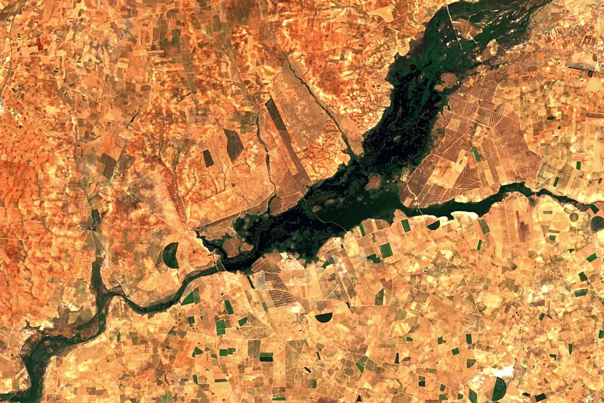
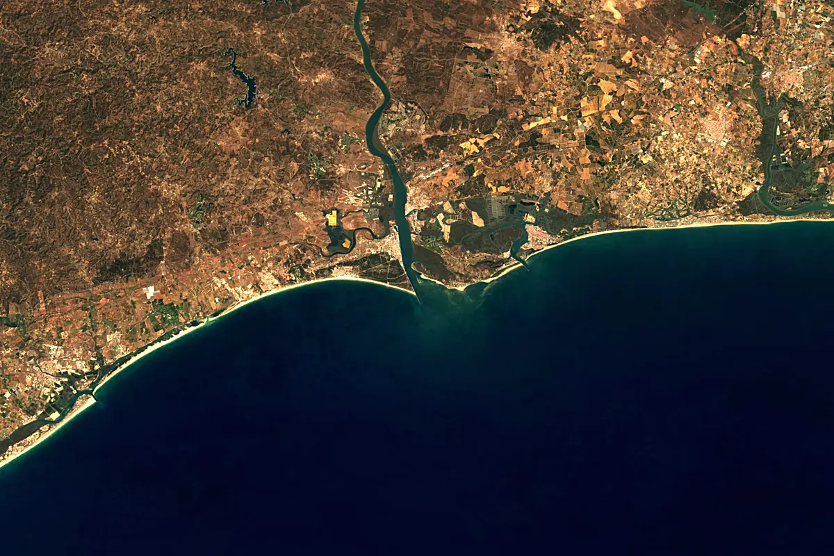
Sentinel-2 cloudless 2016 by EOX IT Services GmbH (contains modified Copernicus Sentinel data 2016), CC BY 4.0. The glowing line is the river as drawn by RiverATLAS.
Photos
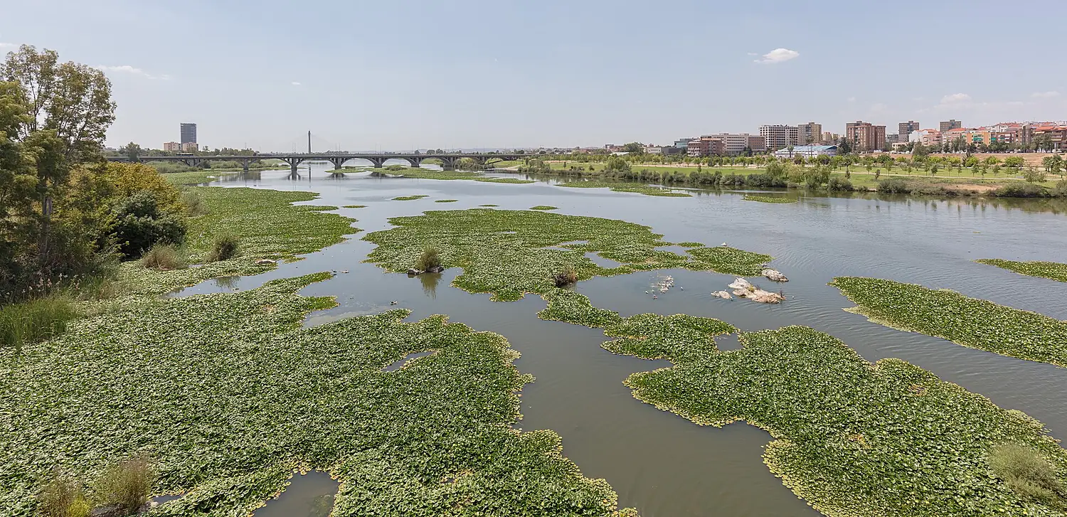
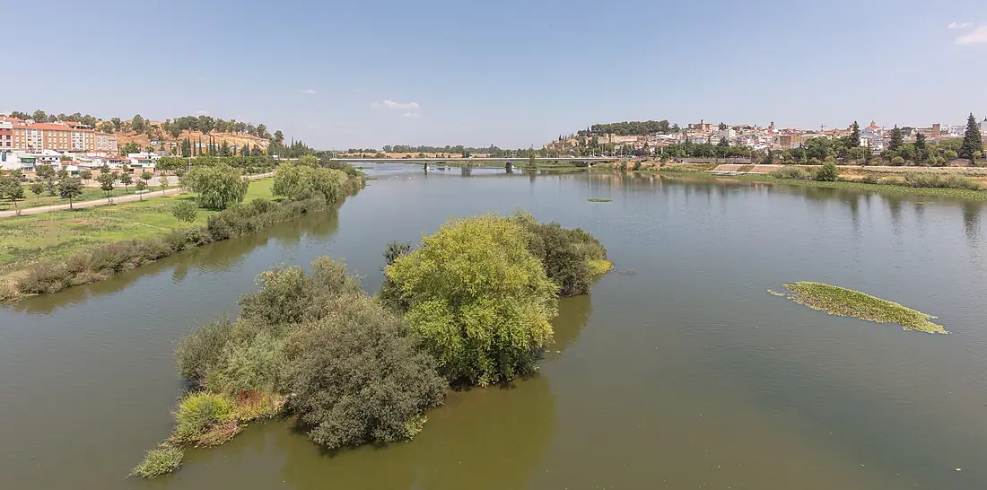
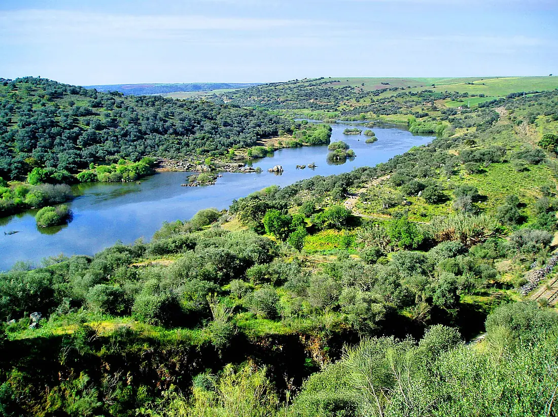
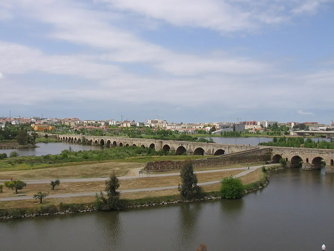
Guadiana in pictures
Tributaries
Where it flows, and what flows into it
Tributaries (37)
Also: Zújar River, Guadalupe River, Cigüela, Ardila River, Jabalón, Matachel, Odeleite River, Caia River, Azuer, Bullaque, Gévora River, Albarregas, Vascão, Ribeira de Cobres, Chanza River, Estena River, Ruecas River, Lácara River, Guadajira River, río Saona, Ribeira de Oeiras, Tirteafuera River, Rivilla River, Arroyo del Entrín
Nearby
Rivers nearby
Spain657 km160 m³/s103 km awayTinto RiverSpain100 km14 m³/s43 km awayGuadaleteSpain159 km20 m³/s123 km awaySado RiverPortugal180 km40 m³/s173 km awayTagus RiverPortugal1,007 km500 m³/s240 km awayGenilSpain358 km40 m³/s192 km awayLoukkos River Morocco176 km50 m³/s247 km awayZêzere RiverPortugal248 km62 m³/s268 km away
Where these numbers come from
| Name, length, places | Wikidata (Q14305) · CC0 |
|---|---|
| Course, profile, basin | RiverATLAS v1.0 (HydroATLAS, Linke et al. 2019) · CC BY 4.0 — followed from the source to the mouth given by Wikidata |
| Flow | WaterGAP (RiverATLAS), 1971–2000 · CC BY 4.0 |
| Climate along the river | WorldClim (RiverATLAS), 1970–2000 · CC BY 4.0 |
| Towns, bridges, dams | Wikidata · CC0; GeoNames · CC BY 4.0 |
| Along the river | © OpenStreetMap contributors · ODbL |
| Images | EOX Sentinel-2 cloudless 2016 · CC BY 4.0; Wikimedia Commons |
| Our other atlases | Cascadyas, Lakeyas, Coastya, Peakyas, Islandyas — Wikidata · CC0; © OpenStreetMap contributors · ODbL; GeoNames · CC BY 4.0; HydroLAKES · CC BY 4.0; NOAA OISST |
Every source and licence is on the data sources page.
The family
Do you prefer beaches, lakes, mountains, waterfalls, islands, rivers or canyons?
Same idea, other landscapes: field atlases built on open data, month by month, in seven languages.
beaches Find your beach: sea temperature, sun and swimming month by month.Visit lakes
 Every lake on Earth: water temperature, ice, depth and the shore.Coming soonVisit mountains
 Every summit in 3D: summit weather, the 0 °C line, huts and trails.Visit waterfalls
 Every waterfall: height, flow month by month and when it roars.Coming soonVisit islands
 Every island from the sea up: size, sea temperature, ferries and 3D.Coming soonVisit
  rivers
 Every river from source to sea: the journey, the flow and the basin in numbers.You are here
 canyons
 Every canyon cut to scale: depth to the floor, rim and floor temperatures, trails and viewpoints.Coming soonVisit