River
Tagus River
1,007 km from source to mouth · Portugal and Spain.

 Portugal and SpainFlows into Atlantic Ocean1st longest in Portugal
In numbers
Length
1,007km
Average flow
500m³/s
Basin
80,602km²
Drop
934m
from 934 m to 0 m
Countries
2
The journey
From source to mouth
1,007 km of river and 68 stops on the way: 26 towns and cities on its banks, dams, bridges and the tributaries that feed it.
- 0 kmFuente Garcíaat 934 m
- 115 kmGuadalajara93,470 people
- 130 kmAzuqueca de Henares34,685 people
- 144 kmAlcalá de Henares193,751 people
- 158 kmTorrejón de Ardoz118,162 people
- 164 kmSan Fernando de Henares39,466 people
- 165 kmMejorada del Campo22,488 people
- 171 kmVelilla de San Antonio11,553 people
- 179 kmRivas-Vaciamadrid68,405 people
- 180 kmLaguna del Campillo0.3 km²
- 198 kmSan Martín de la Vega18,256 people
- 222 kmAranjuez63,040 people
- 225 kmJaramatributary
- 260 kmAlgodor Rivertributary
- 276 kmPuerta de Alcántara
- 277 kmToledo Province740,148 people
- 278 kmToledo city59,990 people
- 280 kmToledo87,216 people
- 291 kmArroyo de Guajaraztributary
- 297 kmGuadarrama Rivertributary
- 318 kmCastrejón Reservoir4.3 km²
- 342 kmArroyo del Torcóntributary
- 356 kmCedena Rivertributary
- 361 kmMalpica de Tajo1,655 people
- 366 kmPusa Rivertributary
- 380 kmArroyo Sangreratributary
- 392 kmAlberchetributary
- 399 kmTalavera de la Reina83,803 people
- 423 kmGévalo Rivertributary
- 439 kmAzután Reservoir9.2 km²
- 443 kmHuso Rivertributary
- 448 kmEl Puente del Arzobispo1,143 people
- 453 kmArroyo Pedrosotributary
- 476 kmGualija Rivertributary
- 496 kmIbor Rivertributary
- 504 kmValdecañas reservoir38 km²
- 505 kmValdecañas Dam
- 513 kmRomangordo240 people
- 518 kmArrocampo Reservoir5.9 km²
- 551 kmTorrejón-Tajo Reservoir8.5 km²
- 552 kmTorrejón-Tiétar Reservoir1.8 km²
- 556 kmTorrejón el Rubio537 people
- 559 kmTiétartributary
- 568 kmSerradilla1,448 people
- 609 kmAlmontetributary
- 614 kmGarrovillas de Alconétar1,941 people
- 641 kmRivera de Fresnedosatributary
- 654 kmAlagón Rivertributary
- 655 kmAlcántara Reservoir45 km²
- 655 kmAlcántara dam
- 656 kmAlcántara1,329 people
- 656 kmAlcántara Bridge
- 676 kmRiver Ergestributary
- 676 kmSalor Rivertributary
- 726 kmRiver Ponsultributary
- 728 kmCedillo Reservoir5.8 km²
- 732 kmRiver Severtributary
- 746 kmVila Velha de Ródão3,521 people
- 768 kmFratel Dam
- 769 kmRio Ocrezatributary
- 793 kmBelver Dam
- 816 kmAbrantes39,325 people
- 835 kmZêzere Rivertributary
- 846 kmEntroncamento19,887 people
- 888 kmAlviela Rivertributary
- 889 kmSantarém62,200 people
- 933 kmRio Otatributary
- 944 kmVila Franca de Xira18,355 people
- 946 kmSorraia Rivertributary
- 1,007 kmAtlantic Oceanat 0 m
Water level along the river (RiverATLAS; the height is exaggerated). Towns: GeoNames and Wikidata; bridges, dams and tributaries: Wikidata.
Longest river in the Iberian Peninsula
At the mouth it carries 500 m³/s on average: an Olympic pool every 5.0 seconds. It drops from 934 m to 0 m, 0.9 m per kilometre on average. Its basin covers 80,602 km², about the size of CZ. 8.5 million people live in it. Highest water: from December to February; lowest: from July to September. It is heavily dammed: reservoirs can hold 98% of a year's flow.
Where to start
- Toledo ProvinceLargest city on its banks · 740,148 people
- Adolfo Suárez Madrid–Barajas Airport (MAD)Nearest airport with scheduled flights, 82 km from the cityCar hire at MAD airport (Madrid)Discover Cars · Affiliate link↗
- On the water35 ferry piers, marinas, boat rentals and boat ramps along the river (OpenStreetMap)
- Kayak and canoe7 put-ins and rapids mapped (OpenStreetMap)
- From May to SeptemberThe best months to visit
Tagus River, month by month
Highest water: from December to February
Lowest water: from July to September. Best months to visit: from May to September.
From about 68 m³/s in the lowest month to 960 m³/s in the highest. An estimate: the monthly flow is modelled from the lowest and highest months of WaterGAP (RiverATLAS, 1971–2000) and the rain and snow along the river (WorldClim). Dams change the real rhythm. The chip is the average air temperature; below it, the month's rain.
Plan the trip
Plan the trip: boat trips, a bed by the river, a car
Some links above are affiliate links: if you book through them we may earn a commission, at no extra cost to you. It never changes what the data on this page says.
The basin
Tagus River: the basin in numbers
70,755 km² of land send their water to this river. This is what lives on it.
- 8.5millionpeople live in the basin
- 120/km²people per km²
- 649maverage altitude of the basin
- 566mmof rain a year (basin average)
- 13.7°Caverage air temperature
- 10%protected areas
- 0.5%covered by lakes
- 13km³held in reservoirs
What covers the basin
- 36% Forest
- 30% Cropland
- 14% Pasture
- 3% Towns and cities
RiverATLAS (HydroATLAS v1.0, CC BY 4.0): land cover, people, protected areas, glaciers and dams over the whole basin upstream of the mouth.
Along the river
Tagus River: what you find on the way
- 40WeirsPresa de Palacio, Cascada de las Castañuelas, Açude Insuflável de Abrantes and 37 more
- 5Locks
- 4Waterfalls"La Rotura" and 3 more
- 7Canoe put-ins
- 23Boat rampsRampa para embarcaciones, Barca d'Amieira (Envendos), Barca d'Amieira (Amieira do Tejo) and 20 more
- 4Ferry piersBarca pasaje, Embarcadero de Cedillo and 2 more
- 7MarinasCais de Monte Fidalgo, Fluvina de Valada, Porto da Palha and 4 more
- 7River beachesPraia Fluvial do Alamal, Praia Fluvial de Abrantes, Praia Fluvial Porto das Mulheres and 4 more
From OpenStreetMap, within 2.3 km of the river. Not mapped is not the same as not there.
Cross-checked with our atlases
Tagus River in our other atlases
What our sister atlases know about the waterfalls on this river, the lakes it flows through, the beaches at its mouth, the mountains where it rises and the islands off its mouth.
 9lakes on its wayLakeyas
 1island off the mouthIslandyas
Lakes and reservoirs (9)
Lakes it flows through, by Lakeyas
- Laguna del Campillokm 1500.3km²
- Castrejón Reservoirkm 2654.3km²
- Azután Reservoirkm 3669.2km²
- Valdecañas reservoirkm 42038km²
- Arrocampo Reservoirkm 4315.9km²
- Torrejón-Tajo Reservoirkm 4598.5km²
- Torrejón-Tiétar Reservoirkm 4591.8km²
- Alcántara Reservoirkm 54545km²
1 more on LakeyasLakeyas is coming soonOpen Lakeyas ↗
Islands off the mouth (1)
Within 30 km of the mouth, by Islandyas
- Mouchão do Malagueiro Grande16 km away
Islandyas is coming soonOpen Islandyas ↗
From space
The source and the mouth, seen from orbit
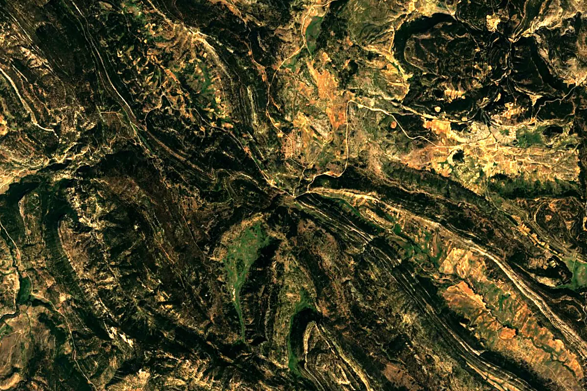
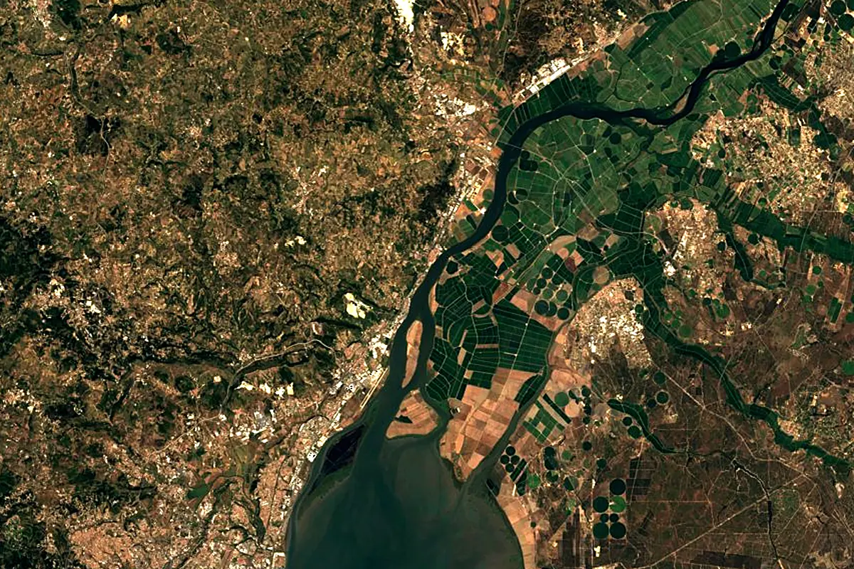
Sentinel-2 cloudless 2016 by EOX IT Services GmbH (contains modified Copernicus Sentinel data 2016), CC BY 4.0. The glowing line is the river as drawn by RiverATLAS.
Photos
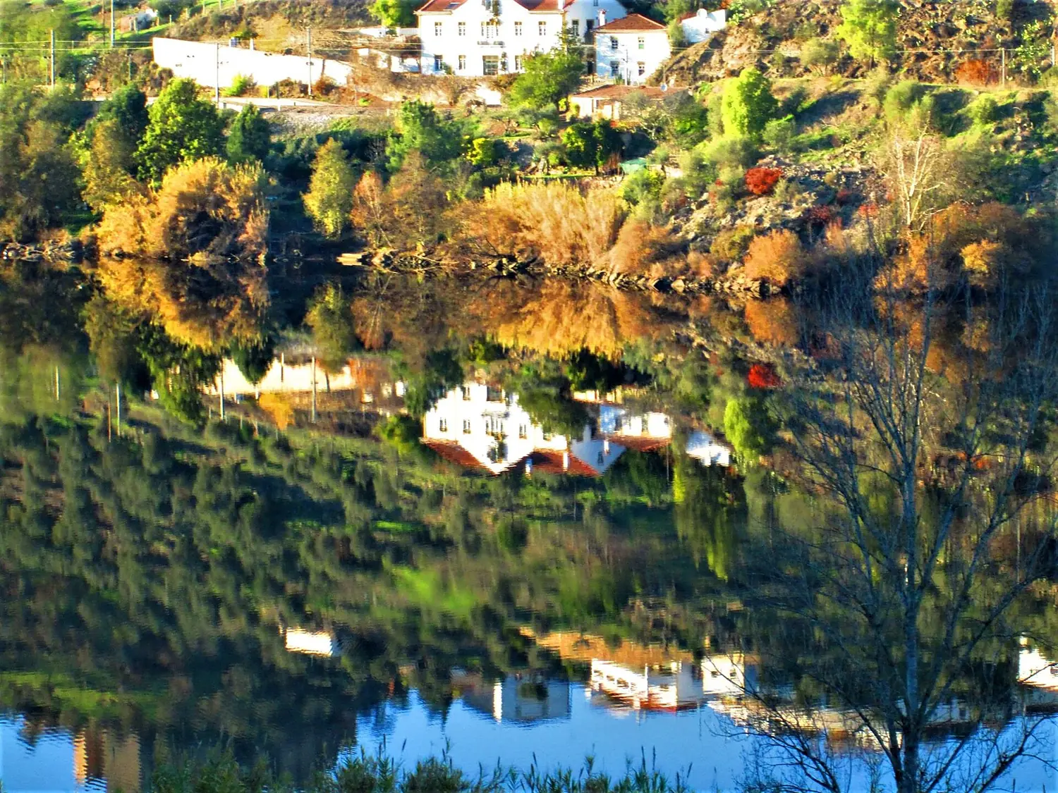
Tagus River in pictures
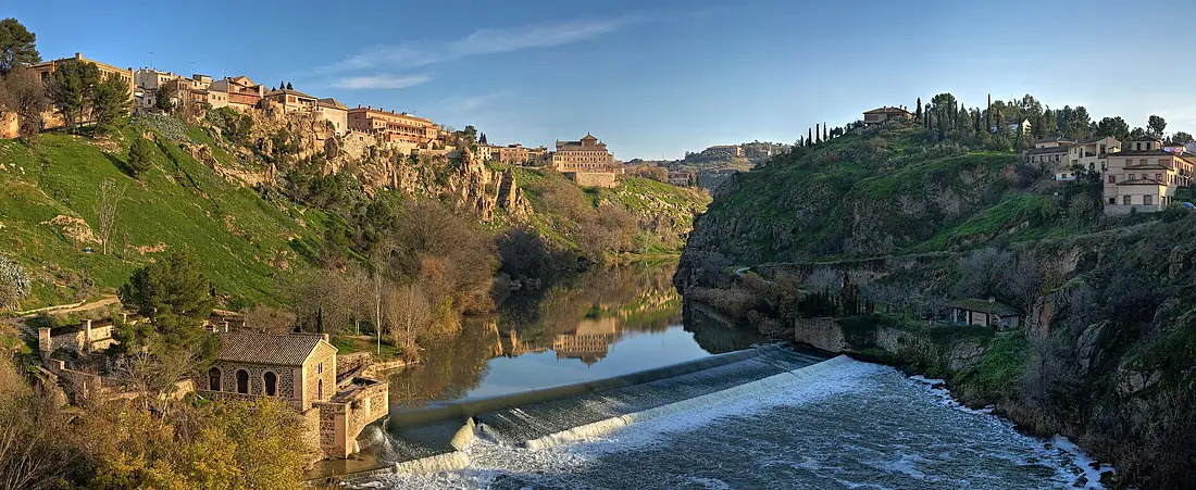
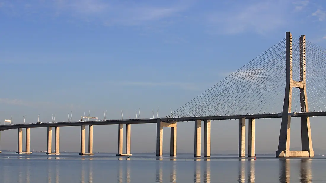
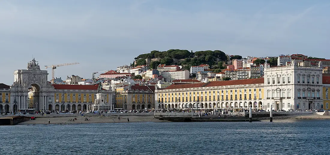
Tributaries
Where it flows, and what flows into it
Tributaries (50)
Portugal248 km62 m³/sjoins at km 695JaramaSpain194 km32 m³/sjoins at km 187AlbercheSpain100 km15 m³/sjoins at km 326Also: Alagón River, Tiétar, Guadarrama River, Almonte, Sorraia River, Guadiela, Algodor River, River Ponsul, Trancão River, Río Gallo, Salor River, Ibor River, Gévalo River, Cifuentes River, Pusa River, Algés River, Cedena River, Alviela River, Hoz Seca River, Huso River, River Erges, Arroyo Cedrón, Arroyo de Guajaraz, Rivera de Fresnedosa
In the same basin
Nearby
Rivers nearby
Portugal180 km40 m³/s68 km awayZêzere RiverPortugal248 km62 m³/s82 km awayMondego RiverPortugal234 km110 m³/s134 km awayDouro RiverPortugal897 km680 m³/s247 km awayGuadianaPortugal778 km70 m³/s240 km awayVouga RiverPortugal148 km62 m³/s197 km awayTâmega RiverPortugal184 km69 m³/s244 km awayTinto RiverSpain100 km14 m³/s263 km awayWhere these numbers come from
| Name, length, places | Wikidata (Q14294) · CC0 |
|---|---|
| Course, profile, basin | RiverATLAS v1.0 (HydroATLAS, Linke et al. 2019) · CC BY 4.0 — followed along the river network from the point given by Wikidata |
| Flow | WaterGAP (RiverATLAS), 1971–2000 · CC BY 4.0 |
| Climate along the river | WorldClim (RiverATLAS), 1970–2000 · CC BY 4.0 |
| Towns, bridges, dams | Wikidata · CC0; GeoNames · CC BY 4.0 |
| Along the river | © OpenStreetMap contributors · ODbL |
| Images | EOX Sentinel-2 cloudless 2016 · CC BY 4.0; Wikimedia Commons |
| Our other atlases | Lakeyas, Islandyas — Wikidata · CC0; © OpenStreetMap contributors · ODbL; GeoNames · CC BY 4.0; HydroLAKES · CC BY 4.0; NOAA OISST |
Every source and licence is on the data sources page.
The family
Do you prefer beaches, lakes, mountains, waterfalls, islands, rivers or canyons?
Same idea, other landscapes: field atlases built on open data, month by month, in seven languages.
 beaches
 Find your beach: sea temperature, sun and swimming month by month.Visit lakes
 Every lake on Earth: water temperature, ice, depth and the shore.Coming soonVisit
  mountains
 Every summit in 3D: summit weather, the 0 °C line, huts and trails.Visit
  waterfalls
 Every waterfall: height, flow month by month and when it roars.Coming soonVisit islands
 Every island from the sea up: size, sea temperature, ferries and 3D.Coming soonVisit
  rivers
 Every river from source to sea: the journey, the flow and the basin in numbers.You are here
 canyons
 Every canyon cut to scale: depth to the floor, rim and floor temperatures, trails and viewpoints.Coming soonVisit