River
Lena River
4,294 km from source to mouth · Russia.
 RussiaFlows into Laptev Sea1st longest in Russia
In numbers
Length
4,294km
Average flow
16,400m³/s
Basin
2,490,000km²
Drop
1,320m
from 1,187 m to -133 m
Country
1
The journey
From source to mouth
4,294 km of river and 68 stops on the way: 0 towns and cities on its banks, dams, bridges and the tributaries that feed it.
- 0 kmBaikal Mountainsat 1,187 m
- 163 kmIliktatributary
- 194 kmManzurkatributary
- 327 kmTuturatributary
- 359 kmIlgatributary
- 624 kmKuta Rivertributary
- 638 kmYakurimtributary
- 694 kmTayuratributary
- 761 kmBol'shaya Tiratributary
- 888 kmKirengatributary
- 976 kmPilyudatributary
- 988 kmChechuytributary
- 1,005 kmChayatributary
- 1,250 kmChuyatributary
- 1,272 kmVitimtributary
- 1,296 kmPeleduytributary
- 1,378 kmPilkatributary
- 1,394 kmKhamratributary
- 1,494 kmBol'shaya Kontaykatributary
- 1,542 kmNyuyatributary
- 1,591 kmUra River, Lena basintributary
- 1,620 kmBol'shoy Patomtributary
- 1,631 kmMalyy Patomtributary
- 1,766 kmCherendeytributary
- 1,783 kmBiryuktributary
- 1,848 kmOlyokmatributary
- 1,888 kmNamanatributary
- 1,973 kmTuolbachantributary
- 1,998 kmMarkhatributary
- 2,011 kmMarkhachantributary
- 2,047 kmTuolbatributary
- 2,193 kmSinyayatributary
- 2,247 kmKetemetributary
- 2,292 kmBuotamatributary
- 2,320 kmLyutengetributary
- 2,329 kmMendatributary
- 2,363 kmTammatributary
- 2,372 kmMylatributary
- 2,398 kmSuolatributary
- 2,544 kmAldantributary
- 2,548 kmBatamaytributary
- 2,579 kmBelyankatributary
- 2,589 kmKengkemetributary
- 2,591 kmKhanchalytributary
- 2,664 kmSittetributary
- 2,673 kmChochumatributary
- 2,686 kmTyugyuenetributary
- 2,697 kmLyunkyubeytributary
- 2,710 kmLungkhatributary
- 2,730 kmVilyuytributary
- 2,772 kmLyapisketributary
- 2,775 kmTympylykantributary
- 2,830 kmDyanyshkatributary
- 2,848 kmLinde Rivertributary
- 2,892 kmKyundyudeytributary
- 2,896 kmInnyakhtributary
- 2,965 kmBakhynaytributary
- 2,972 kmUndyulyungtributary
- 2,977 kmOruchantributary
- 3,017 kmBegidyantributary
- 3,035 kmStrekalovkatributary
- 3,068 kmUkunkutributary
- 3,083 kmSobolokh-Mayantributary
- 3,088 kmKhoruongkatributary
- 3,115 kmKyuelenketributary
- 3,153 kmMunatributary
- 3,167 kmMotorchunatributary
- 3,175 kmMenkeretributary
- 3,218 kmNataratributary
- 4,294 kmLaptev Seaat -133 m
Water level along the river (RiverATLAS; the height is exaggerated). Towns: GeoNames and Wikidata; bridges, dams and tributaries: Wikidata.
River in Eastern Siberia, Russia
At the mouth it carries 16,350 m³/s on average: 6.5 Olympic pools every second. It drops from 1,187 m to -133 m, 0.3 m per kilometre on average. Its basin covers 2,490,000 km², about the size of DZ. 1.1 million people live in it. Highest water, with the snowmelt: from June to August; lowest: from January to April. Its dams hold back little of its water (7.3% of a year's flow).
Where to start
- Ust’-KutLargest city on its banks · 48,202 people
- Ust-Kut Airport (UKX)Nearest airport with scheduled flights, 7 km from the city
- On the water78 ferry piers, marinas, boat rentals and boat ramps along the river (OpenStreetMap)
- From June to AugustThe best months to visit
Lena River, month by month
Highest water: from June to August
Lowest water: from January to April. Freezing months (average below −4 °C): from October to April. Melting snow makes up much of its water. Best months to visit: from June to August.
From about 2,000 m³/s in the lowest month to 42,500 m³/s in the highest. An estimate: the monthly flow is modelled from the lowest and highest months of WaterGAP (RiverATLAS, 1971–2000) and the rain and snow along the river (WorldClim). Dams change the real rhythm. The chip is the average air temperature; below it, the month's rain.
Plan the trip
Plan the trip: boat trips, a bed by the river, a car
Some links above are affiliate links: if you book through them we may earn a commission, at no extra cost to you. It never changes what the data on this page says.
The basin
Lena River: the basin in numbers
2,446,631 km² of land send their water to this river. This is what lives on it.
- 1.1millionpeople live in the basin
- 0/km²people per km²
- 584maverage altitude of the basin
- 388mmof rain a year (basin average)
- -9.8°Caverage air temperature
- 10%protected areas
- 0.5%covered by lakes
- 88%permafrost
- 36km³held in reservoirs
What covers the basin
- 72% Forest
RiverATLAS (HydroATLAS v1.0, CC BY 4.0): land cover, people, protected areas, glaciers and dams over the whole basin upstream of the mouth.
Along the river
Lena River: what you find on the way
- 1WaterfallsElanka's pillars
- 3Boat ramps
- 70Ferry piersSangar port and 69 more
- 3MarinasOlyekminsk River Port
From OpenStreetMap, within 3.2 km of the river. Not mapped is not the same as not there.
From space
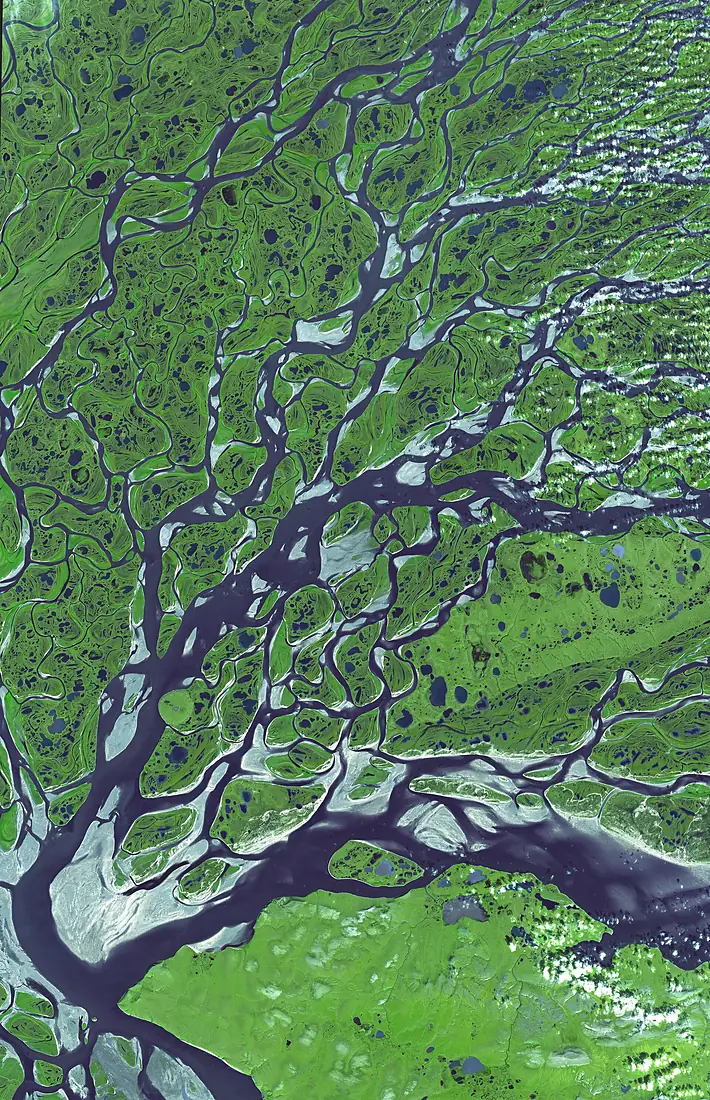
The source and the mouth, seen from orbit
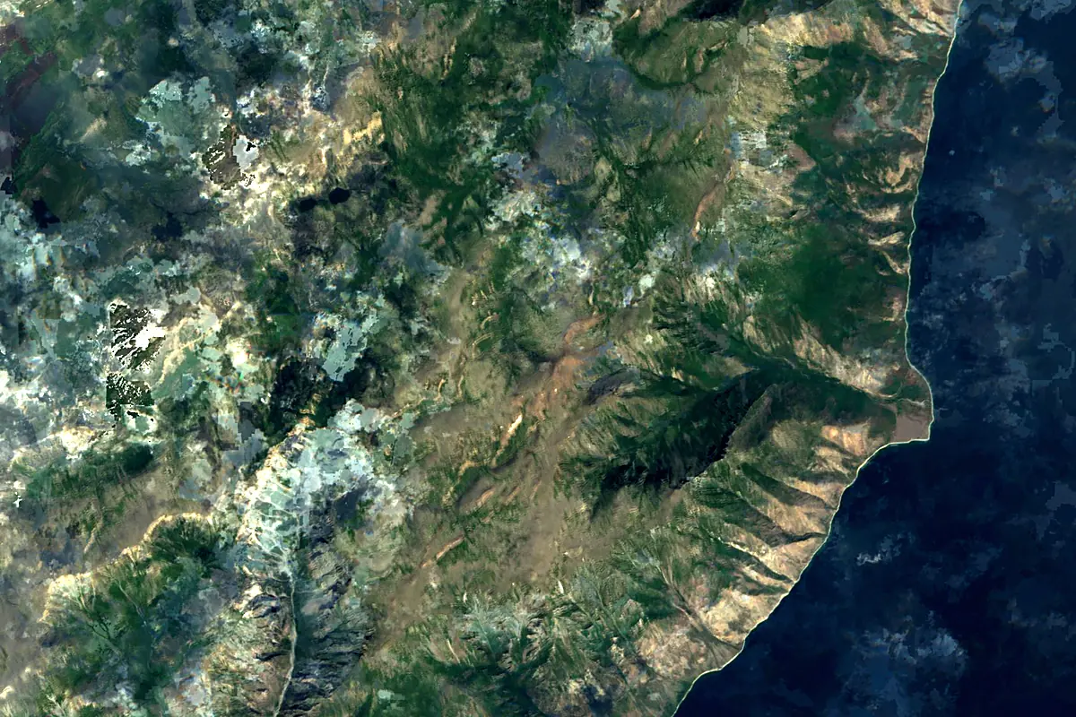
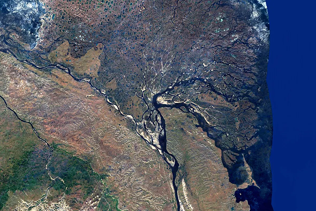
Sentinel-2 cloudless 2016 by EOX IT Services GmbH (contains modified Copernicus Sentinel data 2016), CC BY 4.0. The glowing line is the river as drawn by RiverATLAS.
Photos
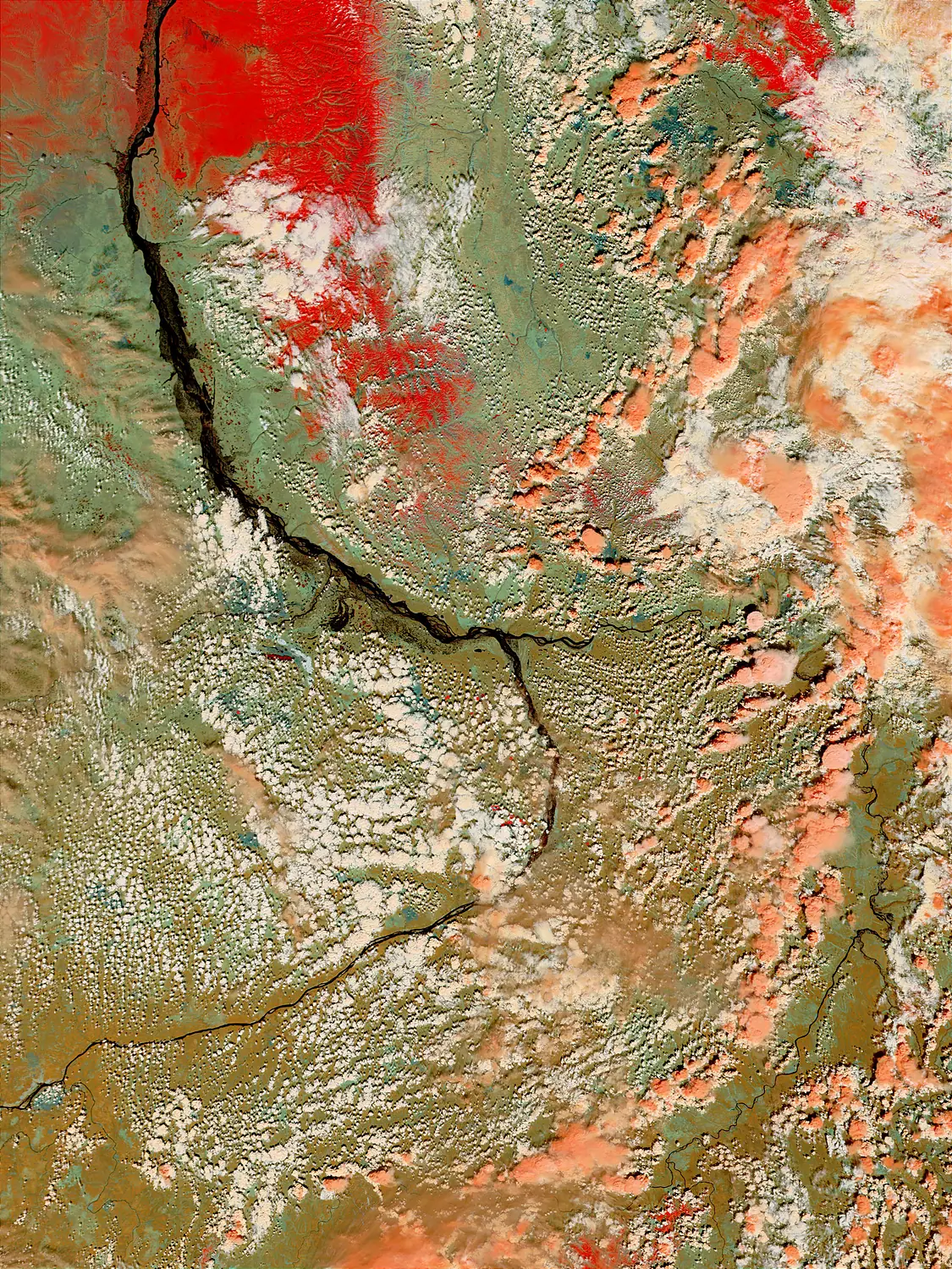
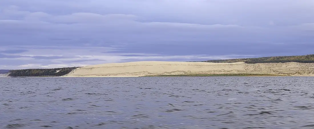
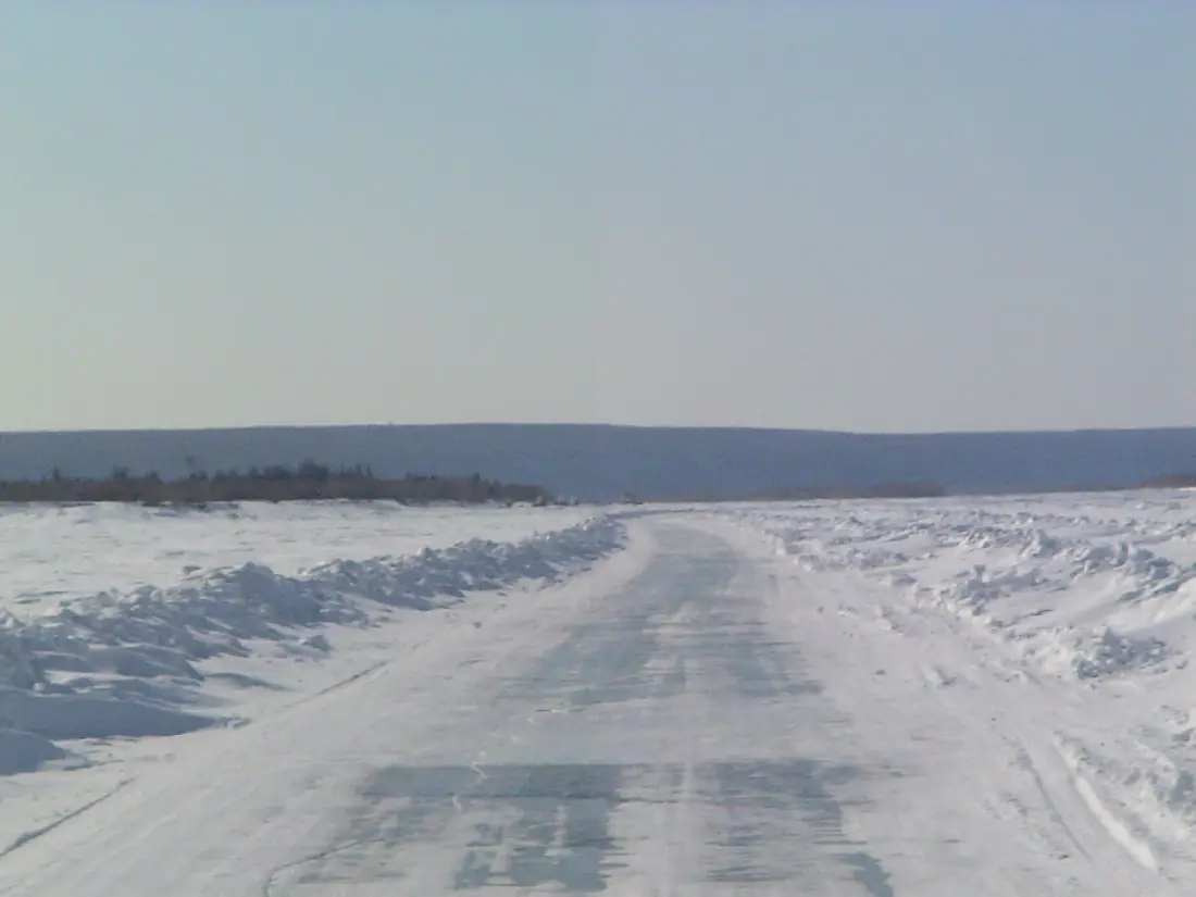
Lena River in pictures
Tributaries
Where it flows, and what flows into it
Tributaries (94)
Russia2,650 km1,500 m³/sjoins at km 2,899AldanRussia2,273 km5,100 m³/sjoins at km 2,701VitimRussia1,837 km1,500 m³/sjoins at km 1,351OlyokmaRussia1,436 km2,000 m³/sjoins at km 1,963Also: Kirenga, Nyuya, Muna, Linde River, Chaya, Buotama, Molodo, Lungkha, Sinyaya, Chuya, Kuta River, Markha, Tuolba, Peleduy, Bol'shoy Patom, Kengkeme, Namana, Menkere, Dzhardzhan, Motorchuna, Suola, Biryuk, Undyulyung, Tayura
Where these numbers come from
| Name, length, places | Wikidata (Q46841) · CC0 |
|---|---|
| Course, profile, basin | RiverATLAS v1.0 (HydroATLAS, Linke et al. 2019) · CC BY 4.0 — followed from the source to the mouth given by Wikidata |
| Flow | WaterGAP (RiverATLAS), 1971–2000 · CC BY 4.0 |
| Climate along the river | WorldClim (RiverATLAS), 1970–2000 · CC BY 4.0 |
| Towns, bridges, dams | Wikidata · CC0; GeoNames · CC BY 4.0 |
| Along the river | © OpenStreetMap contributors · ODbL |
| Images | EOX Sentinel-2 cloudless 2016 · CC BY 4.0; Wikimedia Commons |
Every source and licence is on the data sources page.
The family
Do you prefer beaches, lakes, mountains, waterfalls, islands, rivers or canyons?
Same idea, other landscapes: field atlases built on open data, month by month, in seven languages.
 beaches
 Find your beach: sea temperature, sun and swimming month by month.Visit
  lakes
lakes Every lake on Earth: water temperature, ice, depth and the shore.Coming soonVisit
  mountains
 Every summit in 3D: summit weather, the 0 °C line, huts and trails.Visit
  waterfalls
 Every waterfall: height, flow month by month and when it roars.Coming soonVisit
  islands
 Every island from the sea up: size, sea temperature, ferries and 3D.Coming soonVisit
  rivers
 Every river from source to sea: the journey, the flow and the basin in numbers.You are here
 canyons
 Every canyon cut to scale: depth to the floor, rim and floor temperatures, trails and viewpoints.Coming soonVisit