River
Meuse
950 km from source to mouth · The Netherlands, France and Belgium.

 The Netherlands, France and BelgiumFlows into North Sea2nd longest in The Netherlands
In numbers
Length
950km
Average flow
230m³/s
Basin
36,000km²
Drop
325m
from 322 m to -3 m
Countries
3
The journey
From source to mouth
950 km of river and 68 stops on the way: 35 towns and cities on its banks, dams, bridges and the tributaries that feed it.
- 0 kmLe Châtelet-sur-Meuseat 322 m
- 48 kmMouzontributary
- 68 kmVairtributary
- 92 kmAroffetributary
- 117 kmMéholletributary
- 130 kmCommercy5,350 people
- 204 kmVerdun16,890 people
- 265 kmWiseppetributary
- 307 kmChierstributary
- 314 kmSedan16,667 people
- 327 kmDonchery1,989 people
- 329 kmBartributary
- 335 kmVrignetributary
- 346 kmCharleville-Mézières45,560 people
- 359 kmVencetributary
- 364 kmAiglemont1,692 people
- 369 kmNouzonville5,523 people
- 379 kmBogny-sur-Meuse4,889 people
- 384 kmSemoistributary
- 406 kmRevin5,716 people
- 406 kmFauxtributary
- 406 kmRocroi2,270 people
- 418 kmFumay3,086 people
- 422 kmHaybes1,794 people
- 434 kmVirointributary
- 455 kmGivet6,364 people
- 457 kmHouilletributary
- 477 kmLessetributary
- 481 kmDinant13,544 people
- 491 kmBocqtributary
- 512 kmNamur115,330 people
- 513 kmSambretributary
- 536 kmAndenne27,573 people
- 548 kmMehaignetributary
- 576 kmFlémalle26,174 people
- 588 kmOurthetributary
- 591 kmLiège195,278 people
- 597 kmRidatributary
- 606 kmJuliennetributary
- 610 kmVisé17,767 people
- 625 kmJekertributary
- 629 kmMaastricht120,227 people
- 631 kmLanaken25,818 people
- 637 kmGeultributary
- 649 kmZiepbeektributary
- 650 kmMaasmechelen38,193 people
- 670 kmMaaseik25,201 people
- 672 kmHeerenlaak0.9 km²
- 676 kmBosbeektributary
- 684 kmMaasgouw23,947 people
- 692 kmVlootbeektributary
- 694 kmOolderplas1.6 km²
- 695 kmLeudal36,045 people
- 704 kmRurtributary
- 708 kmSchwalmtributary
- 728 kmVenlo101,988 people
- 760 kmLeukermeer0.4 km²
- 777 kmBoxmeer29,065 people
- 782 kmGennep17,035 people
- 785 kmNierstributary
- 788 kmMookerplas0.5 km²
- 794 kmMook en Middelaar7,909 people
- 798 kmHeumen16,569 people
- 807 kmGrave12,486 people
- 813 kmWijchen41,261 people
- 831 kmOss92,526 people
- 853 kmMaasdriel25,452 people
- 857 km's-Hertogenbosch155,490 people
- 861 kmEngelermeer0.7 km²
- 950 kmNorth Seaat -3 m
Water level along the river (RiverATLAS; the height is exaggerated). Towns: GeoNames and Wikidata; bridges, dams and tributaries: Wikidata.
River in western Europe
At the mouth it carries 230 m³/s on average: an Olympic pool every 11 seconds. It drops from 322 m to -3 m, 0.3 m per kilometre on average. Its basin covers 36,000 km², about the size of TW. 8.4 million people live in it. Highest water: from December to February. Its dams hold back little of its water (3.3% of a year's flow).
Where to start
- LiègeLargest city on its banks · 195,278 people
- Liège Airport (LGG)Nearest airport with scheduled flights, 9 km from the cityCar hire at LGG airport (Grâce-Hollogne)Discover Cars · Affiliate link↗
- On the water402 ferry piers, marinas, boat rentals and boat ramps along the river (OpenStreetMap)
- Kayak and canoe4 put-ins and rapids mapped (OpenStreetMap)
- From May to SeptemberThe best months to visit
Meuse, month by month
Highest water: from December to February
Best months to visit: from May to September.
From about 170 m³/s in the lowest month to 680 m³/s in the highest. An estimate: the monthly flow is modelled from the lowest and highest months of WaterGAP (RiverATLAS, 1971–2000) and the rain and snow along the river (WorldClim). Dams change the real rhythm. The chip is the average air temperature; below it, the month's rain.
Plan the trip
Plan the trip: boat trips, a bed by the river, a car
Some links above are affiliate links: if you book through them we may earn a commission, at no extra cost to you. It never changes what the data on this page says.
The basin
Meuse: the basin in numbers
32,770 km² of land send their water to this river. This is what lives on it.
- 8.4millionpeople live in the basin
- 259/km²people per km²
- 215maverage altitude of the basin
- 885mmof rain a year (basin average)
- 9.2°Caverage air temperature
- 21%protected areas
- 0.3%covered by lakes
- 0.4km³held in reservoirs
What covers the basin
- 24% Forest
- 26% Cropland
- 20% Pasture
- 17% Towns and cities
RiverATLAS (HydroATLAS v1.0, CC BY 4.0): land cover, people, protected areas, glaciers and dams over the whole basin upstream of the mouth.
Along the river
Meuse: what you find on the way
- 472WeirsSeuil de Traveron, Barrage de Romery, Barrage à clapet Mazarin and 469 more
- 283LocksCanal de la Meuse, Canal de la Marne au Rhin Ouest, Zuid-Willemsvaart and 280 more
- 4WaterfallsLes Cascatelles and 3 more
- 2Rapids
- 2Canoe put-ins
- 176Boat rampsMise à l'eau, Club Nautique Les Tchéroux, WSV MCC + WSV MWC and 173 more
- 86Ferry piersHalte Jambes, Halte Évêché, Halte Salzinnes and 83 more
- 125MarinasPort de Plaisance de Pagny-sur-Meuse, Pagny mooring point, Port de Void and 122 more
- 14River beachesLa plage de Traveron, Plage de Champougny, Fosse bleue and 11 more
From OpenStreetMap, within 2.1 km of the river. Not mapped is not the same as not there.
Cross-checked with our atlases
Meuse in our other atlases
What our sister atlases know about the waterfalls on this river, the lakes it flows through, the beaches at its mouth, the mountains where it rises and the islands off its mouth.
 5lakes on its wayLakeyas
 1mountain at the sourcePeakyas
Lakes and reservoirs (5)
Lakes it flows through, by Lakeyas
- Heerenlaakkm 5560.9km²
- Oolderplaskm 5741.6km²
- Leukermeerkm 6280.4km²
- Mookerplaskm 6520.5km²
- Engelermeerkm 7120.7km²
Lakeyas is coming soonOpen Lakeyas ↗
Mountains at the source (1)
Within 15 km of the source, by Peakyas
- Mont Mercure9.2 km away
From space
The source and the mouth, seen from orbit
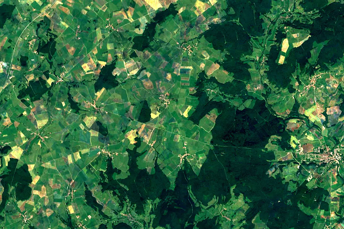
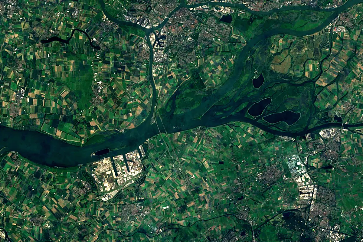
Sentinel-2 cloudless 2016 by EOX IT Services GmbH (contains modified Copernicus Sentinel data 2016), CC BY 4.0. The glowing line is the river as drawn by RiverATLAS.
Photos
Meuse in pictures
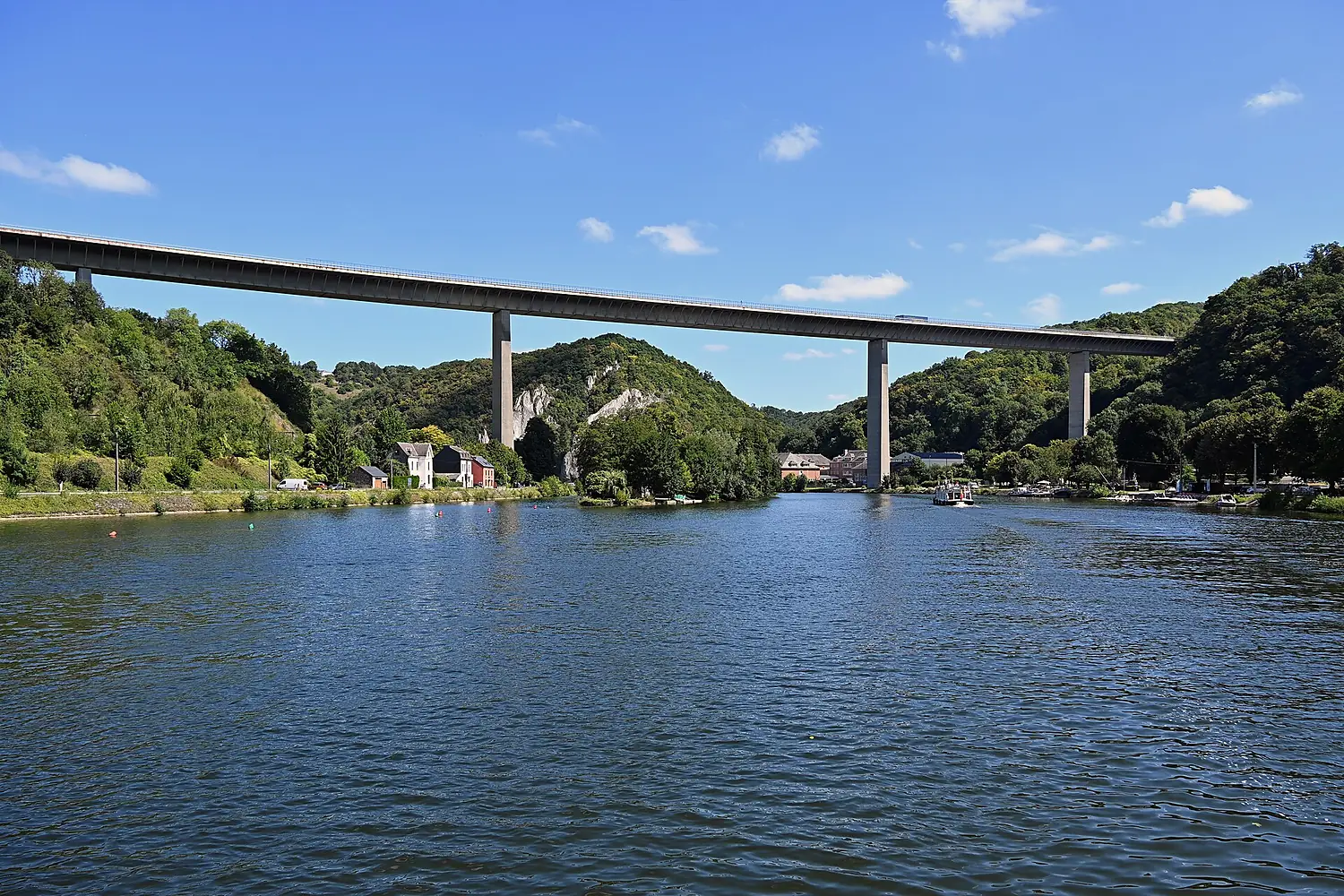
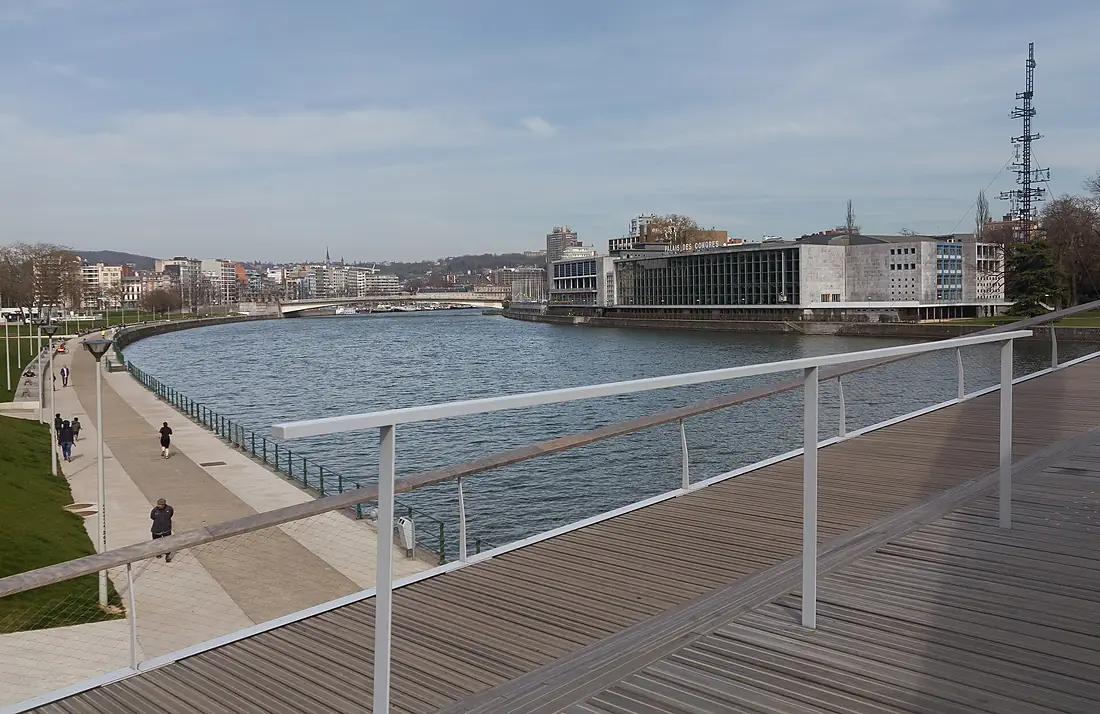
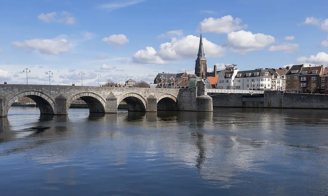
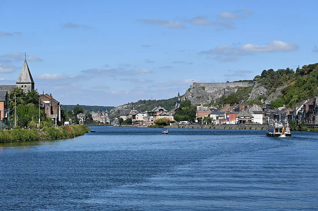
Tributaries
Where it flows, and what flows into it
Tributaries (72)
France210 km35 m³/sjoins at km 318SambreBelgium190 km36 m³/sjoins at km 424OurtheBelgium165 km55 m³/sjoins at km 487RurThe Netherlands164 km25 m³/sjoins at km 582ChiersFrance112 km31 m³/sjoins at km 253Also: Lesse, Jeker, Niers, Geul, Schwalm, Bar, Dieze, Mehaigne, Viroin, Bocq, Voer, Vair, Hoyoux, Berwinne, Mouzon, Sormonne, Samson, Houille, Aroffe, Molignée, Faux, Hermeton, Légia, Vence
In the same basin
Nearby
Rivers nearby
The Netherlands1,233 km2,200 m³/s44 km awayDommelBelgium80 km10 m³/s43 km awaySenneBelgium103 km5.5 m³/s74 km awayLysBelgium202 km22 m³/s99 km awayDyle / DijleBelgium86 km69 m³/s74 km awayDenderBelgium65 km8.8 m³/s86 km awayRurThe Netherlands164 km25 m³/s107 km awayRuhr Germany217 km79 m³/s145 km away
Where these numbers come from
| Name, length, places | Wikidata (Q41986) · CC0 |
|---|---|
| Course, profile, basin | RiverATLAS v1.0 (HydroATLAS, Linke et al. 2019) · CC BY 4.0 — followed from the source to the mouth given by Wikidata |
| Flow | WaterGAP (RiverATLAS), 1971–2000 · CC BY 4.0 |
| Climate along the river | WorldClim (RiverATLAS), 1970–2000 · CC BY 4.0 |
| Towns, bridges, dams | Wikidata · CC0; GeoNames · CC BY 4.0 |
| Along the river | © OpenStreetMap contributors · ODbL |
| Images | EOX Sentinel-2 cloudless 2016 · CC BY 4.0; Wikimedia Commons |
| Our other atlases | Lakeyas, Peakyas — Wikidata · CC0; © OpenStreetMap contributors · ODbL; GeoNames · CC BY 4.0; HydroLAKES · CC BY 4.0; NOAA OISST |
Every source and licence is on the data sources page.
The family
Do you prefer beaches, lakes, mountains, waterfalls, islands, rivers or canyons?
Same idea, other landscapes: field atlases built on open data, month by month, in seven languages.
 beaches
 Find your beach: sea temperature, sun and swimming month by month.Visit lakes
 Every lake on Earth: water temperature, ice, depth and the shore.Coming soonVisit mountains
 Every summit in 3D: summit weather, the 0 °C line, huts and trails.Visit
  waterfalls
 Every waterfall: height, flow month by month and when it roars.Coming soonVisit
  islands
 Every island from the sea up: size, sea temperature, ferries and 3D.Coming soonVisit
  rivers
 Every river from source to sea: the journey, the flow and the basin in numbers.You are here
 canyons
 Every canyon cut to scale: depth to the floor, rim and floor temperatures, trails and viewpoints.Coming soonVisit