River
Minho River
315 km from source to mouth · Portugal and Spain.

 Portugal and SpainFlows into Atlantic Ocean4th longest in Portugal
In numbers
Length
315km
Average flow
340m³/s
Basin
17,619km²
Drop
432m
from 431 m to -1 m
Countries
2
The journey
From source to mouth
315 km of river and 42 stops on the way: 12 towns and cities on its banks, dams, bridges and the tributaries that feed it.
- 0 kmPedregal de Irimiaat 431 m
- 28 kmAnllo Rivertributary
- 31 kmMos14,650 people
- 46 kmOuteiro de Rei5,001 people
- 52 kmLadra Rivertributary
- 63 kmLugo98,025 people
- 63 kmOld bridge of Lugo
- 66 kmChamoso Rivertributary
- 83 kmNeiratributary
- 102 kmLoio Rivertributary
- 132 kmBelesar reservoir10 km²
- 136 kmAsma Rivertributary
- 160 kmOs Peares reservoir3.7 km²
- 162 kmSilistributary
- 162 kmBúbal Rivertributary
- 177 kmColes3,049 people
- 180 kmVelle Reservoir1.4 km²
- 180 kmVelle Power Plant
- 182 kmOurense Viaduct
- 183 kmPonte Vella
- 183 kmOurense105,769 people
- 183 kmPonte do Milenio
- 199 kmBarbantiño rivertributary
- 215 kmRibadavia5,028 people
- 217 kmAviatributary
- 219 kmArnoia Rivertributary
- 226 kmCerves Rivertributary
- 251 kmInternational bridge Arbo - Melgaço
- 253 kmArbo3,973 people
- 263 kmRio Mourotributary
- 272 kmMonção19,738 people
- 274 kmInternational bridge Salvaterra do Miño - Monção
- 274 kmSalvatierra de Miño9,566 people
- 275 kmTea rivertributary
- 290 kmTui17,262 people
- 291 kmValença-Tui international bridge
- 291 kmValenza14,172 people
- 292 kmInternational bridge Tui - Valença
- 305 kmTomiño13,315 people
- 308 kmPonte da Amizade
- 312 kmTamuxe Rivertributary
- 313 kmInsua Lighthouse
- 313 kmCoura rivertributary
- 315 kmAtlantic Oceanat -1 m
Water level along the river (RiverATLAS; the height is exaggerated). Towns: GeoNames and Wikidata; bridges, dams and tributaries: Wikidata.
River in Spain
At the mouth it carries 342 m³/s on average: an Olympic pool every 7.3 seconds. It drops from 431 m to -1 m, 1.4 m per kilometre on average. Its basin covers 17,619 km², about the size of KW. 851,000 people live in it. Highest water: from December to February; lowest: from June to September. Dams and reservoirs hold back a large share of its water (24% of a year's flow).
Where to start
- OurenseLargest city on its banks · 105,769 people
- Vigo Airport (VGO)Nearest airport with scheduled flights, 64 km from the cityCar hire at VGO airport (Vigo)Discover Cars · Affiliate link↗
- On the water27 ferry piers, marinas, boat rentals and boat ramps along the river (OpenStreetMap)
- Kayak and canoe1 put-ins and rapids mapped (OpenStreetMap)
- From June to SeptemberThe best months to visit
Minho River, month by month
Highest water: from December to February
Lowest water: from June to September. Best months to visit: from June to September.
From about 62 m³/s in the lowest month to 710 m³/s in the highest. An estimate: the monthly flow is modelled from the lowest and highest months of WaterGAP (RiverATLAS, 1971–2000) and the rain and snow along the river (WorldClim). Dams change the real rhythm. The chip is the average air temperature; below it, the month's rain.
Plan the trip
Plan the trip: boat trips, a bed by the river, a car
Some links above are affiliate links: if you book through them we may earn a commission, at no extra cost to you. It never changes what the data on this page says.
The basin
Minho River: the basin in numbers
16,651 km² of land send their water to this river. This is what lives on it.
- 851,000people live in the basin
- 51/km²people per km²
- 729maverage altitude of the basin
- 1,067mmof rain a year (basin average)
- 11.3°Caverage air temperature
- 10%protected areas
- 0.4%covered by lakes
- 2.7km³held in reservoirs
What covers the basin
- 89% Forest
- 4% Cropland
- 10% Pasture
- 2% Towns and cities
RiverATLAS (HydroATLAS v1.0, CC BY 4.0): land cover, people, protected areas, glaciers and dams over the whole basin upstream of the mouth.
Along the river
Minho River: what you find on the way
- 77WeirsO Caneiro do Carballal, O Caneiro do Santo da Acea, O Caneiro do Muíño de Guevara and 74 more
- 5WaterfallsSalto da Fervenza, Fervenza do Fondós, Fervenza de Auga Caída and 2 more
- 1RapidsOnda da Frieira
- 19Boat rampsAntigo Transbordador de Goián, Rampla dos Pescadores and 17 more
- 2Ferry piers
- 5MarinasPorto deportivo, Cais da Senhora da Cabeça, Marina de Cristelo Covo and 2 more
- 14River beachesPraia Fluvial de Baltar, Praia Fluvial da Cova, Área Recreativa do Río Búbal and 11 more
From OpenStreetMap, within 1.9 km of the river. Not mapped is not the same as not there.
Cross-checked with our atlases
Minho River in our other atlases
What our sister atlases know about the waterfalls on this river, the lakes it flows through, the beaches at its mouth, the mountains where it rises and the islands off its mouth.
 3lakes on its wayLakeyas
 22beaches at the mouth and on the banksCoastya
 1mountain at the sourcePeakyas
 1island off the mouthIslandyas
Lakes and reservoirs (3)
Lakes it flows through, by Lakeyas
- Belesar reservoirkm 11610km²
- Os Peares reservoirkm 1413.7km²
- Velle Reservoirkm 1591.4km²
Lakeyas is coming soonOpen Lakeyas ↗
Beaches (22)
At the mouth (25 km) and on the banks, by Coastya
- Praia do Lumiar22 km away17.3°C
- Praia Fedorento8.7 km away17.2°C
- Bayona Playa22 km away17.2°C
- Playa Baiona23 km away17.2°C
- Playa Marta22 km away17.2°C
- Praia de Camposancos9.2 km away17.2°C
- Praia de Areeiroskm 25417.2°C
- Praia do Porto de Vinha24 km away17.3°C
14 more on CoastyaOpen Coastya ↗
Mountains at the source (1)
Within 15 km of the source, by Peakyas
- Serra de Meira2.8 km away
Islands off the mouth (1)
Within 30 km of the mouth, by Islandyas
- Insua11 km away
Islandyas is coming soonOpen Islandyas ↗
From space
The source and the mouth, seen from orbit
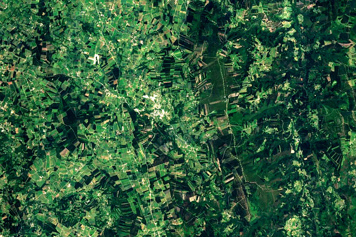
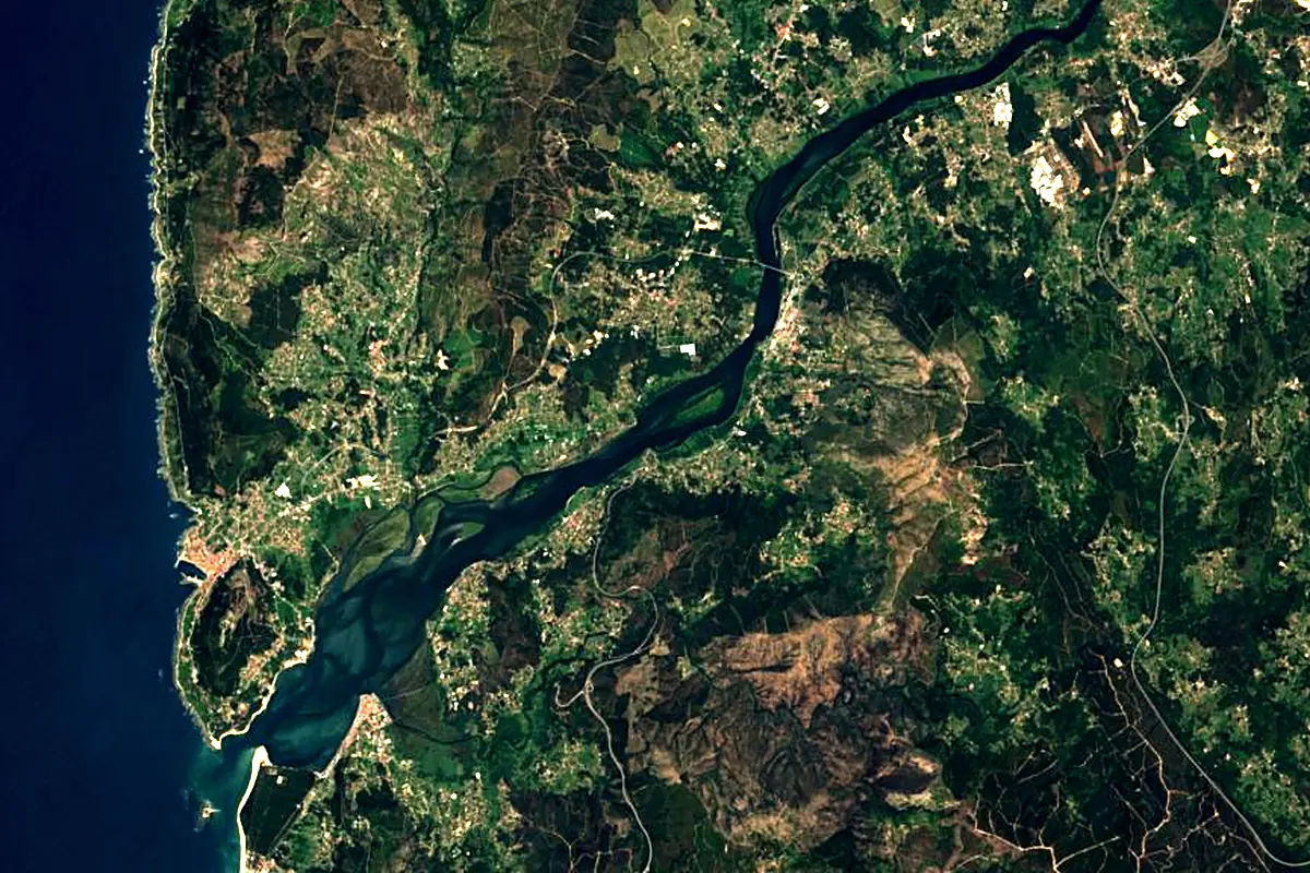
Sentinel-2 cloudless 2016 by EOX IT Services GmbH (contains modified Copernicus Sentinel data 2016), CC BY 4.0. The glowing line is the river as drawn by RiverATLAS.
Photos
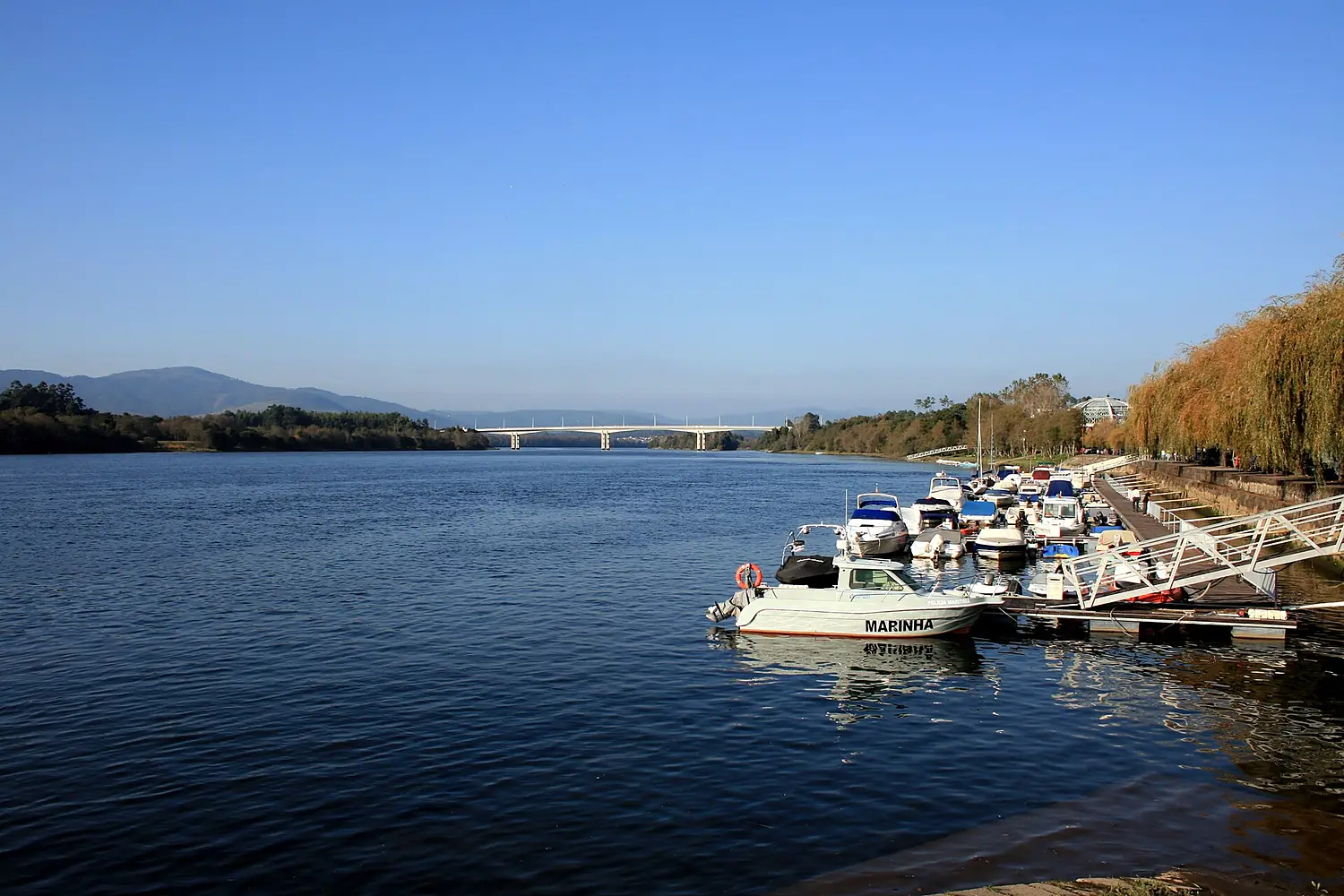
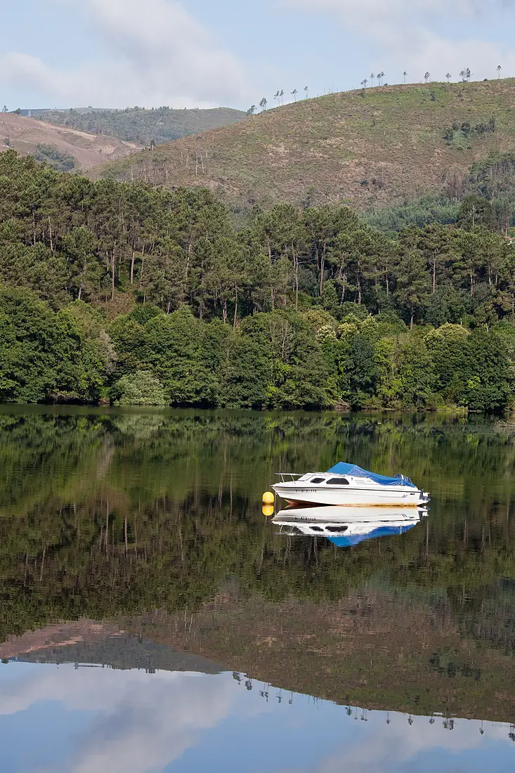
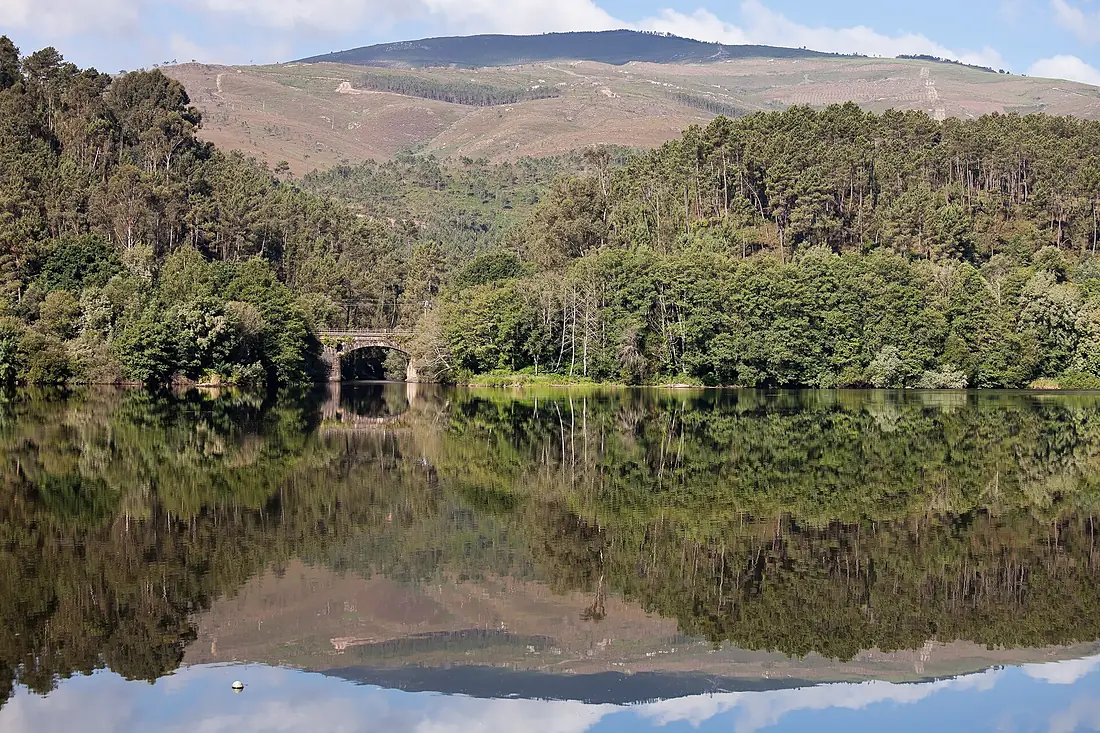
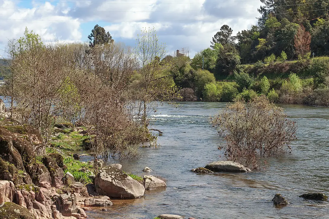
Minho River in pictures
Tributaries
Where it flows, and what flows into it
Tributaries (32)
Also: Avia, Neira, Tea river, Coura river, Asma River, Deva River, Arnoia River, Ladra River, río Barbaña, Lonia River, Barxas, Anllo River, Azúmara River, Caselas River, Barbantiño river, Río Támoga, río Narla, Búbal River, río Ferreira, Río Lea, Louro River, Río Sardiñeira, Tamuxe River, río Pequeno
Nearby
Rivers nearby
Portugal897 km680 m³/s87 km awayLima RiverPortugal135 km75 m³/s26 km awaySilisSpain228 km240 m³/s104 km awayTâmega RiverPortugal184 km69 m³/s103 km awayVouga RiverPortugal148 km62 m³/s136 km awayMondego RiverPortugal234 km110 m³/s198 km awayÁgueda RiverPortugal176 km23 m³/s182 km awayTormesSpain284 km42 m³/s203 km awayWhere these numbers come from
| Name, length, places | Wikidata (Q14554) · CC0 |
|---|---|
| Course, profile, basin | RiverATLAS v1.0 (HydroATLAS, Linke et al. 2019) · CC BY 4.0 — followed from the source to the mouth given by Wikidata |
| Flow | WaterGAP (RiverATLAS), 1971–2000 · CC BY 4.0 |
| Climate along the river | WorldClim (RiverATLAS), 1970–2000 · CC BY 4.0 |
| Towns, bridges, dams | Wikidata · CC0; GeoNames · CC BY 4.0 |
| Along the river | © OpenStreetMap contributors · ODbL |
| Images | EOX Sentinel-2 cloudless 2016 · CC BY 4.0; Wikimedia Commons |
| Our other atlases | Lakeyas, Coastya, Peakyas, Islandyas — Wikidata · CC0; © OpenStreetMap contributors · ODbL; GeoNames · CC BY 4.0; HydroLAKES · CC BY 4.0; NOAA OISST |
Every source and licence is on the data sources page.
The family
Do you prefer beaches, lakes, mountains, waterfalls, islands, rivers or canyons?
Same idea, other landscapes: field atlases built on open data, month by month, in seven languages.
beaches Find your beach: sea temperature, sun and swimming month by month.Visit lakes
 Every lake on Earth: water temperature, ice, depth and the shore.Coming soonVisit mountains
 Every summit in 3D: summit weather, the 0 °C line, huts and trails.Visit
  waterfalls
 Every waterfall: height, flow month by month and when it roars.Coming soonVisit islands
 Every island from the sea up: size, sea temperature, ferries and 3D.Coming soonVisit
  rivers
 Every river from source to sea: the journey, the flow and the basin in numbers.You are here
 canyons
 Every canyon cut to scale: depth to the floor, rim and floor temperatures, trails and viewpoints.Coming soonVisit