Stream
Noguera Pallaresa
154 km from source to mouth · Spain.
 SpainFlows into Segre
In numbers
Length
154km
Average flow
37m³/s
Basin
2,820km²
Drop
954m
from 1,288 m to 334 m
Country
1
The journey
From source to mouth
154 km of river and 57 stops on the way: 24 towns and cities on its banks, dams, bridges and the tributaries that feed it.
- 0 kmPla de Beretat 1,288 m
- 0 kmPònt dera Glèisa
- 0 kmPònt deth Porquèr
- 0 kmMontgarri
- 0 kmNaut Aran1,902 people
- 2 kmPont de Montgosso
- 6 kmPont de Perosa
- 9 kmPont de l'Escala Alta
- 12 kmPont Nou
- 13 kmPont de Pina
- 15 kmPont d'Alós
- 18 kmPont d'Isil
- 20 kmPont d'Àrreu
- 23 kmPont d'Isavarre
- 26 kmAlt Àneu453 people
- 27 kmEsterri d'Àneu917 people
- 27 kmPont d'Esterri
- 27 kmPont de la Central
- 32 kmLa Guingueta d'Àneu278 people
- 32 kmPont de Poldo
- 33 kmEspot377 people
- 38 kmriu Escritatributary
- 48 kmLlavorsí342 people
- 48 kmPont de Llavorsí
- 52 kmRiu de Santa Magdalenatributary
- 59 kmRialp654 people
- 64 kmSort2,236 people
- 67 kmPont de l'Hostal Nou
- 67 kmSoriguera446 people
- 73 kmPont d'Arcalís
- 77 kmPont d'Arboló
- 79 kmBaix Pallars345 people
- 79 kmPont del Monestir
- 95 kmConca de Dalt438 people
- 96 kmPont de Claverol
- 96 kmLa Pobla de Segur3,143 people
- 100 kmel Flamiselltributary
- 101 kmRiu de Carreutributary
- 104 kmSalàs de Pallars365 people
- 107 kmPantà de Sant Antoni4.9 km²
- 108 kmTalarn555 people
- 110 kmTremp6,123 people
- 116 kmGavet de la Conca252 people
- 116 kmIsona i Conca Dellà1,038 people
- 121 kmCastell de Mur159 people
- 122 kmLlimiana130 people
- 126 kmPantà dels Terradets2.0 km²
- 126 kmPont Nou de Monares
- 127 kmPont de la Presa de Terradets
- 128 kmPont de Terradets
- 128 kmPont d'Àger
- 128 kmPont de Rajola
- 131 kmVilanova de Meià479 people
- 135 kmPont de la Baronia
- 139 kmÀger637 people
- 149 kmLes Avellanes i Santa Linya434 people
- 153 kmPantà de Camarasa4.3 km²
- 154 kmCamarasa788 people
- 154 kmSegreat 334 m
Water level along the river (RiverATLAS; the height is exaggerated). Towns: GeoNames and Wikidata; bridges, dams and tributaries: Wikidata.
River in Catalonia, Spain
At the mouth it carries 37 m³/s on average: an Olympic pool every 67 seconds. It drops from 1,288 m to 334 m, 6.2 m per kilometre on average. Its basin covers 2,820 km², about the size of LU. 19,000 people live in it. Highest water: from May to June and from November to December. Dams and reservoirs hold back a large share of its water (50% of a year's flow).
Where to start
- TrempLargest city on its banks · 6,123 people
- Pirineus - la Seu d'Urgel Airport (LEU)Nearest airport with scheduled flights, 46 km from the cityCar hire at REU airport (Reus)Discover Cars · Affiliate link↗
- On the water2 ferry piers, marinas, boat rentals and boat ramps along the river (OpenStreetMap)
- Kayak and canoe8 put-ins and rapids mapped (OpenStreetMap)
- From June to SeptemberThe best months to visit
Noguera Pallaresa, month by month
Highest water: from May to June and from November to December
Best months to visit: from June to September.
From about 6.9 m³/s in the lowest month to 44 m³/s in the highest. An estimate: the monthly flow is modelled from the lowest and highest months of WaterGAP (RiverATLAS, 1971–2000) and the rain and snow along the river (WorldClim). Dams change the real rhythm. The chip is the average air temperature; below it, the month's rain.
Plan the trip
Plan the trip: boat trips, a bed by the river, a car
Some links above are affiliate links: if you book through them we may earn a commission, at no extra cost to you. It never changes what the data on this page says.
The basin
Noguera Pallaresa: the basin in numbers
2,806 km² of land send their water to this river. This is what lives on it.
- 19,000people live in the basin
- 7/km²people per km²
- 1,404maverage altitude of the basin
- 1,033mmof rain a year (basin average)
- 7.4°Caverage air temperature
- 53%protected areas
- 0.5%covered by lakes
- 0.4km³held in reservoirs
What covers the basin
- 68% Forest
- 13% Cropland
- 12% Pasture
RiverATLAS (HydroATLAS v1.0, CC BY 4.0): land cover, people, protected areas, glaciers and dams over the whole basin upstream of the mouth.
Along the river
Noguera Pallaresa: what you find on the way
- 5WeirsResclosa de l'Hostalet, Presa de Sossís and 3 more
- 2WaterfallsBarranc de Raspamala
- 5RapidsThe Washing Machine, The Wall and 3 more
- 3Canoe put-insYeti Emotions, Roc Roi, Gerri de la Sal
- 2River beachesMoll sortida barques Raffting, De la Morrera
From OpenStreetMap, within 1.5 km of the river. Not mapped is not the same as not there.
Cross-checked with our atlases
Noguera Pallaresa in our other atlases
What our sister atlases know about the waterfalls on this river, the lakes it flows through, the beaches at its mouth, the mountains where it rises and the islands off its mouth.
 3lakes on its wayLakeyas
 168mountains at the sourcePeakyas
Lakes and reservoirs (3)
Lakes it flows through, by Lakeyas
- Pantà de Sant Antonikm 914.9km²
- Pantà dels Terradetskm 1062.0km²
- Pantà de Camarasakm 1294.3km²
Lakeyas is coming soonOpen Lakeyas ↗
Mountains at the source (168)
Within 15 km of the source, by Peakyas
- Gran Tuc de Colomers14 km away · prominence 185 m2,933m
- Pic de Contraix14 km away · prominence 151 m2,958m
- Mont Valier15 km away · prominence 508 m2,839m
- Montardo11 km away · prominence 359 m2,833m
- Tuc de Maubèrme9.4 km away · prominence 796 m2,882m
- crestells de Colieto15 km away · prominence 80 m2,967m
- la Creu de Colomèrs13 km away · prominence 147 m2,895m
- Punta d'Harlé14 km away · prominence 128 m2,885m
160 more on PeakyasOpen Peakyas ↗
From space
The source and the mouth, seen from orbit
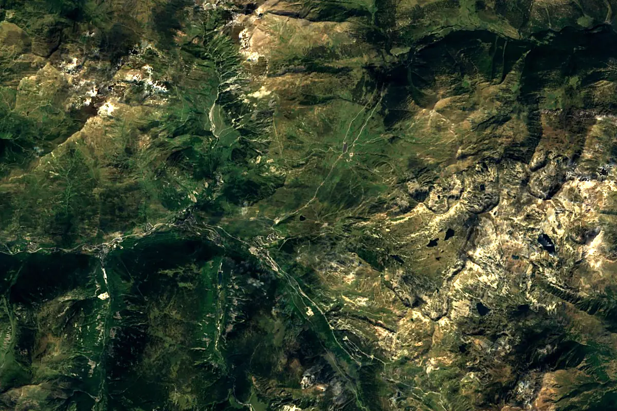
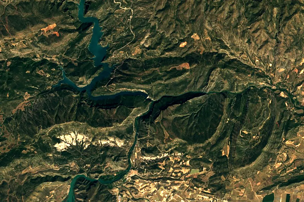
Sentinel-2 cloudless 2016 by EOX IT Services GmbH (contains modified Copernicus Sentinel data 2016), CC BY 4.0. The glowing line is the river as drawn by RiverATLAS.
Photos
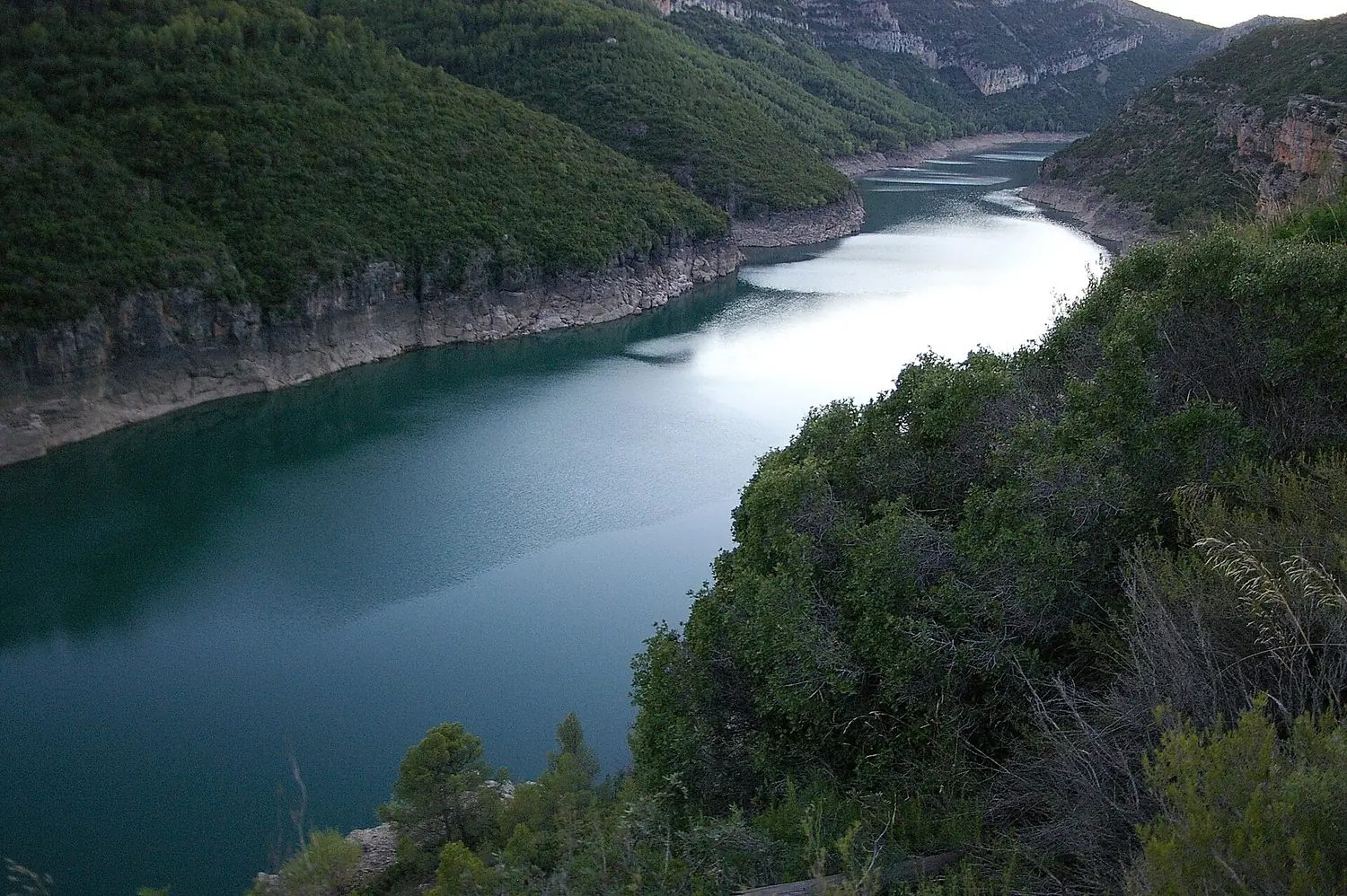
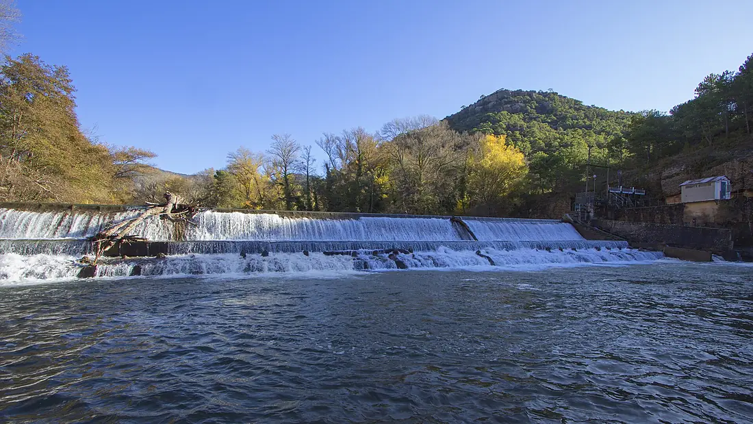
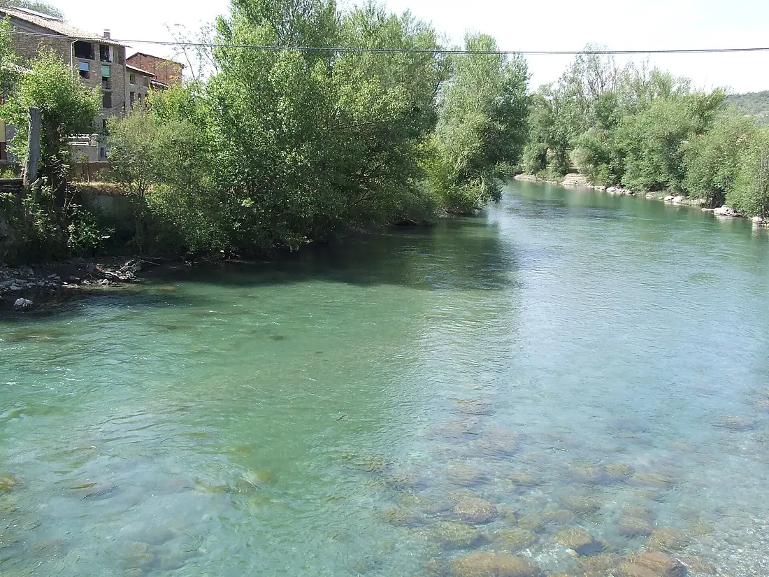
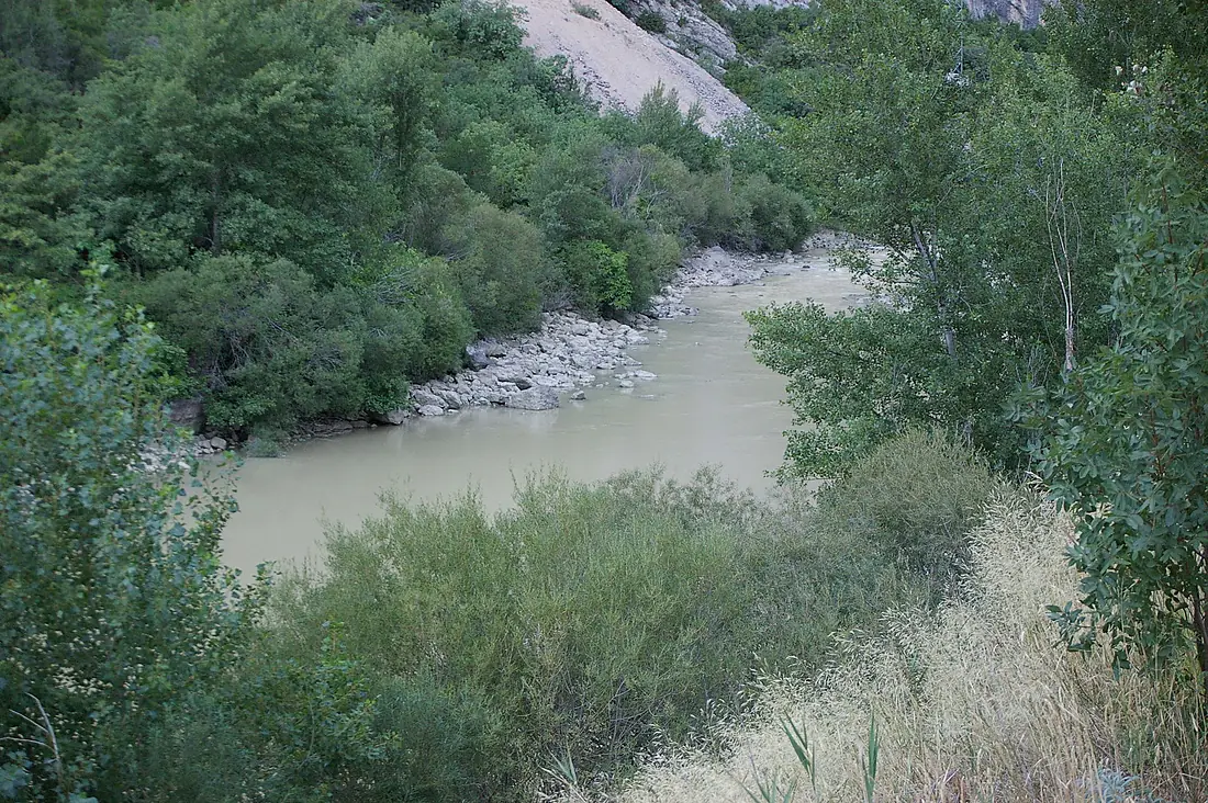
Noguera Pallaresa in pictures
Tributaries
Where it flows, and what flows into it
It flows into
SegreSpain265 km100 m³/sTributaries (30)
Also: el Flamisell, Riu de Carreu, Noguera de Cardós, riu Escrita, Riu de Conques, barranc de la Molina (Conca de Dalt), barranc de Sant Pere (la Pobla de Segur), barranc de Seròs, barranc de l'Infern (Collegats), barranc de Ricós, Riu de Santa Magdalena, barranc de Barcedana, barranc de Moror, barranc de Palau, barranc de Puimanyons, barranc de Rubiol, barranc de Santa Cecília (Torallola), barranc de la Podega, riu de la Bonaigua, barranc de Fontfreda, barranc de l'Espona (Puigmaçana), barranc de Santa, Barranc de Vallcarga, Barranc del Bosc (Montsec)
Nearby
Rivers nearby
 France
Where these numbers come from
| Name, length, places | Wikidata (Q23160) · CC0 |
|---|---|
| Course, profile, basin | RiverATLAS v1.0 (HydroATLAS, Linke et al. 2019) · CC BY 4.0 — followed from the source to the mouth given by Wikidata |
| Flow | WaterGAP (RiverATLAS), 1971–2000 · CC BY 4.0 |
| Climate along the river | WorldClim (RiverATLAS), 1970–2000 · CC BY 4.0 |
| Towns, bridges, dams | Wikidata · CC0; GeoNames · CC BY 4.0 |
| Along the river | © OpenStreetMap contributors · ODbL |
| Images | EOX Sentinel-2 cloudless 2016 · CC BY 4.0; Wikimedia Commons |
| Our other atlases | Lakeyas, Peakyas — Wikidata · CC0; © OpenStreetMap contributors · ODbL; GeoNames · CC BY 4.0; HydroLAKES · CC BY 4.0; NOAA OISST |
Every source and licence is on the data sources page.
The family
Do you prefer beaches, lakes, mountains, waterfalls, islands, rivers or canyons?
Same idea, other landscapes: field atlases built on open data, month by month, in seven languages.
 beaches
 Find your beach: sea temperature, sun and swimming month by month.Visit lakes
 Every lake on Earth: water temperature, ice, depth and the shore.Coming soonVisit mountains
 Every summit in 3D: summit weather, the 0 °C line, huts and trails.Visit
  waterfalls
 Every waterfall: height, flow month by month and when it roars.Coming soonVisit
  islands
 Every island from the sea up: size, sea temperature, ferries and 3D.Coming soonVisit
  rivers
 Every river from source to sea: the journey, the flow and the basin in numbers.You are here
 canyons
 Every canyon cut to scale: depth to the floor, rim and floor temperatures, trails and viewpoints.Coming soonVisit