River
Oglio
280 km from source to mouth · Italy.
 ItalyFlows into Po5th longest in Italy
In numbers
Length
280km
Average flow
140m³/s
Basin
6,649km²
Drop
1,241m
from 1,258 m to 17 m
Country
1
The journey
From source to mouth
280 km of river and 40 stops on the way: 33 towns and cities on its banks, dams, bridges and the tributaries that feed it.
- 0 kmSourceat 1,258 m
- 23 kmEdolo3,926 people
- 27 kmDazza railway bridge
- 59 kmBreno3,617 people
- 63 kmBienno3,433 people
- 66 kmEsine3,289 people
- 69 kmPiamborno4,670 people
- 75 kmMontecchio Bridge
- 75 kmDarfo Boario Terme14,932 people
- 83 kmRogno3,333 people
- 84 kmPian Camuno3,541 people
- 88 kmCosta Volpino8,705 people
- 90 kmPisogne5,248 people
- 91 kmLovere5,255 people
- 112 kmIseo5,311 people
- 120 kmSarnico6,177 people
- 120 kmLake Iseo59 km²
- 121 kmParatico4,365 people
- 123 kmVillongo7,436 people
- 128 kmCapriolo8,817 people
- 130 kmGrumello del Monte6,233 people
- 134 kmCastelli Calepio9,459 people
- 135 kmPalazzolo sull'Oglio17,973 people
- 139 kmPalosco5,233 people
- 141 kmPontoglio6,153 people
- 143 kmCividate al Piano4,985 people
- 150 kmUrago d'Oglio3,506 people
- 151 kmCalcio4,772 people
- 154 kmRudiano5,445 people
- 159 kmRoccafranca3,239 people
- 166 kmOrzinuovi9,973 people
- 167 kmSoncino5,416 people
- 188 kmQuinzano d'Oglio6,062 people
- 199 kmPontevico6,931 people
- 219 kmMellatributary
- 238 kmrailway bridge between Canneto sull'Oglio and Piadena
- 238 kmCanneto sull'Oglio3,992 people
- 240 kmPiadena3,432 people
- 244 kmChiesetributary
- 254 kmBozzolo4,049 people
- 278 kmTorre d'Oglio pontoon bridge
- 280 kmPoat 17 m
Water level along the river (RiverATLAS; the height is exaggerated). Towns: GeoNames and Wikidata; bridges, dams and tributaries: Wikidata.
River in Italy
At the mouth it carries 137 m³/s on average: an Olympic pool every 18 seconds. It drops from 1,258 m to 17 m, 4.4 m per kilometre on average. Its basin covers 6,649 km², about the size of PS. 1.5 million people live in it. Highest water: from November to December. Its dams hold back little of its water (2.8% of a year's flow).
Where to start
- Palazzolo sull'OglioLargest city on its banks · 17,973 people
- Il Caravaggio International Airport (BGY)Nearest airport with scheduled flights, 16 km from the cityCar hire at BGY airport (Orio al Serio)Discover Cars · Affiliate link↗
- On the water50 ferry piers, marinas, boat rentals and boat ramps along the river (OpenStreetMap)
- From May to SeptemberThe best months to visit
Oglio, month by month
Highest water: from November to December
Best months to visit: from May to September.
From about 84 m³/s in the lowest month to 200 m³/s in the highest. An estimate: the monthly flow is modelled from the lowest and highest months of WaterGAP (RiverATLAS, 1971–2000) and the rain and snow along the river (WorldClim). Dams change the real rhythm. The chip is the average air temperature; below it, the month's rain.
Plan the trip
Plan the trip: boat trips, a bed by the river, a car
Some links above are affiliate links: if you book through them we may earn a commission, at no extra cost to you. It never changes what the data on this page says.
The basin
Oglio: the basin in numbers
6,598 km² of land send their water to this river. This is what lives on it.
- 1.5millionpeople live in the basin
- 234/km²people per km²
- 668maverage altitude of the basin
- 870mmof rain a year (basin average)
- 9.6°Caverage air temperature
- 5%protected areas
- 1.2%covered by lakes
- 2%permafrost
- 0.1km³held in reservoirs
What covers the basin
- 40% Forest
- 38% Cropland
- 9% Pasture
- 15% Towns and cities
RiverATLAS (HydroATLAS v1.0, CC BY 4.0): land cover, people, protected areas, glaciers and dams over the whole basin upstream of the mouth.
Along the river
Oglio: what you find on the way
- 119Weirs
- 1Locks
- 22WaterfallsCascata del Calderù and 21 more
- 12Boat ramps
- 24Ferry piersCosta Volpino, Lovere 2, Lovere 1 and 21 more
- 11MarinasPorto di Pisogne, Porto Turistico di Lovere, Associazione Nautica Sebina (ANS) and 8 more
- 7River beachesCapo di Lago, Spiaggia di Toline, Spiaggia Vertine and 4 more
From OpenStreetMap, within 1.7 km of the river. Not mapped is not the same as not there.
Cross-checked with our atlases
Oglio in our other atlases
What our sister atlases know about the waterfalls on this river, the lakes it flows through, the beaches at its mouth, the mountains where it rises and the islands off its mouth.
 1lake on its wayLakeyas
 94mountains at the sourcePeakyas
Lakes and reservoirs (1)
Lakes it flows through, by Lakeyas
- Lake Iseokm 99 · 251 m deep59km²
Lakeyas is coming soonOpen Lakeyas ↗
Mountains at the source (94)
Within 15 km of the source, by Peakyas
- Mount Adamello12 km away · prominence 670 m3,539m
- Presanella13 km away · prominence 1,672 m3,556m
- Punta San Matteo14 km away3,678m
- Pizzo Tresero15 km away3,594m
- Corno dei Tre Signori9.4 km away · prominence 368 m3,360m
- Punta Pedranzini15 km away3,599m
- Cima Dosegù14 km away3,560m
- Corno di Cavento15 km away3,402m
86 more on PeakyasOpen Peakyas ↗
From space
The source and the mouth, seen from orbit
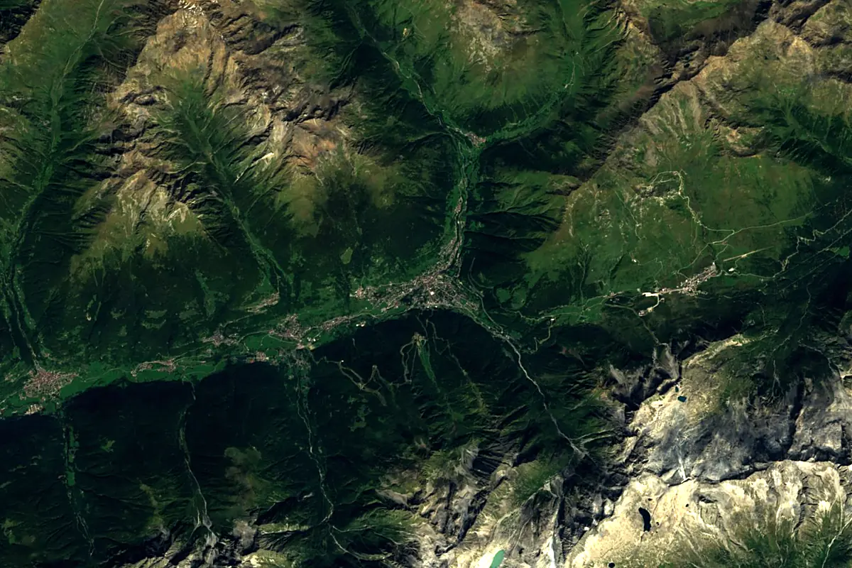
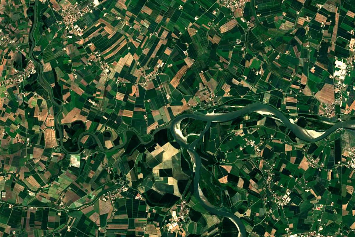
Sentinel-2 cloudless 2016 by EOX IT Services GmbH (contains modified Copernicus Sentinel data 2016), CC BY 4.0. The glowing line is the river as drawn by RiverATLAS.
Photos
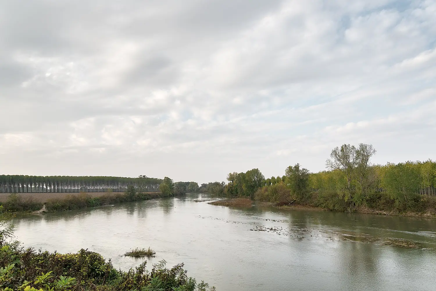
Oglio in pictures
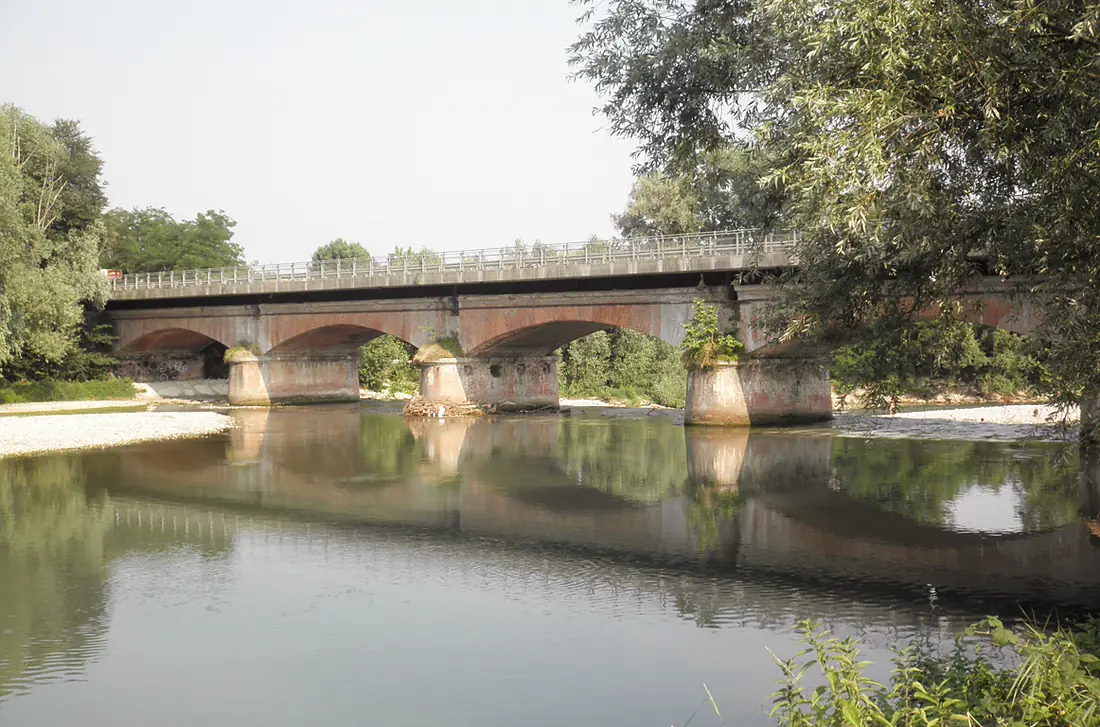
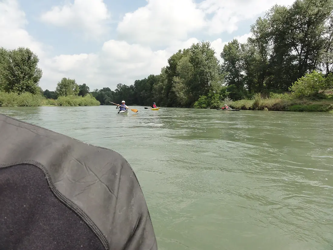
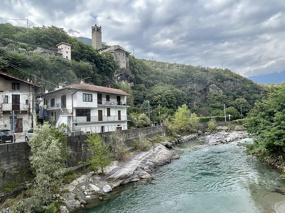
Tributaries
Where it flows, and what flows into it
It flows into
PoItaly652 km1,500 m³/sTributaries (11)
Also: Chiese, Mella, Cherio River, Dezzo, Frigidolfo, Narcanello, Ogliolo, Figna, Trobiolo, Torrente Grigna, Guerna
Where these numbers come from
| Name, length, places | Wikidata (Q848670) · CC0 |
|---|---|
| Course, profile, basin | RiverATLAS v1.0 (HydroATLAS, Linke et al. 2019) · CC BY 4.0 — followed from the source to the mouth given by Wikidata |
| Flow | WaterGAP (RiverATLAS), 1971–2000 · CC BY 4.0 |
| Climate along the river | WorldClim (RiverATLAS), 1970–2000 · CC BY 4.0 |
| Towns, bridges, dams | Wikidata · CC0; GeoNames · CC BY 4.0 |
| Along the river | © OpenStreetMap contributors · ODbL |
| Images | EOX Sentinel-2 cloudless 2016 · CC BY 4.0; Wikimedia Commons |
| Our other atlases | Lakeyas, Peakyas — Wikidata · CC0; © OpenStreetMap contributors · ODbL; GeoNames · CC BY 4.0; HydroLAKES · CC BY 4.0; NOAA OISST |
Every source and licence is on the data sources page.
The family
Do you prefer beaches, lakes, mountains, waterfalls, islands, rivers or canyons?
Same idea, other landscapes: field atlases built on open data, month by month, in seven languages.
 beaches
 Find your beach: sea temperature, sun and swimming month by month.Visit lakes
 Every lake on Earth: water temperature, ice, depth and the shore.Coming soonVisit mountains
 Every summit in 3D: summit weather, the 0 °C line, huts and trails.Visit
  waterfalls
 Every waterfall: height, flow month by month and when it roars.Coming soonVisit
  islands
 Every island from the sea up: size, sea temperature, ferries and 3D.Coming soonVisit
  rivers
 Every river from source to sea: the journey, the flow and the basin in numbers.You are here
 canyons
 Every canyon cut to scale: depth to the floor, rim and floor temperatures, trails and viewpoints.Coming soonVisit