River
Adige
410 km from source to mouth · Italy.
 ItalyFlows into Adriatic Sea2nd longest in Italy
In numbers
Length
410km
Average flow
270m³/s
Basin
14,700km²
Drop
1,493m
from 1,487 m to -6 m
Country
1
The journey
From source to mouth
410 km of river and 56 stops on the way: 34 towns and cities on its banks, dams, bridges and the tributaries that feed it.
- 0 kmReschen Passat 1,487 m
- 8 kmReschensee5.4 km²
- 11 kmHaidersee0.7 km²
- 20 kmVal Müstair1,435 people
- 28 kmPunitributary
- 42 kmSilandro4,517 people
- 63 kmNaturno4,023 people
- 77 kmMerano41,051 people
- 78 kmPassertributary
- 82 kmFalschauertributary
- 84 kmLana9,244 people
- 92 kmVilpian Waterfall
- 103 kmCosta Viaduct
- 103 kmBolzano107,436 people
- 105 kmEisacktributary
- 107 kmSan Giacomo3,404 people
- 110 kmLaives10,710 people
- 119 kmOra3,198 people
- 123 kmEgna3,474 people
- 133 kmSalurn waterfall
- 140 kmMezzocorona4,975 people
- 141 kmSan Michele all'Adige bridge
- 142 kmMezzolombardo6,754 people
- 146 kmLavis6,404 people
- 149 kmKaiserjäger bridge
- 158 kmTrento119,359 people
- 160 kmSardagna waterfall
- 161 kmRavina3,093 people
- 162 kmFersinatributary
- 165 kmMattarello5,214 people
- 177 kmVolano3,068 people
- 181 kmRovereto34,152 people
- 188 kmMori7,660 people
- 198 kmAla5,331 people
- 232 kmSant'Ambrogio di Valpolicella10,384 people
- 236 kmLake Garda355 km²
- 239 kmBussolengo15,170 people
- 240 kmPescantina11,743 people
- 246 kmPedemonte3,111 people
- 247 kmArbizzano-Santa Maria5,148 people
- 247 kmParona3,110 people
- 250 kmChievo Dam with bridge
- 254 kmCastelvecchio Bridge
- 254 kmPonte della Vittoria
- 254 kmVeronaUNESCO World Heritage
- 255 kmGaribaldi Bridge
- 255 kmPonte Pietra
- 256 kmPonte Navi
- 268 kmSan Giovanni Lupatoto20,038 people
- 275 kmZevio12,035 people
- 287 kmRonco All'Adige3,360 people
- 308 kmLegnago21,646 people
- 314 kmVilla Bartolomea3,221 people
- 327 kmBadia Polesine6,940 people
- 331 kmCable-stayed bridge over the Adige river
- 380 kmCavarzere8,992 people
- 400 kmSant'Anna3,062 people
- 410 kmAdriatic Seaat -6 m
Water level along the river (RiverATLAS; the height is exaggerated). Towns: GeoNames and Wikidata; bridges, dams and tributaries: Wikidata.
River in northern Italy
At the mouth it carries 266 m³/s on average: an Olympic pool every 9.4 seconds. It drops from 1,487 m to -6 m, 3.6 m per kilometre on average. Its basin covers 14,700 km², about the size of TL. 1.9 million people live in it. Highest water: from November to December. Its dams hold back little of its water (6.2% of a year's flow).
Where to start
- VeronaLargest city on its banks · 258,031 people
- Verona Villafranca Valerio Catullo Airport (VRN)Nearest airport with scheduled flights, 10 km from the cityCar hire at VRN airport (Caselle)Discover Cars · Affiliate link↗
- On the water15 ferry piers, marinas, boat rentals and boat ramps along the river (OpenStreetMap)
- Kayak and canoe2 put-ins and rapids mapped (OpenStreetMap)
- From May to SeptemberThe best months to visit
Adige, month by month
Highest water: from November to December
Best months to visit: from May to September.
From about 80 m³/s in the lowest month to 470 m³/s in the highest. An estimate: the monthly flow is modelled from the lowest and highest months of WaterGAP (RiverATLAS, 1971–2000) and the rain and snow along the river (WorldClim). Dams change the real rhythm. The chip is the average air temperature; below it, the month's rain.
Plan the trip
Plan the trip: boat trips, a bed by the river, a car
Some links above are affiliate links: if you book through them we may earn a commission, at no extra cost to you. It never changes what the data on this page says.
The basin
Adige: the basin in numbers
14,459 km² of land send their water to this river. This is what lives on it.
- 1.9millionpeople live in the basin
- 134/km²people per km²
- 1,267maverage altitude of the basin
- 904mmof rain a year (basin average)
- 6.1°Caverage air temperature
- 15%protected areas
- 0.1%covered by lakes
- 5%permafrost
- 0.4km³held in reservoirs
What covers the basin
- 58% Forest
- 24% Cropland
- 4% Pasture
- 7% Towns and cities
RiverATLAS (HydroATLAS v1.0, CC BY 4.0): land cover, people, protected areas, glaciers and dams over the whole basin upstream of the mouth.
Along the river
Adige: what you find on the way
- 374WeirsSerra di San Giorgio, Idrovora and 372 more
- 22LocksHochkehr, Adigetto, Idrovia Po-Brondolo and 19 more
- 42WaterfallsFragsburger Wasserfall - Cascata del Rio Sinigo, Brandis Wasserfall, Gargazoner Wasserfall - Cascata di Gargazzone and 39 more
- 2Canoe put-insFine campetto
- 12Boat ramps
- 1Ferry piers
- 2MarinasMolo turistico, Porto Fossone
- 14River beachesTizè Beach, Bagno Happy Days, Villaggio Rosapineta Sud and 11 more
From OpenStreetMap, within 1.9 km of the river. Not mapped is not the same as not there.
Cross-checked with our atlases
Adige in our other atlases
What our sister atlases know about the waterfalls on this river, the lakes it flows through, the beaches at its mouth, the mountains where it rises and the islands off its mouth.
 3waterfalls on the riverCascadyas
 3lakes on its wayLakeyas
 5beaches at the mouth and on the banksCoastya
 153mountains at the sourcePeakyas
 20islands off the mouthIslandyas
Waterfalls (3)
On the river, by Cascadyas
- Vilpian Waterfallkm 93
- Salurn waterfallkm 134
- Sardagna waterfallkm 161
Cascadyas is coming soonOpen Cascadyas ↗
Lakes and reservoirs (3)
Lakes it flows through, by Lakeyas
- Reschenseekm 8 · 6 m deep5.4km²
- Haiderseekm 11 · 15 m deep0.7km²
- Lake Gardakm 238 · 346 m deep355km²
Lakeyas is coming soonOpen Lakeyas ↗
Beaches (5)
At the mouth (25 km) and on the banks, by Coastya
- Litorale di Pellestrina14 km away25.8°C
- Spiaggia di Sottomarina7.1 km away25.9°C
- Spiaggia di Isola Bacucco2.4 km away25.9°C
- Spiaggia di Rosolina Mare3.0 km away25.9°C
- Spiaggia Libera Albarella7.8 km away25.9°C
Mountains at the source (153)
Within 15 km of the source, by Peakyas
- Muttler13 km away · prominence 701 m3,294m
- Glockturm13 km away · prominence 390 m3,355m
- Äußerer Bärenbartkogel15 km away · prominence 167 m3,473m
- Piz Tschütta13 km away · prominence 444 m3,254m
- Rabenkopf13 km away · prominence 195 m3,394m
- Piz Lischana15 km away · prominence 286 m3,105m
- Piz Mundin12 km away · prominence 342 m3,146m
- Piz Cristanas15 km away · prominence 239 m3,092m
145 more on PeakyasOpen Peakyas ↗
Islands off the mouth (20)
Within 30 km of the mouth, by Islandyas
- Lido di Venezia25 km away4.0km²
- Poveglia25 km away0.1km²
- Giudecca30 km away0.6km²
- San Lazzaro degli Armeni28 km away0.0km²
- Pellestrina13 km away2.0km²
- Sacca Fisola30 km away0.2km²
- San Servolo29 km away0.0km²
- Lazzaretto Vecchio28 km away0.0km²
12 more on IslandyasIslandyas is coming soonOpen Islandyas ↗
From space
The source and the mouth, seen from orbit
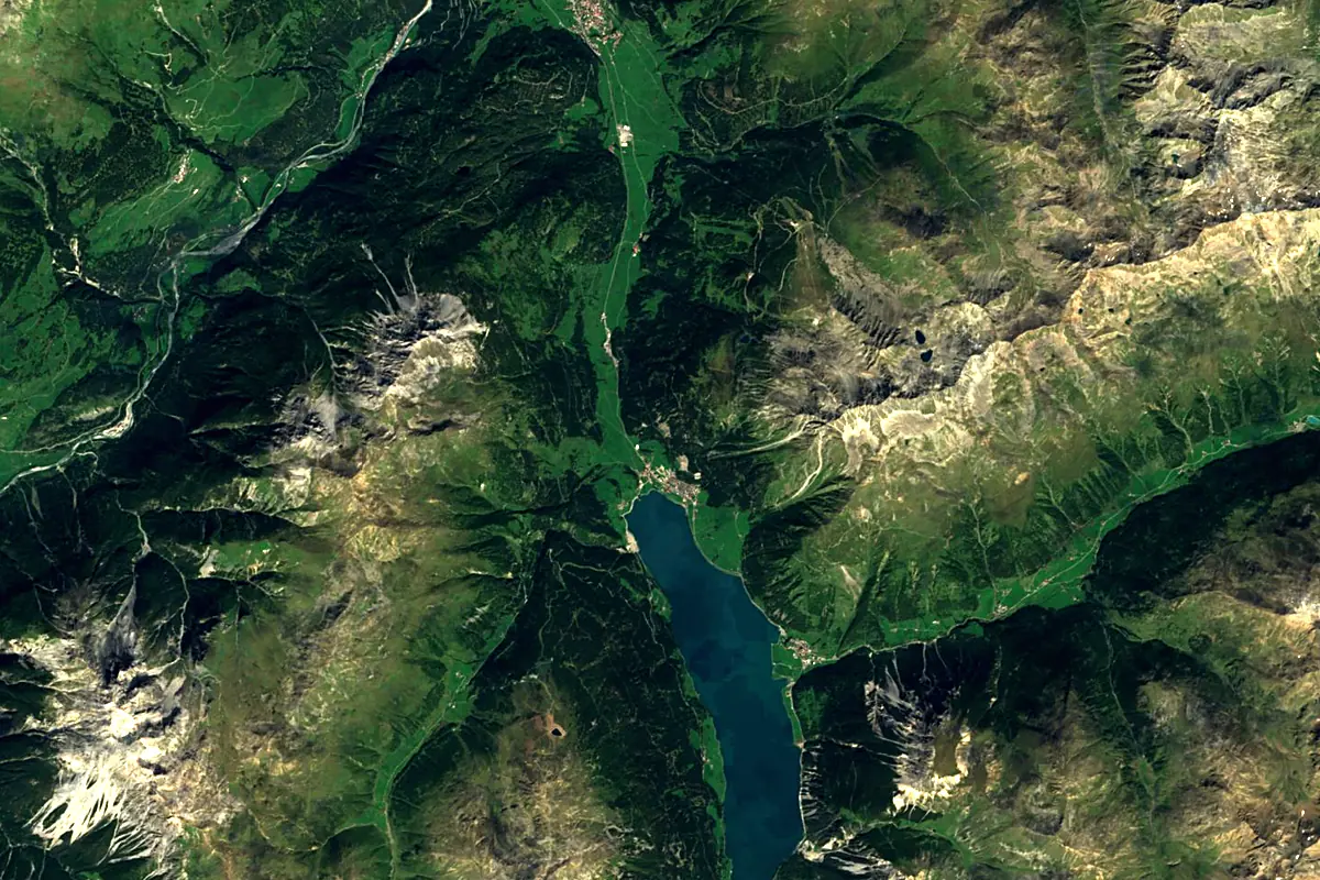
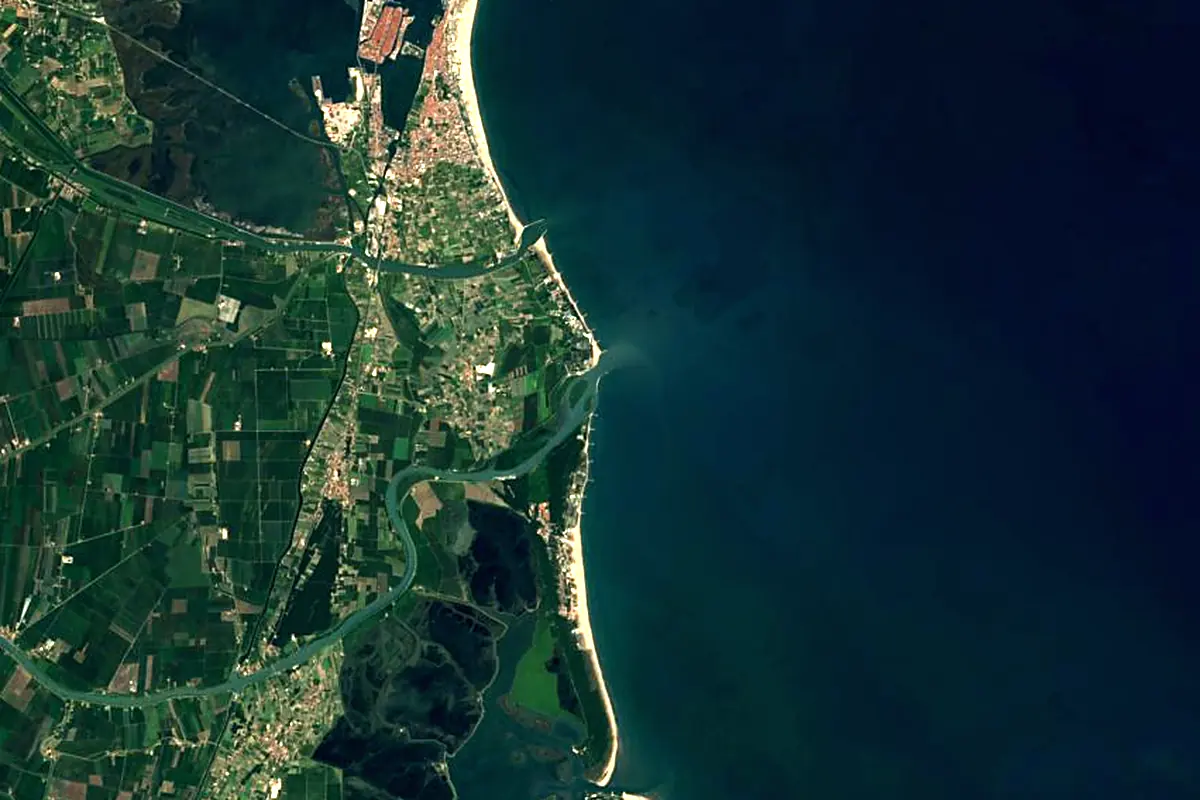
Sentinel-2 cloudless 2016 by EOX IT Services GmbH (contains modified Copernicus Sentinel data 2016), CC BY 4.0. The glowing line is the river as drawn by RiverATLAS.
Photos
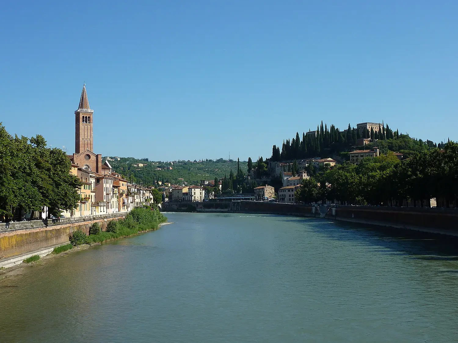
Adige in pictures
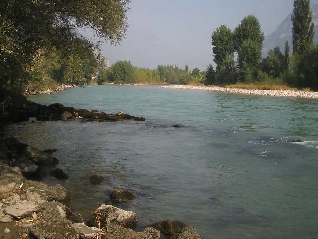
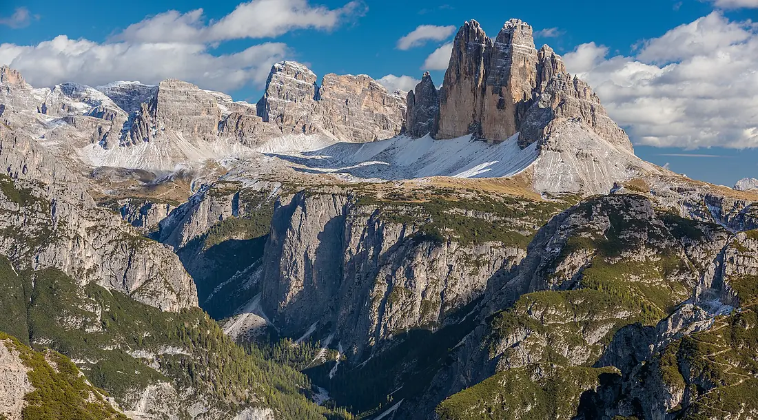
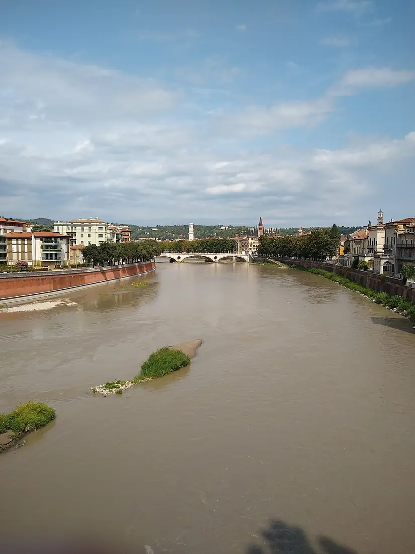
Tributaries
Where it flows, and what flows into it
Tributaries (13)
Also: Rom, Passer, Falschauer, Suldenbach, Schnalser Bach, Saldurbach, Plima, Schwarzenbach, Puni, Fersina, Fossa di Bronzolo-Branzoller Graben, Alpone
In the same basin
Where these numbers come from
| Name, length, places | Wikidata (Q13696) · CC0 |
|---|---|
| Course, profile, basin | RiverATLAS v1.0 (HydroATLAS, Linke et al. 2019) · CC BY 4.0 — followed from the source to the mouth given by Wikidata |
| Flow | WaterGAP (RiverATLAS), 1971–2000 · CC BY 4.0 |
| Climate along the river | WorldClim (RiverATLAS), 1970–2000 · CC BY 4.0 |
| Towns, bridges, dams | Wikidata · CC0; GeoNames · CC BY 4.0 |
| Along the river | © OpenStreetMap contributors · ODbL |
| Images | EOX Sentinel-2 cloudless 2016 · CC BY 4.0; Wikimedia Commons |
| Our other atlases | Cascadyas, Lakeyas, Coastya, Peakyas, Islandyas — Wikidata · CC0; © OpenStreetMap contributors · ODbL; GeoNames · CC BY 4.0; HydroLAKES · CC BY 4.0; NOAA OISST |
Every source and licence is on the data sources page.
The family
Do you prefer beaches, lakes, mountains, waterfalls, islands, rivers or canyons?
Same idea, other landscapes: field atlases built on open data, month by month, in seven languages.
beaches Find your beach: sea temperature, sun and swimming month by month.Visit lakes
 Every lake on Earth: water temperature, ice, depth and the shore.Coming soonVisit mountains
 Every summit in 3D: summit weather, the 0 °C line, huts and trails.Visit waterfalls
 Every waterfall: height, flow month by month and when it roars.Coming soonVisit islands
 Every island from the sea up: size, sea temperature, ferries and 3D.Coming soonVisit
  rivers
 Every river from source to sea: the journey, the flow and the basin in numbers.You are here
 canyons
 Every canyon cut to scale: depth to the floor, rim and floor temperatures, trails and viewpoints.Coming soonVisit