River
Rio Grande
3,051 km from source to mouth · United States and Mexico.

 United States and MexicoFlows into Gulf of Mexico3rd longest in United States
In numbers
Length
3,051km
Average flow
85m³/s
Basin
471,900km²
Drop
2,915m
from 2,915 m to 0 m
Countries
2
The journey
From source to mouth
3,051 km of river and 68 stops on the way: 44 towns and cities on its banks, dams, bridges and the tributaries that feed it.
- 0 kmSourceat 2,915 m
- 35 kmRoad Canyon Reservoir Number 10.6 km²
- 108 kmSouth Fork Rio Grandetributary
- 134 kmDel Norte1,458 people
- 207 kmAlamosa Rivertributary
- 219 kmTrinchera Creektributary
- 219 kmConejos Rivertributary
- 237 kmCulebra Creektributary
- 321 kmRio Hondotributary
- 346 kmRio Pueblo de Taostributary
- 371 kmEmbudo Creektributary
- 376 kmEmbudo Stream Gauging Station
- 402 kmRio Chamatributary
- 407 kmEspañola10,224 people
- 462 kmCochiti Reservoir4.3 km²
- 466 kmSanta Fe Rivertributary
- 469 kmPeña Blanca624 people
- 476 kmKewa Pueblo2,311 people
- 489 kmPueblo of San Felipe2,542 people
- 500 kmJemez Rivertributary
- 507 kmEnchanted Hills87,521 people
- 525 kmRio Rancho87,521 people
- 528 kmNorth Valley11,333 people
- 544 kmAlbuquerque564,559 people
- 552 kmSouth Valley40,976 people
- 574 kmBosque Farms4,020 people
- 580 kmLos Lunas15,336 people
- 588 kmTome1,718 people
- 638 kmRio Puercotributary
- 679 kmSocorro8,707 people
- 808 kmElephant Butte Reservoir110 km²
- 815 kmTruth or Consequences6,052 people
- 819 kmWilliamsburg462 people
- 846 kmCaballo Lake28 km²
- 882 kmHatch1,539 people
- 950 kmMesilla1,797 people
- 1,016 kmSunland Park15,940 people
- 1,027 kmEl Paso678,815 people
- 1,043 kmCiudad Juárez1,501,551 people
- 1,055 kmSocorro Mission Number 1 Colonia28,637 people
- 1,061 kmSan Elizario8,999 people
- 1,409 kmRio Conchostributary
- 1,411 kmManuel Ojinaga22,744 people
- 1,413 kmOjinaga22,744 people
- 1,416 kmPresidio3,264 people
- 1,614 kmHot Springs
- 1,900 kmPecos Rivertributary
- 1,969 kmAmistad Reservoir132 km²
- 1,990 kmCiudad Acuña160,225 people
- 2,086 kmEagle Pass28,130 people
- 2,086 kmPiedras Negras173,959 people
- 2,090 kmEidson Road8,960 people
- 2,305 kmNuevo Laredo416,055 people
- 2,306 kmLaredo255,205 people
- 2,324 kmRio Bravo4,450 people
- 2,375 kmSan Ygnacio504 people
- 2,410 kmRio Saladotributary
- 2,449 kmFalcon International Reservoir121 km²
- 2,484 kmCiudad Miguel Alemán19,998 people
- 2,484 kmRoma10,223 people
- 2,484 kmRoma-Los Saenz9,765 people
- 2,510 kmRio Grande City14,404 people
- 2,517 kmRío San Juan (Nuevo León)tributary
- 2,556 kmCiudad Gustavo Díaz Ordaz11,523 people
- 2,607 kmReynosa691,557 people
- 2,608 kmHidalgo13,964 people
- 2,648 kmNuevo Progreso10,178 people
- 2,707 kmBrownsville186,738 people
- 2,713 kmHeroica Matamoros541,979 people
- 3,051 kmGulf of Mexicoat 0 m
Water level along the river (RiverATLAS; the height is exaggerated). Towns: GeoNames and Wikidata; bridges, dams and tributaries: Wikidata.
River originating in Colorado, flowing south through New Mexico, and forming part of the US-Mexico border along Texas until emptying into the Gulf of Mexico
At the mouth it carries 85 m³/s on average: an Olympic pool every 29 seconds. It drops from 2,915 m to 0 m, 1.0 m per kilometre on average. Its basin covers 471,900 km², about the size of CM. 14.3 million people live in it. Highest water: from September to October; lowest: from March to April. It is heavily dammed: reservoirs can hold 100% of a year's flow.
Where to start
- Ciudad JuárezLargest city on its banks · 1,501,551 people
- Abraham González International Airport (CJS)Nearest airport with scheduled flights, 4 km from the cityCar hire at ELP airport (El Paso)Discover Cars · Affiliate link↗
- On the water59 ferry piers, marinas, boat rentals and boat ramps along the river (OpenStreetMap)
- Kayak and canoe21 put-ins and rapids mapped (OpenStreetMap)
- From April to June and from September to OctoberThe best months to visit
Rio Grande, month by month
Highest water: from September to October
Lowest water: from March to April. Best months to visit: from April to June and from September to October.
From about 10 m³/s in the lowest month to 150 m³/s in the highest. An estimate: the monthly flow is modelled from the lowest and highest months of WaterGAP (RiverATLAS, 1971–2000) and the rain and snow along the river (WorldClim). Dams change the real rhythm. The chip is the average air temperature; below it, the month's rain.
Plan the trip
Plan the trip: boat trips, a bed by the river, a car
Some links above are affiliate links: if you book through them we may earn a commission, at no extra cost to you. It never changes what the data on this page says.
The basin
Rio Grande: the basin in numbers
475,503 km² of land send their water to this river. This is what lives on it.
- 14.3millionpeople live in the basin
- 30/km²people per km²
- 1,275maverage altitude of the basin
- 397mmof rain a year (basin average)
- 16.5°Caverage air temperature
- 9%protected areas
- 0.2%covered by lakes
- 30km³held in reservoirs
What covers the basin
- 18% Forest
- 6% Cropland
- 62% Pasture
- 1% Towns and cities
RiverATLAS (HydroATLAS v1.0, CC BY 4.0): land cover, people, protected areas, glaciers and dams over the whole basin upstream of the mouth.
Along the river
Rio Grande: what you find on the way
- 72WeirsLos Luceros Diversion Dam, Enchanted Hills Detention Dam Number 1, San Acacia Diversion Dam and 69 more
- 36Locks
- 12WaterfallsUpper Frijoles Falls, Lower Frijoles Falls and 10 more
- 21RapidsBig Arsenic Falls, Horse Thief Shorty Rapid, Ski Jump Rapid and 18 more
- 55Boat rampsTaos Junction Bridge Boat Launch, Lone Juniper Boat Takeout, Tetilla Boat Ramp and 52 more
- 2Ferry piers
- 2MarinasMarina del Sur, Dam Site Marina
From OpenStreetMap, within 2.8 km of the river. Not mapped is not the same as not there.
Cross-checked with our atlases
Rio Grande in our other atlases
What our sister atlases know about the waterfalls on this river, the lakes it flows through, the beaches at its mouth, the mountains where it rises and the islands off its mouth.
 6lakes on its wayLakeyas
 5beaches at the mouth and on the banksCoastya
 57mountains at the sourcePeakyas
 1island off the mouthIslandyas
Lakes and reservoirs (6)
Lakes it flows through, by Lakeyas
- Road Canyon Reservoir Number 1km 310.6km²
- Cochiti Reservoirkm 4144.3km²
- Elephant Butte Reservoirkm 725110km²
- Caballo Lakekm 75928km²
- Amistad Reservoirkm 1,766132km²
- Falcon International Reservoirkm 2,197121km²
Lakeyas is coming soonOpen Lakeyas ↗
Beaches (5)
At the mouth (25 km) and on the banks, by Coastya
- Playa Lauro Villar14 km away28.9°C
- Playa Washington14 km away28.9°C
- Boca Chica Beach4.0 km away28.9°C
- Del Mar Beach8.1 km away28.9°C
- Playa Bagdad14 km away28.9°C
Mountains at the source (57)
Within 15 km of the source, by Peakyas
- Handies Peak13 km away4,282m
- Half Peak9.7 km away · prominence 458 m4,221m
- Arrow Peak13 km away · prominence 287 m4,209m
- Jones Mountain11 km away4,226m
- Niagara Peak10 km away · prominence 173 m4,210m
- Tower Mountain9.9 km away · prominence 504 m4,132m
- Sultan Mountain15 km away · prominence 569 m4,076m
- Vestal Peak13 km away · prominence 343 m
49 more on PeakyasOpen Peakyas ↗
Islands off the mouth (1)
Within 30 km of the mouth, by Islandyas
- Brazos Island8.3 km away
Islandyas is coming soonOpen Islandyas ↗
From space
The source and the mouth, seen from orbit
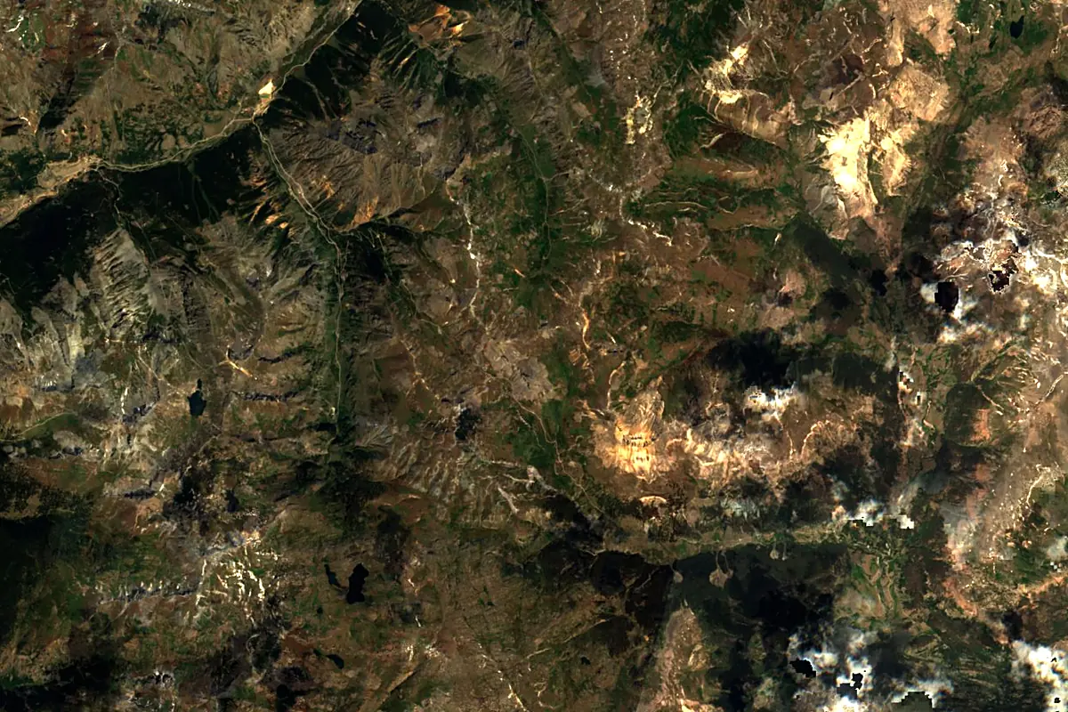
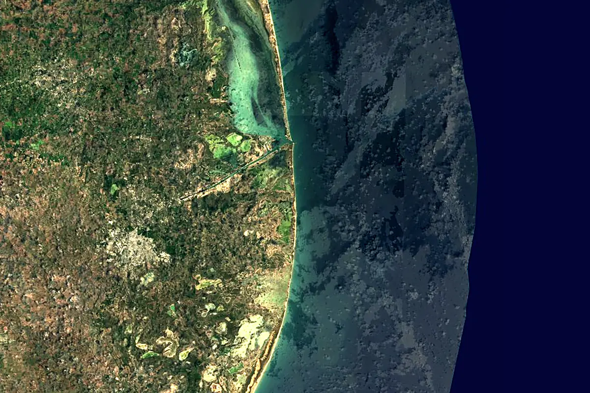
Sentinel-2 cloudless 2016 by EOX IT Services GmbH (contains modified Copernicus Sentinel data 2016), CC BY 4.0. The glowing line is the river as drawn by RiverATLAS.
Photos
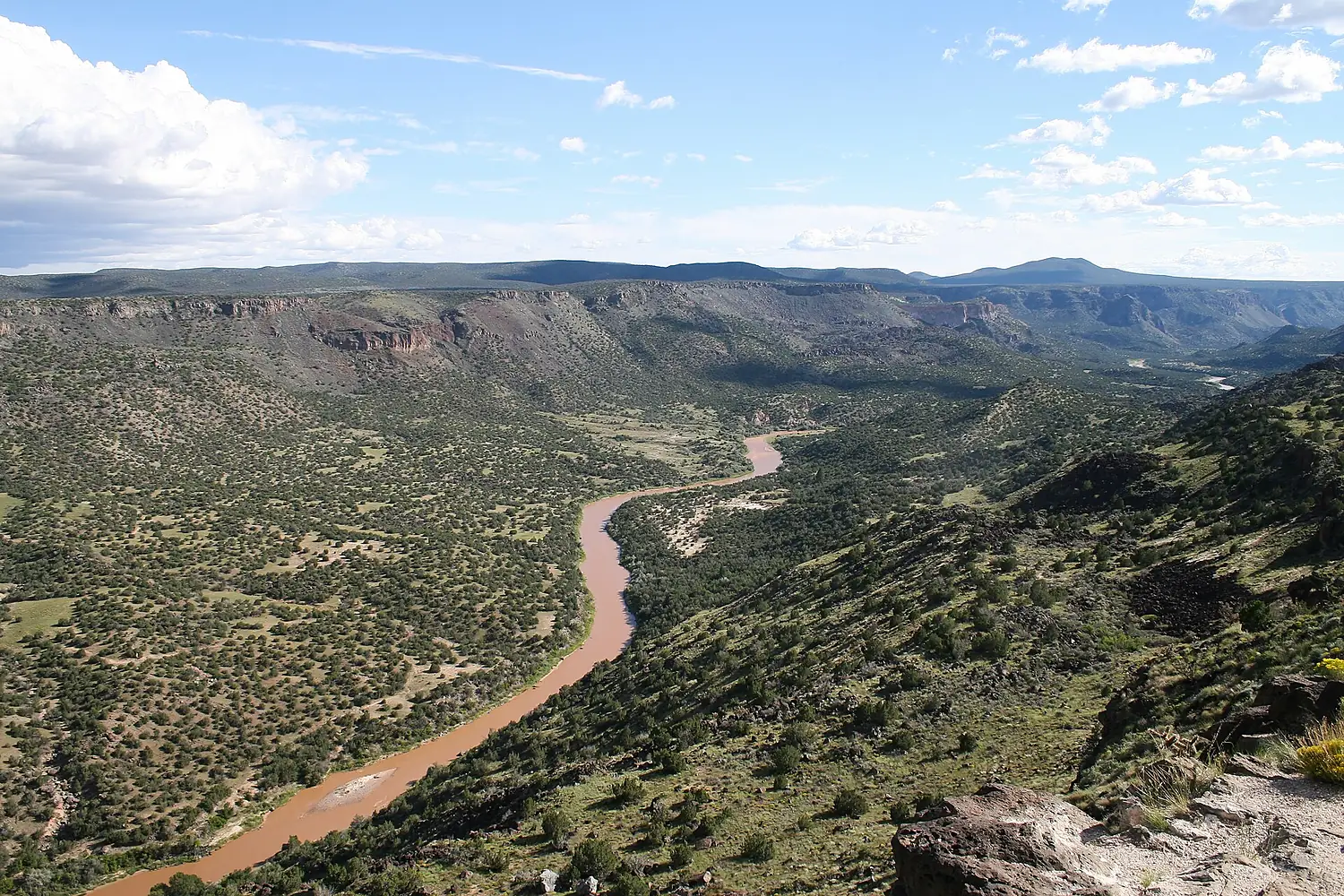
Rio Grande in pictures
Tributaries
Where it flows, and what flows into it
Tributaries (35)
United States1,560 km8.0 m³/sjoins at km 1,704Rio ConchosMexico910 km57 m³/sjoins at km 1,264Also: Rio Salado, Alamosa River, Río San Juan (Nuevo León), Conejos River, Embudo Creek, Santa Fe River, Jemez River, Rio Pueblo de Taos, Culebra Creek, Red River, Rio Chama, Rio Hondo, Rio Puerco, Rio Salado, South Fork Rio Grande, Trinchera Creek, Galisteo Creek, Costilla Creek, Alamito Creek, Chacon Creek, Rio Ojo Caliente, San Francisco Creek, San Ildefonso Creek, Santa Isabel Creek
Where these numbers come from
| Name, length, places | Wikidata (Q160636) · CC0 |
|---|---|
| Course, profile, basin | RiverATLAS v1.0 (HydroATLAS, Linke et al. 2019) · CC BY 4.0 — followed from the source to the mouth given by Wikidata |
| Flow | WaterGAP (RiverATLAS), 1971–2000 · CC BY 4.0 |
| Climate along the river | WorldClim (RiverATLAS), 1970–2000 · CC BY 4.0 |
| Towns, bridges, dams | Wikidata · CC0; GeoNames · CC BY 4.0 |
| Along the river | © OpenStreetMap contributors · ODbL |
| Images | EOX Sentinel-2 cloudless 2016 · CC BY 4.0; Wikimedia Commons |
| Our other atlases | Lakeyas, Coastya, Peakyas, Islandyas — Wikidata · CC0; © OpenStreetMap contributors · ODbL; GeoNames · CC BY 4.0; HydroLAKES · CC BY 4.0; NOAA OISST |
Every source and licence is on the data sources page.
The family
Do you prefer beaches, lakes, mountains, waterfalls, islands, rivers or canyons?
Same idea, other landscapes: field atlases built on open data, month by month, in seven languages.
beaches Find your beach: sea temperature, sun and swimming month by month.Visit lakes
 Every lake on Earth: water temperature, ice, depth and the shore.Coming soonVisit mountains
 Every summit in 3D: summit weather, the 0 °C line, huts and trails.Visit
  waterfalls
 Every waterfall: height, flow month by month and when it roars.Coming soonVisit islands
 Every island from the sea up: size, sea temperature, ferries and 3D.Coming soonVisit
  rivers
 Every river from source to sea: the journey, the flow and the basin in numbers.You are here
 canyons
 Every canyon cut to scale: depth to the floor, rim and floor temperatures, trails and viewpoints.Coming soonVisit