Stream
Ter
208 km from source to mouth · Spain.
 SpainFlows into Mediterranean Sea
In numbers
Length
208km
Average flow
25m³/s
Basin
3,010km²
Drop
953m
from 953 m to 0 m
Country
1
The journey
From source to mouth
208 km of river and 68 stops on the way: 52 towns and cities on its banks, dams, bridges and the tributaries that feed it.
- 0 kmUlldeterat 953 m
- 0 kmSetcases195 people
- 1 kmVilallonga de Ter395 people
- 5 kmLlanars516 people
- 18 kmCampdevànol3,349 people
- 22 kmRipoll10,665 people
- 23 kmPont de la Font Viva
- 23 kmPont de la Barricona
- 24 kmPont de Ribamala
- 24 kmPont de Calatrava
- 24 kmSant Joan de les Abadesses3,393 people
- 24 kmla Palanca
- 24 kmSant Joan de les Abadesses Old Bridge
- 27 kmLes Llosses197 people
- 33 kmSanta Maria de Besora164 people
- 38 kmMontesquiu1,131 people
- 39 kmSant Quirze de Besora2,164 people
- 39 kmPont de l'U d'Octubre de 2017
- 48 kmOrís355 people
- 49 kmSant Vicenç de Torelló2,117 people
- 49 kmVilaseca17,305 people
- 51 kmTorelló15,334 people
- 51 kmGestributary
- 55 kmLes Masies de Voltregà3,345 people
- 60 kmPont de la Gleva
- 61 kmSorreigs Streamtributary
- 61 kmGurb2,741 people
- 65 kmManlleu21,425 people
- 65 kmPont de Can Molas
- 69 kmLes Masies de Roda758 people
- 70 kmPont Vell de Roda
- 70 kmRoda de Ter6,937 people
- 74 kmTavèrnoles354 people
- 80 kmL'Esquirol2,301 people
- 88 kmVilanova de Sau325 people
- 89 kmPantà de Sau2.0 km²
- 92 kmTavertet128 people
- 100 kmSant Hilari Sacalm6,069 people
- 105 kmOsor430 people
- 106 kmSusqueda Reservoir2.0 km²
- 111 kmSusqueda103 people
- 121 kmLa Cellera de Ter2,027 people
- 124 kmAnglès5,944 people
- 125 kmSant Julià del Llor i Bonmatí1,457 people
- 138 kmBescanó5,088 people
- 142 kmRiera de Llémenatributary
- 142 kmSant Gregori4,191 people
- 144 kmSalt34,491 people
- 147 kmGirona108,666 people
- 153 kmSarrià de Ter5,406 people
- 156 kmSant Julià de Ramis3,715 people
- 160 kmCelrà5,621 people
- 168 kmCervià de Ter1,029 people
- 169 kmBordils1,841 people
- 172 kmSant Joan de Mollet536 people
- 174 kmFlaçà1,175 people
- 178 kmSant Jordi Desvalls880 people
- 180 kmColomers208 people
- 183 kmJafre386 people
- 185 kmFoixà298 people
- 188 kmLa Tallada d'Empordà490 people
- 189 kmVerges1,167 people
- 190 kmUltramort218 people
- 194 kmSerra de Daró240 people
- 197 kmGualta438 people
- 197 kmUllà1,258 people
- 198 kmTorroella de Montgrí12,570 people
- 200 kmFontanilles171 people
- 208 kmDarótributary
- 208 kmMediterranean Seaat 0 m
Water level along the river (RiverATLAS; the height is exaggerated). Towns: GeoNames and Wikidata; bridges, dams and tributaries: Wikidata.
River in Catalonia, Spain
At the mouth it carries 25 m³/s on average: an Olympic pool every 100 seconds. It drops from 953 m to 0 m, 4.6 m per kilometre on average. Its basin covers 3,010 km², about the size of LU. 409,000 people live in it. Highest water: October. Dams and reservoirs hold back a large share of its water (30% of a year's flow).
Where to start
- GironaLargest city on its banks · 108,666 people
- Girona-Costa Brava Airport (GRO)Nearest airport with scheduled flights, 10 km from the cityCar hire at GRO airport (Girona)Discover Cars · Affiliate link↗
- On the water1 ferry piers, marinas, boat rentals and boat ramps along the river (OpenStreetMap)
- Kayak and canoe1 put-ins and rapids mapped (OpenStreetMap)
- From May to SeptemberThe best months to visit
Ter, month by month
Highest water: October
Best months to visit: from May to September.
From about 22 m³/s in the lowest month to 63 m³/s in the highest. An estimate: the monthly flow is modelled from the lowest and highest months of WaterGAP (RiverATLAS, 1971–2000) and the rain and snow along the river (WorldClim). Dams change the real rhythm. The chip is the average air temperature; below it, the month's rain.
Plan the trip
Plan the trip: boat trips, a bed by the river, a car
Some links above are affiliate links: if you book through them we may earn a commission, at no extra cost to you. It never changes what the data on this page says.
The basin
Ter: the basin in numbers
3,170 km² of land send their water to this river. This is what lives on it.
- 409,000people live in the basin
- 129/km²people per km²
- 683maverage altitude of the basin
- 846mmof rain a year (basin average)
- 12.2°Caverage air temperature
- 29%protected areas
- 0.2%covered by lakes
- 0.4km³held in reservoirs
What covers the basin
- 79% Forest
- 13% Cropland
- 8% Pasture
- 7% Towns and cities
RiverATLAS (HydroATLAS v1.0, CC BY 4.0): land cover, people, protected areas, glaciers and dams over the whole basin upstream of the mouth.
Along the river
Ter: what you find on the way
- 70WeirsAssut CH Escorxadors, Resclosa de Can Guetes, Resclosa del Roig and 67 more
- 3LocksCanal Bures
- 9WaterfallsCascada de Angelats, Salt de les Conques, Salt del Cabrit and 6 more
- 1RapidsParc d'Aigües Braces de la Pilastra
- 2River beachesPlatjeta de Bonmatí, Platja de la Platera
From OpenStreetMap, within 1.5 km of the river. Not mapped is not the same as not there.
Cross-checked with our atlases
Ter in our other atlases
What our sister atlases know about the waterfalls on this river, the lakes it flows through, the beaches at its mouth, the mountains where it rises and the islands off its mouth.
 2lakes on its wayLakeyas
 52beaches at the mouth and on the banksCoastya
 146mountains at the sourcePeakyas
 6islands off the mouthIslandyas
Lakes and reservoirs (2)
Lakes it flows through, by Lakeyas
- Pantà de Saukm 682.0km²
- Susqueda Reservoirkm 812.0km²
Lakeyas is coming soonOpen Lakeyas ↗
Beaches (52)
At the mouth (25 km) and on the banks, by Coastya
- Platja de Can Cristos23 km away23.5°C
- Platja de Canyelles Petites25 km away22.5°C
- Platja de l'Estartit3.0 km away22.5°C
- Platja de Pals3.4 km away23.5°C
- Platja de la Gola del Terkm 15923.5°C
- Cala Sa Tuna7.5 km away23.5°C
- Cala Rovira24 km away23.5°C
- Platja de Belladona24 km away23.5°C
44 more on CoastyaOpen Coastya ↗
Mountains at the source (146)
Within 15 km of the source, by Peakyas
- Puigmal11 km away · prominence 1,331 m2,910m
- Bastiments1.0 km away · prominence 276 m2,881m
- Pic de Noufonts6.3 km away · prominence 210 m2,861m
- Pic del Segre10 km away · prominence 95 m2,843m
- Pic de l'Infern2.5 km away · prominence 164 m2,870m
- Pic de Finestrelles9.2 km away · prominence 221 m2,826m
- Pic d'Eina7.2 km away · prominence 57 m2,789m
- Pic de la Fossa del Gegant4.5 km away · prominence 84 m2,808m
138 more on PeakyasOpen Peakyas ↗
Islands off the mouth (6)
Within 30 km of the mouth, by Islandyas
- S'Arenella30 km away0.0km²
- Illa de la Pedrosa5.7 km away
- Illes de la Farriola6.8 km away
- Carall Bernat3.5 km away
- Meda Gran3.6 km away0.2km²
- Illa des Sortell30 km away
Islandyas is coming soonOpen Islandyas ↗
From space
The source and the mouth, seen from orbit
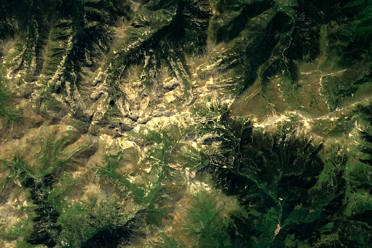
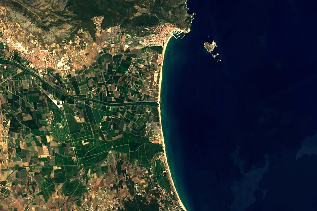
Sentinel-2 cloudless 2016 by EOX IT Services GmbH (contains modified Copernicus Sentinel data 2016), CC BY 4.0. The glowing line is the river as drawn by RiverATLAS.
Photos
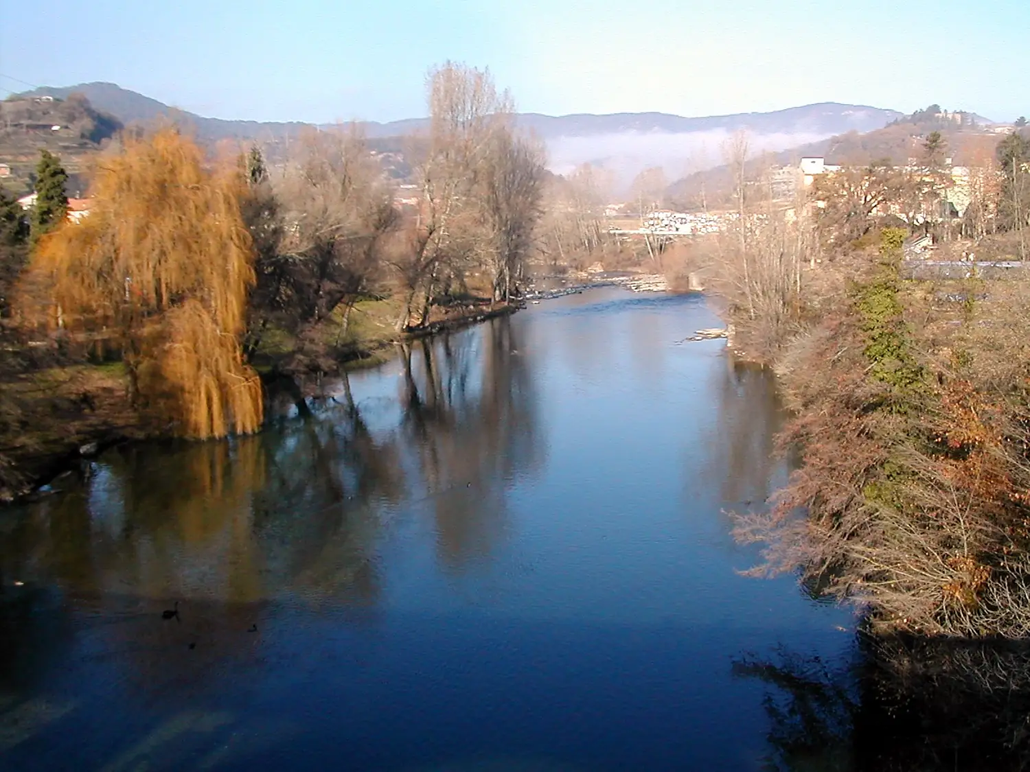
Ter in pictures
Tributaries
Where it flows, and what flows into it
Tributaries (18)
Also: Onyar, Daró, Brugent River, Freser River, Güell, Ges, Riera de Llémena, Terri, Gurri, Ritort River, El Merdàs, riera de Rupit, Sorreigs Stream, riera de Rifós, riera d'Osor, Riera d'en Xuncla, Ribera de Faitús, Riera de Malatosca
Nearby
Rivers nearby
 France
Where these numbers come from
| Name, length, places | Wikidata (Q31482) · CC0 |
|---|---|
| Course, profile, basin | RiverATLAS v1.0 (HydroATLAS, Linke et al. 2019) · CC BY 4.0 — followed from the source to the mouth given by Wikidata |
| Flow | WaterGAP (RiverATLAS), 1971–2000 · CC BY 4.0 |
| Climate along the river | WorldClim (RiverATLAS), 1970–2000 · CC BY 4.0 |
| Towns, bridges, dams | Wikidata · CC0; GeoNames · CC BY 4.0 |
| Along the river | © OpenStreetMap contributors · ODbL |
| Images | EOX Sentinel-2 cloudless 2016 · CC BY 4.0; Wikimedia Commons |
| Our other atlases | Lakeyas, Coastya, Peakyas, Islandyas — Wikidata · CC0; © OpenStreetMap contributors · ODbL; GeoNames · CC BY 4.0; HydroLAKES · CC BY 4.0; NOAA OISST |
Every source and licence is on the data sources page.
The family
Do you prefer beaches, lakes, mountains, waterfalls, islands, rivers or canyons?
Same idea, other landscapes: field atlases built on open data, month by month, in seven languages.
beaches Find your beach: sea temperature, sun and swimming month by month.Visit lakes
 Every lake on Earth: water temperature, ice, depth and the shore.Coming soonVisit mountains
 Every summit in 3D: summit weather, the 0 °C line, huts and trails.Visit
  waterfalls
 Every waterfall: height, flow month by month and when it roars.Coming soonVisit islands
 Every island from the sea up: size, sea temperature, ferries and 3D.Coming soonVisit
  rivers
 Every river from source to sea: the journey, the flow and the basin in numbers.You are here
 canyons
 Every canyon cut to scale: depth to the floor, rim and floor temperatures, trails and viewpoints.Coming soonVisit