River
Ural River
2,428 km from source to mouth · Kazakhstan and Russia.
 Kazakhstan and RussiaFlows into Caspian Sea1st longest in Kazakhstan
In numbers
Length
2,428km
Average flow
400m³/s
Basin
231,000km²
Drop
545m
from 516 m to -29 m
Countries
2
The journey
From source to mouth
2,428 km of river and 60 stops on the way: 11 towns and cities on its banks, dams, bridges and the tributaries that feed it.
- 0 kmUral Mountainsat 516 m
- 3 kmOzero Beloye (lanaw sa Rusya, Bashkortostan, lat 54,54, long 59,44)0.8 km²
- 16 kmBaraltributary
- 17 kmKalkan1.6 km²
- 18 kmBirsyatributary
- 52 kmKandybulaktributary
- 68 kmMindyaktributary
- 77 kmKaranyelgatributary
- 97 kmUrlyadatributary
- 97 kmVerkhneural’sk10,267 people
- 146 kmVerkhneural'skoye Vodokhranilishche65 km²
- 156 kmRzhavchiktributary
- 160 kmMaly Kiziltributary
- 173 kmMagnitogorsk413,351 people
- 185 kmZavodskiy Prud25 km²
- 209 kmGumbeykatributary
- 209 kmZingeykatributary
- 218 kmYangelkatributary
- 271 kmBolshoy Kiziltributary
- 284 kmKhudolaztributary
- 320 kmBol'shaya Karagankatributary
- 339 kmVerkhnyaya Gusikhatributary
- 360 kmSrednyaya Gusikhatributary
- 379 kmBol'shaya Urtazymkatributary
- 399 kmBurlyatributary
- 412 kmTanalyktributary
- 440 kmIriklinsk Reservoir222 km²
- 506 kmBolshoy Kumaktributary
- 514 kmOr Rivertributary
- 518 kmYelshankatributary
- 520 kmOrsk246,836 people
- 533 kmNovotroitsk106,186 people
- 555 kmEbitatributary
- 574 kmTereklatributary
- 585 kmGuberlyatributary
- 604 kmKinderlyatributary
- 622 kmAlimbettributary
- 636 kmPismenkatributary
- 644 kmKiyaly-Burtyatributary
- 688 kmBurlytributary
- 737 kmUrtaburtyatributary
- 782 kmBurtyatributary
- 873 kmBerdyankatributary
- 897 kmOrenburg564,773 people
- 904 kmSakmaratributary
- 928 kmKargalkatributary
- 939 kmDonguztributary
- 953 kmPogromkatributary
- 1,100 kmIlek9,898 people
- 1,172 kmKindelyatributary
- 1,172 kmKoshtributary
- 1,197 kmUtva Rivertributary
- 1,200 kmIrtektributary
- 1,270 kmEmbolattributary
- 1,278 kmBykovkatributary
- 1,367 kmOral330,000 people
- 1,382 kmShagantributary
- 1,894 kmInderbor13,254 people
- 2,059 kmMakhambet8,905 people
- 2,161 kmAtyrau323,295 people
- 2,168 kmBalykshi19,260 people
- 2,428 kmCaspian Seaat -29 m
Water level along the river (RiverATLAS; the height is exaggerated). Towns: GeoNames and Wikidata; bridges, dams and tributaries: Wikidata.
River in Russia and Kazakhstan
At the mouth it carries 400 m³/s on average: an Olympic pool every 6.2 seconds. It drops from 516 m to -29 m, 0.2 m per kilometre on average. Its basin covers 231,000 km², about the size of UG. 3.4 million people live in it. Highest water, with the snowmelt: from April to June; lowest: from December to March. Dams and reservoirs hold back a large share of its water (31% of a year's flow).
Where to start
- OrenburgLargest city on its banks · 564,773 people
- Orenburg Central Airport (REN)Nearest airport with scheduled flights, 25 km from the cityCar hire at NQZ airport (Astana)Discover Cars · Affiliate link↗
- On the water11 ferry piers, marinas, boat rentals and boat ramps along the river (OpenStreetMap)
- Kayak and canoe2 put-ins and rapids mapped (OpenStreetMap)
- From May to SeptemberThe best months to visit
Ural River, month by month
Highest water: from April to June
Lowest water: from December to March. Freezing months (average below −4 °C): from December to March. Melting snow makes up much of its water. Best months to visit: from May to September.
From about 57 m³/s in the lowest month to 2,000 m³/s in the highest. An estimate: the monthly flow is modelled from the lowest and highest months of WaterGAP (RiverATLAS, 1971–2000) and the rain and snow along the river (WorldClim). Dams change the real rhythm. The chip is the average air temperature; below it, the month's rain.
Plan the trip
Plan the trip: boat trips, a bed by the river, a car
Some links above are affiliate links: if you book through them we may earn a commission, at no extra cost to you. It never changes what the data on this page says.
The basin
Ural River: the basin in numbers
210,581 km² of land send their water to this river. This is what lives on it.
- 3.4millionpeople live in the basin
- 16/km²people per km²
- 246maverage altitude of the basin
- 339mmof rain a year (basin average)
- 3.9°Caverage air temperature
- 2%protected areas
- 0.5%covered by lakes
- 3.3km³held in reservoirs
What covers the basin
- 5% Forest
- 35% Cropland
- 45% Pasture
- 1% Towns and cities
RiverATLAS (HydroATLAS v1.0, CC BY 4.0): land cover, people, protected areas, glaciers and dams over the whole basin upstream of the mouth.
Along the river
Ural River: what you find on the way
- 7Weirs
- 2Waterfalls
- 2Rapids
- 9Ferry piers
- 1Marinas
- 20River beaches
From OpenStreetMap, within 2.6 km of the river. Not mapped is not the same as not there.
Cross-checked with our atlases
Ural River in our other atlases
What our sister atlases know about the waterfalls on this river, the lakes it flows through, the beaches at its mouth, the mountains where it rises and the islands off its mouth.
 5lakes on its wayLakeyas
 7mountains at the sourcePeakyas
Lakes and reservoirs (5)
Lakes it flows through, by Lakeyas
- Ozero Beloye (lanaw sa Rusya, Bashkortostan, lat 54,54, long 59,44)km 20.8km²
- Kalkankm 161.6km²
- Verkhneural'skoye Vodokhranilishchekm 13465km²
- Zavodskiy Prudkm 17025km²
- Iriklinsk Reservoirkm 405 · 34 m deep222km²
Lakeyas is coming soonOpen Lakeyas ↗
Mountains at the source (7)
Within 15 km of the source, by Peakyas
- Gora Uytash12 km away
- Gora Kruglaya Sopka3.3 km away
- Gora Golaya14 km away
- Gora Nazhim3.5 km away
- Gora Zengur5.8 km away
- Gora Karaul'naya9.8 km away
- Gora Aratau14 km away
From space
The source and the mouth, seen from orbit
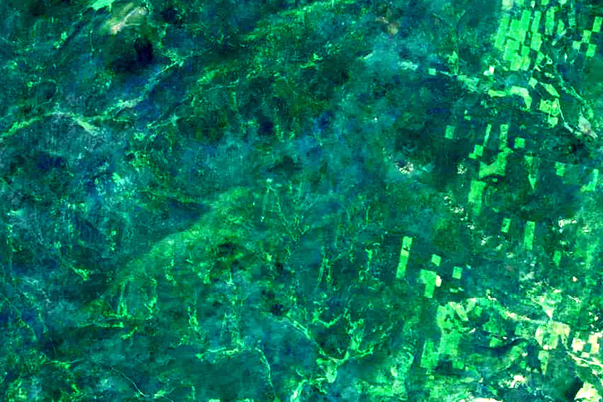
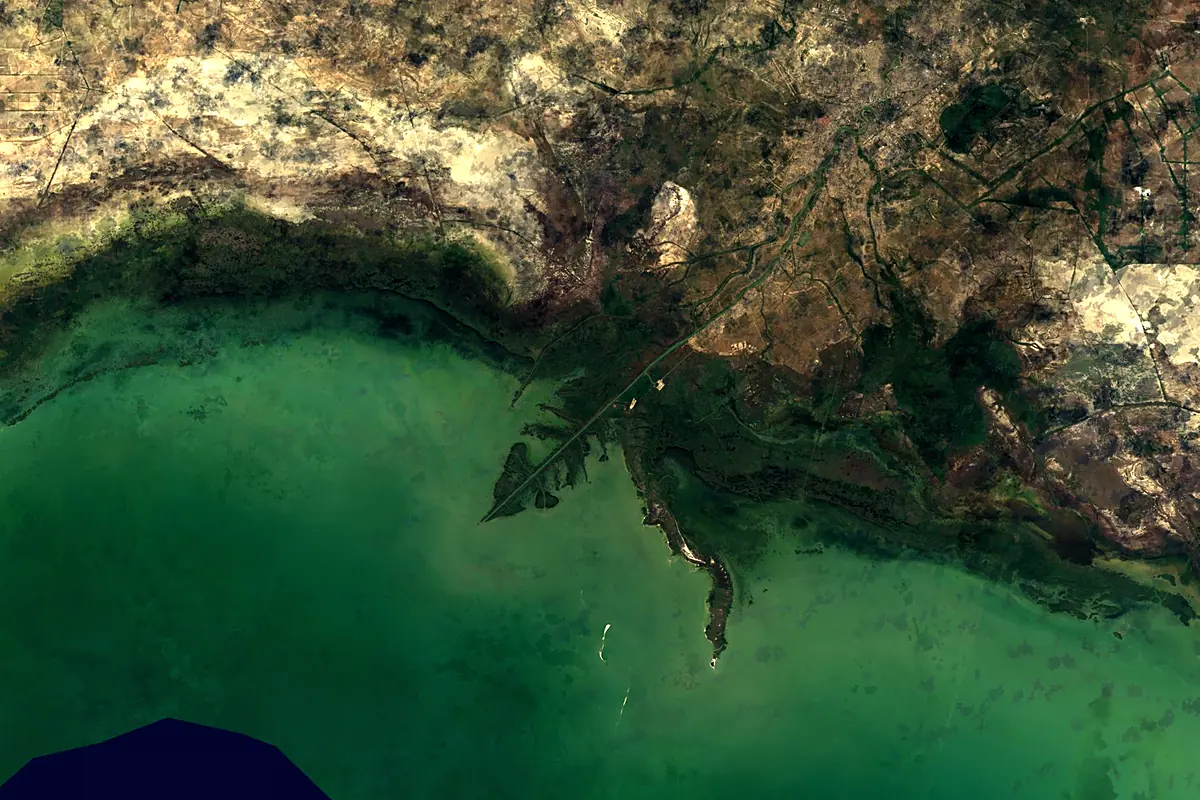
Sentinel-2 cloudless 2016 by EOX IT Services GmbH (contains modified Copernicus Sentinel data 2016), CC BY 4.0. The glowing line is the river as drawn by RiverATLAS.
Photos
Ural River in pictures
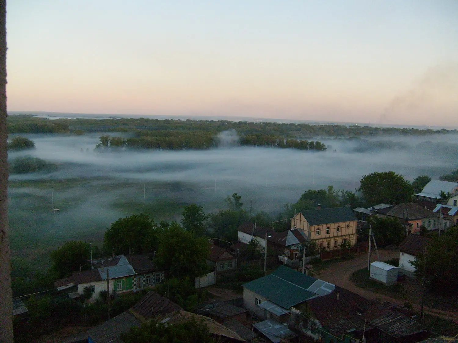
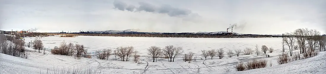
Tributaries
Where it flows, and what flows into it
Tributaries (70)
Also: Ilek, Or River, Utva River, Tanalyk, Bolshoy Kizil, Gumbeyka, Ebita, Bolshoy Kumak, Donguz, Guberlya, Irtek, Birsya, Bol'shaya Karaganka, Bol'shaya Urtazymka, Maly Kizil, Khudolaz, Zingeyka, Tuzlukkol, Kinderlya, Urtaburtya, Baral, Vorovskaya, Alimbet, Kiyaly-Burtya
Nearby
Rivers nearby
Where these numbers come from
| Name, length, places | Wikidata (Q80240) · CC0 |
|---|---|
| Course, profile, basin | RiverATLAS v1.0 (HydroATLAS, Linke et al. 2019) · CC BY 4.0 — followed from the source to the mouth given by Wikidata |
| Flow | WaterGAP (RiverATLAS), 1971–2000 · CC BY 4.0 |
| Climate along the river | WorldClim (RiverATLAS), 1970–2000 · CC BY 4.0 |
| Towns, bridges, dams | Wikidata · CC0; GeoNames · CC BY 4.0 |
| Along the river | © OpenStreetMap contributors · ODbL |
| Images | EOX Sentinel-2 cloudless 2016 · CC BY 4.0; Wikimedia Commons |
| Our other atlases | Lakeyas, Peakyas — Wikidata · CC0; © OpenStreetMap contributors · ODbL; GeoNames · CC BY 4.0; HydroLAKES · CC BY 4.0; NOAA OISST |
Every source and licence is on the data sources page.
The family
Do you prefer beaches, lakes, mountains, waterfalls, islands, rivers or canyons?
Same idea, other landscapes: field atlases built on open data, month by month, in seven languages.
 beaches
 Find your beach: sea temperature, sun and swimming month by month.Visit lakes
 Every lake on Earth: water temperature, ice, depth and the shore.Coming soonVisit mountains
 Every summit in 3D: summit weather, the 0 °C line, huts and trails.Visit
  waterfalls
 Every waterfall: height, flow month by month and when it roars.Coming soonVisit
  islands
 Every island from the sea up: size, sea temperature, ferries and 3D.Coming soonVisit
  rivers
 Every river from source to sea: the journey, the flow and the basin in numbers.You are here
 canyons
 Every canyon cut to scale: depth to the floor, rim and floor temperatures, trails and viewpoints.Coming soonVisit