River
Vistula
1,047 km from source to mouth · Poland.
 PolandFlows into Gdańsk Bay1st longest in Poland
In numbers
Length
1,047km
Average flow
1,100m³/s
Basin
194,500km²
Drop
417m
from 413 m to -4 m
Country
1
The journey
From source to mouth
1,047 km of river and 68 stops on the way: 28 towns and cities on its banks, dams, bridges and the tributaries that feed it.
- 0 kmBarania Góraat 413 m
- 25 kmŻywiec Lake7.5 km²
- 32 kmLake Międzybrodzie2.5 km²
- 36 kmZbiornik Czaniecki0.5 km²
- 47 kmCzechowice-Dziedzice35,261 people
- 49 kmBiałatributary
- 59 kmGostyniatributary
- 62 kmOświęcim36,956 people
- 63 kmPszczynkatributary
- 65 kmBieruń19,100 people
- 66 kmPrzemszatributary
- 72 kmSołatributary
- 87 kmSkawatributary
- 103 kmRudnotributary
- 128 kmKraków804,237 people
- 137 kmPrądnik Rivertributary
- 188 kmRabatributary
- 190 kmSzreniawatributary
- 200 kmNidzicatributary
- 200 kmUszwicatributary
- 209 kmDunajectributary
- 221 kmNidatributary
- 257 kmBreńtributary
- 269 kmCzarna Staszowskatributary
- 274 kmWisłokatributary
- 304 kmTarnobrzeg44,901 people
- 317 kmSandomierz22,189 people
- 323 kmŁęgtributary
- 329 kmSantributary
- 331 kmOpatówkatributary
- 347 kmSannatributary
- 365 kmWyżnicatributary
- 371 kmKrępiankatributary
- 371 kmKamiennatributary
- 387 kmChodelkatributary
- 391 kmIłżankatributary
- 400 kmZwoleńkatributary
- 410 kmBochotnica1,001 people
- 418 kmPuławy45,267 people
- 422 kmKurówkatributary
- 439 kmWieprztributary
- 476 kmRadomkatributary
- 485 kmZagożdżonkatributary
- 494 kmWilgatributary
- 503 kmPilicatributary
- 532 kmOtwock44,524 people
- 532 kmŚwidertributary
- 537 kmJeziorkatributary
- 549 kmPraga-Południe178,447 people
- 549 kmPraga Południe179,836 people
- 550 kmMokotów226,667 people
- 553 kmWarsaw1,862,402 people
- 553 kmŚródmieście102,936 people
- 558 kmTargówek124,279 people
- 561 kmBiałołęka150,999 people
- 563 kmBielany134,557 people
- 564 kmBiałołeka129,106 people
- 589 kmNowy Dwór Mazowiecki28,651 people
- 672 kmPłock114,594 people
- 715 kmWłocławek Reservoir57 km²
- 721 kmWłocławek104,705 people
- 777 kmToruń198,273 people
- 815 kmBydgoszcz324,984 people
- 852 kmChełmno18,837 people
- 858 kmŚwiecie24,796 people
- 876 kmJezioro Wielkie Rudnickie1.4 km²
- 882 kmGrudziądz90,890 people
- 942 kmMalbork37,635 people
- 958 kmTczew57,990 people
- 1,047 kmGdańsk Bayat -4 m
Water level along the river (RiverATLAS; the height is exaggerated). Towns: GeoNames and Wikidata; bridges, dams and tributaries: Wikidata.
River in East-Central Europe
At the mouth it carries 1,080 m³/s on average: an Olympic pool every 2.3 seconds. It drops from 413 m to -4 m, 0.4 m per kilometre on average. Its basin covers 194,500 km², about the size of SN. 23.6 million people live in it. Highest water: June; lowest: from January to February. Its dams hold back little of its water (6.6% of a year's flow).
Where to start
- WarsawLargest city on its banks · 1,862,402 people
- Warsaw Chopin Airport (WAW)Nearest airport with scheduled flights, 8 km from the cityCar hire at WAW airport (Warsaw)Discover Cars · Affiliate link↗
- On the water229 ferry piers, marinas, boat rentals and boat ramps along the river (OpenStreetMap)
- Kayak and canoe8 put-ins and rapids mapped (OpenStreetMap)
- From May to SeptemberThe best months to visit
Vistula, month by month
Highest water: June
Lowest water: from January to February. Best months to visit: from May to September.
From about 720 m³/s in the lowest month to 2,000 m³/s in the highest. An estimate: the monthly flow is modelled from the lowest and highest months of WaterGAP (RiverATLAS, 1971–2000) and the rain and snow along the river (WorldClim). Dams change the real rhythm. The chip is the average air temperature; below it, the month's rain.
Plan the trip
Plan the trip: boat trips, a bed by the river, a car
Some links above are affiliate links: if you book through them we may earn a commission, at no extra cost to you. It never changes what the data on this page says.
The basin
Vistula: the basin in numbers
192,632 km² of land send their water to this river. This is what lives on it.
- 23.6millionpeople live in the basin
- 123/km²people per km²
- 206maverage altitude of the basin
- 603mmof rain a year (basin average)
- 7.3°Caverage air temperature
- 19%protected areas
- 0.8%covered by lakes
- 2.3km³held in reservoirs
What covers the basin
- 26% Forest
- 45% Cropland
- 15% Pasture
- 5% Towns and cities
RiverATLAS (HydroATLAS v1.0, CC BY 4.0): land cover, people, protected areas, glaciers and dams over the whole basin upstream of the mouth.
Along the river
Vistula: what you find on the way
- 175WeirsStopień Dwory, Stopień Wodny Kościuszko, Niagara Ludwinowska and 172 more
- 39LocksDwory, Stopień wodny Smolice, Śluza Borek Szlachecki and 36 more
- 24WaterfallsKaskada and 23 more
- 4Rapids
- 4Canoe put-insPrzystań kajakowa and 3 more
- 97Boat rampsOstrówek, Karczew, Przystań w Wyszogrodzie and 94 more
- 49Ferry piersPrzystań na Zaporze, Most Piłsudskiego, Most Kotlarski and 46 more
- 66MarinasKlub Żeglarski Halny, Yacht Klub Polski Bielsko, Klub Żeglarski LOK „Dryf” and 63 more
- 22River beachesPlaża w Czernichowie, Plaża dla naturystów, Plaża Zwierzyniecka and 19 more
From OpenStreetMap, within 2.6 km of the river. Not mapped is not the same as not there.
Cross-checked with our atlases
Vistula in our other atlases
What our sister atlases know about the waterfalls on this river, the lakes it flows through, the beaches at its mouth, the mountains where it rises and the islands off its mouth.
 5lakes on its wayLakeyas
 58mountains at the sourcePeakyas
 3islands off the mouthIslandyas
Lakes and reservoirs (5)
Lakes it flows through, by Lakeyas
- Żywiec Lakekm 24 · 20 m deep7.5km²
- Lake Międzybrodziekm 312.5km²
- Zbiornik Czanieckikm 340.5km²
- Włocławek Reservoirkm 686 · 6 m deep57km²
- Jezioro Wielkie Rudnickiekm 841 · 12 m deep1.4km²
Lakeyas is coming soonOpen Lakeyas ↗
Mountains at the source (58)
Within 15 km of the source, by Peakyas
- Barania Góra0.8 km away · prominence 170 m1,220m
- Skrzyczne8.9 km away1,257m
- Stożek Wielki13 km away978m
- Klimczok15 km away1,117m
- Magurka Wiślańska2.6 km away1,140m
- Zielony Kopiec4.1 km away1,154m
- Magura15 km away1,109m
- Kiczory12 km away · prominence 253 m990m
50 more on PeakyasOpen Peakyas ↗
Islands off the mouth (3)
Within 30 km of the mouth, by Islandyas
- Port Island16 km away26km²
- Aestian Island29 km away
- Kępa Bazarowa18 km away0.3km²
Islandyas is coming soonOpen Islandyas ↗
From space
The source and the mouth, seen from orbit
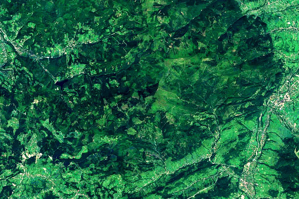
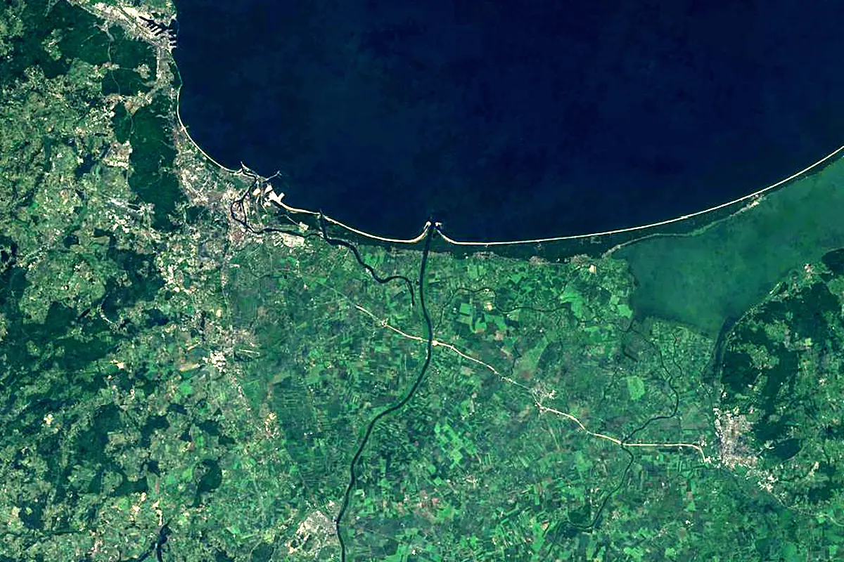
Sentinel-2 cloudless 2016 by EOX IT Services GmbH (contains modified Copernicus Sentinel data 2016), CC BY 4.0. The glowing line is the river as drawn by RiverATLAS.
Photos
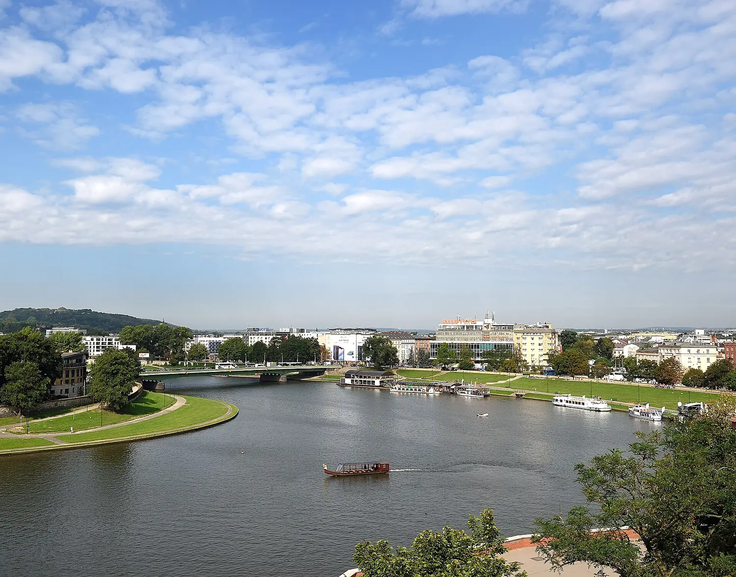
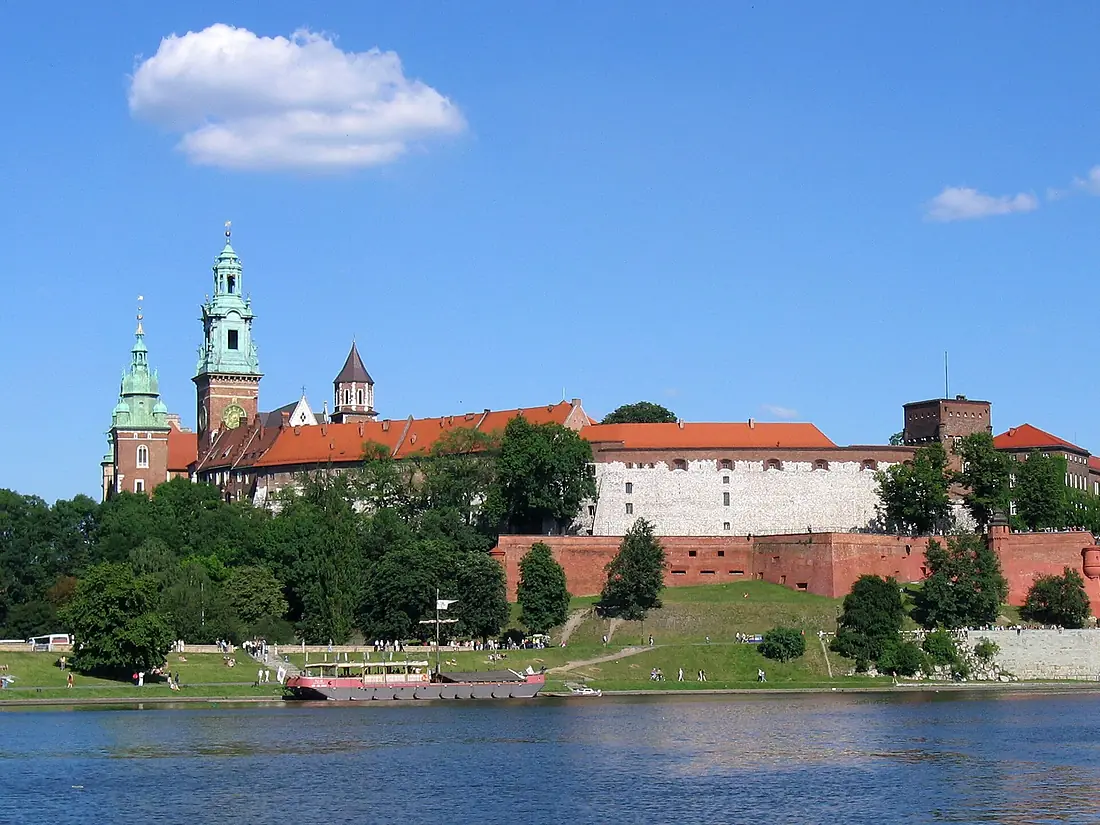
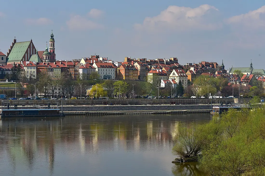
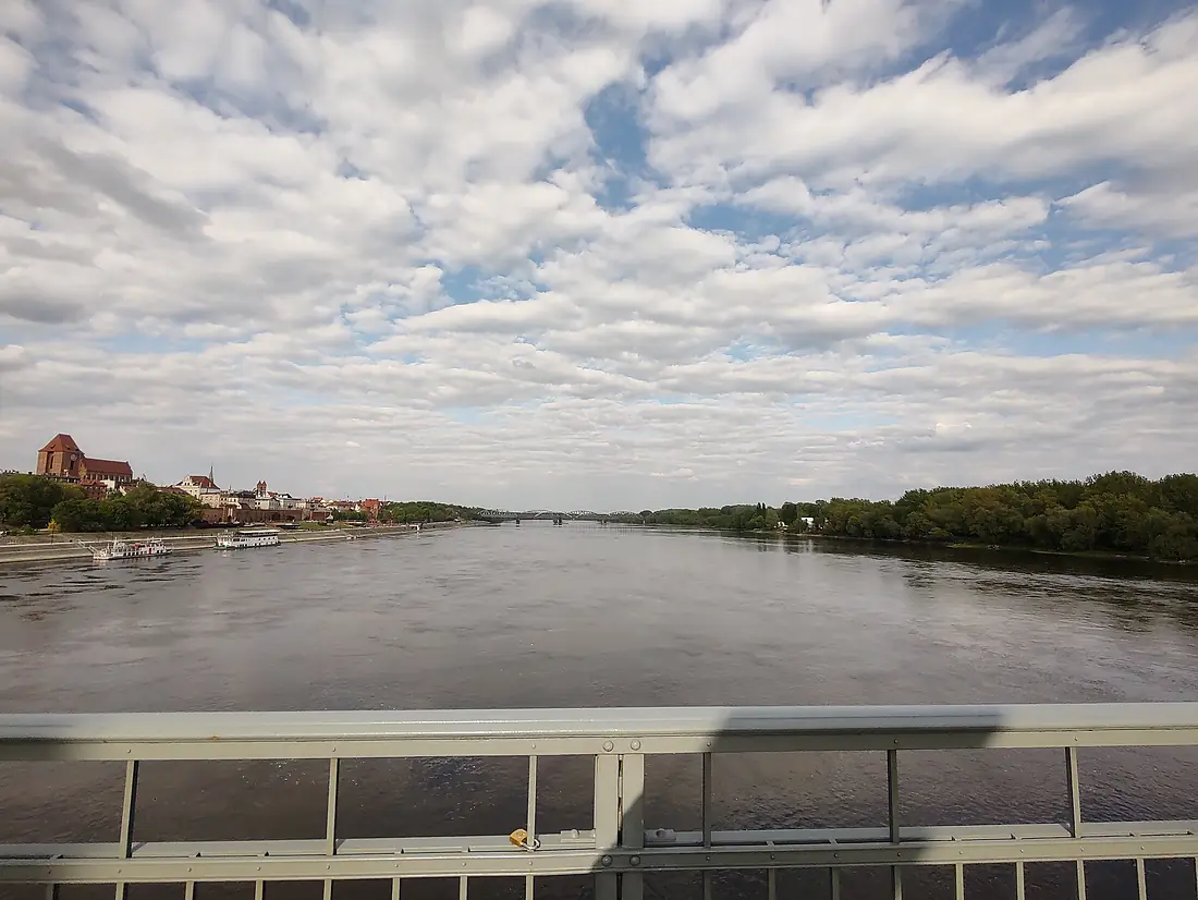
Vistula in pictures
Tributaries
Where it flows, and what flows into it
Tributaries (87)
Poland484 km320 m³/sjoins at km 568SanPoland444 km120 m³/sjoins at km 315WieprzPoland328 km490 m³/sjoins at km 422PilicaPoland319 km49 m³/sjoins at km 482DunajecPoland274 km84 m³/sjoins at km 201BrdaPoland217 km24 m³/sjoins at km 786DrwęcaPoland207 km1,000 m³/sjoins at km 743WdaPoland198 km6.5 m³/sjoins at km 828BzuraPoland166 km26 m³/sjoins at km 604WisłokaPoland164 km26 m³/sjoins at km 263NidaPoland151 km19 m³/sjoins at km 212SołaPoland89 km19 m³/sjoins at km 69Also: Kurówka, Nogat, Raba, Przemsza, Radomka, Biała, Skawa, Wierzyca, Kamienna, Rudawa, Prądnik River, Zgłowiączka, Sanna, Wilga, Świder, Skawinka, Wilga, Pszczynka, Łęg, Gostynia, Skrwa, Czarna Staszowska, Zagożdżonka, Jeziorka
 Belarus
Nearby
Rivers nearby
 Lithuania
Where these numbers come from
| Name, length, places | Wikidata (Q548) · CC0 |
|---|---|
| Course, profile, basin | RiverATLAS v1.0 (HydroATLAS, Linke et al. 2019) · CC BY 4.0 — followed from the source to the mouth given by Wikidata |
| Flow | WaterGAP (RiverATLAS), 1971–2000 · CC BY 4.0 |
| Climate along the river | WorldClim (RiverATLAS), 1970–2000 · CC BY 4.0 |
| Towns, bridges, dams | Wikidata · CC0; GeoNames · CC BY 4.0 |
| Along the river | © OpenStreetMap contributors · ODbL |
| Images | EOX Sentinel-2 cloudless 2016 · CC BY 4.0; Wikimedia Commons |
| Our other atlases | Lakeyas, Peakyas, Islandyas — Wikidata · CC0; © OpenStreetMap contributors · ODbL; GeoNames · CC BY 4.0; HydroLAKES · CC BY 4.0; NOAA OISST |
Every source and licence is on the data sources page.
The family
Do you prefer beaches, lakes, mountains, waterfalls, islands, rivers or canyons?
Same idea, other landscapes: field atlases built on open data, month by month, in seven languages.
 beaches
 Find your beach: sea temperature, sun and swimming month by month.Visit lakes
 Every lake on Earth: water temperature, ice, depth and the shore.Coming soonVisit mountains
 Every summit in 3D: summit weather, the 0 °C line, huts and trails.Visit
  waterfalls
 Every waterfall: height, flow month by month and when it roars.Coming soonVisit islands
 Every island from the sea up: size, sea temperature, ferries and 3D.Coming soonVisit
  rivers
 Every river from source to sea: the journey, the flow and the basin in numbers.You are here
 canyons
 Every canyon cut to scale: depth to the floor, rim and floor temperatures, trails and viewpoints.Coming soonVisit