River
White Nile
2,620 km from source to mouth · 6 countries.
 Sudan, Uganda, Rwanda, Tanzania, South Sudan and DR CongoFlows into Nile1st longest in Sudan
In numbers
Length
2,620km
Average flow
880m³/s
Basin
1,059,000km²
Drop
760m
from 1,133 m to 373 m
Countries
6
The journey
From source to mouth
2,620 km of river and 54 stops on the way: 19 towns and cities on its banks, dams, bridges and the tributaries that feed it.
- 0 kmLake Victoriaat 1,133 m
- 2 kmLake Victoria67,166 km²
- 2 kmJinja93,061 people
- 2 kmRipon Falls
- 3 kmNew Jinja Bridge
- 3 kmOwen Falls
- 4 kmNalubaale Hydroelectric Power Station
- 4 kmNjeru178,800 people
- 11 kmBujagali Falls
- 24 kmBusowa Falls
- 26 kmItanda Falls
- 28 kmKalagala Falls
- 188 kmLake Kwania2,788 km²
- 219 kmKafutributary
- 313 kmNew Karuma Bridge
- 314 kmKaruma Falls
- 386 kmMurchison Falls43 m
- 425 kmWanseko13,616 people
- 467 kmPakwach28,700 people
- 468 kmAlbert Nile Bridge
- 502 kmOra Rivertributary
- 511 kmLake Albert5,527 km²
- 668 kmFula Rapids
- 675 kmAchwatributary
- 819 kmJuba Nile Bridge
- 820 kmJuba450,000 people
- 877 kmLake Jalarei2.5 km²
- 884 kmLake Bayer5.3 km²
- 987 kmBor26,782 people
- 1,009 kmLake Fajarial2.5 km²
- 1,031 kmLake Papiu2.9 km²
- 1,184 kmLake Nuong35 km²
- 1,479 kmLake No47 km²
- 1,480 kmBahr el Ghazal Rivertributary
- 1,492 kmMay‘a Sinyora1.7 km²
- 1,537 kmNyibodo12 km²
- 1,542 kmMay‘a Berboi2.2 km²
- 1,553 kmBahr el Zeraftributary
- 1,603 kmSobat Rivertributary
- 1,622 kmMalakal160,765 people
- 1,757 kmAdar Rivertributary
- 2,116 kmRabak135,281 people
- 2,122 kmKosti345,068 people
- 2,139 kmAl Jazeera Aba21,683 people
- 2,196 kmAl Kawa10,167 people
- 2,207 kmUm Jar Al Gharbiyya9,038 people
- 2,216 kmALdinigila wad dhahi15,000 people
- 2,231 kmAd Douiem87,068 people
- 2,288 kmWad az Zāki9,271 people
- 2,322 kmAl-Quṭaynah26,893 people
- 2,341 kmAl Qiţena18,321 people
- 2,417 kmAl-Dabasin Bridge
- 2,429 kmKhartoum5,345,000 people
- 2,429 kmOmdurman Bridge
- 2,430 kmOmdurman1,849,659 people
- 2,620 kmNileat 373 m
Water level along the river (RiverATLAS; the height is exaggerated). Towns: GeoNames and Wikidata; bridges, dams and tributaries: Wikidata.
River in Africa and tributary of the Nile River
At the mouth it carries 878 m³/s on average: an Olympic pool every 2.8 seconds. It drops from 1,133 m to 373 m, 0.3 m per kilometre on average. Its basin covers 1,059,000 km², about the size of MR. 104 million people live in it. Highest water: from August to October; lowest: from January to April. Its dams hold back little of its water (8.7% of a year's flow).
Where to start
- KhartoumLargest city on its banks · 5,345,000 people
- Khartoum International Airport (KRT)Nearest airport with scheduled flights, 3 km from the city
- On the water33 ferry piers, marinas, boat rentals and boat ramps along the river (OpenStreetMap)
- From November to FebruaryThe best months to visit
White Nile, month by month
Highest water: from August to October
Lowest water: from January to April. Best months to visit: from November to February.
From about 230 m³/s in the lowest month to 3,200 m³/s in the highest. An estimate: the monthly flow is modelled from the lowest and highest months of WaterGAP (RiverATLAS, 1971–2000) and the rain and snow along the river (WorldClim). Dams change the real rhythm. The chip is the average air temperature; below it, the month's rain.
Plan the trip
Plan the trip: boat trips, a bed by the river, a car
Some links above are affiliate links: if you book through them we may earn a commission, at no extra cost to you. It never changes what the data on this page says.
The basin
White Nile: the basin in numbers
1,670,777 km² of land send their water to this river. This is what lives on it.
- 104millionpeople live in the basin
- 64/km²people per km²
- 767maverage altitude of the basin
- 894mmof rain a year (basin average)
- 25.3°Caverage air temperature
- 12%protected areas
- 4.9%covered by lakes
- 3.6km³held in reservoirs
What covers the basin
- 15% Forest
- 15% Cropland
- 46% Pasture
- 2% Towns and cities
RiverATLAS (HydroATLAS v1.0, CC BY 4.0): land cover, people, protected areas, glaciers and dams over the whole basin upstream of the mouth.
Along the river
White Nile: what you find on the way
- 1Weirs
- 7WaterfallsBusowooko Falls, Kalagala Falls, Itanda Falls and 4 more
- 3Boat rampsNile River Explorers
- 25Ferry piersJinja Port, Nile Boat Cruise, Paraa Ferry - Northern Bank and 22 more
- 5MarinasJinja Port, Jinja Sailing Club, Paraa Landing site and 2 more
- 1River beaches
From OpenStreetMap, within 3.1 km of the river. Not mapped is not the same as not there.
Cross-checked with our atlases
White Nile in our other atlases
What our sister atlases know about the waterfalls on this river, the lakes it flows through, the beaches at its mouth, the mountains where it rises and the islands off its mouth.
 9waterfalls on the riverCascadyas
 12lakes on its wayLakeyas
 24mountains at the sourcePeakyas
Waterfalls (9)
On the river, by Cascadyas
- Ripon Fallskm 2
- Owen Fallskm 3
- Bujagali Fallskm 11
- Busowa Fallskm 24
- Itanda Fallskm 26
- Karuma Fallskm 312
- Murchison Fallskm 38343m
- Fula Rapidskm 664
1 more on CascadyasCascadyas is coming soonOpen Cascadyas ↗
Lakes and reservoirs (12)
Lakes it flows through, by Lakeyas
- Lake Victoriakm 2 · 83 m deep67,166km²
- Lake Kwaniakm 1862,788km²
- Lake Albertkm 508 · 58 m deep5,527km²
- Lake Bayerkm 8785.3km²
- Lake Papiukm 1,0242.9km²
- Lake Nuongkm 1,17635km²
- Lake Nokm 1,47047km²
- Nyibodokm 1,52812km²
4 more on LakeyasLakeyas is coming soonOpen Lakeyas ↗
Mountains at the source (24)
Within 15 km of the source, by Peakyas
- Kimaka4.3 km away1,180m
- Buwenda5.8 km away
- Nkungwe15 km away
- Nakyesanja11 km away
- Muganga6.0 km away
- Msoli14 km away
- Kiunga9.1 km away
- Butiki8.9 km away
16 more on PeakyasOpen Peakyas ↗
From space
The source and the mouth, seen from orbit
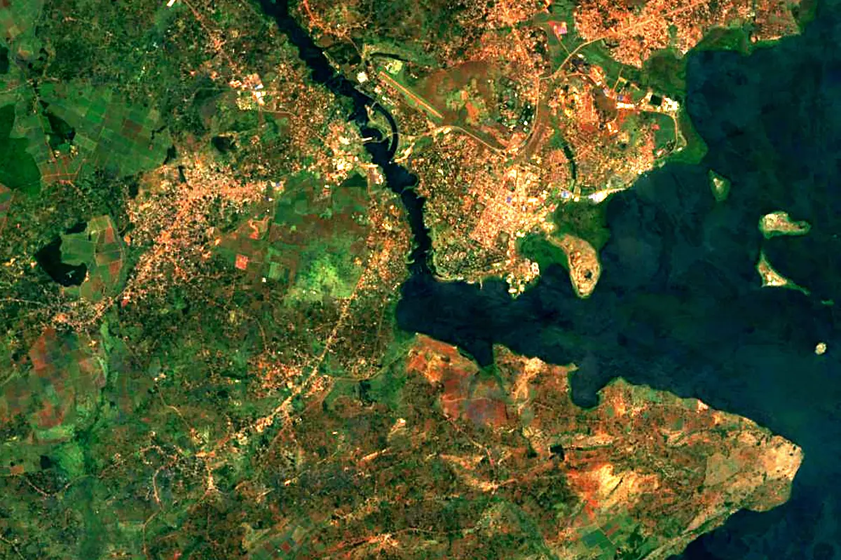
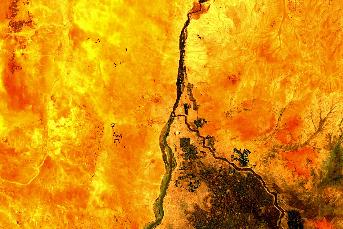
Sentinel-2 cloudless 2016 by EOX IT Services GmbH (contains modified Copernicus Sentinel data 2016), CC BY 4.0. The glowing line is the river as drawn by RiverATLAS.
Photos
White Nile in pictures
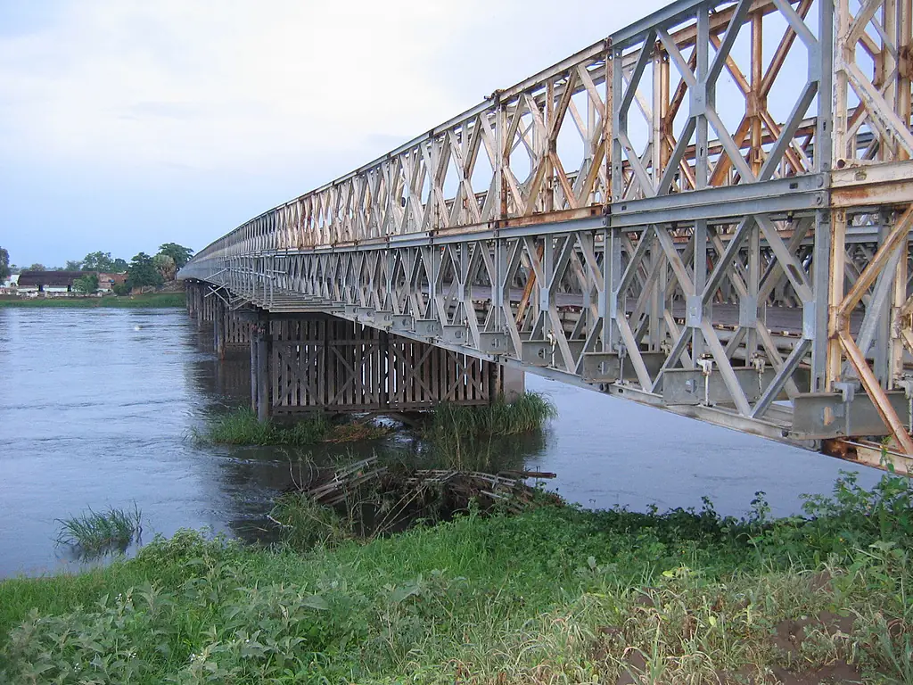
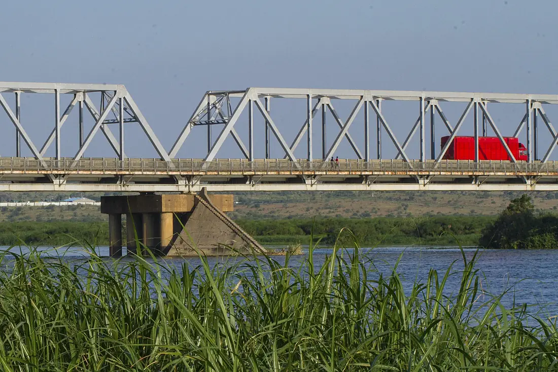
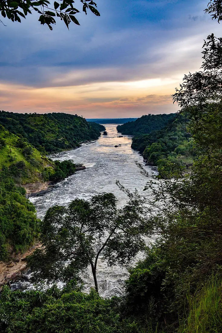
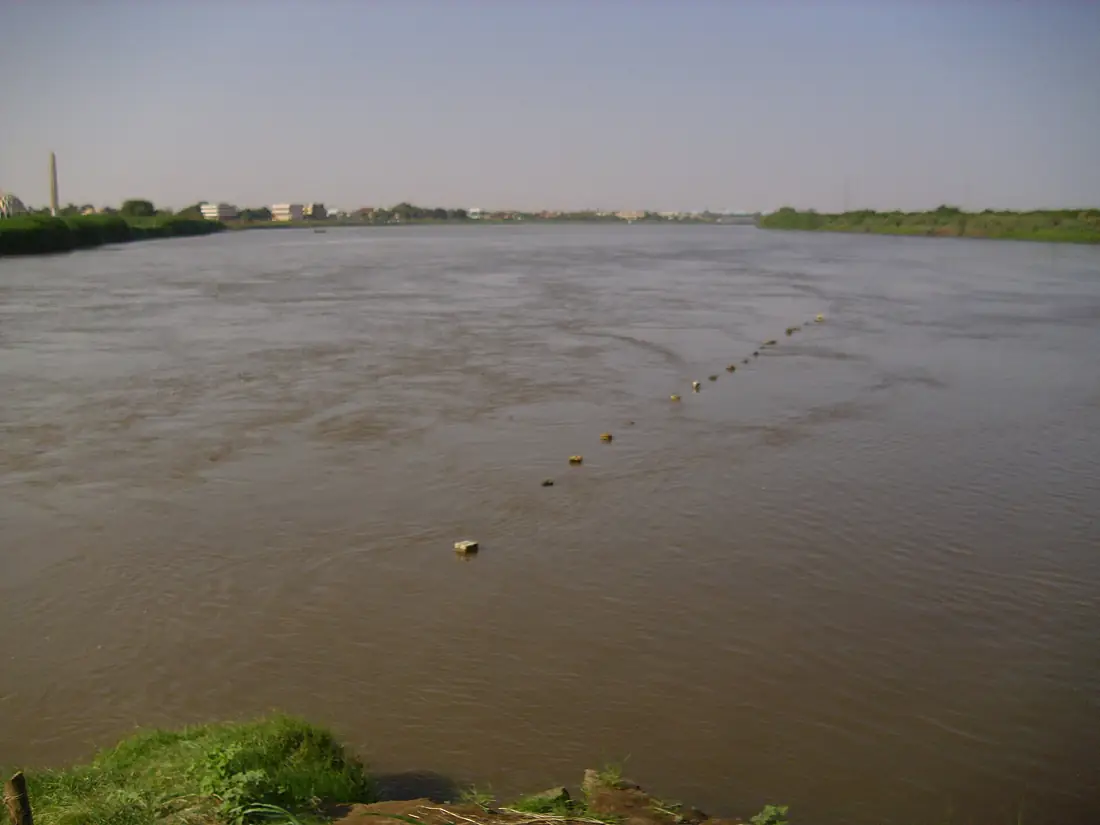
Tributaries
Where it flows, and what flows into it
It flows into
Nile Egypt6,650 km2,800 m³/s
Tributaries (9)
South Sudan716 km2.0 m³/sjoins at km 1,470Sobat RiverSouth Sudan306 km410 m³/sjoins at km 1,593Also: Achwa, Kidepo River, Adar River, Bahr el Zeraf, Kafu, Ora River, Victoria Nile
In the same basin
Sudan1,783 km1,500 m³/sKagera RiverUganda400 km350 m³/sAtbarah RiverSudan1,120 km370 m³/sTekezé RiverSudan608 km140 m³/sMara RiverTanzania395 km18 m³/sValley of the QueensEgypt4,302 km2,600 m³/sBaro River Ethiopia306 km240 m³/sSemliki RiverUganda230 km240 m³/sRurubu RiverTanzania300 km100 m³/sMareb RiverSudan440 km80 m³/s
Where these numbers come from
| Name, length, places | Wikidata (Q4814791) · CC0 |
|---|---|
| Course, profile, basin | RiverATLAS v1.0 (HydroATLAS, Linke et al. 2019) · CC BY 4.0 — followed from the source to the mouth given by Wikidata |
| Flow | WaterGAP (RiverATLAS), 1971–2000 · CC BY 4.0 |
| Climate along the river | WorldClim (RiverATLAS), 1970–2000 · CC BY 4.0 |
| Towns, bridges, dams | Wikidata · CC0; GeoNames · CC BY 4.0 |
| Along the river | © OpenStreetMap contributors · ODbL |
| Images | EOX Sentinel-2 cloudless 2016 · CC BY 4.0; Wikimedia Commons |
| Our other atlases | Cascadyas, Lakeyas, Peakyas — Wikidata · CC0; © OpenStreetMap contributors · ODbL; GeoNames · CC BY 4.0; HydroLAKES · CC BY 4.0; NOAA OISST |
Every source and licence is on the data sources page.
The family
Do you prefer beaches, lakes, mountains, waterfalls, islands, rivers or canyons?
Same idea, other landscapes: field atlases built on open data, month by month, in seven languages.
 beaches
 Find your beach: sea temperature, sun and swimming month by month.Visit lakes
 Every lake on Earth: water temperature, ice, depth and the shore.Coming soonVisit mountains
 Every summit in 3D: summit weather, the 0 °C line, huts and trails.Visit waterfalls
 Every waterfall: height, flow month by month and when it roars.Coming soonVisit
  islands
 Every island from the sea up: size, sea temperature, ferries and 3D.Coming soonVisit
  rivers
 Every river from source to sea: the journey, the flow and the basin in numbers.You are here
 canyons
 Every canyon cut to scale: depth to the floor, rim and floor temperatures, trails and viewpoints.Coming soonVisit