River
Zeya
1,242 km from source to mouth · Russia.
 RussiaFlows into Amur River
In numbers
Length
1,242km
Average flow
1,900m³/s
Basin
233,000km²
Drop
691m
from 807 m to 116 m
Country
1
The journey
From source to mouth
1,242 km of river and 22 stops on the way: 5 towns and cities on its banks, dams, bridges and the tributaries that feed it.
- 0 kmStanovoy Rangeat 807 m
- 162 kmKupuri rivertributary
- 288 kmToktributary
- 294 kmArgitributary
- 485 kmGilyuytributary
- 511 kmZeya Reservoir2,235 km²
- 511 kmZeya Dam
- 517 kmZeya26,999 people
- 575 kmUrkantributary
- 679 kmDeptributary
- 719 kmTygdatributary
- 882 kmSelemdzha Rivertributary
- 899 kmMazanovo719 people
- 905 kmBeloyarovo927 people
- 950 kmBirmatributary
- 979 kmBolshaya Pyora Rivertributary
- 982 kmSvobodnyy61,017 people
- 1,015 kmOzero Bol'shoye (lanaw nga porma ug arko sa Rusya, Amurskaya Oblast', lat 51,15, long 128,13)1.4 km²
- 1,063 kmTom Rivertributary
- 1,107 kmBelayatributary
- 1,152 kmIvanovkatributary
- 1,166 kmRoad bridge over Zeya in Blagoveshchensk
- 1,168 kmBlagoveshchensk225,091 people
- 1,242 kmAmur Riverat 116 m
Water level along the river (RiverATLAS; the height is exaggerated). Towns: GeoNames and Wikidata; bridges, dams and tributaries: Wikidata.
River in Amur Oblast, Russia
At the mouth it carries 1,910 m³/s on average: an Olympic pool every 1.3 seconds. It drops from 807 m to 116 m, 0.6 m per kilometre on average. Its basin covers 233,000 km², about the size of UG. 3.6 million people live in it. Highest water: from August to September; lowest: from January to April. It is heavily dammed: reservoirs can hold 76% of a year's flow.
Where to start
- BlagoveshchenskLargest city on its banks · 225,091 people
- Ignatyevo Airport (BQS)Nearest airport with scheduled flights, 18 km from the city
- On the water14 ferry piers, marinas, boat rentals and boat ramps along the river (OpenStreetMap)
- June and AugustThe best months to visit
Zeya, month by month
Highest water: from August to September
Lowest water: from January to April. Freezing months (average below −4 °C): from November to March. Best months to visit: June and August.
From about 990 m³/s in the lowest month to 6,000 m³/s in the highest. An estimate: the monthly flow is modelled from the lowest and highest months of WaterGAP (RiverATLAS, 1971–2000) and the rain and snow along the river (WorldClim). Dams change the real rhythm. The chip is the average air temperature; below it, the month's rain.
Plan the trip
Plan the trip: boat trips, a bed by the river, a car
Some links above are affiliate links: if you book through them we may earn a commission, at no extra cost to you. It never changes what the data on this page says.
The basin
Zeya: the basin in numbers
848,503 km² of land send their water to this river. This is what lives on it.
- 3.6millionpeople live in the basin
- 4/km²people per km²
- 750maverage altitude of the basin
- 449mmof rain a year (basin average)
- -3.6°Caverage air temperature
- 10%protected areas
- 0.7%covered by lakes
- 31%permafrost
- 68km³held in reservoirs
What covers the basin
- 52% Forest
- 5% Cropland
- 24% Pasture
RiverATLAS (HydroATLAS v1.0, CC BY 4.0): land cover, people, protected areas, glaciers and dams over the whole basin upstream of the mouth.
Along the river
Zeya: what you find on the way
- 3Boat ramps
- 7Ferry piersRiver Terminal, Blagoveschensk Port and 5 more
- 4Marinas
- 2River beaches
From OpenStreetMap, within 3.0 km of the river. Not mapped is not the same as not there.
Cross-checked with our atlases
Zeya in our other atlases
What our sister atlases know about the waterfalls on this river, the lakes it flows through, the beaches at its mouth, the mountains where it rises and the islands off its mouth.
 2lakes on its wayLakeyas
 3mountains at the sourcePeakyas
Lakes and reservoirs (2)
Lakes it flows through, by Lakeyas
- Zeya Reservoirkm 4752,235km²
- Ozero Bol'shoye (lanaw nga porma ug arko sa Rusya, Amurskaya Oblast', lat 51,15, long 128,13)km 9441.4km²
Lakeyas is coming soonOpen Lakeyas ↗
Mountains at the source (3)
Within 15 km of the source, by Peakyas
- Gora Bezymyannaya12 km away
- Gora Sygynnyakh5.3 km away
- Gora Kyutyur8.9 km away
From space
The source and the mouth, seen from orbit
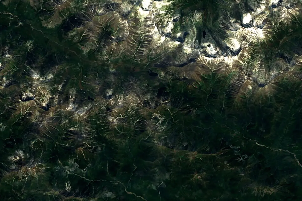
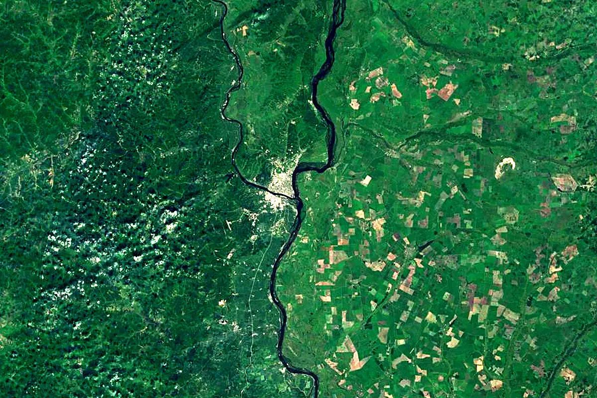
Sentinel-2 cloudless 2016 by EOX IT Services GmbH (contains modified Copernicus Sentinel data 2016), CC BY 4.0. The glowing line is the river as drawn by RiverATLAS.
Tributaries
Where it flows, and what flows into it
It flows into
Amur RiverRussia2,824 km12,800 m³/sTributaries (19)
Also: Selemdzha River, Gilyuy, Tom River, Dep, Bryanta, Argi, Bolshaya Pyora River, Urkan, Urkan, Kupuri river, Tok, Ivanovka, Tygda, Belaya, Birma, Temna, Burkhanovka, Chigiri, Tu
In the same basin
 China
ChinaWhere these numbers come from
| Name, length, places | Wikidata (Q210220) · CC0 |
|---|---|
| Course, profile, basin | RiverATLAS v1.0 (HydroATLAS, Linke et al. 2019) · CC BY 4.0 — followed from the source to the mouth given by Wikidata |
| Flow | WaterGAP (RiverATLAS), 1971–2000 · CC BY 4.0 |
| Climate along the river | WorldClim (RiverATLAS), 1970–2000 · CC BY 4.0 |
| Towns, bridges, dams | Wikidata · CC0; GeoNames · CC BY 4.0 |
| Along the river | © OpenStreetMap contributors · ODbL |
| Images | EOX Sentinel-2 cloudless 2016 · CC BY 4.0; Wikimedia Commons |
| Our other atlases | Lakeyas, Peakyas — Wikidata · CC0; © OpenStreetMap contributors · ODbL; GeoNames · CC BY 4.0; HydroLAKES · CC BY 4.0; NOAA OISST |
Every source and licence is on the data sources page.
The family
Do you prefer beaches, lakes, mountains, waterfalls, islands, rivers or canyons?
Same idea, other landscapes: field atlases built on open data, month by month, in seven languages.
 beaches
 Find your beach: sea temperature, sun and swimming month by month.Visit lakes
 Every lake on Earth: water temperature, ice, depth and the shore.Coming soonVisit mountains
 Every summit in 3D: summit weather, the 0 °C line, huts and trails.Visit
  waterfalls
 Every waterfall: height, flow month by month and when it roars.Coming soonVisit
  islands
 Every island from the sea up: size, sea temperature, ferries and 3D.Coming soonVisit
  rivers
 Every river from source to sea: the journey, the flow and the basin in numbers.You are here
 canyons
 Every canyon cut to scale: depth to the floor, rim and floor temperatures, trails and viewpoints.Coming soonVisit