River
Piave
220 km from source to mouth · Italy.
 ItalyFlows into Adriatic Sea9th longest in Italy
In numbers
Length
220km
Average flow
140m³/s
Basin
4,127km²
Drop
974m
from 970 m to -4 m
Country
1
The journey
From source to mouth
220 km of river and 31 stops on the way: 26 towns and cities on its banks, dams, bridges and the tributaries that feed it.
- 0 kmPeralbaat 970 m
- 32 kmLago di Centro Cadore0.6 km²
- 33 kmPieve di Cadore3,342 people
- 35 kmCadore Viaduct
- 37 kmBoitetributary
- 65 kmPonte nelle Alpi-Polpet5,089 people
- 68 kmPonte nelle Alpi7,913 people
- 77 kmBelluno25,064 people
- 81 kmLimana3,128 people
- 90 kmSedico5,478 people
- 93 kmCordevoletributary
- 96 kmSanta Giustina4,587 people
- 120 kmSetteville5,820 people
- 125 kmValdobbiadene6,307 people
- 133 kmVidor3,509 people
- 135 kmCrocetta del Montello5,709 people
- 145 kmSernaglia della Battaglia3,869 people
- 154 kmNervesa della Battaglia4,349 people
- 158 kmPriula-Colfosco6,743 people
- 167 kmMaserada sul Piave9,145 people
- 178 kmSan Biagio di Callalta12,652 people
- 182 kmPonte di Piave8,307 people
- 184 kmSalgareda6,545 people
- 187 kmZenson di Piave1,744 people
- 192 kmNoventa di Piave6,978 people
- 193 kmFossalta di Piave4,137 people
- 198 kmSan Donà di Piave41,535 people
- 199 kmPonte della Vittoria
- 200 kmMusile di Piave11,372 people
- 207 kmHeraclea90,000 people
- 210 kmJesolo26,558 people
- 211 kmEraclea11,970 people
- 220 kmAdriatic Seaat -4 m
Water level along the river (RiverATLAS; the height is exaggerated). Towns: GeoNames and Wikidata; bridges, dams and tributaries: Wikidata.
River in Italy
At the mouth it carries 135 m³/s on average: an Olympic pool every 19 seconds. It drops from 970 m to -4 m, 4.4 m per kilometre on average. Its basin covers 4,127 km², about the size of CV. 428,000 people live in it. Highest water: November. Its dams hold back little of its water (3.8% of a year's flow).
Where to start
- HeracleaLargest city on its banks · 90,000 people
- Venice Marco Polo Airport (VCE)Nearest airport with scheduled flights, 28 km from the cityCar hire at VCE airport (Venezia)Discover Cars · Affiliate link↗
- On the water9 ferry piers, marinas, boat rentals and boat ramps along the river (OpenStreetMap)
- From May to SeptemberThe best months to visit
Piave, month by month
Highest water: November
Best months to visit: from May to September.
From about 39 m³/s in the lowest month to 200 m³/s in the highest. An estimate: the monthly flow is modelled from the lowest and highest months of WaterGAP (RiverATLAS, 1971–2000) and the rain and snow along the river (WorldClim). Dams change the real rhythm. The chip is the average air temperature; below it, the month's rain.
Plan the trip
Plan the trip: boat trips, a bed by the river, a car
Some links above are affiliate links: if you book through them we may earn a commission, at no extra cost to you. It never changes what the data on this page says.
The basin
Piave: the basin in numbers
4,420 km² of land send their water to this river. This is what lives on it.
- 428,000people live in the basin
- 97/km²people per km²
- 1,108maverage altitude of the basin
- 981mmof rain a year (basin average)
- 6.9°Caverage air temperature
- 11%protected areas
- 0.2%covered by lakes
- 2%permafrost
- 0.1km³held in reservoirs
What covers the basin
- 57% Forest
- 50% Cropland
- 3% Pasture
- 7% Towns and cities
RiverATLAS (HydroATLAS v1.0, CC BY 4.0): land cover, people, protected areas, glaciers and dams over the whole basin upstream of the mouth.
Along the river
Piave: what you find on the way
- 45Weirs
- 4LocksLa Roggia and 3 more
- 18WaterfallsPidandol de le Móre, Pisandol de Vara and 16 more
- 6Boat ramps
- 2MarinasApprodo Piave Vecchia, Marina di Cortellazzo
- 1River beachesSpiaggia del Mort
From OpenStreetMap, within 1.6 km of the river. Not mapped is not the same as not there.
Cross-checked with our atlases
Piave in our other atlases
What our sister atlases know about the waterfalls on this river, the lakes it flows through, the beaches at its mouth, the mountains where it rises and the islands off its mouth.
 1lake on its wayLakeyas
 11beaches at the mouth and on the banksCoastya
 75mountains at the sourcePeakyas
 19islands off the mouthIslandyas
Lakes and reservoirs (1)
Lakes it flows through, by Lakeyas
- Lago di Centro Cadorekm 29 · 106 m deep0.6km²
Lakeyas is coming soonOpen Lakeyas ↗
Beaches (11)
At the mouth (25 km) and on the banks, by Coastya
- Spiaggia Libera5.8 km away25.8°C
- Spiaggia del Faro12 km away25.8°C
- Spiaggia di Cavallino16 km away25.8°C
- Spiaggia di Bibione Pineda24 km away25.6°C
- Litorale del Cavallino20 km away25.8°C
- Spiaggia di Caorle14 km away25.6°C
- Spiaggia di Levante15 km away25.6°C
- Spiaggia di Porto Santa Margherita12 km away25.6°C
3 more on CoastyaOpen Coastya ↗
Mountains at the source (75)
Within 15 km of the source, by Peakyas
- Coglians12 km away · prominence 1,144 m2,780m
- Peralba1.3 km away · prominence 725 m2,694m
- Kellerspitzen14 km away2,774m
- Monte Terza Grande13 km away · prominence 1,277 m2,586m
- Kollinkofel14 km away2,689m
- Creta Forata9.4 km away · prominence 857 m2,462m
- Monte Chiadenis1.1 km away2,459m
- Porze12 km away2,600m
67 more on PeakyasOpen Peakyas ↗
Islands off the mouth (19)
Within 30 km of the mouth, by Islandyas
- Burano25 km away0.2km²
- Torcello24 km away0.4km²
- Sant'Erasmo26 km away3.3km²
- La Certosa30 km away0.2km²
- Vignole29 km away0.1km²
- San Francesco del Deserto25 km away0.0km²
- Lazzaretto Nuovo28 km away0.1km²
- San Giacomo in Paludo28 km away0.0km²
11 more on IslandyasIslandyas is coming soonOpen Islandyas ↗
From space
The source and the mouth, seen from orbit
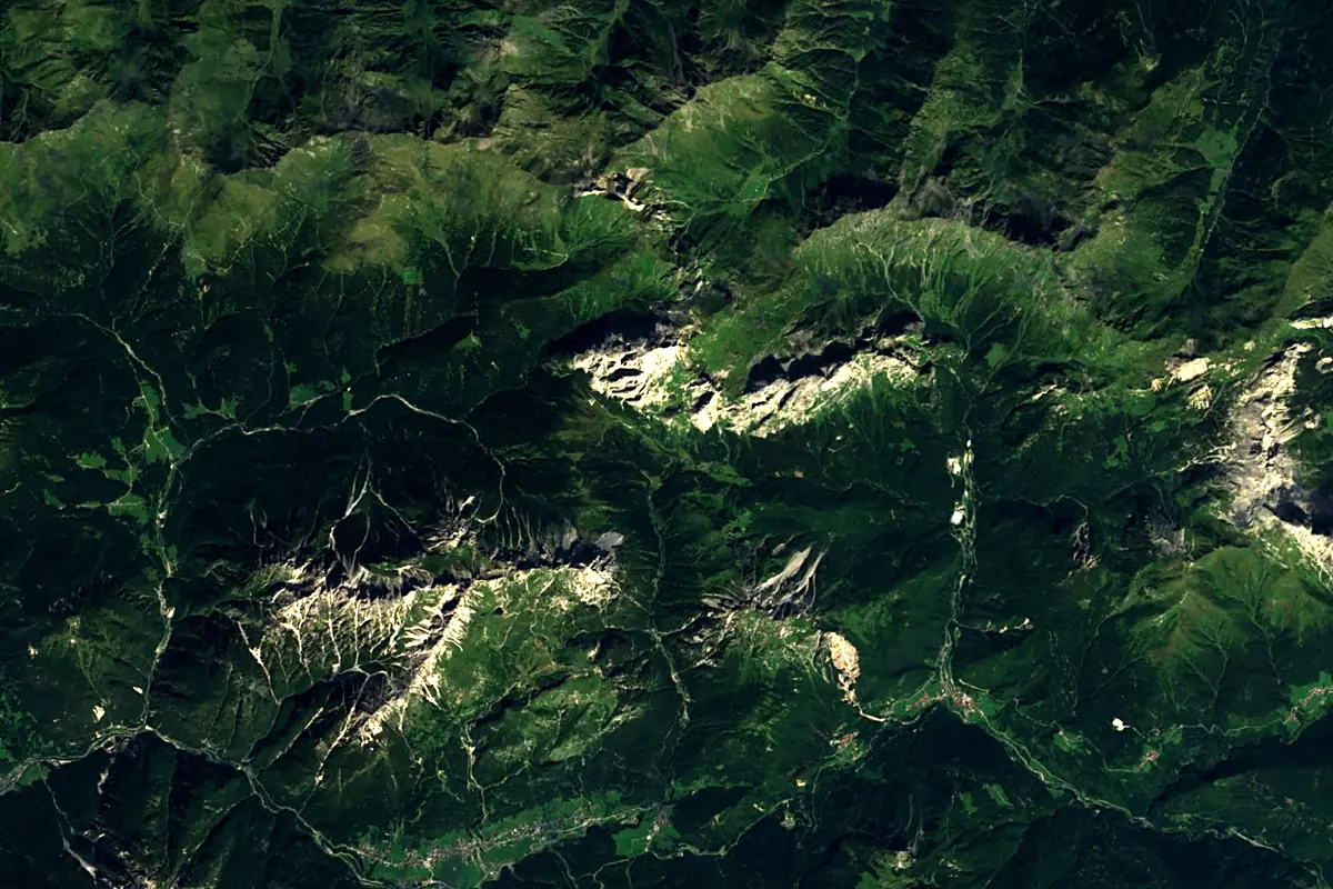
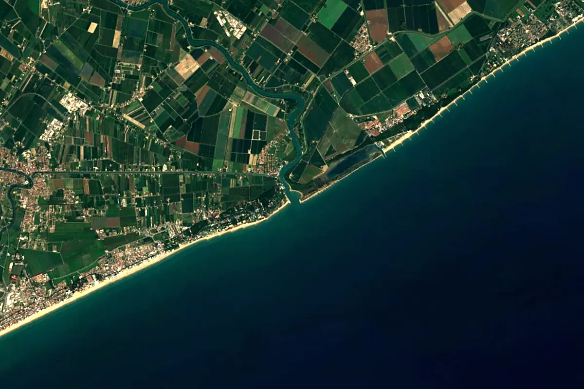
Sentinel-2 cloudless 2016 by EOX IT Services GmbH (contains modified Copernicus Sentinel data 2016), CC BY 4.0. The glowing line is the river as drawn by RiverATLAS.
Photos
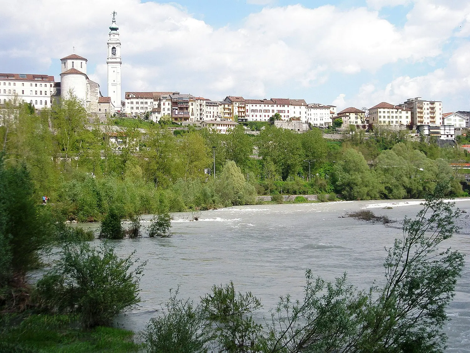
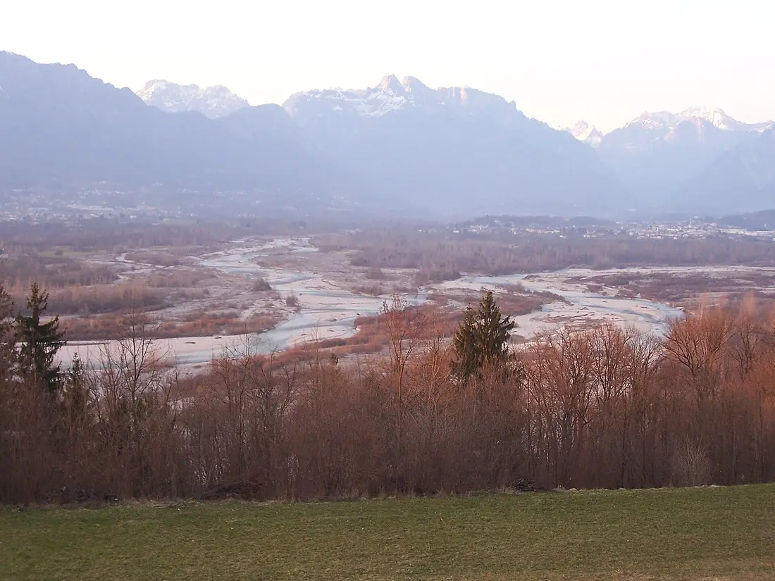
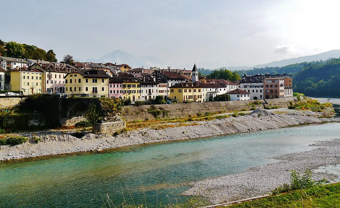
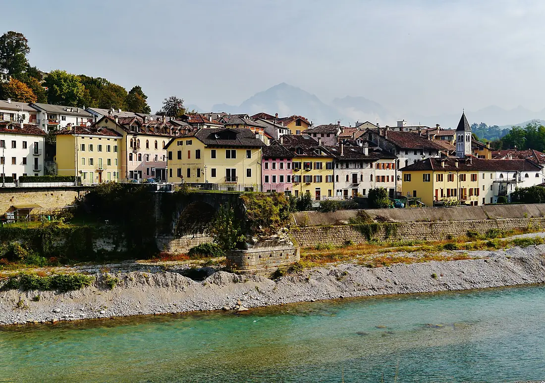
Piave in pictures
Tributaries
Where it flows, and what flows into it
Tributaries (12)
Also: Cordevole, Boite, Vajont, Padola, Maè, Ansiei, Ardo, Caorame river, Soligo, Tegorzo, Cicogna, Ardo
 Slovenia
Where these numbers come from
| Name, length, places | Wikidata (Q213462) · CC0 |
|---|---|
| Course, profile, basin | RiverATLAS v1.0 (HydroATLAS, Linke et al. 2019) · CC BY 4.0 — followed from the source to the mouth given by Wikidata |
| Flow | WaterGAP (RiverATLAS), 1971–2000 · CC BY 4.0 |
| Climate along the river | WorldClim (RiverATLAS), 1970–2000 · CC BY 4.0 |
| Towns, bridges, dams | Wikidata · CC0; GeoNames · CC BY 4.0 |
| Along the river | © OpenStreetMap contributors · ODbL |
| Images | EOX Sentinel-2 cloudless 2016 · CC BY 4.0; Wikimedia Commons |
| Our other atlases | Lakeyas, Coastya, Peakyas, Islandyas — Wikidata · CC0; © OpenStreetMap contributors · ODbL; GeoNames · CC BY 4.0; HydroLAKES · CC BY 4.0; NOAA OISST |
Every source and licence is on the data sources page.
The family
Do you prefer beaches, lakes, mountains, waterfalls, islands, rivers or canyons?
Same idea, other landscapes: field atlases built on open data, month by month, in seven languages.
beaches Find your beach: sea temperature, sun and swimming month by month.Visit lakes
 Every lake on Earth: water temperature, ice, depth and the shore.Coming soonVisit mountains
 Every summit in 3D: summit weather, the 0 °C line, huts and trails.Visit
  waterfalls
 Every waterfall: height, flow month by month and when it roars.Coming soonVisit islands
 Every island from the sea up: size, sea temperature, ferries and 3D.Coming soonVisit
  rivers
 Every river from source to sea: the journey, the flow and the basin in numbers.You are here
 canyons
 Every canyon cut to scale: depth to the floor, rim and floor temperatures, trails and viewpoints.Coming soonVisit