River
Ain
190 km from source to mouth · France.
 FranceFlows into Rhône
In numbers
Length
190km
Average flow
120m³/s
Basin
3,630km²
Drop
528m
from 717 m to 189 m
Country
1
The journey
From source to mouth
190 km of river and 68 stops on the way: 59 towns and cities on its banks, dams, bridges and the tributaries that feed it.
- 0 kmLa Favièreat 717 m
- 0 kmNozeroy393 people
- 1 kmDoye110 people
- 6 kmSirod543 people
- 9 kmBourg-de-Sirod88 people
- 12 kmSyam184 people
- 16 kmCize797 people
- 17 kmChampagnole8,036 people
- 21 kmNey599 people
- 28 kmCrotenay610 people
- 32 kmMonnet-la-Ville332 people
- 33 kmPont-du-Navoy275 people
- 34 kmMontigny-sur-l'Ain217 people
- 37 kmMarigny215 people
- 38 kmLac de Chalain2.1 km²
- 43 kmDoucier285 people
- 45 kmChâtillon122 people
- 49 kmBlye143 people
- 50 kmCharézier166 people
- 52 kmMesnois162 people
- 53 kmBoissia119 people
- 54 kmPont-de-Poitte624 people
- 54 kmPatornay154 people
- 55 kmSaut de la Saisse
- 58 kmBarésia-sur-l'Ain163 people
- 60 kmLargillay-Marsonnay128 people
- 65 kmCoyron68 people
- 66 kmLa Tour-du-Meix261 people
- 67 kmOrgelet1,554 people
- 71 kmMaisod326 people
- 77 kmMoirans-en-Montagne2,107 people
- 85 kmLect319 people
- 85 kmLac de Vouglans14 km²
- 86 kmCernon235 people
- 92 kmVescles181 people
- 93 kmChancia211 people
- 94 kmDortan2,074 people
- 94 kmBiennetributary
- 95 kmCondes117 people
- 100 kmLac de Coiselet3.0 km²
- 106 kmSamognat630 people
- 107 kmcascade de Charmine sur l'Oignin et descente de Matafelon
- 107 kmMatafelon-Granges623 people
- 110 kmValousetributary
- 114 kmCorveissiat601 people
- 121 kmBolozon103 people
- 126 kmSerrières-sur-Ain135 people
- 128 kmHautecourt-Romanèche748 people
- 137 kmPoncin1,803 people
- 140 kmNeuville-sur-Ain1,794 people
- 143 kmJujurieux2,260 people
- 143 kmSaint-Jean-le-Vieux1,839 people
- 147 kmPont-d'Ain2,843 people
- 148 kmSurantributary
- 149 kmVarambon675 people
- 151 kmAmbronay2,841 people
- 155 kmPriay1,842 people
- 158 kmVillette-sur-Ain780 people
- 159 kmChâtillon-la-Palud1,698 people
- 159 kmAlbarinetributary
- 160 kmSaint-Maurice-de-Rémens756 people
- 167 kmVillieu-Loyes-Mollon3,849 people
- 171 kmChazey-sur-Ain1,632 people
- 176 kmCharnoz-sur-Ain951 people
- 179 kmBlyes1,401 people
- 180 kmSaint-Vulbas1,247 people
- 181 kmSaint-Jean-de-Niost1,866 people
- 185 kmSaint-Maurice-de-Gourdans2,903 people
- 189 kmLoyettes3,554 people
- 190 kmRhôneat 189 m
Water level along the river (RiverATLAS; the height is exaggerated). Towns: GeoNames and Wikidata; bridges, dams and tributaries: Wikidata.
River in eastern France
At the mouth it carries 123 m³/s on average: an Olympic pool every 20 seconds. It drops from 717 m to 189 m, 2.8 m per kilometre on average. Its basin covers 3,630 km², about the size of CV. 218,000 people live in it. Highest water: from November to February. Dams and reservoirs hold back a large share of its water (18% of a year's flow).
Where to start
- ChampagnoleLargest city on its banks · 8,036 people
- Dole Tavaux Airport (DLE)Nearest airport with scheduled flights, 49 km from the cityCar hire at GVA airport (Geneva)Discover Cars · Affiliate link↗
- On the water35 ferry piers, marinas, boat rentals and boat ramps along the river (OpenStreetMap)
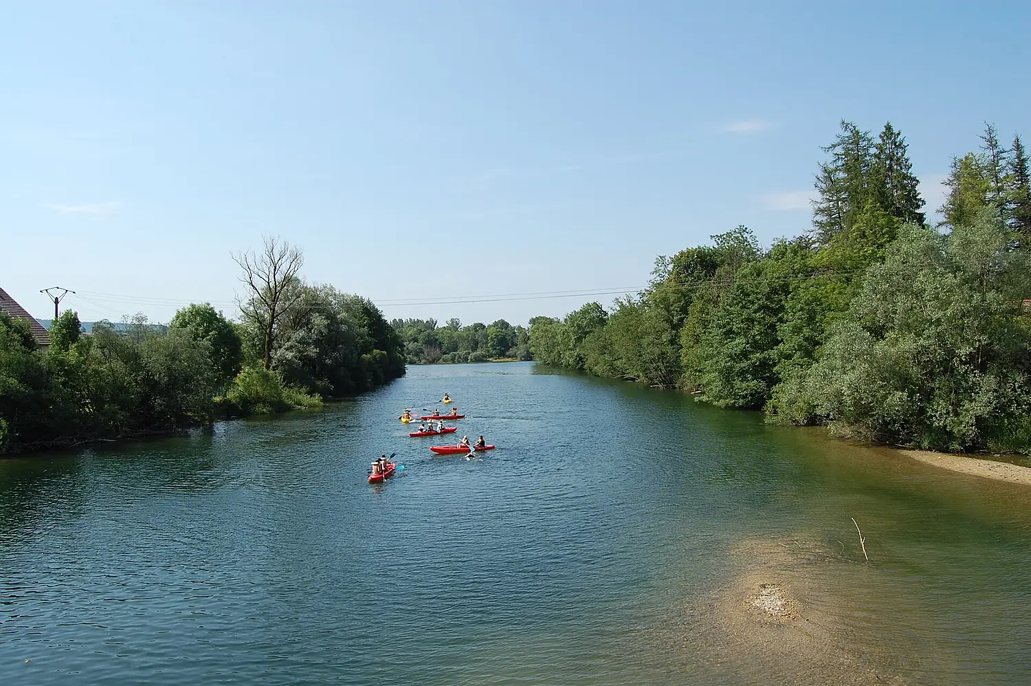
- Kayak and canoe2 put-ins and rapids mapped (OpenStreetMap)
- From May to SeptemberThe best months to visit
Ain, month by month
Highest water: from November to February
Best months to visit: from May to September.
From about 41 m³/s in the lowest month to 170 m³/s in the highest. An estimate: the monthly flow is modelled from the lowest and highest months of WaterGAP (RiverATLAS, 1971–2000) and the rain and snow along the river (WorldClim). Dams change the real rhythm. The chip is the average air temperature; below it, the month's rain.
Plan the trip
Plan the trip: boat trips, a bed by the river, a car
Some links above are affiliate links: if you book through them we may earn a commission, at no extra cost to you. It never changes what the data on this page says.
The basin
Ain: the basin in numbers
3,605 km² of land send their water to this river. This is what lives on it.
- 218,000people live in the basin
- 61/km²people per km²
- 652maverage altitude of the basin
- 1,090mmof rain a year (basin average)
- 8.8°Caverage air temperature
- 28%protected areas
- 0.8%covered by lakes
- 0.7km³held in reservoirs
What covers the basin
- 76% Forest
- 6% Cropland
- 18% Pasture
- 3% Towns and cities
RiverATLAS (HydroATLAS v1.0, CC BY 4.0): land cover, people, protected areas, glaciers and dams over the whole basin upstream of the mouth.
Along the river
Ain: what you find on the way
- 20WeirsSaut des Maillys, Seuil de Neuville and 18 more
- 18WaterfallsMoulin du Saut, Cascade du Moulin du Saut, Cascade du Saut des Maillys and 15 more
- 2Canoe put-insL'Ain
- 27Boat ramps
- 3MarinasPort de la Saisse, Le Port du Meix, Port de la Mercantine
- 10River beachesLa Pergola, Plage de Surchauffant, Plage de Maisod and 7 more
From OpenStreetMap, within 1.5 km of the river. Not mapped is not the same as not there.
Cross-checked with our atlases
Ain in our other atlases
What our sister atlases know about the waterfalls on this river, the lakes it flows through, the beaches at its mouth, the mountains where it rises and the islands off its mouth.
 2waterfalls on the riverCascadyas
 3lakes on its wayLakeyas
 5mountains at the sourcePeakyas
Waterfalls (2)
On the river, by Cascadyas
- Saut de la Saissekm 48
- cascade de Charmine sur l'Oignin et descente de Matafelonkm 94
Cascadyas is coming soonOpen Cascadyas ↗
Lakes and reservoirs (3)
Lakes it flows through, by Lakeyas
- Lac de Chalainkm 33 · 30 m deep2.1km²
- Lac de Vouglanskm 75 · 100 m deep14km²
- Lac de Coiseletkm 893.0km²
Lakeyas is coming soonOpen Lakeyas ↗
Mountains at the source (5)
Within 15 km of the source, by Peakyas
- Le Mont Noir14 km away1,234m
- Mont Rivel7.5 km away812m
- Mont de Saint-Sorlin9.2 km away
- Montagne de Fresse5.7 km away
- Turchet11 km away
From space
The source and the mouth, seen from orbit
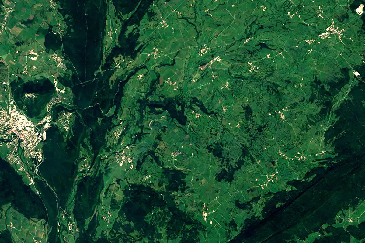
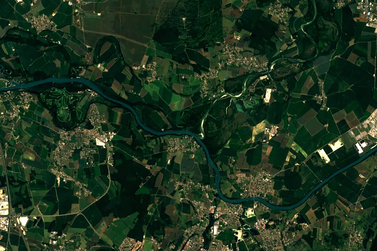
Sentinel-2 cloudless 2016 by EOX IT Services GmbH (contains modified Copernicus Sentinel data 2016), CC BY 4.0. The glowing line is the river as drawn by RiverATLAS.
Photos
Ain in pictures
Tributaries
Where it flows, and what flows into it
It flows into
RhôneFrance812 km1,800 m³/sTributaries (14)
Also: Albarine, Suran, Bienne, Saine, Hérisson, Valouse, Cimante, Toison, Oignin, Angillon, Drouvenant, Serpentine, Gardon, Veyron
 Switzerland
Nearby
Rivers nearby
Where these numbers come from
| Name, length, places | Wikidata (Q405836) · CC0 |
|---|---|
| Course, profile, basin | RiverATLAS v1.0 (HydroATLAS, Linke et al. 2019) · CC BY 4.0 — followed from the source to the mouth given by Wikidata |
| Flow | WaterGAP (RiverATLAS), 1971–2000 · CC BY 4.0 |
| Climate along the river | WorldClim (RiverATLAS), 1970–2000 · CC BY 4.0 |
| Towns, bridges, dams | Wikidata · CC0; GeoNames · CC BY 4.0 |
| Along the river | © OpenStreetMap contributors · ODbL |
| Images | EOX Sentinel-2 cloudless 2016 · CC BY 4.0; Wikimedia Commons |
| Our other atlases | Cascadyas, Lakeyas, Peakyas — Wikidata · CC0; © OpenStreetMap contributors · ODbL; GeoNames · CC BY 4.0; HydroLAKES · CC BY 4.0; NOAA OISST |
Every source and licence is on the data sources page.
The family
Do you prefer beaches, lakes, mountains, waterfalls, islands, rivers or canyons?
Same idea, other landscapes: field atlases built on open data, month by month, in seven languages.
 beaches
 Find your beach: sea temperature, sun and swimming month by month.Visit lakes
 Every lake on Earth: water temperature, ice, depth and the shore.Coming soonVisit mountains
 Every summit in 3D: summit weather, the 0 °C line, huts and trails.Visit waterfalls
 Every waterfall: height, flow month by month and when it roars.Coming soonVisit
  islands
 Every island from the sea up: size, sea temperature, ferries and 3D.Coming soonVisit
  rivers
 Every river from source to sea: the journey, the flow and the basin in numbers.You are here
 canyons
 Every canyon cut to scale: depth to the floor, rim and floor temperatures, trails and viewpoints.Coming soonVisit