River
Doubs
453 km from source to mouth · France and Switzerland.

 France and SwitzerlandFlows into Saône9th longest in France
In numbers
Length
453km
Average flow
180m³/s
Basin
7,710km²
Drop
753m
from 924 m to 171 m
Countries
2
The journey
From source to mouth
453 km of river and 68 stops on the way: 59 towns and cities on its banks, dams, bridges and the tributaries that feed it.
- 0 kmMoutheat 924 m
- 1 kmMouthe1,037 people
- 16 kmLabergement-Sainte-Marie1,273 people
- 17 kmLac de Remoray1.1 km²
- 20 kmMalbuisson903 people
- 26 kmLac de Saint-Point4.0 km²
- 32 kmLa Cluse-et-Mijoux1,310 people
- 36 kmPontarlier18,067 people
- 39 kmDoubs3,335 people
- 44 kmArçon961 people
- 53 kmMontbenoît1,923 people
- 55 kmLa Longeville844 people
- 65 kmLes Combes777 people
- 67 kmGrand'Combe-Châteleu1,491 people
- 70 kmMontlebon2,244 people
- 71 kmMorteau6,953 people
- 73 kmLes Fins3,048 people
- 77 kmVillers-le-Lac5,292 people
- 82 kmLac des Brenets0.6 km²
- 83 kmSaut du Doubs27 m
- 87 kmLac de Moron0.4 km²
- 91 kmBonnétage987 people
- 95 kmLa Chaux-de-Fonds38,965 people
- 102 kmFournet-Blancheroche353 people
- 103 kmCharquemont2,900 people
- 183 kmSaint-Hippolyte981 people
- 184 kmDessoubretributary
- 196 kmPont-de-Roide-Vermondans3,912 people
- 200 kmBourguignon876 people
- 204 kmMathay2,115 people
- 208 kmMandeure4,612 people
- 212 kmValentigney10,501 people
- 214 kmAudincourt14,071 people
- 219 kmCourcelles-lès-Montbéliard1,370 people
- 220 kmBart1,985 people
- 221 kmVoujeaucourt3,174 people
- 223 kmBerche534 people
- 224 kmBavans3,582 people
- 227 kmÉtouvans823 people
- 228 kmAllainetributary
- 229 kmColombier-Fontaine1,232 people
- 233 kmSaint-Maurice-Colombier875 people
- 242 kmL'Isle-sur-le-Doubs2,780 people
- 244 kmAppenans385 people
- 275 kmBaume-les-Dames5,155 people
- 293 kmDeluz630 people
- 299 kmNovillars1,334 people
- 302 kmRoche-lez-Beaupré2,158 people
- 305 kmThise2,994 people
- 306 kmChalezeule1,335 people
- 309 kmMontfaucon1,622 people
- 314 kmBesançon118,489 people
- 320 kmCascade du Bout du Monde
- 320 kmBeure1,305 people
- 324 kmAvanne-Aveney2,256 people
- 328 kmBusy682 people
- 331 kmMontferrand-le-Château2,180 people
- 332 kmGrandfontaine1,827 people
- 334 kmBoussières1,208 people
- 338 kmAbbans-Dessous250 people
- 340 kmByans-sur-Doubs613 people
- 346 kmSaint-Vit5,133 people
- 352 kmFraisans1,160 people
- 353 kmDampierre1,314 people
- 381 kmDole23,840 people
- 395 kmLouetributary
- 405 kmChaussin1,606 people
- 405 kmAsnans-Beauvoisin713 people
- 447 kmVerdun-sur-le-Doubs1,811 people
- 453 kmSaôneat 171 m
Water level along the river (RiverATLAS; the height is exaggerated). Towns: GeoNames and Wikidata; bridges, dams and tributaries: Wikidata.
River in Switzerland and France
At the mouth it carries 176 m³/s on average: an Olympic pool every 14 seconds. It drops from 924 m to 171 m, 1.7 m per kilometre on average. Its basin covers 7,710 km², about the size of PR. 1.5 million people live in it. Highest water: from December to February. No large dam holds it back: it is one of the world's free-flowing rivers.
Where to start
- BesançonLargest city on its banks · 118,489 people
- Dole Tavaux Airport (DLE)Nearest airport with scheduled flights, 50 km from the cityCar hire at GVA airport (Geneva)Discover Cars · Affiliate link↗
- On the water75 ferry piers, marinas, boat rentals and boat ramps along the river (OpenStreetMap)
- Kayak and canoe12 put-ins and rapids mapped (OpenStreetMap)
- From May to SeptemberThe best months to visit
Doubs, month by month
Highest water: from December to February
Best months to visit: from May to September.
From about 130 m³/s in the lowest month to 560 m³/s in the highest. An estimate: the monthly flow is modelled from the lowest and highest months of WaterGAP (RiverATLAS, 1971–2000) and the rain and snow along the river (WorldClim). Dams change the real rhythm. The chip is the average air temperature; below it, the month's rain.
Plan the trip
Plan the trip: boat trips, a bed by the river, a car
Some links above are affiliate links: if you book through them we may earn a commission, at no extra cost to you. It never changes what the data on this page says.
The basin
Doubs: the basin in numbers
19,271 km² of land send their water to this river. This is what lives on it.
- 1.5millionpeople live in the basin
- 79/km²people per km²
- 403maverage altitude of the basin
- 968mmof rain a year (basin average)
- 9.4°Caverage air temperature
- 6%protected areas
- 0.1%covered by lakes
- 0.0km³held in reservoirs
What covers the basin
- 34% Forest
- 29% Cropland
- 24% Pasture
- 3% Towns and cities
RiverATLAS (HydroATLAS v1.0, CC BY 4.0): land cover, people, protected areas, glaciers and dams over the whole basin upstream of the mouth.
Along the river
Doubs: what you find on the way
- 111WeirsLa Goule, Le Theusseret, Barrage de la d'Appenans and 108 more
- 207LocksCanal du Rhône au Rhin - Branche Sud and 206 more
- 37WaterfallsPont du Lhaut, Grande Cascade de la Source bleue, Saut-du-Doubs and 34 more
- 7RapidsMoulin Janottat, Rapides de Soubey and 5 more
- 5Canoe put-insVille du Pont and 4 more
- 55Boat rampsMise à l'eau du Port, Goumois, Mise a l'eau Mise à l'eau les Chézeaux and 52 more
- 8Ferry piersVillers-le-Lac, Les Brenets, Saut du Doubs and 5 more
- 10MarinasPort de Montbéliard, Halte Nautique, Halte Fluviale de Deluz and 7 more
- 2River beachesPlage des Landes, La plage
From OpenStreetMap, within 2.0 km of the river. Not mapped is not the same as not there.
Cross-checked with our atlases
Doubs in our other atlases
What our sister atlases know about the waterfalls on this river, the lakes it flows through, the beaches at its mouth, the mountains where it rises and the islands off its mouth.
 2waterfalls on the riverCascadyas
 4lakes on its wayLakeyas
 15mountains at the sourcePeakyas
Waterfalls (2)
On the river, by Cascadyas
- Saut du Doubskm 7527m
- Cascade du Bout du Mondekm 289
Cascadyas is coming soonOpen Cascadyas ↗
Lakes and reservoirs (4)
Lakes it flows through, by Lakeyas
- Lac de Remoraykm 15 · 27 m deep1.1km²
- Lac de Saint-Pointkm 24 · 43 m deep4.0km²
- Lac des Brenetskm 74 · 38 m deep0.6km²
- Lac de Moronkm 79 · 59 m deep0.4km²
Lakeyas is coming soonOpen Lakeyas ↗
Mountains at the source (15)
Within 15 km of the source, by Peakyas
- Mont Tendre14 km away · prominence 451 m1,679m
- Dent de Vaulion11 km away · prominence 339 m1,483m
- Mont d'Or12 km away · prominence 368 m1,463m
- Mont Risoux5.5 km away · prominence 169 m1,419m
- Le Risel14 km away1,527m
- Le Morond12 km away1,419m
- Le Gros Crêt / Grand Crêt5.5 km away1,419m
- Haut du Mollendruz13 km away1,441m
7 more on PeakyasOpen Peakyas ↗
From space
The source and the mouth, seen from orbit
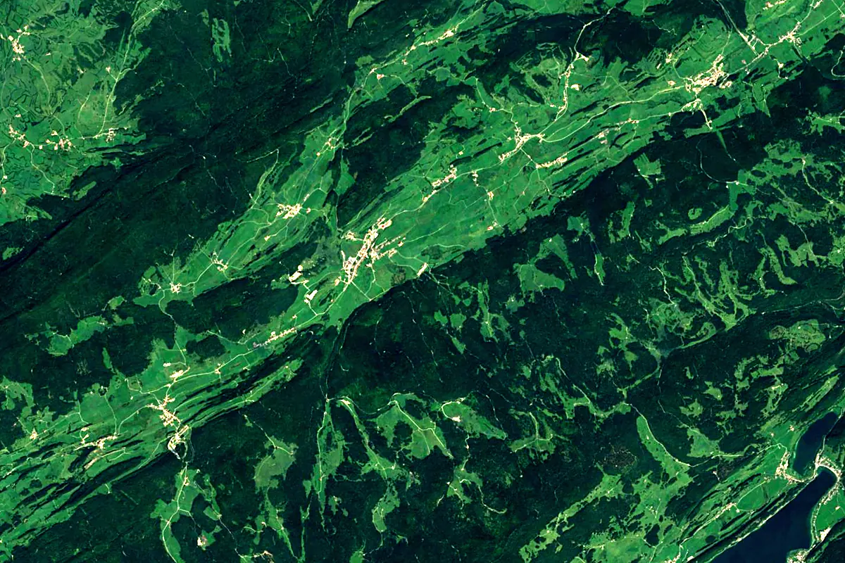
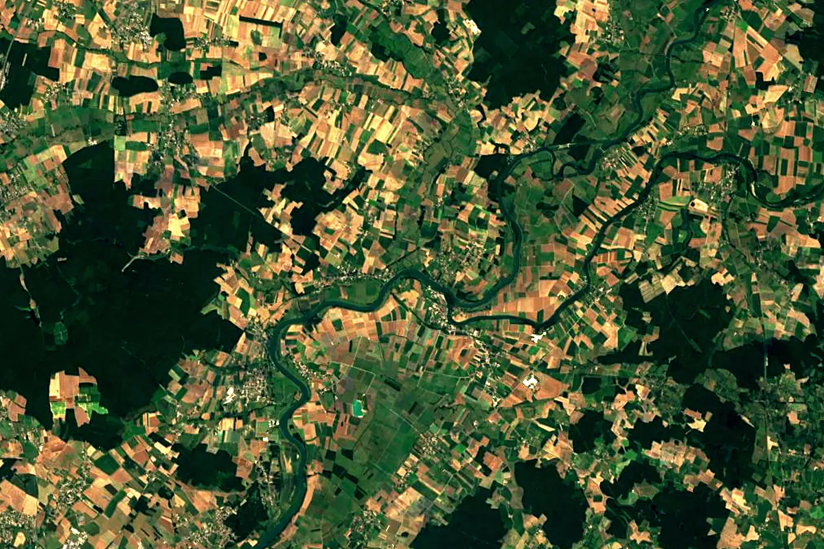
Sentinel-2 cloudless 2016 by EOX IT Services GmbH (contains modified Copernicus Sentinel data 2016), CC BY 4.0. The glowing line is the river as drawn by RiverATLAS.
Photos
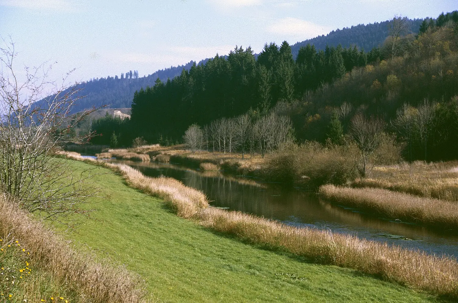
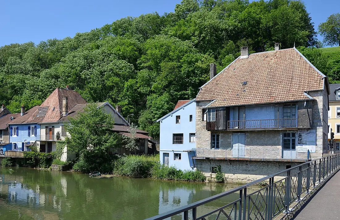
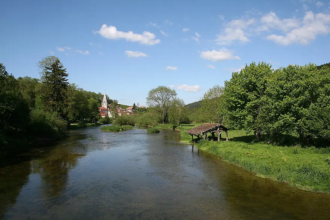
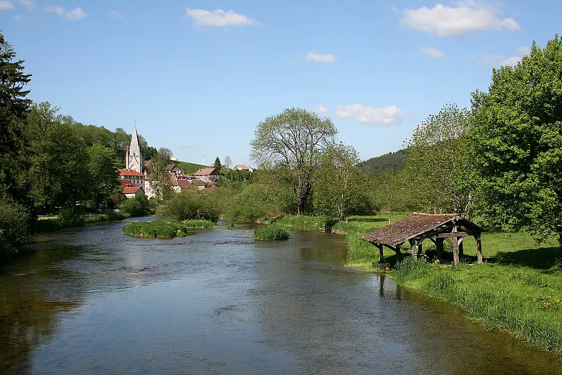
Doubs in pictures
Tributaries
Where it flows, and what flows into it
It flows into
SaôneFrance480 km470 m³/sTributaries (12)
Also: Allaine, Loue, Dessoubre, Clauge, Drugeon, Guyotte, Cusancin, Gland, Ruisseau de Fontaine Ronde, Sablonne, Cébriot, Orain
Nearby
Rivers nearby
France214 km35 m³/s59 km awayArrouxFrance132 km34 m³/s95 km awayArveSwitzerland108 km78 m³/s113 km awayAinFrance190 km120 m³/s124 km awayAllierFrance421 km150 m³/s147 km awaySaane/SarineSwitzerland126 km54 m³/s172 km awayArmançonFrance202 km30 m³/s163 km awayIsèreFrance286 km360 m³/s215 km awayWhere these numbers come from
| Name, length, places | Wikidata (Q14372) · CC0 |
|---|---|
| Course, profile, basin | RiverATLAS v1.0 (HydroATLAS, Linke et al. 2019) · CC BY 4.0 — followed from the source to the mouth given by Wikidata |
| Flow | WaterGAP (RiverATLAS), 1971–2000 · CC BY 4.0 |
| Climate along the river | WorldClim (RiverATLAS), 1970–2000 · CC BY 4.0 |
| Towns, bridges, dams | Wikidata · CC0; GeoNames · CC BY 4.0 |
| Along the river | © OpenStreetMap contributors · ODbL |
| Images | EOX Sentinel-2 cloudless 2016 · CC BY 4.0; Wikimedia Commons |
| Our other atlases | Cascadyas, Lakeyas, Peakyas — Wikidata · CC0; © OpenStreetMap contributors · ODbL; GeoNames · CC BY 4.0; HydroLAKES · CC BY 4.0; NOAA OISST |
Every source and licence is on the data sources page.
The family
Do you prefer beaches, lakes, mountains, waterfalls, islands, rivers or canyons?
Same idea, other landscapes: field atlases built on open data, month by month, in seven languages.
 beaches
 Find your beach: sea temperature, sun and swimming month by month.Visit lakes
 Every lake on Earth: water temperature, ice, depth and the shore.Coming soonVisit mountains
 Every summit in 3D: summit weather, the 0 °C line, huts and trails.Visit waterfalls
 Every waterfall: height, flow month by month and when it roars.Coming soonVisit
  islands
 Every island from the sea up: size, sea temperature, ferries and 3D.Coming soonVisit
  rivers
 Every river from source to sea: the journey, the flow and the basin in numbers.You are here
 canyons
 Every canyon cut to scale: depth to the floor, rim and floor temperatures, trails and viewpoints.Coming soonVisit