River
Bow River
587 km from source to mouth · Canada.
 CanadaFlows into South Saskatchewan River
In numbers
Length
587km
Average flow
130m³/s
Basin
26,200km²
Drop
1,123m
from 1,821 m to 698 m
Country
1
The journey
From source to mouth
587 km of river and 60 stops on the way: 28 towns and cities on its banks, dams, bridges and the tributaries that feed it.
- 0 kmBow Glacierat 1,821 m
- 0 kmBow Lake3.1 km²
- 11 kmHector Lake5.5 km²
- 28 kmLake Louise0.8 km²
- 65 kmJohnston Creektributary
- 85 kmBow River Bridge
- 85 kmBanff8,305 people
- 86 kmBow Falls9 m
- 87 kmSpray Rivertributary
- 94 kmCascade Rivertributary
- 108 kmCanmore13,992 people
- 124 kmLac des Arcs2.5 km²
- 132 kmChilver Lake0.4 km²
- 133 kmSeebe Dam pipeline bridge
- 133 kmKananaskis Rivertributary
- 136 kmHorseshoe Falls
- 164 kmGhost Lake11 km²
- 164 kmGhost Rivertributary
- 181 kmCochrane32,199 people
- 183 kmRiver Avenue Bridge
- 204 kmTuscany19,700 people
- 205 kmStoney Trail Bow River Bridge
- 208 kmSilver Springs8,570 people
- 208 kmDalhousie8,530 people
- 210 kmVarsity12,040 people
- 210 kmBowness10,770 people
- 211 kmJohn Hextall Bridge
- 212 kmWest Springs11,560 people
- 212 kmAspen Woods9,435 people
- 218 kmBeltline25,880 people
- 218 kmLouise Bridge
- 219 kmCentre City41,000 people
- 219 kmSunnyside CTrain Bridge
- 219 kmPeace Bridge
- 220 kmDowntown Commercial Core8,225 people
- 220 kmPrince's Island Pedestrian Bridge
- 220 kmCentre Street Bridge
- 221 kmCalgary1,306,784 people
- 221 km4th Avenue Flyover
- 221 kmReconciliation Bridge
- 221 km5th Avenue Flyover
- 221 kmHenry Kroeger Bridge
- 222 kmGeorge C. King Bridge
- 223 km12 Street SE Bridge
- 224 kmElbow Rivertributary
- 226 kmDover10,795 people
- 230 kmOgden8,315 people
- 232 kmAcadia9,915 people
- 233 kmRiverbend9,205 people
- 235 kmLake Bonavista10,145 people
- 238 kmDouglasdale12,920 people
- 240 kmNew Brighton12,885 people
- 240 kmMcKenzie Towne17,505 people
- 240 kmMcKenzie Lake13,290 people
- 242 kmChaparral12,500 people
- 242 kmSundance9,590 people
- 244 kmCranston20,850 people
- 244 kmAuburn Bay18,090 people
- 247 kmLegacy8,000 people
- 264 kmHighwood Rivertributary
- 395 kmBassano Dam
- 587 kmSouth Saskatchewan Riverat 698 m
Water level along the river (RiverATLAS; the height is exaggerated). Towns: GeoNames and Wikidata; bridges, dams and tributaries: Wikidata.
Watercourse in Alberta, Canada
At the mouth it carries 129 m³/s on average: an Olympic pool every 19 seconds. It drops from 1,821 m to 698 m, 1.9 m per kilometre on average. Its basin covers 26,200 km², about the size of RW. 1.5 million people live in it. Highest water: from April to June; lowest: from December to March. Dams and reservoirs hold back a large share of its water (49% of a year's flow).
Where to start
- CalgaryLargest city on its banks · 1,306,784 people
- Calgary International Airport (YYC)Nearest airport with scheduled flights, 9 km from the cityCar hire at YYC airport (Calgary)Discover Cars · Affiliate link↗
- On the water48 ferry piers, marinas, boat rentals and boat ramps along the river (OpenStreetMap)
- Kayak and canoe11 put-ins and rapids mapped (OpenStreetMap)
- From June to AugustThe best months to visit
Bow River, month by month
Highest water: from April to June
Lowest water: from December to March. Freezing months (average below −4 °C): from December to February. Best months to visit: from June to August.
From about 150 m³/s in the lowest month to 370 m³/s in the highest. An estimate: the monthly flow is modelled from the lowest and highest months of WaterGAP (RiverATLAS, 1971–2000) and the rain and snow along the river (WorldClim). Dams change the real rhythm. The chip is the average air temperature; below it, the month's rain.
Plan the trip
Plan the trip: boat trips, a bed by the river, a car
Some links above are affiliate links: if you book through them we may earn a commission, at no extra cost to you. It never changes what the data on this page says.
The basin
Bow River: the basin in numbers
52,421 km² of land send their water to this river. This is what lives on it.
- 1.5millionpeople live in the basin
- 29/km²people per km²
- 1,277maverage altitude of the basin
- 479mmof rain a year (basin average)
- 2.8°Caverage air temperature
- 17%protected areas
- 1.2%covered by lakes
- 3%permafrost
- 3.2km³held in reservoirs
What covers the basin
- 39% Forest
- 33% Cropland
- 26% Pasture
- 1% Towns and cities
RiverATLAS (HydroATLAS v1.0, CC BY 4.0): land cover, people, protected areas, glaciers and dams over the whole basin upstream of the mouth.
Along the river
Bow River: what you find on the way
- 26Weirs
- 21WaterfallsSilverton Falls, Lower Falls, Tunnel Falls and 18 more
- 11Rapids
- 37Boat rampsExhshaw Launch, Public Slipway, CottageClub Slipway and 34 more
- 2Ferry piers
- 5MarinasGhost Lake Marina, Bearspaw Marina and 3 more
- 11River beachesCrosbow Beach, Exshaw Beach, Main Beach and 8 more
From OpenStreetMap, within 2.2 km of the river. Not mapped is not the same as not there.
Cross-checked with our atlases
Bow River in our other atlases
What our sister atlases know about the waterfalls on this river, the lakes it flows through, the beaches at its mouth, the mountains where it rises and the islands off its mouth.
 2waterfalls on the riverCascadyas
 6lakes on its wayLakeyas
 32mountains at the sourcePeakyas
Waterfalls (2)
On the river, by Cascadyas
- Bow Fallskm 909m
- Horseshoe Fallskm 142
Cascadyas is coming soonOpen Cascadyas ↗
Lakes and reservoirs (6)
Lakes it flows through, by Lakeyas
- Bow Lakekm 03.1km²
- Hector Lakekm 115.5km²
- Lake Louisekm 290.8km²
- Lac des Arcskm 1302.5km²
- Chilver Lakekm 1380.4km²
- Ghost Lakekm 171 · 34 m deep11km²
Lakeyas is coming soonOpen Lakeyas ↗
Mountains at the source (32)
Within 15 km of the source, by Peakyas
- Mount Baker8.9 km away · prominence 490 m3,180m
- Crowfoot Mountain10 km away · prominence 355 m3,055m
- Observation Peak3.8 km away · prominence 659 m3,174m
- Mount Patterson6.9 km away · prominence 810 m3,197m
- Mount Olive11 km away · prominence 146 m3,126m
- Mount Collie12 km away · prominence 423 m3,143m
- Mount Habel8.9 km away · prominence 227 m3,073m
- Mistaya Mountain6.5 km away · prominence 356 m3,096m
24 more on PeakyasOpen Peakyas ↗
From space
The source and the mouth, seen from orbit
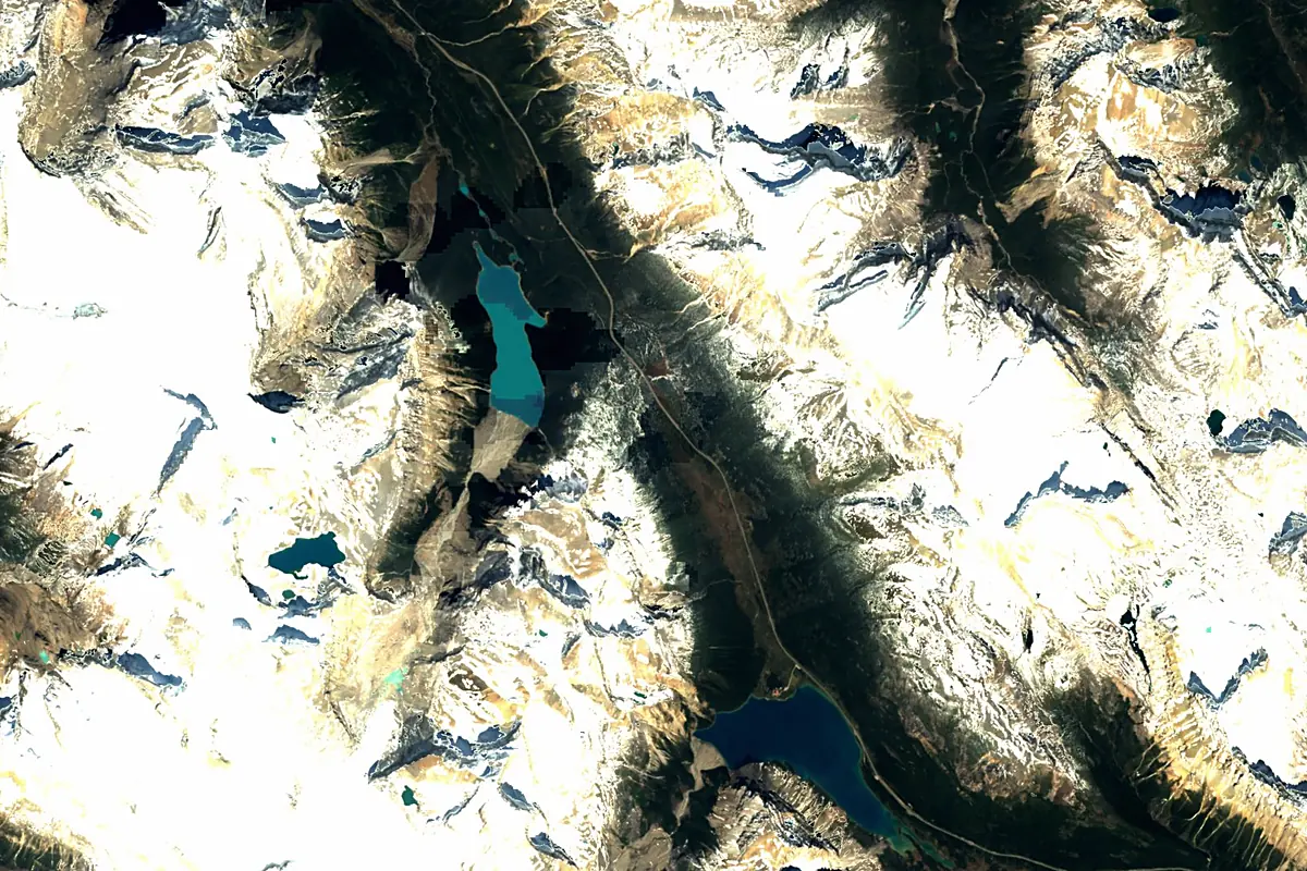
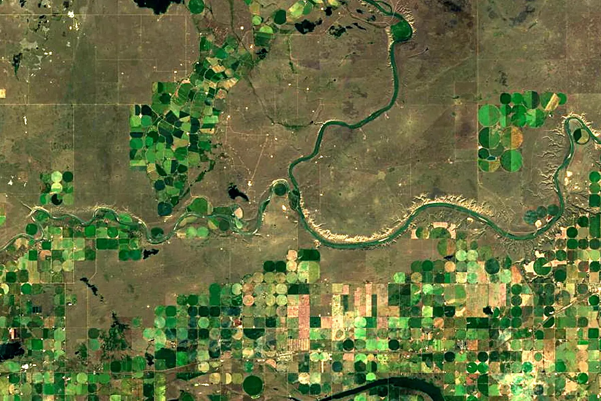
Sentinel-2 cloudless 2016 by EOX IT Services GmbH (contains modified Copernicus Sentinel data 2016), CC BY 4.0. The glowing line is the river as drawn by RiverATLAS.
Tributaries
Where it flows, and what flows into it
It flows into
South Saskatchewan RiverCanada1,000 km250 m³/sTributaries (8)
Also: Elbow River, Highwood River, Johnston Creek, Kananaskis River, Spray River, Cascade River, Ghost River, Pipestone River
In the same basin
Canada644 km2,800 m³/sSaskatchewan RiverCanada547 km700 m³/sNorth Saskatchewan RiverCanada1,380 km240 m³/sRed River of the NorthCanada890 km260 m³/sAssiniboine RiverCanada1,275 km45 m³/sRed Deer RiverCanada801 km70 m³/sOldman RiverCanada445 km95 m³/sWinnipeg RiverCanada298 km950 m³/sQu'Appelle RiverCanada743 km14 m³/sSouris RiverCanada1,240 km60 m³/sNearby
Rivers nearby
Canada445 km95 m³/s0 km awayRed Deer RiverCanada801 km70 m³/s169 km awayClark Fork United States499 km620 m³/s389 km awayKootenay RiverCanada780 km780 m³/s435 km awayMilk RiverUnited States1,173 km17 m³/s444 km awayJefferson RiverUnited States134 km54 m³/s445 km awayPend Oreille RiverCanada209 km740 m³/s441 km away
Where these numbers come from
| Name, length, places | Wikidata (Q895385) · CC0 |
|---|---|
| Course, profile, basin | RiverATLAS v1.0 (HydroATLAS, Linke et al. 2019) · CC BY 4.0 — followed from the source to the mouth given by Wikidata |
| Flow | WaterGAP (RiverATLAS), 1971–2000 · CC BY 4.0 |
| Climate along the river | WorldClim (RiverATLAS), 1970–2000 · CC BY 4.0 |
| Towns, bridges, dams | Wikidata · CC0; GeoNames · CC BY 4.0 |
| Along the river | © OpenStreetMap contributors · ODbL |
| Images | EOX Sentinel-2 cloudless 2016 · CC BY 4.0; Wikimedia Commons |
| Our other atlases | Cascadyas, Lakeyas, Peakyas — Wikidata · CC0; © OpenStreetMap contributors · ODbL; GeoNames · CC BY 4.0; HydroLAKES · CC BY 4.0; NOAA OISST |
Every source and licence is on the data sources page.
The family
Do you prefer beaches, lakes, mountains, waterfalls, islands, rivers or canyons?
Same idea, other landscapes: field atlases built on open data, month by month, in seven languages.
 beaches
 Find your beach: sea temperature, sun and swimming month by month.Visit lakes
 Every lake on Earth: water temperature, ice, depth and the shore.Coming soonVisit mountains
 Every summit in 3D: summit weather, the 0 °C line, huts and trails.Visit waterfalls
 Every waterfall: height, flow month by month and when it roars.Coming soonVisit
  islands
 Every island from the sea up: size, sea temperature, ferries and 3D.Coming soonVisit
  rivers
 Every river from source to sea: the journey, the flow and the basin in numbers.You are here
 canyons
 Every canyon cut to scale: depth to the floor, rim and floor temperatures, trails and viewpoints.Coming soonVisit