River
North Saskatchewan River
1,380 km from source to mouth · Canada.
 CanadaFlows into Saskatchewan River6th longest in Canada
In numbers
Length
1,380km
Average flow
240m³/s
Basin
122,800km²
Drop
1,197m
from 1,576 m to 379 m
Country
1
The journey
From source to mouth
1,380 km of river and 57 stops on the way: 9 towns and cities on its banks, dams, bridges and the tributaries that feed it.
- 0 kmColumbia Icefieldat 1,576 m
- 8 kmColeman Lake0.3 km²
- 16 kmAlexandra Rivertributary
- 34 kmHowse Rivertributary
- 34 kmMistaya Rivertributary
- 60 kmSiffleur Rivertributary
- 91 kmAbraham Lake52 km²
- 99 kmBighorn Rivertributary
- 168 kmRam Rivertributary
- 205 kmClearwater Rivertributary
- 275 kmBrazeau Rivertributary
- 434 kmConjuring Creektributary
- 434 kmDevon Bridge
- 453 kmConstables Travis Jordan and Brett Ryan EPS Memorial Bridges
- 457 kmThe Hamptons9,405 people
- 459 kmTerwillegar Park Footbridge
- 461 kmFort Edmonton Footbridge
- 463 kmQuesnell Bridge
- 466 kmBuena Vista / Hawrelak Park Footbridge
- 467 kmWhitemud Creektributary
- 469 kmGroat Bridge
- 469 kmWîhkwêntôwin18,180 people
- 471 kmDudley B. Menzies Bridge
- 471 kmGreat Divide waterfall64 m
- 471 kmHigh Level Bridge
- 471 kmGarneau9,480 people
- 471 kmEdmonton1,010,899 people
- 471 kmWalterdale Bridge
- 472 kmStrathcona8,984 people
- 473 kmDowntown12,423 people
- 473 kmJames MacDonald Bridge
- 473 kmLow Level Bridge
- 474 kmTawatinâ Bridge
- 475 kmDawson Bridge
- 477 kmCapilano Bridge
- 478 kmCapilano Foot Bridge
- 480 kmAinsworth Dyer Footbridge
- 482 kmClover Bar Footbridge
- 483 kmBeverly Bridge
- 483 kmClover Bar Bridge
- 483 kmClover Bar Railway Bridge
- 488 kmNortheast Anthony Henday Bridge
- 494 kmAmisk Wâciw Âsokan
- 506 kmHighway 15 Bridge
- 506 kmFort Saskatchewan14,957 people
- 513 kmSturgeon Rivertributary
- 751 kmAlma Lake1.5 km²
- 763 kmVermilion Rivertributary
- 769 kmCabin Lake0.7 km²
- 959 kmNorth Battleford19,440 people
- 960 kmBattlefords Bridge
- 962 kmBattleford Bridge
- 968 kmBattle Rivertributary
- 1,055 kmBorden Bridge
- 1,096 kmPetrofka Bridge
- 1,205 kmDiefenbaker Bridge
- 1,205 kmCanadian Northern Railway Bridge
- 1,206 kmPrince Albert37,756 people
- 1,380 kmSaskatchewan Riverat 379 m
Water level along the river (RiverATLAS; the height is exaggerated). Towns: GeoNames and Wikidata; bridges, dams and tributaries: Wikidata.
River in Alberta and Saskatchewan
At the mouth it carries 238 m³/s on average: an Olympic pool every 11 seconds. It drops from 1,576 m to 379 m, 0.9 m per kilometre on average. Its basin covers 122,800 km², about the size of ER. 1.5 million people live in it. Highest water: July; lowest: from December to March. Dams and reservoirs hold back a large share of its water (33% of a year's flow).
Where to start
- EdmontonLargest city on its banks · 1,010,899 people
- Edmonton International Airport (YEG)Nearest airport with scheduled flights, 25 km from the cityCar hire at YEG airport (Edmonton)Discover Cars · Affiliate link↗
- On the water24 ferry piers, marinas, boat rentals and boat ramps along the river (OpenStreetMap)
- Kayak and canoe14 put-ins and rapids mapped (OpenStreetMap)
- From June to AugustThe best months to visit
North Saskatchewan River, month by month
Highest water: July
Lowest water: from December to March. Freezing months (average below −4 °C): from November to March. Best months to visit: from June to August.
From about 160 m³/s in the lowest month to 420 m³/s in the highest. An estimate: the monthly flow is modelled from the lowest and highest months of WaterGAP (RiverATLAS, 1971–2000) and the rain and snow along the river (WorldClim). Dams change the real rhythm. The chip is the average air temperature; below it, the month's rain.
Plan the trip
Plan the trip: boat trips, a bed by the river, a car
Some links above are affiliate links: if you book through them we may earn a commission, at no extra cost to you. It never changes what the data on this page says.
The basin
North Saskatchewan River: the basin in numbers
121,599 km² of land send their water to this river. This is what lives on it.
- 1.5millionpeople live in the basin
- 13/km²people per km²
- 821maverage altitude of the basin
- 455mmof rain a year (basin average)
- 1.3°Caverage air temperature
- 8%protected areas
- 2.0%covered by lakes
- 2%permafrost
- 2.5km³held in reservoirs
What covers the basin
- 26% Forest
- 45% Cropland
- 22% Pasture
- 1% Towns and cities
RiverATLAS (HydroATLAS v1.0, CC BY 4.0): land cover, people, protected areas, glaciers and dams over the whole basin upstream of the mouth.
Along the river
North Saskatchewan River: what you find on the way
- 1Weirs
- 15WaterfallsCi Fuentes Path, Old Wonder Falls, Panther Falls and 12 more
- 14Rapids
- 15Boat rampsSaunders Boat Launch, Genesee Bridge Boat Launch, Emily Murphy Park Canoe Launch and 12 more
- 6Ferry piersWingard Ferry West Terminal, Wingard Ferry East Terminal and 4 more
- 1MarinasBoat Launch
- 1River beachesAccidental Beach
From OpenStreetMap, within 2.5 km of the river. Not mapped is not the same as not there.
Cross-checked with our atlases
North Saskatchewan River in our other atlases
What our sister atlases know about the waterfalls on this river, the lakes it flows through, the beaches at its mouth, the mountains where it rises and the islands off its mouth.
 1waterfall on the riverCascadyas
 4lakes on its wayLakeyas
 17mountains at the sourcePeakyas
Waterfalls (1)
On the river, by Cascadyas
- Great Divide waterfallkm 48464m
Cascadyas is coming soonOpen Cascadyas ↗
Lakes and reservoirs (4)
Lakes it flows through, by Lakeyas
- Coleman Lakekm 80.3km²
- Abraham Lakekm 9452km²
- Alma Lakekm 7731.5km²
- Cabin Lakekm 7920.7km²
Lakeyas is coming soonOpen Lakeyas ↗
Mountains at the source (17)
Within 15 km of the source, by Peakyas
- Mount Athabasca5.1 km away · prominence 671 m3,491m
- Mount Kitchener14 km away · prominence 280 m3,505m
- Mount Andromeda7.2 km away · prominence 330 m3,450m
- Snow Dome13 km away · prominence 171 m3,456m
- Mount Saskatchewan7.6 km away · prominence 1,102 m3,342m
- Cirrus Mountain11 km away · prominence 890 m3,270m
- Mount Stewart14 km away · prominence 1,117 m3,312m
- Nigel Peak8.8 km away · prominence 611 m3,211m
9 more on PeakyasOpen Peakyas ↗
From space
The source and the mouth, seen from orbit
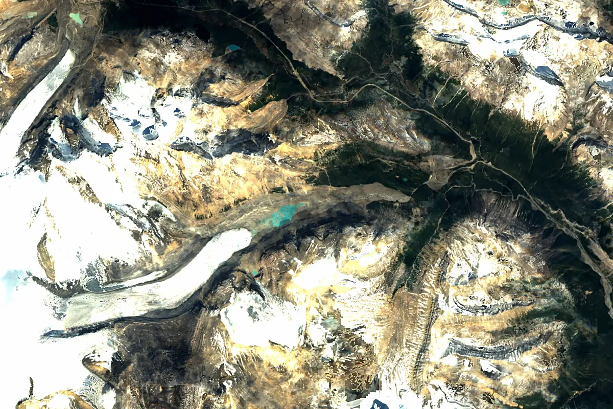
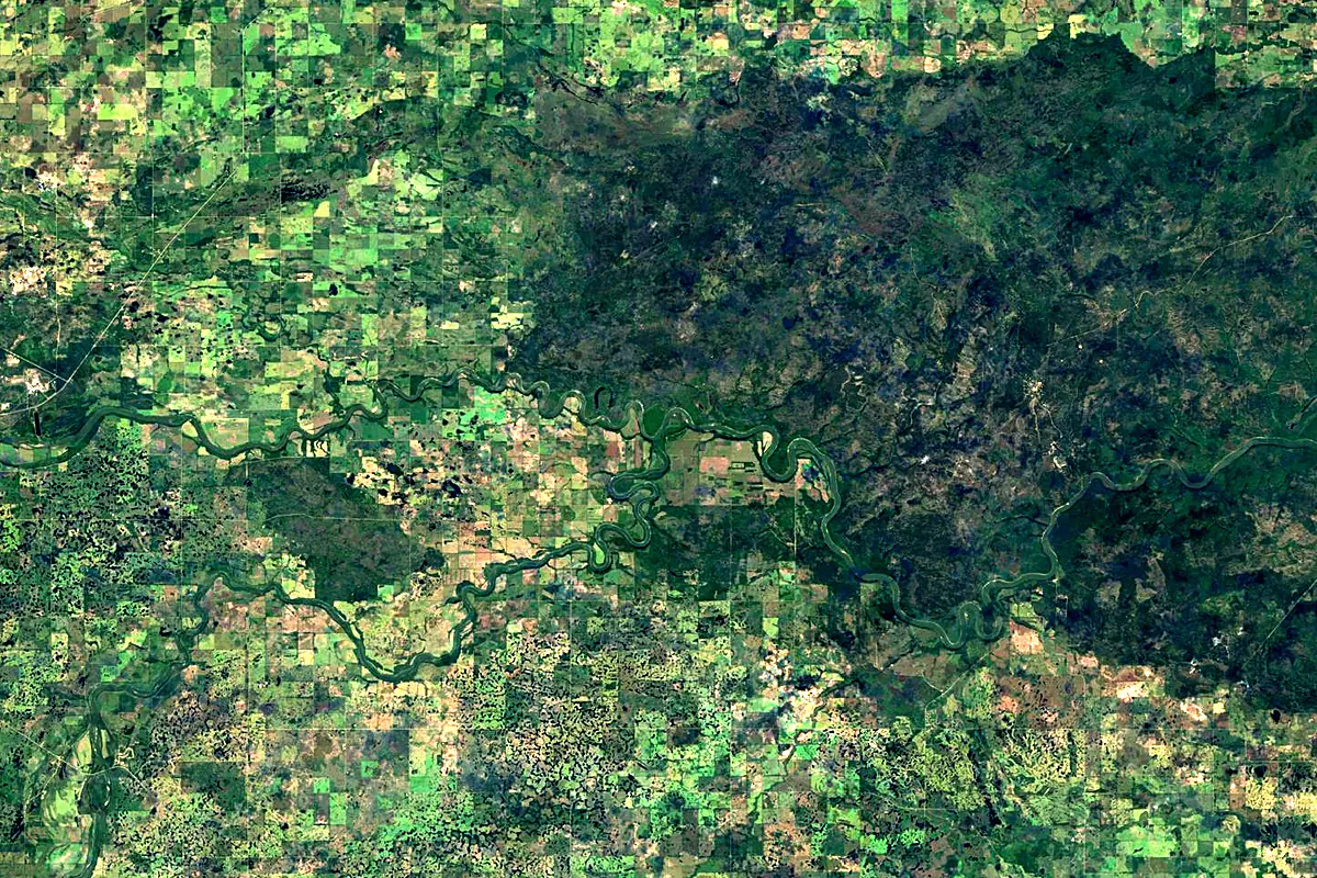
Sentinel-2 cloudless 2016 by EOX IT Services GmbH (contains modified Copernicus Sentinel data 2016), CC BY 4.0. The glowing line is the river as drawn by RiverATLAS.
Photos
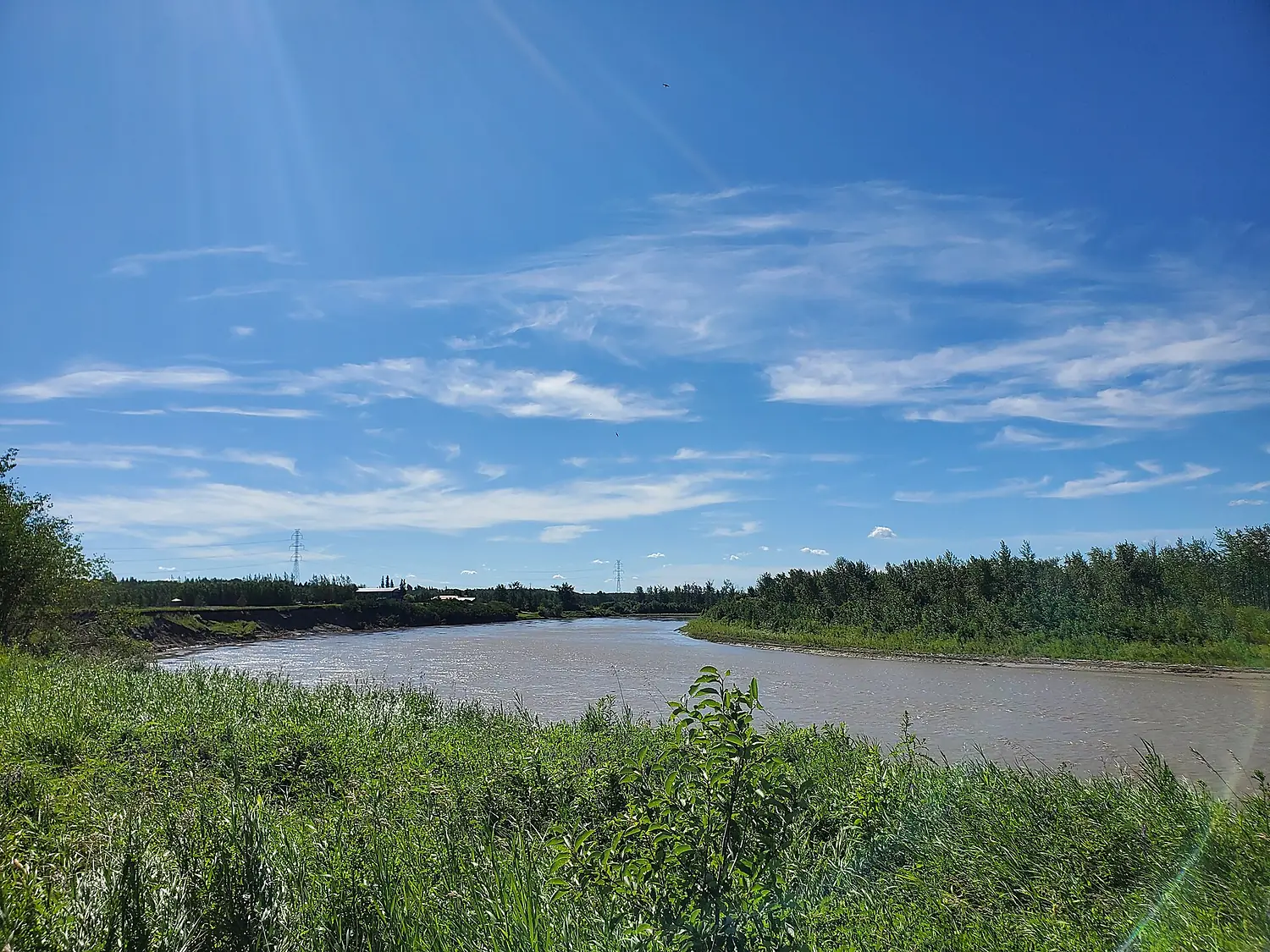
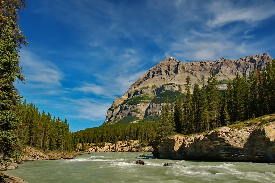
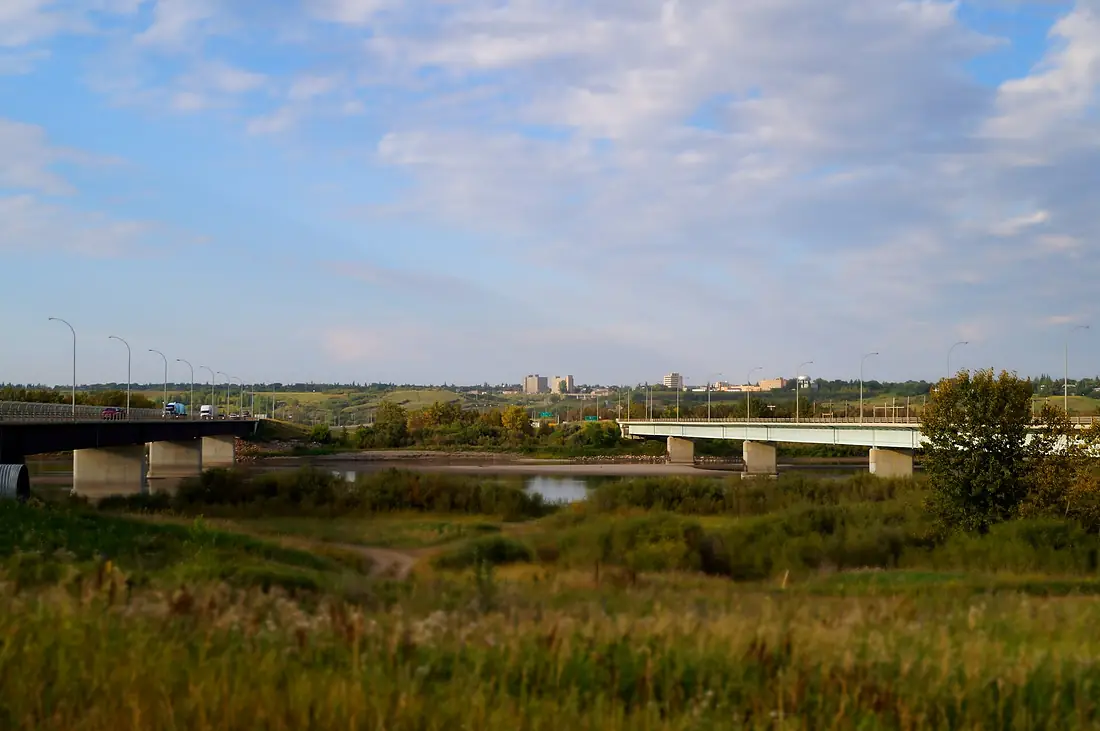
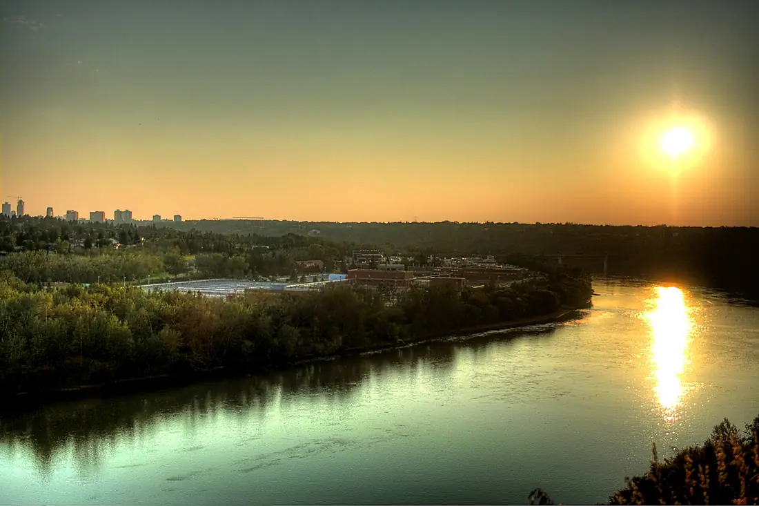
North Saskatchewan River in pictures
Tributaries
Where it flows, and what flows into it
It flows into
Saskatchewan RiverCanada547 km700 m³/sTributaries (20)
Also: Battle River, Brazeau River, Clearwater River, Sturgeon River, Mistaya River, Ram River, Whitemud Creek, Howse River, Bighorn River, Conjuring Creek, Siffleur River, Alexandra River, Redwater River, Vermilion River, Sturgeon River, Horsehills Creek, Jackfish River, Eagle Creek, Pipestone Creek, Baptiste River
In the same basin
Canada644 km2,800 m³/sSouth Saskatchewan RiverCanada1,000 km250 m³/sRed River of the NorthCanada890 km260 m³/sAssiniboine RiverCanada1,275 km45 m³/sBow RiverCanada587 km130 m³/sRed Deer RiverCanada801 km70 m³/sOldman RiverCanada445 km95 m³/sWinnipeg RiverCanada298 km950 m³/sQu'Appelle RiverCanada743 km14 m³/sSouris RiverCanada1,240 km60 m³/sWhere these numbers come from
| Name, length, places | Wikidata (Q2237) · CC0 |
|---|---|
| Course, profile, basin | RiverATLAS v1.0 (HydroATLAS, Linke et al. 2019) · CC BY 4.0 — followed from the source to the mouth given by Wikidata |
| Flow | WaterGAP (RiverATLAS), 1971–2000 · CC BY 4.0 |
| Climate along the river | WorldClim (RiverATLAS), 1970–2000 · CC BY 4.0 |
| Towns, bridges, dams | Wikidata · CC0; GeoNames · CC BY 4.0 |
| Along the river | © OpenStreetMap contributors · ODbL |
| Images | EOX Sentinel-2 cloudless 2016 · CC BY 4.0; Wikimedia Commons |
| Our other atlases | Cascadyas, Lakeyas, Peakyas — Wikidata · CC0; © OpenStreetMap contributors · ODbL; GeoNames · CC BY 4.0; HydroLAKES · CC BY 4.0; NOAA OISST |
Every source and licence is on the data sources page.
The family
Do you prefer beaches, lakes, mountains, waterfalls, islands, rivers or canyons?
Same idea, other landscapes: field atlases built on open data, month by month, in seven languages.
 beaches
 Find your beach: sea temperature, sun and swimming month by month.Visit lakes
 Every lake on Earth: water temperature, ice, depth and the shore.Coming soonVisit mountains
 Every summit in 3D: summit weather, the 0 °C line, huts and trails.Visit waterfalls
 Every waterfall: height, flow month by month and when it roars.Coming soonVisit
  islands
 Every island from the sea up: size, sea temperature, ferries and 3D.Coming soonVisit
  rivers
 Every river from source to sea: the journey, the flow and the basin in numbers.You are here
 canyons
 Every canyon cut to scale: depth to the floor, rim and floor temperatures, trails and viewpoints.Coming soonVisit