River
Columbia River
2,000 km from source to mouth · United States and Canada.
 United States and CanadaFlows into Pacific Ocean6th longest in United States
In numbers
Length
2,000km
Average flow
7,500m³/s
Basin
668,217km²
Drop
813m
from 807 m to -6 m
Countries
2
The journey
From source to mouth
2,000 km of river and 68 stops on the way: 5 towns and cities on its banks, dams, bridges and the tributaries that feed it.
- 0 kmColumbia Lakeat 807 m
- 8 kmColumbia Lake24 km²
- 15 kmMud Lake0.7 km²
- 36 kmWindermere Lake16 km²
- 84 kmTempleton Rivertributary
- 90 kmSpillimacheen Rivertributary
- 157 kmKicking Horse Rivertributary
- 166 kmCooper Lake1.1 km²
- 171 kmBlaeberry Rivertributary
- 202 kmBeaver Rivertributary
- 313 kmKinbasket Lake419 km²
- 367 kmGoldstream Rivertributary
- 444 kmLake Revelstoke111 km²
- 454 kmIllecillewaet Rivertributary
- 456 kmWilliamson Lake0.7 km²
- 473 kmSutherland Falls
- 679 kmLower Arrow Lake510 km²
- 690 kmKootenay Rivertributary
- 734 kmPend Oreille Rivertributary
- 797 kmKettle Rivertributary
- 799 kmKettle Falls
- 899 kmSpokane Rivertributary
- 937 kmSanpoil Rivertributary
- 966 kmBanks Lake107 km²
- 966 kmFranklin D. Roosevelt Lake269 km²
- 989 kmNespelem Rivertributary
- 1,068 kmOkanogan Rivertributary
- 1,082 kmMethow Rivertributary
- 1,112 kmLake Chelan128 km²
- 1,146 kmEntiat Rivertributary
- 1,171 kmWenatchee Rivertributary
- 1,385 kmYakima Rivertributary
- 1,387 kmTri-Cities244,036 people
- 1,406 kmSnake Rivertributary
- 1,460 kmUmatilla Rivertributary
- 1,518 kmWillow Lake0.7 km²
- 1,574 kmJohn Day Rivertributary
- 1,598 kmDeschutes Rivertributary
- 1,604 kmCelilo Falls
- 1,612 kmEightmile Creek Falls
- 1,617 kmCushing Falls
- 1,617 kmFifteenmile Creektributary
- 1,622 kmThe Dalles16,010 people
- 1,637 kmKlickitat Rivertributary
- 1,659 kmWah Gwin Gwin Falls
- 1,669 kmDog Creek Falls
- 1,670 kmStarvation Creek Falls
- 1,671 kmHole-in-the-Wall Falls
- 1,671 kmWarren Creek Falls
- 1,673 kmCamp Benson Falls
- 1,697 kmWahe Falls
- 1,699 kmElowah Falls
- 1,705 kmHorsetail Falls
- 1,706 kmOneonta Gorge
- 1,710 kmWahkeena Falls
- 1,711 kmMist Falls
- 1,714 kmCoopey Falls
- 1,737 kmFairview Lake0.3 km²
- 1,753 kmPortland652,503 people
- 1,757 kmVancouver196,442 people
- 1,761 kmRamsey Lake1.0 km²
- 1,775 kmPost Office Lake0.3 km²
- 1,776 kmGreen Lake0.6 km²
- 1,778 kmCampbell Lake0.8 km²
- 1,780 kmCrane Lake0.4 km²
- 1,780 kmMcNary Lake0.8 km²
- 1,786 kmBryce Lake1.1 km²
- 1,800 kmResting Lake0.3 km²
- 1,822 kmLongview37,818 people
- 2,000 kmPacific Oceanat -6 m
Water level along the river (RiverATLAS; the height is exaggerated). Towns: GeoNames and Wikidata; bridges, dams and tributaries: Wikidata.
River in North America; flows from British Columbia, through Washington, and along the Washington-Oregon border to the Pacific Ocean
At the mouth it carries 7,500 m³/s on average: 3.0 Olympic pools every second. It drops from 807 m to -6 m, 0.4 m per kilometre on average. Its basin covers 668,217 km², about the size of MM. 7.7 million people live in it. Highest water, with the snowmelt: from March to May; lowest: February and from July to September. Dams and reservoirs hold back a large share of its water (40% of a year's flow).
Where to start
- PortlandLargest city on its banks · 652,503 people
- Portland International Airport (PDX)Nearest airport with scheduled flights, 10 km from the cityCar hire at PDX airport (Portland)Discover Cars · Affiliate link↗
- On the water338 ferry piers, marinas, boat rentals and boat ramps along the river (OpenStreetMap)
- Kayak and canoe45 put-ins and rapids mapped (OpenStreetMap)
- From June to SeptemberThe best months to visit
Columbia River, month by month
Highest water: from March to May
Lowest water: February and from July to September. Melting snow makes up much of its water. Best months to visit: from June to September.
From about 3,900 m³/s in the lowest month to 13,800 m³/s in the highest. An estimate: the monthly flow is modelled from the lowest and highest months of WaterGAP (RiverATLAS, 1971–2000) and the rain and snow along the river (WorldClim). Dams change the real rhythm. The chip is the average air temperature; below it, the month's rain.
Plan the trip
Plan the trip: boat trips, a bed by the river, a car
Some links above are affiliate links: if you book through them we may earn a commission, at no extra cost to you. It never changes what the data on this page says.
The basin
Columbia River: the basin in numbers
651,407 km² of land send their water to this river. This is what lives on it.
- 7.7millionpeople live in the basin
- 12/km²people per km²
- 1,314maverage altitude of the basin
- 620mmof rain a year (basin average)
- 5.3°Caverage air temperature
- 11%protected areas
- 1.0%covered by lakes
- 1%permafrost
- 96km³held in reservoirs
What covers the basin
- 55% Forest
- 11% Cropland
- 25% Pasture
- 1% Towns and cities
RiverATLAS (HydroATLAS v1.0, CC BY 4.0): land cover, people, protected areas, glaciers and dams over the whole basin upstream of the mouth.
Along the river
Columbia River: what you find on the way
- 10Weirs
- 19LocksColumbia River, John Day Lock and Dam, John Day Lock and 16 more
- 123WaterfallsSinclair Canyon, Brisco Falls, Lower Bugaboo Falls and 120 more
- 43RapidsLittle Dalles, Monaghan Rapids, Equilibrium Rapids and 40 more
- 2Canoe put-ins
- 279Boat rampsMcDonald Creek Provincial Park, China Bend Boat Launch, North Gorge Boat Launch and 276 more
- 16Ferry piersShelter Bay, Galena Bay, Arrow Park Ferry and 13 more
- 40MarinasPete's Marina, Kettle Falls Marina, Seven Bays Marina and 37 more
- 31River beachesKinsmen Beach, Nakusp_Municipal_Beach, Black Sand Beach and 28 more
From OpenStreetMap, within 2.9 km of the river. Not mapped is not the same as not there.
Cross-checked with our atlases
Columbia River in our other atlases
What our sister atlases know about the waterfalls on this river, the lakes it flows through, the beaches at its mouth, the mountains where it rises and the islands off its mouth.
 18waterfalls on the riverCascadyas
 21lakes on its wayLakeyas
 4mountains at the sourcePeakyas
Waterfalls (18)
On the river, by Cascadyas
- Kettle Fallskm 778
- Celilo Fallskm 1,562
- Elowah Fallskm 1,654
- Horsetail Fallskm 1,661
- Oneonta Gorgekm 1,661
- Wahkeena Fallskm 1,666
- Mist Fallskm 1,666
- Coopey Fallskm 1,669
10 more on CascadyasCascadyas is coming soonOpen Cascadyas ↗
Lakes and reservoirs (21)
Lakes it flows through, by Lakeyas
- Columbia Lakekm 824km²
- Windermere Lakekm 35 · 5 m deep16km²
- Kinbasket Lakekm 305419km²
- Lake Revelstokekm 432111km²
- Lower Arrow Lakekm 661510km²
- Banks Lakekm 940 · 14 m deep107km²
- Franklin D. Roosevelt Lakekm 941 · 121 m deep269km²
- Lake Chelankm 1,083 · 453 m deep128km²
13 more on LakeyasLakeyas is coming soonOpen Lakeyas ↗
Mountains at the source (4)
Within 15 km of the source, by Peakyas
- Mount De Smet6.9 km away
- Mount Grainger11 km away
- Fairmont Mountain11 km away
- Mount Sabine6.1 km away
From space
The source and the mouth, seen from orbit
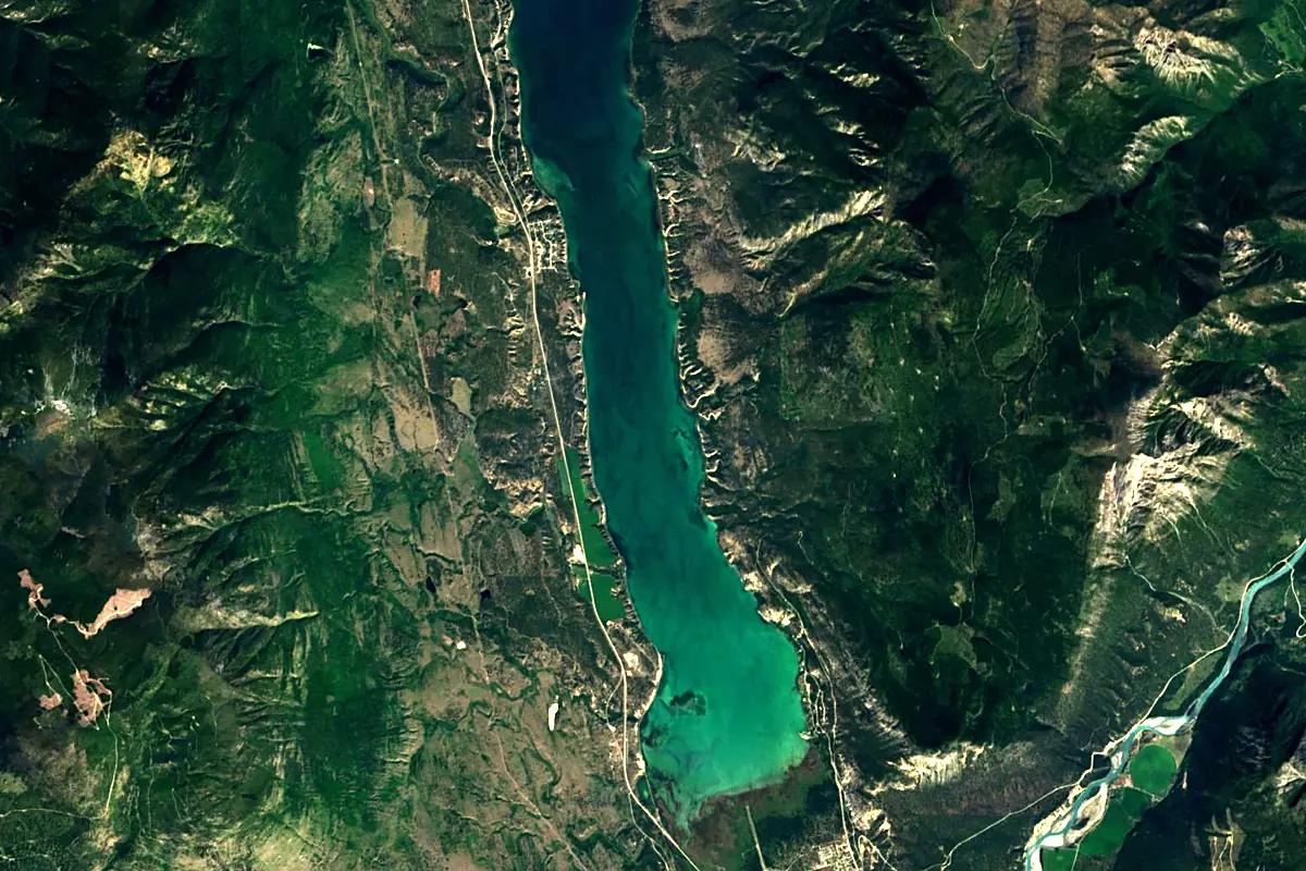
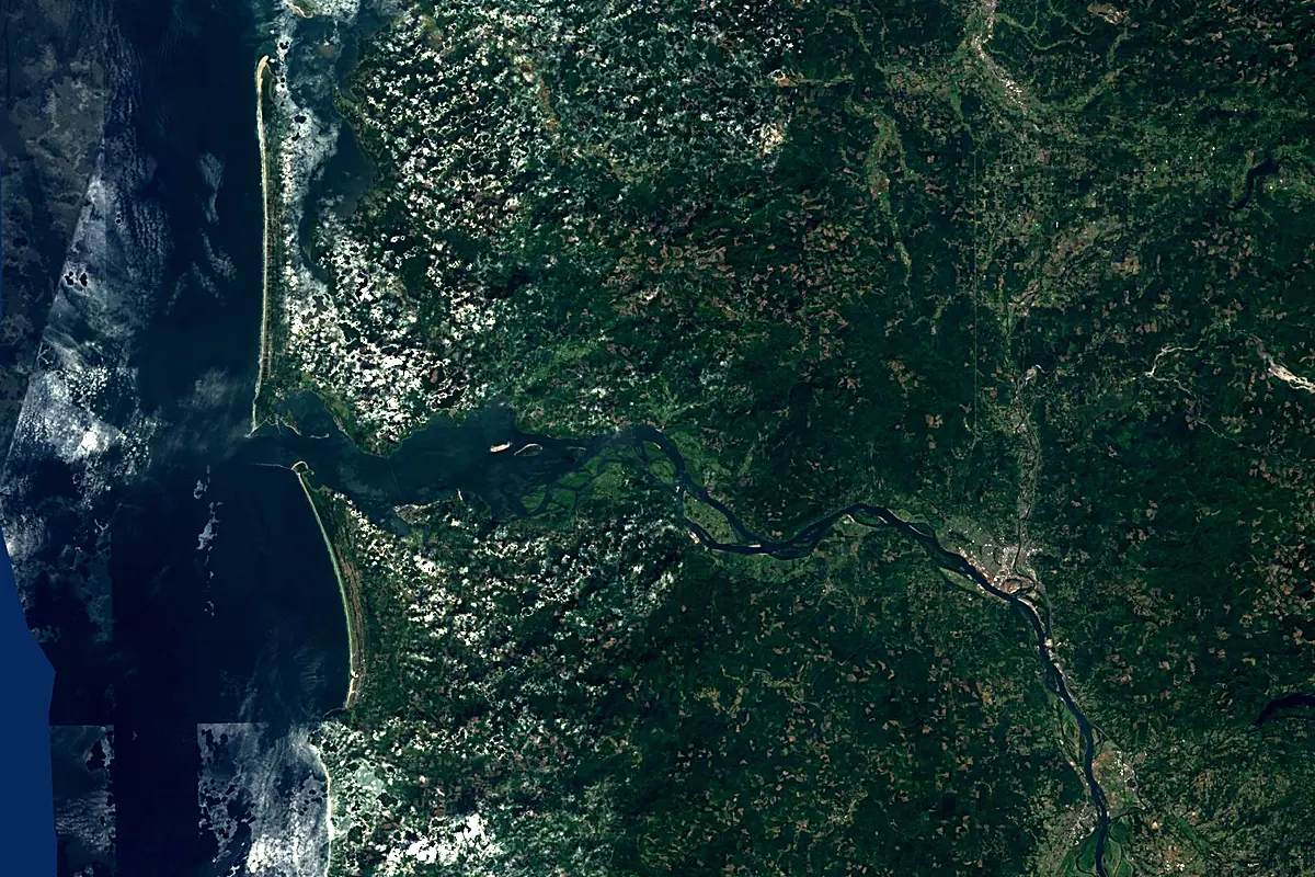
Sentinel-2 cloudless 2016 by EOX IT Services GmbH (contains modified Copernicus Sentinel data 2016), CC BY 4.0. The glowing line is the river as drawn by RiverATLAS.
Photos
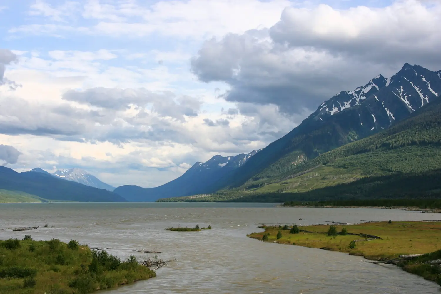
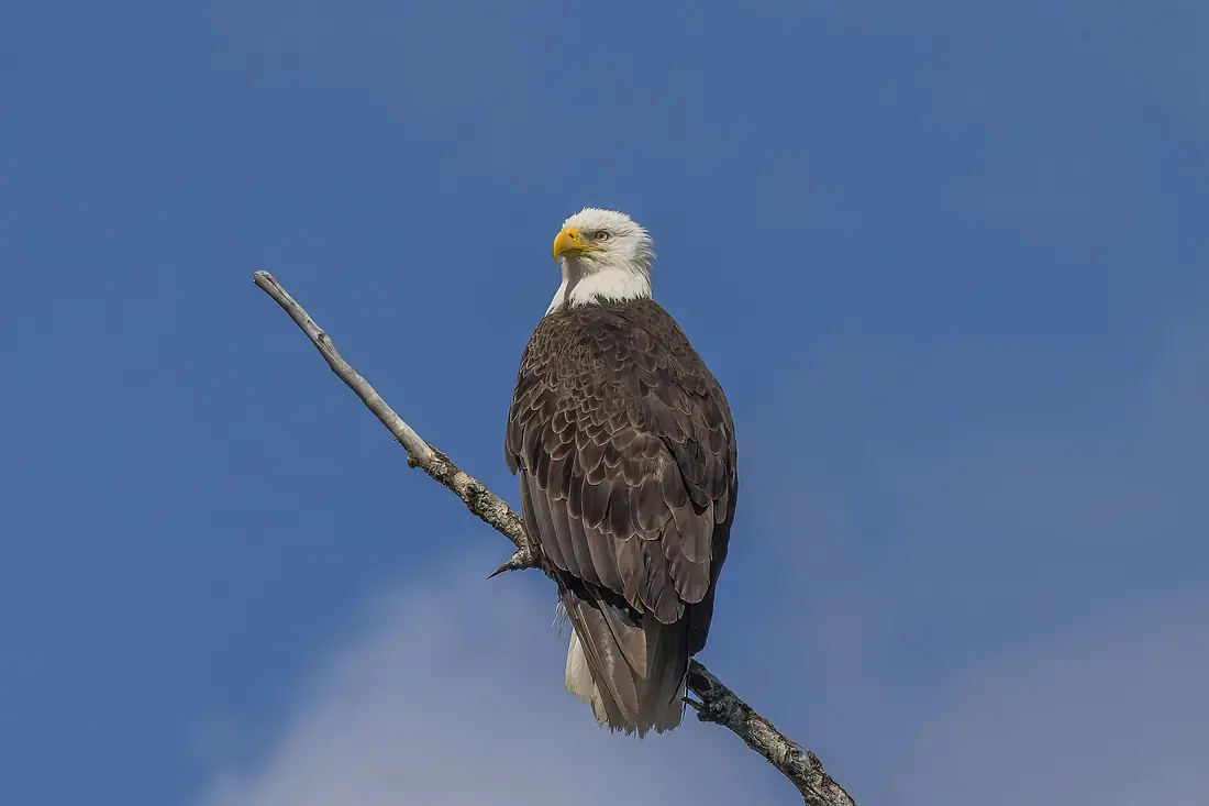
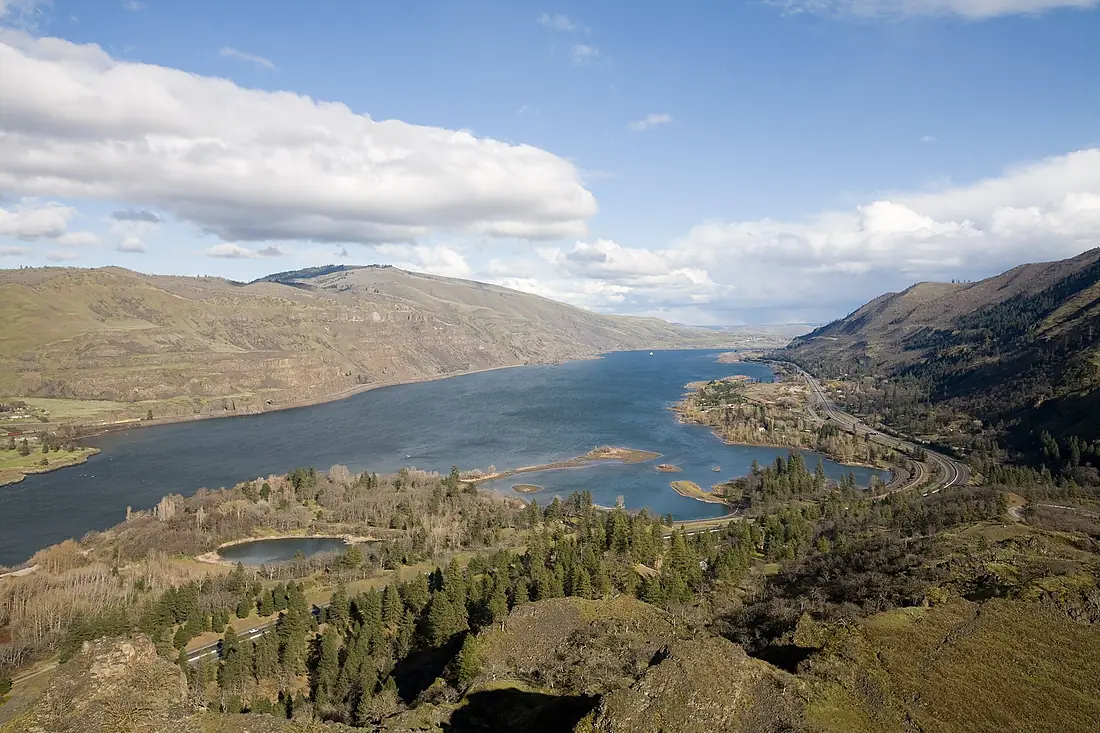
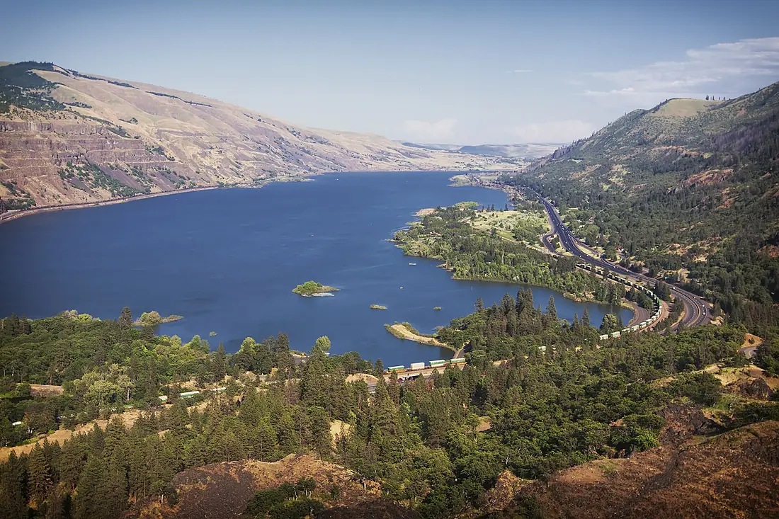
Columbia River in pictures
Tributaries
Where it flows, and what flows into it
Tributaries (61)
United States1,735 km1,600 m³/sjoins at km 1,369Kootenay RiverCanada780 km780 m³/sjoins at km 672Willamette RiverUnited States301 km900 m³/sjoins at km 1,719Pend Oreille RiverCanada209 km740 m³/sjoins at km 715Also: Okanogan River, Yakima River, Spokane River, Kicking Horse River, John Day River, Deschutes River, Kettle River, Walla Walla River, Cowlitz River, Illecillewaet River, Lewis River, Sandy River, Wenatchee River, Methow River, Canoe River, Hood River, Lewis and Clark River, Klickitat River, Beaver River, Umatilla River, Incomappleux River, White Salmon River, Spillimacheen River, Kalama River
In the same basin
Where these numbers come from
| Name, length, places | Wikidata (Q2251) · CC0 |
|---|---|
| Course, profile, basin | RiverATLAS v1.0 (HydroATLAS, Linke et al. 2019) · CC BY 4.0 — followed from the source to the mouth given by Wikidata |
| Flow | WaterGAP (RiverATLAS), 1971–2000 · CC BY 4.0 |
| Climate along the river | WorldClim (RiverATLAS), 1970–2000 · CC BY 4.0 |
| Towns, bridges, dams | Wikidata · CC0; GeoNames · CC BY 4.0 |
| Along the river | © OpenStreetMap contributors · ODbL |
| Images | EOX Sentinel-2 cloudless 2016 · CC BY 4.0; Wikimedia Commons |
| Our other atlases | Cascadyas, Lakeyas, Peakyas — Wikidata · CC0; © OpenStreetMap contributors · ODbL; GeoNames · CC BY 4.0; HydroLAKES · CC BY 4.0; NOAA OISST |
Every source and licence is on the data sources page.
The family
Do you prefer beaches, lakes, mountains, waterfalls, islands, rivers or canyons?
Same idea, other landscapes: field atlases built on open data, month by month, in seven languages.
 beaches
 Find your beach: sea temperature, sun and swimming month by month.Visit lakes
 Every lake on Earth: water temperature, ice, depth and the shore.Coming soonVisit mountains
 Every summit in 3D: summit weather, the 0 °C line, huts and trails.Visit waterfalls
 Every waterfall: height, flow month by month and when it roars.Coming soonVisit
  islands
 Every island from the sea up: size, sea temperature, ferries and 3D.Coming soonVisit
  rivers
 Every river from source to sea: the journey, the flow and the basin in numbers.You are here
 canyons
 Every canyon cut to scale: depth to the floor, rim and floor temperatures, trails and viewpoints.Coming soonVisit