River
Fraser River
2,657 km from source to mouth · Canada.
 CanadaFlows into Strait of Georgia2nd longest in Canada
In numbers
Length
2,657km
Average flow
3,500m³/s
Basin
233,100km²
Drop
1,516m
from 1,516 m to 0 m
Country
1
The journey
From source to mouth
2,657 km of river and 68 stops on the way: 25 towns and cities on its banks, dams, bridges and the tributaries that feed it.
- 0 kmRocky Mountainsat 1,516 m
- 28 kmWitney Lake0.6 km²
- 46 kmMoose Rivertributary
- 60 kmMoose Lake14 km²
- 75 kmOverlander Falls
- 80 kmRobson Rivertributary
- 89 kmRearguard Falls
- 151 kmRaush Rivertributary
- 156 kmCastle Creektributary
- 168 kmHorseshoe Lake0.3 km²
- 169 kmRainbow Falls
- 174 kmDoré Rivertributary
- 217 kmGoat Rivertributary
- 384 kmBowron Rivertributary
- 399 kmHansard Lake3.9 km²
- 405 kmMcGregor Rivertributary
- 467 kmWillow Rivertributary
- 471 kmSalmon Rivertributary
- 502 kmNechako Rivertributary
- 503 kmPrince George76,708 people
- 564 kmNaver Creektributary
- 591 kmWest Road Rivertributary
- 622 kmCottonwood Rivertributary
- 649 kmQuesnel9,889 people
- 650 kmQuesnel Rivertributary
- 685 kmEveline Lake0.8 km²
- 806 kmChilcotin Rivertributary
- 834 kmChurn Creektributary
- 942 kmBridge Rivertributary
- 951 kmSeton Rivertributary
- 1,007 kmStein Rivertributary
- 1,009 kmThompson Rivertributary
- 1,010 kmLytton249 people
- 1,056 kmAnderson Rivertributary
- 1,111 kmKawkawa Lake0.8 km²
- 1,113 kmCoquihalla Rivertributary
- 1,116 kmSilverhope Creektributary
- 1,139 kmHarrison Lake222 km²
- 1,163 kmHarrison Rivertributary
- 1,167 kmChilliwack83,788 people
- 1,179 kmSumas Rivertributary
- 1,189 kmHatzic Lake2.9 km²
- 1,193 kmD'Herbomez Creektributary
- 1,195 kmAbbotsford153,524 people
- 1,195 kmMission41,519 people
- 1,205 kmSilvermere Lake1.2 km²
- 1,205 kmStave Rivertributary
- 1,213 kmLangley132,603 people
- 1,220 kmMaple Ridge90,990 people
- 1,220 kmHaney21,041 people
- 1,225 kmKanaka Creektributary
- 1,228 kmPitt Meadows19,146 people
- 1,233 kmFraser Heights25,000 people
- 1,234 kmPort Coquitlam61,498 people
- 1,235 kmGuildford64,985 people
- 1,235 kmPitt Rivertributary
- 1,235 kmCoquitlam Rivertributary
- 1,235 kmCoquitlam148,625 people
- 1,240 kmCoquitlam West25,656 people
- 1,240 kmCariboo22,780 people
- 1,242 kmBurnaby249,125 people
- 1,243 kmSurrey568,322 people
- 1,243 kmNew Westminster78,916 people
- 1,244 kmEdmonds22,318 people
- 1,244 kmWhalley102,555 people
- 1,247 kmNorth Delta60,769 people
- 1,251 kmRichmond209,937 people
- 1,251 kmDelta108,455 people
- 1,251 kmLulu Island168,162 people
- 1,338 kmStrait of Georgiaat 0 m
Water level along the river (RiverATLAS; the height is exaggerated). Towns: GeoNames and Wikidata; bridges, dams and tributaries: Wikidata.
River in British Columbia, Canada
At the mouth it carries 3,475 m³/s on average: 1.4 Olympic pools every second. It drops from 1,516 m to 0 m, 0.6 m per kilometre on average. Its basin covers 233,100 km², about the size of UG. 1.3 million people live in it. Highest water, with the snowmelt: from April to June; lowest: from December to February and August. Dams and reservoirs hold back a large share of its water (24% of a year's flow).
Where to start
- SurreyLargest city on its banks · 568,322 people
- Vancouver International Airport (YVR)Nearest airport with scheduled flights, 24 km from the cityCar hire at YVR airport (Vancouver)Discover Cars · Affiliate link↗
- On the water47 ferry piers, marinas, boat rentals and boat ramps along the river (OpenStreetMap)
- Kayak and canoe122 put-ins and rapids mapped (OpenStreetMap)
- From June to AugustThe best months to visit
Fraser River, month by month
Highest water: from April to June
Lowest water: from December to February and August. Freezing months (average below −4 °C): from December to January. Melting snow makes up much of its water. Best months to visit: from June to August.
From about 1,600 m³/s in the lowest month to 7,200 m³/s in the highest. An estimate: the monthly flow is modelled from the lowest and highest months of WaterGAP (RiverATLAS, 1971–2000) and the rain and snow along the river (WorldClim). Dams change the real rhythm. The chip is the average air temperature; below it, the month's rain.
Plan the trip
Plan the trip: boat trips, a bed by the river, a car
Some links above are affiliate links: if you book through them we may earn a commission, at no extra cost to you. It never changes what the data on this page says.
The basin
Fraser River: the basin in numbers
230,824 km² of land send their water to this river. This is what lives on it.
- 1.3millionpeople live in the basin
- 6/km²people per km²
- 1,192maverage altitude of the basin
- 637mmof rain a year (basin average)
- 2.2°Caverage air temperature
- 14%protected areas
- 3.3%covered by lakes
- 1%glaciers
- 3%permafrost
- 27km³held in reservoirs
What covers the basin
- 72% Forest
- 1% Cropland
- 2% Pasture
- 1% Ice
RiverATLAS (HydroATLAS v1.0, CC BY 4.0): land cover, people, protected areas, glaciers and dams over the whole basin upstream of the mouth.
Along the river
Fraser River: what you find on the way
- 1Weirs
- 1Locks
- 61WaterfallsOverlander Falls, Rearguard Waterfalls, Beaver Falls and 58 more
- 122RapidsFraser River, Knowlton Falls, Rearguard Falls and 119 more
- 37Boat rampsRaft Take-out, Dewdney Regional Park Boat Ramp, Kanaka Landing and 34 more
- 8Ferry piersBarnston Island, Port Kells, Quayside and 5 more
- 2MarinasMcIvor's Landing, Grants Landing Marina
- 13River beachesTexas Bar, Cantilever Bar, Kanaka Bar and 10 more
From OpenStreetMap, within 2.6 km of the river. Not mapped is not the same as not there.
Cross-checked with our atlases
Fraser River in our other atlases
What our sister atlases know about the waterfalls on this river, the lakes it flows through, the beaches at its mouth, the mountains where it rises and the islands off its mouth.
 3waterfalls on the riverCascadyas
 9lakes on its wayLakeyas
 19beaches at the mouth and on the banksCoastya
 17mountains at the sourcePeakyas
 5islands off the mouthIslandyas
Waterfalls (3)
On the river, by Cascadyas
- Overlander Fallskm 75
- Rearguard Fallskm 89
- Rainbow Fallskm 170
Cascadyas is coming soonOpen Cascadyas ↗
Lakes and reservoirs (9)
Lakes it flows through, by Lakeyas
- Witney Lakekm 280.6km²
- Moose Lakekm 6014km²
- Hansard Lakekm 3993.9km²
- Eveline Lakekm 6850.8km²
- Kawkawa Lakekm 1,1120.8km²
- Harrison Lakekm 1,139222km²
- Hatzic Lakekm 1,1892.9km²
- Silvermere Lakekm 1,2051.2km²
1 more on LakeyasLakeyas is coming soonOpen Lakeyas ↗
Beaches (19)
At the mouth (25 km) and on the banks, by Coastya
- Third Beach21 km away17.5°C
- Locarno Beach22 km away17.5°C
- Jericho Beach21 km away16.3°C
- Wreck Beach24 km away17.5°C
- Sapperton Barkm 1,23916.3°C
- Sunnyside Beach17 km away16.3°C
- Spanish Banks22 km away17.5°C
- Kitsilano Beach19 km away16.3°C
11 more on CoastyaOpen Coastya ↗
Mountains at the source (17)
Within 15 km of the source, by Peakyas
- Mount Erebus13 km away3,112m
- Scarp Mountain13 km away · prominence 317 m3,012m
- Mastodon Mountain9.9 km away · prominence 453 m2,986m
- Elephas Mountain8.6 km away · prominence 328 m2,978m
- Blackrock Mountain6.0 km away · prominence 479 m2,911m
- Whitecrow Mountain5.8 km away · prominence 313 m2,881m
- Angle Peak12 km away2,910m
- Mallard Peak6.6 km away · prominence 828 m2,848m
9 more on PeakyasOpen Peakyas ↗
Islands off the mouth (5)
Within 30 km of the mouth, by Islandyas
- Barnston Island20 km away
- Kirkland Island11 km away
- Westham Island16 km away
- Tree Island14 km away
- Deadman's Island19 km away
Islandyas is coming soonOpen Islandyas ↗
From space
The source and the mouth, seen from orbit
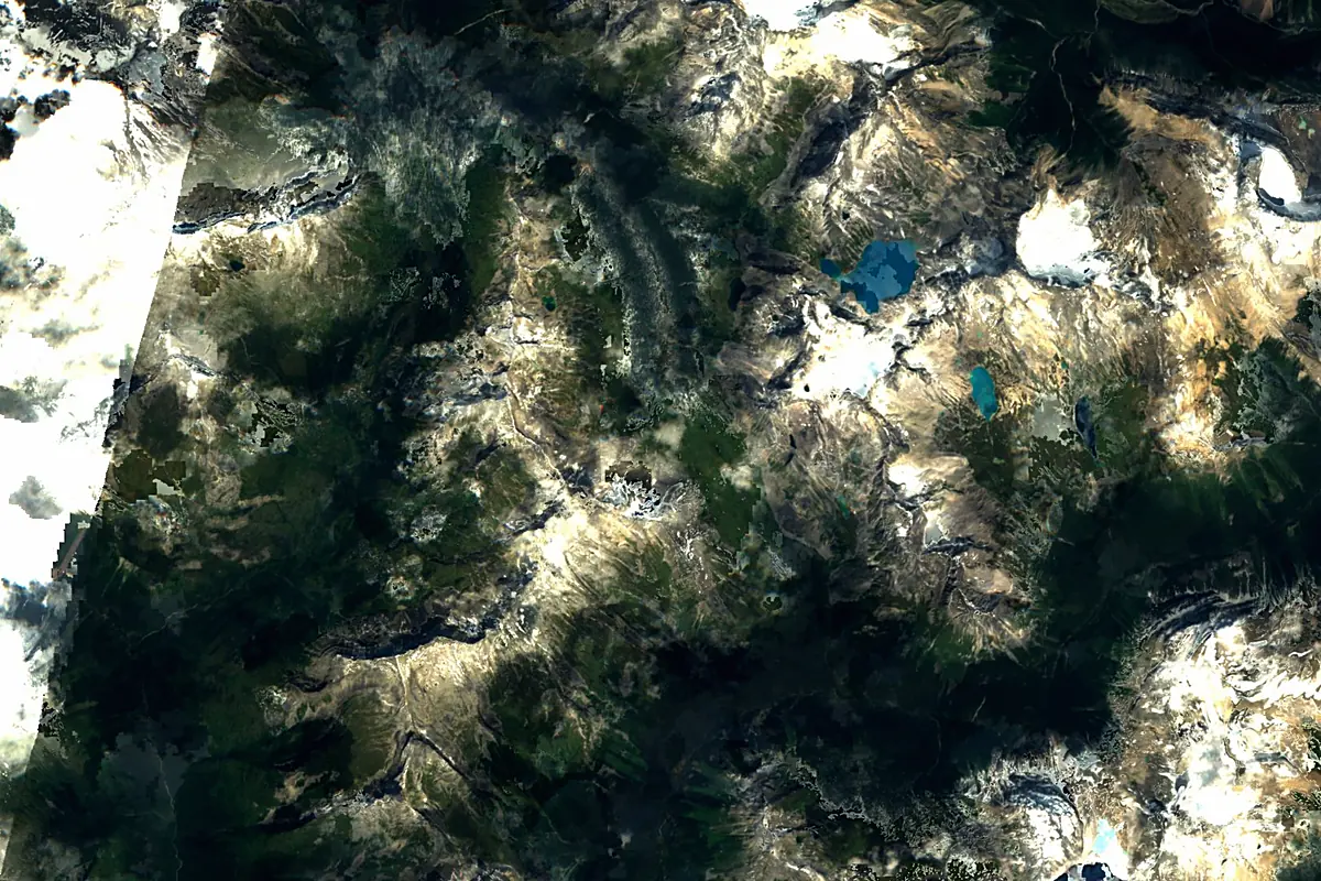
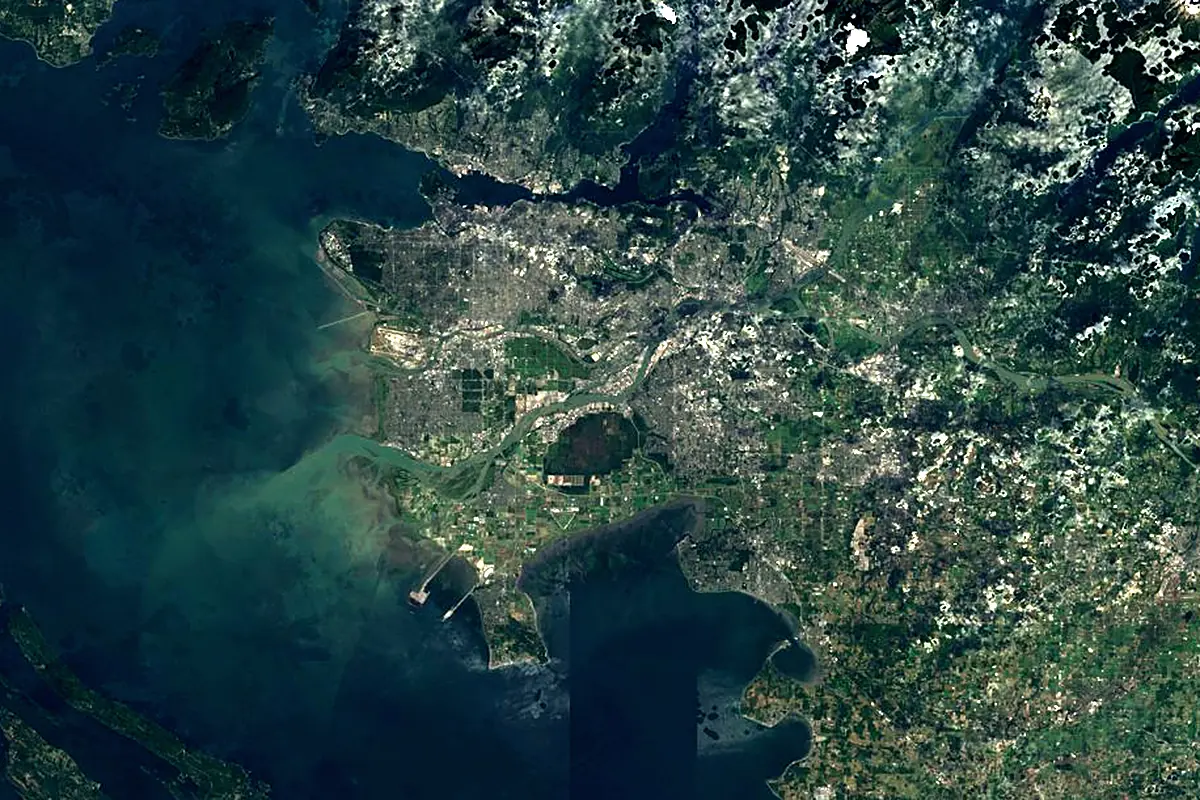
Sentinel-2 cloudless 2016 by EOX IT Services GmbH (contains modified Copernicus Sentinel data 2016), CC BY 4.0. The glowing line is the river as drawn by RiverATLAS.
Photos
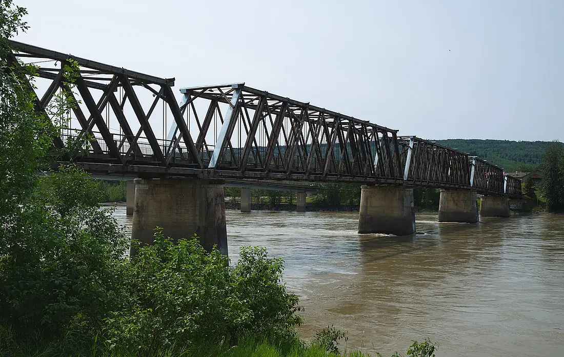
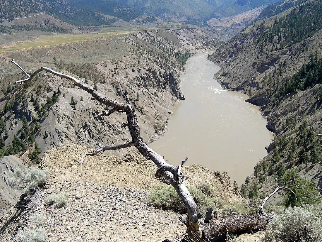
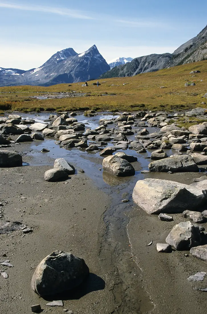
Fraser River in pictures
Tributaries
Where it flows, and what flows into it
Tributaries (42)
Also: Chilcotin River, Pitt River, Quesnel River, Coquihalla River, West Road River, Harrison River, Anderson River, Robson River, Bridge River, McGregor River, Stave River, Moose River, Doré River, Salmon River, Bowron River, Coquitlam River, Cottonwood River, Seton River, Sumas River, Kanaka Creek, Willow River, Brunette River, Chehalis River, Churn Creek
Nearby
Rivers nearby
Canada489 km770 m³/s156 km awayColumbia River United States2,000 km7,500 m³/s324 km awayWillamette RiverUnited States301 km900 m³/s389 km awayKootenay RiverCanada780 km780 m³/s386 km awayPend Oreille RiverCanada209 km740 m³/s390 km awaySnake RiverUnited States1,735 km1,600 m³/s445 km awayClark ForkUnited States499 km620 m³/s499 km away
Where these numbers come from
| Name, length, places | Wikidata (Q269710) · CC0 |
|---|---|
| Course, profile, basin | RiverATLAS v1.0 (HydroATLAS, Linke et al. 2019) · CC BY 4.0 — followed from the source to the mouth given by Wikidata |
| Flow | WaterGAP (RiverATLAS), 1971–2000 · CC BY 4.0 |
| Climate along the river | WorldClim (RiverATLAS), 1970–2000 · CC BY 4.0 |
| Towns, bridges, dams | Wikidata · CC0; GeoNames · CC BY 4.0 |
| Along the river | © OpenStreetMap contributors · ODbL |
| Images | EOX Sentinel-2 cloudless 2016 · CC BY 4.0; Wikimedia Commons |
| Our other atlases | Cascadyas, Lakeyas, Coastya, Peakyas, Islandyas — Wikidata · CC0; © OpenStreetMap contributors · ODbL; GeoNames · CC BY 4.0; HydroLAKES · CC BY 4.0; NOAA OISST |
Every source and licence is on the data sources page.
The family
Do you prefer beaches, lakes, mountains, waterfalls, islands, rivers or canyons?
Same idea, other landscapes: field atlases built on open data, month by month, in seven languages.
beaches Find your beach: sea temperature, sun and swimming month by month.Visit lakes
 Every lake on Earth: water temperature, ice, depth and the shore.Coming soonVisit mountains
 Every summit in 3D: summit weather, the 0 °C line, huts and trails.Visit waterfalls
 Every waterfall: height, flow month by month and when it roars.Coming soonVisit islands
 Every island from the sea up: size, sea temperature, ferries and 3D.Coming soonVisit
  rivers
 Every river from source to sea: the journey, the flow and the basin in numbers.You are here
 canyons
 Every canyon cut to scale: depth to the floor, rim and floor temperatures, trails and viewpoints.Coming soonVisit