River
Dnieper
2,285 km from source to mouth · Ukraine, Russia and Belarus.
 Ukraine, Russia and BelarusFlows into Dnieper Estuary1st longest in Ukraine
In numbers
Length
2,285km
Average flow
1,700m³/s
Basin
503,500km²
Drop
222m
from 219 m to -3 m
Countries
3
The journey
From source to mouth
2,285 km of river and 68 stops on the way: 31 towns and cities on its banks, dams, bridges and the tributaries that feed it.
- 0 kmValdai Hillsat 219 m
- 76 kmVyazmatributary
- 106 kmDymatributary
- 138 kmVopetstributary
- 155 kmOsmatributary
- 159 kmDorogobuzh9,086 people
- 213 kmVoptributary
- 218 kmUstromtributary
- 242 kmKhmosttributary
- 254 kmVolosttributary
- 268 kmBolshoy Vopetstributary
- 268 kmMaly Vopetstributary
- 299 kmKolodnyatributary
- 307 kmSmolensk310,460 people
- 382 kmMereyatributary
- 449 kmKobelyakskiye Porogi
- 453 kmVorsha100,422 people
- 454 kmOrsha101,662 people
- 455 kmAršycatributary
- 460 kmAdroŭtributary
- 525 kmArcislaŭkatributary
- 551 kmMahilyow352,891 people
- 555 kmSviatoje Lake, Mahilioŭ0.5 km²
- 557 kmDubravienkatributary
- 595 kmLachva Rivertributary
- 607 kmMokryankatributary
- 655 kmUchliasćtributary
- 701 kmRahachow31,323 people
- 704 kmDabrycatributary
- 729 kmZhlobin75,732 people
- 739 kmAsušnoje0.5 km²
- 804 kmOzero Vir (korvsjö)0.4 km²
- 823 kmRechytsa64,508 people
- 850 kmVialikaje0.4 km²
- 959 kmOzero Lutovskoje0.4 km²
- 1,136 kmKyiv Reservoir636 km²
- 1,138 kmVyshhorod29,913 people
- 1,141 kmRedkyne Lake, Kyiv0.5 km²
- 1,148 kmObolon239,500 people
- 1,155 kmKyiv2,952,301 people
- 1,156 kmPechersk100,900 people
- 1,159 kmDniprovskyi357,900 people
- 1,164 kmPozniaky104,400 people
- 1,262 kmPereiaslav27,088 people
- 1,296 kmKaniv Reservoir470 km²
- 1,298 kmKaniv23,503 people
- 1,365 kmCherkasy269,836 people
- 1,474 kmKremenchuk Reservoir1,849 km²
- 1,474 kmSvitlovodsk45,312 people
- 1,487 kmKremenchuk215,271 people
- 1,510 kmHorishni Plavni49,854 people
- 1,606 kmKamianske Reservoir507 km²
- 1,612 kmKamyanske226,845 people
- 1,654 kmDnipro968,502 people
- 1,658 kmNyzhnodniprovsk160,123 people
- 1,751 kmDnieper Reservoir132 km²
- 1,756 kmZaporizhzhya710,052 people
- 1,756 kmZaporizhzhia710,052 people
- 1,830 kmEnerhodar52,237 people
- 1,856 kmNikopol105,160 people
- 1,996 kmKakhovka35,900 people
- 2,004 kmKakhovka Reservoir2,092 km²
- 2,006 kmNova Kakhovka45,069 people
- 2,068 kmOleshky24,639 people
- 2,076 kmKherson279,131 people
- 2,082 kmKruhle Ozero1.1 km²
- 2,091 kmBile5.0 km²
- 2,093 kmPohorile Ozero2.2 km²
- 2,104 kmKrasnykove Ozero2.1 km²
- 2,285 kmDnieper Estuaryat -3 m
Water level along the river (RiverATLAS; the height is exaggerated). Towns: GeoNames and Wikidata; bridges, dams and tributaries: Wikidata.
River in Eastern Europe
At the mouth it carries 1,670 m³/s on average: an Olympic pool every 1.5 seconds. It drops from 219 m to -3 m, 0.1 m per kilometre on average. Its basin covers 503,500 km², about the size of ES. 29.3 million people live in it. Highest water: from May to July; lowest: from January to March. It is heavily dammed: reservoirs can hold 89% of a year's flow.
Where to start
- KyivLargest city on its banks · 2,952,301 people
- Gomel Airport (GME)Nearest airport with scheduled flights, 234 km from the cityCar hire at KBP airport (Boryspil)Discover Cars · Affiliate link↗
- On the water230 ferry piers, marinas, boat rentals and boat ramps along the river (OpenStreetMap)
- From May to SeptemberThe best months to visit
Dnieper, month by month
Highest water: from May to July
Lowest water: from January to March. Freezing months (average below −4 °C): from January to February. Best months to visit: from May to September.
From about 1,000 m³/s in the lowest month to 3,100 m³/s in the highest. An estimate: the monthly flow is modelled from the lowest and highest months of WaterGAP (RiverATLAS, 1971–2000) and the rain and snow along the river (WorldClim). Dams change the real rhythm. The chip is the average air temperature; below it, the month's rain.
Plan the trip
Plan the trip: boat trips, a bed by the river, a car
Some links above are affiliate links: if you book through them we may earn a commission, at no extra cost to you. It never changes what the data on this page says.
The basin
Dnieper: the basin in numbers
509,822 km² of land send their water to this river. This is what lives on it.
- 29.3millionpeople live in the basin
- 59/km²people per km²
- 160maverage altitude of the basin
- 590mmof rain a year (basin average)
- 7.0°Caverage air temperature
- 3%protected areas
- 1.5%covered by lakes
- 44km³held in reservoirs
What covers the basin
- 22% Forest
- 48% Cropland
- 13% Pasture
- 2% Towns and cities
RiverATLAS (HydroATLAS v1.0, CC BY 4.0): land cover, people, protected areas, glaciers and dams over the whole basin upstream of the mouth.
Along the river
Dnieper: what you find on the way
- 16Weirs
- 17LocksDnieper River and 16 more
- 10WaterfallsShevchik Falls and 9 more
- 12Boat ramps
- 82Ferry piersRiver Station, Pier No. 1, Pier No. 2 and 79 more
- 92MarinasKOBA Pirates Bay, YACHT CHARTER, Bartolomeo and 89 more
- 68River beachesTroia nude beach, Obolon nude beach, Beach on Pryrichna and 65 more
From OpenStreetMap, within 2.8 km of the river. Not mapped is not the same as not there.
Cross-checked with our atlases
Dnieper in our other atlases
What our sister atlases know about the waterfalls on this river, the lakes it flows through, the beaches at its mouth, the mountains where it rises and the islands off its mouth.
 1waterfall on the riverCascadyas
 16lakes on its wayLakeyas
Waterfalls (1)
On the river, by Cascadyas
- Kobelyakskiye Porogikm 392
Cascadyas is coming soonOpen Cascadyas ↗
Lakes and reservoirs (16)
Lakes it flows through, by Lakeyas
- Asušnojekm 6460.5km²
- Ozero Lutovskojekm 8380.4km²
- Kyiv Reservoirkm 993636km²
- Kaniv Reservoirkm 1,133470km²
- Kremenchuk Reservoirkm 1,2881,849km²
- Kamianske Reservoirkm 1,403507km²
- Dnieper Reservoirkm 1,530 · 53 m deep132km²
- Kakhovka Reservoirkm 1,752 · 26 m deep2,092km²
8 more on LakeyasLakeyas is coming soonOpen Lakeyas ↗
From space
The source and the mouth, seen from orbit
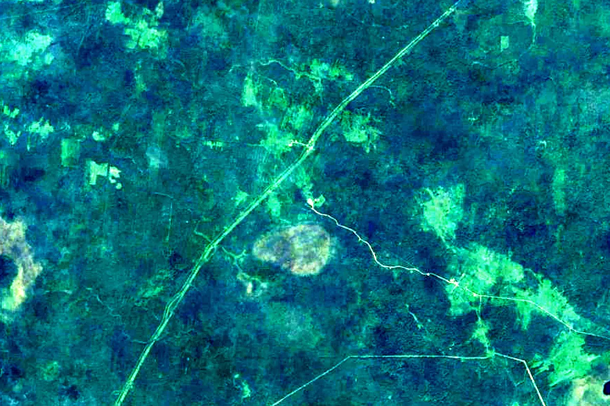
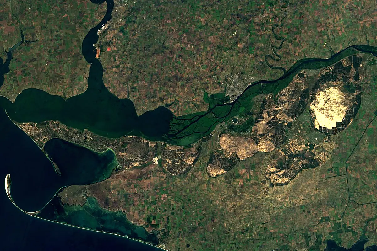
Sentinel-2 cloudless 2016 by EOX IT Services GmbH (contains modified Copernicus Sentinel data 2016), CC BY 4.0. The glowing line is the river as drawn by RiverATLAS.
Photos
Dnieper in pictures
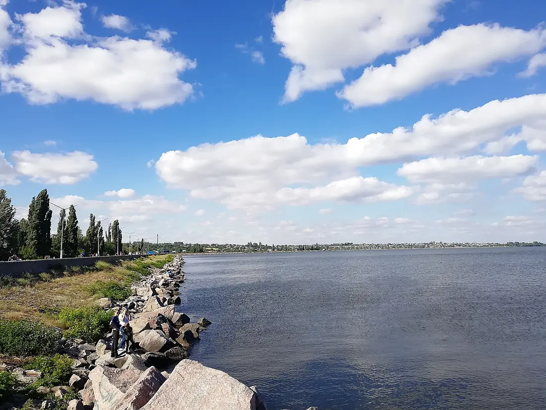
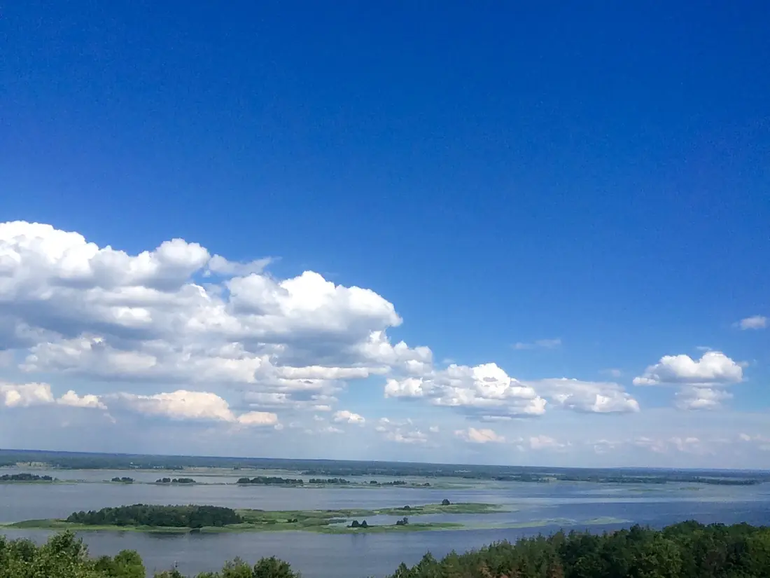
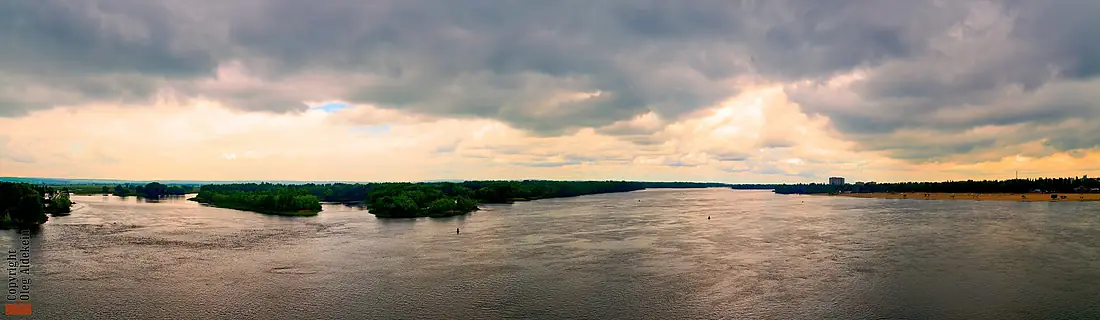
Tributaries
Where it flows, and what flows into it
Tributaries (111)
Ukraine1,130 km360 m³/sjoins at km 999Pripyat RiverUkraine775 km460 m³/sjoins at km 926PselUkraine717 km55 m³/sjoins at km 1,313SozhBelarus648 km210 m³/sjoins at km 803BerezinaBelarus613 km140 m³/sjoins at km 694Inhulets RiverUkraine549 km1,500 m³/sjoins at km 1,816VorsklaUkraine464 km36 m³/sjoins at km 1,355TeterivUkraine385 km18 m³/sSula RiverUkraine363 km29 m³/sRos RiverUkraine346 km22 m³/sjoins at km 1,160Oril RiverUkraine346 km13 m³/sjoins at km 1,436Samara RiverUkraine320 km17 m³/sjoins at km 1,450Also: Vop, Vyazma, Tiasmyn, Bazavluk River, Stuhna River, Supiy River, Lybid River, Mereya, Viedryč, Adamenka, Aršyca, Adroŭ, Khmost, Berezina, Uchliasć, Zolotonoshka, Lachva River, Mokra Sura, Dubravienka, Osma, Bilozerka, Dobasna, Krapivnya, Mokra Moskovka
Nearby
Rivers nearby
Ukraine806 km160 m³/s50 km awayInhulets RiverUkraine549 km1,500 m³/s22 km awayInhul RiverUkraine354 km150 m³/s50 km awayDniesterUkraine1,352 km310 m³/s163 km awayDanube Romania2,850 km5,400 m³/s251 km awayAlmaUkraine83 km1.2 m³/s209 km awaySalhyrUkraine232 km2.0 m³/s223 km awayBâc
 Moldova155 km1.0 m³/s226 km away
Where these numbers come from
| Name, length, places | Wikidata (Q40855) · CC0 |
|---|---|
| Course, profile, basin | RiverATLAS v1.0 (HydroATLAS, Linke et al. 2019) · CC BY 4.0 — followed from the source to the mouth given by Wikidata |
| Flow | WaterGAP (RiverATLAS), 1971–2000 · CC BY 4.0 |
| Climate along the river | WorldClim (RiverATLAS), 1970–2000 · CC BY 4.0 |
| Towns, bridges, dams | Wikidata · CC0; GeoNames · CC BY 4.0 |
| Along the river | © OpenStreetMap contributors · ODbL |
| Images | EOX Sentinel-2 cloudless 2016 · CC BY 4.0; Wikimedia Commons |
| Our other atlases | Cascadyas, Lakeyas — Wikidata · CC0; © OpenStreetMap contributors · ODbL; GeoNames · CC BY 4.0; HydroLAKES · CC BY 4.0; NOAA OISST |
Every source and licence is on the data sources page.
The family
Do you prefer beaches, lakes, mountains, waterfalls, islands, rivers or canyons?
Same idea, other landscapes: field atlases built on open data, month by month, in seven languages.
 beaches
 Find your beach: sea temperature, sun and swimming month by month.Visit lakes
 Every lake on Earth: water temperature, ice, depth and the shore.Coming soonVisit
  mountains
 Every summit in 3D: summit weather, the 0 °C line, huts and trails.Visit waterfalls
 Every waterfall: height, flow month by month and when it roars.Coming soonVisit
  islands
 Every island from the sea up: size, sea temperature, ferries and 3D.Coming soonVisit
  rivers
 Every river from source to sea: the journey, the flow and the basin in numbers.You are here
 canyons
 Every canyon cut to scale: depth to the floor, rim and floor temperatures, trails and viewpoints.Coming soonVisit