River
Dniester
1,352 km from source to mouth · Ukraine and Moldova.
 Ukraine and MoldovaFlows into Dniester Lyman2nd longest in Ukraine
In numbers
Length
1,352km
Average flow
310m³/s
Basin
72,100km²
Drop
466m
from 463 m to -3 m
Countries
2
The journey
From source to mouth
1,352 km of river and 68 stops on the way: 3 towns and cities on its banks, dams, bridges and the tributaries that feed it.
- 0 kmUkrainian Carpathiansat 463 m
- 23 kmTopilnytsiatributary
- 50 kmSambir34,444 people
- 75 kmStrviazhtributary
- 101 kmVereshchytsiatributary
- 106 kmBystritsatributary
- 110 kmLitniankatributary
- 117 kmZubratributary
- 117 kmShchyretstributary
- 149 kmStryi Rivertributary
- 155 kmLuhtributary
- 166 kmLiubeshkatributary
- 168 kmSvichatributary
- 184 kmSvirzhtributary
- 188 kmSivkatributary
- 205 kmLimnytsiatributary
- 207 kmLukva Rivertributary
- 209 kmHnyla Lypatributary
- 219 kmBystrytsia Rivertributary
- 234 kmHorozhankatributary
- 251 kmZolota Lypatributary
- 260 kmTlumachtributary
- 276 kmKoropetstributary
- 282 kmDeleva Waterfalls16 m
- 300 kmVozyliv Waterfalls
- 309 kmBaryshtributary
- 340 kmStrypatributary
- 347 kmProvaltributary
- 365 kmDzhuryntributary
- 405 kmSerettributary
- 455 kmNichlavatributary
- 480 kmDzvinatributary
- 498 kmZhvanchyktributary
- 498 kmZbruchtributary
- 543 kmMukshatributary
- 544 kmSmotrych Rivertributary
- 590 kmStudenytsiatributary
- 590 kmTernavatributary
- 610 kmUshytsia Rivertributary
- 632 kmKalyustributary
- 635 kmMatirkatributary
- 643 kmDniester Reservoir75 km²
- 646 kmZhvan Rivertributary
- 666 kmKarayetstributary
- 666 kmLyadova Rivertributary
- 684 kmNemyiatributary
- 696 kmDerlotributary
- 696 kmKotlubaivkatributary
- 739 kmOlynektributary
- 745 kmMurafa Rivertributary
- 758 kmRusavatributary
- 809 kmMarkivka Rivertributary
- 850 kmKamenka River, Nistrutributary
- 866 kmCușmircatributary
- 885 kmBilochtributary
- 890 kmOcnatributary
- 900 kmChornatributary
- 902 kmRibnitsatributary
- 955 kmYahorlyk Rivertributary
- 977 kmDubăsari Reservoir35 km²
- 983 kmRăuttributary
- 1,002 kmIcheltributary
- 1,091 kmBâctributary
- 1,091 kmLake Salas2.7 km²
- 1,101 kmBender110,175 people
- 1,125 kmTiraspol157,000 people
- 1,219 kmOzero Tudorove3.0 km²
- 1,238 kmLake Bile0.9 km²
- 1,238 kmLake Safiany0.4 km²
- 1,352 kmDniester Lymanat -3 m
Water level along the river (RiverATLAS; the height is exaggerated). Towns: GeoNames and Wikidata; bridges, dams and tributaries: Wikidata.
River in Eastern Europe
At the mouth it carries 310 m³/s on average: an Olympic pool every 8.1 seconds. It drops from 463 m to -3 m, 0.3 m per kilometre on average. Its basin covers 72,100 km², about the size of SL. 7.1 million people live in it. Highest water: from March to May; lowest: from December to February. It is heavily dammed: reservoirs can hold 56% of a year's flow.
Where to start
- TiraspolLargest city on its banks · 157,000 people
- Chişinău International Airport (RMO)Nearest airport with scheduled flights, 54 km from the cityCar hire at ODS airport (Odesa)Discover Cars · Affiliate link↗
- On the water125 ferry piers, marinas, boat rentals and boat ramps along the river (OpenStreetMap)
- From May to SeptemberThe best months to visit
Dniester, month by month
Highest water: from March to May
Lowest water: from December to February. Best months to visit: from May to September.
From about 200 m³/s in the lowest month to 770 m³/s in the highest. An estimate: the monthly flow is modelled from the lowest and highest months of WaterGAP (RiverATLAS, 1971–2000) and the rain and snow along the river (WorldClim). Dams change the real rhythm. The chip is the average air temperature; below it, the month's rain.
Plan the trip
Plan the trip: boat trips, a bed by the river, a car
Some links above are affiliate links: if you book through them we may earn a commission, at no extra cost to you. It never changes what the data on this page says.
The basin
Dniester: the basin in numbers
72,362 km² of land send their water to this river. This is what lives on it.
- 7.1millionpeople live in the basin
- 99/km²people per km²
- 290maverage altitude of the basin
- 640mmof rain a year (basin average)
- 8.0°Caverage air temperature
- 7%protected areas
- 0.5%covered by lakes
- 6.0km³held in reservoirs
What covers the basin
- 14% Forest
- 54% Cropland
- 8% Pasture
- 4% Towns and cities
RiverATLAS (HydroATLAS v1.0, CC BY 4.0): land cover, people, protected areas, glaciers and dams over the whole basin upstream of the mouth.
Along the river
Dniester: what you find on the way
- 22Weirs
- 76WaterfallsMaiden tears, Cascadă, Cascada Bulboana and 73 more
- 1Boat ramps
- 27Ferry piersMolovata, Molovata Nouă, Tour boats and 24 more
- 95MarinasZona de parcare a corabiei „Legenda” and 94 more
- 21River beachesBabyn Beach, Plaja, Plaja Cocieri and 18 more
From OpenStreetMap, within 2.3 km of the river. Not mapped is not the same as not there.
Cross-checked with our atlases
Dniester in our other atlases
What our sister atlases know about the waterfalls on this river, the lakes it flows through, the beaches at its mouth, the mountains where it rises and the islands off its mouth.
 2waterfalls on the riverCascadyas
 6lakes on its wayLakeyas
 6mountains at the sourcePeakyas
Waterfalls (2)
On the river, by Cascadyas
- Deleva Waterfallskm 26416m
- Vozyliv Waterfallskm 281
Cascadyas is coming soonOpen Cascadyas ↗
Lakes and reservoirs (6)
Lakes it flows through, by Lakeyas
- Dniester Reservoirkm 60275km²
- Dubăsari Reservoirkm 915 · 19 m deep35km²
- Lake Salaskm 1,0222.7km²
- Ozero Tudorovekm 1,1413.0km²
- Lake Bilekm 1,1590.9km²
- Lake Safianykm 1,1590.4km²
Lakeyas is coming soonOpen Lakeyas ↗
Mountains at the source (6)
Within 15 km of the source, by Peakyas
- Krzemień15 km away1,335m
- Bukowe Berdo14 km away1,311m
- Wołowy14 km away1,248m
- Rozluch7.5 km away933m
- Halicz15 km away
- Kopa Bukowska14 km away
From space
The source and the mouth, seen from orbit
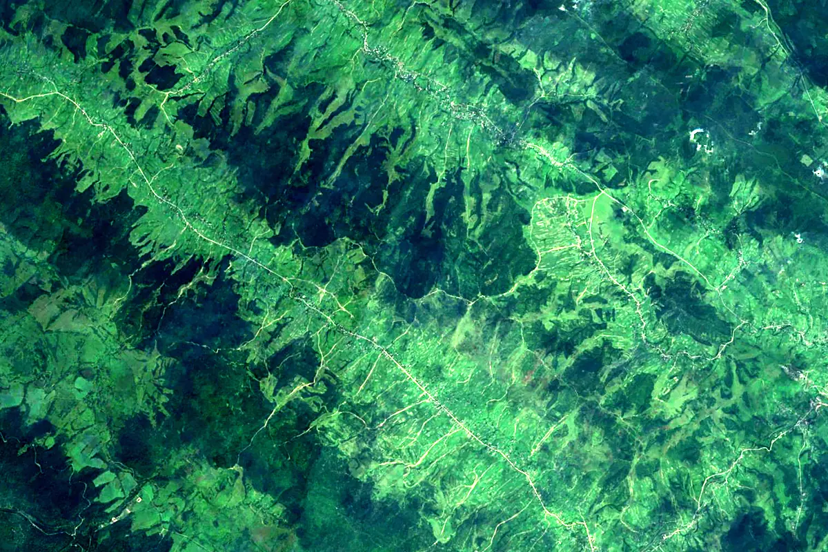
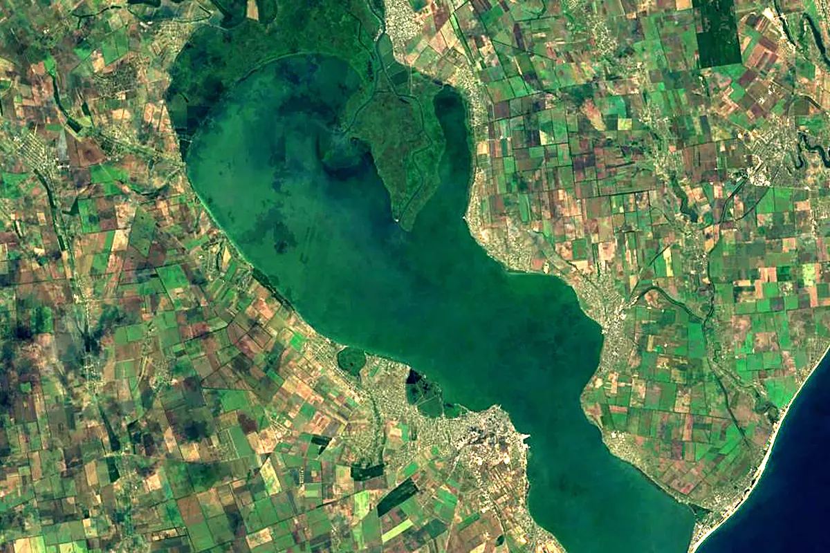
Sentinel-2 cloudless 2016 by EOX IT Services GmbH (contains modified Copernicus Sentinel data 2016), CC BY 4.0. The glowing line is the river as drawn by RiverATLAS.
Photos
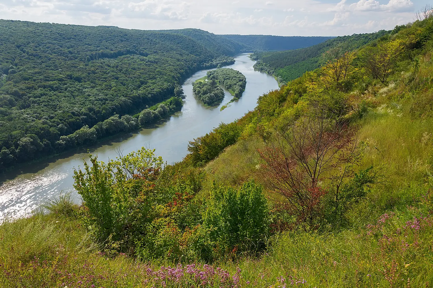
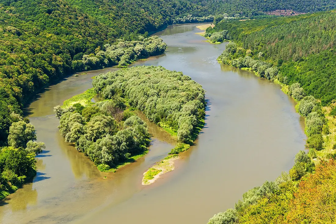
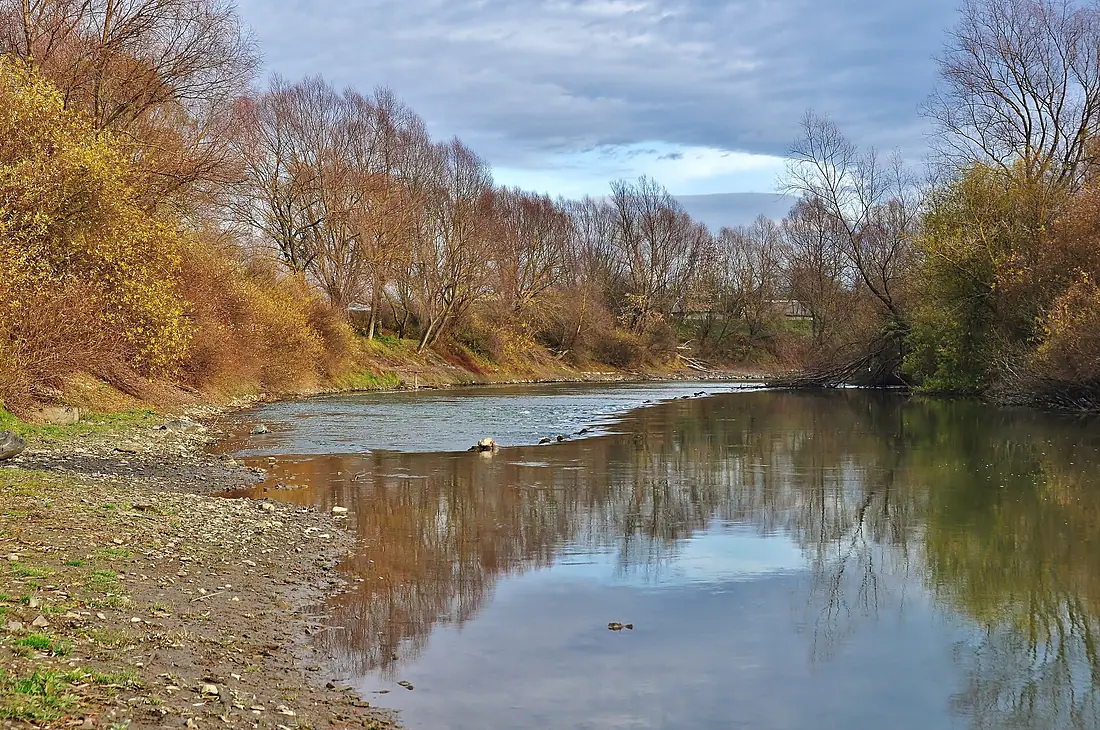
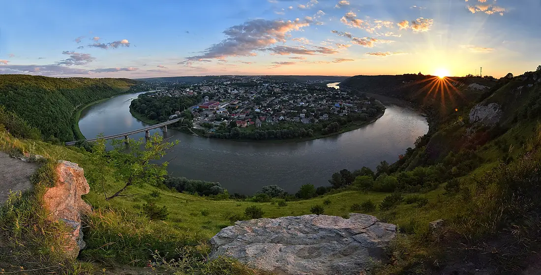
Dniester in pictures
Tributaries
Where it flows, and what flows into it
Tributaries (96)
Moldova286 km320 m³/sjoins at km 921ZbruchUkraine247 km230 m³/sjoins at km 467SeretUkraine242 km12 m³/sjoins at km 380Stryi RiverUkraine232 km45 m³/sjoins at km 139Smotrych RiverUkraine168 km4.0 m³/sjoins at km 510BâcMoldova155 km1.0 m³/sjoins at km 1,022Also: Hnyla Lypa, Strypa, Zolota Lypa, Murafa River, Bystrytsia River, Kuchurhan, Strviazh, Limnytsia, Turunchuk River, Botna, Svicha, Kamenka River, Nistru, Zubra, Rusava, Zhvanchyk, Koropets, Lyadova River, Yahorlyk River, Hnizna, Ichel, Nichlava, Zhvan River, Bystritsa, Ushytsia River
Nearby
Rivers nearby
 Romania2,850 km5,400 m³/s123 km awayDnieperUkraine2,285 km1,700 m³/s163 km awayBâcMoldova155 km1.0 m³/s94 km awaySouthern BugUkraine806 km160 m³/s148 km awayRăutMoldova286 km320 m³/s137 km awayPrutMoldova953 km120 m³/s183 km awayInhul RiverUkraine354 km150 m³/s148 km awaySiret RiverRomania740 km230 m³/s200 km away
Where these numbers come from
| Name, length, places | Wikidata (Q131210) · CC0 |
|---|---|
| Course, profile, basin | RiverATLAS v1.0 (HydroATLAS, Linke et al. 2019) · CC BY 4.0 — followed from the source to the mouth given by Wikidata |
| Flow | WaterGAP (RiverATLAS), 1971–2000 · CC BY 4.0 |
| Climate along the river | WorldClim (RiverATLAS), 1970–2000 · CC BY 4.0 |
| Towns, bridges, dams | Wikidata · CC0; GeoNames · CC BY 4.0 |
| Along the river | © OpenStreetMap contributors · ODbL |
| Images | EOX Sentinel-2 cloudless 2016 · CC BY 4.0; Wikimedia Commons |
| Our other atlases | Cascadyas, Lakeyas, Peakyas — Wikidata · CC0; © OpenStreetMap contributors · ODbL; GeoNames · CC BY 4.0; HydroLAKES · CC BY 4.0; NOAA OISST |
Every source and licence is on the data sources page.
The family
Do you prefer beaches, lakes, mountains, waterfalls, islands, rivers or canyons?
Same idea, other landscapes: field atlases built on open data, month by month, in seven languages.
 beaches
 Find your beach: sea temperature, sun and swimming month by month.Visit lakes
 Every lake on Earth: water temperature, ice, depth and the shore.Coming soonVisit mountains
 Every summit in 3D: summit weather, the 0 °C line, huts and trails.Visit waterfalls
 Every waterfall: height, flow month by month and when it roars.Coming soonVisit
  islands
 Every island from the sea up: size, sea temperature, ferries and 3D.Coming soonVisit
  rivers
 Every river from source to sea: the journey, the flow and the basin in numbers.You are here
 canyons
 Every canyon cut to scale: depth to the floor, rim and floor temperatures, trails and viewpoints.Coming soonVisit