River
Irtysh
4,248 km from source to mouth · Russia, China and Kazakhstan.
 Russia, China and KazakhstanFlows into Ob2nd longest in Russia
In numbers
Length
4,248km
Average flow
3,000m³/s
Basin
1,643,000km²
Drop
1,711m
from 1,711 m to 0 m
Countries
3
The journey
From source to mouth
4,248 km of river and 68 stops on the way: 6 towns and cities on its banks, dams, bridges and the tributaries that feed it.
- 0 kmMongolian Altaiat 1,711 m
- 274 kmKelan Rivertributary
- 313 kmBurqin Hetributary
- 377 kmQaba rivertributary
- 477 kmQaljırtributary
- 680 kmKürshim Rivertributary
- 866 kmLake Zaysan4,194 km²
- 933 kmOskemen Reservoir29 km²
- 946 kmUst-Kamenogorsk319,067 people
- 946 kmÜlbi Rivertributary
- 1,039 kmUba Rivertributary
- 1,099 kmShar Rivertributary
- 1,151 kmSemey292,780 people
- 1,243 kmChagantributary
- 1,557 kmPavlodar329,002 people
- 1,624 kmOzero Shirokaya Lyaga1.5 km²
- 1,654 kmOzero Bashkirskoye0.5 km²
- 1,733 kmOzero Orlovskoye0.9 km²
- 1,928 kmTugochaykatributary
- 1,932 kmOzero Ivanovskoye (lanaw sa Rusya, Omskaya Oblast')3.1 km²
- 2,042 kmOmsk1,101,367 people
- 2,044 kmOmtributary
- 2,118 kmOzero Krugloye (lanaw sa Rusya, Omskaya Oblast', lat 55,38, long 73,18)2.0 km²
- 2,122 kmOzero Ashkul'0.9 km²
- 2,158 kmZamaraykatributary
- 2,165 kmOzero Grishino (lanaw nga asin)0.7 km²
- 2,173 kmSargatkatributary
- 2,187 kmOzero Inberen'0.9 km²
- 2,234 kmOzero Bol'shiye Murly8.5 km²
- 2,278 kmArtynkatributary
- 2,289 kmTakmystributary
- 2,289 kmByzovkatributary
- 2,292 kmOzero Zaton0.4 km²
- 2,333 kmOzero Yelankul'0.4 km²
- 2,345 kmNyukhalovkatributary
- 2,373 kmTaratributary
- 2,384 kmZaykatributary
- 2,396 kmIbeykatributary
- 2,441 kmOzero Seitovskoye (lanaw nga porma ug arko)2.7 km²
- 2,442 kmOzero Sinengsu1.0 km²
- 2,455 kmUytributary
- 2,494 kmOshatributary
- 2,532 kmShishtributary
- 2,532 kmPlotnikovkatributary
- 2,551 kmBolshaya Taychinkatributary
- 2,581 kmImistributary
- 2,652 kmSyrtsatributary
- 2,693 kmKiptributary
- 2,693 kmTentistributary
- 2,713 kmAvatributary
- 2,758 kmIshimtributary
- 2,810 kmOzero Mangulinsk2.0 km²
- 2,848 kmBichatributary
- 2,850 kmBolshoy Kiliktributary
- 2,913 kmKishatributary
- 2,948 kmBolshaya Supratributary
- 2,987 kmInzhuratributary
- 3,009 kmVagaytributary
- 3,085 kmToboltributary
- 3,089 kmTobolsk113,800 people
- 3,104 kmRogalikhatributary
- 3,146 kmTaymatributary
- 3,146 kmAremzyankatributary
- 3,222 kmBolshoy Ingairtributary
- 3,222 kmNoskatributary
- 3,271 kmTurtastributary
- 3,333 kmTyumatributary
- 3,600 kmErginsky Sor172 km²
- 3,654 kmKhanty-Mansiysk113,663 people
- 4,248 kmObat 0 m
Water level along the river (RiverATLAS; the height is exaggerated). Towns: GeoNames and Wikidata; bridges, dams and tributaries: Wikidata.
River in Mongolia, China, Kazakhstan and Russia
At the mouth it carries 3,000 m³/s on average: 1.2 Olympic pools every second. It drops from 1,711 m to 0 m, 0.4 m per kilometre on average. Its basin covers 1,643,000 km², about the size of IR. 13.5 million people live in it. Highest water: from May to July; lowest: from December to March. It is heavily dammed: reservoirs can hold 59% of a year's flow.
Where to start
- OmskLargest city on its banks · 1,101,367 people
- Omsk Central Airport (OMS)Nearest airport with scheduled flights, 4 km from the city
- On the water85 ferry piers, marinas, boat rentals and boat ramps along the river (OpenStreetMap)
- From June to AugustThe best months to visit
Irtysh, month by month
Highest water: from May to July
Lowest water: from December to March. Freezing months (average below −4 °C): from November to March. Best months to visit: from June to August.
From about 1,800 m³/s in the lowest month to 4,300 m³/s in the highest. An estimate: the monthly flow is modelled from the lowest and highest months of WaterGAP (RiverATLAS, 1971–2000) and the rain and snow along the river (WorldClim). Dams change the real rhythm. The chip is the average air temperature; below it, the month's rain.
Plan the trip
Plan the trip: boat trips, a bed by the river, a car
Some links above are affiliate links: if you book through them we may earn a commission, at no extra cost to you. It never changes what the data on this page says.
The basin
Irtysh: the basin in numbers
1,139,612 km² of land send their water to this river. This is what lives on it.
- 13.5millionpeople live in the basin
- 12/km²people per km²
- 315maverage altitude of the basin
- 413mmof rain a year (basin average)
- 1.0°Caverage air temperature
- 5%protected areas
- 2.1%covered by lakes
- 2%permafrost
- 55km³held in reservoirs
What covers the basin
- 32% Forest
- 17% Cropland
- 27% Pasture
- 1% Towns and cities
RiverATLAS (HydroATLAS v1.0, CC BY 4.0): land cover, people, protected areas, glaciers and dams over the whole basin upstream of the mouth.
Along the river
Irtysh: what you find on the way
- 11Weirs
- 13LocksUst-Kamenogorsk Lock and 12 more
- 1Waterfalls
- 3Boat ramps
- 75Ferry piers
- 6Marinas
- 8River beachesMiami and 7 more
From OpenStreetMap, within 3.0 km of the river. Not mapped is not the same as not there.
Cross-checked with our atlases
Irtysh in our other atlases
What our sister atlases know about the waterfalls on this river, the lakes it flows through, the beaches at its mouth, the mountains where it rises and the islands off its mouth.
 17lakes on its wayLakeyas
Lakes and reservoirs (17)
Lakes it flows through, by Lakeyas
- Lake Zaysankm 871 · 15 m deep4,194km²
- Oskemen Reservoirkm 938 · 45 m deep29km²
- Ozero Ivanovskoye (lanaw sa Rusya, Omskaya Oblast')km 1,9433.1km²
- Ozero Krugloye (lanaw sa Rusya, Omskaya Oblast', lat 55,38, long 73,18)km 2,1302.0km²
- Ozero Bol'shiye Murlykm 2,2478.5km²
- Ozero Seitovskoye (lanaw nga porma ug arko)km 2,4552.7km²
- Ozero Mangulinskkm 2,8262.0km²
- Erginsky Sorkm 3,620172km²
9 more on LakeyasLakeyas is coming soonOpen Lakeyas ↗
From space
The source and the mouth, seen from orbit
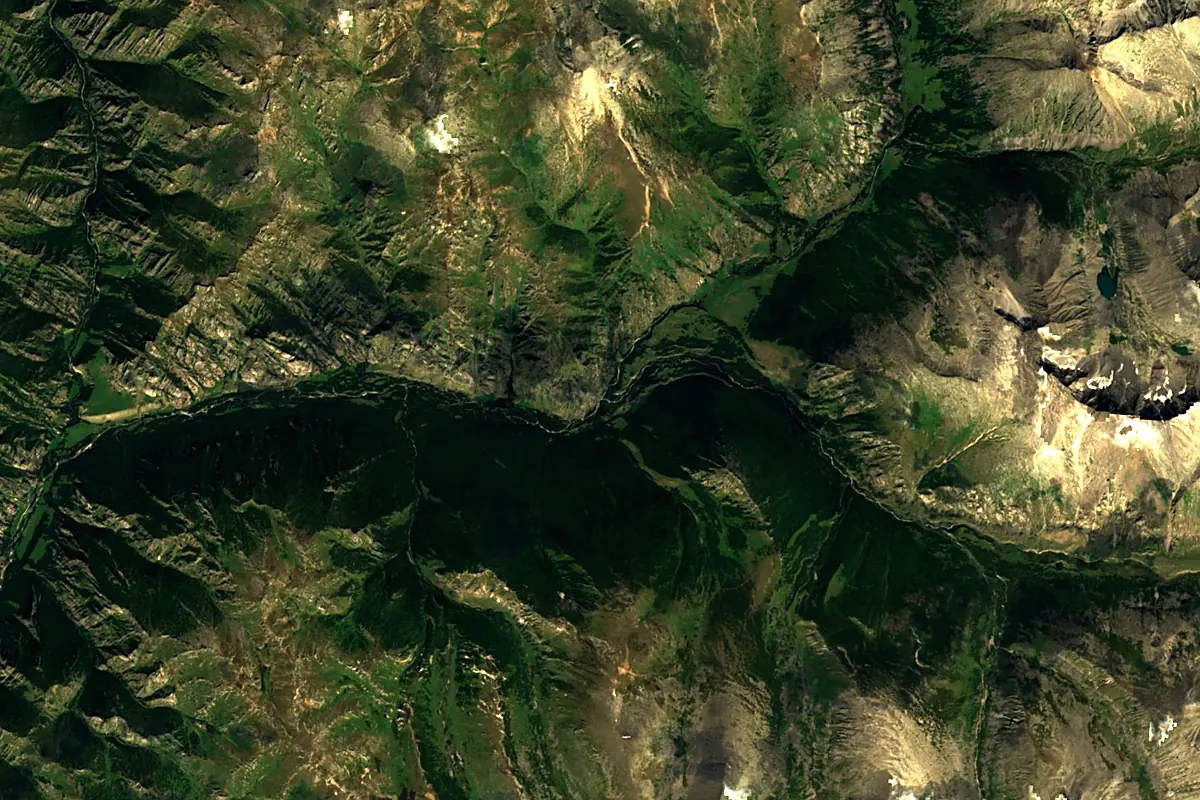
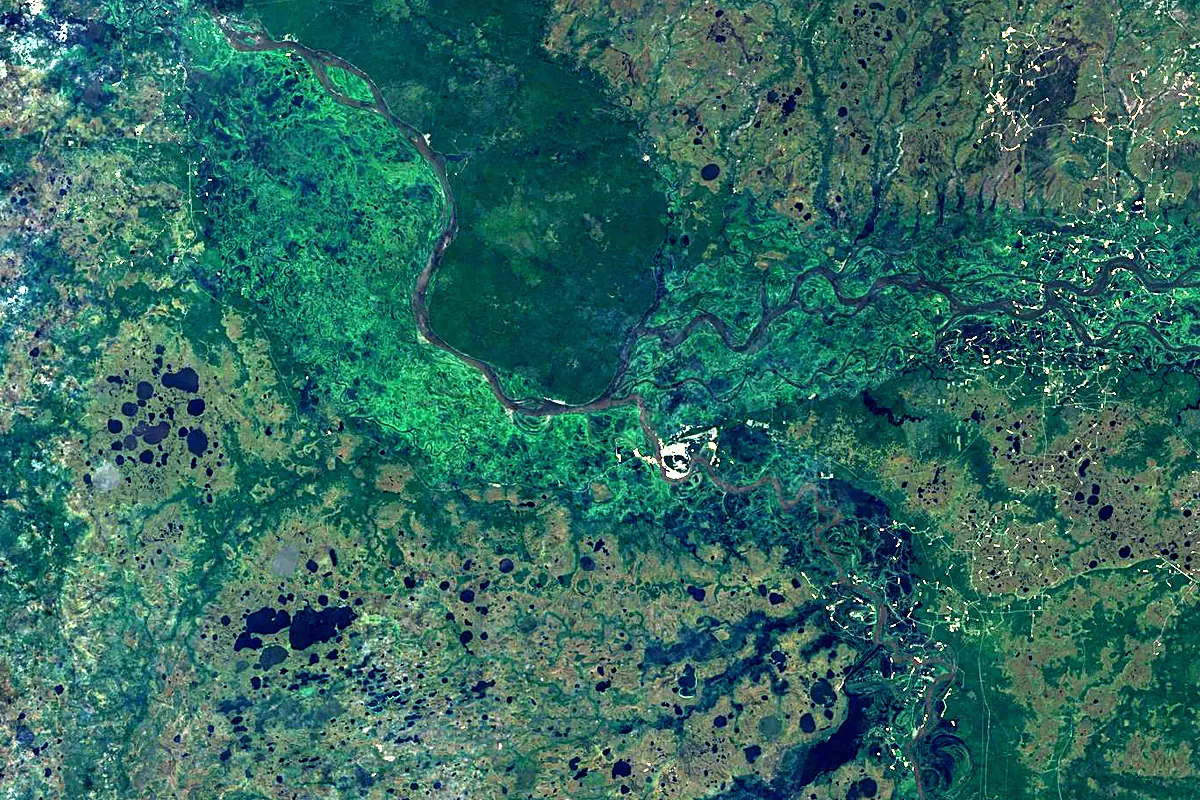
Sentinel-2 cloudless 2016 by EOX IT Services GmbH (contains modified Copernicus Sentinel data 2016), CC BY 4.0. The glowing line is the river as drawn by RiverATLAS.
Photos
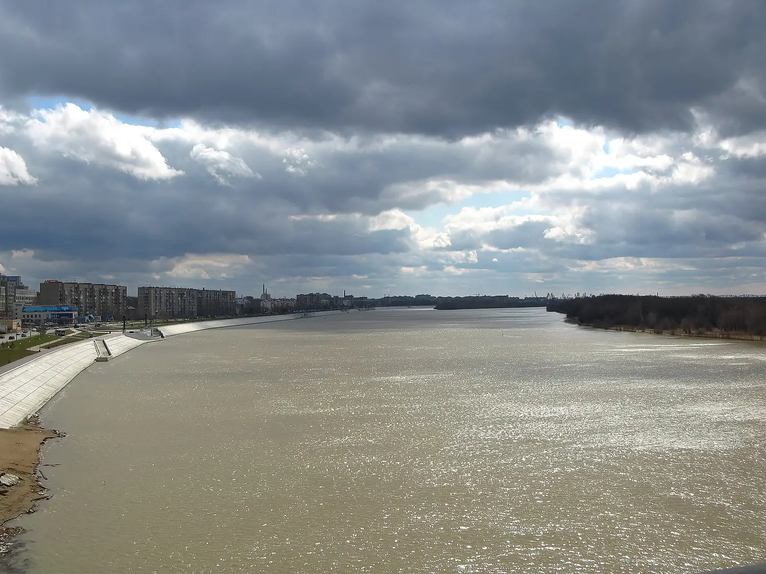
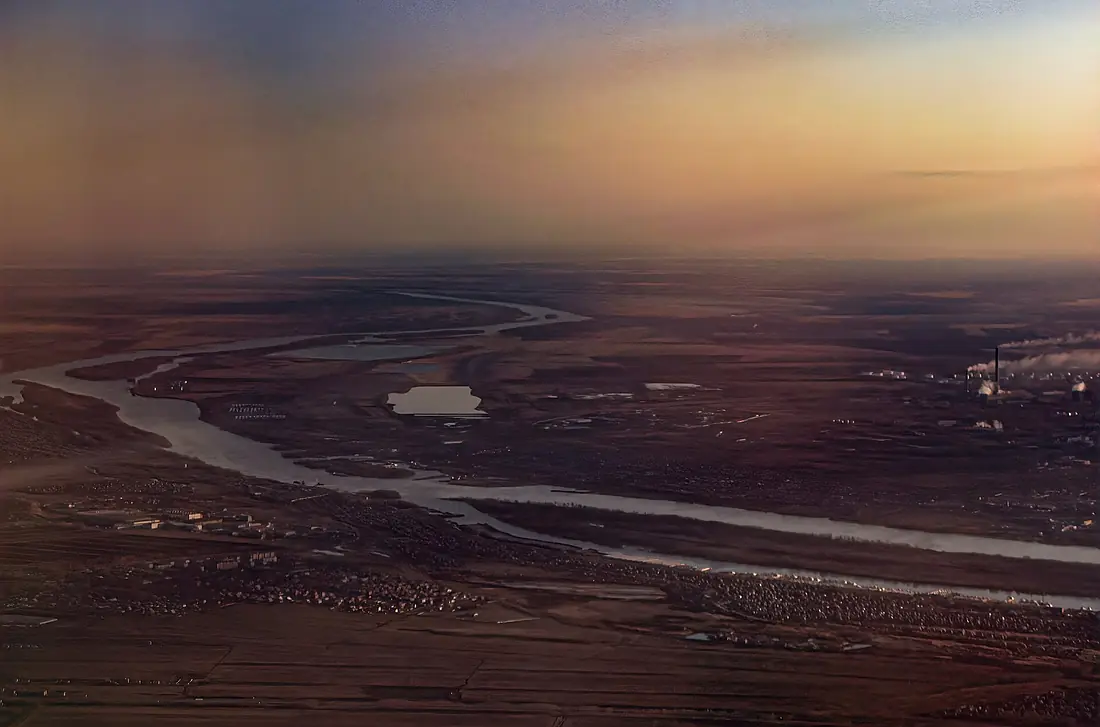
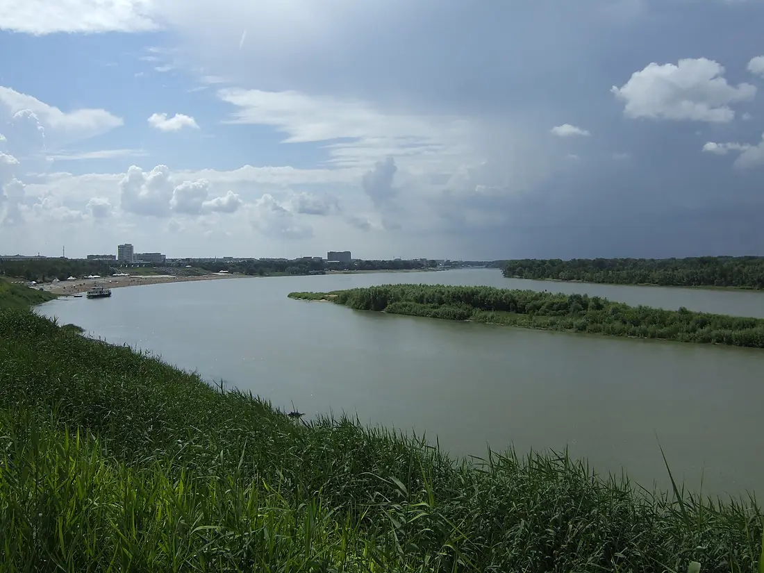
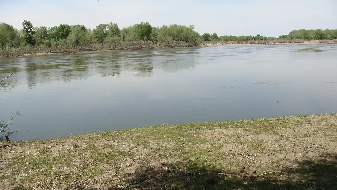
Irtysh in pictures
Tributaries
Where it flows, and what flows into it
It flows into
ObRussia3,650 km12,500 m³/sTributaries (98)
Russia2,450 km56 m³/sjoins at km 2,773TobolRussia1,591 km800 m³/sjoins at km 3,102OmRussia1,091 km64 m³/sjoins at km 2,055Bukhtarma RiverKazakhstan336 km210 m³/sUba RiverKazakhstan278 km180 m³/sjoins at km 1,045Ülbi RiverKazakhstan100 km100 m³/sjoins at km 952Also: Demyanka, Konda, Tara, Uy, Osha, Shish, Vagay, Naryn, Chagan, Noska, Kürshim River, Tuy, Turtas, Qaljır, Shar River, Sogom, Bicha, Byzovka, Ananyevka, Stepanovka, Tozepka, Tyuma, Zayka, Kamyshlovka
Where these numbers come from
| Name, length, places | Wikidata (Q128102) · CC0 |
|---|---|
| Course, profile, basin | RiverATLAS v1.0 (HydroATLAS, Linke et al. 2019) · CC BY 4.0 — followed from the source to the mouth given by Wikidata |
| Flow | WaterGAP (RiverATLAS), 1971–2000 · CC BY 4.0 |
| Climate along the river | WorldClim (RiverATLAS), 1970–2000 · CC BY 4.0 |
| Towns, bridges, dams | Wikidata · CC0; GeoNames · CC BY 4.0 |
| Along the river | © OpenStreetMap contributors · ODbL |
| Images | EOX Sentinel-2 cloudless 2016 · CC BY 4.0; Wikimedia Commons |
| Our other atlases | Lakeyas — Wikidata · CC0; © OpenStreetMap contributors · ODbL; GeoNames · CC BY 4.0; HydroLAKES · CC BY 4.0; NOAA OISST |
Every source and licence is on the data sources page.
The family
Do you prefer beaches, lakes, mountains, waterfalls, islands, rivers or canyons?
Same idea, other landscapes: field atlases built on open data, month by month, in seven languages.
 beaches
 Find your beach: sea temperature, sun and swimming month by month.Visit lakes
 Every lake on Earth: water temperature, ice, depth and the shore.Coming soonVisit
  mountains
 Every summit in 3D: summit weather, the 0 °C line, huts and trails.Visit
  waterfalls
 Every waterfall: height, flow month by month and when it roars.Coming soonVisit
  islands
 Every island from the sea up: size, sea temperature, ferries and 3D.Coming soonVisit
  rivers
 Every river from source to sea: the journey, the flow and the basin in numbers.You are here
 canyons
 Every canyon cut to scale: depth to the floor, rim and floor temperatures, trails and viewpoints.Coming soonVisit