In numbers
Length
827km
Average flow
1,100m³/s
Basin
62,030km²
Drop
737m
from 798 m to 61 m
Country
1
The journey
From source to mouth
827 km of river and 68 stops on the way: 6 towns and cities on its banks, dams, bridges and the tributaries that feed it.
- 0 kmSourceat 798 m
- 19 kmKuysugtributary
- 51 kmShoratributary
- 56 kmTerensugtributary
- 56 kmBalyksutributary
- 85 kmBolshoy Kazyrtributary
- 116 kmTebatributary
- 132 kmBelsutributary
- 143 kmNagazaktributary
- 148 kmMayzastributary
- 156 kmMezhdurechensk101,026 people
- 162 kmUsatributary
- 178 kmMrassutributary
- 186 kmTutuyastributary
- 201 kmTalzhinatributary
- 201 kmAbashevatributary
- 201 kmErbogachtributary
- 220 kmAbagur6,696 people
- 225 kmKondomatributary
- 227 kmNovokuznetsk528,747 people
- 230 kmAbatributary
- 252 kmEsaulkatributary
- 256 kmPetriktributary
- 256 kmUskattributary
- 284 kmBolshaya Kuryatributary
- 288 kmKukshatributary
- 291 kmVerkhnyaya Terstributary
- 301 kmSrednyaya Terstributary
- 305 kmChyorny Naryktributary
- 327 kmLyagushechyatributary
- 334 kmNizhnyaya Terstributary
- 361 kmTuralatributary
- 361 kmTykhtatributary
- 361 kmBungaraptributary
- 415 kmTaydontributary
- 425 kmBolshaya Osipovatributary
- 433 kmBystrukhatributary
- 434 kmMungattributary
- 453 kmZalomnayatributary
- 454 kmGryaznayatributary
- 513 kmBolshaya Promyshlennayatributary
- 521 kmKuzbassky Bridge, Kemerovo
- 523 kmBolshaya Kamyshnayatributary
- 524 kmKemerovo542,928 people
- 524 kmKuznetskiy Bridge, Kemerovo
- 555 kmBolshaya Podikovatributary
- 567 kmStrelinatributary
- 579 kmPachatributary
- 595 kmKungurkatributary
- 616 kmIskitimtributary
- 653 kmLebyazhya Rivertributary
- 654 kmChuburtributary
- 665 kmShumikhatributary
- 665 kmSosnovkatributary
- 676 kmBolshaya Chyornaya Rivertributary
- 687 kmTugoyakovkatributary
- 702 kmUmtributary
- 713 kmBasandaykatributary
- 717 kmKommunalny Bridge
- 721 kmTomsk544,566 people
- 722 kmUshaykatributary
- 731 kmBolshaya Kirgizkatributary
- 734 kmSeversk109,844 people
- 739 kmKislovkatributary
- 759 kmSamus'katributary
- 762 kmKamyshkatributary
- 764 kmMostovkatributary
- 769 kmShishkoboykatributary
- 774 kmOzero Tikhonovskoye0.5 km²
- 827 kmObat 61 m
Water level along the river (RiverATLAS; the height is exaggerated). Towns: GeoNames and Wikidata; bridges, dams and tributaries: Wikidata.
River in Khakassia, Kemerovo Oblast, and Tomsk Oblast, Russia
At the mouth it carries 1,110 m³/s on average: an Olympic pool every 2.3 seconds. It drops from 798 m to 61 m, 0.9 m per kilometre on average. Its basin covers 62,030 km², about the size of LV. 2.7 million people live in it. Highest water: from April to June; lowest: from December to March. No large dam holds it back: it is one of the world's free-flowing rivers.
Where to start
- TomskLargest city on its banks · 544,566 people
- Tomsk Kamov Airport (TOF)Nearest airport with scheduled flights, 20 km from the city
- On the water22 ferry piers, marinas, boat rentals and boat ramps along the river (OpenStreetMap)
- Kayak and canoe2 put-ins and rapids mapped (OpenStreetMap)
- From June to AugustThe best months to visit
Tom, month by month
Highest water: from April to June
Lowest water: from December to March. Freezing months (average below −4 °C): from November to March. Best months to visit: from June to August.
From about 130 m³/s in the lowest month to 3,700 m³/s in the highest. An estimate: the monthly flow is modelled from the lowest and highest months of WaterGAP (RiverATLAS, 1971–2000) and the rain and snow along the river (WorldClim). Dams change the real rhythm. The chip is the average air temperature; below it, the month's rain.
Plan the trip
Plan the trip: boat trips, a bed by the river, a car
Some links above are affiliate links: if you book through them we may earn a commission, at no extra cost to you. It never changes what the data on this page says.
The basin
Tom: the basin in numbers
61,311 km² of land send their water to this river. This is what lives on it.
- 2.7millionpeople live in the basin
- 45/km²people per km²
- 445maverage altitude of the basin
- 506mmof rain a year (basin average)
- 0.6°Caverage air temperature
- 19%protected areas
- 0.1%covered by lakes
- 4%permafrost
What covers the basin
- 77% Forest
- 10% Cropland
- 6% Pasture
- 2% Towns and cities
RiverATLAS (HydroATLAS v1.0, CC BY 4.0): land cover, people, protected areas, glaciers and dams over the whole basin upstream of the mouth.
Along the river
Tom: what you find on the way
- 6Weirs
- 2Waterfalls
- 2Rapids
- 2Boat ramps
- 13Ferry piers
- 7Marinas
- 5River beachesSemeykin Ostrov and 4 more
From OpenStreetMap, within 2.3 km of the river. Not mapped is not the same as not there.
Cross-checked with our atlases
Tom in our other atlases
What our sister atlases know about the waterfalls on this river, the lakes it flows through, the beaches at its mouth, the mountains where it rises and the islands off its mouth.
 1lake on its wayLakeyas
 4mountains at the sourcePeakyas
Lakes and reservoirs (1)
Lakes it flows through, by Lakeyas
- Ozero Tikhonovskoyekm 7940.5km²
Lakeyas is coming soonOpen Lakeyas ↗
Mountains at the source (4)
Within 15 km of the source, by Peakyas
- Karlygan7.6 km away1,747m
- Gora Kaskylakh2.9 km away
- Gora Bandit13 km away
- Gora Karabash11 km away
From space
The source and the mouth, seen from orbit
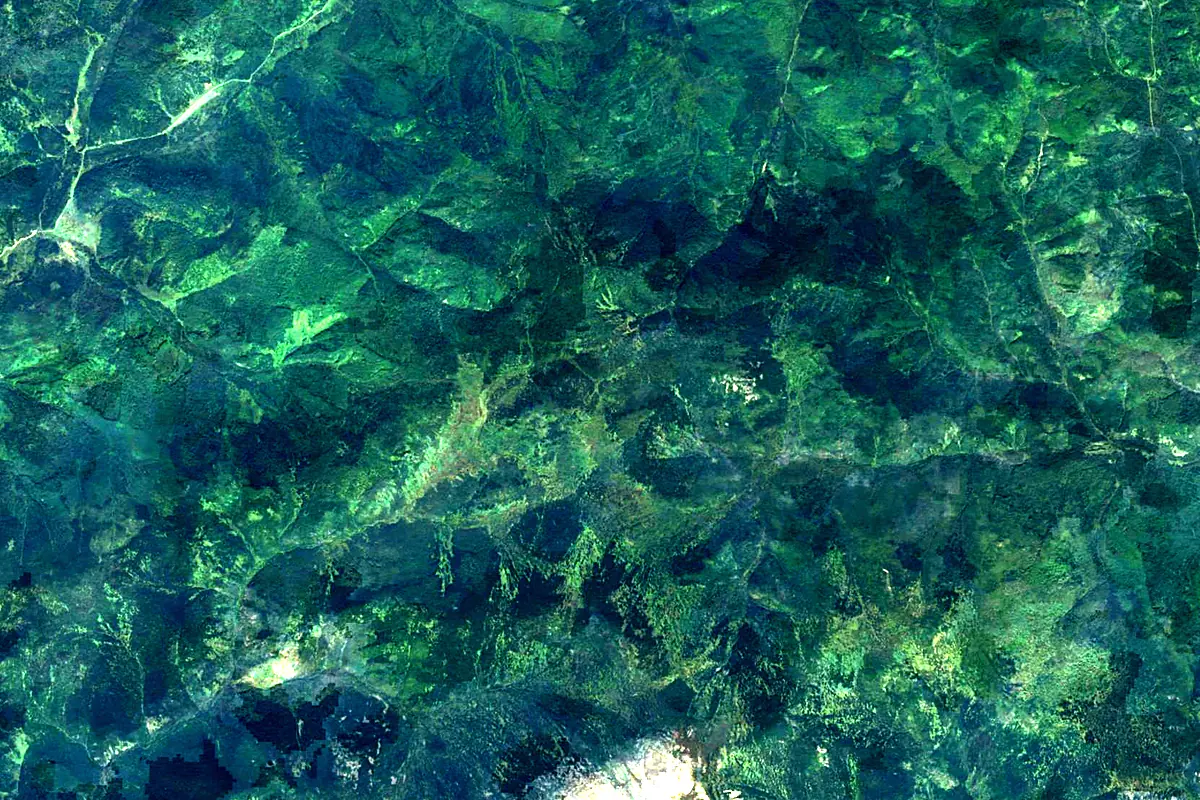
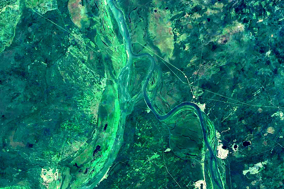
Sentinel-2 cloudless 2016 by EOX IT Services GmbH (contains modified Copernicus Sentinel data 2016), CC BY 4.0. The glowing line is the river as drawn by RiverATLAS.
Photos
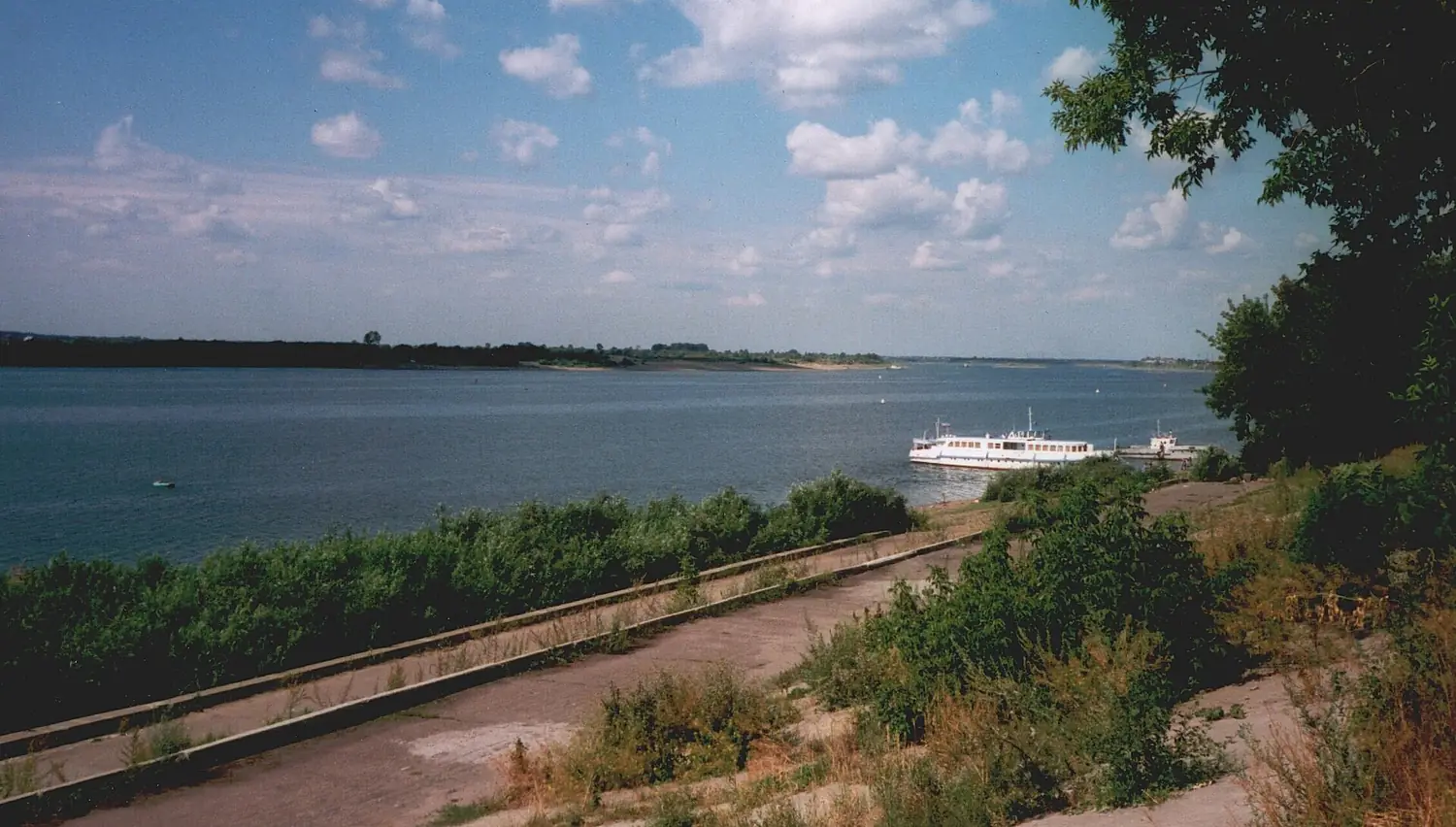
Tom in pictures
Tributaries
Where it flows, and what flows into it
It flows into
Ob Russia3,650 km12,500 m³/s
Tributaries (119)
Also: Kondoma, Mrassu, Aba, Ushayka, Verkhnyaya Ters, Usa, Bolshaya Kirgizka, Balyksu, Belsu, Abasheva, Chyorny Naryk, Chubur, Tugoyakovka, Strelina, Bolshaya Chyornaya River, Bolshaya Kamyshnaya, Podobas, Tuzakhsug, Kumzas, Mayzas, Chebalsu, Petrik, Kalandas, Igaza
Where these numbers come from
| Name, length, places | Wikidata (Q216188) · CC0 |
|---|---|
| Course, profile, basin | RiverATLAS v1.0 (HydroATLAS, Linke et al. 2019) · CC BY 4.0 — followed from the source to the mouth given by Wikidata |
| Flow | WaterGAP (RiverATLAS), 1971–2000 · CC BY 4.0 |
| Climate along the river | WorldClim (RiverATLAS), 1970–2000 · CC BY 4.0 |
| Towns, bridges, dams | Wikidata · CC0; GeoNames · CC BY 4.0 |
| Along the river | © OpenStreetMap contributors · ODbL |
| Images | EOX Sentinel-2 cloudless 2016 · CC BY 4.0; Wikimedia Commons |
| Our other atlases | Lakeyas, Peakyas — Wikidata · CC0; © OpenStreetMap contributors · ODbL; GeoNames · CC BY 4.0; HydroLAKES · CC BY 4.0; NOAA OISST |
Every source and licence is on the data sources page.
The family
Do you prefer beaches, lakes, mountains, waterfalls, islands, rivers or canyons?
Same idea, other landscapes: field atlases built on open data, month by month, in seven languages.
 beaches
 Find your beach: sea temperature, sun and swimming month by month.Visit lakes
 Every lake on Earth: water temperature, ice, depth and the shore.Coming soonVisit mountains
 Every summit in 3D: summit weather, the 0 °C line, huts and trails.Visit
  waterfalls
 Every waterfall: height, flow month by month and when it roars.Coming soonVisit
  islands
 Every island from the sea up: size, sea temperature, ferries and 3D.Coming soonVisit
  rivers
 Every river from source to sea: the journey, the flow and the basin in numbers.You are here
 canyons
 Every canyon cut to scale: depth to the floor, rim and floor temperatures, trails and viewpoints.Coming soonVisit