River
Oka
1,500 km from source to mouth · Russia.
 RussiaFlows into Volga
In numbers
Length
1,500km
Average flow
1,300m³/s
Basin
245,000km²
Drop
124m
from 184 m to 60 m
Country
1
The journey
From source to mouth
1,500 km of river and 68 stops on the way: 11 towns and cities on its banks, dams, bridges and the tributaries that feed it.
- 0 kmSourceat 184 m
- 26 kmRakitnyatributary
- 26 kmTrosnatributary
- 51 kmItskatributary
- 51 kmKromatributary
- 70 kmTsontributary
- 73 kmRybnitsatributary
- 83 kmOrël303,696 people
- 89 kmOrliktributary
- 100 kmNepolod'tributary
- 105 kmOptukhatributary
- 162 kmZushatributary
- 176 kmIstatributary
- 182 kmNugrtributary
- 218 kmBelyov12,746 people
- 218 kmVyrkatributary
- 240 kmSrednyaya Vyrkatributary
- 254 kmUpatributary
- 268 kmCherepettributary
- 279 kmSvobodtributary
- 293 kmZhizdratributary
- 303 kmPtaratributary
- 319 kmVyssatributary
- 328 kmUgratributary
- 337 kmYachenskoe Reservoir1.5 km²
- 339 kmKaluga324,989 people
- 345 kmKaluzhkatributary
- 364 kmUzherdtributary
- 388 kmKomolatributary
- 397 kmKrushmatributary
- 410 kmMyshegatributary
- 421 kmVashanatributary
- 440 kmTarusa9,791 people
- 444 kmTarusa Rivertributary
- 450 kmTulovnyatributary
- 457 kmProtvatributary
- 466 kmSknigatributary
- 469 kmPavlenskoye Lake1.4 km²
- 472 kmNaratributary
- 482 kmPushchino21,281 people
- 507 kmBesputatributary
- 507 kmLopasnyatributary
- 514 kmMutenkatributary
- 518 kmKashira49,638 people
- 526 kmKashirkatributary
- 549 kmBolshaya Smedvatributary
- 579 kmOsyotrtributary
- 585 kmKolomna147,690 people
- 590 kmMoskva Rivertributary
- 615 kmTsnatributary
- 647 kmVoblyatributary
- 696 kmSolotchatributary
- 716 kmVozhatributary
- 751 kmOzero Vel'ye1.3 km²
- 769 kmRakatributary
- 790 kmTysyatributary
- 807 kmIstyatributary
- 809 kmPronyatributary
- 812 kmOzero Dlinnoye (lanaw sa Rusya, Ryazanskaya Oblast')0.5 km²
- 964 kmShomsha0.3 km²
- 1,062 kmOzero Shiverkhi0.8 km²
- 1,082 kmOzero Staritsa (lanaw nga porma ug arko sa Rusya, Ryazanskaya Oblast', lat 54,91, long 41,79)0.6 km²
- 1,158 kmPrud Doschatinskiy2.5 km²
- 1,182 kmMurom126,931 people
- 1,202 kmOzero Staryy Klyuch0.5 km²
- 1,265 kmKustorka lake1.6 km²
- 1,346 kmDzerzhinsk233,126 people
- 1,390 kmNizhniy Novgorod1,259,013 people
- 1,390 kmNizhny Novgorod1,198,245 people
- 1,500 kmVolgaat 60 m
Water level along the river (RiverATLAS; the height is exaggerated). Towns: GeoNames and Wikidata; bridges, dams and tributaries: Wikidata.
River in Russia, tributary of Volga
At the mouth it carries 1,258 m³/s on average: an Olympic pool every 2.0 seconds. It drops from 184 m to 60 m, 0.1 m per kilometre on average. Its basin covers 245,000 km², about the size of GB. 26.9 million people live in it. Highest water, with the snowmelt: from April to July; lowest: from December to March. No large dam holds it back: it is one of the world's free-flowing rivers.
Where to start
- Nizhniy NovgorodLargest city on its banks · 1,259,013 people
- Nizhny Novgorod / Strigino International Airport (GOJ)Nearest airport with scheduled flights, 18 km from the city
- On the water122 ferry piers, marinas, boat rentals and boat ramps along the river (OpenStreetMap)
- Kayak and canoe3 put-ins and rapids mapped (OpenStreetMap)
- From May to AugustThe best months to visit
Oka, month by month
Highest water: from April to July
Lowest water: from December to March. Freezing months (average below −4 °C): from December to February. Melting snow makes up much of its water. Best months to visit: from May to August.
From about 390 m³/s in the lowest month to 5,000 m³/s in the highest. An estimate: the monthly flow is modelled from the lowest and highest months of WaterGAP (RiverATLAS, 1971–2000) and the rain and snow along the river (WorldClim). Dams change the real rhythm. The chip is the average air temperature; below it, the month's rain.
Plan the trip
Plan the trip: boat trips, a bed by the river, a car
Some links above are affiliate links: if you book through them we may earn a commission, at no extra cost to you. It never changes what the data on this page says.
The basin
Oka: the basin in numbers
244,308 km² of land send their water to this river. This is what lives on it.
- 26.9millionpeople live in the basin
- 112/km²people per km²
- 166maverage altitude of the basin
- 600mmof rain a year (basin average)
- 4.7°Caverage air temperature
- 6%protected areas
- 0.3%covered by lakes
- 0.4km³held in reservoirs
What covers the basin
- 38% Forest
- 37% Cropland
- 14% Pasture
- 4% Towns and cities
RiverATLAS (HydroATLAS v1.0, CC BY 4.0): land cover, people, protected areas, glaciers and dams over the whole basin upstream of the mouth.
Along the river
Oka: what you find on the way
- 9Weirs
- 8Locks
- 9Waterfalls
- 3Rapids
- 11Boat ramps
- 83Ferry piersDock 19, Dock 1552, Dock 148 and 80 more
- 27Marinas
- 21River beaches
From OpenStreetMap, within 2.6 km of the river. Not mapped is not the same as not there.
Cross-checked with our atlases
Oka in our other atlases
What our sister atlases know about the waterfalls on this river, the lakes it flows through, the beaches at its mouth, the mountains where it rises and the islands off its mouth.
 10lakes on its wayLakeyas
Lakes and reservoirs (10)
Lakes it flows through, by Lakeyas
- Yachenskoe Reservoirkm 3321.5km²
- Pavlenskoye Lakekm 4621.4km²
- Ozero Vel'yekm 7411.3km²
- Shomshakm 9500.3km²
- Ozero Shiverkhikm 1,0470.8km²
- Ozero Staritsa (lanaw nga porma ug arko sa Rusya, Ryazanskaya Oblast', lat 54,91, long 41,79)km 1,0660.6km²
- Prud Doschatinskiykm 1,1412.5km²
- Kustorka lakekm 1,2471.6km²
2 more on LakeyasLakeyas is coming soonOpen Lakeyas ↗
From space
The source and the mouth, seen from orbit
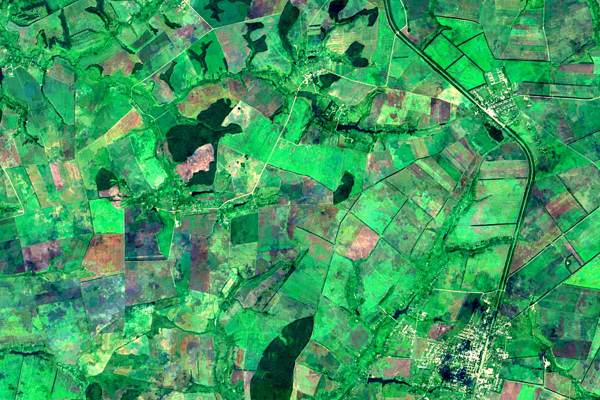
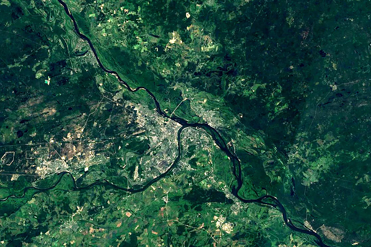
Sentinel-2 cloudless 2016 by EOX IT Services GmbH (contains modified Copernicus Sentinel data 2016), CC BY 4.0. The glowing line is the river as drawn by RiverATLAS.
Tributaries
Where it flows, and what flows into it
It flows into
VolgaRussia3,530 km8,100 m³/sTributaries (133)
Russia686 km150 m³/sjoins at km 1,286MokshaRussia656 km95 m³/sjoins at km 1,037Moskva RiverRussia473 km110 m³/sjoins at km 582Also: Ugra, Upa, Nara, Protva, Zhizdra, Osyotr, Pronya, Tyosha, Pra, Gus, Para, Vozha, Zusha, Lopasnya, Ushna, Besputa, Tsna, Kishma, Tarusa River, Trubezh, Vyssa, Myshega, Pyot, Seyma
Nearby
Rivers nearby
Russia686 km150 m³/s65 km awaySuraRussia841 km260 m³/s126 km awayVetlugaRussia889 km260 m³/s141 km awayMokshaRussia656 km95 m³/s221 km awayMoskva RiverRussia473 km110 m³/s350 km awayKamaRussia1,805 km4,100 m³/s390 km awayCheptsaRussia501 km130 m³/s439 km awayVyatkaRussia1,314 km890 m³/s474 km awayWhere these numbers come from
| Name, length, places | Wikidata (Q172089) · CC0 |
|---|---|
| Course, profile, basin | RiverATLAS v1.0 (HydroATLAS, Linke et al. 2019) · CC BY 4.0 — followed from the source to the mouth given by Wikidata |
| Flow | WaterGAP (RiverATLAS), 1971–2000 · CC BY 4.0 |
| Climate along the river | WorldClim (RiverATLAS), 1970–2000 · CC BY 4.0 |
| Towns, bridges, dams | Wikidata · CC0; GeoNames · CC BY 4.0 |
| Along the river | © OpenStreetMap contributors · ODbL |
| Images | EOX Sentinel-2 cloudless 2016 · CC BY 4.0; Wikimedia Commons |
| Our other atlases | Lakeyas — Wikidata · CC0; © OpenStreetMap contributors · ODbL; GeoNames · CC BY 4.0; HydroLAKES · CC BY 4.0; NOAA OISST |
Every source and licence is on the data sources page.
The family
Do you prefer beaches, lakes, mountains, waterfalls, islands, rivers or canyons?
Same idea, other landscapes: field atlases built on open data, month by month, in seven languages.
 beaches
 Find your beach: sea temperature, sun and swimming month by month.Visit lakes
 Every lake on Earth: water temperature, ice, depth and the shore.Coming soonVisit
  mountains
 Every summit in 3D: summit weather, the 0 °C line, huts and trails.Visit
  waterfalls
 Every waterfall: height, flow month by month and when it roars.Coming soonVisit
  islands
 Every island from the sea up: size, sea temperature, ferries and 3D.Coming soonVisit
  rivers
 Every river from source to sea: the journey, the flow and the basin in numbers.You are here
 canyons
 Every canyon cut to scale: depth to the floor, rim and floor temperatures, trails and viewpoints.Coming soonVisit