River
River Dee
110 km from source to mouth · United Kingdom.
 United KingdomFlows into Dee Estuary
In numbers
Length
110km
Average flow
30m³/s
Basin
1,817km²
Drop
160m
from 160 m to 0 m
Country
1
The journey
From source to mouth
110 km of river and 38 stops on the way: 8 towns and cities on its banks, dams, bridges and the tributaries that feed it.
- 0 kmDdualltat 160 m
- 4 kmLlyn Tegid3.9 km²
- 5 kmBala1,974 people
- 15 kmPont Cilan
- 20 kmRhaeadr Cynwyd
- 20 kmPont Dyffrdwy
- 29 kmPont Carrog
- 41 kmHorseshoe Falls
- 44 kmLlangollen Bridge
- 44 kmLlangollen3,658 people
- 50 kmPont Cysyllte
- 51 kmPontcysyllte AqueductUNESCO World Heritage
- 61 kmRiver Ceiriogtributary
- 64 kmOverton Bridge
- 68 kmBangor Bridge
- 74 kmRiver Clywedogtributary
- 78 kmHolt1,554 people
- 78 kmWych Brooktributary
- 79 kmFarndon Bridge
- 86 kmAldford Iron Bridge
- 92 kmBarrel Well House
- 92 kmChester House, garden chambers and wall
- 92 kmHoole1,180 people
- 92 kmBoundary wall to Number 17 Tower Summerhouse and boundary wall to Number 14A (Number 14A not included)
- 93 kmGrosvenor Rowing Club Boathouse (The East Boathouse)
- 93 kmGrove Cottage
- 93 kmQueens Park Bridge
- 93 kmChester90,524 people
- 93 kmChester Bandstand
- 93 kmOld Dee Bridge
- 93 kmHandbridge4,223 people
- 93 kmRetaining wall to bank of River Dee opposite County Hall (not included)
- 94 kmGrosvenor Bridge
- 94 kmChester Rail Bridge
- 95 km5, Sealand Road
- 95 kmBlacon13,495 people
- 104 kmJubilee Bridge
- 105 kmDeeside32,000 people
- 105 kmHawarden Bridge
- 110 kmDee Estuaryat 0 m
Water level along the river (RiverATLAS; the height is exaggerated). Towns: GeoNames and Wikidata; bridges, dams and tributaries: Wikidata.
River in England and Wales
At the mouth it carries 30 m³/s on average: an Olympic pool every 84 seconds. It drops from 160 m to 0 m, 1.5 m per kilometre on average. Its basin covers 1,817 km², about the size of GP. 379,000 people live in it. Highest water: from November to January. Its dams hold back little of its water (9.8% of a year's flow).
Where to start
- ChesterLargest city on its banks · 90,524 people
- Liverpool John Lennon Airport (LPL)Nearest airport with scheduled flights, 16 km from the cityCar hire at LPL airport (Liverpool)Discover Cars · Affiliate link↗
- On the water14 ferry piers, marinas, boat rentals and boat ramps along the river (OpenStreetMap)
- Kayak and canoe1 put-ins and rapids mapped (OpenStreetMap)
- From June to SeptemberThe best months to visit
River Dee, month by month
Highest water: from November to January
Best months to visit: from June to September.
From about 25 m³/s in the lowest month to 80 m³/s in the highest. An estimate: the monthly flow is modelled from the lowest and highest months of WaterGAP (RiverATLAS, 1971–2000) and the rain and snow along the river (WorldClim). Dams change the real rhythm. The chip is the average air temperature; below it, the month's rain.
Plan the trip
Plan the trip: boat trips, a bed by the river, a car
Some links above are affiliate links: if you book through them we may earn a commission, at no extra cost to you. It never changes what the data on this page says.
The basin
River Dee: the basin in numbers
1,991 km² of land send their water to this river. This is what lives on it.
- 379,000people live in the basin
- 191/km²people per km²
- 223maverage altitude of the basin
- 976mmof rain a year (basin average)
- 8.3°Caverage air temperature
- 34%protected areas
- 0.7%covered by lakes
- 0.2km³held in reservoirs
What covers the basin
- 5% Forest
- 10% Cropland
- 43% Pasture
- 9% Towns and cities
RiverATLAS (HydroATLAS v1.0, CC BY 4.0): land cover, people, protected areas, glaciers and dams over the whole basin upstream of the mouth.
Along the river
River Dee: what you find on the way
- 29WeirsHorseshoe Falls, Llangollen Town Weir and 27 more
- 31LocksShropshire Union Canal, Chemistry Lock, Bridge Lock and 28 more
- 5Waterfalls
- 1RapidsBala Mill Falls
- 9Boat rampsBala Lake slipway and 8 more
- 2Ferry piersThe Meadows, Sandy Lane
- 2MarinasLlangollen Moorings, Chirk Marina
From OpenStreetMap, within 1.4 km of the river. Not mapped is not the same as not there.
Cross-checked with our atlases
River Dee in our other atlases
What our sister atlases know about the waterfalls on this river, the lakes it flows through, the beaches at its mouth, the mountains where it rises and the islands off its mouth.
 2waterfalls on the riverCascadyas
 1lake on its wayLakeyas
 1beach at the mouth or on the banksCoastya
 172mountains at the sourcePeakyas
 1island off the mouthIslandyas
Waterfalls (2)
On the river, by Cascadyas
- Rhaeadr Cynwydkm 22
- Horseshoe Fallskm 43
Cascadyas is coming soonOpen Cascadyas ↗
Lakes and reservoirs (1)
Lakes it flows through, by Lakeyas
- Llyn Tegidkm 5 · 42 m deep3.9km²
Lakeyas is coming soonOpen Lakeyas ↗
Beaches (1)
At the mouth (25 km) and on the banks, by Coastya
- Thurstaston Beach11 km away17.0°C
Mountains at the source (172)
Within 15 km of the source, by Peakyas
- Snowdonia9.6 km away1,085m
- Aran Fawddwy7.0 km away · prominence 670 m905m
- Aran Benllyn6.2 km away · prominence 50 m885m
- Arenig Fawr9.5 km away · prominence 479 m854m
- Erw y Ddafad-ddu6.5 km away · prominence 38 m872m
- Glasgwm8.2 km away · prominence 215 m779m
- Arenig Fawr South Top9.2 km away836m
- Rhobell Fawr3.3 km away · prominence 309 m734m
164 more on PeakyasOpen Peakyas ↗
Islands off the mouth (1)
Within 30 km of the mouth, by Islandyas
- Hilbre Island17 km away0.0km²
Islandyas is coming soonOpen Islandyas ↗
From space
The source and the mouth, seen from orbit
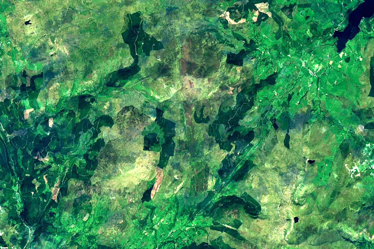
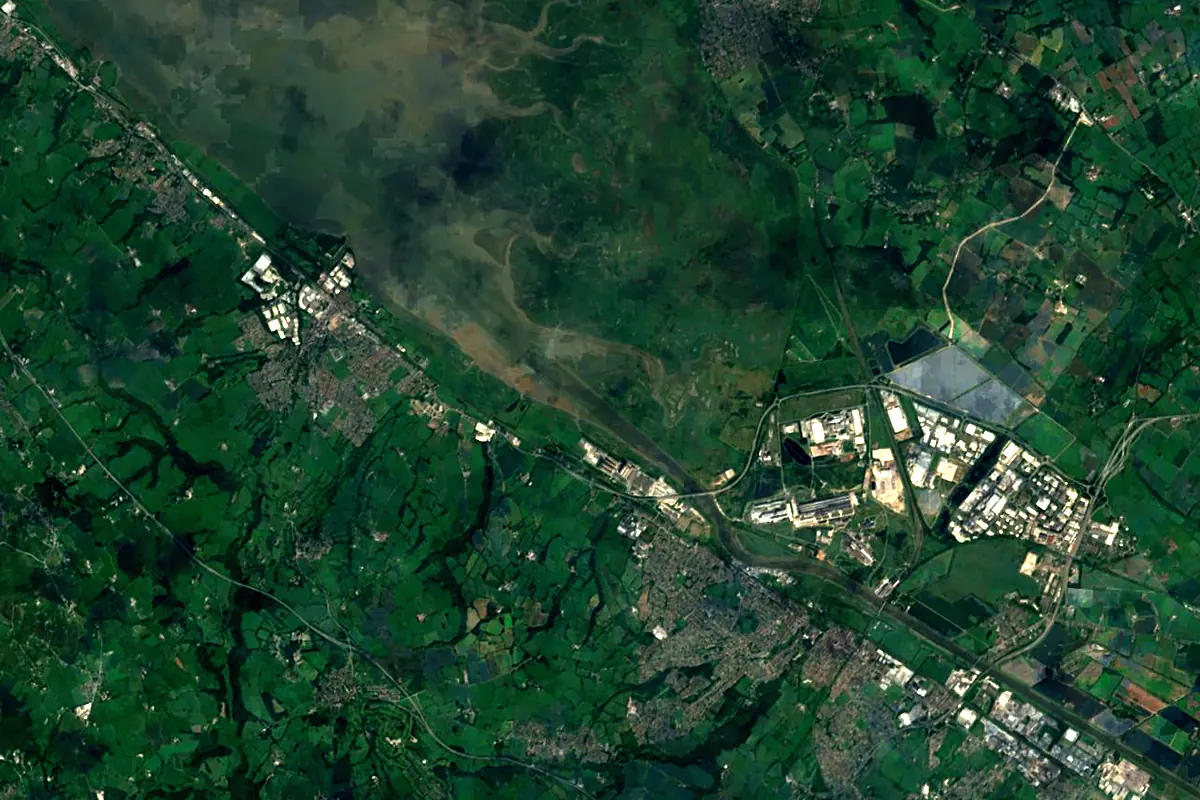
Sentinel-2 cloudless 2016 by EOX IT Services GmbH (contains modified Copernicus Sentinel data 2016), CC BY 4.0. The glowing line is the river as drawn by RiverATLAS.
Tributaries
Where it flows, and what flows into it
Tributaries (6)
Also: River Ceiriog, Afon Tryweryn, River Clywedog, River Lliw, Wych Brook, River Eitha
Nearby
Rivers nearby
United Kingdom354 km110 m³/s174 km awayRiver TrentUnited Kingdom298 km95 m³/s166 km awayRiver DerwentUnited Kingdom80 km29 m³/s125 km awayRiver AvonUnited Kingdom154 km31 m³/s152 km awayRiver AireUnited Kingdom114 km36 m³/s154 km awayRiver OuseUnited Kingdom90 km50 m³/s165 km awayRiver WyeUnited Kingdom215 km100 m³/s183 km awayLiffey Ireland125 km14 m³/s207 km away
Where these numbers come from
| Name, length, places | Wikidata (Q1043657) · CC0 |
|---|---|
| Course, profile, basin | RiverATLAS v1.0 (HydroATLAS, Linke et al. 2019) · CC BY 4.0 — followed from the source to the mouth given by Wikidata |
| Flow | WaterGAP (RiverATLAS), 1971–2000 · CC BY 4.0 |
| Climate along the river | WorldClim (RiverATLAS), 1970–2000 · CC BY 4.0 |
| Towns, bridges, dams | Wikidata · CC0; GeoNames · CC BY 4.0 |
| Along the river | © OpenStreetMap contributors · ODbL |
| Images | EOX Sentinel-2 cloudless 2016 · CC BY 4.0; Wikimedia Commons |
| Our other atlases | Cascadyas, Lakeyas, Coastya, Peakyas, Islandyas — Wikidata · CC0; © OpenStreetMap contributors · ODbL; GeoNames · CC BY 4.0; HydroLAKES · CC BY 4.0; NOAA OISST |
Every source and licence is on the data sources page.
The family
Do you prefer beaches, lakes, mountains, waterfalls, islands, rivers or canyons?
Same idea, other landscapes: field atlases built on open data, month by month, in seven languages.
beaches Find your beach: sea temperature, sun and swimming month by month.Visit lakes
 Every lake on Earth: water temperature, ice, depth and the shore.Coming soonVisit mountains
 Every summit in 3D: summit weather, the 0 °C line, huts and trails.Visit waterfalls
 Every waterfall: height, flow month by month and when it roars.Coming soonVisit islands
 Every island from the sea up: size, sea temperature, ferries and 3D.Coming soonVisit
  rivers
 Every river from source to sea: the journey, the flow and the basin in numbers.You are here
 canyons
 Every canyon cut to scale: depth to the floor, rim and floor temperatures, trails and viewpoints.Coming soonVisit