River
River Lea
68 km from source to mouth · United Kingdom.
 United KingdomFlows into Bow Creek
In numbers
Length
68km
Average flow
38m³/s
Basin
1,420km²
Drop
44m
from 45 m to 1 m
Country
1
The journey
From source to mouth
68 km of river and 67 stops on the way: 44 towns and cities on its banks, dams, bridges and the tributaries that feed it.
- 0 kmSourceat 45 m
- 6 kmLuton213,052 people
- 12 kmHarpenden30,674 people
- 15 kmWheathampstead4,326 people
- 20 kmWelwyn Garden City51,505 people
- 21 kmHatfield41,265 people
- 28 kmRoxford Bridge over River Lea
- 29 kmHornsmill Viaduct
- 30 kmHertford29,418 people
- 32 kmKingsmead Viaduct
- 34 kmWare17,576 people
- 35 kmBayford Brooktributary
- 35 kmRiver Beanetributary
- 35 kmRiver Mimramtributary
- 35 kmRiver Ribtributary
- 37 kmGreat Amwell1,098 people
- 37 kmLittle Amwell2,606 people
- 38 kmRiver Ashtributary
- 38 kmRoydon1,582 people
- 39 kmHoddesdon35,174 people
- 40 kmBroxbourne13,298 people
- 41 kmRiver Storttributary
- 41 kmStort Navigationtributary
- 41 kmpipeline bridge near Broxbourne
- 44 kmTurnford Brooktributary
- 45 kmCheshunt43,680 people
- 45 kmSmall River Leatributary
- 45 kmWaltham Abbey22,859 people
- 46 kmWaltham Cross8,577 people
- 47 kmEnfield Lock16,469 people
- 49 kmTurkey Brooktributary
- 50 kmKing George V Reservoir2.0 km²
- 50 kmChingford70,583 people
- 51 kmPonders End15,664 people
- 52 kmWilliam Girling Reservoir1.5 km²
- 52 kmEdmonton80,546 people
- 53 kmHighams Park11,355 people
- 53 kmBanbury Reservoir0.5 km²
- 54 kmRiver Chingtributary
- 54 kmPymmes Brooktributary
- 54 kmWalthamstow109,424 people
- 54 kmNorthumberland Park14,429 people
- 54 kmTottenham129,237 people
- 55 kmTottenham Hale15,064 people
- 55 kmLow Maynard Reservoir0.8 km²
- 56 kmSeven Sisters15,968 people
- 56 kmSt. Ann's14,638 people
- 56 kmMoselle Brooktributary
- 56 kmWest Warwick Reservoir1.1 km²
- 56 kmStamford Hill68,050 people
- 58 kmFriends Bridge
- 58 kmLeyton14,184 people
- 59 kmHackney Wick11,734 people
- 60 kmBow27,720 people
- 60 kmStepney16,238 people
- 61 kmStratford51,387 people
- 61 kmWest Ham15,551 people
- 61 kmBromley14,480 people
- 62 kmLimehouse15,986 people
- 62 kmPoplar8,069 people
- 63 kmBlackwall19,461 people
- 63 kmCanary Wharf73,390 people
- 63 kmCanning Town42,667 people
- 64 kmBlackheath Westcombe1,098 people
- 65 kmCharlton14,385 people
- 67 kmPlumstead16,736 people
- 67 kmAbbey Wood17,700 people
- 68 kmThamesmead31,824 people
- 68 kmBow Creekat 1 m
Water level along the river (RiverATLAS; the height is exaggerated). Towns: GeoNames and Wikidata; bridges, dams and tributaries: Wikidata.
River in southern England
At the mouth it carries 38 m³/s on average: an Olympic pool every 66 seconds. It drops from 45 m to 1 m, 0.6 m per kilometre on average. Its basin covers 1,420 km². 12.0 million people live in it. Highest water: from December to January. No large dam holds it back: it is one of the world's free-flowing rivers.
Where to start
- LutonLargest city on its banks · 213,052 people
- London Luton Airport (LTN)Nearest airport with scheduled flights, 3 km from the cityCar hire at LTN airport (Luton, Luton)Discover Cars · Affiliate link↗
- On the water65 ferry piers, marinas, boat rentals and boat ramps along the river (OpenStreetMap)
- From May to SeptemberThe best months to visit
River Lea, month by month
Highest water: from December to January
Best months to visit: from May to September.
From about 45 m³/s in the lowest month to 160 m³/s in the highest. An estimate: the monthly flow is modelled from the lowest and highest months of WaterGAP (RiverATLAS, 1971–2000) and the rain and snow along the river (WorldClim). Dams change the real rhythm. The chip is the average air temperature; below it, the month's rain.
Plan the trip
Plan the trip: boat trips, a bed by the river, a car
Some links above are affiliate links: if you book through them we may earn a commission, at no extra cost to you. It never changes what the data on this page says.
The basin
River Lea: the basin in numbers
12,210 km² of land send their water to this river. This is what lives on it.
- 12.0millionpeople live in the basin
- 995/km²people per km²
- 103maverage altitude of the basin
- 675mmof rain a year (basin average)
- 9.7°Caverage air temperature
- 31%protected areas
- 0.5%covered by lakes
What covers the basin
- 1% Forest
- 39% Cropland
- 14% Pasture
- 28% Towns and cities
RiverATLAS (HydroATLAS v1.0, CC BY 4.0): land cover, people, protected areas, glaciers and dams over the whole basin upstream of the mouth.
Along the river
River Lea: what you find on the way
- 78WeirsFeilde's Weir, Dobb's Weir, Kiora Radial Gates and 75 more
- 134LocksRiver Lee Navigation, Hardmead Lock, Stanstead lock and 131 more
- 2Waterfalls
- 36Boat rampsLee River, Johnson's Drawdock, Bargehouse Causeway and 33 more
- 8Ferry piersRotherhithe Pier, Canary Wharf, Trinity Buoy Wharf and 5 more
- 12MarinasWardown Leisure Boating, South Island Marina, Lee Valley Marina, Springfield and 9 more
- 2River beachesKelson Beach, Dock Beach
From OpenStreetMap, within 1.9 km of the river. Not mapped is not the same as not there.
Cross-checked with our atlases
River Lea in our other atlases
What our sister atlases know about the waterfalls on this river, the lakes it flows through, the beaches at its mouth, the mountains where it rises and the islands off its mouth.
 5lakes on its wayLakeyas
 16mountains at the sourcePeakyas
Lakes and reservoirs (5)
Lakes it flows through, by Lakeyas
- King George V Reservoirkm 652.0km²
- William Girling Reservoirkm 681.5km²
- Banbury Reservoirkm 700.5km²
- Low Maynard Reservoirkm 720.8km²
- West Warwick Reservoirkm 731.1km²
Lakeyas is coming soonOpen Lakeyas ↗
Mountains at the source (16)
Within 15 km of the source, by Peakyas
- Ivinghoe Beacon12 km away233m
- Markham's Hill8.8 km away
- Deacon Hill8.4 km away
- Clark's Hill7.6 km away
- The Meg7.2 km away
- Butts Hill7.3 km away
- Gravel Hill6.7 km away
- Lion Hill6.8 km away
8 more on PeakyasOpen Peakyas ↗
From space
The source and the mouth, seen from orbit
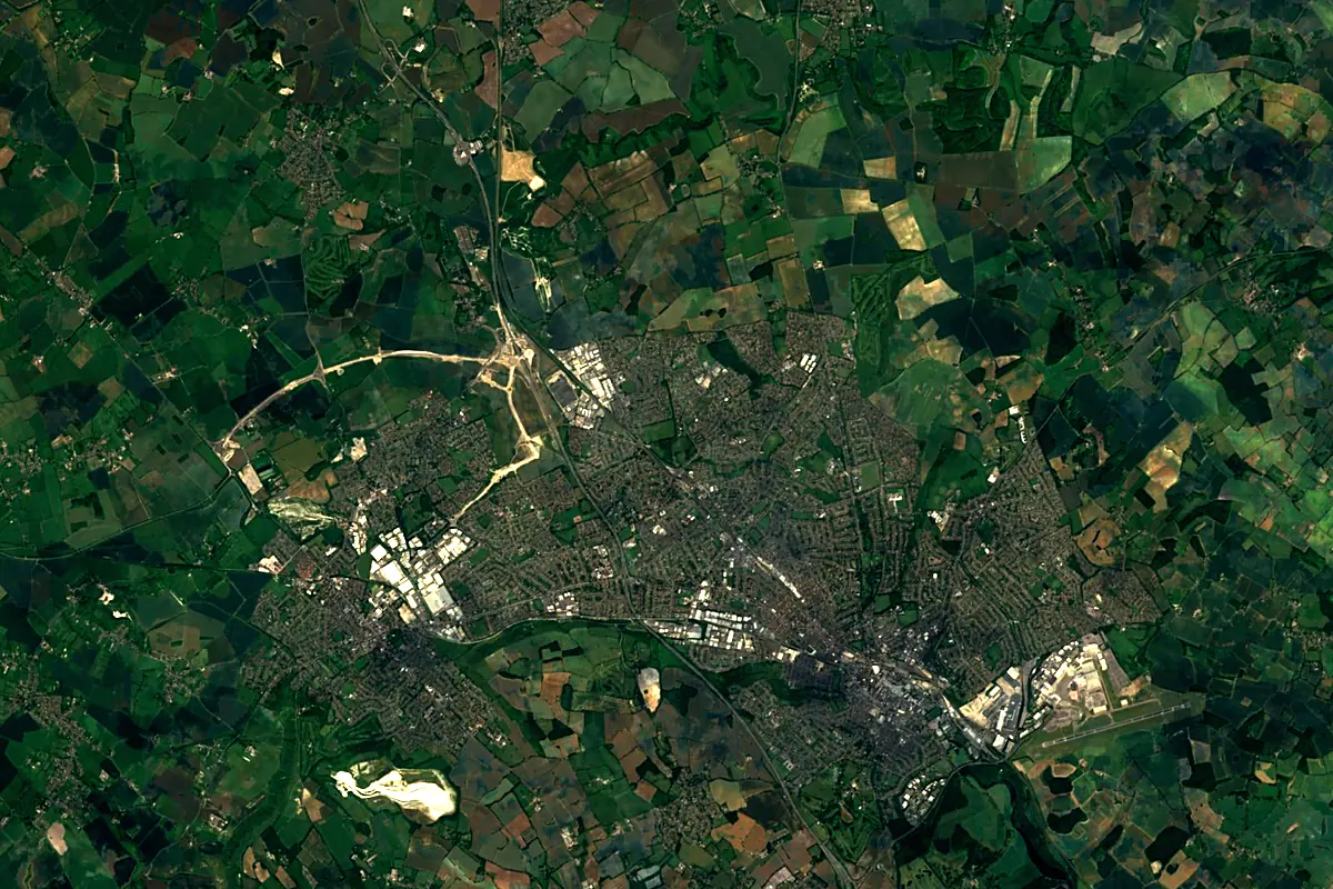
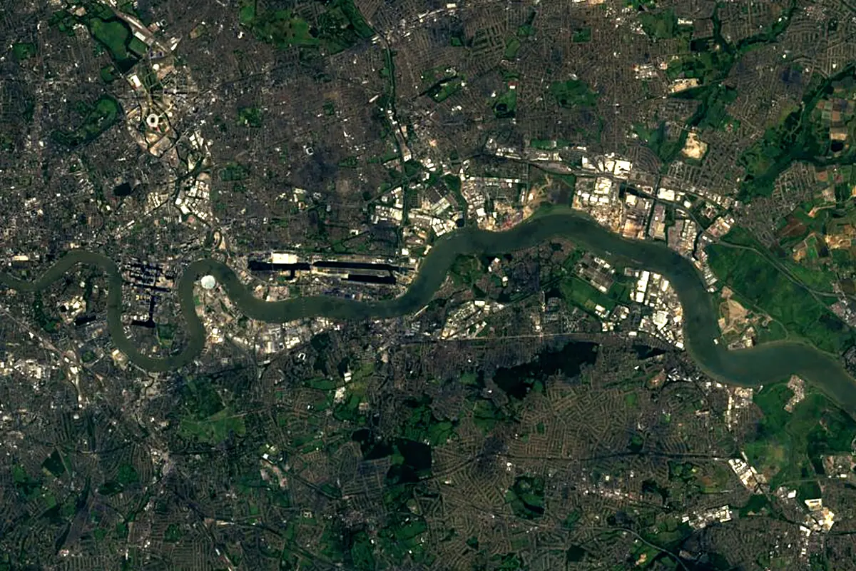
Sentinel-2 cloudless 2016 by EOX IT Services GmbH (contains modified Copernicus Sentinel data 2016), CC BY 4.0. The glowing line is the river as drawn by RiverATLAS.
Photos
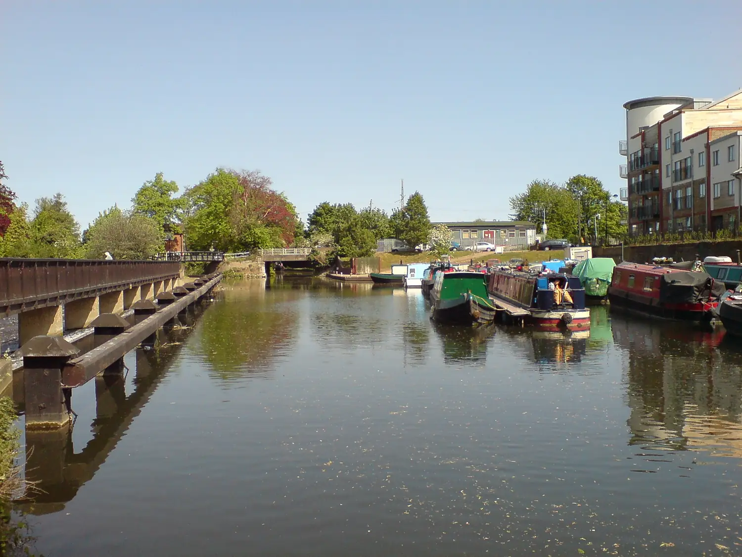
River Lea in pictures
Tributaries
Where it flows, and what flows into it
Tributaries (18)
Also: River Stort, River Ching, Moselle Brook, River Beane, River Rib, Pymmes Brook, Small River Lea, Turnford Brook, River Ash, Bayford Brook, River Lynch, River Mimram, Stort Navigation, Turkey Brook, Abbey Creek, Cornmill Stream, Wormleybury Brook, Rags Brook
In the same basin
Nearby
Rivers nearby
United Kingdom334 km66 m³/s17 km awayRiver Great OuseUnited Kingdom240 km66 m³/s144 km awayRiver SevernUnited Kingdom354 km110 m³/s179 km awaySeine France777 km500 m³/s226 km awayRiver SommeFrance245 km35 m³/s182 km awayRiver AvonUnited Kingdom154 km31 m³/s164 km awayRiver NeneUnited Kingdom146 km20 m³/s148 km awayAa RiverFrance89 km10 m³/s151 km away
Where these numbers come from
| Name, length, places | Wikidata (Q10675) · CC0 |
|---|---|
| Course, profile, basin | RiverATLAS v1.0 (HydroATLAS, Linke et al. 2019) · CC BY 4.0 — followed from the source to the mouth given by Wikidata |
| Flow | WaterGAP (RiverATLAS), 1971–2000 · CC BY 4.0 |
| Climate along the river | WorldClim (RiverATLAS), 1970–2000 · CC BY 4.0 |
| Towns, bridges, dams | Wikidata · CC0; GeoNames · CC BY 4.0 |
| Along the river | © OpenStreetMap contributors · ODbL |
| Images | EOX Sentinel-2 cloudless 2016 · CC BY 4.0; Wikimedia Commons |
| Our other atlases | Lakeyas, Peakyas — Wikidata · CC0; © OpenStreetMap contributors · ODbL; GeoNames · CC BY 4.0; HydroLAKES · CC BY 4.0; NOAA OISST |
Every source and licence is on the data sources page.
The family
Do you prefer beaches, lakes, mountains, waterfalls, islands, rivers or canyons?
Same idea, other landscapes: field atlases built on open data, month by month, in seven languages.
 beaches
 Find your beach: sea temperature, sun and swimming month by month.Visit lakes
 Every lake on Earth: water temperature, ice, depth and the shore.Coming soonVisit mountains
 Every summit in 3D: summit weather, the 0 °C line, huts and trails.Visit
  waterfalls
 Every waterfall: height, flow month by month and when it roars.Coming soonVisit
  islands
 Every island from the sea up: size, sea temperature, ferries and 3D.Coming soonVisit
  rivers
 Every river from source to sea: the journey, the flow and the basin in numbers.You are here
 canyons
 Every canyon cut to scale: depth to the floor, rim and floor temperatures, trails and viewpoints.Coming soonVisit