River
Seine
777 km from source to mouth · France.
 FranceFlows into English Channel3rd longest in France
In numbers
Length
777km
Average flow
500m³/s
Basin
78,650km²
Drop
323m
from 320 m to -3 m
Country
1
The journey
From source to mouth
777 km of river and 68 stops on the way: 68 towns and cities on its banks, dams, bridges and the tributaries that feed it.
- 0 kmsource of the Seine Riverat 320 m
- 273 kmFontainebleau15,583 people
- 296 kmMelun45,995 people
- 323 kmCorbeil-Essonnes54,471 people
- 327 kmÉvry53,641 people
- 331 kmRis-Orangis31,189 people
- 337 kmAthis-Mons36,613 people
- 342 kmVilleneuve-Saint-Georges36,221 people
- 346 kmOrly24,658 people
- 347 kmChoisy-le-Roi45,946 people
- 350 kmVitry-sur-Seine93,963 people
- 351 kmAlfortville45,531 people
- 354 kmCharenton-le-Pont28,830 people
- 354 kmParis 12e Arrondissement140,311 people
- 355 kmIvry-sur-Seine65,064 people
- 357 km12th arrondissement of Paris138,024 people
- 357 kmParis 12 Reuilly138,024 people
- 357 kmParis 13e Arrondissement177,833 people
- 358 kmParis 13 Gobelins181,271 people
- 358 km13th arrondissement of Paris181,271 people
- 359 kmParis 20 Ménilmontant185,140 people
- 359 kmParis 11 Popincourt138,170 people
- 359 kmParis 11e Arrondissement144,292 people
- 360 km4th arrondissement of Paris27,332 people
- 361 kmParis2,103,778 people
- 361 km5th arrondissement of Paris55,252 people
- 361 kmParis 14 Observatoire136,455 people
- 364 kmParis 17 Batignolles-Monceau159,212 people
- 364 km7th arrondissement of Paris48,015 people
- 364 km8th arrondissement of Paris35,317 people
- 367 kmParis 16 Passy159,386 people
- 367 km16th arrondissement of Paris159,386 people
- 368 km15th arrondissement of Paris229,713 people
- 368 kmParis 15 Vaugirard229,713 people
- 371 kmIssy-les-Moulineaux67,669 people
- 372 kmBoulogne-Billancourt119,019 people
- 373 kmMeudon46,334 people
- 373 kmSèvres22,303 people
- 376 kmSaint-Cloud29,855 people
- 380 kmSuresnes48,956 people
- 382 kmPuteaux44,002 people
- 383 kmLa Défense42,000 people
- 383 kmNeuilly-sur-Seine59,538 people
- 384 kmCourbevoie82,902 people
- 386 kmLevallois-Perret68,092 people
- 387 kmAsnières-sur-Seine93,941 people
- 387 kmClichy64,410 people
- 388 kmParis 18 Buttes-Montmartre183,127 people
- 389 kmGennevilliers50,979 people
- 389 kmSaint-Ouen-sur-Seine53,615 people
- 392 kmSaint-Denis115,237 people
- 395 kmÉpinay-sur-Seine52,833 people
- 400 kmArgenteuil106,130 people
- 402 kmColombes91,053 people
- 404 kmBezons36,434 people
- 407 kmNanterre97,783 people
- 411 kmChatou30,598 people
- 411 kmRueil-Malmaison82,874 people
- 426 kmMaisons-Laffitte23,093 people
- 427 kmSartrouville52,763 people
- 431 kmCormeilles-en-Parisis27,292 people
- 438 kmConflans-Sainte-Honorine36,958 people
- 448 kmPoissy40,983 people
- 466 kmLes Mureaux34,632 people
- 484 kmMantes-la-Jolie43,526 people
- 530 kmVernon25,290 people
- 629 kmSaint-Étienne-du-Rouvray29,518 people
- 637 kmRouen117,662 people
- 645 kmLe Grand-Quevilly25,789 people
- 777 kmEnglish Channelat -3 m
Water level along the river (RiverATLAS; the height is exaggerated). Towns: GeoNames and Wikidata; bridges, dams and tributaries: Wikidata.
River in France
At the mouth it carries 500 m³/s on average: an Olympic pool every 5.0 seconds. It drops from 320 m to -3 m, 0.4 m per kilometre on average. Its basin covers 78,650 km², about the size of CZ. 16.2 million people live in it. Highest water: from December to February. Its dams hold back little of its water (5.4% of a year's flow).
Where to start
- ParisLargest city on its banks · 2,103,778 people
- Paris-Orly Airport (ORY)Nearest airport with scheduled flights, 14 km from the cityCar hire at ORY airport (Paris)Discover Cars · Affiliate link↗
- On the water298 ferry piers, marinas, boat rentals and boat ramps along the river (OpenStreetMap)
- From May to SeptemberThe best months to visit
Seine, month by month
Highest water: from December to February
Best months to visit: from May to September.
From about 190 m³/s in the lowest month to 880 m³/s in the highest. An estimate: the monthly flow is modelled from the lowest and highest months of WaterGAP (RiverATLAS, 1971–2000) and the rain and snow along the river (WorldClim). Dams change the real rhythm. The chip is the average air temperature; below it, the month's rain.
Plan the trip
Plan the trip: boat trips, a bed by the river, a car
Some links above are affiliate links: if you book through them we may earn a commission, at no extra cost to you. It never changes what the data on this page says.
The basin
Seine: the basin in numbers
73,249 km² of land send their water to this river. This is what lives on it.
- 16.2millionpeople live in the basin
- 223/km²people per km²
- 174maverage altitude of the basin
- 690mmof rain a year (basin average)
- 10.2°Caverage air temperature
- 9%protected areas
- 0.3%covered by lakes
- 0.9km³held in reservoirs
What covers the basin
- 10% Forest
- 51% Cropland
- 9% Pasture
- 7% Towns and cities
RiverATLAS (HydroATLAS v1.0, CC BY 4.0): land cover, people, protected areas, glaciers and dams over the whole basin upstream of the mouth.
Along the river
Seine: what you find on the way
- 126WeirsDéversoir de Baseville, Pertuis des Bouchets, Seuil de Rosoy and 123 more
- 422LocksCanal du Nivernais, La Seine and 420 more
- 29WaterfallsGrotte et Cascade, La Grande Cascade, Jardin en Cascade and 26 more
- 139Boat rampsponton de mise à l'eau, Cale de La Monnaie, Bac de Yainville and 136 more
- 52Ferry piersBibliothèque F. Mitterrand, Jardin des Plantes, Notre-Dame and 49 more
- 95MarinasPort de plaisance Stéphane Mallarmé, Port de Tolbiac, Port de la Gare and 92 more
- 8River beachesBase de loisirs de la Tambourinette, Plage de la Baignade de Mailly-la-Ville, Migennes Plage and 5 more
From OpenStreetMap, within 2.3 km of the river. Not mapped is not the same as not there.
Cross-checked with our atlases
Seine in our other atlases
What our sister atlases know about the waterfalls on this river, the lakes it flows through, the beaches at its mouth, the mountains where it rises and the islands off its mouth.
 1waterfall on the riverCascadyas
 4lakes on its wayLakeyas
 2beaches at the mouth and on the banksCoastya
 4mountains at the sourcePeakyas
Waterfalls (1)
On the river, by Cascadyas
- Château d'Eaukm 318
Cascadyas is coming soonOpen Cascadyas ↗
Lakes and reservoirs (4)
Lakes it flows through, by Lakeyas
- Lac de Pannecièrekm 11 · 48 m deep3.3km²
- Lac de Viry-Châtillonkm 290 · 6 m deep1.0km²
- Lac de Créteilkm 3020.3km²
- Lac d'Enghienkm 3440.3km²
Lakeyas is coming soonOpen Lakeyas ↗
Beaches (2)
At the mouth (25 km) and on the banks, by Coastya
- Plage du Vasouy24 km away19.0°C
- Plage du Butin22 km away19.0°C
Mountains at the source (4)
Within 15 km of the source, by Peakyas
- Morvan4.0 km away901m
- Haut-Folin12 km away901m
- Bois de la Loge12 km away818m
- Mont Preneley15 km away
From space
The source and the mouth, seen from orbit
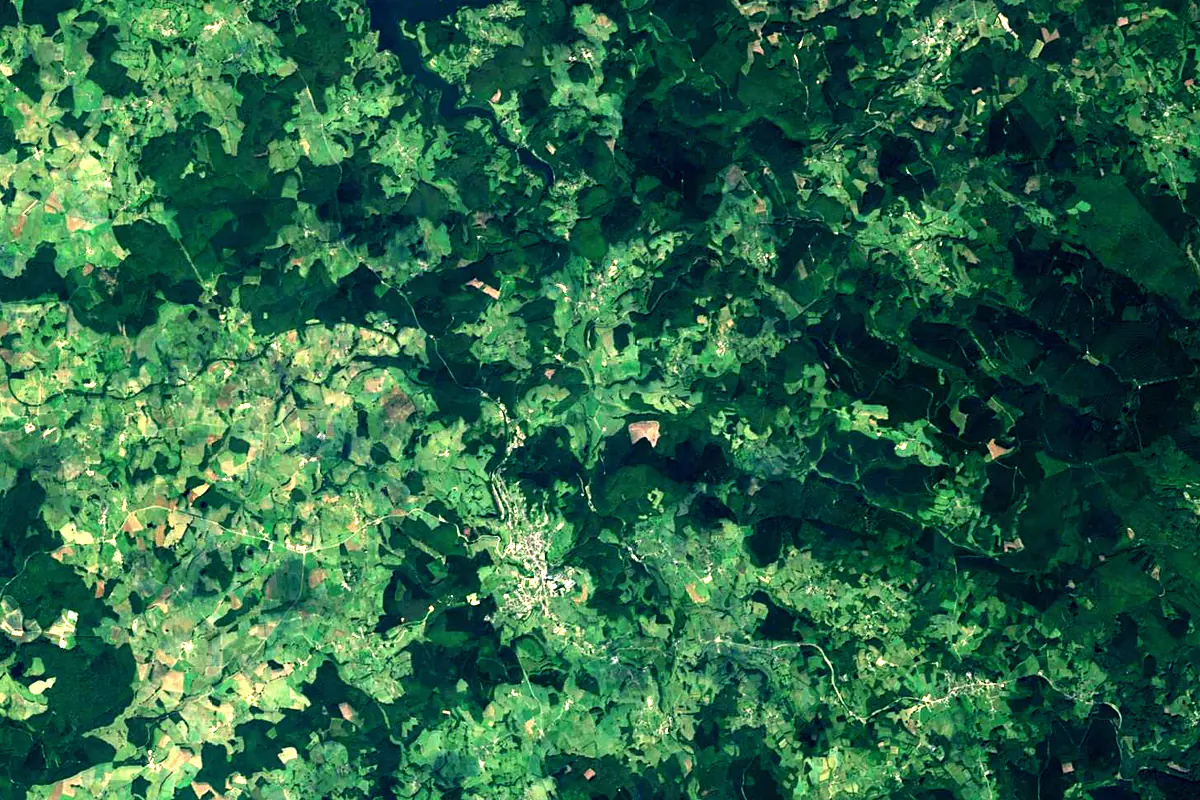
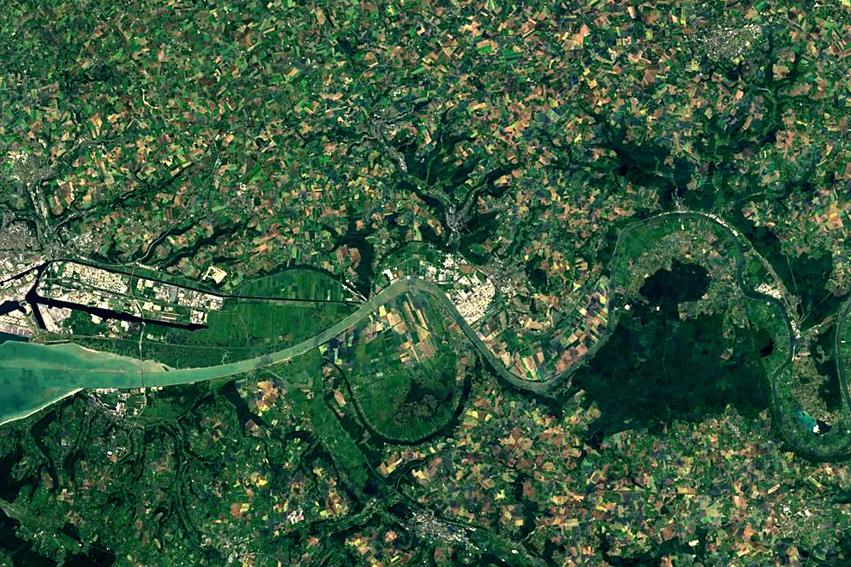
Sentinel-2 cloudless 2016 by EOX IT Services GmbH (contains modified Copernicus Sentinel data 2016), CC BY 4.0. The glowing line is the river as drawn by RiverATLAS.
Photos
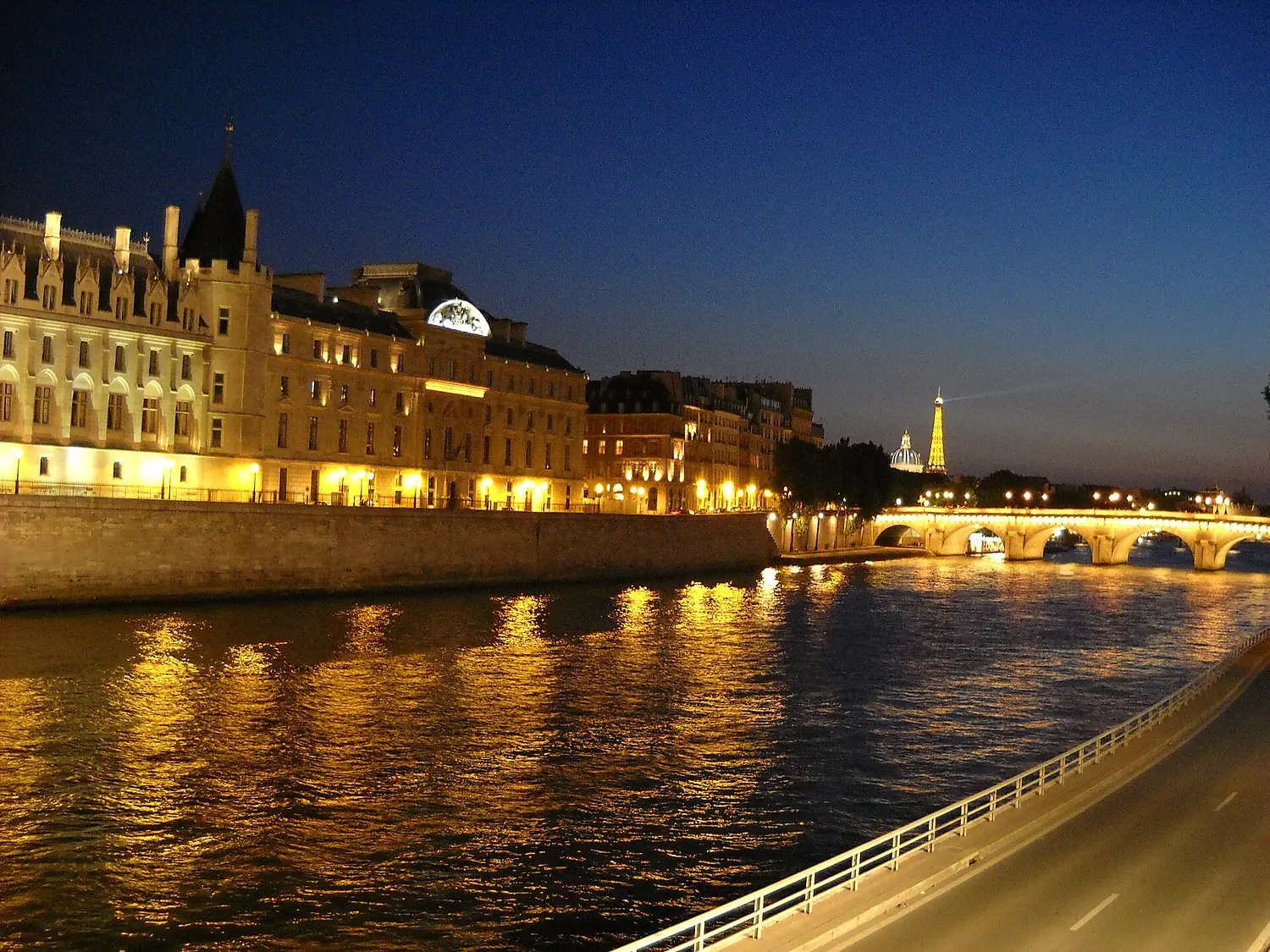
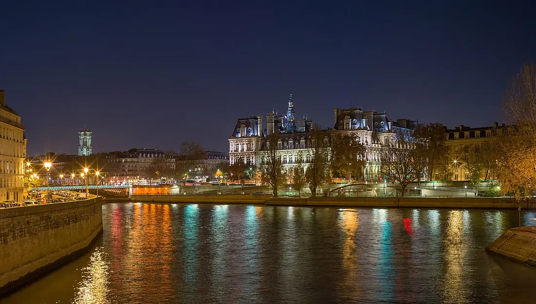
Seine in pictures
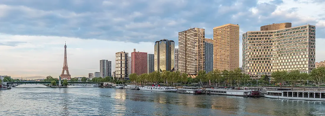
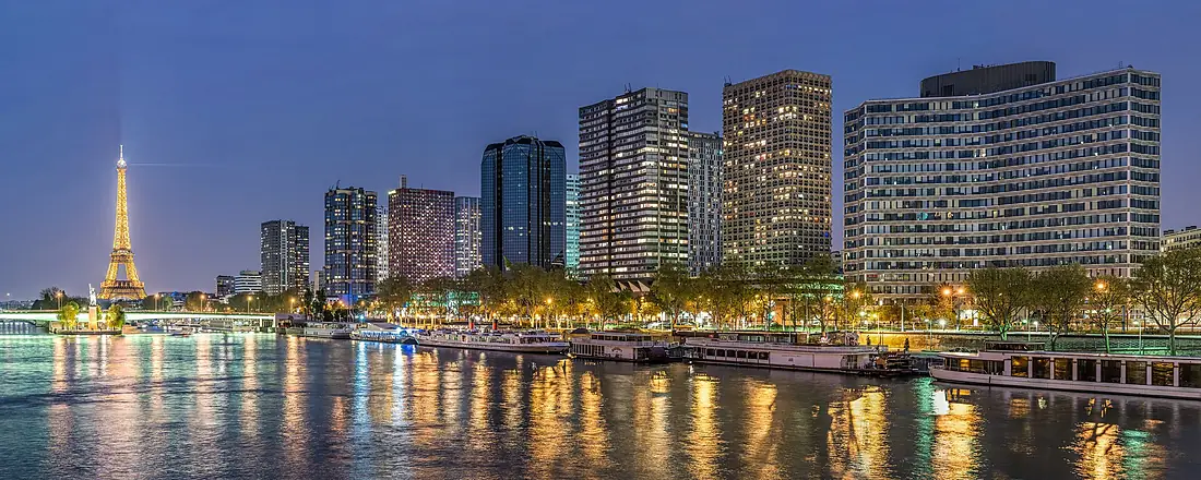
Tributaries
Where it flows, and what flows into it
Tributaries (49)
France514 km100 m³/sjoins at km 308OiseFrance341 km110 m³/sjoins at km 387YonneFrance292 km100 m³/sjoins at km 218AubeFrance248 km41 m³/sEureFrance229 km26 m³/sjoins at km 529LoingFrance143 km19 m³/sjoins at km 231EpteFrance113 km9.8 m³/sjoins at km 457EssonneFrance97 km8.4 m³/sjoins at km 281Also: Bièvre, Risle, Andelle, Orge, Ource, Barse, Yerres, Mauldre, Almont, Arce, Cailly, Voulzie, Vaucouleurs, Aubette de Meulan, Austreberthe, Sarce, Commerce, École, Ardusson, Laigne, Auxence, Hozain, Orvin, Lézarde
In the same basin
Nearby
Rivers nearby
Where these numbers come from
| Name, length, places | Wikidata (Q1471) · CC0 |
|---|---|
| Course, profile, basin | RiverATLAS v1.0 (HydroATLAS, Linke et al. 2019) · CC BY 4.0 — followed along the river network from the point given by Wikidata |
| Flow | WaterGAP (RiverATLAS), 1971–2000 · CC BY 4.0 |
| Climate along the river | WorldClim (RiverATLAS), 1970–2000 · CC BY 4.0 |
| Towns, bridges, dams | Wikidata · CC0; GeoNames · CC BY 4.0 |
| Along the river | © OpenStreetMap contributors · ODbL |
| Images | EOX Sentinel-2 cloudless 2016 · CC BY 4.0; Wikimedia Commons |
| Our other atlases | Cascadyas, Lakeyas, Coastya, Peakyas — Wikidata · CC0; © OpenStreetMap contributors · ODbL; GeoNames · CC BY 4.0; HydroLAKES · CC BY 4.0; NOAA OISST |
Every source and licence is on the data sources page.
The family
Do you prefer beaches, lakes, mountains, waterfalls, islands, rivers or canyons?
Same idea, other landscapes: field atlases built on open data, month by month, in seven languages.
beaches Find your beach: sea temperature, sun and swimming month by month.Visit lakes
 Every lake on Earth: water temperature, ice, depth and the shore.Coming soonVisit mountains
 Every summit in 3D: summit weather, the 0 °C line, huts and trails.Visit waterfalls
 Every waterfall: height, flow month by month and when it roars.Coming soonVisit
  islands
 Every island from the sea up: size, sea temperature, ferries and 3D.Coming soonVisit
  rivers
 Every river from source to sea: the journey, the flow and the basin in numbers.You are here
 canyons
 Every canyon cut to scale: depth to the floor, rim and floor temperatures, trails and viewpoints.Coming soonVisit