River
River Tyne
100 km from source to mouth · United Kingdom.
 United KingdomFlows into North Sea
In numbers
Length
100km
Average flow
63m³/s
Basin
2,145km²
Drop
119m
from 119 m to 0 m
Country
1
The journey
From source to mouth
100 km of river and 60 stops on the way: 26 towns and cities on its banks, dams, bridges and the tributaries that feed it.
- 0 kmRiver North Tyneat 119 m
- 13 kmBellingham1,070 people
- 41 kmConstantius Bridge
- 41 kmBorder Counties Bridge
- 41 kmAcomb1,106 people
- 42 kmHexham Old Bridge
- 42 kmRiver North Tynetributary
- 42 kmRiver South Tynetributary
- 43 kmHexham11,388 people
- 43 kmHexham Bridge
- 49 kmCorbridge2,946 people
- 49 kmCorbridge Bridge
- 55 kmStyford Bridge
- 58 kmBywell Bridge
- 58 kmStocksfield2,616 people
- 62 kmOvingham footbridge
- 62 kmOvingham road bridge
- 62 kmOvingham Bridges
- 62 kmPrudhoe12,075 people
- 65 kmWylam Railway Bridge
- 66 kmWylam1,412 people
- 66 kmWylam Bridge
- 69 kmHeddon on the Wall1,318 people
- 72 kmNewburn Bridge
- 72 kmNewburn41,347 people
- 72 kmNewburn Urban District27,886 people
- 75 kmBlaydon-on-Tyne15,155 people
- 76 kmBlaydon Bridge
- 76 kmScotswood Railway Bridge
- 77 kmScotswood Bridge
- 77 kmNewcastle upon Tyne300,196 people
- 78 kmWhickham16,625 people
- 78 kmBenwell6,500 people
- 82 kmGateshead196,151 people
- 82 kmRedheugh Bridge
- 82 kmKing Edward VII Bridge
- 82 kmQueen Elizabeth II Metro Bridge
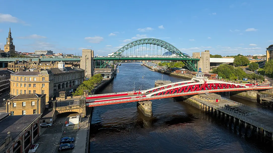
- 83 kmHigh Level Bridge
- 83 kmSwing Bridge
- 83 kmTyne Bridge
- 83 kmCounty Borough of Newcastle upon Tyne291,724 people
- 83 kmRiver Teamtributary
- 84 kmGateshead Millennium Bridge
- 87 kmFelling34,355 people
- 90 kmHebburn21,345 people
- 91 kmOuseburntributary
- 91 kmNorth Tyneside205,985 people
- 91 kmWallsend42,739 people
- 94 kmTyne pedestrian and cyclist tunnel
- 94 kmfirst Tyne vehicle tunnel
- 94 kmsecond Tyne vehicle tunnel
- 94 kmJarrow27,526 people
- 96 kmSouth Tyneside150,265 people
- 96 kmRiver Dontributary
- 98 kmSouth Shields83,655 people
- 99 kmNorth Shields6,137 people
- 99 kmCounty Borough of Tynemouth70,091 people
- 99 kmNew High Light
- 100 kmHerd Groyne Light
- 100 kmTynemouth North Pier light
- 100 kmTynemouth60,605 people
- 100 kmNorth Seaat 0 m
Water level along the river (RiverATLAS; the height is exaggerated). Towns: GeoNames and Wikidata; bridges, dams and tributaries: Wikidata.
River in North East England
At the mouth it carries 63 m³/s on average: an Olympic pool every 40 seconds. It drops from 119 m to 0 m, 1.2 m per kilometre on average. Its basin covers 2,145 km², about the size of KM. 828,000 people live in it. Highest water: from November to January. Dams and reservoirs hold back a large share of its water (13% of a year's flow).
Where to start
- Newcastle upon TyneLargest city on its banks · 300,196 people
- Newcastle International Airport (NCL)Nearest airport with scheduled flights, 4 km from the cityCar hire at NCL airport (Newcastle upon Tyne, Tyne and Wear)Discover Cars · Affiliate link↗
- On the water26 ferry piers, marinas, boat rentals and boat ramps along the river (OpenStreetMap)
- Kayak and canoe2 put-ins and rapids mapped (OpenStreetMap)
- From June to AugustThe best months to visit
River Tyne, month by month
Highest water: from November to January
Best months to visit: from June to August.
From about 31 m³/s in the lowest month to 95 m³/s in the highest. An estimate: the monthly flow is modelled from the lowest and highest months of WaterGAP (RiverATLAS, 1971–2000) and the rain and snow along the river (WorldClim). Dams change the real rhythm. The chip is the average air temperature; below it, the month's rain.
Plan the trip
Plan the trip: boat trips, a bed by the river, a car
Some links above are affiliate links: if you book through them we may earn a commission, at no extra cost to you. It never changes what the data on this page says.
The basin
River Tyne: the basin in numbers
2,877 km² of land send their water to this river. This is what lives on it.
- 828,000people live in the basin
- 291/km²people per km²
- 253maverage altitude of the basin
- 875mmof rain a year (basin average)
- 7.4°Caverage air temperature
- 48%protected areas
- 0.6%covered by lakes
- 0.2km³held in reservoirs
What covers the basin
- 11% Forest
- 12% Cropland
- 42% Pasture
- 11% Towns and cities
RiverATLAS (HydroATLAS v1.0, CC BY 4.0): land cover, people, protected areas, glaciers and dams over the whole basin upstream of the mouth.
Along the river
River Tyne: what you find on the way
- 31Weirs
- 4LocksOuseburn, Ouseburn Barrage and 2 more
- 2WaterfallsHareshaw Linn
- 1Rapids
- 1Canoe put-insTyne confluence
- 17Boat rampsAbove Weir, Byker Pier, Friars Goose and 14 more
- 4Ferry piersNewcastle, Port of Tyne International Passenger Terminal, South Shields Ferry Terminal and 1 more
- 4MarinasSweet William Charter Boat, Albert Edward Dock and 2 more
- 8River beachesShingle Beach, Shingles, Herd Sand and 5 more
From OpenStreetMap, within 1.5 km of the river. Not mapped is not the same as not there.
Cross-checked with our atlases
River Tyne in our other atlases
What our sister atlases know about the waterfalls on this river, the lakes it flows through, the beaches at its mouth, the mountains where it rises and the islands off its mouth.
 1beach at the mouth or on the banksCoastya
 1island off the mouthIslandyas
Beaches (1)
At the mouth (25 km) and on the banks, by Coastya
- Little Bay20 km away · cove14.5°C
Islands off the mouth (1)
Within 30 km of the mouth, by Islandyas
- St Mary's Island6.9 km away
Islandyas is coming soonOpen Islandyas ↗
From space
The source and the mouth, seen from orbit
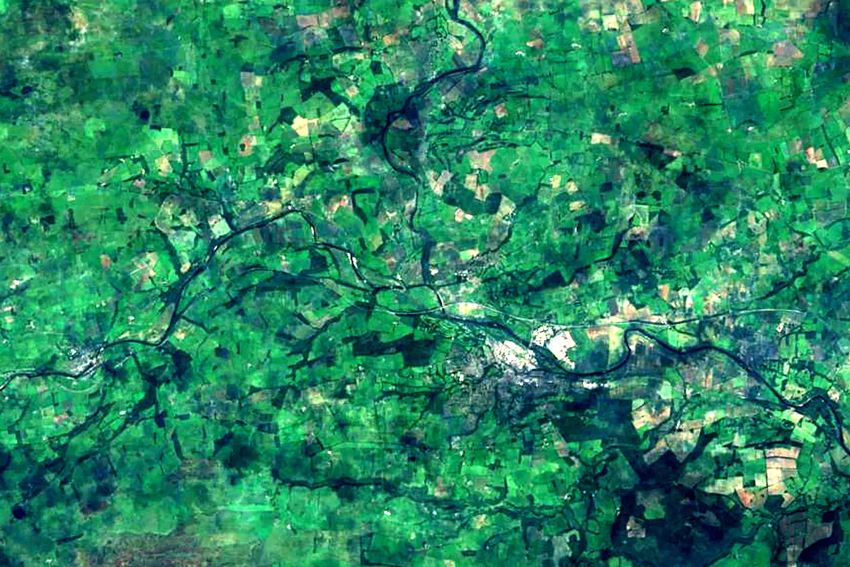
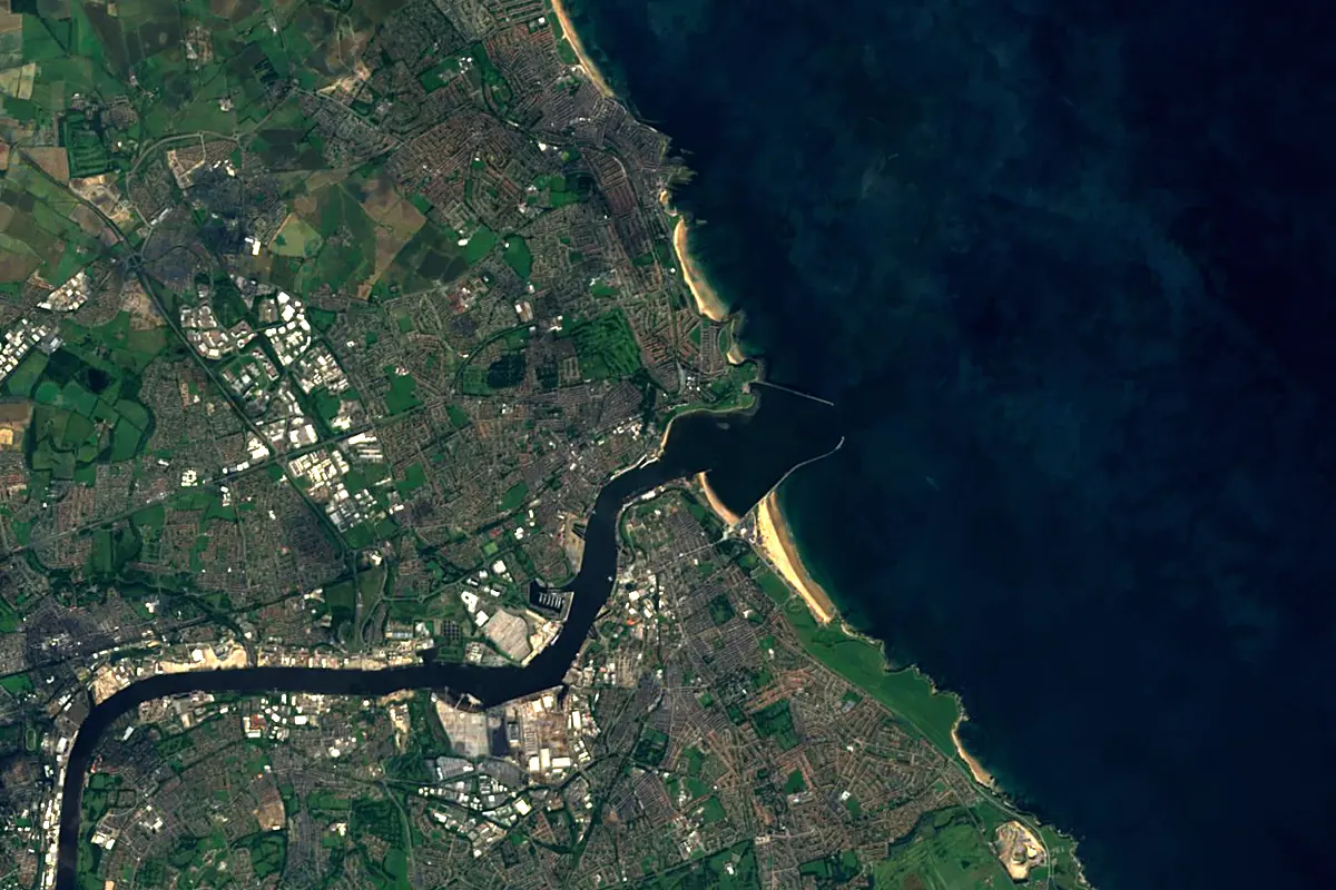
Sentinel-2 cloudless 2016 by EOX IT Services GmbH (contains modified Copernicus Sentinel data 2016), CC BY 4.0. The glowing line is the river as drawn by RiverATLAS.
Photos
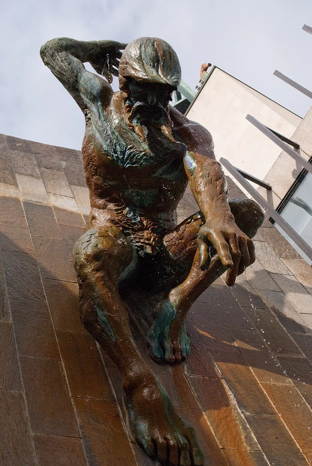
River Tyne in pictures
Tributaries
Where it flows, and what flows into it
Tributaries (6)
Also: River Derwent, River North Tyne, River Don, River South Tyne, Ouseburn, River Team
Nearby
Rivers nearby
United Kingdom96 km21 m³/s11 km awayRiver TeesUnited Kingdom137 km34 m³/s49 km awayRiver TweedUnited Kingdom156 km89 m³/s91 km awayRiver TrentUnited Kingdom298 km95 m³/s156 km awayRiver AireUnited Kingdom114 km36 m³/s147 km awayRiver OuseUnited Kingdom90 km50 m³/s152 km awayRiver TayUnited Kingdom193 km170 m³/s192 km awayRiver ClydeUnited Kingdom176 km90 m³/s217 km awayWhere these numbers come from
| Name, length, places | Wikidata (Q216373) · CC0 |
|---|---|
| Course, profile, basin | RiverATLAS v1.0 (HydroATLAS, Linke et al. 2019) · CC BY 4.0 — followed from the source to the mouth given by Wikidata |
| Flow | WaterGAP (RiverATLAS), 1971–2000 · CC BY 4.0 |
| Climate along the river | WorldClim (RiverATLAS), 1970–2000 · CC BY 4.0 |
| Towns, bridges, dams | Wikidata · CC0; GeoNames · CC BY 4.0 |
| Along the river | © OpenStreetMap contributors · ODbL |
| Images | EOX Sentinel-2 cloudless 2016 · CC BY 4.0; Wikimedia Commons |
| Our other atlases | Coastya, Islandyas — Wikidata · CC0; © OpenStreetMap contributors · ODbL; GeoNames · CC BY 4.0; HydroLAKES · CC BY 4.0; NOAA OISST |
Every source and licence is on the data sources page.
The family
Do you prefer beaches, lakes, mountains, waterfalls, islands, rivers or canyons?
Same idea, other landscapes: field atlases built on open data, month by month, in seven languages.
beaches Find your beach: sea temperature, sun and swimming month by month.Visit
  lakes
lakes Every lake on Earth: water temperature, ice, depth and the shore.Coming soonVisit
  mountains
 Every summit in 3D: summit weather, the 0 °C line, huts and trails.Visit
  waterfalls
 Every waterfall: height, flow month by month and when it roars.Coming soonVisit islands
 Every island from the sea up: size, sea temperature, ferries and 3D.Coming soonVisit
  rivers
 Every river from source to sea: the journey, the flow and the basin in numbers.You are here
 canyons
 Every canyon cut to scale: depth to the floor, rim and floor temperatures, trails and viewpoints.Coming soonVisit