River
Saale
413 km from source to mouth · Germany.
 GermanyFlows into Elbe5th longest in Germany
In numbers
Length
413km
Average flow
120m³/s
Basin
24,100km²
Drop
454m
from 499 m to 45 m
Country
1
The journey
From source to mouth
413 km of river and 68 stops on the way: 49 towns and cities on its banks, dams, bridges and the tributaries that feed it.
- 0 kmFichtel Mountainsat 499 m
- 0 kmZell im Fichtelgebirge1,809 people
- 0 kmSparneck1,499 people
- 0 kmWeißdorf1,209 people
- 6 kmFörmitztalsperre0.9 km²
- 10 kmSchwarzenbach an der Saale6,878 people
- 16 kmOberkotzau5,249 people
- 18 kmUntreusee0.4 km²
- 19 kmDöhlau3,741 people
- 23 kmHof46,624 people
- 41 kmHirschberg2,047 people
- 55 kmBlankenstein705 people
- 58 kmHarra828 people
- 74 kmBleiloch Reservoir6.8 km²
- 74 kmBleiloch Dam
- 80 kmBurgk88 people
- 82 kmWisentatributary
- 89 kmZiegenrück630 people
- 110 kmHohenwarte Lake5.3 km²
- 111 kmHohenwarte160 people
- 115 kmEichicht Reservoir0.4 km²
- 118 kmKaulsdorf2,332 people
- 127 kmSaalfeld28,474 people
- 133 kmSchwarzatributary
- 137 kmRudolstadt24,560 people
- 158 kmOrlamünde1,061 people
- 162 kmGroßeutersdorf261 people
- 164 kmKahla6,809 people
- 167 kmGroßpürschütz373 people
- 169 kmSchöps290 people
- 171 kmRothenstein1,130 people
- 178 kmLobeda23,508 people
- 180 kmRodatributary
- 182 kmJena109,353 people
- 193 kmGleisetributary
- 200 kmWichmar225 people
- 205 kmCamburg2,846 people
- 213 kmGroßheringen628 people
- 213 kmIlmtributary
- 221 kmBad Kösen5,522 people
- 230 kmNaumburg31,617 people
- 231 kmUnstruttributary
- 237 kmSchönburg953 people
- 249 kmWeißenfels37,308 people
- 251 kmBurgwerben1,062 people
- 255 kmDehlitz536 people
- 265 kmBad Dürrenberg11,458 people
- 268 kmEllerbachtributary
- 270 kmLeuna14,013 people
- 275 kmWallendorfer See3.0 km²
- 275 kmMerseburg34,491 people
- 280 kmSchkopau10,646 people
- 284 kmRattmannsdorfer See0.9 km²
- 290 kmWeisse Elstertributary
- 296 kmHalle (Saale)226,186 people
- 296 kmHalle-Neustadt44,515 people
- 303 kmHafen Halle
- 308 kmBrachwitz991 people
- 316 kmDöblitz162 people
- 321 kmWettin2,355 people
- 333 kmRothenburg796 people
- 335 kmKönnern7,804 people
- 343 kmAlsleben2,518 people
- 351 kmPlötzkau1,165 people
- 356 kmGröna588 people
- 358 kmWippertributary
- 361 kmBernburg30,572 people
- 380 kmCalbe7,933 people
- 388 kmBodetributary
- 413 kmElbeat 45 m
Water level along the river (RiverATLAS; the height is exaggerated). Towns: GeoNames and Wikidata; bridges, dams and tributaries: Wikidata.
River in Germany
At the mouth it carries 115 m³/s on average: an Olympic pool every 22 seconds. It drops from 499 m to 45 m, 1.1 m per kilometre on average. Its basin covers 24,100 km², about the size of DJ. 13.6 million people live in it. Highest water: February, April and from July to August. Dams and reservoirs hold back a large share of its water (18% of a year's flow).
Where to start
- Halle (Saale)Largest city on its banks · 226,186 people
- Leipzig/Halle Airport (LEJ)Nearest airport with scheduled flights, 20 km from the cityCar hire at LEJ airport (Schkeuditz)Discover Cars · Affiliate link↗
- On the water163 ferry piers, marinas, boat rentals and boat ramps along the river (OpenStreetMap)
- Kayak and canoe36 put-ins and rapids mapped (OpenStreetMap)
- From May to SeptemberThe best months to visit
Saale, month by month
Highest water: February, April and from July to August
Best months to visit: from May to September.
From about 290 m³/s in the lowest month to 1,200 m³/s in the highest. An estimate: the monthly flow is modelled from the lowest and highest months of WaterGAP (RiverATLAS, 1971–2000) and the rain and snow along the river (WorldClim). Dams change the real rhythm. The chip is the average air temperature; below it, the month's rain.
Plan the trip
Plan the trip: boat trips, a bed by the river, a car
Some links above are affiliate links: if you book through them we may earn a commission, at no extra cost to you. It never changes what the data on this page says.
The basin
Saale: the basin in numbers
93,738 km² of land send their water to this river. This is what lives on it.
- 13.6millionpeople live in the basin
- 146/km²people per km²
- 381maverage altitude of the basin
- 639mmof rain a year (basin average)
- 7.6°Caverage air temperature
- 23%protected areas
- 0.6%covered by lakes
- 3.3km³held in reservoirs
What covers the basin
- 32% Forest
- 40% Cropland
- 11% Pasture
- 7% Towns and cities
RiverATLAS (HydroATLAS v1.0, CC BY 4.0): land cover, people, protected areas, glaciers and dams over the whole basin upstream of the mouth.
Along the river
Saale: what you find on the way
- 110WeirsWehr am Saaledurchstich, Lamitzmühlwehr, Steinmühlenwehr and 107 more
- 26LocksSchleuse Beuditz, Schleuse Brückenmühle, Schleuse Bad Dürrenberg and 23 more
- 5WaterfallsSmall Waterfall Röderbach and 4 more
- 36Canoe put-insKanueinsatzstelle, Großpürschütz, Wasserkraftanlage Dorndorf and 33 more
- 86Boat rampsAnlegestelle Pottiga-Blumenaumühle, Bootsanleger Grüne Band Brücke, Anlegestelle Blankenberg- Schmidtsleite and 83 more
- 35Ferry piersHarra, Saaldorf, Heinrichstein and 32 more
- 22MarinasBootsverleih Saalburg, Segelverein Saalburg e.V., Seesportverein Rudolstadt 1990 and 19 more
- 6River beachesZauchenwiese, Fundgrube, Karlsbad and 3 more
From OpenStreetMap, within 2.4 km of the river. Not mapped is not the same as not there.
Cross-checked with our atlases
Saale in our other atlases
What our sister atlases know about the waterfalls on this river, the lakes it flows through, the beaches at its mouth, the mountains where it rises and the islands off its mouth.
 7lakes on its wayLakeyas
 67mountains at the sourcePeakyas
Lakes and reservoirs (7)
Lakes it flows through, by Lakeyas
- Förmitztalsperrekm 50.9km²
- Untreuseekm 160.4km²
- Bleiloch Reservoirkm 646.8km²
- Hohenwarte Lakekm 955.3km²
- Eichicht Reservoirkm 990.4km²
- Wallendorfer Seekm 2373.0km²
- Rattmannsdorfer Seekm 2450.9km²
Lakeyas is coming soonOpen Lakeyas ↗
Mountains at the source (67)
Within 15 km of the source, by Peakyas
- Schneeberg7.8 km away · prominence 484 m1,051m
- Ochsenkopf10 km away · prominence 253 m1,024m
- Platte12 km away885m
- Großer Waldstein2.0 km away877m
- Rudolfstein6.3 km away866m
- Epprechtstein6.8 km away797m
- Haberstein8.3 km away924m
- Bergkopf4.4 km away857m
59 more on PeakyasOpen Peakyas ↗
From space
The source and the mouth, seen from orbit
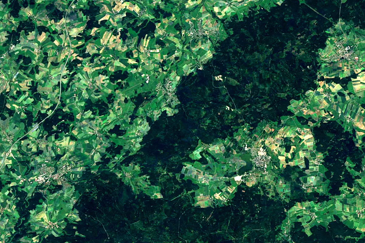
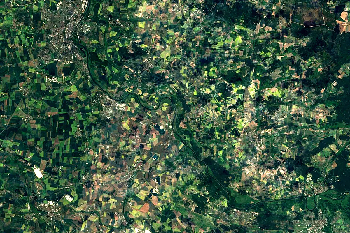
Sentinel-2 cloudless 2016 by EOX IT Services GmbH (contains modified Copernicus Sentinel data 2016), CC BY 4.0. The glowing line is the river as drawn by RiverATLAS.
Photos
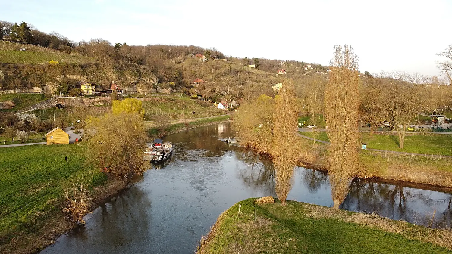
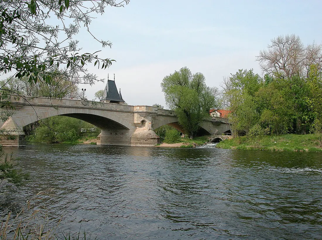
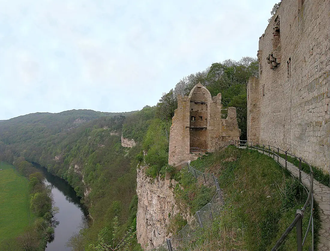
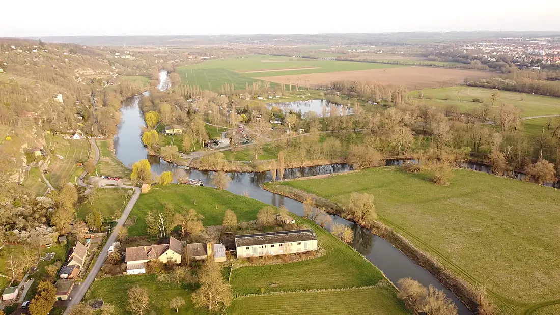
Saale in pictures
Tributaries
Where it flows, and what flows into it
Tributaries (30)
Also: Bode, Ilm, Schwarza, Wipper, Orla, Selbitz, Tannbach, Roda, Loquitz, Salza, Schwesnitz, Schlenze, Wisenta, Wethau, Südliche Regnitz, Gönnerbach, Luppe, Zottelbach, Ellerbach, Gleise, Nördliche Regnitz, Förmitz, Rippach, Lohme
 Czechia
Nearby
Rivers nearby
Germany147 km65 m³/s27 km awayWeisse ElsterGermany257 km100 m³/s62 km awayHavelGermany325 km89 m³/s97 km awaySpreeGermany382 km36 m³/s108 km awayBlack ElsterGermany179 km350 m³/s68 km awayUnstrutGermany192 km4.6 m³/s92 km awayGeraGermany85 km54 m³/s117 km awayEldeGermany208 km11 m³/s131 km awayWhere these numbers come from
| Name, length, places | Wikidata (Q1678) · CC0 |
|---|---|
| Course, profile, basin | RiverATLAS v1.0 (HydroATLAS, Linke et al. 2019) · CC BY 4.0 — followed from the source to the mouth given by Wikidata |
| Flow | WaterGAP (RiverATLAS), 1971–2000 · CC BY 4.0 |
| Climate along the river | WorldClim (RiverATLAS), 1970–2000 · CC BY 4.0 |
| Towns, bridges, dams | Wikidata · CC0; GeoNames · CC BY 4.0 |
| Along the river | © OpenStreetMap contributors · ODbL |
| Images | EOX Sentinel-2 cloudless 2016 · CC BY 4.0; Wikimedia Commons |
| Our other atlases | Lakeyas, Peakyas — Wikidata · CC0; © OpenStreetMap contributors · ODbL; GeoNames · CC BY 4.0; HydroLAKES · CC BY 4.0; NOAA OISST |
Every source and licence is on the data sources page.
The family
Do you prefer beaches, lakes, mountains, waterfalls, islands, rivers or canyons?
Same idea, other landscapes: field atlases built on open data, month by month, in seven languages.
 beaches
 Find your beach: sea temperature, sun and swimming month by month.Visit lakes
 Every lake on Earth: water temperature, ice, depth and the shore.Coming soonVisit mountains
 Every summit in 3D: summit weather, the 0 °C line, huts and trails.Visit
  waterfalls
 Every waterfall: height, flow month by month and when it roars.Coming soonVisit
  islands
 Every island from the sea up: size, sea temperature, ferries and 3D.Coming soonVisit
  rivers
 Every river from source to sea: the journey, the flow and the basin in numbers.You are here
 canyons
 Every canyon cut to scale: depth to the floor, rim and floor temperatures, trails and viewpoints.Coming soonVisit