River
Sázava
226 km from source to mouth · Czechia.
 CzechiaFlows into Vltava3rd longest in Czechia
In numbers
Length
226km
Average flow
25m³/s
Basin
4,350km²
Drop
270m
from 474 m to 204 m
Country
1
The journey
From source to mouth
226 km of river and 68 stops on the way: 12 towns and cities on its banks, dams, bridges and the tributaries that feed it.
- 0 kmVelké Dářkoat 474 m
- 0 kmVodní nádrž Pilská0.4 km²
- 0 kmMostek přes Sázavu
- 1 kmŽďár nad Sázavou20,404 people
- 3 kmRailway bridge in Žďár nad Sázavou
- 8 kmBrdičkův mlýn
- 21 kmRonov bridge
- 25 kmPřibyslav3,997 people
- 26 kmLosenický potoktributary
- 31 kmBorovský potoktributary
- 32 kmStone bridge over the Sázava near Štukhejlský mlýn
- 41 kmBřevnický potoktributary
- 46 kmHavlíčkův Brod23,368 people
- 46 kmŽabinectributary
- 58 kmÚsobský potoktributary
- 68 kmSázavkatributary
- 69 kmSvětlá nad Sázavou6,394 people
- 79 kmPerlový potoktributary
- 86 kmLedeč nad Sázavou6,048 people
- 94 kmPstružný potoktributary
- 100 kmBudčický mlýn
- 110 kmZruč nad Sázavou4,925 people
- 110 kmŠvihov Reservoir11 km²
- 111 kmbridge of Vlašimská street over the Sázava in Zruč nad Sázavou
- 111 kmOstrovský potoktributary
- 116 kmŽelivkatributary
- 129 kmTichonický vodopád15 m
- 134 kmBridge over the Sázava in Soběšín
- 136 kmBlanicetributary
- 136 kmVodopád pod Dubinou5 m
- 138 kmŠternovské vodopády2 m
- 141 kmDrahňovické kaskády
- 144 kmRoad bridge over the Sázava in Ledečko
- 148 kmVranické vodopády
- 148 kmBělokozelské vodopády
- 149 kmFootbridge over the Sázava in Samopše
- 152 kmNechybský vodopád3 m
- 155 kmVodní mlýn Sázavského kláštera
- 155 kmFootbridge of K Podzámčí street in Sázava
- 155 kmRoad bridge over the Sázava in Sázava
- 155 kmSázava3,797 people
- 160 kmSamechovský vodopád6 m
- 161 kmJevanský potoktributary
- 161 kmBridge over the Sázava in Stříbrná Skalice
- 164 kmVodopády pod Hájenkou
- 170 kmHvězdonice343 people
- 170 kmKaliště389 people
- 171 kmVisutá lávka Hvězdonice
- 171 kmHighway bridge Hvězdonice
- 174 kmLensedelské vodopády2 m
- 179 kmBridge Lštění - Čtyřkoly
- 181 kmroad bridge over the Sázava in Čerčany
- 181 kmRailway bridge in Čerčany
- 182 kmČerčany3,133 people
- 184 kmKonopišťský potoktributary
- 185 kmMost císaře Františka Josefa
- 195 kmbikeway bridge in Zbořený Kostelec
- 198 kmJawa footbridge
- 198 kmrailway bridge over the Sázava in Týnec nad Sázavou
- 199 kmMasaryk bridge
- 199 kmTýnec nad Sázavou5,732 people
- 203 kmJanovický potoktributary
- 209 kmNovoveský vodopád2 m
- 210 kmBridge in Kamenný Přívoz
- 211 kmHostěradické vodopády3 m
- 212 kmJílové u Prahy5,262 people
- 214 kmOvčínské vodopády
- 216 kmTřebsínský vodopád3 m
- 221 kmFootbridge in Pikovice
- 226 kmVltavaat 204 m
Water level along the river (RiverATLAS; the height is exaggerated). Towns: GeoNames and Wikidata; bridges, dams and tributaries: Wikidata.
River in the Czech Republic
At the mouth it carries 25 m³/s on average: an Olympic pool every 99 seconds. It drops from 474 m to 204 m, 1.2 m per kilometre on average. Its basin covers 4,350 km², about the size of CV. 323,000 people live in it. Highest water: March; lowest: from December to February. Dams and reservoirs hold back a large share of its water (40% of a year's flow).
Where to start
- Havlíčkův BrodLargest city on its banks · 23,368 people
- Pardubice Airport (PED)Nearest airport with scheduled flights, 47 km from the cityCar hire at BRQ airport (Brno)Discover Cars · Affiliate link↗
- On the water21 ferry piers, marinas, boat rentals and boat ramps along the river (OpenStreetMap)
- Kayak and canoe3 put-ins and rapids mapped (OpenStreetMap)
- From May to SeptemberThe best months to visit
Sázava, month by month
Highest water: March
Lowest water: from December to February. Best months to visit: from May to September.
From about 8.3 m³/s in the lowest month to 57 m³/s in the highest. An estimate: the monthly flow is modelled from the lowest and highest months of WaterGAP (RiverATLAS, 1971–2000) and the rain and snow along the river (WorldClim). Dams change the real rhythm. The chip is the average air temperature; below it, the month's rain.
Plan the trip
Plan the trip: boat trips, a bed by the river, a car
Some links above are affiliate links: if you book through them we may earn a commission, at no extra cost to you. It never changes what the data on this page says.
The basin
Sázava: the basin in numbers
4,328 km² of land send their water to this river. This is what lives on it.
- 323,000people live in the basin
- 75/km²people per km²
- 498maverage altitude of the basin
- 632mmof rain a year (basin average)
- 7.4°Caverage air temperature
- 5%protected areas
- 0.4%covered by lakes
- 0.3km³held in reservoirs
What covers the basin
- 31% Forest
- 42% Cropland
- 7% Pasture
- 2% Towns and cities
RiverATLAS (HydroATLAS v1.0, CC BY 4.0): land cover, people, protected areas, glaciers and dams over the whole basin upstream of the mouth.
Along the river
Sázava: what you find on the way
- 107Weirs203,6 Holemář, 202,3 U mamuta, Svetlá nad Sázavou and 104 more
- 8WaterfallsOvčinské vodopády, Třebsínský vodopád, Kletecký vodopád and 5 more
- 3Canoe put-insSvětlá nad Sázavou, Pikovice
- 4Boat ramps
- 4Ferry piersPřívoz Žampach and 3 more
- 3MarinasDavle, PPS, Marina Davle, Zastávka Měchenice PPS
From OpenStreetMap, within 1.6 km of the river. Not mapped is not the same as not there.
Cross-checked with our atlases
Sázava in our other atlases
What our sister atlases know about the waterfalls on this river, the lakes it flows through, the beaches at its mouth, the mountains where it rises and the islands off its mouth.
 14waterfalls on the riverCascadyas
 2lakes on its wayLakeyas
 29mountains at the sourcePeakyas
Waterfalls (14)
On the river, by Cascadyas
- Tichonický vodopádkm 9515m
- Vodopád pod Dubinoukm 1015m
- Šternovské vodopádykm 1022m
- Nechybský vodopádkm 1133m
- Samechovský vodopádkm 1196m
- Hostěradické vodopádykm 1563m
- Ovčínské vodopádykm 159
- Třebsínský vodopádkm 1603m
6 more on CascadyasCascadyas is coming soonOpen Cascadyas ↗
Lakes and reservoirs (2)
Lakes it flows through, by Lakeyas
- Vodní nádrž Pilskákm 00.4km²
- Švihov Reservoirkm 8211km²
Lakeyas is coming soonOpen Lakeyas ↗
Mountains at the source (29)
Within 15 km of the source, by Peakyas
- Žákova hora4.2 km away810m
- Kopeček13 km away822m
- Buchtův Kopec14 km away · prominence 124 m813m
- Šindelný vrch1.1 km away · prominence 107 m806m
- Křovina Sněžné-Samotín8.6 km away830m
- Křivý javor7.0 km away823m
- Vysoký kopec Sněžné13 km away806m
- Kamenný vrch0.9 km away803m
21 more on PeakyasOpen Peakyas ↗
From space
The source and the mouth, seen from orbit
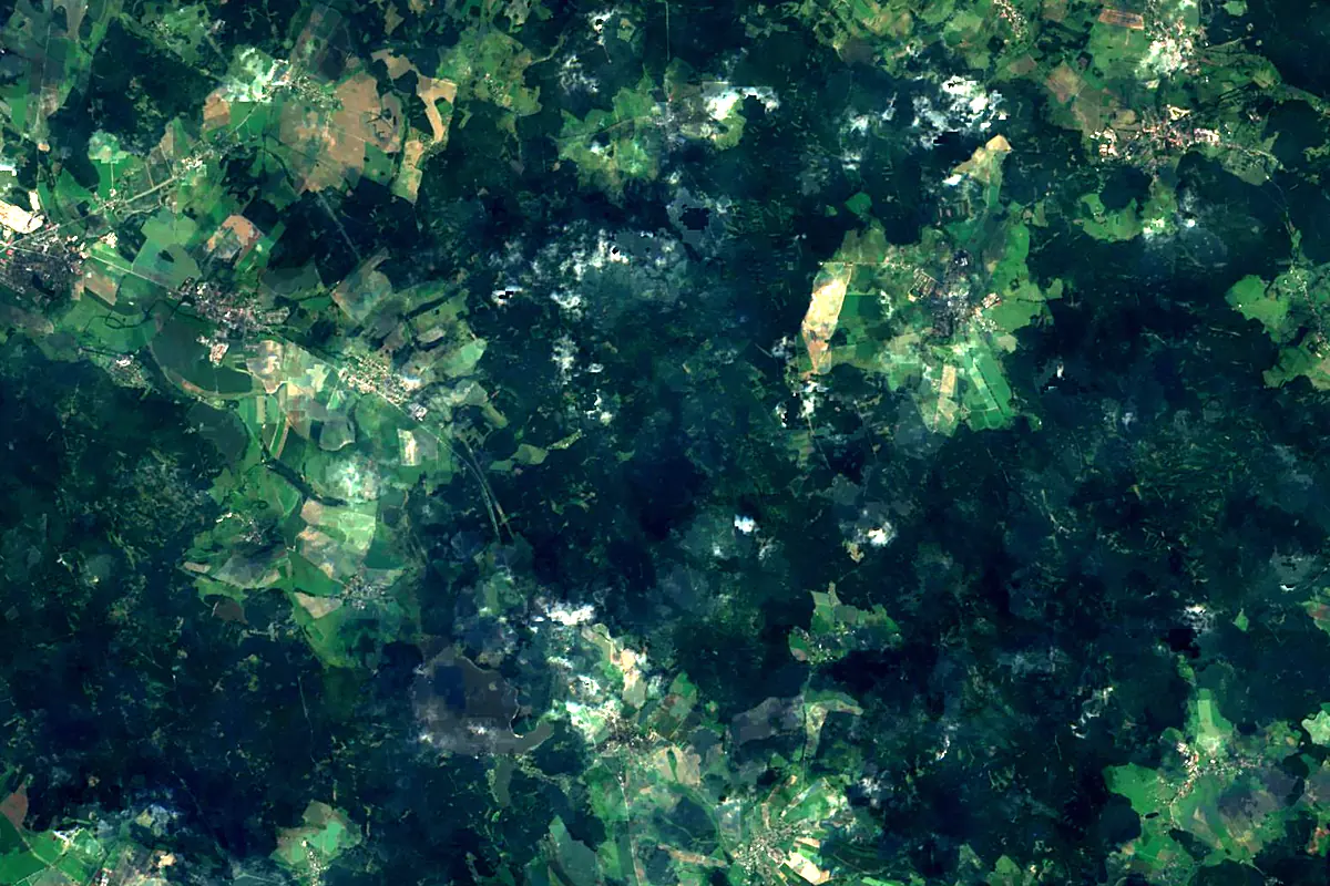
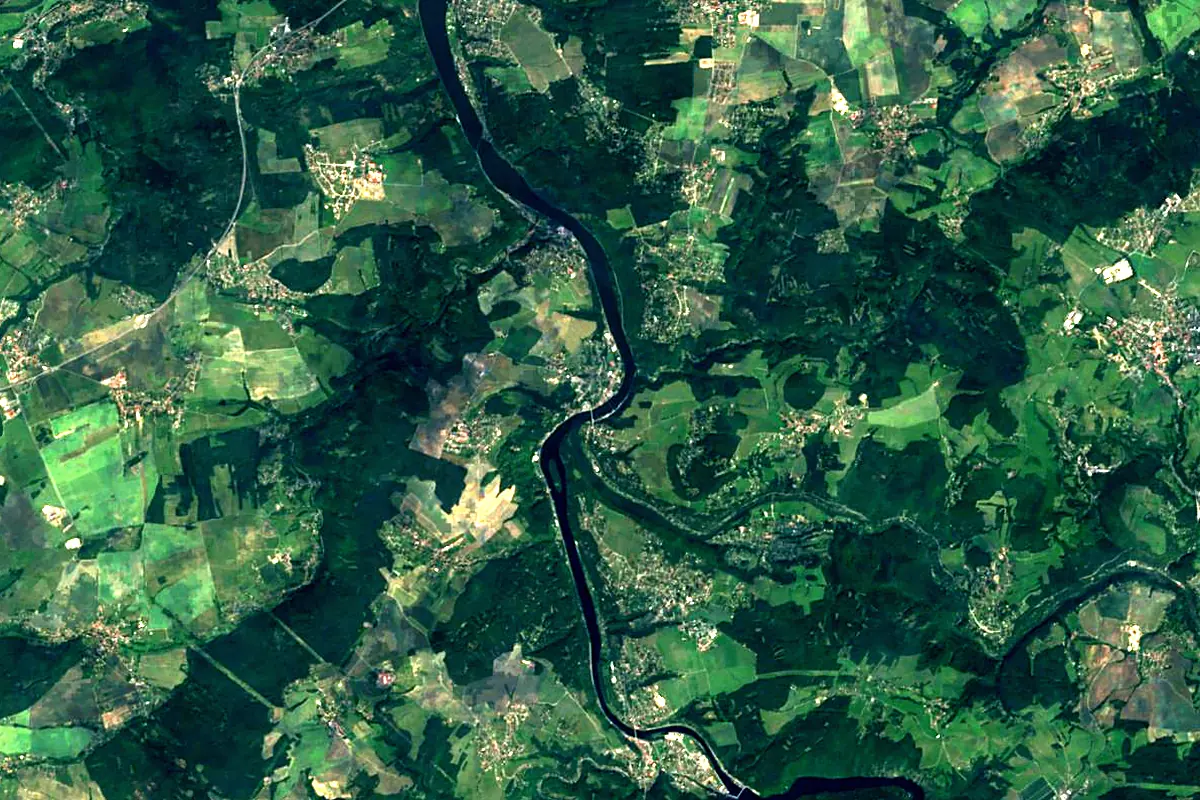
Sentinel-2 cloudless 2016 by EOX IT Services GmbH (contains modified Copernicus Sentinel data 2016), CC BY 4.0. The glowing line is the river as drawn by RiverATLAS.
Photos
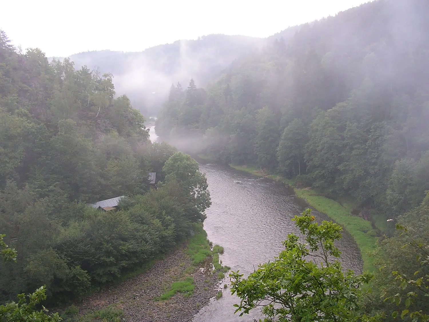
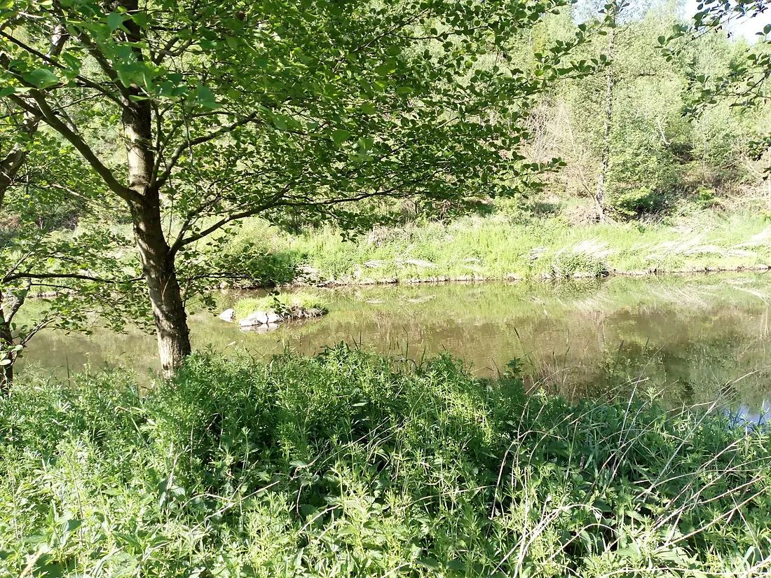
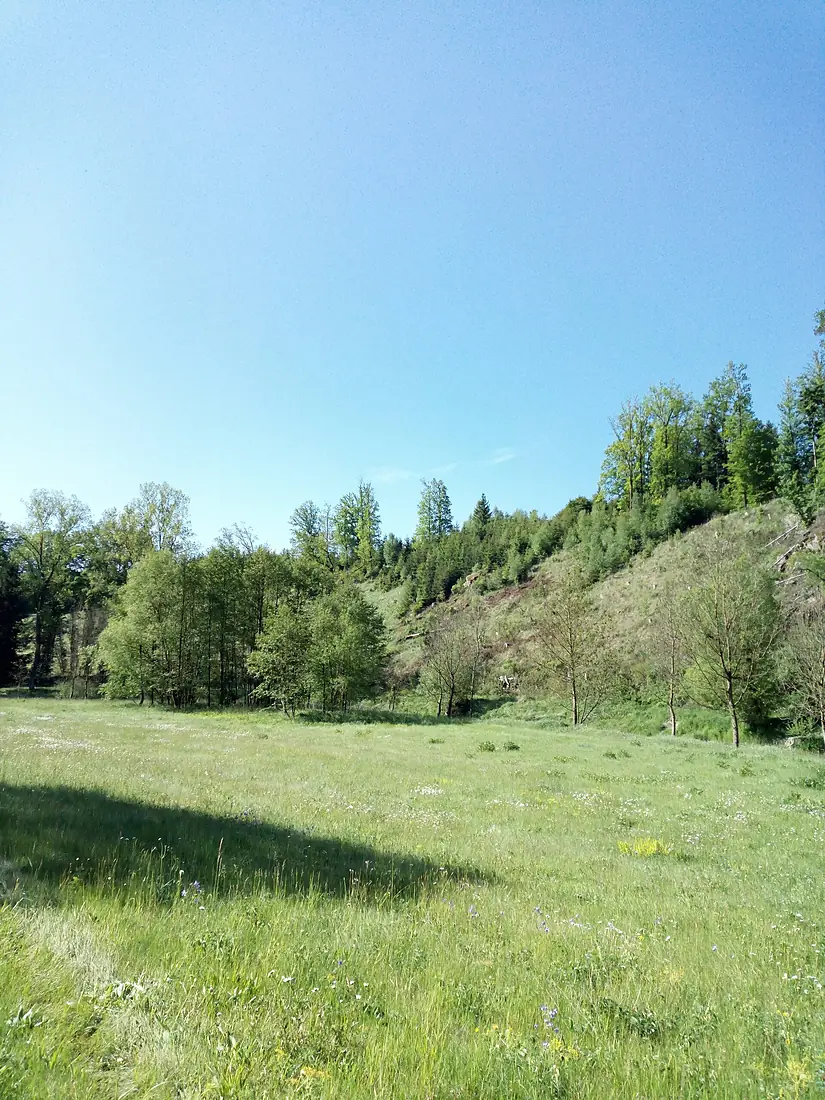
Sázava in pictures
Tributaries
Where it flows, and what flows into it
It flows into
VltavaCzechia430 km150 m³/sTributaries (40)
Also: Želivka, Šlapanka, Blanice, Sázavka, Žabinec, Úsobský potok, Borovský potok, Břevnický potok, Janovický potok, Jevanský potok, Kamenický potok, Konopišťský potok, Losenický potok, Lučický potok, Nučický potok, Perlový potok, Staviště, Čestínský potok, Mokřanský potok, Ostrovský potok, Pstružný potok, Losinský potok, Žebrákovský potok, Štěpánovský potok
 Germany
Nearby
Rivers nearby
 Austria
Where these numbers come from
| Name, length, places | Wikidata (Q38771) · CC0 |
|---|---|
| Course, profile, basin | RiverATLAS v1.0 (HydroATLAS, Linke et al. 2019) · CC BY 4.0 — followed from the source to the mouth given by Wikidata |
| Flow | WaterGAP (RiverATLAS), 1971–2000 · CC BY 4.0 |
| Climate along the river | WorldClim (RiverATLAS), 1970–2000 · CC BY 4.0 |
| Towns, bridges, dams | Wikidata · CC0; GeoNames · CC BY 4.0 |
| Along the river | © OpenStreetMap contributors · ODbL |
| Images | EOX Sentinel-2 cloudless 2016 · CC BY 4.0; Wikimedia Commons |
| Our other atlases | Cascadyas, Lakeyas, Peakyas — Wikidata · CC0; © OpenStreetMap contributors · ODbL; GeoNames · CC BY 4.0; HydroLAKES · CC BY 4.0; NOAA OISST |
Every source and licence is on the data sources page.
The family
Do you prefer beaches, lakes, mountains, waterfalls, islands, rivers or canyons?
Same idea, other landscapes: field atlases built on open data, month by month, in seven languages.
 beaches
 Find your beach: sea temperature, sun and swimming month by month.Visit lakes
 Every lake on Earth: water temperature, ice, depth and the shore.Coming soonVisit mountains
 Every summit in 3D: summit weather, the 0 °C line, huts and trails.Visit waterfalls
 Every waterfall: height, flow month by month and when it roars.Coming soonVisit
  islands
 Every island from the sea up: size, sea temperature, ferries and 3D.Coming soonVisit
  rivers
 Every river from source to sea: the journey, the flow and the basin in numbers.You are here
 canyons
 Every canyon cut to scale: depth to the floor, rim and floor temperatures, trails and viewpoints.Coming soonVisit