River
Havel
325 km from source to mouth · Germany.
 GermanyFlows into Elbe9th longest in Germany
In numbers
Length
325km
Average flow
89m³/s
Basin
23,858km²
Drop
37m
from 57 m to 20 m
Country
1
The journey
From source to mouth
325 km of river and 68 stops on the way: 9 towns and cities on its banks, dams, bridges and the tributaries that feed it.
- 0 kmSourceat 57 m
- 0 kmJäthensee1.0 km²
- 3 kmGörtowsee0.3 km²
- 5 kmKramssee1.1 km²
- 8 kmKrummer See0.4 km²
- 9 kmUseriner See3.6 km²
- 11 kmGroßer Labussee3.0 km²
- 19 kmWoblitzsee4.6 km²
- 23 kmDrewensee2.3 km²
- 26 kmKlenzsee0.6 km²
- 26 kmPlätlinsee2.1 km²
- 29 kmGroßer Pälitzsee2.9 km²
- 32 kmGroßer Priepertsee0.9 km²
- 35 kmEllbogensee1.4 km²
- 36 kmZiernsee1.0 km²
- 38 kmMenowsee0.3 km²
- 38 kmPeetschsee0.8 km²
- 42 kmRöblinsee0.8 km²
- 45 kmSchwedtsee0.5 km²
- 45 kmThymensee0.9 km²
- 49 kmModerfitzsee0.5 km²
- 49 kmHaussee0.3 km²
- 50 kmStolpsee3.5 km²
- 50 kmWoblitztributary
- 66 kmGroßer Beutelsee0.5 km²
- 74 kmGroßer Wentowsee2.3 km²
- 83 kmZehdenick12,875 people
- 120 kmOranienburg40,793 people
- 120 kmLehnitzsee0.6 km²
- 128 kmBriesetributary
- 142 kmNieder Neuendorfer See2.0 km²
- 143 kmLake Tegel2.7 km²
- 146 kmSpandau245,197 people
- 147 kmSpreetributary
- 148 kmWilhelmstadt40,463 people
- 157 kmSteglitz-Zehlendorf295,786 people
- 161 kmGroß Glienicker See0.5 km²
- 162 kmPfaueninselUNESCO World Heritage
- 165 kmSacrower See0.9 km²
- 166 kmGroßer Wannsee16 km²
- 166 kmGriebnitzsee0.4 km²
- 166 kmGlienicke Bridge
- 168 kmTiefer See0.4 km²
- 168 kmNuthetributary
- 169 kmPotsdam185,137 people
- 178 kmTempliner See4.8 km²
- 178 kmCaputher See0.4 km²
- 180 kmLake Schwielowsee6.9 km²
- 181 kmGlindowsee1.5 km²
- 183 kmGroßer Plessower See2.6 km²
- 183 kmWerder (Havel)27,064 people
- 187 kmWublitzsee0.5 km²
- 195 kmKleiner Zernsee5.2 km²
- 213 kmTrebelsee5.0 km²
- 223 kmBeetzsee3.1 km²
- 225 kmBrandenburg an der Havel73,945 people
- 228 kmPlanetributary
- 232 kmBuckautributary
- 237 kmGroßer Wusterwitzer See1.4 km²
- 237 kmHeilige See0.5 km²
- 242 kmWendsee17 km²
- 250 kmPritzerber See1.6 km²
- 266 kmStremmetributary
- 279 kmHohennauener See3.8 km²
- 287 kmSchollener See0.7 km²
- 295 kmGülper See4.8 km²
- 299 kmRhintributary
- 306 kmDossetributary
- 313 kmHavelberg6,174 people
- 325 kmElbeat 20 m
Water level along the river (RiverATLAS; the height is exaggerated). Towns: GeoNames and Wikidata; bridges, dams and tributaries: Wikidata.
River in northeastern Germany
At the mouth it carries 89 m³/s on average: an Olympic pool every 28 seconds. It drops from 57 m to 20 m, 0.1 m per kilometre on average. Its basin covers 23,858 km², about the size of DJ. 19.5 million people live in it. Highest water: from February to March, May and December. Dams and reservoirs hold back a large share of its water (16% of a year's flow).
Where to start
- Steglitz-ZehlendorfLargest city on its banks · 295,786 people
- Berlin Brandenburg Airport (BER)Nearest airport with scheduled flights, 19 km from the cityCar hire at BER airport (Berlin)Discover Cars · Affiliate link↗
- On the water550 ferry piers, marinas, boat rentals and boat ramps along the river (OpenStreetMap)
- Kayak and canoe3 put-ins and rapids mapped (OpenStreetMap)
- From May to SeptemberThe best months to visit
Havel, month by month
Highest water: from February to March, May and December
Best months to visit: from May to September.
From about 370 m³/s in the lowest month to 1,300 m³/s in the highest. An estimate: the monthly flow is modelled from the lowest and highest months of WaterGAP (RiverATLAS, 1971–2000) and the rain and snow along the river (WorldClim). Dams change the real rhythm. The chip is the average air temperature; below it, the month's rain.
Plan the trip
Plan the trip: boat trips, a bed by the river, a car
Some links above are affiliate links: if you book through them we may earn a commission, at no extra cost to you. It never changes what the data on this page says.
The basin
Havel: the basin in numbers
120,971 km² of land send their water to this river. This is what lives on it.
- 19.5millionpeople live in the basin
- 163/km²people per km²
- 311maverage altitude of the basin
- 620mmof rain a year (basin average)
- 7.9°Caverage air temperature
- 27%protected areas
- 0.9%covered by lakes
- 3.5km³held in reservoirs
What covers the basin
- 32% Forest
- 38% Cropland
- 11% Pasture
- 7% Towns and cities
RiverATLAS (HydroATLAS v1.0, CC BY 4.0): land cover, people, protected areas, glaciers and dams over the whole basin upstream of the mouth.
Along the river
Havel: what you find on the way
- 82WeirsMühlenwehr, Wehr Freiarche, Wehr Krewelin and 79 more
- 43Locksehem. Schleuse Babke, Havel, Müritz-Havel-Wasserstraße and 40 more
- 6WaterfallsWilhelm Wasserfall and 5 more
- 3Canoe put-ins
- 140Boat rampsWesenberg, Badestelle am Woblitzsee, Boot Slipway for smal Motorboat, VKB Motorboot Slipanlage and 137 more
- 71Ferry piersFähre Burchardi, Schulfarm Insel Scharfenberg (Landseite), Tegelort and 68 more
- 297MarinasMarina Havelberge, Kanuzentrum Havelberge, Wasserwanderrastplatz Wesenberg and 294 more
- 89River beachesBadestelle Großer Prälanksee, Badestrand Userin, Hundestrand and 86 more
From OpenStreetMap, within 2.4 km of the river. Not mapped is not the same as not there.
Cross-checked with our atlases
Havel in our other atlases
What our sister atlases know about the waterfalls on this river, the lakes it flows through, the beaches at its mouth, the mountains where it rises and the islands off its mouth.
 48lakes on its wayLakeyas
 23mountains at the sourcePeakyas
Lakes and reservoirs (48)
Lakes it flows through, by Lakeyas
- Lake Tegelkm 138 · 16 m deep2.7km²
- Sacrower Seekm 1590.9km²
- Großer Wannseekm 16016km²
- Griebnitzseekm 160 · 5 m deep0.4km²
- Templiner Seekm 1714.8km²
- Lake Schwielowseekm 1736.9km²
- Beetzseekm 2153.1km²
- Wendseekm 23317km²
40 more on LakeyasLakeyas is coming soonOpen Lakeyas ↗
Mountains at the source (23)
Within 15 km of the source, by Peakyas
- Käflingsberge6.7 km away
- Lindenberg11 km away
- Hütten-Berg7.4 km away
- Gerichts Berg14 km away
- Bäver Berg3.7 km away
- Heidberge2.1 km away
- Warens-Berg1.5 km away
- Pieverstorfer Berge3.9 km away
15 more on PeakyasOpen Peakyas ↗
From space
The source and the mouth, seen from orbit
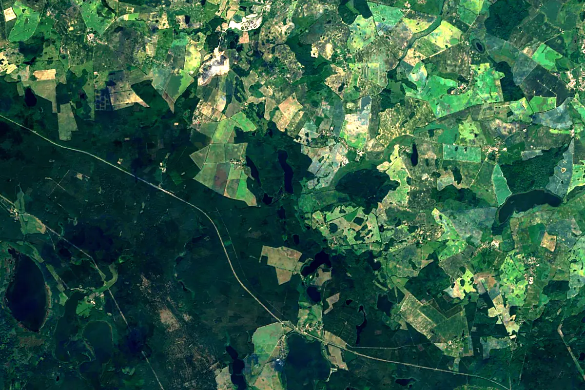
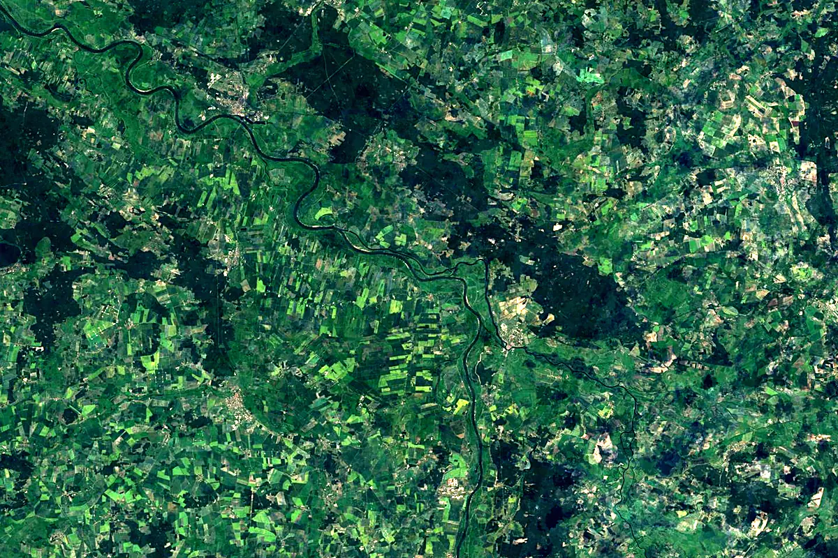
Sentinel-2 cloudless 2016 by EOX IT Services GmbH (contains modified Copernicus Sentinel data 2016), CC BY 4.0. The glowing line is the river as drawn by RiverATLAS.
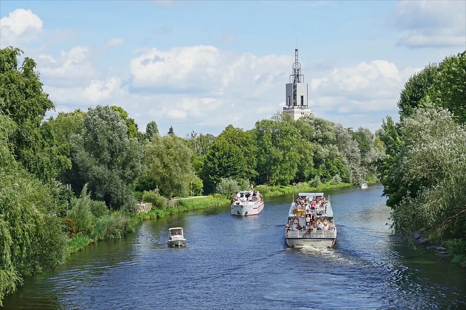
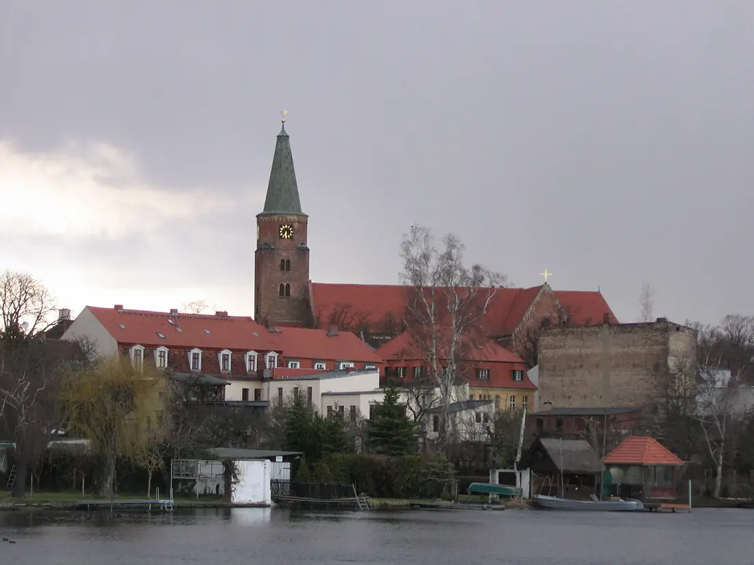
Photos
Havel in pictures
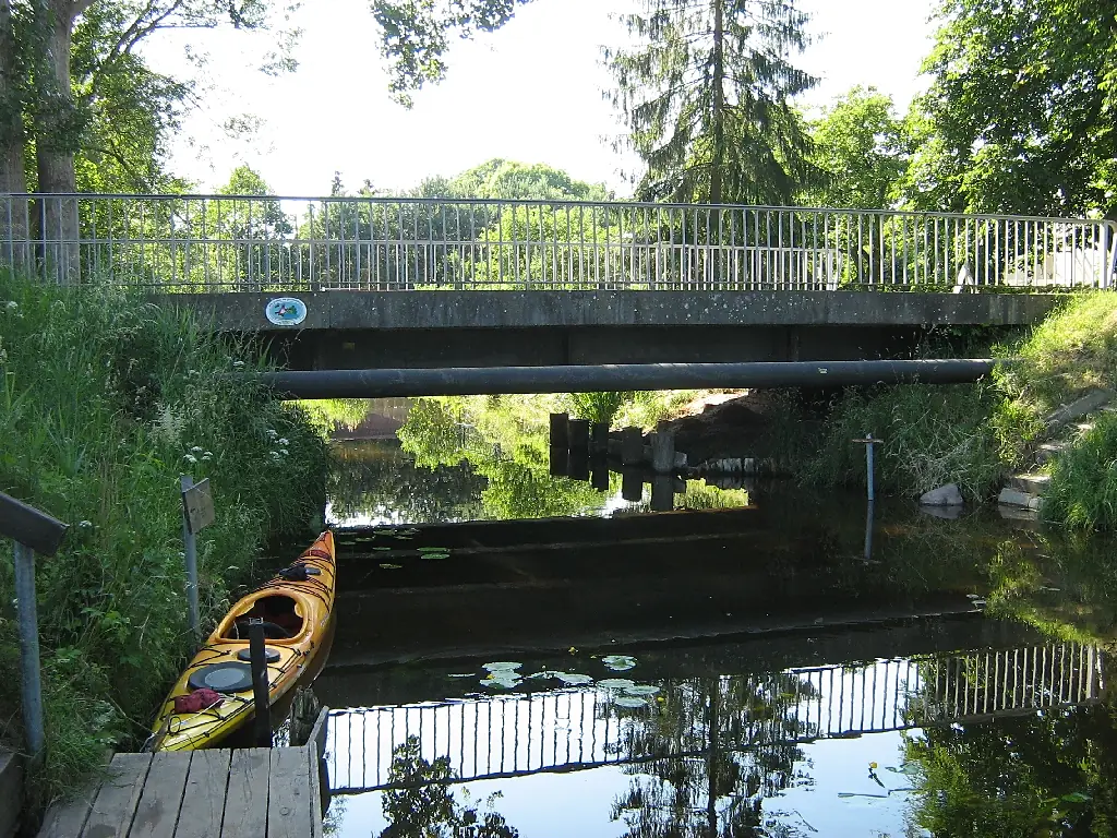
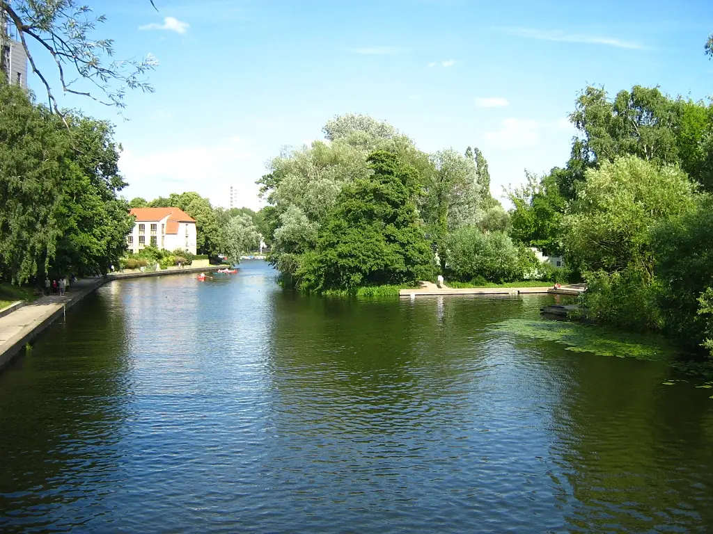
Tributaries
Where it flows, and what flows into it
Tributaries (15)
Also: Rhin, Dosse, Nuthe, Plane, Buckau, Briese, Woblitz, Wublitz, Tegeler Fließ, Schwaanhavel, Emster, Stremme, Schnelle Havel, Königsgraben
 Czechia
Nearby
Rivers nearby
 Poland
Where these numbers come from
| Name, length, places | Wikidata (Q1682) · CC0 |
|---|---|
| Course, profile, basin | RiverATLAS v1.0 (HydroATLAS, Linke et al. 2019) · CC BY 4.0 — followed from the source to the mouth given by Wikidata |
| Flow | WaterGAP (RiverATLAS), 1971–2000 · CC BY 4.0 |
| Climate along the river | WorldClim (RiverATLAS), 1970–2000 · CC BY 4.0 |
| Towns, bridges, dams | Wikidata · CC0; GeoNames · CC BY 4.0 |
| Along the river | © OpenStreetMap contributors · ODbL |
| Images | EOX Sentinel-2 cloudless 2016 · CC BY 4.0; Wikimedia Commons |
| Our other atlases | Lakeyas, Peakyas — Wikidata · CC0; © OpenStreetMap contributors · ODbL; GeoNames · CC BY 4.0; HydroLAKES · CC BY 4.0; NOAA OISST |
Every source and licence is on the data sources page.
The family
Do you prefer beaches, lakes, mountains, waterfalls, islands, rivers or canyons?
Same idea, other landscapes: field atlases built on open data, month by month, in seven languages.
 beaches
 Find your beach: sea temperature, sun and swimming month by month.Visit lakes
 Every lake on Earth: water temperature, ice, depth and the shore.Coming soonVisit mountains
 Every summit in 3D: summit weather, the 0 °C line, huts and trails.Visit
  waterfalls
 Every waterfall: height, flow month by month and when it roars.Coming soonVisit
  islands
 Every island from the sea up: size, sea temperature, ferries and 3D.Coming soonVisit
  rivers
 Every river from source to sea: the journey, the flow and the basin in numbers.You are here
 canyons
 Every canyon cut to scale: depth to the floor, rim and floor temperatures, trails and viewpoints.Coming soonVisit