River
Connecticut River
660 km from source to mouth · United States.
 United StatesFlows into Long Island Sound
In numbers
Length
660km
Average flow
520m³/s
Basin
29,137km²
Drop
552m
from 552 m to 0 m
Country
1
The journey
From source to mouth
660 km of river and 68 stops on the way: 31 towns and cities on its banks, dams, bridges and the tributaries that feed it.
- 0 kmSourceat 552 m
- 0 kmSecond Connecticut Lake3.8 km²
- 14 kmFirst Connecticut Lake11 km²
- 27 kmLake Francis6.4 km²
- 106 kmUpper Ammonoosuc Rivertributary
- 122 kmIsrael Rivertributary
- 138 kmJohns Rivertributary
- 159 kmMoore Reservoir9.8 km²
- 162 kmGale Rivertributary
- 172 kmComerford Reservoir3.7 km²
- 175 kmPassumpsic Rivertributary
- 196 kmAmmonoosuc Rivertributary
- 203 kmNewbury2,293 people
- 216 kmHaverhill4,585 people
- 222 kmWaits Rivertributary
- 235 kmOrford1,237 people
- 236 kmFairlee988 people
- 247 kmPost Pond0.4 km²
- 267 kmHanover9,078 people
- 270 kmMink Brooktributary
- 271 kmWilder3,071 people
- 274 kmWhite River Junction2,532 people
- 284 kmOttauquechee Rivertributary
- 309 kmSugar Rivertributary
- 330 kmBlack Rivertributary
- 341 kmWilliams Rivertributary
- 346 kmGreat Falls
- 349 kmSaxtons Rivertributary
- 390 kmWhetstone Brooktributary
- 390 kmWest Rivertributary
- 403 kmAshuelot Rivertributary
- 403 kmConnecticut River Reservoir4.7 km²
- 427 kmMillers Rivertributary
- 438 kmGreenfield19,753 people
- 439 kmDeerfield Rivertributary
- 444 kmMontague8,637 people
- 478 kmNorthampton29,571 people
- 480 kmMill Rivertributary
- 486 kmThe Oxbow0.8 km²
- 489 kmManhan Rivertributary
- 489 kmSouth Hadley17,652 people
- 493 kmWhiting Street Reservoir0.5 km²
- 497 kmHolyoke38,238 people
- 501 kmNorth Chicopee55,179 people
- 504 kmAshley Reservoir0.9 km²
- 508 kmChicopee Rivertributary
- 508 kmChicopee55,560 people
- 512 kmWest Springfield27,912 people
- 515 kmSpringfield154,341 people
- 516 kmWestfield Rivertributary
- 520 kmAgawam28,761 people
- 521 kmLongmeadow15,784 people
- 530 kmEnfield45,212 people
- 537 kmWindsor Locks12,613 people
- 547 kmScantic Rivertributary
- 547 kmWindsor28,778 people
- 549 kmSouth Windsor24,412 people
- 558 kmHartford121,054 people
- 560 kmPark Rivertributary
- 561 kmEast Hartford51,045 people
- 565 kmWethersfield26,668 people
- 568 kmGlastonbury31,876 people
- 587 kmCromwell13,750 people
- 589 kmPortland9,384 people
- 590 kmMiddletown47,717 people
- 616 kmEast Haddam9,042 people
- 617 kmSalmon Rivertributary
- 628 kmEightmile Rivertributary
- 638 kmOld Saybrook10,627 people
- 660 kmLong Island Soundat 0 m
Water level along the river (RiverATLAS; the height is exaggerated). Towns: GeoNames and Wikidata; bridges, dams and tributaries: Wikidata.
River in the New England region of the United States
At the mouth it carries 521 m³/s on average: an Olympic pool every 4.8 seconds. It drops from 552 m to 0 m, 0.8 m per kilometre on average. Its basin covers 29,137 km², about the size of AL. 2.3 million people live in it. Highest water: from April to June; lowest: from December to March. Dams and reservoirs hold back a large share of its water (23% of a year's flow).
Where to start
- SpringfieldLargest city on its banks · 154,341 people
- Bradley International Airport (BDL)Nearest airport with scheduled flights, 20 km from the cityCar hire at BDL airport (Hartford)Discover Cars · Affiliate link↗
- On the water134 ferry piers, marinas, boat rentals and boat ramps along the river (OpenStreetMap)
- Kayak and canoe4 put-ins and rapids mapped (OpenStreetMap)
- From May to SeptemberThe best months to visit
Connecticut River, month by month
Highest water: from April to June
Lowest water: from December to March. Freezing months (average below −4 °C): from December to February. Best months to visit: from May to September.
From about 360 m³/s in the lowest month to 1,300 m³/s in the highest. An estimate: the monthly flow is modelled from the lowest and highest months of WaterGAP (RiverATLAS, 1971–2000) and the rain and snow along the river (WorldClim). Dams change the real rhythm. The chip is the average air temperature; below it, the month's rain.
Plan the trip
Plan the trip: boat trips, a bed by the river, a car
Some links above are affiliate links: if you book through them we may earn a commission, at no extra cost to you. It never changes what the data on this page says.
The basin
Connecticut River: the basin in numbers
28,999 km² of land send their water to this river. This is what lives on it.
- 2.3millionpeople live in the basin
- 80/km²people per km²
- 357maverage altitude of the basin
- 1,138mmof rain a year (basin average)
- 6.2°Caverage air temperature
- 4%protected areas
- 1.3%covered by lakes
- 4.2km³held in reservoirs
What covers the basin
- 96% Forest
- 4% Cropland
- 1% Pasture
- 6% Towns and cities
RiverATLAS (HydroATLAS v1.0, CC BY 4.0): land cover, people, protected areas, glaciers and dams over the whole basin upstream of the mouth.
Along the river
Connecticut River: what you find on the way
- 28WeirsGilman Project Dam, Newbury Dam, Mascoma River Dam Number 3 and 25 more
- 2Locks
- 29WaterfallsWaits River Falls, Glen Falls, Sumner Falls and 26 more
- 4RapidsBailey Eddy, Enfield Falls and 2 more
- 96Boat rampsSecond Connecticut Lake Boat Launch, First Connecticut Lake Picnic and Launch Area Ramp, Lake Francis State Park Boat Ramp and 93 more
- 4Ferry piersGlastonbury Ferry Terminal, Historic Ferry, Chester-Hadlyme Ferry and 1 more
- 33MarinasOxbow Marina, Brunelles Marina, Pioneer Valley Yacht Club and 30 more
- 5River beachesFairlee Town Beach, Mink Brook Swimming Area, Sandy Beach and 2 more
From OpenStreetMap, within 2.1 km of the river. Not mapped is not the same as not there.
Cross-checked with our atlases
Connecticut River in our other atlases
What our sister atlases know about the waterfalls on this river, the lakes it flows through, the beaches at its mouth, the mountains where it rises and the islands off its mouth.
 1waterfall on the riverCascadyas
 10lakes on its wayLakeyas
 31beaches at the mouth and on the banksCoastya
 14mountains at the sourcePeakyas
 5islands off the mouthIslandyas
Waterfalls (1)
On the river, by Cascadyas
- Great Fallskm 312
Cascadyas is coming soonOpen Cascadyas ↗
Lakes and reservoirs (10)
Lakes it flows through, by Lakeyas
- Second Connecticut Lakekm 03.8km²
- First Connecticut Lakekm 1211km²
- Lake Franciskm 246.4km²
- Moore Reservoirkm 1439.8km²
- Comerford Reservoirkm 1553.7km²
- Connecticut River Reservoirkm 3634.7km²
- The Oxbowkm 4370.8km²
- Ashley Reservoirkm 4530.9km²
2 more on LakeyasLakeyas is coming soonOpen Lakeyas ↗
Beaches (31)
At the mouth (25 km) and on the banks, by Coastya
- Shennecossett Beach23 km away21.4°C
- Green Harbor Beach21 km away21.4°C
- Great Hammock Beach5.7 km away21.8°C
- Grove Beach12 km away21.8°C
- Hammonasset Beach18 km away22.3°C
- Harveys Beach5.7 km away21.8°C
- Plum Bank Beach6.0 km away21.8°C
- West Beach10 km away21.8°C
23 more on CoastyaOpen Coastya ↗
Mountains at the source (14)
Within 15 km of the source, by Peakyas
- Montagne des Lignes3.7 km away904m
- Mount D'Urban9.8 km away
- Prospect Hill2.5 km away
- Bowman Hill13 km away
- Rump Mountain11 km away
- Beaman Hill10 km away
- Corkscrew Hill12 km away
- Black Cat Spur6.1 km away
6 more on PeakyasOpen Peakyas ↗
Islands off the mouth (5)
Within 30 km of the mouth, by Islandyas
- Plum Island19 km away3.4km²
- North Dumpling Island28 km away
- Falkner Island28 km away
- Gardiners Point Island25 km away
- Tuxis Island22 km away
Islandyas is coming soonOpen Islandyas ↗
From space
The source and the mouth, seen from orbit
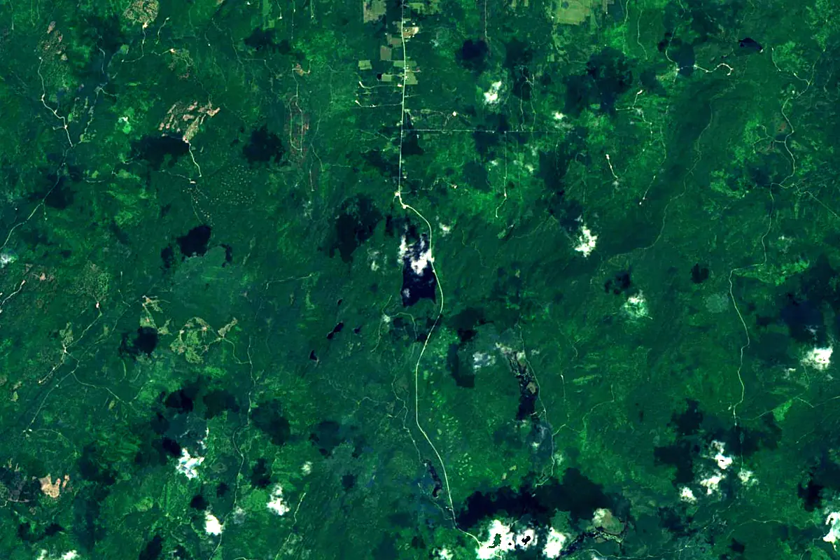
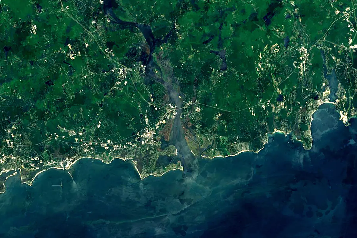
Sentinel-2 cloudless 2016 by EOX IT Services GmbH (contains modified Copernicus Sentinel data 2016), CC BY 4.0. The glowing line is the river as drawn by RiverATLAS.
Photos
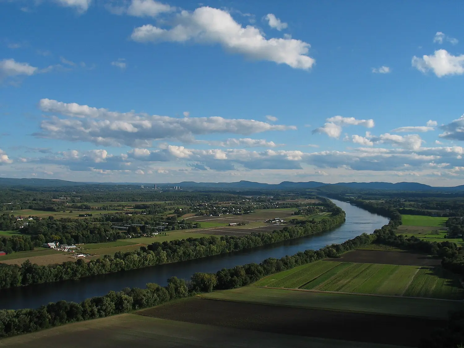
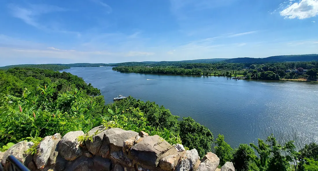
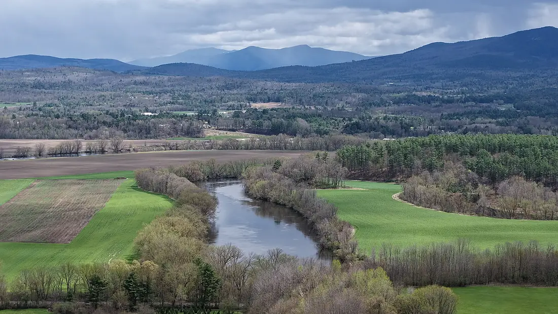
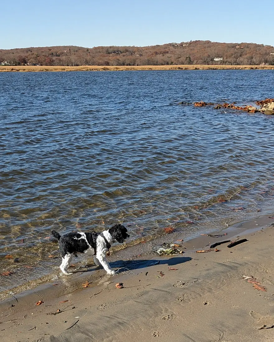
Connecticut River in pictures
Tributaries
Where it flows, and what flows into it
Tributaries (64)
Also: Farmington River, Ottauquechee River, Chicopee River, Mohawk River, Millers River, White River, Westfield River, Ammonoosuc River, Ashuelot River, Deerfield River, Upper Ammonoosuc River, Black River, Israel River, Passumpsic River, Waits River, Ware River, West River, Mattabesset River, Halls Stream, Quaboag River, Saxtons River, Sugar River, Williams River, Mill River
Nearby
Rivers nearby
United States492 km210 m³/s154 km awayCharles RiverUnited States129 km9.0 m³/s160 km awayMohawk RiverUnited States240 km220 m³/s196 km awayMerrimack RiverUnited States177 km210 m³/s211 km awayDelaware RiverUnited States579 km220 m³/s322 km awaySusquehanna RiverUnited States715 km1,100 m³/s372 km awayPenobscot RiverUnited States563 km1,000 m³/s463 km awayRappahannock RiverUnited States296 km47 m³/s483 km awayWhere these numbers come from
| Name, length, places | Wikidata (Q379648) · CC0 |
|---|---|
| Course, profile, basin | RiverATLAS v1.0 (HydroATLAS, Linke et al. 2019) · CC BY 4.0 — followed from the source to the mouth given by Wikidata |
| Flow | WaterGAP (RiverATLAS), 1971–2000 · CC BY 4.0 |
| Climate along the river | WorldClim (RiverATLAS), 1970–2000 · CC BY 4.0 |
| Towns, bridges, dams | Wikidata · CC0; GeoNames · CC BY 4.0 |
| Along the river | © OpenStreetMap contributors · ODbL |
| Images | EOX Sentinel-2 cloudless 2016 · CC BY 4.0; Wikimedia Commons |
| Our other atlases | Cascadyas, Lakeyas, Coastya, Peakyas, Islandyas — Wikidata · CC0; © OpenStreetMap contributors · ODbL; GeoNames · CC BY 4.0; HydroLAKES · CC BY 4.0; NOAA OISST |
Every source and licence is on the data sources page.
The family
Do you prefer beaches, lakes, mountains, waterfalls, islands, rivers or canyons?
Same idea, other landscapes: field atlases built on open data, month by month, in seven languages.
beaches Find your beach: sea temperature, sun and swimming month by month.Visit lakes
 Every lake on Earth: water temperature, ice, depth and the shore.Coming soonVisit mountains
 Every summit in 3D: summit weather, the 0 °C line, huts and trails.Visit waterfalls
 Every waterfall: height, flow month by month and when it roars.Coming soonVisit islands
 Every island from the sea up: size, sea temperature, ferries and 3D.Coming soonVisit
  rivers
 Every river from source to sea: the journey, the flow and the basin in numbers.You are here
 canyons
 Every canyon cut to scale: depth to the floor, rim and floor temperatures, trails and viewpoints.Coming soonVisit