River
Delaware River
579 km from source to mouth · United States.
 United StatesFlows into Delaware Bay
In numbers
Length
579km
Average flow
220m³/s
Basin
36,568km²
Drop
435m
from 429 m to -6 m
Country
1
The journey
From source to mouth
579 km of river and 68 stops on the way: 34 towns and cities on its banks, dams, bridges and the tributaries that feed it.
- 0 kmSourceat 429 m
- 46 kmPepacton Reservoir20 km²
- 100 kmHancock2,764 people
- 100 kmEast Branch Delaware Rivertributary
- 138 kmFremont1,161 people
- 158 kmCochecton1,448 people
- 172 kmNarrowsburg379 people
- 185 kmWestcolang Pond0.8 km²
- 191 kmYork Lake0.3 km²
- 193 kmLackawaxen Rivertributary
- 207 kmWalker Lake0.4 km²
- 216 kmLumberland2,243 people
- 236 kmPort Jervis8,775 people
- 236 kmMatamoras2,362 people
- 237 kmNeversink Rivertributary
- 248 kmHoliday Lake0.5 km²
- 255 kmRaymondskill Falls
- 269 kmDingmans Creektributary
- 337 kmPequest Rivertributary
- 362 kmEaston28,127 people
- 362 kmLehigh Rivertributary
- 362 kmDelaware Division of the Pennsylvania Canal
- 365 kmLopatcong Creektributary
- 379 kmMusconetcong Rivertributary
- 381 kmCooks Creektributary
- 390 kmGallows Runtributary
- 394 kmHakihokake Creektributary
- 411 kmTohickon Creektributary
- 411 kmLumberville Wing Dam
- 415 kmLockatong Creektributary
- 423 kmWickecheoke Creektributary
- 441 kmScudders Falls
- 451 kmMercer County387,340 people
- 452 kmTrenton90,871 people
- 453 kmMorrisville9,809 people
- 453 kmAssunpink Creektributary
- 464 kmFieldsboro526 people
- 471 kmFlorence4,704 people
- 473 kmLevittown52,983 people
- 478 kmBristol9,861 people
- 484 kmBristol College
- 485 kmNeshaminy Creektributary
- 498 kmHolmesburg28,046 people
- 498 kmRiverton2,764 people
- 501 kmTacony17,846 people
- 501 kmWissinoming21,445 people
- 503 kmFrankford23,503 people
- 506 kmPennsauken36,332 people
- 509 kmPort Richmond27,554 people
- 511 kmFrankford Creektributary
- 511 kmHartranft19,748 people
- 512 kmFishtown16,307 people
- 514 kmPhiladelphia1,603,797 people
- 514 kmCenter City57,239 people
- 514 kmRittenhouse21,582 people
- 516 kmCamden71,791 people
- 517 kmPennsport26,000 people
- 517 kmWharton49,732 people
- 517 kmWhitman49,732 people
- 517 kmLower Moyamensing16,481 people
- 519 kmCooper Rivertributary
- 527 kmRed Bank Battlefield
- 528 kmSchuylkill Rivertributary
- 534 kmTinicum Island Rear Range Light
- 541 kmDarby Creektributary
- 546 kmChester32,605 people
- 549 kmChester Creektributary
- 567 kmChristina Rivertributary
- 568 kmNew Castle5,551 people
- 579 kmDelaware Bayat -6 m
Water level along the river (RiverATLAS; the height is exaggerated). Towns: GeoNames and Wikidata; bridges, dams and tributaries: Wikidata.
Major river on the East coast of the United States of America
At the mouth it carries 224 m³/s on average: an Olympic pool every 11 seconds. It drops from 429 m to -6 m, 0.8 m per kilometre on average. Its basin covers 36,568 km², about the size of GW. 7.7 million people live in it. Highest water: from March to May; lowest: from January to February. Dams and reservoirs hold back a large share of its water (15% of a year's flow).
Where to start
- PhiladelphiaLargest city on its banks · 1,603,797 people
- Philadelphia International Airport (PHL)Nearest airport with scheduled flights, 11 km from the cityCar hire at PHL airport (Philadelphia)Discover Cars · Affiliate link↗
- On the water125 ferry piers, marinas, boat rentals and boat ramps along the river (OpenStreetMap)
- Kayak and canoe11 put-ins and rapids mapped (OpenStreetMap)
- From May to SeptemberThe best months to visit
Delaware River, month by month
Highest water: from March to May
Lowest water: from January to February. Best months to visit: from May to September.
From about 310 m³/s in the lowest month to 1,200 m³/s in the highest. An estimate: the monthly flow is modelled from the lowest and highest months of WaterGAP (RiverATLAS, 1971–2000) and the rain and snow along the river (WorldClim). Dams change the real rhythm. The chip is the average air temperature; below it, the month's rain.
Plan the trip
Plan the trip: boat trips, a bed by the river, a car
Some links above are affiliate links: if you book through them we may earn a commission, at no extra cost to you. It never changes what the data on this page says.
The basin
Delaware River: the basin in numbers
28,584 km² of land send their water to this river. This is what lives on it.
- 7.7millionpeople live in the basin
- 274/km²people per km²
- 281maverage altitude of the basin
- 1,148mmof rain a year (basin average)
- 9.2°Caverage air temperature
- 6%protected areas
- 1.0%covered by lakes
- 2.6km³held in reservoirs
What covers the basin
- 80% Forest
- 13% Cropland
- 2% Pasture
- 18% Towns and cities
RiverATLAS (HydroATLAS v1.0, CC BY 4.0): land cover, people, protected areas, glaciers and dams over the whole basin upstream of the mouth.
Along the river
Delaware River: what you find on the way
- 41WeirsEaston Dam, Lumberville Wing Dam, Prallsville Lock and 38 more
- 71LocksLock 24, Outlet Lock 49, Lock 47 and 68 more
- 28WaterfallsJensen Cascade, Fish Cabin Falls, Hackers Falls and 25 more
- 6RapidsDingmans Rapids, Scudders Falls and 4 more
- 5Canoe put-insRiver Road Canal Access, General Washington Memorial Boulevard Canal Access, Ferry Road Canal Access West and 2 more
- 97Boat rampsZane Grey Access, Westfall Boat Launch, Caddoo Access Hand Launch and 94 more
- 2Ferry piersPenn’s Landing, Camden
- 20MarinasCapital City Yacht Club, Neshaminy Marina, Dredge Harbor Marina and 17 more
- 5River beachesriver access, West End Beach, Turtle Beach and 2 more
From OpenStreetMap, within 2.1 km of the river. Not mapped is not the same as not there.
Cross-checked with our atlases
Delaware River in our other atlases
What our sister atlases know about the waterfalls on this river, the lakes it flows through, the beaches at its mouth, the mountains where it rises and the islands off its mouth.
 2waterfalls on the riverCascadyas
 5lakes on its wayLakeyas
 18mountains at the sourcePeakyas
 1island off the mouthIslandyas
Waterfalls (2)
On the river, by Cascadyas
- Raymondskill Fallskm 230
- Scudders Fallskm 398
Cascadyas is coming soonOpen Cascadyas ↗
Lakes and reservoirs (5)
Lakes it flows through, by Lakeyas
- Pepacton Reservoirkm 4120km²
- Westcolang Pondkm 1660.8km²
- York Lakekm 1720.3km²
- Walker Lakekm 1870.4km²
- Holiday Lakekm 2230.5km²
Lakeyas is coming soonOpen Lakeyas ↗
Mountains at the source (18)
Within 15 km of the source, by Peakyas
- Elm Tree Ridge10 km away
- Big Fork Mountain14 km away
- Taylor Hill14 km away
- Rattlesnake Hill11 km away
- Point Mountain1.3 km away
- Hawk Mountain9.4 km away
- Bittersweet Hill9.4 km away
- Bouchoux Hill11 km away
10 more on PeakyasOpen Peakyas ↗
Islands off the mouth (1)
Within 30 km of the mouth, by Islandyas
- Reedy Island21 km away
Islandyas is coming soonOpen Islandyas ↗
From space
The source and the mouth, seen from orbit
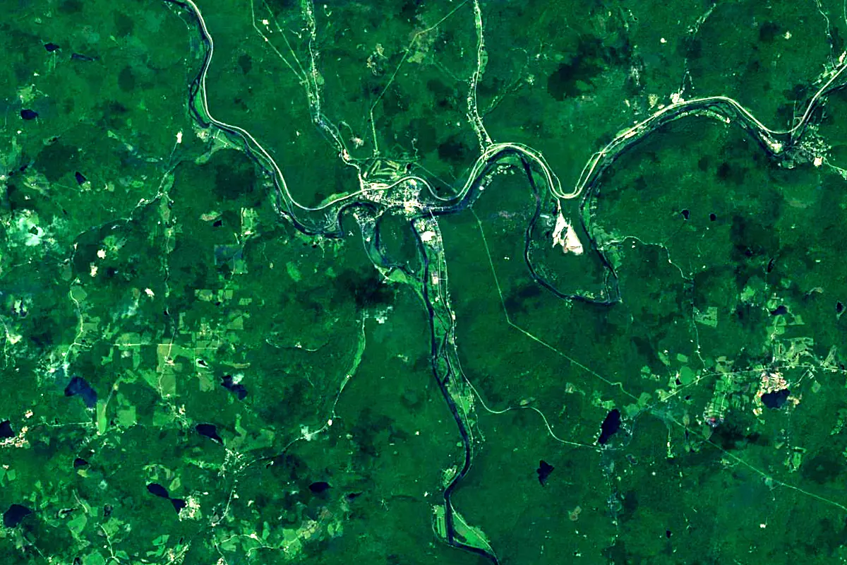
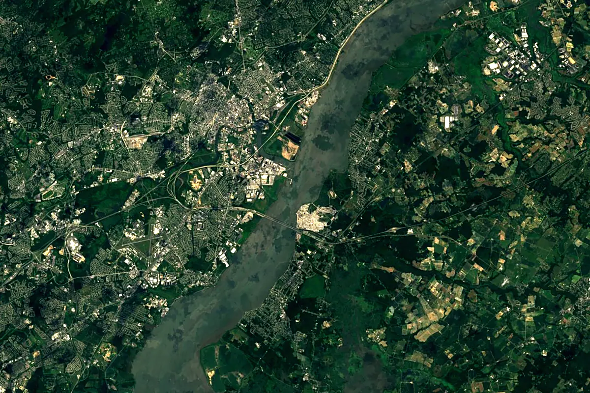
Sentinel-2 cloudless 2016 by EOX IT Services GmbH (contains modified Copernicus Sentinel data 2016), CC BY 4.0. The glowing line is the river as drawn by RiverATLAS.
Photos
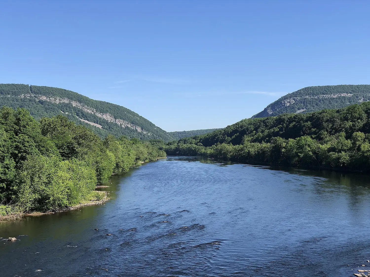
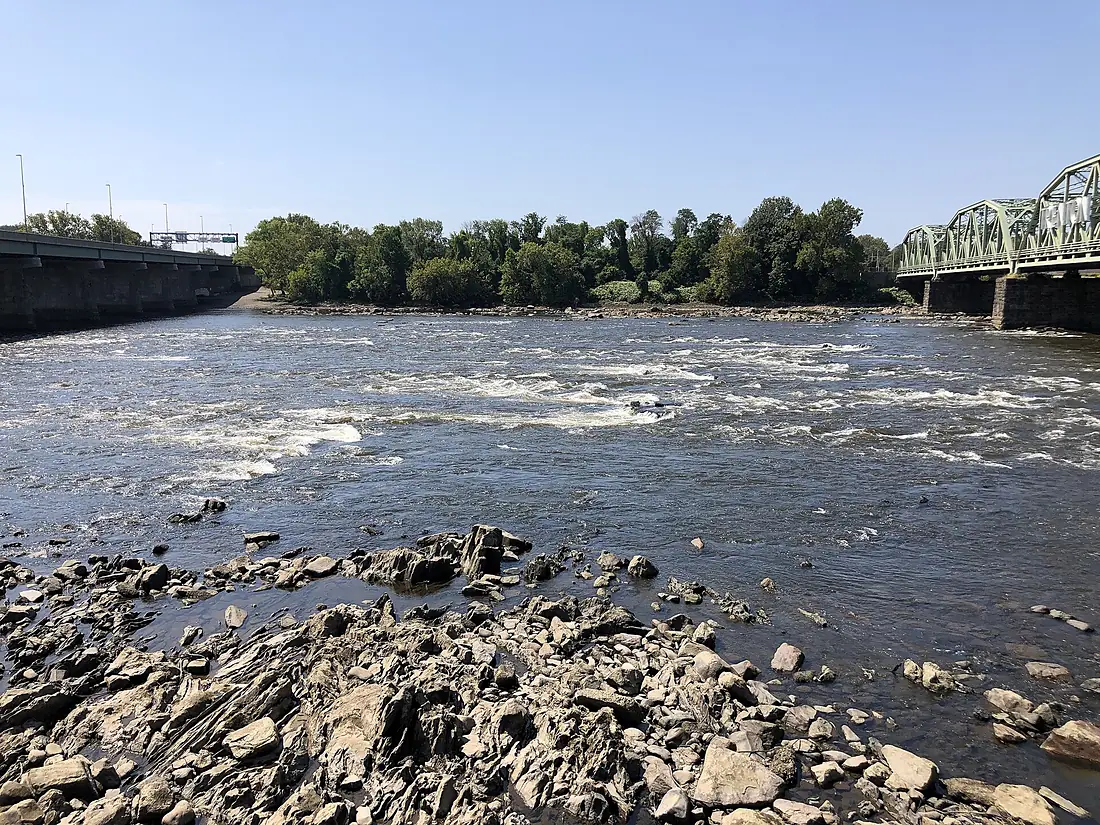
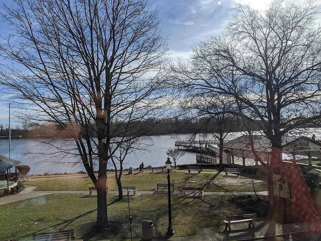
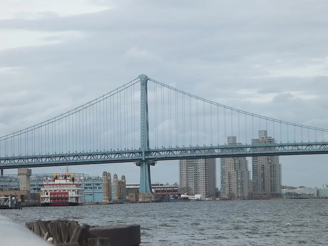
Delaware River in pictures
Tributaries
Where it flows, and what flows into it
Tributaries (66)
Also: Schuylkill River, Lehigh River, Christina River, Lackawaxen River, Assunpink Creek, East Branch Delaware River, Musconetcong River, Neversink River, West Branch Delaware River, Cooks Creek, Alloway Creek, Chester Creek, Cooper River, Crosswicks Creek, Crum Creek, Darby Creek, Lockatong Creek, Pennsauken Creek, Pennypack Creek, Pequest River, Ridley Creek, Tohickon Creek, Wickecheoke Creek, Frankford Creek
Nearby
Rivers nearby
United States715 km1,100 m³/s52 km awayHudson RiverUnited States492 km210 m³/s171 km awayRappahannock RiverUnited States296 km47 m³/s161 km awayShenandoah RiverUnited States241 km85 m³/s195 km awayConnecticut RiverUnited States660 km520 m³/s322 km awayAllegheny RiverUnited States523 km560 m³/s392 km awayMohawk RiverUnited States240 km220 m³/s373 km awayMonongahela RiverUnited States209 km360 m³/s392 km awayWhere these numbers come from
| Name, length, places | Wikidata (Q143762) · CC0 |
|---|---|
| Course, profile, basin | RiverATLAS v1.0 (HydroATLAS, Linke et al. 2019) · CC BY 4.0 — followed from the source to the mouth given by Wikidata |
| Flow | WaterGAP (RiverATLAS), 1971–2000 · CC BY 4.0 |
| Climate along the river | WorldClim (RiverATLAS), 1970–2000 · CC BY 4.0 |
| Towns, bridges, dams | Wikidata · CC0; GeoNames · CC BY 4.0 |
| Along the river | © OpenStreetMap contributors · ODbL |
| Images | EOX Sentinel-2 cloudless 2016 · CC BY 4.0; Wikimedia Commons |
| Our other atlases | Cascadyas, Lakeyas, Peakyas, Islandyas — Wikidata · CC0; © OpenStreetMap contributors · ODbL; GeoNames · CC BY 4.0; HydroLAKES · CC BY 4.0; NOAA OISST |
Every source and licence is on the data sources page.
The family
Do you prefer beaches, lakes, mountains, waterfalls, islands, rivers or canyons?
Same idea, other landscapes: field atlases built on open data, month by month, in seven languages.
 beaches
 Find your beach: sea temperature, sun and swimming month by month.Visit lakes
 Every lake on Earth: water temperature, ice, depth and the shore.Coming soonVisit mountains
 Every summit in 3D: summit weather, the 0 °C line, huts and trails.Visit waterfalls
 Every waterfall: height, flow month by month and when it roars.Coming soonVisit islands
 Every island from the sea up: size, sea temperature, ferries and 3D.Coming soonVisit
  rivers
 Every river from source to sea: the journey, the flow and the basin in numbers.You are here
 canyons
 Every canyon cut to scale: depth to the floor, rim and floor temperatures, trails and viewpoints.Coming soonVisit