River
Siret River
740 km from source to mouth · Romania.
 RomaniaFlows into Danube2nd longest in Romania
In numbers
Length
740km
Average flow
230m³/s
Basin
43,960km²
Drop
583m
from 586 m to 3 m
Country
1
The journey
From source to mouth
740 km of river and 68 stops on the way: 56 towns and cities on its banks, dams, bridges and the tributaries that feed it.
- 0 kmCarpathiansat 586 m
- 25 kmBerehomet7,583 people
- 29 kmMyhove3,693 people
- 46 kmMyhivkatributary
- 77 kmStorozhynets14,198 people
- 91 kmRopcha3,324 people
- 108 kmKamyanka6,847 people
- 110 kmMalyi Serettributary
- 117 kmCherepkivtsi9,376 people
- 133 kmSiret6,708 people
- 139 kmMihăileni5,037 people
- 155 kmZamostea3,177 people
- 171 kmBucovineni3,885 people
- 173 kmZvoriştea6,275 people
- 196 kmBucecea5,143 people
- 207 kmVlădeni4,963 people
- 235 kmVorona Teodoru7,992 people
- 240 kmLiteni4,410 people
- 240 kmSuceava Rivertributary
- 255 kmDolhasca11,025 people
- 273 kmLespezi6,138 people
- 294 kmPaşcani45,000 people
- 299 kmStolniceni-Prăjescu5,625 people
- 321 kmMirceşti6,797 people
- 328 kmButea3,893 people
- 337 kmAdjudeni4,456 people
- 337 kmDoljeşti7,359 people
- 341 kmBuruienești3,361 people
- 341 kmTămăşeni8,292 people
- 346 kmSagna7,443 people
- 357 kmMoldova Rivertributary
- 357 kmCotu Vameș3,168 people
- 381 kmIcuseşti4,648 people
- 398 kmNegri3,101 people
- 411 kmTraian4,662 people
- 424 kmBuhoci4,736 people
- 431 kmUngureni3,728 people
- 435 kmTamaşi6,330 people
- 438 kmBistrița Rivertributary
- 440 kmNicolae Bălcescu10,140 people
- 449 kmGioseni3,243 people
- 467 kmPânceşti4,272 people
- 508 kmHomocea9,869 people
- 528 kmTrotuș Rivertributary
- 531 kmPufeşti4,179 people
- 545 kmNicorești4,037 people
- 553 kmCosmeşti6,526 people
- 556 kmCosmești5,662 people
- 564 kmȘușița Rivertributary
- 573 kmMovileni3,090 people
- 586 kmSuraia7,770 people
- 604 kmIvești9,584 people
- 606 kmBârlad Rivertributary
- 606 kmLieşti10,956 people
- 610 kmPutna Rivertributary
- 613 kmFundeni3,020 people
- 619 kmNănești1,849 people
- 626 kmRâmnicul Sărat Rivertributary
- 626 kmMăicăneşti5,312 people
- 635 kmNămoloasa1,773 people
- 637 kmLiești8,505 people
- 641 kmTudor Vladimirescu5,498 people
- 668 kmIndependența4,371 people
- 676 kmBuzău Rivertributary
- 690 kmSiliștea1,465 people
- 695 kmBraniștea3,956 people
- 701 kmŞendreni3,126 people
- 707 kmVădeni3,700 people
- 709 kmBalta Cătușa0.3 km²
- 740 kmDanubeat 3 m
Water level along the river (RiverATLAS; the height is exaggerated). Towns: GeoNames and Wikidata; bridges, dams and tributaries: Wikidata.
River in Romania and Ukraine
At the mouth it carries 230 m³/s on average: an Olympic pool every 11 seconds. It drops from 586 m to 3 m, 0.8 m per kilometre on average. Its basin covers 43,960 km², about the size of DK. 3.6 million people live in it. Highest water: May; lowest: from December to February. Dams and reservoirs hold back a large share of its water (21% of a year's flow).
Where to start
- PaşcaniLargest city on its banks · 45,000 people
- Suceava Ștefan cel Mare International Airport (SCV)Nearest airport with scheduled flights, 56 km from the cityCar hire at IAS airport (Iaşi)Discover Cars · Affiliate link↗
- On the water4 ferry piers, marinas, boat rentals and boat ramps along the river (OpenStreetMap)
- From May to SeptemberThe best months to visit
Siret River, month by month
Highest water: May
Lowest water: from December to February. Best months to visit: from May to September.
From about 92 m³/s in the lowest month to 790 m³/s in the highest. An estimate: the monthly flow is modelled from the lowest and highest months of WaterGAP (RiverATLAS, 1971–2000) and the rain and snow along the river (WorldClim). Dams change the real rhythm. The chip is the average air temperature; below it, the month's rain.
Plan the trip
Plan the trip: boat trips, a bed by the river, a car
Some links above are affiliate links: if you book through them we may earn a commission, at no extra cost to you. It never changes what the data on this page says.
The basin
Siret River: the basin in numbers
45,857 km² of land send their water to this river. This is what lives on it.
- 3.6millionpeople live in the basin
- 78/km²people per km²
- 496maverage altitude of the basin
- 612mmof rain a year (basin average)
- 7.8°Caverage air temperature
- 3%protected areas
- 0.4%covered by lakes
- 2.0km³held in reservoirs
What covers the basin
- 44% Forest
- 36% Cropland
- 17% Pasture
- 3% Towns and cities
RiverATLAS (HydroATLAS v1.0, CC BY 4.0): land cover, people, protected areas, glaciers and dams over the whole basin upstream of the mouth.
Along the river
Siret River: what you find on the way
- 1Weirs
- 2Waterfalls
- 4Ferry piersGalați, I. C. Brătianu and 2 more
- 4River beachesZamolxia, Tamasidava Nord, Tamasidava Sud and 1 more
From OpenStreetMap, within 2.2 km of the river. Not mapped is not the same as not there.
Cross-checked with our atlases
Siret River in our other atlases
What our sister atlases know about the waterfalls on this river, the lakes it flows through, the beaches at its mouth, the mountains where it rises and the islands off its mouth.
 1lake on its wayLakeyas
 4mountains at the sourcePeakyas
Lakes and reservoirs (1)
Lakes it flows through, by Lakeyas
- Balta Cătușakm 5090.3km²
Lakeyas is coming soonOpen Lakeyas ↗
Mountains at the source (4)
Within 15 km of the source, by Peakyas
- Gora Lungul7.8 km away1,344m
- Lunhul8.0 km away
- Hora Mehura5.0 km away
- Gora Petroushka14 km away
From space
The source and the mouth, seen from orbit
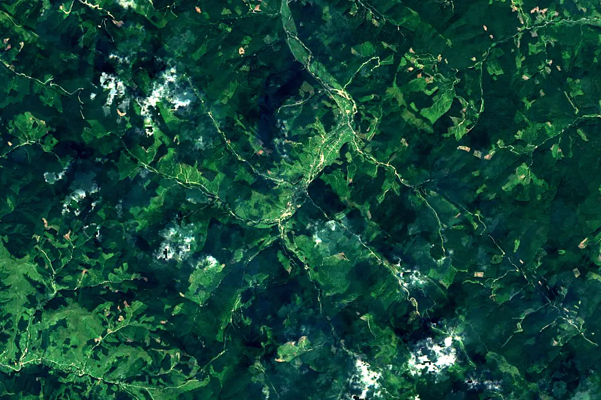
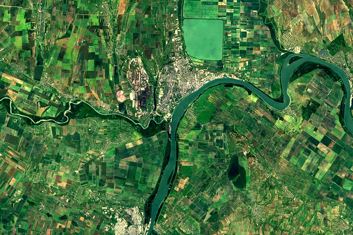
Sentinel-2 cloudless 2016 by EOX IT Services GmbH (contains modified Copernicus Sentinel data 2016), CC BY 4.0. The glowing line is the river as drawn by RiverATLAS.
Photos
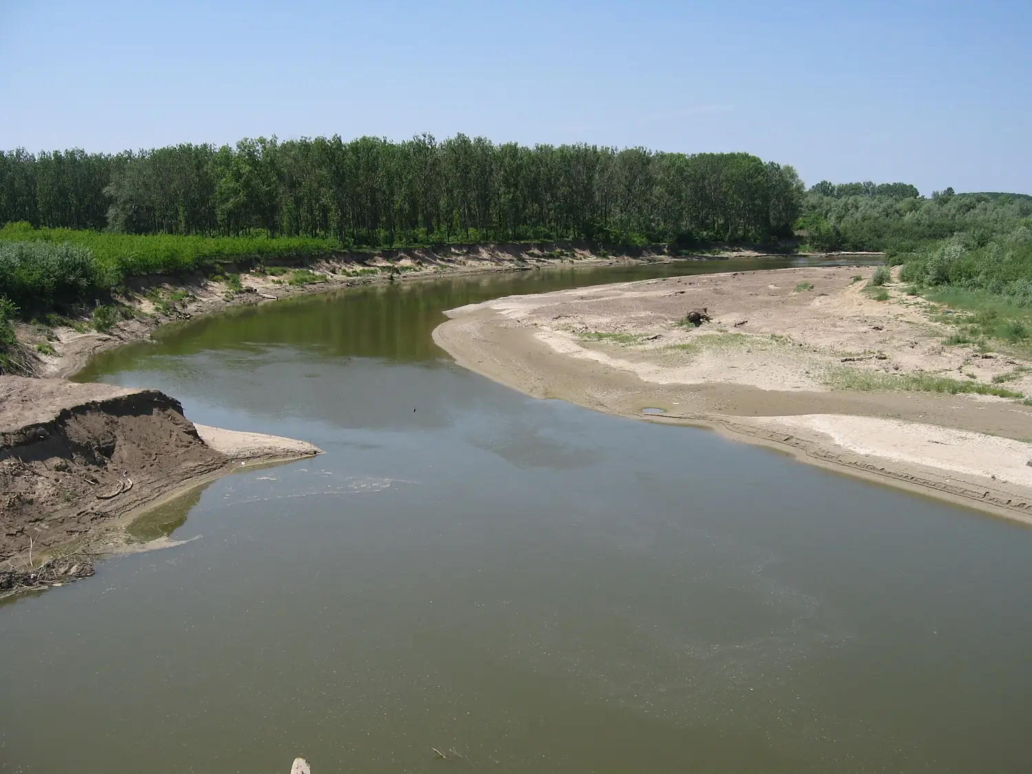
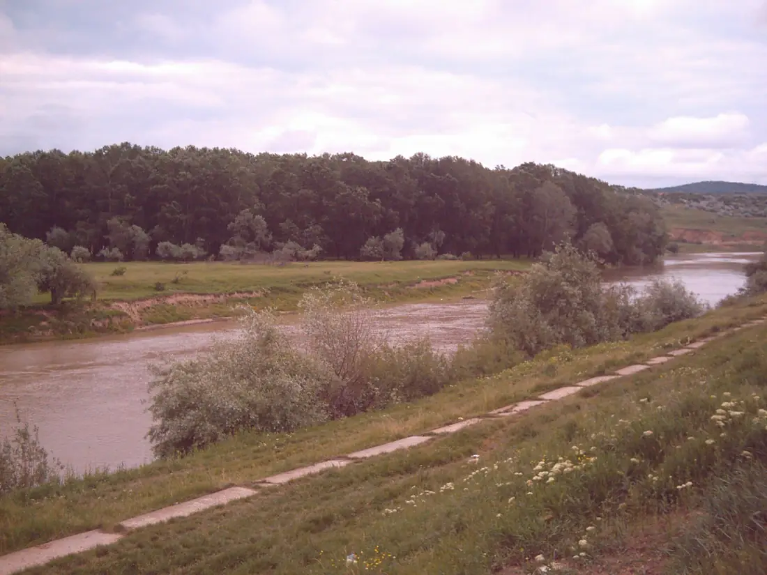
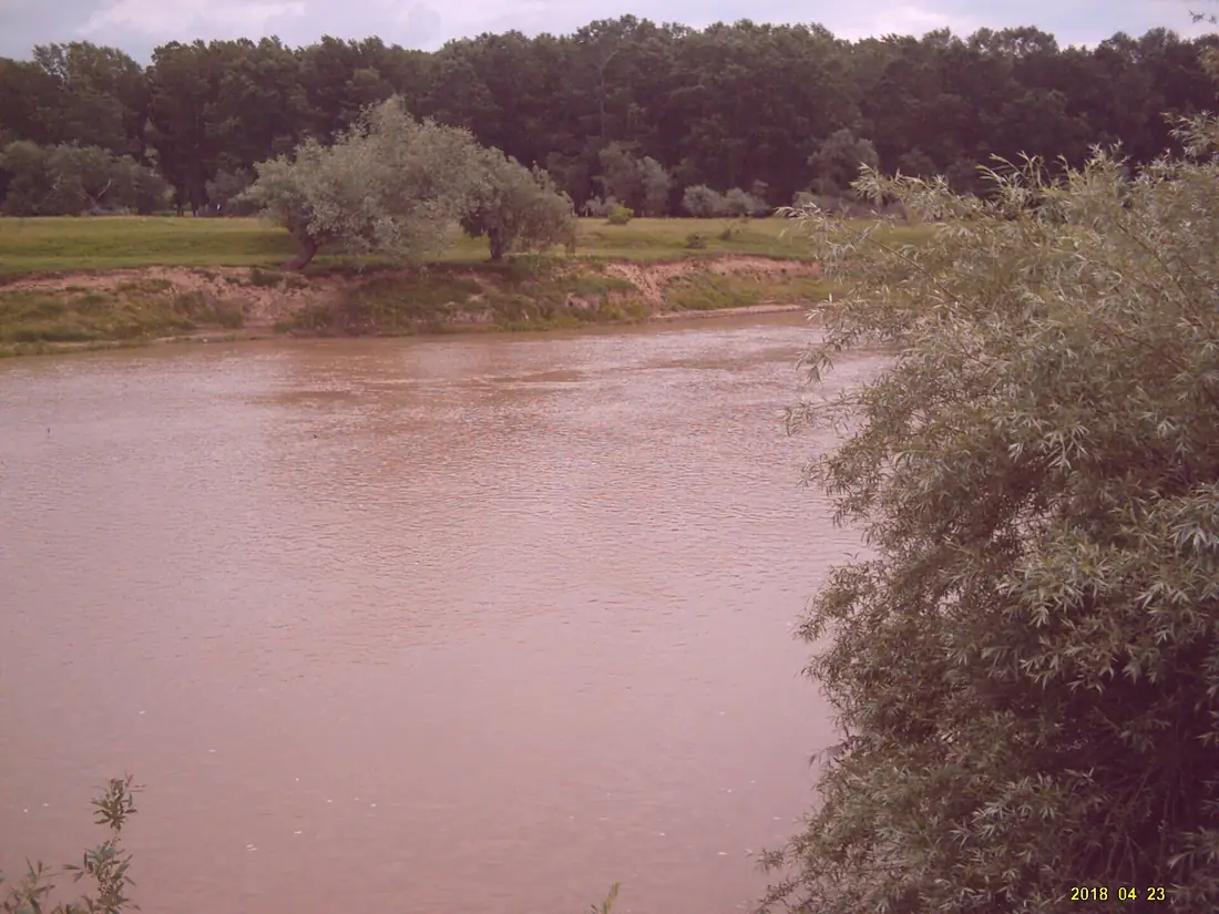
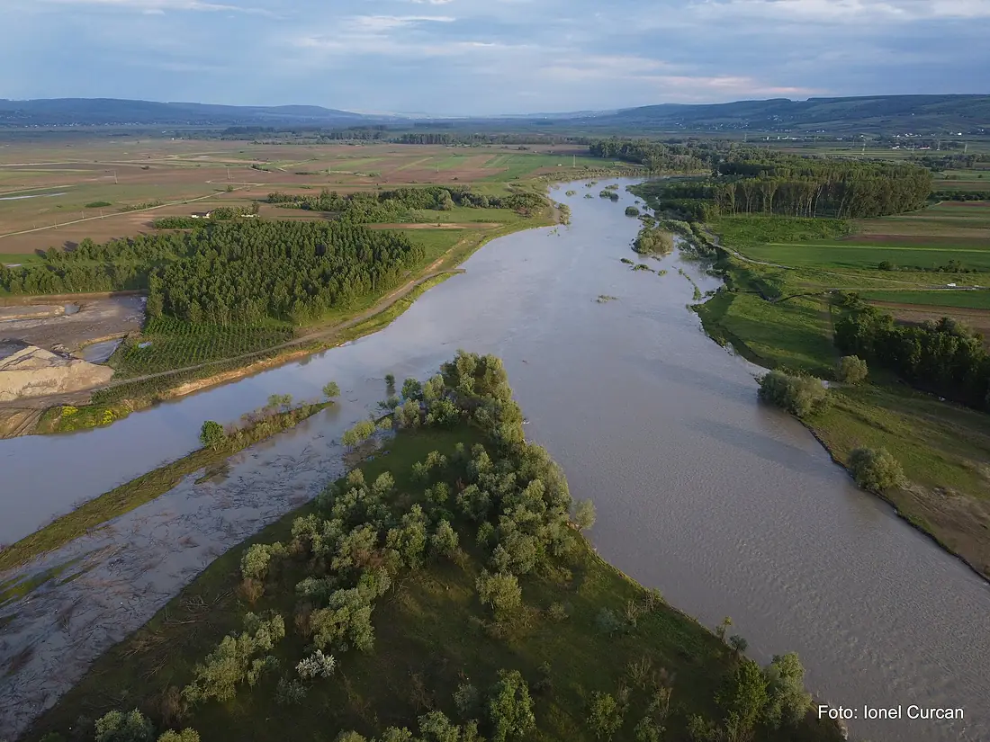
Siret River in pictures
Tributaries
Where it flows, and what flows into it
It flows into
DanubeRomania2,850 km5,400 m³/sTributaries (35)
Romania325 km28 m³/sjoins at km 485Bistrița RiverRomania272 km66 m³/sjoins at km 314Bârlad RiverRomania207 km9.0 m³/sjoins at km 435Moldova RiverRomania205 km32 m³/sjoins at km 257Suceava RiverRomania160 km20 m³/sjoins at km 173Also: Trotuș River, Râmnicul Sărat River, Putna River, Malyi Seret, Șușița River, Molnița River, Vorona River, Cătușa River, Conțeasca River, Călmățui River, Albuia River, Boca River, Carecna River, Gerului River, Leica River, Polocin River, Pârâul Țigăncilor, Răcăciuni River, Răcătău River, Zăbrăuți River, Myhivka, Șomuzul Mare River, Șomuzul Mic River, Negostina River
 Serbia
 Croatia
 Germany
 Austria
 Hungary
Nearby
Rivers nearby
 Moldova953 km120 m³/s16 km awayBuzău RiverRomania325 km28 m³/s22 km awayBârlad RiverRomania207 km9.0 m³/s47 km awayIalomița RiverRomania414 km70 m³/s79 km awayDniester
 Ukraine1,352 km310 m³/s200 km awayBistrița RiverRomania272 km66 m³/s146 km awayPrahova RiverRomania183 km28 m³/s144 km awayArgeș RiverRomania350 km73 m³/s186 km away
Where these numbers come from
| Name, length, places | Wikidata (Q208302) · CC0 |
|---|---|
| Course, profile, basin | RiverATLAS v1.0 (HydroATLAS, Linke et al. 2019) · CC BY 4.0 — followed from the source to the mouth given by Wikidata |
| Flow | WaterGAP (RiverATLAS), 1971–2000 · CC BY 4.0 |
| Climate along the river | WorldClim (RiverATLAS), 1970–2000 · CC BY 4.0 |
| Towns, bridges, dams | Wikidata · CC0; GeoNames · CC BY 4.0 |
| Along the river | © OpenStreetMap contributors · ODbL |
| Images | EOX Sentinel-2 cloudless 2016 · CC BY 4.0; Wikimedia Commons |
| Our other atlases | Lakeyas, Peakyas — Wikidata · CC0; © OpenStreetMap contributors · ODbL; GeoNames · CC BY 4.0; HydroLAKES · CC BY 4.0; NOAA OISST |
Every source and licence is on the data sources page.
The family
Do you prefer beaches, lakes, mountains, waterfalls, islands, rivers or canyons?
Same idea, other landscapes: field atlases built on open data, month by month, in seven languages.
 beaches
 Find your beach: sea temperature, sun and swimming month by month.Visit lakes
 Every lake on Earth: water temperature, ice, depth and the shore.Coming soonVisit mountains
 Every summit in 3D: summit weather, the 0 °C line, huts and trails.Visit
  waterfalls
 Every waterfall: height, flow month by month and when it roars.Coming soonVisit
  islands
 Every island from the sea up: size, sea temperature, ferries and 3D.Coming soonVisit
  rivers
 Every river from source to sea: the journey, the flow and the basin in numbers.You are here
 canyons
 Every canyon cut to scale: depth to the floor, rim and floor temperatures, trails and viewpoints.Coming soonVisit